Keelung

Keelung Martyrs Shrine (基隆忠烈祠)

One of my on-going projects over the past few years has been visiting and writing about Taiwan’s Martyrs Shrines, and if you’ve been reading this blog regularly, you’re likely aware that I’ve been doing so for a very specific reason. By now, it should be fairly obvious that when I visit these shrines, it doesn’t really have nothing to do with the purpose of the shrines, which are essentially propaganda tools of an authoritarian regime that has little to do with Taiwan.

My motivation for visiting is a little easier to understand and to put it simply, the majority of these so-called ‘Martyrs Shrines’ in Taiwan today were once the home of a Japanese-era Shinto Shrine, and whenever you visit one of them, you’re often able to find traces of that era of Taiwan’s history. 

To be fair, even though the Martyrs Shrines were a tool used by the Chinese Nationalists, the same could be said about Shinto Shrines, and the Japanese regime that controlled Taiwan for over five decades. Both are pretty good examples of how a foreign power attempted to forcibly convert the citizens of Taiwan into their loyal subjects. 

I just so happen to think Shinto Shrines are much more interesting - I’m sure not everyone feels the same way, and thats completely okay. 

I’ve already written extensively about these Shinto Shrines-turned-Martyrs Shrines, so today I’ll be continuing by adding another piece to the puzzle with the Keelung Martyrs Shrine, which was once home to the former Keelung Shinto Shrine. 

As is the case with most of Taiwan’s other former Shinto Shrines, the Keelung Martyrs Shrine continues to retain elements of the original shrine. Unfortunately there is very little information available online about either the Martyrs Shrine or the former Shinto Shrine, so taking into consideration that it was one of the earliest and most important Shinto Shrines in Taiwan, I’m going to delve pretty deep into describing its history below. 

Hopefully this article helps people learn a bit more about the shrine. 

Keelung Shinto Shrine (基隆神社 / きーるんじんじゃ)

I know, I’ve probably already made this claim several times already about other Shinto Shrines in Taiwan (but I really mean it this time), the Keelung Shinto Shrine was one of Taiwan’s prettiest shrines! 

Dating back to 1912 (明治45年), the shrine was constructed as a branch of the Kotohira Shrine in southwestern Japan’s Kagawa prefecture (香川縣) - one of Japan’s most historic shrines, known for its patronage of the sea, ship transport and sailors. 

Link: Kotohira-gu | 金刀比羅宮 (Wiki) 

Originally named, “Keelung Kotohira Shrine” (基隆金刀比羅神社 / きーるんことひらぐう), that was changed three years later in 1915 (大正4年) to “Kiirun Jinjya” (きーるんじんじゃ), or the Keelung Shinto Shrine (基隆神社). 

From the outset of the colonial era, Keelung, or “Kiirun” (きーるん) was one of the first areas in Taiwan where the Japanese set up official administrative agencies. This was in part due to the port, Taiwan’s northern-most, becoming instrumental in transporting people and supplies to the island, in addition to there already having an established, yet rudimentary railway link between the port and Taihoku (Taipei). 

With that in mind, in the early years of the colonial era, there would have been a considerable number of Japanese nationals living in the area, (or stopping by while passing through) bringing with them their knowledge and expertise as well as their cultural and religious practices. 

The Keelung of 1935

Prior to the construction of the Kotohira Shrine, a number of other Japanese religious buildings started to appear in the port area including the Jodo (淨土宗), Soto (曹洞宗) and Shingon (真言宗) Buddhist sects, in addition to a smaller Inari Shrine (稲荷神社). 

Interestingly, even though Shintoism essentially disappeared when the Japanese left Taiwan, the Japanese Buddhist tradition took hold, and continues to shape the Buddhist experience in Taiwan today. 

While there were a few small Shinto Shrines constructed in Keelung prior, none of them were large enough to take on the role of a ‘Guardian Shrine’ (產土神 / うぶすながみ), which meant that a larger shrine would have to be constructed in order to assist in maintaining a spiritual balance with all the development that was taking place around the port-city. 

So, in 1903 (明治36年), a group of Japanese businessmen, and the technicians behind the construction of the Kiirun Power Plant (基隆發電所) initiated a campaign to raise funds for the construction of the shrine, which took until at least 1910 (明治43年).

Planning for the shrine however met with considerable difficulty as the location chosen for its construction was located on state-owned land and was reserved as part of the colonial government’s urban renewal plans (市區改正) for Keelung. The plan, which required mass land-expropriation sought to re-shape the city and modernize it by improving roads, electrifying the area, ensuring that there was proper sanitation and sewage and providing access to running water.

Similar urban renewal projects like this took place in every major city and town across the island, and are today still considered by many historians to be one of the most beneficial aspects of the period of Japanese rule, as these ambitious projects reshaped Taiwan’s towns and cities, improved quality of life, and were instrumental in Taiwan’s modern development. Today, the success of many of these development projects can still be felt across the country as many areas have maintained the original urban planning of the Japanese-era and expanded upon it.

Link: 臺灣日治時期都市計畫 (Wiki) 

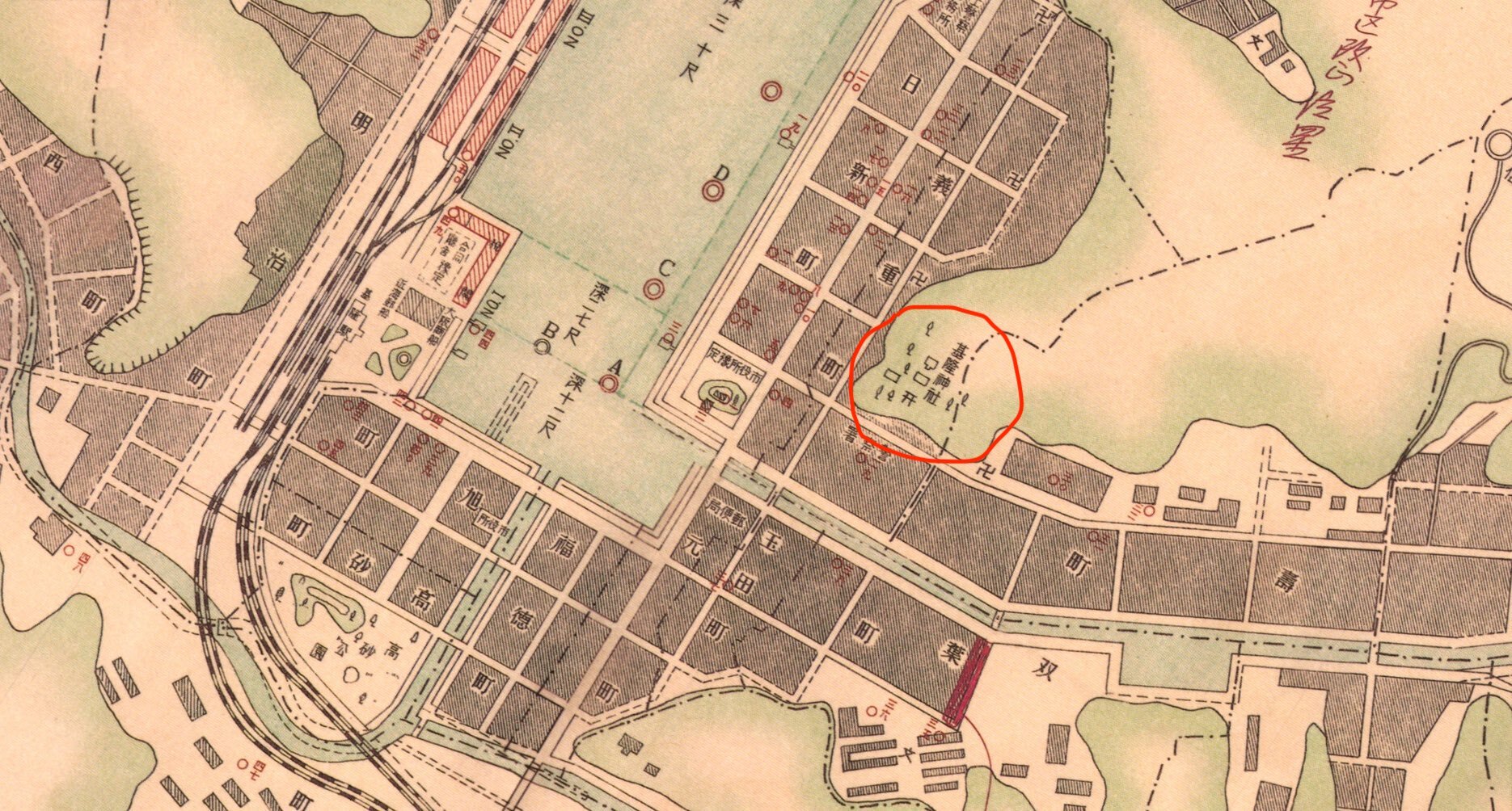
With the assistance of some powerful figures in the capital however, the application process to negotiate for the land was expedited within the Governor Generals office, but ultimately couldn’t be approved until the buildings that were previously constructed on the site were demolished, and the urban renewal was completed. In the meantime, fundraising and planning for the shrine continued and even though the application to build the shrine wasn’t ‘officially’ approved until 1911 (明治44年), the ceremonial ground-breaking ceremony was held a year prior.

It probably all sounds a bit confusing with the jumping back and forth, but there’s an important reason why they jumped the gun on the construction of the shrine before the application was formally approved.

This was because one of the founders of the shrine had to return to Japan to take part in a ceremonial ‘Bunrei’ (分靈) process in which a kami’s spirit is ‘divided’ and re-enshrined elsewhere. As mentioned above, the Keelung Shrine was originally meant to be a branch of the Kotohira Shrine, which means that they had to return to Kagawa Prefecture (香川縣) in Japan’s Shikoku Region (四國) to complete the process.

Link: Kanjo (分靈) | English / Japanese (Wiki)

When the kami arrived in Taiwan in 1912 (大正元年), a ceremony was held to allow it to officially take up residence within the shrine, but by that time construction had only been partially completed with only part of the Visiting Path (參道) and the Main Hall (本殿) completed. This was due to the fact that even after several years of fundraising, the money raised for the construction of the shrine pretty much dried up, and was in competition with the various other fundraising campaigns taking place in the area - most notably for the construction of Kiirun Community Hall (基隆公會堂).

Likewise, as mentioned above, one of the original reasons for the construction of the shrine was to build a “Guardian Shrine” for the port city, but as it was initially constructed as a branch shrine, it couldn’t serve the same purpose as a typical Prefectural Level Shrine due to the rigid set of rules that governs Japanese Shinto Shrines.

This is especially the case as the enshrined deity, Ōmononushi (大物主命), the same deity enshrined at the Kotohira Shrine back in Japan wasn’t the major type of kami that you’d expect at a shrine of that rank, and it was likely that only people from that area of Japan would contribute financially.

To solve this problem, it was decided to change the name of the shrine to the “Kiirun Jinjya” (きーるんじんじゃ), or the “Keelung Shinto Shrine” (基隆神社) in 1913 (大正1年) in order to gain more support, and donations from local residents. As fundraising efforts continued, the Hall of Worship (拜殿) was completed that same year and a longer list of kami took up residence inside, including Amaterasu, the Three Deities of Cultivation, Emperor Sutoku, and Prince Kitashirakawa Yoshihisa. 

Unfortunately as construction on the shrine continued, disaster struck in 1914 (大正3年) when a typhoon blew through the area and destroyed parts of the shrine, forcing an expensive reparation and rebuild project that took place as the other parts of the shrine were still being built.

Given all of issues with fundraising, bureaucratic complications and typhoon damage, I guess it shouldn’t really surprise anyone that it took more than a decade to complete construction on the Keelung Shrine and have it fully opened to the public. 

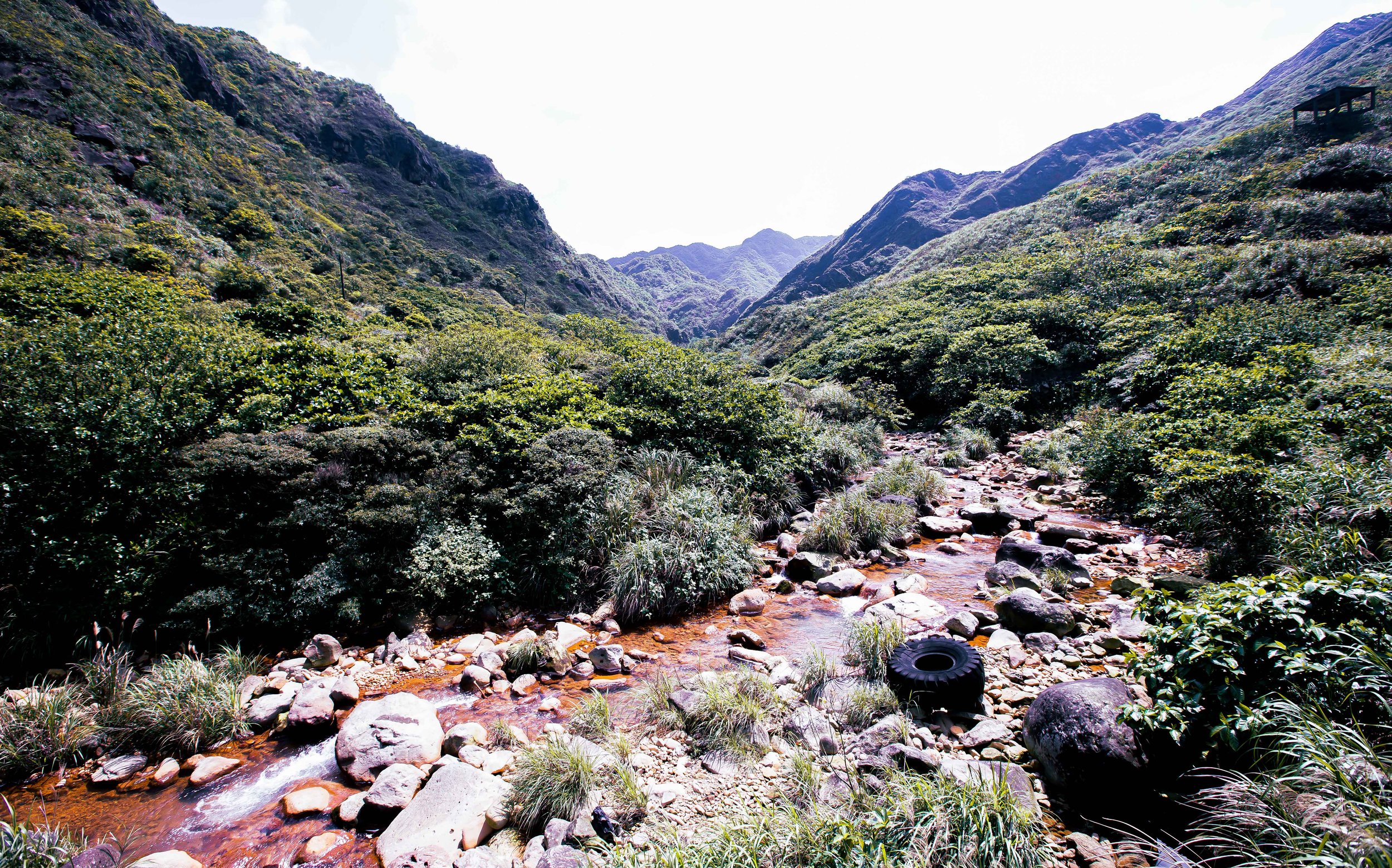
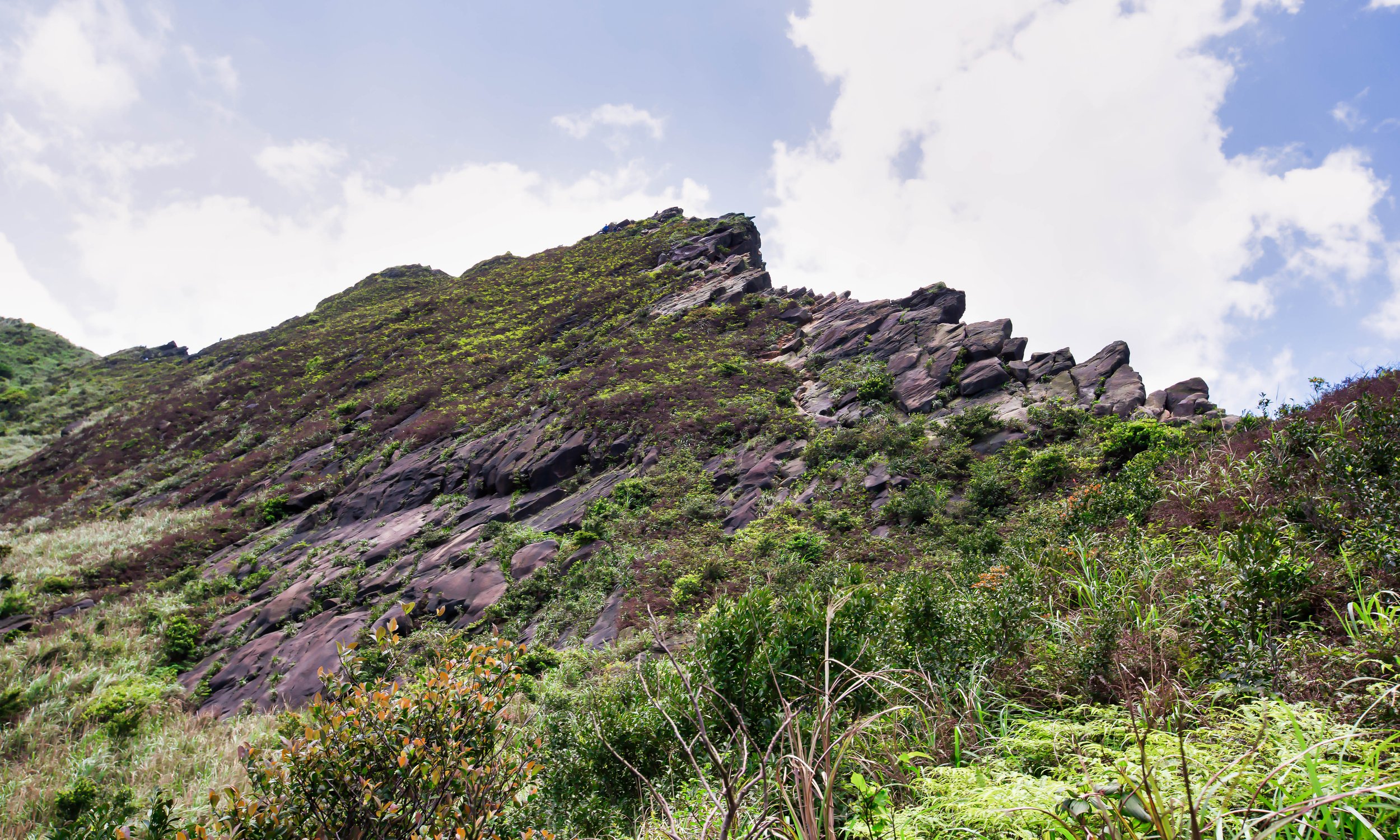
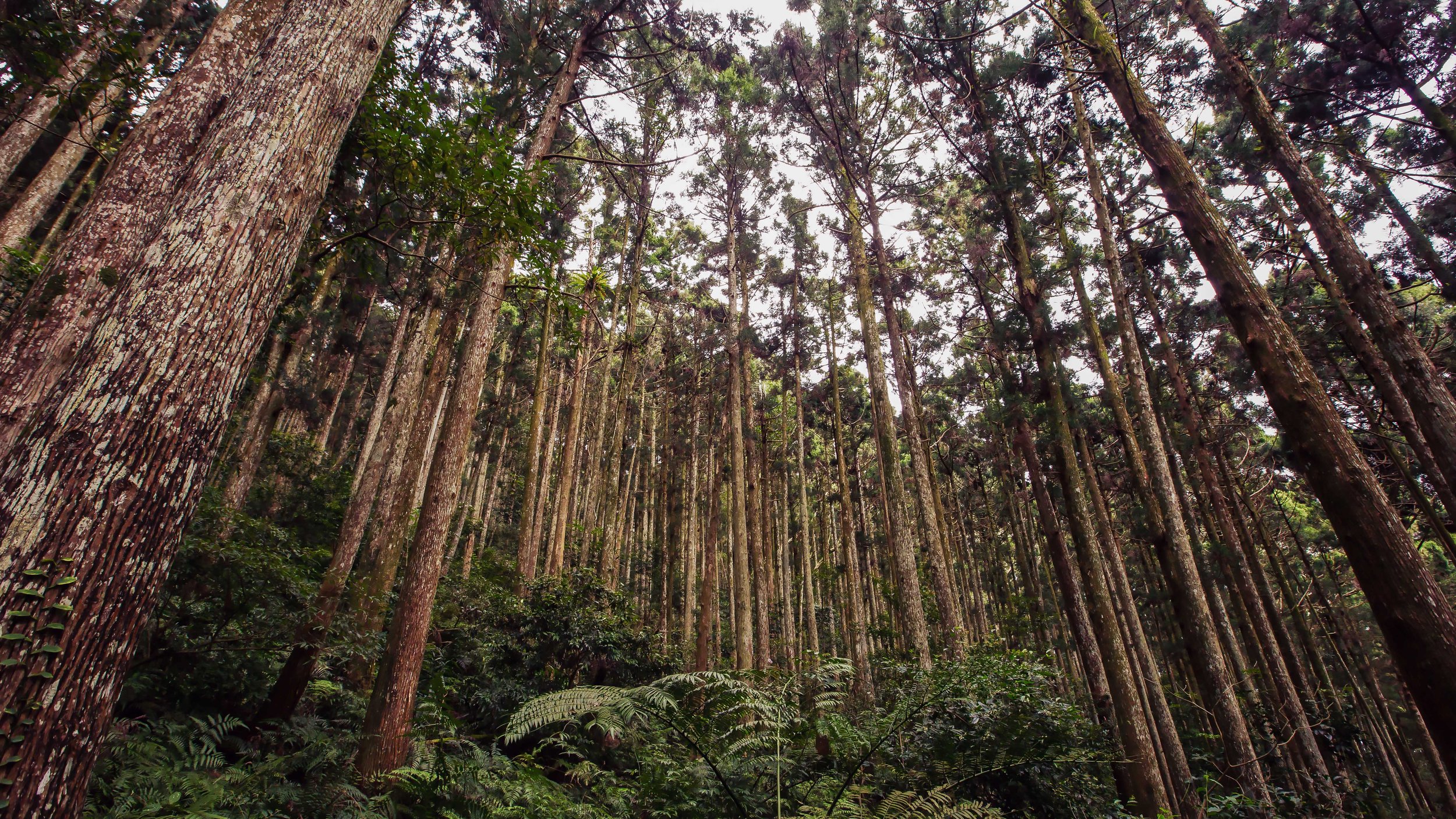
Located on a steep hillside on the east-side of the port, the shrine faces in the opposite direction of the ocean and even though purchasing the land proved to be difficult, it was essentially what you’d consider the ideal location for a shrine of this nature. It was not only close to the port, but the commercial and residential areas of the city as well, it was easy to access, and more importantly was also in an area surrounded by the natural environment. 

If you weren’t already aware, Shinto Shrines are renowned for their impressive ability to blend in harmoniously with the natural environment around them, which shouldn’t really be all that surprising considering that it is a religion that worships deities related to nature. Similarity, the Shinto deities, or “kami” are almost always objects found in the natural environment such as animals, birds, rivers, mountains, trees, etc.

For the Shinto, the relationship with the natural environment is extremely important given that the earth can bring both blessing and disaster. It is thought that if the kami are worshipped adequately and in a responsible way, then they will bring good fortune to the world. If on the other hand they are disrespected or neglected, they will react violently or bring misfortune. Essentially, respect for the environment is one of the main tenets of Shintoism and the construction of these shrines never fails to keep that in mind. With over 80,000 shrines in Japan, Shintoism contributes to society providing ecological sanctuaries that can be enjoyed by all.

Before I talk about what you would have found at the Shrine while it was still around, lets take a few minutes to talk about the deities enshrined within:

Amaterasu (天照皇大神)

One of the children of the god and goddess of creation, Izanami (伊邪那美命) and Izanagi (伊邪那岐神), Amaterasu is one Shintoism’s most important deities. 

Known more formally as Amaterasu-Ōmikami (天照大御神), she is the goddess of the sun and the universe, and is considered to be the mythical ancestor of the Imperial House of Japan.

Enshrined at the Ise Grand Shrine (伊勢神宮) in Ise, Mie Prefecture (三重縣), worship of the goddess is often directly linked to worship of “Japan” itself, known as “Japanese Spirit”, or Yamato-damashii (大和魂).

This in itself was problematic during the period when State Shintoism was one of the tools used to fuel the militarism of the era, but worship of Amaterasu far predates all of that insanity as she has been one of the most important Shinto deities for more than thirteen centuries.

Given that most Shinto Shrines in Taiwan would have been home to an Amaterasu shrine, this was one of the reasons why the Chinese Nationalists were so keen on destroying the shrines, given her links to the militarism of the early 20th Century.

The Three Deities Of Cultivation (かいたくさんじん / 開拓三神)

The “Three Deities of Cultivation”, consist of three figures known for their skills with regard to nation-building, farming, business and medicine.

The three “Kaitaku Sannin” are as follows: 

  1. Ōkunitama no Mikoto (大國魂大神 / おおくにたまのかみ)

  2. Ōkuninushi no Mikoto (大名牟遲大神 / おおなむちのかみ)

  3. Sukunabikona no Mikoto (少彥名大神 / すくなひこなのかみ)

While these deities are also quite common within Japan’s Shinto Shrines, they were especially important here in Taiwan due to what they represented. Given Taiwan’s position as a new addition to the Japanese empire, ‘nation-building’ and the association of a ‘Japanese way of life’ was something that was being pushed on the local people in more ways than one. Likewise, considering the economy at the time was largely agricultural-based, it was important that the gods enshrined reflected that aspect of life. 

Prince Kitashirakawa Yoshihisa (北白川宮能久親王)

Prince Yoshihisa, a western educated Major-General in the Japanese imperial army was commissioned to participate in the invasion of Taiwan after the island was ceded to the empire. 

Unfortunately for the Prince, he contracted malaria and died in either modern day Hsinchu or Tainan (where he died is disputed), making him the first member of the Japanese royal family to pass away outside of Japan in more than nine hundred years. 

Shortly after his death he was elevated to the status of a ‘kami’ under state Shinto and was given the name “Kitashirakawa no Miya Yoshihisa-shinno no Mikoto“, and subsequently became one of the most important patron deities here in Taiwan, as well as being enshrined at the Yasukuni Shrine (靖國神社) in Tokyo.

Link: Prince Kitashirakawa Yoshihisa (Wiki) 

Coincidentally, sharing part of the same mountain as the former Keelung Shinto Shrine, you can find a monument that was erected in memorial for the Prince Yoshihisa. The monument isn’t really all that well advertised, but it wasn’t (completely) destroyed when the Chinese Nationalists took control of Taiwan. It was however completely defaced and the Chinese characters that were written on the front of the monument have been filled in with cement.

That being said, the monument is another one of Keelung’s many Japanese-era structures that continue to exist and if you’re interested you should definitely take some time to visit.

Japanese Prince Kitashirakawa Yoshihisa Monument (北白川宮能久親王紀念碑)

Address: #68, Alley #122 Zhongchuan Road, Keelung City (基隆市中正區中船路112巷68號)

Emperor Sutoku (崇德天皇) 

The inclusion of Emperor Sutoku as one of the kami enshrined at the Keelung Shrine was certainly an interesting and somewhat obscure choice, given his role as one of the Three Great Onryo of Japan (日本三大怨霊).

Emperor Sutoku (崇徳天皇/すとくてんのう) was the 75th Emperor of Japan, reigning from 1123 to 1142 during the Tenji (天治), Daiji (大治), Tensho (天承), Chosho (長承), Hoen (保延) and Eiji (永治) Periods. 

Although his reign as Emperor spanned a period of nineteen years, his time in power was considerably shorter given that he officially came to the throne at the age of three - This left the country governed under the stewardship of his father, Emperor Toba (鳥羽天皇), until Sutoku came of age. 

It’s unclear when that actually happened, but the Eiji era (1141 - 1142) when the Emperor was 22 years old would become the most eventful, and final years of his reign.

Considered a “bastard”, Sutoku was not well-liked by his “father”, Emperor Toba, who was forced to abdicate the throne when Sutoku was just three years old. Unfortunately for Sutoku, his true father, former Emperor Shirikawa (白河天皇) died in 1129 leaving Toba with a firm grip on the reigns of power.

The story of Emperor Sutoku is ultimately a sad tale that involves a life of alienation, emotional abuse and coercion resulting in his being forced to adopt Toba’s bastard son (in a situation similar to his own), early retirement, a failed attempt at retaking the throne and banishment to a distant province to live his life as a monk.

Sutoku passed away in 1164 having lived his final years as a monk, but after being disposed and humiliated, it is said that he was full of bitterness and rage. Prior to his death, legend has it that he bit off his own tongue and wrote holy manuscripts with his own blood, which he then sent back to Kyoto, imbuing them with his hatred for the imperial court. 

But by that time he was already persona-non-grata and was largely ignored. 

When he passed away, a series of strange events occurred, with storms, plagues, fires, droughts and earthquakes all taking place in the capital and resulted in a civil war that ended the dynasty. 

This is how Sutoku became known as one of the “Nihon San Dai Onryo”, or the “Three Great Demons of Japan,” along with Sugawara no Michizane (菅原道真) and Taira no Masakado (平将門).

According to Japanese folklore, an “onryo” (怨霊) is a kind of “yokai” (妖怪),or a demon that is considered to be a wrathful or vengeful spirit capable of causing harm to the world in an attempt to exact revenge against their enemies. This isn’t something that people in Japan really joke about, and as recent as 2012, Sutoku was blamed for an earthquake that took place in the Kanto region after an NHK drama depicted his transformation into a demon. 

Links: The Peculiar Life of Emperor Sutoku (Yabai) | Sutoku Tenno (Yokai) 

So why was Emperor Sutoku enshrined at the Keelung Shinto Shrine?

Well, in 1868 (明治元年), the first year of Emperor Meiji’s reign, it was commanded that Sutoku be enshrined as a kami at the Shiramine Shrine (白峯神宮) in Kyoto, which was seen as his return to the capital and an attempt to sooth the country’s most vengeful sprit. 

Shintoism is a complicated polytheistic religion with a myriad of deities hailing from both natural and supernatural world. Given that there are so many deities, it shouldn’t surprise anyone that there are those that are ‘good’ and those that are ‘bad’ in an attempt to better explain how the world works.

Kami are generally divided by their “mitama” (魂), or their ‘spirits’ into “Nigi-mitama” (和魂 / にきたま) and “Ara-mitama” (荒魂 / あらたま), essentially positive and negative. In the latter case, the “nigi-mitama” are often blamed for natural disasters, droughts, food shortages, war and suffering. So, in order to avoid misfortune, it is important to deal with any negative energy through pacification rites and worship.

This is why Emperor Meiji brought the remains of former Emperor Sutoku back to Kyoto and placed them within a shrine dedicated in his honor. Given the centuries of havoc brought on by the rage and bitterness of Sutoku, it was thought that bringing him back to the capital to give him the proper burial rites of an emperor would help to ease his path into becoming an honourable spirit.

Link: Mitama | 荒魂與和魂 (Wiki) 

Okay, so once again lets get back to the Keelung Shinto Shrine. 

Why would they enshrine one of Japan’s most vengeful spirits within the important port city? 

If that isn’t clear already, the pacification of these negative spirits is an important ritual for maintaining the safety and security of society. The inclusion of Emperor Sutoku within the Keelung Shrine was an attempt to ensure the safety of the port, which would have been one of the busiest in Taiwan at the time. It was especially important at the time because Emperor Meiji had only started the pacification process of the negative spirit a few decades prior to the construction of the shrine, and if more people worshipped him, less terrible things would happen.  

Ōmononushi (大物主命) 

Similar to the Three Deities of Cultivation mentioned above, Ōmononushi-no-kami (おほものぬし) is another one of Shintoism’s most important deities. Known literally as the ‘Great Thing Master’ or the ‘Great Spirit Master’, he is likewise considered the god of nation-building, agriculture, business, medicine and brewing.

More importantly in this case however, Omononushi is known as a patron spirit for seafarers. 

Dating as far back as the ‘pacification’ and development of the earth, the mythology of Omononushi was told as far back as 712CE in the Kojiki (古事記), but you’ll also find mention of him in other important books like the Shoki (日本書紀) and the Fudoki (風土記). 

So, even though he serves the same purpose as the gods mentioned above, his importance and power in the scope of Shintoism far exceeds them.

Link: Ōmononushi (Wiki) 

Architectural Design

The Keelung Shrine was constructed on a steep hillside and was beautifully layered with the traditional “Visiting Path” rising up not just one steep set of stairs, but two, culminating with the ‘Main Hall’ located on a third layer to the rear of the Hall of Worship. 

With this in mind, you’ll have to take into consideration how much effort it took to shape the land into the various layers for the construction of the shrine, as well as the genius it took to construct a drainage system that would allow rainwater from the mountain above to flow down the mountain, without causing any structural damage to the shrine. 

As the largest shrine in the Keelung area, the shrine would have featured all the bells and whistles of a typical Prefectural Level Shrine (縣社) and consisted of the following: 

  1. A Visiting Path or “sando” (參道 /さんどう)

  2. Stone Lanterns or “toro” (石燈籠/しゃむしょ)

  3. Stone Guardian Lion-Dogs or “komainu” (狛犬/こまいぬ)

  4. Shrine Gates or “torii” (鳥居 /とりい)

  5. A Sacred Fence or “tamagaki” (玉垣 / たまがき)

  6. An Administration Office or “shamusho” (社務所/しゃむしょ) 50坪

  7. A Purification Fountain or “chozuya” (手水舍 /ちょうずや) 1.5坪

  8. A ‘Mikoshi Storehouse’ or “shinyosha” (神輿舎 / しんよしゃ) 3坪

  9. A Hall of Worship or “haiden” (拜殿 /はいでん) 300坪

  10. An Offertory Hall or “heiden” (幣殿 / へいでん)

  11. A Main Hall or “honden” (本殿/ほんでん) 110坪

  12. A massive cannon (戰利砲)

What we know about the architectural design of the shrine today comes from a combination of the layout that remains today, and the assistance of historic photos and records.

Starting with the ‘Visiting Path’ (參道), there was a large Shrine Gate (一の鳥居) on ground level. You’ll still find a shrine gate in the same spot today, but it has since been converted into a Chinese-style gate. Once you passed through the gate you’d be met with two large stone-guardian lion-dogs (狛犬) standing on pedestals on either side. The stairs that led up the hill to the shrine were laid with concrete and both sides featured stone lanterns (石燈籠) that were set up on pedestals. 

Once you reached the top of the first set of stairs, you’d find a second Shrine Gate (二の鳥居), and then an open space where there was an Administration Office (社務所) and a Purification Fountain (水手舍) on its right.

And (from the 1930s on), a giant twenty-eight ton cannon on its left. 

The path would have continued to the right of the Administration Office where you’d reach a third Shrine Gate (三の鳥居), with two giant stone lanterns, and a much wider set of stairs that led to the second level. When you reached the top of this set of stairs you would have found the final Shrine Gate (四の鳥居), and two smaller Stone Guardian Lion-Dogs (狛犬) on the left and right side - both of which still exist today.

Often appearing as a male and female, the ‘komainu’ are only distinguishable only by their facial expressions, with the male “a-gyo” (阿型) having an open mouth and the female “un-gyo” (吽形) having a closed mouth. The male guardian is located on the left and the female on the right. If you look closely on their pedestals on the bottom you’ll discover that they date back to 1917 (大正8年), and the names of the people who donated them to the shrine. The fact that both of them continue to exist today in itself is somewhat of a miracle. 

Link: Komainu Lion Dogs (Japan Visitor)

Once you pass through the shrine gate you would have been met directly with the beautiful ‘Hall of Worship’, otherwise known as the ‘oratory’ or the “haiden” (拜殿). The hall was constructed in an architectural style reminiscent of the Maidono Hall (舞殿) at the nearly 1400 year old Yasaka Shrine (八坂神社 / やさかじんじゃ) in Kyoto.

Link: Yasaka Shrine (Japan Guide)

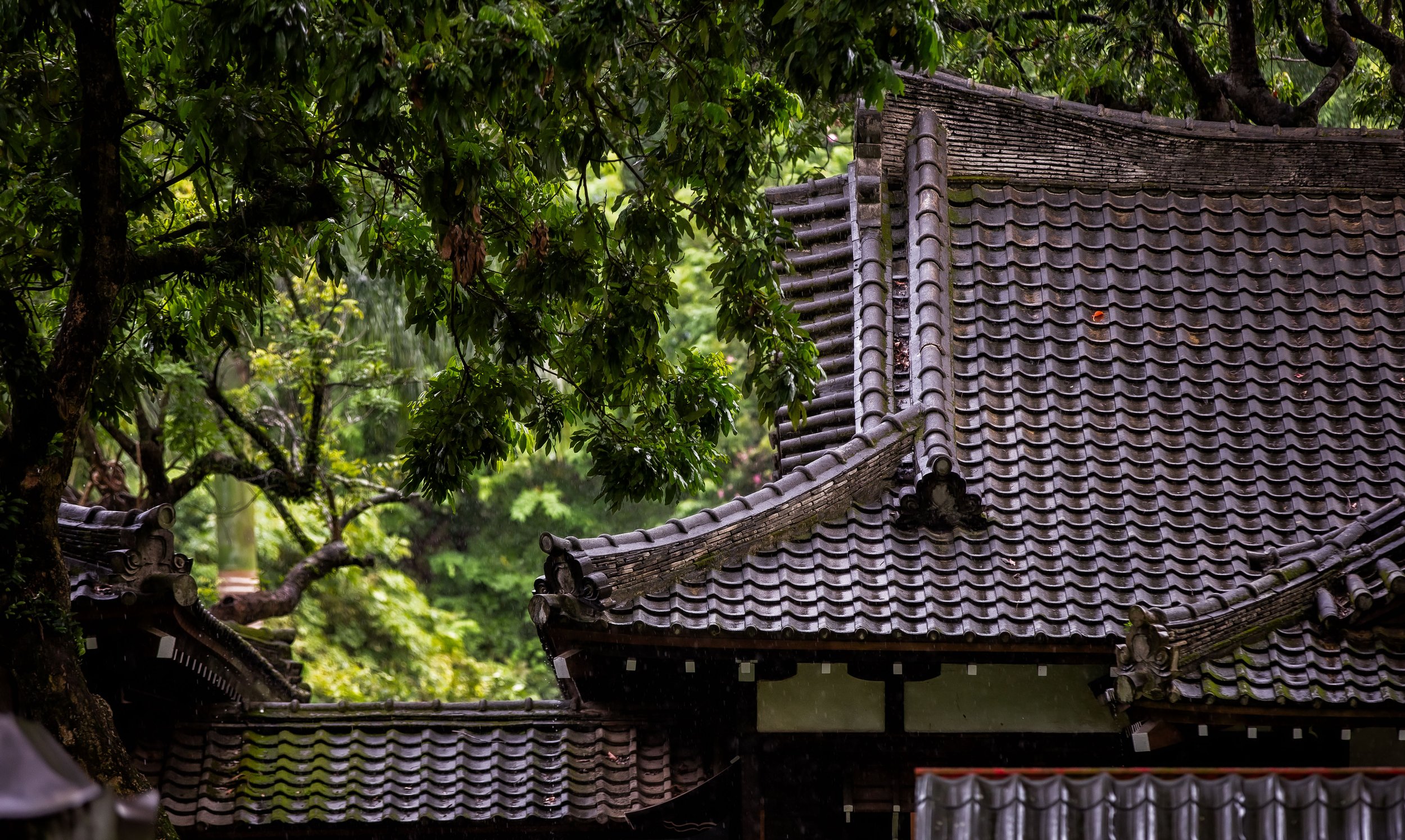
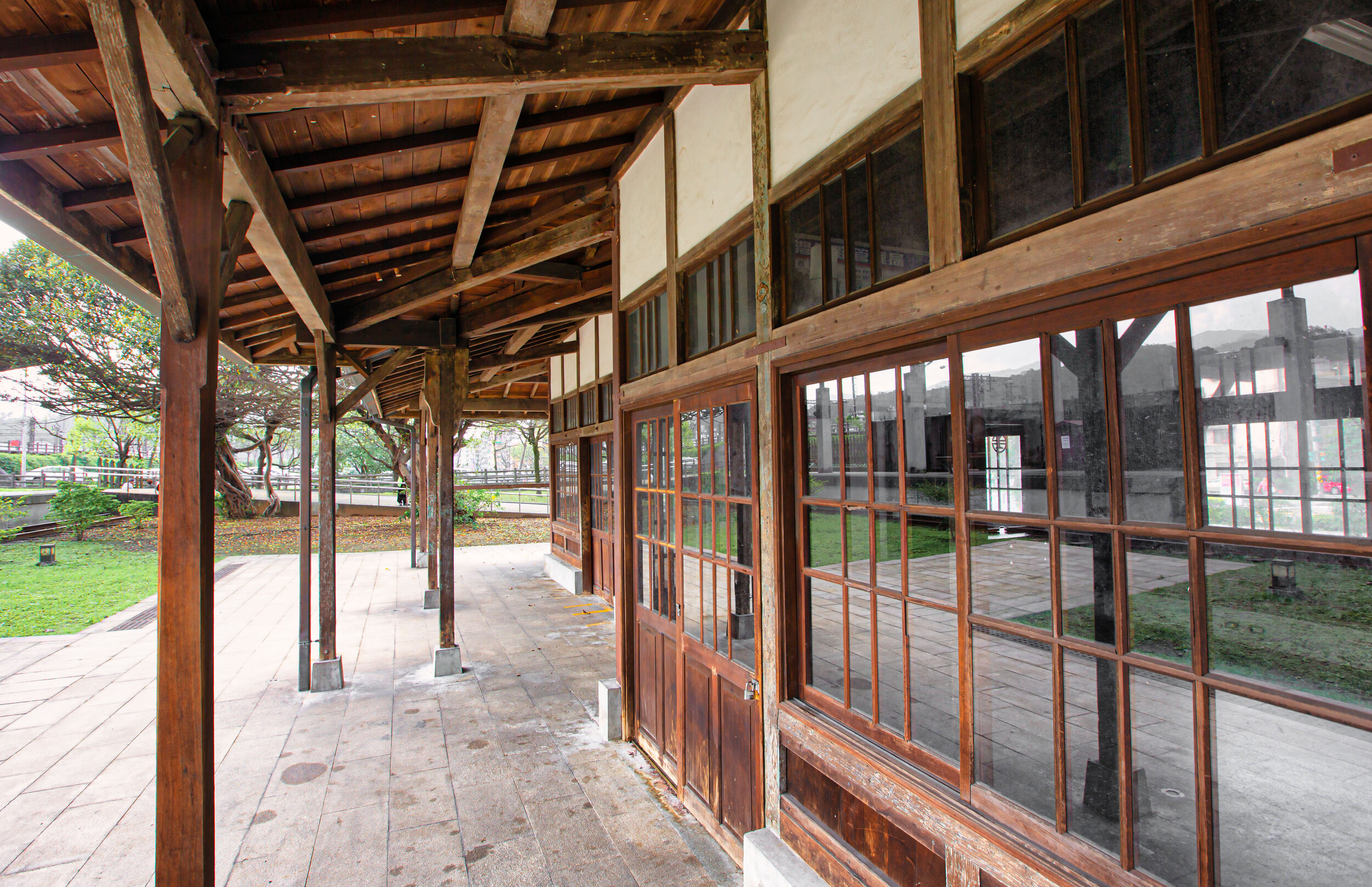
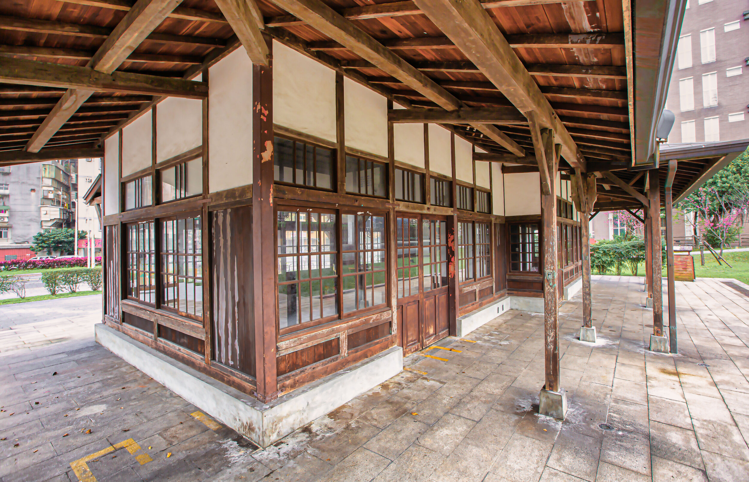
Elevated off of the ground on a concrete base, the architectural style of this Hall of Worship allowed it to stand apart from many of the other shrines around Taiwan in that it was an open-air building designed in the seihoukei haiden (正方形拝殿) style. Held up with a network of pillars around the perimeter of the building, it featured a beautiful Irimoya-zukuri (入母屋造) hip-and-gable roof and given that it was an open-air building, it featured an enclosed Offertory Hall or “Heiden” (幣殿) connected via a passageway at the rear.

<PHOTO> 

Based on historic photos of the shrine, it appears that the overall design of the hall was likely constructed using the “ishinoma-zukuri” (石の間造) style that allowed both the Haiden and the Heiden to be connected by a passageway known as “ishi-no-ma” (石の間). This would have been an instrumental design feature that allowed the main building to maintain its open-air design as well as distributing the weight of the massive roof with the help of the network of pillars. 

It was also pretty important for the elaborate shape of both of the roofs as the larger roof on the front part of the building featured the ‘four-sided’ Irimoya hip-and-gable roof, while the smaller Heiden building to the rear featured a two sided kirizuma nagare-zukuri (切妻流造) gable-style roof, creating a three-dimensional flowing design. 

One of the interesting things about the old photos of the shrine were the purple curtain/banners (御神幕) that surrounded the open-air sections of the Hall of Worship. Each section featured a crest that was used to represent Taiwan’s Shinto Shrines (臺灣神社徽) consisting of a combination of the Taiwan Crest (台字徽 / たいわん) and the fourteen-petal chrysanthemum flower, known as the kikumon (菊紋).

<PHOTO> 

For a look at some of the absolutely beautifully designed crests used in Taiwan during the colonial era, check out the website linked below which features descriptions for quite a few of them. 

Link: 日治臺灣主要都市市徽一覧

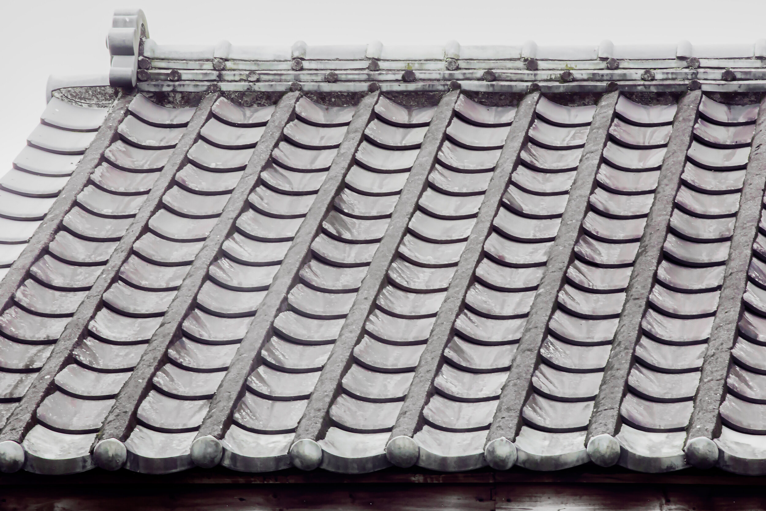
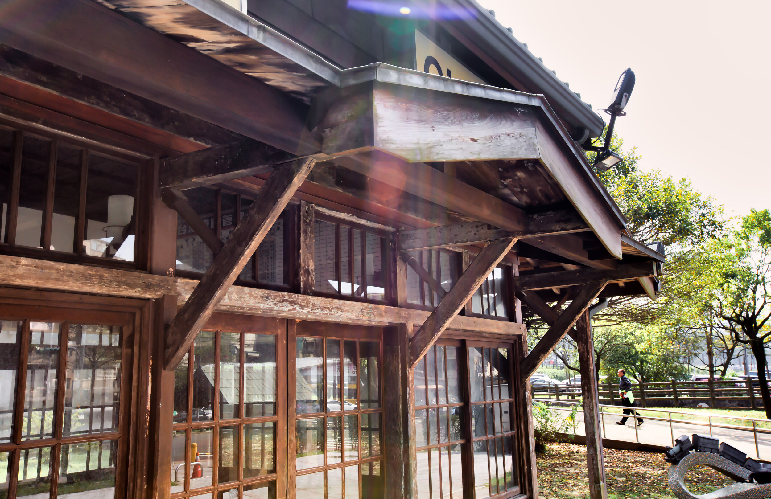
Finally, to the rear of the Hall of Worship, there was another steep set of stairs that led directly to the Main Hall or the “Honden” (本殿), which was off-limits to the public. Elevated above the rest of the shrine, the Hall of Worship was where the deities were enshrined and would have only been accessible to the priests who lived and worked at the shrine. 

The small building featured a beautiful kirizuma-zukuri roof (切妻造), which is best described as a roof that looks like ‘an open book placed with its face down, or like the Chinese character “rù” (入). 

<PHOTO> 

In 1934 (昭和9年), the Keelung Shinto Shrine was updated into a Prefectural Level Shrine (縣社) under the Governor General’s Office policy to ensure that there was a shrine in every borough, town and city in Taiwan (一街一庄一神社). As mentioned above, as part of the celebrations for its upgrade in status, the shrine was gifted a giant cannon. 

When the Colonial Era ended in 1945 (昭和20年), the Keelung Shinto Shrine, like many of the other larger Prefectural Level Shrines was converted into a Martyrs Shrine (忠烈祠) by the Chinese Nationalist Government. 

The cannon was then moved to a park further up the mountain and parts of the shrine started to change. Ultimately the vast majority of the shrine was torn down in 1969 (民國58年), and a Chinese-style shrine was constructed in its place. 

The Keelung Martyrs Shrine (基隆忠烈祠)

After that long-winded deep dive above about a Shinto Shrine that doesn’t even exist anymore, it would be understandable if you’ve read this far and you’re asking yourself: 

What exactly is a Martyrs Shrine?” 

That’s okay - I’ve visited quite a few of these shrines and I still find myself asking this question. 

To put it in simple terms, Martyrs Shrines in Taiwan are more or less war memorials for the fallen members of the Republic of China Armed Forces.

There are over twenty of these shrines throughout Taiwan (including the outlying islands), each of which with has interesting history, but is a history that doesn’t necessarily ever relate to anything to do with the Martyrs Shrine itself.

Its also important to note that these shrines actually have very little to do with “Taiwan” as the majority of the ‘martyrs’ worshipped in the shrines were soldiers who died during the various conflicts in China from the founding of the Republic of China in 1912 until the 1950s.

That being said, even though the ‘Republic of China’ has been at peace for several decades, if a member of any branch of the Armed Forces passes away in the line of duty, they are also afforded the respect of becoming a martyr.

If you’d like more detail about these shrines, I recommend taking a few minutes to check out my post about the National Revolutionary Martyrs Shrine, which explains the purpose of these shrines.

I suppose the key thing to understand about Taiwan’s ‘Martyrs Shrines’ is that of the twenty or so that exist in the country today, the vast majority of them are located on the site of a former Shinto Shrine.

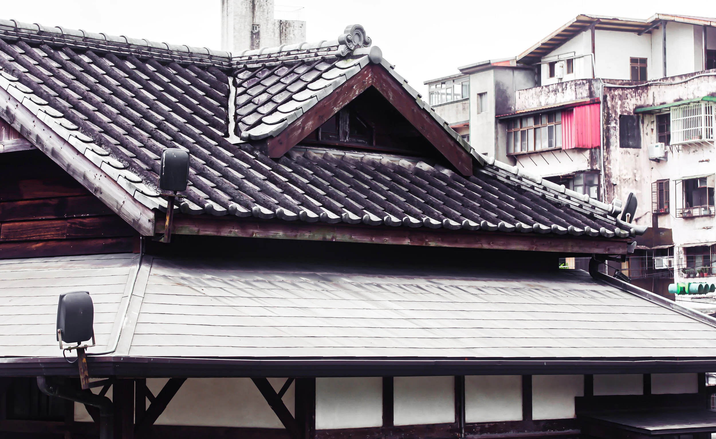
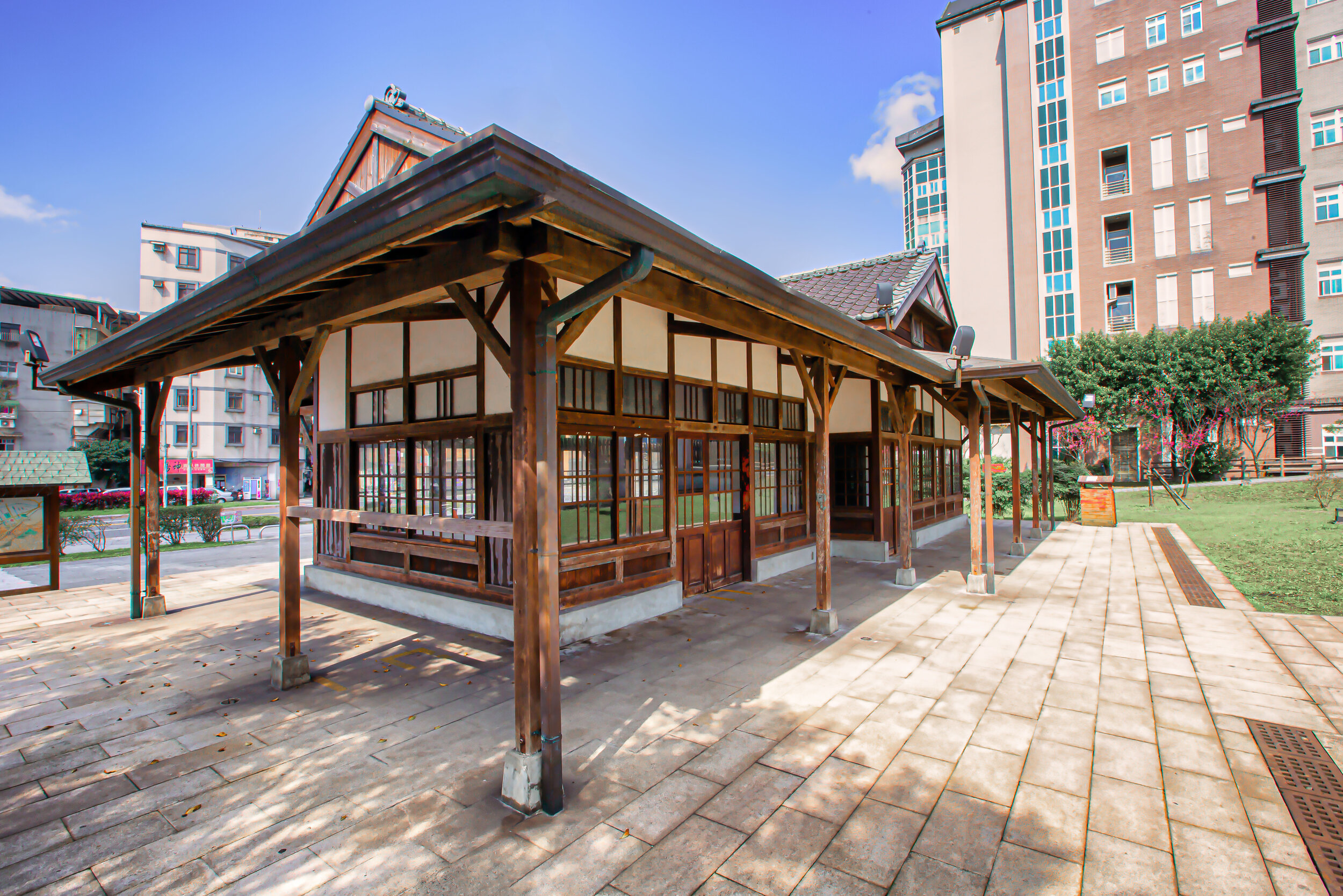
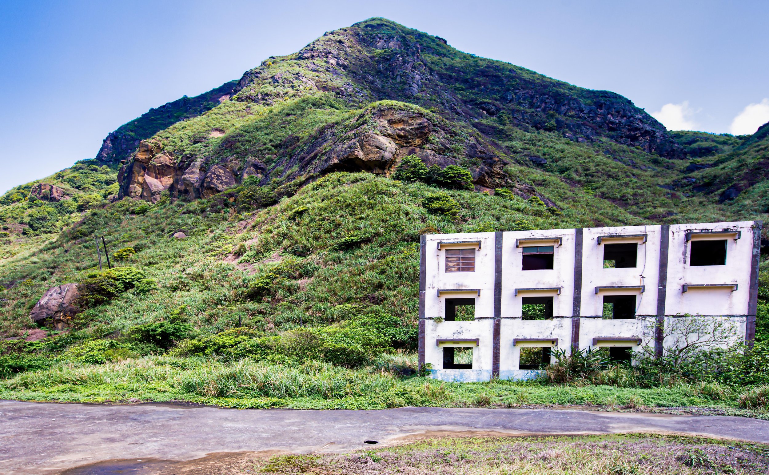
Some of which still retain bits and pieces of their original design and layout, but have been altered to reflect their new roles while others have been completely torn down and rebuilt. The Keelung Martyrs Shrine is no different as it is located on the site of the former Keelung Shinto Shrine, and even though most of what once stood on this site has been torn down, it continues to retain much of its original layout with a few little surprises here and there. 

As I’ve already done several in the past with these articles about Taiwan’s Martyrs Shrines, I’ll explain the current shrine by following the path of the original Shinto Shrine so that you can better understand what currently exists on the site and what used to be there. 

Before we get into that though, let me first explain the short history of the shrine. 

When the Second World War ended with the Japanese Empire’s surrender to the Allied Forces, one of the conditions of their defeat was that they had to relinquish control of the areas they conquered in the decades leading up to the war. This included areas in Korea, Manchuria, China and Taiwan, among others. Having to surrender control of these areas was certainly a major blow to Japan, but none of them could have ever compared to the loss of Taiwan, which was Japan’s most treasured colony. 

Control of Taiwan was ambiguously awarded to the Republic of China and when the Chinese Nationalists arrived here, they were gifted with an island that was developed far better than that of the rest of China. That being said, they inherited a population of people who resisted their rule and who (for the most part) considered themselves Japanese citizens, or had no interest in being ruled by another foreign power. This resulted in protests, massacres and what would become known as the period of White Terror (白色恐怖), where the island was ruled with an iron fist for decades. 

Link: White Terror | 白色恐怖 (Wiki)

Back in China, Chiang Kai-Shek and his Chinese Nationalists found themselves on the losing end of the Chinese Civil War, which eventually forced him to relocate the government to Taipei, bringing with him millions of people and a large portion of China’s priceless national treasures. 

Even though Taiwan was pretty well-developed at the time, the sudden influx of more than two million Chinese refugees put a major strain on the island’s infrastructure, in addition to putting the refugees at odds with the local population.

The Chinese Nationalists having suffered through a terrible war against the Japanese back at home during the Second World War, figured it was better to simply get rid of any Japanese cultural symbols in order to ensure a quicker transition to Chinese Nationalist rule. 

This meant that the majority of Taiwan’s more than two hundred Shinto Shrines would have to be demolished. That being said, many of the larger Prefectural Level Shrines were a little too nice to be simply torn down, so a few of them were saved from being torn down by being converted into Martyrs Shrines, which replaced one regimes cultural symbol with a culture symbol of another regime.

The Keelung Shinto Shrine was one of the lucky Shinto Shrines that was able to escape wanton destruction and for more than two decades only a few minor details were changed to better reflect the change in regime. 

In the late 1960s however, the international political situation started to shift and countries started to formally recognize the People’s Republic of China, which had shut its borders to most of the world after 1949 to better facilitate their ‘Communist’ revolution. One of China’s pre-conditions for the establishment of formal ties was that countries had to respect its position on the situation regarding Taiwan.

With a sudden loss of its seat in the United Nations and international relations in tatters, the government of the Republic of China in Taiwan acted immaturely in its response and burned quite a few bridges in the process. When the Japanese government signed their own Joint Communiqué with the PRC in 1972, the government here in Taiwan responded by tearing down even more of the island’s Japanese past, which included many of the remaining Shinto Shrines. 

The Keelung Shinto Shrine ended up being one of the shrines that got demolished, and in 1969 (民國58年) construction started on a replica of a Northern-Chinese Palace style (中國北方宮殿樣式) designed replacement.

That being said, the construction process was pretty half-assed and even though the main shrine was completed in 1972, much of the site remains to this day a ‘work in progress’ and has suffered through long periods of neglect. 

Suffice to say, annual numbers place the number of people who visited the Shinto Shrine in 1933 at more than 83,000 people. Given how so few people actually visit the shrine these days, it would be hard to imagine that more than 83,000 people have visited since 1972. 

  • Shrine Gates (鳥居 / 牌樓)

Once home to four Japanese Shrine Gates, otherwise known as “Torii”, the Martyrs Shrine currently features two beautiful Chinese-style “Pailou Gates” (牌樓) on street level, and just as you reach the Martyrs Shrine. 

While the street-level gate acts as a gate to the Martyrs Shrine, it is officially the pedestrian entrance to Zhongzheng Park (中正公園), which takes you up the path to the shrine and beyond to the beautiful trails on the mountain park that overlooks the port.

The gate has a beautifully decorated red ‘roof’ with two multi-coloured ridges below, and is easily 20 meters high, making it a very noticeable while walking down the street. 

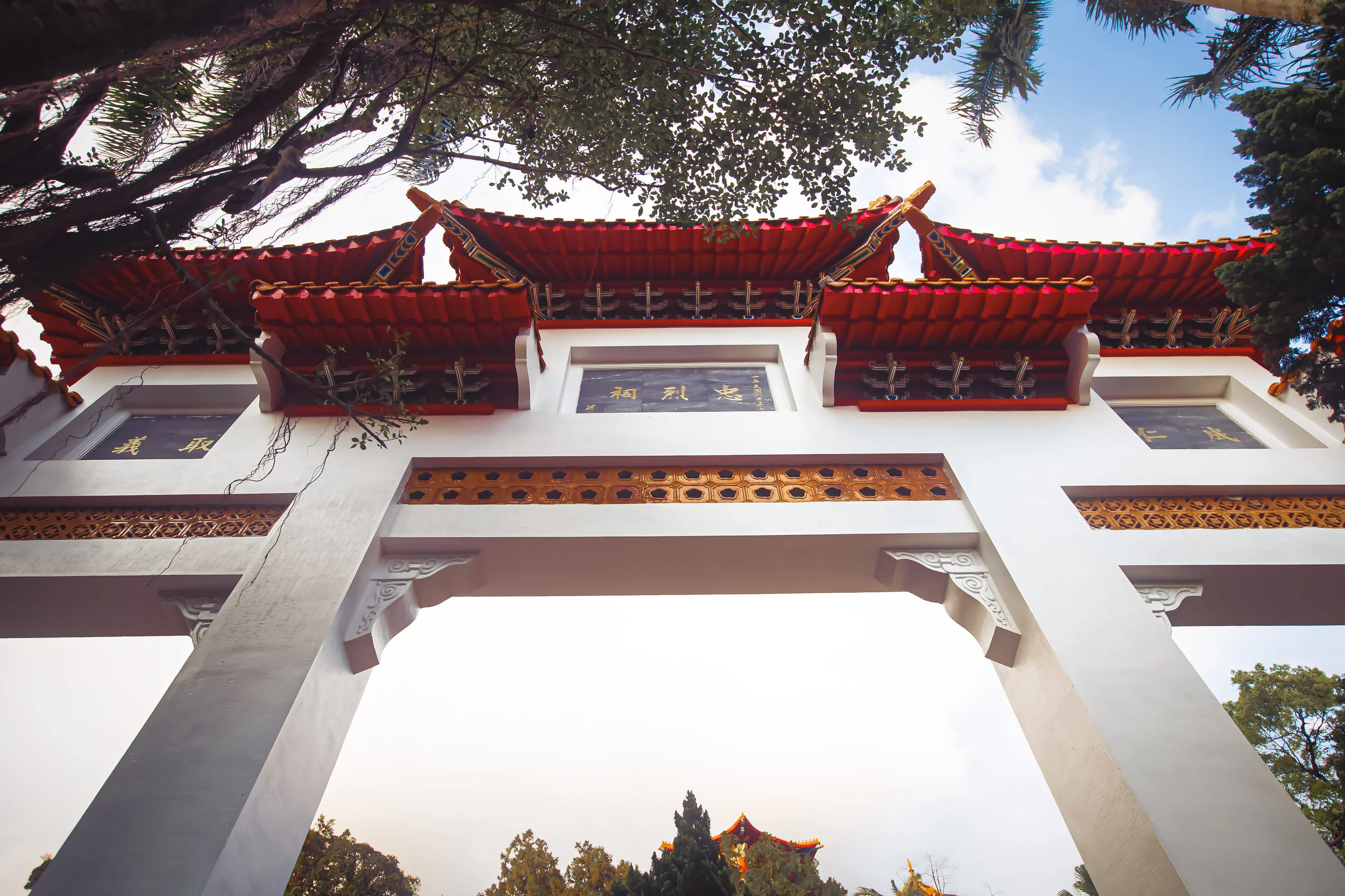
The second gate further up the path is the official Martyrs Shrine Gate (忠烈祠牌樓), and following tradition includes three passageways, a multi-layered roof, and plaques with Chinese calligraphy on both the front and back. Strangely, gates of this kind at other Martyrs Shrines around Taiwan feature similar plaques, with a number of ‘revolutionary’ phases, but they it seems like they were a bit lazy with this one as the three plaques on the front and back are exactly the same.

On both sides you’ll find the largest plaque in the centre that reads “Martyrs’ Shrine” (忠烈祠) with the words “成仁” (chéng rén) and “取義“ (qǔ yì) above the left and right archway, which translate as ‘to die for a good cause’ and ‘to choose honour over life’ respectively. 

  • Visiting Path (參道)

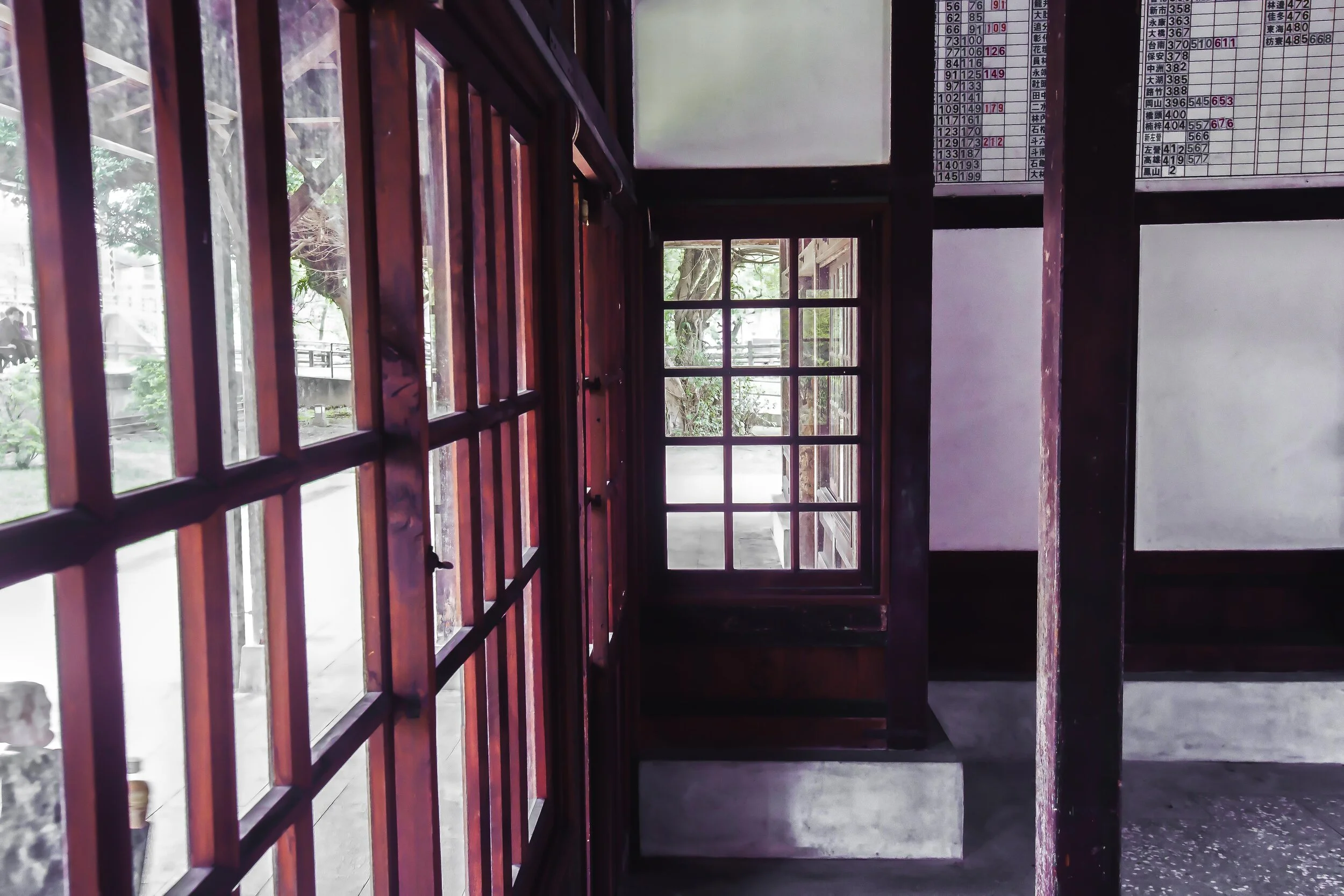
The Visiting Path to the Martyrs Shrine is one of the pieces of the Shinto Shrine that was never really affected, like the rest of the shrine. The original path retains much of its century-old elements and if you’ve ever visited a Shinto Shrine in Japan, it should be easily identifiable.

Starting from ground-level, the path to the shrine is a two-sided stone set of stairs with a railing in the middle and pedestals on both sides. The pedestals were once home to shrine’s Stone Lanterns, but they’ve all since been removed or destroyed. Once you reach the top of the first set of stairs you’ll discover an open section of land where the Shinto Shrine’s Administration Building once existed.

From there, the stone path continues to the right where you’ll reach a second set of steep stairs where you’ll see the second Shrine Gate at the top. Near the base of the stairs you should take a look at the base of the green hill where you’ll see the reinforced cement base that was constructed along with the Shinto Shrine to prevent landslides and help with water drainage.

When you reach the top of the second set of stairs, you’ll find a set of the original Stone Lion-Dog Guardians on both the left and right side, both of which have amazingly survived since they were gifted to the Shinto Shrine in 1918 (大正8年).  

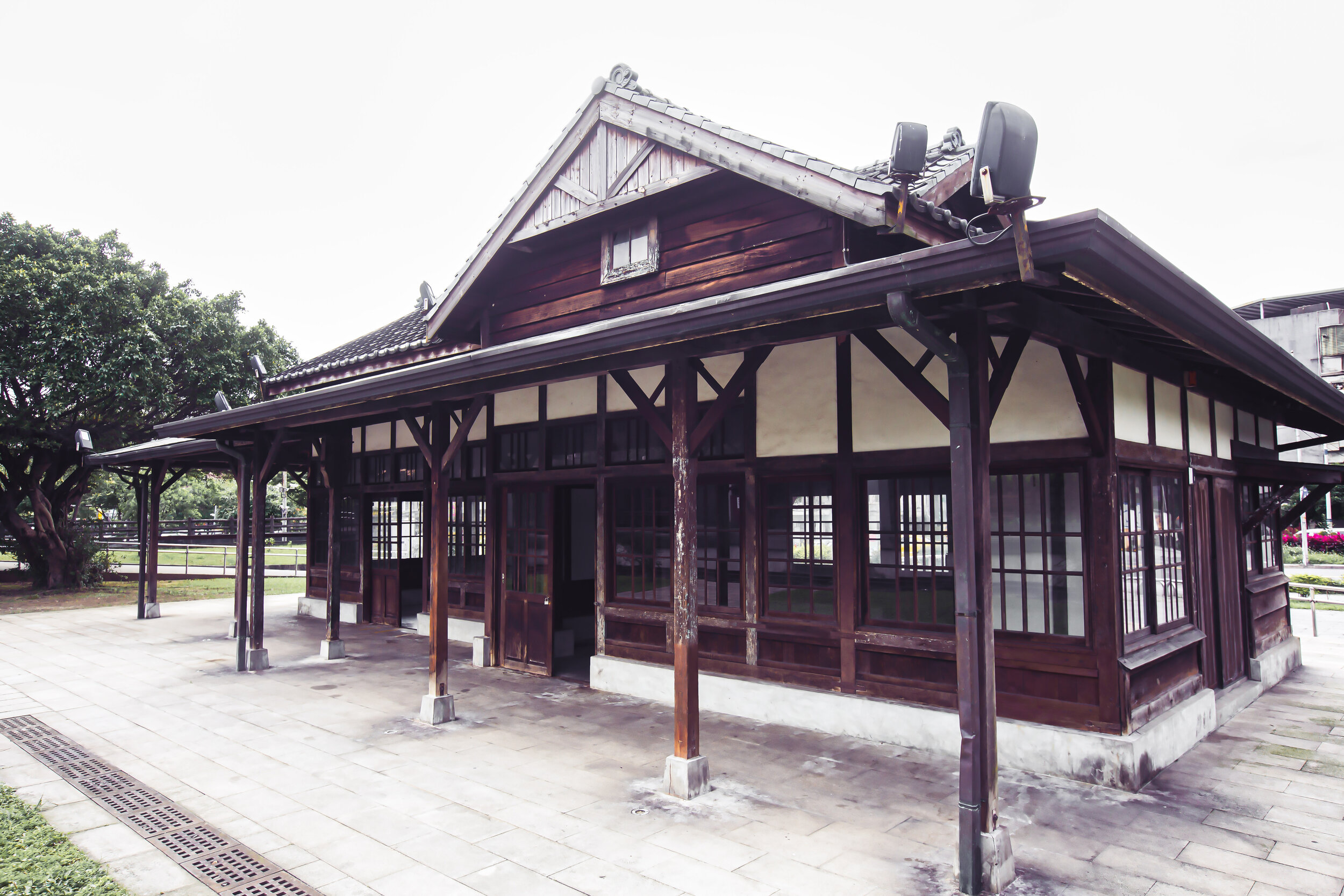
  • Hall of Worship / Martyrs Shrine (拜殿 / 忠烈祠)

Interestingly, the current Main Hall of the Martyrs Shrine building was constructed on the exact location of the original Shinto Shrine, and continues to use the original base to elevate it off of the ground that was constructed for the Shinto Shrine almost a century ago.

The architectural design of the building however has changed considerably. 

Constructed in the Northern-Chinese Palace style, the shrine follows a similar architectural design as many of the other Martyrs Shrines around Taiwan in that it has beautiful red pillars around the perimeter of the building that help to hold up an elaborate two-layered roof.

Between the first and second layer of the roof you’ll find a horizontal plaque in the centre that reads “zhōng liè cí” (忠烈祠), or “Martyrs Shrine” and below that you’ll find another that reads “zhōng liè qiān qiū” (忠烈千秋), which is translated literally as “The Loyalty of the Martyrs.”

On the apex of the roof you’ll find the circular star of the Republic of China, one of the iconic images of the Chinese Nationalist Party. The blue and white star hasn’t really aged well though, and is both fading and falling apart, much like the Chinese Nationalists themselves.

I can’t really tell you much about the interior of the building as like many of the other Martyrs Shrines around the country, its not open to the public very often. 

The thing about these shrines is that they’re not the same as the typical temples or shrines that you’ll find all around Taiwan, and it is actually very uncommon for people to just randomly show up to pray.

The Martyrs Shrines serve their purpose as war memorials (and propaganda tools) for the former authoritarian regime, which is why you’ll rarely find many visitors. 

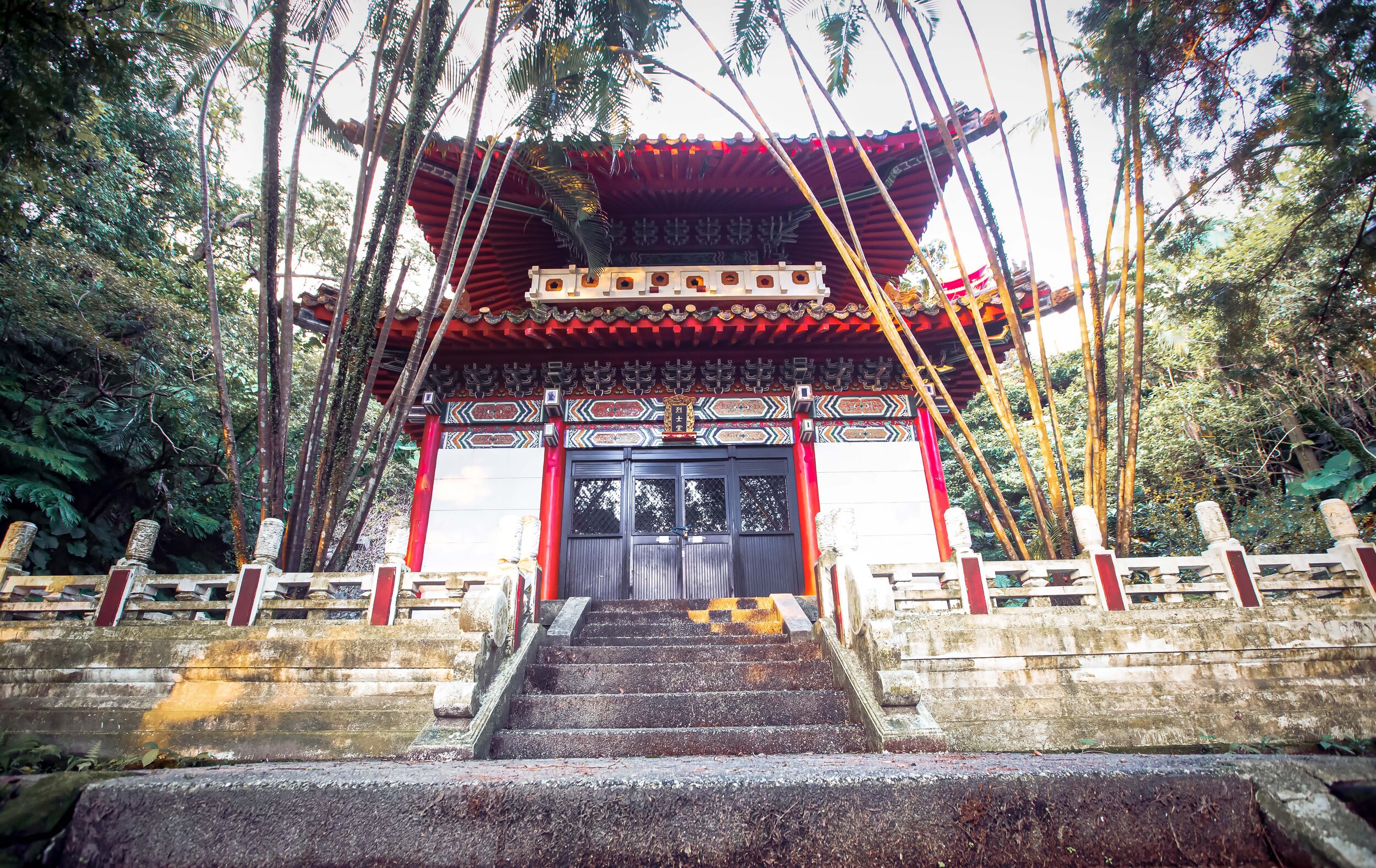
  • Main Hall / Martyrs Hall (本殿 / 烈士堂)

The last section of the Martyrs Shrine is somewhat of a recent addition, but is located in the beautiful space where the Shinto Shrine’s Main Hall (本殿) was once located. 

When the Shinto Shrine was torn down and the Martyrs Shrine was constructed in its place, the area that was once home to the Main Hall became home to a shrine to the glorious dictator, President Chiang Kai-Shek. Unfortunately, statues of the murderous authoritarian don’t seem to be very popular in Taiwan these days and they have a hard time keeping their heads attached to their neck.

The statue of CKS ended up being defaced so many times over the years that the people in charge of the shrine just removed it entirely and replaced it with a “Martyrs Hall”, something that the vast majority of people who visit the area tend to miss. 

Given that I know quite a bit about the architecture of Shinto Shrines, it was always obvious that if I walked around to the rear of the Martyrs Shrine that there would be a path to where the Main Hall would have been located. 

In this case, the path to the Main Hall, an extension of the “Visiting Path” mentioned above would have been off-limits to the public, while the Shinto Shrine was still in existence, but today is pretty much open to anyone who wants to check it out. 

This path though, is absolutely beautiful. 

Constructed with cement, the path is yet another steep set of stairs that bring you up above the roof of the Martyrs Shrine below. The entire area is tree-covered and is harmonious with nature, just like a Shinto Shrine should be. 

Yours truly on my way up to the Main Hall

The path was so beautiful that I made sure to take a rare photo of myself walking up it! 

When you get to the top of the path you will notice a large open space on the mountain where they’ve now constructed a small, but beautiful “Martyrs Hall” (忠烈堂), which like the shrine below is pretty much always closed to the public. 

In front of the hall you’ll find two trees that were planted on either side of the building and date back to the Japanese era. The trees have had over a century to grow and now they’re pretty large and help to add to the natural surroundings of the area. 

If you visit the Martyrs Shrine, I can’t recommend enough that you walk around to the rear of the building to check out this area as I find that its probably the most important and was once the most sacred area of the shrine. 

Getting There


Address: #278 Xin-er Road. Zhongzheng District, Keelung City (基隆市中正區信二路278號)

GPS: 25.131410 121.745610

Keelung, unfortunately isn’t the easiest city to get around, especially if you’re new to the city and aren’t really familiar with the public transportation. That being said, most of the popular tourist attractions are conveniently located within the downtown core of the city meaning that if you visit, you can easily access most of what you’ll want to see on foot.

Adding to the difficulty in getting around, Keelung doesn’t currently have access to YouBikes, GoShare, iRent, or Wemo, which means that if you prefer to get around on bike or scooter, you’ll have to rent one from one of the rental shops near the train station, which is much more expensive than those services listed above.

Similarly, if you have access to a car, I don’t really recommend driving it around Keelung as the city is cramped and parking can quickly become an issue, especially with all the one-way streets and the traffic congestion. 

If you plan on visiting the city, I recommend simply taking the train and walking around. 

You can reach most of what you’ll want to see within 10-20 minutes of walking, which is considerably shorter than the time it will take you to find parking and walking to wherever you want to go from there! 

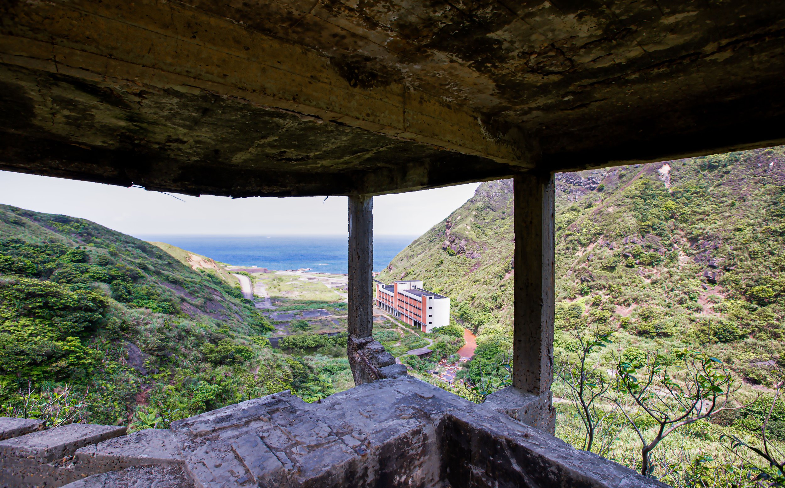
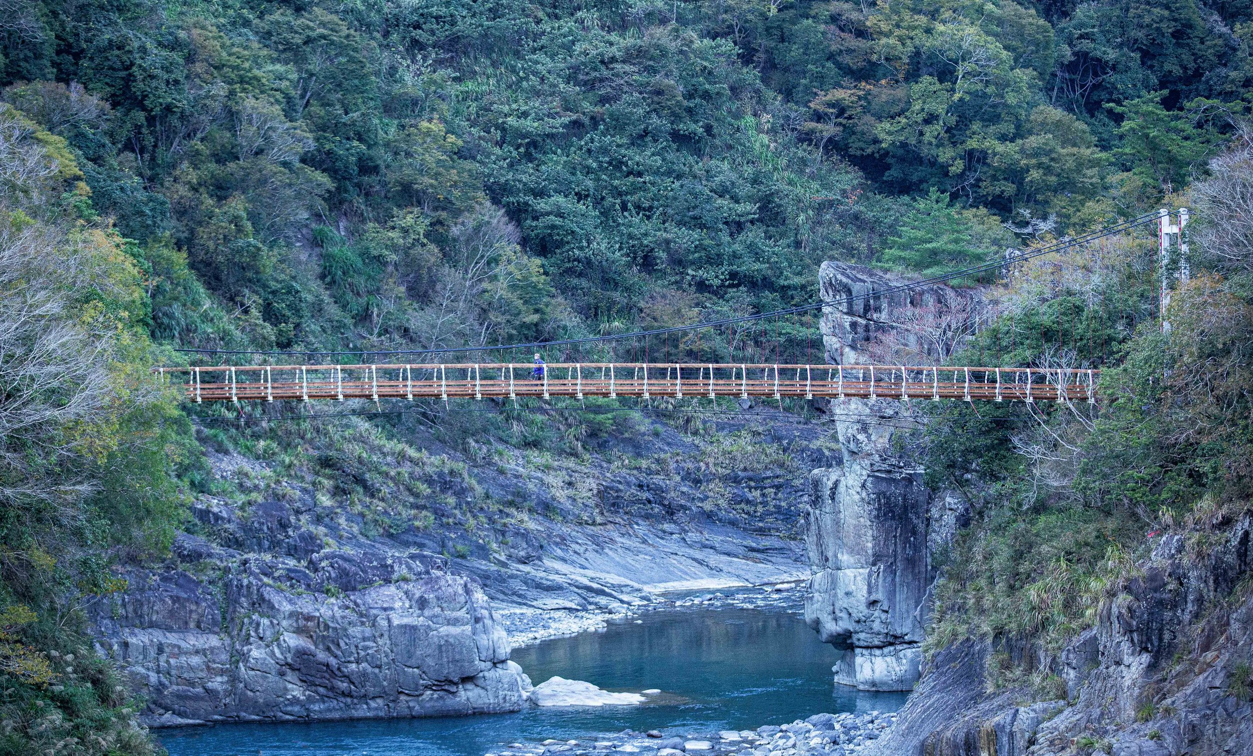
The Keelung Martyrs Shrine is a short walk from the railway station and is just across the bridge from the popular Miaokou night market (廟口夜市). As mentioned above, the Martyrs Shrine is located on the base of a mountain, which features quite a few temples and tourists attractions, so a visit to the shrine should probably also include the short walk to the peak where you’ll be able to enjoy some really amazing views of the Keelung cityscape.

If you follow my advice and walk, getting to the Martyrs Shrine is rather straightforward - Walk straight down Zhongyi Road (中一路) until you reach Aisi Road (愛四路) where you’ll turn left and cross the Japanese-era Jinji Bridge (基隆十二生肖橋). From there, continue walking straight until you reach Xin-er Road (信二路) where you’ll find the gate to the Martyrs Shrine on the right, directly across from a large fire station. 

While you’re in the area, it should go without saying that you should check out the night market, but don’t forget to visit Zhongzheng Park (中正公園), which is a short walk up the mountain from the Martyrs Shrine, in addition to the Maritime Plaza (海洋廣場) and some of the other tourist spots in the area. 

A visit to the Martyrs Shrine certainly won’t take that much time out of your day, but given that this is a spot that has played a pretty big role in the development of the city, its probably worth a bit of your time before you move on to your next destination! 


Qidu Train Station (舊七堵車站)

Amazingly, despite all of the high-tech industry and modern development in Taiwan, most people are relatively surprised when they discover that the country actually remains home to dozens of train stations that date back more than a century. Those living in Taipei have an especially difficult time believing this as their city is home to modern High Speed Rail, train and Metro Stations, all of which are less than a few decades old, sharing one common feature - they’re all underground.

The further you travel outside of the capital however, you’ll find that these historic train stations, often located in the downtown core, have been an important part of the community for a hundred years, and if its not broken, why fix it? Almost without exception, each of these century-year old stations dates back to the five-decade long Japanese Colonial Era from 1895 to 1945 and has been able to stand the test of time, enduring decades of earthquakes, typhoons, regime change, and of course the nationwide push for modern development.

There are probably few countries in the world where the railway is as relevant, popular, or as widely used as it is here in Taiwan - the perpetual march towards modernization however has left the status of quite a few of the nations historic stations in limbo, given that they are either too old or no longer fit the needs of the ever changing railway and a much larger population.

So even though the old adage about the railway station being the beating heart of many of Taiwan’s smaller communities remains true, the vast majority of smaller Japanese-era stations have already been replaced with modern buildings. Making matters worse, the handful that remain today are often in dire need of restoration, which can be as expensive as simply tearing it down and building a new one. 

For example, it was recently announced that an NT$82,000,000 (3 million USD) restoration project will start in the near future to restore several stations along the Miaoli coast including Xinpu Station (新埔車站), Baishatun Station (白沙屯車站), Tongxiao Station (通宵車站) and Yuanli Station (苑裡車站)

Link: 8200萬元補助挹注 苗栗縣推百年鐵道旅行 (UDN)

Fortunately, Taiwan is currently going through somewhat of a renaissance when it comes to the appreciation of buildings of historic and cultural value, and given the railway is something that near and dear to almost everyone’s heart, these older stations have started to receive a lot more appreciation for their historic and cultural value.

Hsinchu’s Xiangshan Station (香山車站) was recently restored to its original condition and was a project that likewise modernized the railway line and the platforms so that the station can remain in operation for the foreseeable future.

With Xiangshan Station, as well as the stations mentioned above, we have examples of those that are restored and remain in operation. What happens though when historic stations are preserved, but cease operations? Well, as in the case of larger stations like those in Kaohsiung and Taichung, we are still able to continue enjoying them in different ways with the creation of culture parks, which have become popular tourist attractions.

Where larger stations are being converted into popular tourist attractions, smaller stations like the Xinbeitou Station in Taipei and Qidu Railway Station near Keelung in Northern Taiwan have become mini railway culture parks, allowing people to enjoy the historic station while learning about the area at the same time.

Albeit in a much quieter setting than the two mentioned above.

One might argue that those larger stations in cities such as Kaohsiung are able to be easily converted into popular tourist attractions, but I’m sure that if you ask most people, the nostalgic feeling that you get when visit one of these smaller wooden stations brings you back to a time when Taiwan was much different than it is today.

For people in Taiwan today, looking back at this nation’s complicated history is an important step in retracing ones roots, and the existence of these buildings is one of the methods that is helping form a national identity, which is something that has been discouraged and violently suppressed for so long. Taiwan’s history over the past few centuries might be considered by some to be rather depressing, but there is ultimately a need to learn more about it and since train stations were the beating-heart of any community, they’re a pretty good place to start!

Today I’ll be introducing the historic Qidu Station as part of my on-going project covering Japanese-era stations, including those that are still in operation as well as those that have been converted into tourist attractions. While this one might be part of the latter, it has been beautifully restored and is geographically speaking one of the most important stations in northern Taiwan.

A quick note before I start - I had originally planned on publishing this article much sooner, but given the tragic railway disaster that took place during the annual Tomb Sweeping Festival long weekend, I held off.

Link: 2021 Hualien Train Derailment (Wiki)

Given that the tragic crash had affected so many families across the country, I felt like sharing an article celebrating the history of Taiwan’s Railway would have been in bad taste. That being said, Taiwan’s railways have been running since the late 1800s and the list of accidents throughout that period is a pretty short one. No matter what the local media might say in a fit of rage, Taiwan’s trains are still, and have always been the safest and most convenient way to travel around this beautiful country.

We mourn the loss of all the people who lost their lives or their loved ones, but we should also continue to show our appreciation for all the good people who work for the TRA!

Historic Qidu Train Station (舊七堵駅 / しちとえき) 

GTJ-2021-0302-48.jpg

Currently one of Northern Taiwan’s most important Railway Stations, the newly constructed Qidu Station (七賭火車站), located in Keelung’s Qidu District opened to the public in 2013 (民國102年).

Serving approximately four and a half million passengers each year, the station’s importance isn’t in the amount of people that pass through its gates, but due to the fact that it is the ‘origin’ station for the most of the trains that travel south along the West Coast Trunkline (西部幹線).

While the new station is large and modern, the history of “Qidu Station” goes all the way back to the early days of Taiwan’s railway network, when construction on a railway between Keelung and Taipei started in the late 1800s.

The original plan was to construct a railway between Keelung and Tainan, but due to the outbreak of the Sino-Japanese War, the Qing (who ruled parts of Taiwan at the time) quickly ran out of funds and lost interest in continuing its construction. In total, they completed around 106 kilometres of track between Keelung (基隆) and Hsinchu (新竹).

As I’ve mentioned numerous times already here on my blog, when the Japanese took control of Taiwan in 1895, things quickly changed and the railway became an extremely important tool for the colonial government’s desires for their newfound colony. The Japanese saw the construction of an island-wide railway network as instrumental in their plans for the development of the island, but more importantly for the extraction of its precious natural resources. 

Railway Links: Taipei Railway Bureau | Taipei Railway Workshop | Xinbeitou Historic Train Station

Upon their arrival in Taiwan, in order to slow the advance on Taipei, the Qing had portions of the railway between Keelung and Taipei sabotaged thinking that it would give them more time to escape. Ultimately though, it didn’t really have much effect as had made all the necessary repairs to the railway within two months of their arrival.

Bringing with them a team of military engineers, the emergency reparations put it the railway back in service and provided the military with the ability to quickly transport supplies from the port in Keelung to the capital. 

Nearing the end of 1895 (明治28年), the Japanese stationed the Temporary Taiwan Railway Team (臨時臺灣鐵道隊) in Keelung to carry out repairs on the existing railway, conduct surveys of the railroad, and to come up with plans for improvements.

By 1896 (明治29年), proposals were drawn up to completely re-route the rail line in another direction for better efficiency, but in the meantime the railway was put back in business for passenger service between the cities. 

Interestingly, by 1896 there were four round trips between Keelung and Hsinchu held each day. Today, there are at least fifty trains leaving Keelung for Hsinchu each day, and vice versa.

This is where the history becomes a little confusing.

In 1897 (明治30年), a “station” was constructed on the site of where the current station is located.

Its original name was Badu Station (八堵車站), but would be relocated in 1899 (明治32年) when another station was constructed in nearby Badu (八堵臨時車站), resulting in this station being renamed Qidu Station (七堵車站).

Admittedly, every time I’ve passed through this area on the train, I’ve wondered about the origin of the names “Qidu” (七堵) and “Badu” (八堵), but until now never really bothered to find out. So, if you’re like me and often wondered where the names came from, I did a little research for the benefit of all of us! 

One of the meanings of the word “堵” (du) is “wall” or “barrier” and each of the areas that exist today “Wudu” (五堵), “Qidu” (七堵), “Badu” (八堵) derive their names from artificial ‘barriers’ that were set up along the Keelung River (基隆河).

This was part of an attempt to prevent the Pingpu (平埔族) and the Ketagalan (凱達格蘭族) Indigenous groups from being able to successfully conduct raids on Han Chinese communities, and then retreating into the mountains through the river valley.

So “Wudu”, “Qidu” and “Badu” quite literally translate to “Fifth Barrier”, “Seventh Barrier” and “Eighth Barrier”, although I’m not particularly sure they were ever very effective in preventing attacks.

Nevertheless, the communities that popped up around them as the Han Chinese ventured further out of the Taipei Basin in the mid to late 1800s retain their names today.

When I mentioned the history was a bit confusing above, what I meant was that the area where “Qidu Station” is located was originally the home of “Badu Station”, which is currently about two and a half kilometres away. The Japanese are renowned for their attention to detail, so its odd that the stations were mis-named like this.  

Nevertheless, passenger service at the “Qidu Railway Station” officially started in 1899, even though the station itself dated back a couple of years prior to the name change.

The historic building that we’re taking a look at today however wasn’t constructed until years later. 

In what became a pretty important year for construction projects around Taiwan, the first year of the Taisho Era (大正元年), more commonly known as 1912, became one where the colonial government invested heavily on refurbishing some of the buildings that were hastily constructed upon arrival on the island. Qidu Station was one of the buildings that was reconstructed during this important year, replacing the original station with a beautifully constructed Japanese-Western fusion building.

Over the next few decades, not much really changed at the station, but as control of Taiwan passed from one colonial power to another, the Taiwan Railways Administration (臺灣鐵路管理局) of the Republic of China started an expansion of the railway in the Qidu area creating the Qidu Marshaling Yard (七堵調車長) in 1968 (民國57年).

This project expanded the width of the railway track considerably and forced the railway authorities to construct a Rear Station (後站) on the other side of the tracks. This created a precarious situation for passengers wanting to get on the train at Qidu as the ‘Front’ and ‘Rear’ sections were separated by a long walk in addition to the trains that they serviced.

By 1972, the original Japanese-era station became known as the “Front Station” (前站) and only serviced those who were traveling northbound to Keelung (基隆), while the newly constructed “Rear Station” serviced those who were on express trains headed to the east coast.

The situation at the station became even stranger in the 1990s when the Rear Station was upgraded to a Class A Station (一等站), while the Front Section was classified as a Simple Platform Station (簡易站); Having a single Railway Station with two different classifications is a rather unique case here in Taiwan.

Then in 1995, the Taiwan Railway Administration renovated the historic station, similar to the renovations that took place on the Xiangshan Station (香山車站) in Hsinchu in that they more or less covered up the exterior design of the building which pretty much covered up the original design, making it like one of the ‘tin house’ (鐵皮屋) extensions you commonly find constructed on top of a building in Taiwan.  

The Japanese-era “Front Station” ultimately remained in service until 2007, when after ninety-five years of use, it was finally ‘retired’ when the front and rear stations were combined into a much larger station a short distance away.

If you’ve been to the ‘modern’ Qidu Station, you’ll probably not really take too much away from your experience as it is lifeless in its architectural design. It is essentially a giant concrete box. 

Finally in 2010, the building was classified by the Keelung City Government’s Cultural Affairs Bureau (基隆市文化局) as a historic building (歷史建築) and was given protected status. The station then underwent a period of restoration where it was restored to its original design, and was subsequently opened as a tourist attraction within the Qidu Railway Memorial Park (七堵鐵道公園).

Today the more than a century old Qidu railway station sits within the modest park and is open to the public.

Even though there’s not much else to see or do in Qidu, stopping by to check out the station doesn’t take a whole lot of time, especially if you’re on your way for a day-trip to Keelung.

Now, lets talk a bit about the design of the station, which is quite special given its architectural fusion.

Design (設計)

Having been recently restored to its original design, the historic Qidu Railway Station is now part of a railway park meant to help tell the story of one of northern Taiwan’s most significant stations. Given its history and its strategic location between Taipei and Keelung, it has acted as one of the gateways to the east coast and was home to a Marshaling Yard. So even though it is a small station by todays standards, it has still seen its fair share of activity over the last century!

Constructed primarily with Taiwanese cedar, the old station is an architectural fusion of a traditional Japanese-style building with western elements carefully mixed in. Differing slightly from many of its contemporaries, the construction of this building made use of not only locally sourced cedar, but also concrete and steel, using modern construction techniques to ensure a long life. 

Official literature about the station states that the design imitates the architectural styles of “Ancient Greece and Rome” with elements of “Gothic Architecture” (模仿古希臘與古羅馬樣式,也模仿哥德式建築). While I don’t doubt that some of this may be true, the inclusion of anything appearing even remotely inspired by Gothic architecture doesn’t really pop out at you like it should. My best guess with what they were trying to say was that the design of the building takes inspiration from elements of Baroque-style design (巴洛克建築), a European architectural design that the Japanese architects of the era had become quite proficient in, especially when fusing it with their own traditional architectural design.

If thats the case, it is easy to see from the exterior that the almost 3D-like shapes and the sense of flowing movement creates the sense of drama that Bernini mastered back in Italy. That being said, the Japanese-style design elements are probably the most obvious to anyone looking at the station today.

Covered roof that extends beyond the building to shield passengers from the rain.

The station was constructed using Irimoya-zukuri (入母屋造 / いりもやづくり) style of design, most often referred to in English as the “East Asian hip-and-gable roof.” 

The key thing to keep in mind about irimoya-style design is that it doesn’t necessarily dictate what kind of roof is constructed on any given building - Granted, buildings constructed in this style feature a hip-and-gable roof - but within traditional Japanese architecture, there are several different styles of roof design and while some of them go hand-in-hand with the irimoya design, its probably better to first take a look at the ‘moya’ (母屋) part of “irimoya”, which describes the core of the building, under the roof.  

In layman’s terms, the ‘moya’ is essentially the base of the building, and when the irimoya-style is used, the ‘moya’, (literally the “mother-house”) is almost always considerably smaller than the roof, which extends well beyond the base. When we talk about irimoya design, we should keep in mind that the base of the building has been especially constructed to ensure that the weight of (whatever style of) the roof above is going to be well-supported and that it will be evenly distributed to ensure that the building doesn’t collapse.

To put it simply, in buildings like this, the roof is always the main attraction. The base is just there to hold it up.

To achieve this even distribution of weight, Japanese design uses an expertly crafted network of roof trusses and pillars on the interior and exterior of the building that allow the roof to become the most important part of the building, which is something that they’ve perfected over a period of a thousand or so years.

So in this case, even though we have an ‘irimoya-zukuri-style’ building, the roof was designed using the kirizuma-zukuri (妻造的樣式) style, which is one of the oldest and most commonly used designs in Japan. Translated simply as a “cut-out gable” roof, the kirizuma-style is one of the simplest of Japan’s hip-and-gable roofs and is indicative of a roof with “two surfaces including from the ridge at the top, or having the shape of a book placed with its face on its lower side” - and is probably one of the main reasons why the roof on this building so so much different than what you’d expect from a temple or shrine.

Looking at the roof, you’ll notice that it is layered with the eaves on the lower layer extending beyond the building, supported by a network of pillars that surround it on three sides. The top layer is where you’ll find the ”cut-out gable” with the gable-section of the roof covering the eastern side of the building, while the longer hipped side cuts through it.

Both of the ends of the ‘hip’ section feature triangular-shaped “hafu” (破風板) bargeboards, while either side of the gable features “tsuma” (妻) or gable-ends, with windows placed in the middle that allow natural light into the interior of the building. 

Even though the roof of this particular building appears rather simple compared to some of the other historic Japanese-era buildings in Taiwan, there is still actually quite a bit going on.

The first thing you’ll probably notice is that it is covered almost entirely with Japanese-style black tiles (日式黑瓦) with wooden rain-boards (雨淋板) on the lower areas.

Likewise you’ll find the following smaller parts working together to complete the roof: 

  1. Hiragawara (平瓦 /ひらがわら) - A type of arc-shaped clay roofing tile.

  2. Munagawara (棟瓦 /むねがわら) - Ridge tiles used to cover the apex of the roof.

  3. Onigawara (鬼瓦/おにがわら) - Decorative roof tiles found at the ends of a main ridge.

  4. Nokigawara (軒瓦/のきがわら) - The roof tiles placed along the eaves lines.

  5. Noshigawara (熨斗瓦/のしがわら) - Thick rectangular tiles located under ridge tiles.

  6. Sodegawara (袖瓦/そでがわら) - Cylindrical sleeve tiles.

  7. Tsuma (妻/つま) - The triangular shaped parts of the gable on the roof under the ridge.

  8. Hafu (破風板/ はふいた) - Bargeboards that lay flat against the ridge ends to finish the gable.

The ‘moya’ or the base of the building is constructed in a cube-like shape that is split in two, one side for passengers who walk through the station hall and the other for the employees of the station.

Like the lower part of the roof, the exterior is covered in wooden rain-boards, but for the most part, the building is covered almost entirely on each of its sides with beautiful Japanese-style paneled sliding glass windows (日式橫拉窗), which provide a considerable amount of natural light into the interior. 

The interior (which is currently only open to the public during the week) has been pretty much gutted, and for the most part doesn’t really have all that much for visitors to see.

The partition between the ‘Station Hall’ and the ‘Staff Section’ still exists, with the glass window ticket booth, but the door between them has been opened up and allows guests to easily pass through to the other side.

The great thing about the building being so empty is that (unlike many of the other Japanese era buildings that have been restored) you are able to better appreciate the architectural design of the interior without a bunch of pointless distractions getting in the way.

When you look up at the ceiling, you’re able to view an open space where you the network of beams and trusses that keep the roof in place. The recent restoration project made sure to leave a large space open that gives tourists the ability to appreciate the skills that went into constructing the building. The sad thing is that the restoration project added some steel beams for extra stability, which takes away from the original design. 

As the historic railway station is currently part of a Railway Park, you’ll find an old platform placed to the rear of the building that features part of a railway track.

Initially, I thought these were just put there for the purpose of the park, but they are actually part of the original station. The reason I thought this was because the rear of the station has an embankment that you can climb up to where the Marshaling Yard, and where the current tracks are located.

Essentially, the track that you’ll see behind the station today is where the original track was once located, but as I mentioned above when the “front station” and the “rear station” were separated, the railway was as well. 

Check out some of the historic photos in the link below that show the last day of operation at the historic station and how it looked back then. 

Link: 七堵前站營業最終日追憶 

What surprises me about the design of the station, the railway and its platform is that passengers would have actually had to cross the railway tracks to get to the train platform - This is something almost unheard of in Taiwan these days and was probably one of the reasons that a change ultimately had to be made!

Getting There


Address: No. 23, Guangming Road, Qidu District, Keelung City (基隆市七堵區光明路23號)

GPS:  25.093050 121.710920

It should go without saying that the Qidu Railway Memorial Park is a short distance from the current Qidu Station. If you’re planning on visiting the park, the best way to get there would be to simply take the train, get off at Qidu and then walk the short distance to the park. 

Qidu Station is currently one of the largest ‘Class A’ stations in northern Taiwan featuring four platforms and services the slower local trains (區間車), as well as the Puyuma (普悠瑪號), Taroko (太魯閣號), Zi-Qiang (自強號) and Chu-Guang (莒光號) express trains.

Given its size and its location, it has become the origin station for most of the southern-bound trains on the West Coast Line (西部幹線). 

If you are traveling northbound from Taipei, you can simply hop on any of the trains listed above and it will stop at Qidu Station. Likewise, if you’re traveling from Keelung or the East Coast, any train headed south or west respectively will get you to the station.

Car / Scooter 

If you’re driving a car or a scooter, I recommend inputting the address or the GPS coordinates provided above into your preferred geolocation system, and it will map out your route.

If you’re riding a scooter, parking along the street near the park should be relatively easy. However if you’re driving a car, you’re going to be forced to park in one of the paid parking lots near the station.

Given the amount of parking lots in the area though, you shouldn’t have any problem finding a spot. 

On either side of the memorial park you’ll find Guang-Ming Public Parking Lot 1 (光明一公停車場) and Guang Ming Public Parking Lot 2 (光明二公停車場), which are probably your best bet if you don’t feel like walking. 

Bus

Bus service in the area is somewhat limited, but there is a bus stop located near the Qidu Administrative Building (七堵區行政大樓), where you can take Keelung Bus (基隆客運) #403.

I’m not sure if this bus will help you much though as it originates at Keelung Station (基隆車站南站) and slowly makes it way through Badu (八堵) and Qidu (七賭), which are both already serviced by the train.   

A short walk away from the Memorial Park on Mingde First Road (明德一路) you’ll find the San Branch Office Bus Stop (三分局) which is serviced by Keelung Bus #402, 403, 406, 407, 408, 409, 410, 503, 510, 606, 1031, 1191, R82, R85 and R86. 

Almost all of which originate in Keelung and not Taipei.

Since you’re visiting a historic train station, it’s probably best to just take the train, don’t you think? 

Hours: Monday to Friday 08:00 - 16:00 (Closed on Weekends and National Holidays)


Stegosaurus Ridge (劍龍稜)

Prior to my arrival in Taiwan, I was admittedly under the impression that the country was more or less a collection of large urban sprawls that had more or less overtaken what little of the island’s natural environment. In my defense, this was long before Google Maps made its appearance, however with a land mass smaller than my home province in Canada, but a population twenty-five times the size, it didn’t seem like I was too far off. 

Shortly after arriving, I quickly found out how wrong I was. 

The “Taiwan” that we often imagine certainly isn’t what we’re led to believe, nor how it is often advertised.       

If you are like a lot of tourists who visit the country without ever leaving Taipei, I suppose you might not have much feel for what I’m talking about, but Taiwan rivals any in terms of natural beauty with its mountains, valleys and coastal areas.

Sadly, this is one area where many of Taiwan’s most fervent supporters lament the way that the nation is officially advertised to the outside world. The natural beauty of the country has unfortunately always been one of its best kept secrets. If it were marketed properly, it would attract a considerably larger amount of interest. The pandemic was obviously disastrous for the travel industry, but now that it appears that the world is finally on the path to normalcy, it would be great if Taiwan could capitalize on all of the international good will it has earned over the past few years, and started attracting a wider variety of tourists. 

For those in the know, Taiwan’s North East Coast (東北角) is one of the best examples of the nation’s natural beauty - Not only is it breathtakingly beautiful, it is arguably one of the most accessible destinations for day-trips outside of the capital. Tourists who visit the area are able to get a feel for local culture and history while enjoying a medley of the turquoise ocean on one side with high mountains on the other. 

The coastal area has a number of popular tourist attractions, which attract both domestic and foreign tourists for day trips - Whether you’re visiting the northern port city of Keelung (基隆), it’s famed Miaokou Night Market (廟口夜市), Yehliu Geopark (野柳), Jiufen (九分), the Golden Waterfall (黃金瀑布), Bitou Cape (鼻頭角), or any of the fishing ports along the way, if you’re a first time visitor, you’re likely to feel like stopping every few minutes along the way to take photos. 

Interestingly, over the past few years, (mostly thanks to Instagram) several new destinations along the coast have gone ‘viral’, and have been attracting a considerable amount of domestic tourists. Unfortunately, for most foreign tourists, these locations don’t often appear on the radar. Elephant Rock (象鼻岩) for example, has become of those hot spots, with crowds visiting the area to check out the rock formation. More recently though, you’ll find just as many more people kayaking, snorkeling and diving nearby, creating new opportunities for adventure tourism. 

Likewise, even though the mountainous areas near the coast have always been popular with avid hikers, they have also recently become the stomping grounds for tourists, who flock to the area on the weekend eager to enjoy the area’s beauty, and more importantly their impromptu Instagram photoshoots! 

Hikers are blessed with numerous trails along the coast, each of which offers spectacular views of the northern coast. The Teapot Mountain (無耳茶壺山) and Jilong Mountain (基隆山) trails are two such examples of well-known and highly-rewarding hikes, which are coincidentally also easily accessible through public transportation and the relative ease for anyone wanting to hike them. 

Surprisingly though, a number of the trails in Northern Taiwan have become viral sensations - some for the potential they offer for photoshoots, but others merely for their sheer difficulty. Most international tourists will be familiar with Elephant Mountain (象山步道), and the other Four Beasts (四獸山步道) in Taipei, but hikes like Wuliaojian (五寮尖), Huang Di Dian (皇帝殿), the Pingxi Crags and Stegosaurus Ridge (劍龍稜) have arguably become just as popular.

Waving to hikers on another ridge in the distance.

Even though all of these trails offer a great hiking experience, some of them are not very accessible for your average tourist, which makes getting there somewhat difficult. Fortunately, there are a number of English-friendly mountaineering groups that plan day-trips to some of these areas, taking care of all of the small details for any of the hikes you want to go on. So, if you are visiting Taiwan, it is always a good idea to check out some of these groups and get in contact with them to see if they have anything planned that you are able to join in on:

Parkbus Taiwan | Taiwan Adventure Outings | Taiwan Adventures | Taipei Hikers 

This time, I’ll be introducing one of the viral hikes mentioned above, the aptly nicknamed ‘Stegosaurus Ridge,’ which happens to be one of the most beautiful and thrilling single-day hikes that you’ll find anywhere in the country. That being said, it’s also both difficult and dangerous, and hiking it certainly isn’t for the faint of heart.

If you’re up to it, this is a hike that is essentially a several hour long full body workout that will result aching muscles at the end. The experience however is worth it as you’ll be rewarded with some spectacular views that’ll ensure you’ll fall in love with Taiwan!      

Stegosaurus Ridge (劍龍稜)

I think it’s pretty safe to say that Stegosaurus Ridge is both literally and figuratively one of the ‘hottest' hikes in Taiwan at the moment. Like some of the other trails mentioned above, this one transformed from being relatively unknown to one where you’re likely to meet hundreds of weekend day-trippers from all over the country, whenever you hike it.  

Being that it is a ridge hike, it is one of those special experiences where hikers are rewarded with (almost) 360 degree views of the North East Coast landscape, and the mountain range that separates it from the capital. 

Deriving its name from the jagged ridge that you’ll have to walk up, which is likened to the dermal plates on the back of a Stegosaurus, the hike is not only one of the prettiest, but also one of the most thrilling thanks to the ridge. 

Speaking frankly though, it is also quite dangerous at the same time.  

It is important for anyone planning to hike this one to remember that not only is it a difficult and time consuming hike, it’s also quite dangerous - especially for inexperienced and unprepared hikers - So, before I go into detail about the hike the following tips should be taken into consideration:

  • The hike will take anywhere between 5-8 hours to complete - Start the hike early in the morning lest you get stuck high in the mountains after dark.

  • DO NOT hike this trail alone - Bring your friends!

  • This trail has several very steep sections: If you’re not an experienced hiker, you may find yourself having some trouble. Take your time and let people pass by.

  • If you are afraid of heights, this hike isn’t for you.

  • There are few areas that offer hikers respite from the hot sun - Wear sunscreen, and make sure you wear a hat to protect yourself.

  • The North East Coast is prone to rain, which makes climbing the ridge even more dangerous. If it is raining, find something else to do and come back another time.

  • It’s not recommended that you bring your trekking poles along with you for this hike - They will get in the way while you are climbing the ridge and could make getting past some sections even more dangerous.

  • Sections of the trail are full of long grass, which is sharp and will slice up your arms and legs if you’re not wearing proper covering. You should wear proper hiking pants as well as hiking shoes to protect yourself.

  • There are several areas where you’ll encounter ropes on the ridge, you should bring a set of gloves to save your hands from rope burn and blisters. Most hardware stores sell cheap pairs for $10NT.

  • You’ll need to carry a generous amount of water to stay hydrated in addition to having having snacks or a packed lunch available.

  • For your safety make sure to follow the hiking flags attached to trees along the trail as well as the arrows sketched on the ridge so that you don’t end up getting lost.

  • There are several off-shoot trails along the way that you can take back to ground level. If you get half-way up and are thinking about giving up, try to take one of these trails rather than turning around as the trails aren’t really set up for two-way traffic.

Climbing fun.

There’s another important thing to mention before I move on: You may have heard that hiking this trail is more or less illegal. Are those rumors true? Well, the answer to that question is both yes and no.

The ‘Stegosaurus Ridge’ hike is part of a loop where hikers start hiking from just above sea level to a height of around 700m, offering access to over ten peaks along the way. When we talk about this hike, we have to first differentiate whether we’re hiking the ‘circuit’, or just the Stegosaurus section. 

If you are planning on hiking the circuit, then there are trailheads that can be accessed where you're not going to have any issues. For those of you who are just coming for the Stegosaurus section, and looking for the most direct route to the ridge, the entrance that most people end up using is considered “trespassing” as it requires a jump over a fence onto abandoned state-owned property.

Most of the online resources you’ll find about the ridge will talk about this and offer ideas for jumping over the fence, or getting around it. What you’ll want to keep in mind are the warning signs posted at the spot where you jump over the fence. The signs aren’t translated into English, but what they essentially say is that warn hikers caught entering the area will be fined and now that the trail is so popular, you’ll find that there are often police cars stationed nearby, or patrolling the area to deter people from using this entrance. 

For those of you who can’t read Chinese, the signs warn that fines for entering the area could amount to NT$500,000 ($17,000USD).

While it is true that this entrance offers the most direct access to the trail, cutting down the amount of time needed to complete the hike, it is (for the time being) illegal to enter, so if you decide to take this route you may have to face the consequences.

Starting the hike from the other trailheads in this area isn’t illegal, but using the copper factory entrance is, so if you are planning on do part of the hike, you may want to consider a newer trailhead located around the 80.2KM marker, or the Golden Lake (黃金池) trail that starts at the 79.6k marker.

One of the three Stegosaurus ridges.

What is currently the most responsible thing to do is take the third option by starting your hike further down the road at the Nanzilin Trailhead (南子吝步道), where a path connecting to the ridge has been marked by hiking groups and where you’ll won’t be in danger of leaving with a criminal record! 

For further information about the legal situation with this hike check out Taiwan hiking master extraordinaire Richard Saunder’s article about it - More Bad News Regarding Access to Taiwan’s Mountain Landscapes

Now that we’ve got all of that out of the way, let’s move onto the hike. 

To start, I guess I should clarify that ‘Stegosaurus Ridge’ isn’t actually a mountain. 

The aptly named ‘stegosaurus’ section of the hike is simply what its name implies, it’s a ridge.

The circuit hike that I highly recommend you complete does however consist of a number of peaks and mountains, including Nanzilin Mountain (南子吝山), 381 Peak (381峰), 555 Peak (555峰), Banping Mountain (半平山) and Teapot Mountain (茶壺山), with several waterfalls and a river along the way.

Navigating the ‘sawtooth’ ridge.

The amount of time it takes to complete the hike ultimately depends on how much of the trail you intend on hiking. For those of you who are only interested in the ridge sections, your hike will be considerably shorter than those who plan on hiking the circuit. In the case of the circuit hike, you can look forward to a 6 to 7 kilometer-long hike starting from sea level to an elevation of around 700 meters.

The circuit hike should take around 6-7 hours, but once again that very much depends on several factors including your level of fitness, the amount of people hiking the trail, and how many breaks you take. For those of you planning to just hike the ridge and head back down to ground level, I’m sorry to say that the hike is still going to take around 5 hours, so you might as well just go ahead and hike the whole thing, right? 

With this hike, I’m admittedly going to advocate that you experience the full thing, so the route I’ll introduce first is what is considered the ‘circuit route’ starting at one temple and ending at another. Even though this is the route that will take the most amount of time, it is also the most rewarding as you get to experience the ridge and beyond. 

The Golden Ridge Circuit (黃金稜線)

Nearing the end of the hike. One last peak to climb.

For this route, you’re able to get off the bus at the Nanxin Temple Bus Stop (南新宮站), where you’ll find small community with a temple, public bathroom, general store and the trailhead to the Nanzilin Trail (南子吝步道). 

Starting from this trailhead ensures that you won’t meet with any of the legal difficulties mentioned above, and also allows you to enjoy the peak of Nanzilin Mountain before making your way to where the Stegosaurus trail starts.

The Nanzilin section of the trail is well-developed and you’re likely to see lots of elderly hikers on this part of the trail. If you’re a first time hiker to the area, I highly recommend you hike to the peak of Nanzilin Mountain before you descend the river. The peak of Nanzilin is a high cliff that overlooks the highway and its absolutely beautiful. You’ll have to backtrack for a few minutes, but it’s well worth the effort. 

A short distance from the peak, you’ll find a bench with a hiking flag marking the route where you’ll make your way through a bunch of tall grass on your descent to the river, which you’ll have to cross before reaching the start of the Stegosaurus section.

The view of the North Coast from the peak of Nanzilin Mountain.

Once you’re across the river, the hike starts becoming quite steep, and after a short tree-covered ascent, you’ll reach the first section of the ridge. Standing in front of the ridge can be a bit daunting, especially when you look on the right side, but you don’t actually have to straddle it all the way up. You can follow a path along the left side which allows hikers to safely make their way up the mountain.  

While making your way up the ridge, you’ll have to pass by three separate sections of the ridge, which are unmarked but are known locally as ‘Stegosaurus 1’ (劍龍1), ‘Stegosaurus 2’ (劍龍2) and ‘Stegosaurus 3’ (劍龍3). Once you’ve made it past there you’ll find yourself at 381 Peak (381峰). While at the ‘peak’ you may want to take a quick break before starting your next leg of the hike to 555 Peak (555峰). 

At this point, you might be thinking: “I’ve finished Stegosaurus Ridge, it’s time to turn around and head back!” Sorry, no. If you did, you’ll be missing on couple of similar jagged rock sections, known as the ‘saw-tooths’ (鋸齒), where you’ll get to climb up some ropes on your way to the next peak. The path between 381 and 555 is a thrilling section of the trail where you’ll climb ropes and large rocks, which are great for photos. 

Note: Are you wondering why the peaks are called 381 and 555? The answer is pretty simple: It’s their recorded elevation.

Unlike the first peak, 551 Peak is a nice flat section of mountain with some tree cover,  where you’ll likely want to take a break and have some lunch before moving on. 

It’s also at this point where you can say that you’ve officially completed the Stegosaurus Ridge hike. There is a fork in the path on the peak that allows hikers to either continue along the circuit, or make their way down to the Golden Lake (黃金池), and one of the trailheads along the highway. 

If you (do the right thing and) continue along the circuit, the path you’ll take is a steep one with more ridge-like sections that’ll bring you to to a crossroads between Banping Mountain (半平山) and Teapot Mountain (茶壺山). The sawtooth sections here are also quite fun, but by the time you’re this far into the hike, you’ll be looking at Teapot Mountain in the distance wondering when punishment will end.

Looking down towards Teapot Mountain

The last truly fun section of the hike is the famed crossroad (V缺口) between the Banping Mountain Trail and the Teapot Mountain Trail. In this section you’ll have a really beautiful view of Teapot Mountain, Jilong Mountain (雞籠山) and the ocean while carefully making your way down the rope in the gorge.  

The hike between the crossroads and Teapot Mountain won’t take that long, but its at this point where your legs are going to be feeling the pain and walking down all the stairs won’t make them feel much better. When you finally arrived at Teapot Mountain, you’ll probably want to enjoy the view for a while before you start your descent to Qianji Temple and the end of the hike. 

To be more concise, this is the route you’ll follow for the circuit: 

Nanxin Temple (南新宮) → Nanzilin Trail (南子吝步道) → Nanzilin Eastern Peak (南子吝山東南峰) → Crossing the Banping River (下切半屏溪) → Stegosaurus Ridge (劍龍稜123) → 381 Peak (381峰) → Stegosaurus Ridge Section 2 (鋸齒稜B段) → 555 Peak (555峰) → Stegosaurus Ridge Section 3 (鋸齒稜C段) → Banping Mountain / Teapot Mountain Crossroad (茶壺山半屏山叉入口) → Teapot Mountain (茶壺山) → Teapot Mountain Trailhead (茶壺山登山口) → Qianji Temple (勸濟堂)

If you’d like to check out the waterfalls, once you’ve crossed the river you can head to the left instead of making your way up to Stegosaurus Ridge. Follow the hiking markers attached to trees and you’ll be find the first one in no time. The other two are much further upstream. 

Stegosaurus Ridge Route (劍龍稜)

For those of you who are interested in experiencing Stegosaurus Ridge, but for whatever reason aren’t as interested in completing the circuit hike, the route you’ll follow for this hike is relatively similar to the one above. Admittedly, the first time I hiked the mountain, this was the route I took as I wasn’t as familiar with the trails at the time and got a later start than I planned. So, if this is the route you choose, you won’t find any judgement here. Lots of people have already hiked to Teapot Mountain on other trips, so it’s not entirely necessary to hike the whole thing again. 

Following the route above, you’ll make your way from Nanxin Temple all the way up to 555 Peak. In this case though, instead of continuing up the mountain, you’ll find a set of ropes that allows you to descend from the peak onto another trail that will bring you to the Golden Lake (黃金池), and then finally to the trailhead that starts at the 79.6k marker along the highway. 

The route down here is a leisurely hike in an area that is often tree-covered, but you need to keep in mind that parts of this trail, especially the area near the lake are covered in sharp grass, where you might get some scrapes and cuts if you’re not wearing proper clothing. 

Be careful of the tall grass. 

While making your way down, you’ll find a fork in the road with one direction that heads down to the highway while the other brings you on another path to the Teapot Mountain trail. The highlight of this trail, if you take it, are the massive waste flues from the Shuinandong Smelter (水湳洞精鍊廠) that make their way up the mountain, and were formerly used to transport noxious gases and fumes away from the refinery.  

To conclude, here is the route you’ll follow for the Nanxin Temple to 79.6k Marker: 

Nanxin Temple (南新宮) → Nanzilin Trail (南子吝步道) → Nanzilin Eastern Peak (南子吝山東南峰) → Crossing the Banping River (下切半屏溪) → Stegosaurus Ridge (劍龍稜) → 381 Peak (381峰) → Stegosaurus Ridge Section 2 (鋸齒稜B段) → 555 Peak (555峰) → Stegosaurus Ridge Section 3 (鋸齒稜C段) → Golden Lake Trail (黃金池的稜線) → Golden Lake (黃金池) → 79.6k Marker (台2線79.6K)

Golden Lake (黃金池)

In the map I’m providing below, I’ve marked the various trails that you’re able to take on this hike and even though the trailheads that are considered ‘illegal’ are marked on the map, I didn’t go into detail about starting your hike there for obvious reasons. If you choose to take those routes, its completely up to you, but if you do, you’re going to miss out on the Nanzilin Peak, which is also quite beautiful.

Getting There

I can’t really stress this enough, the best method regarding getting to this hike (and to save yourself a bit of trouble) is to make use of Taiwan’s excellent public transportation network. Why? The hike generally starts in one area and ends in another. So if you bring a car or scooter and park near one of the trailheads, its not likely that you’ll complete the hike in the same area, so you’re going to make the hike unnecessarily longer.   

If you are following my advice and making use of public transportation, here are some suggestions that’ll get you to the trailheads quite easily: First, you should first take a train to either Keelung Train Station (基隆車站) or Rueifang Station (瑞芳車站), and then transfer to any of the routes that will take you to the Nanya Peculiar Rock area. 

Starting the long hike on the Nanzilin Trail

Bus #791 from Keelung or Bus #886 from Rueifang will both get you there.

The bus from Keelung Station stops a short distance away from the station, so even though the bus stop is labelled “Keelung Station” in English, make your way to the Maritime Plaza (海洋廣場), which is a straight walk from the front of the station to the pier front along Zhongyi Road (忠一路).

From Rueifang Station, you’ll walk out the front door and turn left on Mingdeng Road (明燈路三段) and make your way toward the Rueifang Police Station (瑞芳分局), where you’ll find a very popular bus stop that takes weekend tourists up to Jiufen (九分), and beyond.

In both cases, you’ll find convenience stores between the railway station and the bus stops, so I recommend you stop and get snacks and water for the hike!

No matter which train station you hop on the bus at, there are two stops that you’ll want to keep in mind based on where you plan on starting your hike. The first stop is the “Taijin Company” (台金公司) bus stop where you’ll get off the bus and backtrack until you reach the 79.6k marker. Next to the marker you’ll find a path heading up the hill. 

The second one is the “Nanya Nanxin Temple” (南雅南新宮), which is located just past a tunnel along the highway. The trailhead for the Nanzilin Trail (南子吝步道) is found at the rear of the temple and is clearly marked.

If you’d prefer a slightly more direct (but expensive) route, you can take a bus directly from the Taipei Bus Station (台北公車站). Kuo-Kuang Transport (國光客運) offers a bus from Taipei to Luodong (台北-羅東) that’ll allow you to get of the bus to the stops mentioned above. 

The bus leaves from the bus station next to Taipei Main Station daily at 8:50am, although I would caution that taking this bus won’t really give you an optimal start time for the hike. 

Link: Kuo-Kuang Bus #1811 (English | 中文)

The bus you’ll take on your return journey very much depends on where you complete your hike. If you’re only hiking the Stegosaurus section of the trail, then you’ll probably make your way back down to one of the bus stops mentioned above. However, if you complete the full circuit hike, you’ll be rewarded with a bus at Quanji Temple (勸濟堂) that  lovingly transports weary hikers all the way back to Taipei. 

At the Quanji Temple bus stop you’ll find buses #891 and #1062, each of which will take you to Songshan Train Station (松山車站) or Zhongxiao Fuxing MRT Station (忠孝復興捷運站) in Taipei. The bus stop is also serviced by F802, which will take you back to Ruifang Train Station, if you’re headed in a different direction than Taipei. For each of the routes above, click the link for the bus schedules and real-time information.  

Let me reiterate that this hike is a really fun one, and a little hard work on your part will definitely pay off as you’ll be rewarded with some pretty spectacular views of the natural landscape of the North East Coast, and some great memories. 

However, if you plan on taking this challenge, you must take the tips mentioned above seriously, and make sure to be mindful of your safety at all times. This is a hike where you can easily hurt yourself, or fall to your death if you are not careful. 

If you found this blog post after seeing beautiful photos on Instagram and you’re thinking this hike is one you’d like to try, it’s important that you go fully prepared, and are fully aware of its dangers, so you can better enjoy it. 

All of that being said, this is an extremely rewarding experience that is exhilarating and offers spectacular views of the North East Coast’s landscape. It’s going to tire you out and you’ll come away bruised and beaten, but it will also give you a whole new level of respect for Taiwan’s natural beauty.