東北角

Bitou Cape (鼻頭角)

If someone who planned on visiting Taiwan asked me for some travel advice, I’m not sure that my suggestions would be very much different than what most other people would say: “Hike a mountain”, “Visit a temple” and “Have dinner at a nightmarket”. Most of the time though, I actually just want to say “Travel South”, “Travel East”, and most importantly: “Get out of Taipei!”

For some people though, leaving the city was never actually an option or a consideration. 

So what’s the next best thing? If you’re asking me, I think it would be renting a car or scooter and taking a day trip to the North Coast.

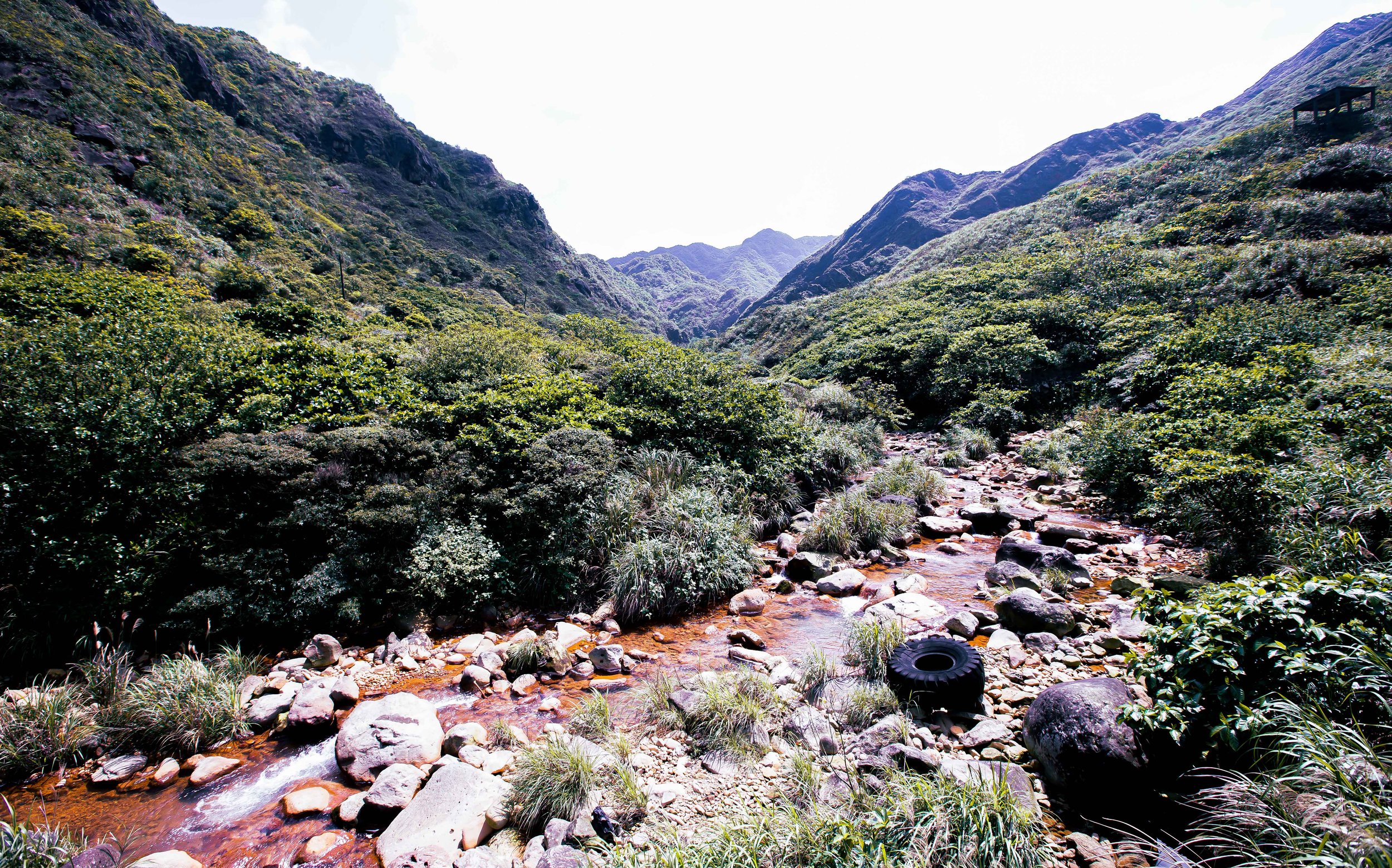
Not only is the North Coast one of the prettiest areas of Taiwan, it is also jam-packed full of places for tourists to visit. It is also home to several beaches and fishery harbours where you can stop for a swim and have the most amazing seafood dinners known to man.

The experience of riding a scooter along the beautiful coast with the Pacific Ocean on one side and tall green mountains on the other is one of those things that you’ll always remember when you think back to your time in Taiwan.

You’ll also want to stop every few minutes to take photos! 

With so many things to see and do, its understandable that most tourists have a bit of difficultly deciding where to spend their precious time - There are of course some places that are considered must-stops - The Yehliu Geopark (野柳地質公園), Golden Waterfall (黃金瀑布), Nanya Peculiar Rocks (南雅奇石), Shen’Ao Elephant Trunk Rock (深澳象鼻岩) and the beautiful nature hike at Bitou Cape (鼻頭角), are a few such examples.

The thing is though, unless you have your heart set on a photo with the ‘Queens Head’ (女王頭), I’m going to suggest that you save some time and just skip the overly crowded Yehliu Geopark.

Yes, I realize that sounds like tourist blasphemy, but the North Coast is full of similar-looking landscapes and cool-looking rocks, so you might be better off taking the road less travelled and enjoying some of the less crowded locations.

If you do you should easily be able to hit all of the other must-stop destinations in a single day-trip (if you start early)

While I can’t predict your itinerary, if I were your guide for the day, I’d probably start with a visit to the Elephant Trunk Rock, followed by the Golden Waterfall, Yin and Yang Sea (陰陽海), Nanya Rocks and then Bitou Cape before heading back in the direction of Taipei.

I’d probably end the day with dinner at one of the fishery harbours, the Keelung Miaokou Night Market (基隆廟口夜市) or heading up the mountain to Jiufen (九分) to enjoy the sunset. 

For those who do take a day trip to explore the coast, the ‘unofficial’ last stop is almost always going to be the Bitou Cape nature trail - The beautiful hike, which for so long was a secret the locals kept to themselves, has become a hot spot for international tourists thanks to the amazing views it provides of the coastal landscape. 

Bitou Cape (鼻頭角)

“Bitou Cape”, known locally as “Bitoujiao” (鼻頭角) is one of the three major capes on Taiwan’s northern coast with the other two being Sandiao Cape (三貂角) to the east and Fugui Cape (富貴角) to the west, all of which are popular tourist destinations. 

Bitou Cape, which is separated from the North Coast Highway (北部濱海公路) by a narrow fishery harbour is home to a small village of local fishers and a number of seafood restaurants, scuba diving tour groups, a park and the popular hiking trail. 

The narrow village, which cuts into the mountain, almost always appears like it is in a perpetual traffic jam as tourists seem to think that they can just drive in to find a parking spot (Pro Tip: You can’t) and with two lanes of traffic trying to traverse the narrow one lane road, its usually a mess.

If you walk in however, you can easily enjoy the quaint little village where the owners of the restaurants will heckle for your business and the park at the far end offers some nice views of the coast.

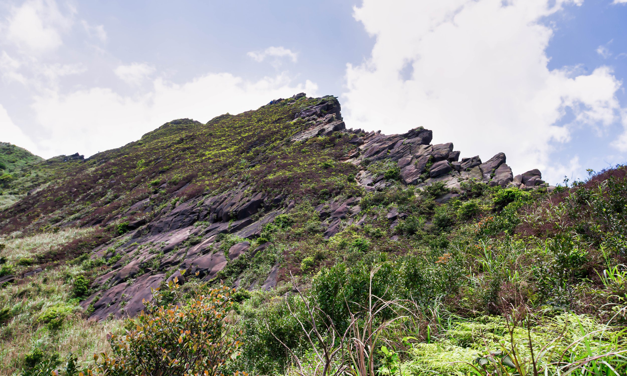
Most people however visit for the popular ‘Bitoujiao Hiking Trail’ which takes you up and around the mountain where you’ll enjoy amazing views of the coast.  

Bitoujiao Trail (鼻頭角步道)

These days, the vast majority of the people visiting Bitou Cape are coming solely for the short (yet rewarding) hike on the Bitoujiao Trail and not the small village below. While I’m sure the restaurants and business owners in the village benefit from the influx of tourists to the area, most people are really only coming to get photos of the beautiful northern coast from the small mountain above the village. 

Like a lot of areas around Taiwan these days, the popularity of the Bitoujiao trail has skyrocketed thanks to the ‘Instagram-effect’ with the majority of people visiting not for the hike itself, but the beautiful photos that you’re rewarded with if you take the time to visit.

Unlike some of the other ‘insta-famous’ landscape areas that have become popular in recent years, this one is probably one of the easiest to hike and shouldn’t actually pose much difficulty as the trail is well-developed and doesn’t require any hiking experience.

So, if you plan on bringing grandma and grandpa, don’t worry too much. They’ll be fine. 

The total length of the trail is 3.5 kilometres from start to finish, but that number includes a part of the trail that leads to the Bitou Lighthouse (鼻頭角燈塔). That part of the trail is currently under reconstruction and isn’t open to the public. So, I’d estimate that the trail is actually no longer than two kilometres in length. 

Likewise, the official estimate of the amount of time that you’ll need to complete the hike is around ninety minutes. Without a trip to the lighthouse though, your trip is going to be considerably shorter, so you’ll probably be able to complete the circuit in about an hour, but that depends on how much time spend taking photos.

So when will the path to the lighthouse re-open? That’s hard to say as there is no official estimate as to when the trail will be fixed. You may think to yourself that you could just do what the fishermen do and walk down to the coast and make your own trail to the lighthouse, but I’d caution you against it. A few months ago a couple of tourists had the same idea and one of them ended up dying while the other was critically injured. 

Link: 鼻頭角祕境浪捲1死1傷/祕境非步道 風管處不管?

If you are planning to do this hike, it is important to note that the trail is simply just a well-developed route that takes you around the mountain and although it may seem like a ‘circuit’, its a bit more like a horseshoe.  

There are two trailheads for the hike - one starts from within the small village while the other starts a short distance away at the local elementary school. With two trailhead options for starting your hike, you might be wondering which one is the best to start your hike.

There are arguments both for and against starting the hike at either one of the trailheads but as far as I’m concerned, there is really only one option. 

The best option for starting this hike is from the Bitou Elementary School side. 

Let me tell you why.  

The first reason is because if you’ve driven there, parking your scooter or car in the small parking lot along the highway (or along the road to the school) is relatively easy. Likewise if you take the bus, the bus stop is next to the road that takes you up the hill to the elementary school.

The most important reason though is that if you start your hike from this trailhead that you’ll be walking in the direction of all the beautiful scenery, which you’d probably miss if you started from other side, unless of course you’re weird and you make a habit of walking backwards. There are also considerably less stairs to walk up if you start from this side.

How you hike the trail of course is up to you, but if you start your hike from the Elementary School, you’ll be able to easily park your vehicle, enjoy the scenic beauty and finally enjoy a bit of the village where you can buy some after-hike snacks from some of the vendors before heading back to your vehicle or the bus stop. 

Getting There


When you look at the map, it might seem like getting to Bitou Cape could be difficult, but don’t let its location fool you, you can easily get there if you have your own means of transportation or through the use of public transportation.

If you’re driving a car or a scooter, all you’ll have to do is input “Bitou Cape” (鼻頭角) into your GPS and let it do all the work for you. If you’re traveling in a car from Taipei, you’ll want to get on the highway and head north until you reach the Dahua Interchange (大華交流道) where you’ll switch to the #62 Expressway (62快速公路). From there you’ll drive until you reach the north coast where you’ll switch to the North Coast Highway (濱海公路) which you’ll follow until you reach Bitou Cape.

If you’re driving a scooter you’re going to have to take a much less direct route to either Keelung (基隆) or Ruifang (瑞芳) where you’ll be able to reach the coastal highway.

I highly recommend that if you’re taking this option that you use the scooter directions option in Google Maps to map out the best route as there are way too many options to list here.  

If you’re taking public transportation you have a couple of options: The first is to take the train to either Keelung Train Station (基隆車站) or Fulong Train Station (福隆車站) and then transferring to Bus #791.

If you take the train to Keelung, you’ll have to sit through a long bus ride along the bus North Coast highway where the traffic can be quite heavy. If on the other hand you take the train to Fulong and transfer to the bus from there, the bus ride is much shorter.

Bus #791 runs from 6:00am - 9:30pm every day and shows up in intervals of 30-40 minutes during peak times and every 50-60 minutes during off hours. 

No matter where you get on the bus, you’ll want to make sure to get off at the “Bitou Cape” (鼻頭角) stop which has a nicely constructed and covered bus stop. It should also go without saying that if you get on the bus at Keelung Train Station that you should hop on the bus heading towards Fulong and vice versa. 

Link: Keelung Bus (基隆客運) #791 

If you’d like to take a bus directly from Taipei, simply make your way to Taipei West Station (台北西站) and purchase a ticket for Kuo Kuang Bus (國光客運) #1811 or ##1812 where you’ll get off at the Bitou Cape stop. I would caution you though, these buses don’t run as frequently and even though they might be ‘faster’, you’re going to pay a bit more.

You could also likewise hop on a bus from Ruifang Train Station (瑞芳車站), which is where you’d want to go if you planned on visiting Pingxi (平溪) or Jiufen (九分). From the bus terminal across the street from the train station you’ll want to hop on Keelung Bus #886 or #856, both of which go to Fulong. 

The reason why I’m not expanding on the Taipei or Ruifang options is that they are either inconvenient, expensive, slow or will require a lot more waiting around than the first option.

Ultimately its up to you, I’ve provided several options, so choose the one that best fits your itinerary! 

Bitou Cape was once considered somewhat of a guarded secret among locals, but the cat is certainly out of the bag as it has become a popular destination over the past few years. Thanks to the effort of photographers and Instagram celebrities, the area has also become a highly-regarded stop for both local and foreign tourists. Considering that it is one of the north coasts most scenic locations, it is definitely one of the places you’re going to want to stop if you’re visiting the area. 

Unfortunately at the moment, a large portion of the Bitou Cape Trail is currently under reconstruction and closed to the public. I plan on revisiting when the trail to the lighthouse reopens to get photos of that part of the trail as well as (I hope) better photos.

Until then though, I’m leaving this post here for your reference! 

If you plan on visiting Taiwan, a visit to the scenic north coast is one of my most highly recommended day trips, so I hope that you’ll take the time to enjoy some of Taiwan’s most stunning landscapes during your visit to the country! 


Shen’Ao Elephant Trunk Rock (深奧象鼻岩)

Note: It has been brought to my attention that authorities have recently started condoning off areas in front of Elephant Trunk Rock. This is meant to prevent people from getting too close to the high cliffs or on top of the Elephant Rock itself. This could be a preventative measure but it could also be a permanent one - If your sole purpose of visiting is to get on top of the “head” for a photo, you may want to hold off for a bit.

Shortly after my arrival in Taiwan, my friends and I planned a trip to the offshore Penghu Islands for a national day long-weekend of island hopping. On our second day we hopped on a boat and headed to beautiful Qimei Island (七美島) where we were led around on a scooter tour to see some of the sights. 

I could hardly contain my excitement as we were led to one rock formation after another. 

The first stop was “Little Taiwan” (小台灣), a rock formation that looked like Taiwan. Shortly after that we arrived at the “Waiting Husband Reef” (望夫石), a giant rock that we were told was supposed to look like a woman waiting for her husband to come back from the sea. Finally we were taken to the “Twin Heart Weir” (雙心石滬), a collection of rocks cleverly arranged in the shape of a pair of hearts that was at one time used to catch fish, but today catches more Instagram likes than seafood.

Suffice to say, I was unimpressed. 

I was of the opinion that instead of wasting time checking out boring rock formations, I could have been lying a beautiful beach or learning about the local area and its long and interesting history. 

Even though it was a long time ago, I still remember the day quite clearly as it was the day that cemented my aversion to anything that has to do with Taiwan travel and rock formations.

Its not that there aren’t cool-looking rock formations, I think the Nanya Peculiar Rocks (南雅奇石) are pretty cool, I just have a lack of imagination when it comes to claims that these rocks are taking the shape of anamorphic objects.

But hey, thats just me. To each their own, right? I might not be a fan, but that doesn’t mean you’re not going to find large groups of people filling tour buses to go check this stuff out. 

If you’re interested in knowing where almost all of those ‘rock-formation tour buses’ have been heading recently, its almost always going to be to Shen’Ao (深奧漁港), a small fishing harbor on the northern coast of Taiwan.

Thanks to a bit of Instagram magic, this once off-limits destination has become a hot spot thanks to a rock formation that just so happens to look like an elephants head. 

I’m not afraid to admit that when a hiking trail becomes popular on Instagram, I’ll join in on the action to see what all the fuss is about - When its a rock formation though, I’m going to be stubborn and take my time.

So here we are, after several years of avoiding it, I’m finally writing about the Elephant Trunk Rock.

I might be a bit late to the game here, but this post isn’t for Instagram fame, its for those wanting to visit and not having any idea how to get there.  

Elephant Trunk Rock (象鼻岩)

So, ‘Elephant Trunk Rock’ - What exactly is it? 

I’m not a geologist, so let me try to explain: It is a rock-arch on the top of a high cliff overlooking the ocean that just so happens to look like an elephant with its trunk lowered into the ocean for some water. 

Does it really look like an elephants head? Well, yeah, actually it does. 

And that is why it has become such a popular location for weekend travelers. 

When you visit the area, not only can you take photos of yourself standing in front of the ‘elephant’, but you can also scale up the back of its head and get photos of yourself standing on top, which is Instagram gold. 

The “Elephant Trunk” is officially named the “Shen’Ao Promontory” (深澳岬角) and is part of Fanzi’Ao Mountain (番子澳山) which separates the harbor port and the cape. Once a military-controlled zone, the area only opened to the public around the year 2000.

It would take quite a few more years however for it to become an internet sensation. 

The lower portion of the mountain near the shoreline features rocks that you’ll notice are similar to those that you’ll find at Yehliu (野柳), Peace Island (和平島) and many other areas on Taiwan’s north coast - These rocks, which often appear in the form of honeycombs and other shapes are the result of thousands of years of weathering and erosion.

Link: Yeliu Natural Landscape (Yeliu Geopark) 

Once you’ve finished checking out all the cool rocks and have progressed a bit further up the mountainside you’ll notice that the cape offers great views of the northern coast with Keelung to your left and Ruifang to your right. You’ll also be able to see the popular tourist town Jiufen (九份) in the distance next to Jilong Mountain (雞籠山)

The main attraction however isn’t the beautiful coastal landscape, it is the Elephant Trunk. 

Once you’ve arrived, there are is a long flat area where you’re likely to find a bunch of people taking photos. This area is the best for taking wide angle shots of the rock as well as for taking photos of your friends who are standing on its “head”. 

If you want to get on the “head” area, you’ll have to climb down a small rock area and then walk up a flat incline. If you decide to try to get on the head, be careful when you’re going up and down as you don’t want to slip and fall into the ocean. 

A gentle reminder that you’ll want to be careful when visiting this area - There have been fatal accidents in the past few years with people taking photos. (See link below) 

Link: 夫拍照轉身驚見妻墜海 瑞芳秘境「象鼻岩」傳憾事 (TVBS) 

Even though Elephant Trunk Rock has become a popular photo spot for local Instagrammers, the area was already quite popular with local snorkeling and diving groups for quite some time. The waters at the base of the trunk area feature a tunnel where you can enjoy some spectacular scenery and beautiful coral.

The current in the area is quite strong though, so if you want to try your hand at snorkeling, you should go with friends and be exercise caution. .

Link: Elephant Trunk Rock (Follow Xiaofei)

Before you arrive at the entrance to Elephant Trunk Rock, you’re going to notice signs pointing you in the direction of “Indian Chief Rock” (酋長岩), another rock formation that (if you’re into stereotyping) is supposed to look like the head of an “Indian Chief.”

Let me blow off a bit of steam here. 

Taiwan is a great country, but there are occasions, like this one, where I have to scratch my head at some of the stuff I see - If you take into consideration the persecution that the local indigenous peoples have had to endure over the past few centuries, you would think that a modern Taiwan would be a little more sensitive to this kind of racial stereotyping, especially when it comes to native peoples.

I could be accused of being a bit sensitive here, but if it were only the rock, I might just forget about it. Unfortunately there are also quite a few signs and images in the area that point to North American indigenous peoples being savage war-like killers. Its not cool and is completely unnecessary. 

Needless to say, I won’t be sharing photos of any of that stuff here. 

Getting There


Getting to the Elephant Truck Rock can be a bit of a hassle if you don’t have your own means of transportation. If you’re lucky enough to be traveling with someone who has a car or a scooter though, you shouldn’t have any problem. 

To get there all you have to do is follow the Northern Coastal Highway (北部濱海公路) until you reach Shen’Ao Fishing Harbor (深奧漁港) where you’ll drive in and find a parking lot. If you’re coming from Keelung, you’ll just want to follow the coastal highway until you arrive. If however you’re coming from Taipei, the fastest way to arrive would be to take Highway Number One and then switch to the #62 Expressway that will take you all the way to the coast. Once you reach the end of the highway, you’ll just have to make a left turn and the harbor is a few minutes from there. 

Once you’ve arrived at the harbor, drive your car all the way down the narrow road until you reach a newly constructed (paid) parking-lot where you’ll have quick access to the trail that leads to the Elephant Trunk Rock. 

If on the other hand you’re relying on public transportation to get there, you’re going to have a bit more of a difficult commute. It shouldn’t be that difficult, but you’re going to have to take a train or a bus, and then walk. 

The first thing you’ll want to do is either take a train (or a bus) to Keelung Station (基隆車站) where you’ll then transfer to a bus that will take you along the beautiful coastal highway. 

You have the option of taking either bus #791 or #1051 from the train station to the Shen’Ao bus stop. From there you’ll simply walk through the fishery harbour until you reach the entrance to where you’ll find the Elephant Trunk. 

Link: Bus Schedule - Bus #791 / Bus #1051

You could likewise take the Pingxi - Shen’Ao rail line’s (平溪深奧線) tourist sight-seeing train to Badouzi Station (八斗子車站) and from there walk to Shen’Ao harbor, which should only take about 15-20 minutes. If you’re not a fan of walking, you could likewise hop on one of the buses mentioned above which are both served outside the train station. Keep in mind though that you’ll want to get on the bus on the train station side to save yourself from heading back to Keelung. 

A few years back when fellow blogger Alex Kunz visited the area, he noted that getting to the rock was a bit difficult and that the trail was more or less unmarked. The sudden popularity of the area over the past few years however has completely changed all of that. The area is now clearly marked with an excessively large paid parking lot constructed near the entrance. 

Likewise, the trail is quite easy to follow and is well-travelled meaning that you’ll be able to safely walk up with trail and won’t get lost. From the entrance, you can expect around a five minute walk to the viewing area for the rock, but depending on the amount of people visiting, you may have to wait in the narrow sections of the trail.

Jilong Mountain and Jiufen in the distance.

You may have noticed that I’ve been a bit tongue in cheek with this blog post - Its true that I’m not a big fan of rock formations, but I’m willing to admit to you that if you’re looking for a rock formation that actually looks how its advertised, then you’ve come to the right place. There is an uncanny resemblance.

That doesn’t mean I’ve changed my mind about rock formations though, I’m going to continue to avoid them. If you like them though, Taiwan’s northern coast is full of them and you’re going to really enjoy yourself if you take a tour of the area.


Stegosaurus Ridge (劍龍稜)

Prior to my arrival in Taiwan, I was admittedly under the impression that the country was more or less a collection of large urban sprawls that had more or less overtaken what little of the island’s natural environment. In my defense, this was long before Google Maps made its appearance, however with a land mass smaller than my home province in Canada, but a population twenty-five times the size, it didn’t seem like I was too far off. 

Shortly after arriving, I quickly found out how wrong I was. 

The “Taiwan” that we often imagine certainly isn’t what we’re led to believe, nor how it is often advertised.       

If you are like a lot of tourists who visit the country without ever leaving Taipei, I suppose you might not have much feel for what I’m talking about, but Taiwan rivals any in terms of natural beauty with its mountains, valleys and coastal areas.

Sadly, this is one area where many of Taiwan’s most fervent supporters lament the way that the nation is officially advertised to the outside world. The natural beauty of the country has unfortunately always been one of its best kept secrets. If it were marketed properly, it would attract a considerably larger amount of interest. The pandemic was obviously disastrous for the travel industry, but now that it appears that the world is finally on the path to normalcy, it would be great if Taiwan could capitalize on all of the international good will it has earned over the past few years, and started attracting a wider variety of tourists. 

For those in the know, Taiwan’s North East Coast (東北角) is one of the best examples of the nation’s natural beauty - Not only is it breathtakingly beautiful, it is arguably one of the most accessible destinations for day-trips outside of the capital. Tourists who visit the area are able to get a feel for local culture and history while enjoying a medley of the turquoise ocean on one side with high mountains on the other. 

The coastal area has a number of popular tourist attractions, which attract both domestic and foreign tourists for day trips - Whether you’re visiting the northern port city of Keelung (基隆), it’s famed Miaokou Night Market (廟口夜市), Yehliu Geopark (野柳), Jiufen (九分), the Golden Waterfall (黃金瀑布), Bitou Cape (鼻頭角), or any of the fishing ports along the way, if you’re a first time visitor, you’re likely to feel like stopping every few minutes along the way to take photos. 

Interestingly, over the past few years, (mostly thanks to Instagram) several new destinations along the coast have gone ‘viral’, and have been attracting a considerable amount of domestic tourists. Unfortunately, for most foreign tourists, these locations don’t often appear on the radar. Elephant Rock (象鼻岩) for example, has become of those hot spots, with crowds visiting the area to check out the rock formation. More recently though, you’ll find just as many more people kayaking, snorkeling and diving nearby, creating new opportunities for adventure tourism. 

Likewise, even though the mountainous areas near the coast have always been popular with avid hikers, they have also recently become the stomping grounds for tourists, who flock to the area on the weekend eager to enjoy the area’s beauty, and more importantly their impromptu Instagram photoshoots! 

Hikers are blessed with numerous trails along the coast, each of which offers spectacular views of the northern coast. The Teapot Mountain (無耳茶壺山) and Jilong Mountain (基隆山) trails are two such examples of well-known and highly-rewarding hikes, which are coincidentally also easily accessible through public transportation and the relative ease for anyone wanting to hike them. 

Surprisingly though, a number of the trails in Northern Taiwan have become viral sensations - some for the potential they offer for photoshoots, but others merely for their sheer difficulty. Most international tourists will be familiar with Elephant Mountain (象山步道), and the other Four Beasts (四獸山步道) in Taipei, but hikes like Wuliaojian (五寮尖), Huang Di Dian (皇帝殿), the Pingxi Crags and Stegosaurus Ridge (劍龍稜) have arguably become just as popular.

Waving to hikers on another ridge in the distance.

Even though all of these trails offer a great hiking experience, some of them are not very accessible for your average tourist, which makes getting there somewhat difficult. Fortunately, there are a number of English-friendly mountaineering groups that plan day-trips to some of these areas, taking care of all of the small details for any of the hikes you want to go on. So, if you are visiting Taiwan, it is always a good idea to check out some of these groups and get in contact with them to see if they have anything planned that you are able to join in on:

Parkbus Taiwan | Taiwan Adventure Outings | Taiwan Adventures | Taipei Hikers 

This time, I’ll be introducing one of the viral hikes mentioned above, the aptly nicknamed ‘Stegosaurus Ridge,’ which happens to be one of the most beautiful and thrilling single-day hikes that you’ll find anywhere in the country. That being said, it’s also both difficult and dangerous, and hiking it certainly isn’t for the faint of heart.

If you’re up to it, this is a hike that is essentially a several hour long full body workout that will result aching muscles at the end. The experience however is worth it as you’ll be rewarded with some spectacular views that’ll ensure you’ll fall in love with Taiwan!      

Stegosaurus Ridge (劍龍稜)

I think it’s pretty safe to say that Stegosaurus Ridge is both literally and figuratively one of the ‘hottest' hikes in Taiwan at the moment. Like some of the other trails mentioned above, this one transformed from being relatively unknown to one where you’re likely to meet hundreds of weekend day-trippers from all over the country, whenever you hike it.  

Being that it is a ridge hike, it is one of those special experiences where hikers are rewarded with (almost) 360 degree views of the North East Coast landscape, and the mountain range that separates it from the capital. 

Deriving its name from the jagged ridge that you’ll have to walk up, which is likened to the dermal plates on the back of a Stegosaurus, the hike is not only one of the prettiest, but also one of the most thrilling thanks to the ridge. 

Speaking frankly though, it is also quite dangerous at the same time.  

It is important for anyone planning to hike this one to remember that not only is it a difficult and time consuming hike, it’s also quite dangerous - especially for inexperienced and unprepared hikers - So, before I go into detail about the hike the following tips should be taken into consideration:

  • The hike will take anywhere between 5-8 hours to complete - Start the hike early in the morning lest you get stuck high in the mountains after dark.

  • DO NOT hike this trail alone - Bring your friends!

  • This trail has several very steep sections: If you’re not an experienced hiker, you may find yourself having some trouble. Take your time and let people pass by.

  • If you are afraid of heights, this hike isn’t for you.

  • There are few areas that offer hikers respite from the hot sun - Wear sunscreen, and make sure you wear a hat to protect yourself.

  • The North East Coast is prone to rain, which makes climbing the ridge even more dangerous. If it is raining, find something else to do and come back another time.

  • It’s not recommended that you bring your trekking poles along with you for this hike - They will get in the way while you are climbing the ridge and could make getting past some sections even more dangerous.

  • Sections of the trail are full of long grass, which is sharp and will slice up your arms and legs if you’re not wearing proper covering. You should wear proper hiking pants as well as hiking shoes to protect yourself.

  • There are several areas where you’ll encounter ropes on the ridge, you should bring a set of gloves to save your hands from rope burn and blisters. Most hardware stores sell cheap pairs for $10NT.

  • You’ll need to carry a generous amount of water to stay hydrated in addition to having having snacks or a packed lunch available.

  • For your safety make sure to follow the hiking flags attached to trees along the trail as well as the arrows sketched on the ridge so that you don’t end up getting lost.

  • There are several off-shoot trails along the way that you can take back to ground level. If you get half-way up and are thinking about giving up, try to take one of these trails rather than turning around as the trails aren’t really set up for two-way traffic.

Climbing fun.

There’s another important thing to mention before I move on: You may have heard that hiking this trail is more or less illegal. Are those rumors true? Well, the answer to that question is both yes and no.

The ‘Stegosaurus Ridge’ hike is part of a loop where hikers start hiking from just above sea level to a height of around 700m, offering access to over ten peaks along the way. When we talk about this hike, we have to first differentiate whether we’re hiking the ‘circuit’, or just the Stegosaurus section. 

If you are planning on hiking the circuit, then there are trailheads that can be accessed where you're not going to have any issues. For those of you who are just coming for the Stegosaurus section, and looking for the most direct route to the ridge, the entrance that most people end up using is considered “trespassing” as it requires a jump over a fence onto abandoned state-owned property.

Most of the online resources you’ll find about the ridge will talk about this and offer ideas for jumping over the fence, or getting around it. What you’ll want to keep in mind are the warning signs posted at the spot where you jump over the fence. The signs aren’t translated into English, but what they essentially say is that warn hikers caught entering the area will be fined and now that the trail is so popular, you’ll find that there are often police cars stationed nearby, or patrolling the area to deter people from using this entrance. 

For those of you who can’t read Chinese, the signs warn that fines for entering the area could amount to NT$500,000 ($17,000USD).

While it is true that this entrance offers the most direct access to the trail, cutting down the amount of time needed to complete the hike, it is (for the time being) illegal to enter, so if you decide to take this route you may have to face the consequences.

Starting the hike from the other trailheads in this area isn’t illegal, but using the copper factory entrance is, so if you are planning on do part of the hike, you may want to consider a newer trailhead located around the 80.2KM marker, or the Golden Lake (黃金池) trail that starts at the 79.6k marker.

One of the three Stegosaurus ridges.

What is currently the most responsible thing to do is take the third option by starting your hike further down the road at the Nanzilin Trailhead (南子吝步道), where a path connecting to the ridge has been marked by hiking groups and where you’ll won’t be in danger of leaving with a criminal record! 

For further information about the legal situation with this hike check out Taiwan hiking master extraordinaire Richard Saunder’s article about it - More Bad News Regarding Access to Taiwan’s Mountain Landscapes

Now that we’ve got all of that out of the way, let’s move onto the hike. 

To start, I guess I should clarify that ‘Stegosaurus Ridge’ isn’t actually a mountain. 

The aptly named ‘stegosaurus’ section of the hike is simply what its name implies, it’s a ridge.

The circuit hike that I highly recommend you complete does however consist of a number of peaks and mountains, including Nanzilin Mountain (南子吝山), 381 Peak (381峰), 555 Peak (555峰), Banping Mountain (半平山) and Teapot Mountain (茶壺山), with several waterfalls and a river along the way.

Navigating the ‘sawtooth’ ridge.

The amount of time it takes to complete the hike ultimately depends on how much of the trail you intend on hiking. For those of you who are only interested in the ridge sections, your hike will be considerably shorter than those who plan on hiking the circuit. In the case of the circuit hike, you can look forward to a 6 to 7 kilometer-long hike starting from sea level to an elevation of around 700 meters.

The circuit hike should take around 6-7 hours, but once again that very much depends on several factors including your level of fitness, the amount of people hiking the trail, and how many breaks you take. For those of you planning to just hike the ridge and head back down to ground level, I’m sorry to say that the hike is still going to take around 5 hours, so you might as well just go ahead and hike the whole thing, right? 

With this hike, I’m admittedly going to advocate that you experience the full thing, so the route I’ll introduce first is what is considered the ‘circuit route’ starting at one temple and ending at another. Even though this is the route that will take the most amount of time, it is also the most rewarding as you get to experience the ridge and beyond. 

The Golden Ridge Circuit (黃金稜線)

Nearing the end of the hike. One last peak to climb.

For this route, you’re able to get off the bus at the Nanxin Temple Bus Stop (南新宮站), where you’ll find small community with a temple, public bathroom, general store and the trailhead to the Nanzilin Trail (南子吝步道). 

Starting from this trailhead ensures that you won’t meet with any of the legal difficulties mentioned above, and also allows you to enjoy the peak of Nanzilin Mountain before making your way to where the Stegosaurus trail starts.

The Nanzilin section of the trail is well-developed and you’re likely to see lots of elderly hikers on this part of the trail. If you’re a first time hiker to the area, I highly recommend you hike to the peak of Nanzilin Mountain before you descend the river. The peak of Nanzilin is a high cliff that overlooks the highway and its absolutely beautiful. You’ll have to backtrack for a few minutes, but it’s well worth the effort. 

A short distance from the peak, you’ll find a bench with a hiking flag marking the route where you’ll make your way through a bunch of tall grass on your descent to the river, which you’ll have to cross before reaching the start of the Stegosaurus section.

The view of the North Coast from the peak of Nanzilin Mountain.

Once you’re across the river, the hike starts becoming quite steep, and after a short tree-covered ascent, you’ll reach the first section of the ridge. Standing in front of the ridge can be a bit daunting, especially when you look on the right side, but you don’t actually have to straddle it all the way up. You can follow a path along the left side which allows hikers to safely make their way up the mountain.  

While making your way up the ridge, you’ll have to pass by three separate sections of the ridge, which are unmarked but are known locally as ‘Stegosaurus 1’ (劍龍1), ‘Stegosaurus 2’ (劍龍2) and ‘Stegosaurus 3’ (劍龍3). Once you’ve made it past there you’ll find yourself at 381 Peak (381峰). While at the ‘peak’ you may want to take a quick break before starting your next leg of the hike to 555 Peak (555峰). 

At this point, you might be thinking: “I’ve finished Stegosaurus Ridge, it’s time to turn around and head back!” Sorry, no. If you did, you’ll be missing on couple of similar jagged rock sections, known as the ‘saw-tooths’ (鋸齒), where you’ll get to climb up some ropes on your way to the next peak. The path between 381 and 555 is a thrilling section of the trail where you’ll climb ropes and large rocks, which are great for photos. 

Note: Are you wondering why the peaks are called 381 and 555? The answer is pretty simple: It’s their recorded elevation.

Unlike the first peak, 551 Peak is a nice flat section of mountain with some tree cover,  where you’ll likely want to take a break and have some lunch before moving on. 

It’s also at this point where you can say that you’ve officially completed the Stegosaurus Ridge hike. There is a fork in the path on the peak that allows hikers to either continue along the circuit, or make their way down to the Golden Lake (黃金池), and one of the trailheads along the highway. 

If you (do the right thing and) continue along the circuit, the path you’ll take is a steep one with more ridge-like sections that’ll bring you to to a crossroads between Banping Mountain (半平山) and Teapot Mountain (茶壺山). The sawtooth sections here are also quite fun, but by the time you’re this far into the hike, you’ll be looking at Teapot Mountain in the distance wondering when punishment will end.

Looking down towards Teapot Mountain

The last truly fun section of the hike is the famed crossroad (V缺口) between the Banping Mountain Trail and the Teapot Mountain Trail. In this section you’ll have a really beautiful view of Teapot Mountain, Jilong Mountain (雞籠山) and the ocean while carefully making your way down the rope in the gorge.  

The hike between the crossroads and Teapot Mountain won’t take that long, but its at this point where your legs are going to be feeling the pain and walking down all the stairs won’t make them feel much better. When you finally arrived at Teapot Mountain, you’ll probably want to enjoy the view for a while before you start your descent to Qianji Temple and the end of the hike. 

To be more concise, this is the route you’ll follow for the circuit: 

Nanxin Temple (南新宮) → Nanzilin Trail (南子吝步道) → Nanzilin Eastern Peak (南子吝山東南峰) → Crossing the Banping River (下切半屏溪) → Stegosaurus Ridge (劍龍稜123) → 381 Peak (381峰) → Stegosaurus Ridge Section 2 (鋸齒稜B段) → 555 Peak (555峰) → Stegosaurus Ridge Section 3 (鋸齒稜C段) → Banping Mountain / Teapot Mountain Crossroad (茶壺山半屏山叉入口) → Teapot Mountain (茶壺山) → Teapot Mountain Trailhead (茶壺山登山口) → Qianji Temple (勸濟堂)

If you’d like to check out the waterfalls, once you’ve crossed the river you can head to the left instead of making your way up to Stegosaurus Ridge. Follow the hiking markers attached to trees and you’ll be find the first one in no time. The other two are much further upstream. 

Stegosaurus Ridge Route (劍龍稜)

For those of you who are interested in experiencing Stegosaurus Ridge, but for whatever reason aren’t as interested in completing the circuit hike, the route you’ll follow for this hike is relatively similar to the one above. Admittedly, the first time I hiked the mountain, this was the route I took as I wasn’t as familiar with the trails at the time and got a later start than I planned. So, if this is the route you choose, you won’t find any judgement here. Lots of people have already hiked to Teapot Mountain on other trips, so it’s not entirely necessary to hike the whole thing again. 

Following the route above, you’ll make your way from Nanxin Temple all the way up to 555 Peak. In this case though, instead of continuing up the mountain, you’ll find a set of ropes that allows you to descend from the peak onto another trail that will bring you to the Golden Lake (黃金池), and then finally to the trailhead that starts at the 79.6k marker along the highway. 

The route down here is a leisurely hike in an area that is often tree-covered, but you need to keep in mind that parts of this trail, especially the area near the lake are covered in sharp grass, where you might get some scrapes and cuts if you’re not wearing proper clothing. 

Be careful of the tall grass. 

While making your way down, you’ll find a fork in the road with one direction that heads down to the highway while the other brings you on another path to the Teapot Mountain trail. The highlight of this trail, if you take it, are the massive waste flues from the Shuinandong Smelter (水湳洞精鍊廠) that make their way up the mountain, and were formerly used to transport noxious gases and fumes away from the refinery.  

To conclude, here is the route you’ll follow for the Nanxin Temple to 79.6k Marker: 

Nanxin Temple (南新宮) → Nanzilin Trail (南子吝步道) → Nanzilin Eastern Peak (南子吝山東南峰) → Crossing the Banping River (下切半屏溪) → Stegosaurus Ridge (劍龍稜) → 381 Peak (381峰) → Stegosaurus Ridge Section 2 (鋸齒稜B段) → 555 Peak (555峰) → Stegosaurus Ridge Section 3 (鋸齒稜C段) → Golden Lake Trail (黃金池的稜線) → Golden Lake (黃金池) → 79.6k Marker (台2線79.6K)

Golden Lake (黃金池)

In the map I’m providing below, I’ve marked the various trails that you’re able to take on this hike and even though the trailheads that are considered ‘illegal’ are marked on the map, I didn’t go into detail about starting your hike there for obvious reasons. If you choose to take those routes, its completely up to you, but if you do, you’re going to miss out on the Nanzilin Peak, which is also quite beautiful.

Getting There

I can’t really stress this enough, the best method regarding getting to this hike (and to save yourself a bit of trouble) is to make use of Taiwan’s excellent public transportation network. Why? The hike generally starts in one area and ends in another. So if you bring a car or scooter and park near one of the trailheads, its not likely that you’ll complete the hike in the same area, so you’re going to make the hike unnecessarily longer.   

If you are following my advice and making use of public transportation, here are some suggestions that’ll get you to the trailheads quite easily: First, you should first take a train to either Keelung Train Station (基隆車站) or Rueifang Station (瑞芳車站), and then transfer to any of the routes that will take you to the Nanya Peculiar Rock area. 

Starting the long hike on the Nanzilin Trail

Bus #791 from Keelung or Bus #886 from Rueifang will both get you there.

The bus from Keelung Station stops a short distance away from the station, so even though the bus stop is labelled “Keelung Station” in English, make your way to the Maritime Plaza (海洋廣場), which is a straight walk from the front of the station to the pier front along Zhongyi Road (忠一路).

From Rueifang Station, you’ll walk out the front door and turn left on Mingdeng Road (明燈路三段) and make your way toward the Rueifang Police Station (瑞芳分局), where you’ll find a very popular bus stop that takes weekend tourists up to Jiufen (九分), and beyond.

In both cases, you’ll find convenience stores between the railway station and the bus stops, so I recommend you stop and get snacks and water for the hike!

No matter which train station you hop on the bus at, there are two stops that you’ll want to keep in mind based on where you plan on starting your hike. The first stop is the “Taijin Company” (台金公司) bus stop where you’ll get off the bus and backtrack until you reach the 79.6k marker. Next to the marker you’ll find a path heading up the hill. 

The second one is the “Nanya Nanxin Temple” (南雅南新宮), which is located just past a tunnel along the highway. The trailhead for the Nanzilin Trail (南子吝步道) is found at the rear of the temple and is clearly marked.

If you’d prefer a slightly more direct (but expensive) route, you can take a bus directly from the Taipei Bus Station (台北公車站). Kuo-Kuang Transport (國光客運) offers a bus from Taipei to Luodong (台北-羅東) that’ll allow you to get of the bus to the stops mentioned above. 

The bus leaves from the bus station next to Taipei Main Station daily at 8:50am, although I would caution that taking this bus won’t really give you an optimal start time for the hike. 

Link: Kuo-Kuang Bus #1811 (English | 中文)

The bus you’ll take on your return journey very much depends on where you complete your hike. If you’re only hiking the Stegosaurus section of the trail, then you’ll probably make your way back down to one of the bus stops mentioned above. However, if you complete the full circuit hike, you’ll be rewarded with a bus at Quanji Temple (勸濟堂) that  lovingly transports weary hikers all the way back to Taipei. 

At the Quanji Temple bus stop you’ll find buses #891 and #1062, each of which will take you to Songshan Train Station (松山車站) or Zhongxiao Fuxing MRT Station (忠孝復興捷運站) in Taipei. The bus stop is also serviced by F802, which will take you back to Ruifang Train Station, if you’re headed in a different direction than Taipei. For each of the routes above, click the link for the bus schedules and real-time information.  

Let me reiterate that this hike is a really fun one, and a little hard work on your part will definitely pay off as you’ll be rewarded with some pretty spectacular views of the natural landscape of the North East Coast, and some great memories. 

However, if you plan on taking this challenge, you must take the tips mentioned above seriously, and make sure to be mindful of your safety at all times. This is a hike where you can easily hurt yourself, or fall to your death if you are not careful. 

If you found this blog post after seeing beautiful photos on Instagram and you’re thinking this hike is one you’d like to try, it’s important that you go fully prepared, and are fully aware of its dangers, so you can better enjoy it. 

All of that being said, this is an extremely rewarding experience that is exhilarating and offers spectacular views of the North East Coast’s landscape. It’s going to tire you out and you’ll come away bruised and beaten, but it will also give you a whole new level of respect for Taiwan’s natural beauty.