Landscape

Yuan-Yang Valley Waterfalls (鴛鴦谷)

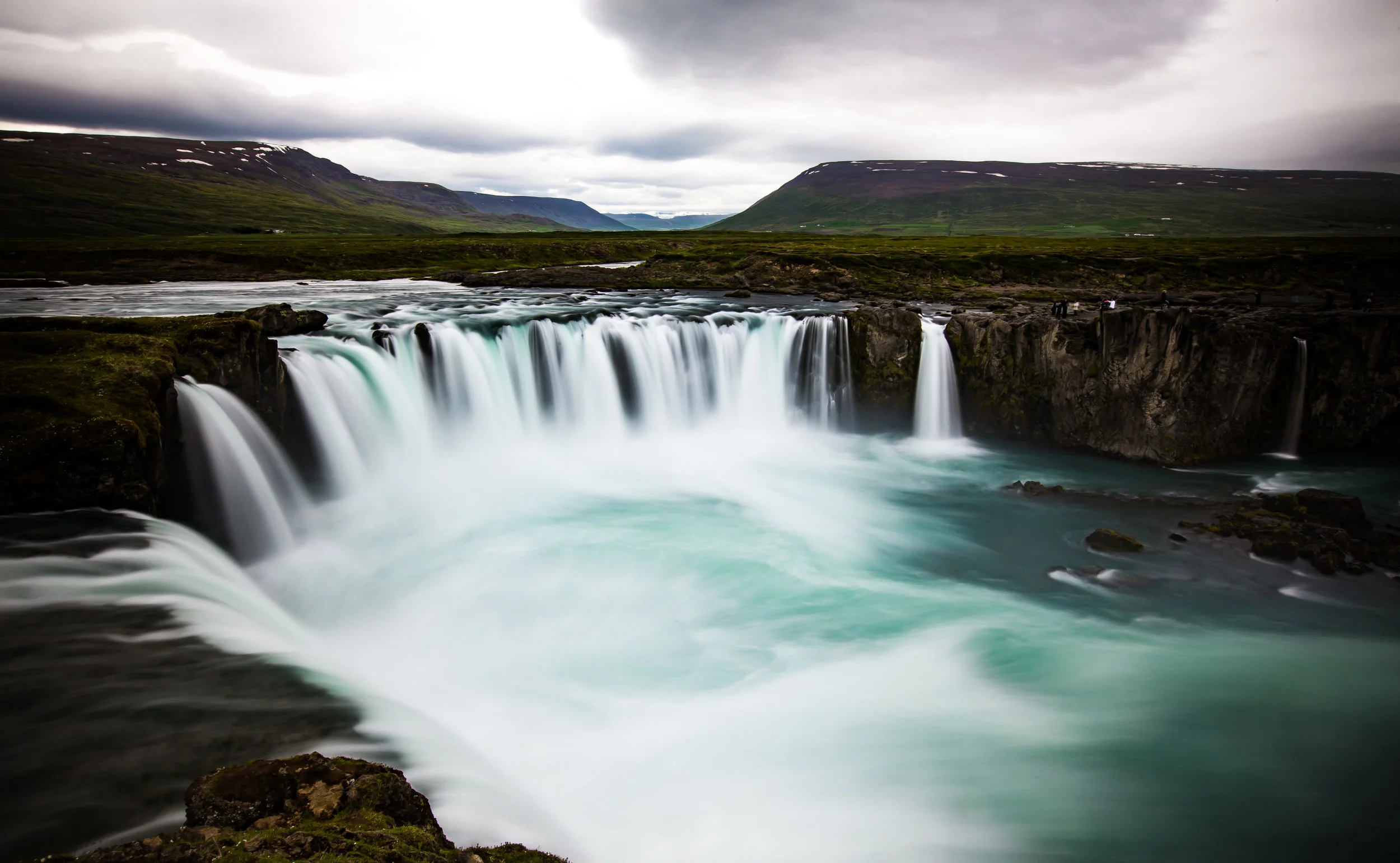
The Yuan-Yang Valley (鴛鴦谷) is set within a National Forest Recreation (國家森林遊樂園) area and is rich in hiking trails, beautiful waterfalls and rivers. The park is just outside of an Atayal Indigenous village in Hsinchu's mountainous and extremely picturesque Jianshi village (尖石鄉). The valley is a short, yet beautiful drive from Neiwan (內灣) and is close to a popular camping ground situated within the small indigenous village.

There is a lot to do within this forest park, but I'm going to focus on a few of the waterfalls found within and post only photos of them. The park has several hiking trails and while the spectacular waterfalls might be the major attraction, there is still a lot for me to explore in this area and I'm eager to get back to hike some of the trails within. 

From the entrance to the park, the waterfalls are a short hike up a paved mountain trail from a trailhead that is just past the village. The trailhead is blocked for cars, but you can easily get a scooter in and drive up to the falls if you're feeling lazy.

The two main waterfalls are not very far from each other but oddly there is a sign along the path that indicates the entrance to a waterfall for one and not the other. This trail is developed quite well while the trail to other requires a bit of bravery to get to it. If you haven't come prepared for a hike (or River trace) it might be best to skip the much larger waterfall and keep hiking towards the second which is on a safer path.

To get to the first waterfall on the trail you have to have a keen eye and watch the road as someone has spray painted in red ink "Waterfall #1" (瀑布1) on the road with arrows pointing to a small path that goes directly off the road. The marker is easy to miss because the road is often covered in foliage. I completely missed it the first time, but truthfully the first time I visited I had no idea that there was more than one set of falls.

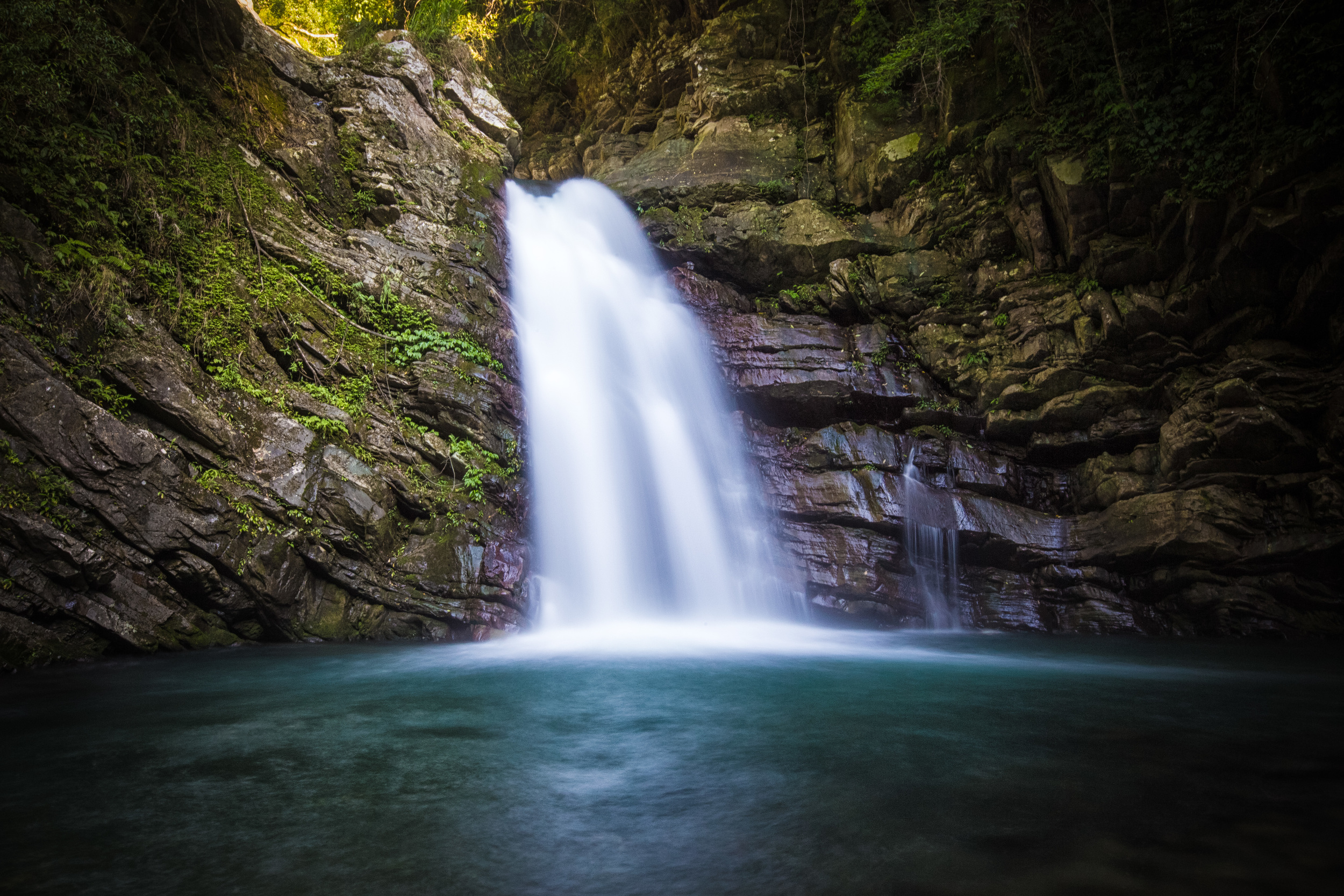
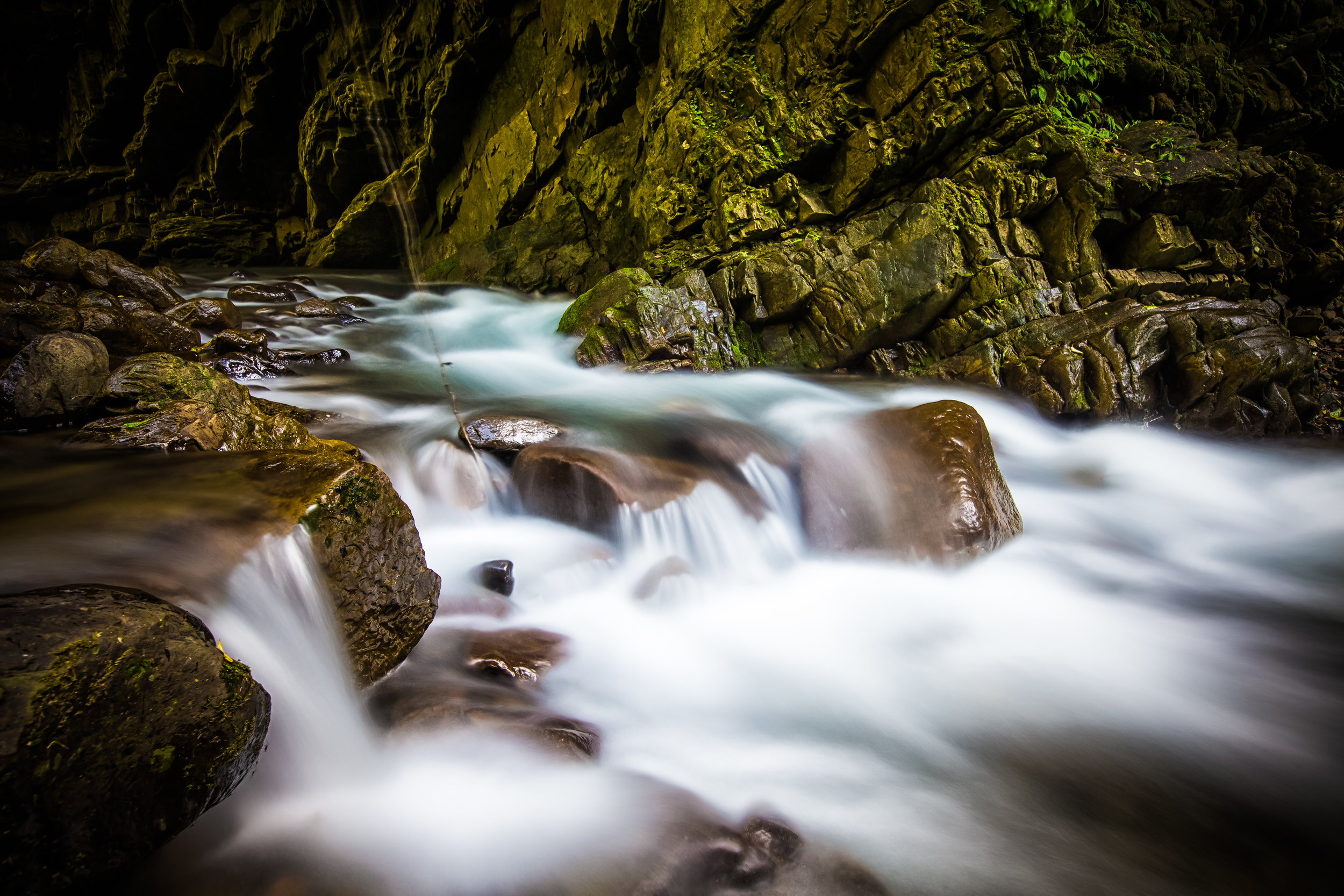
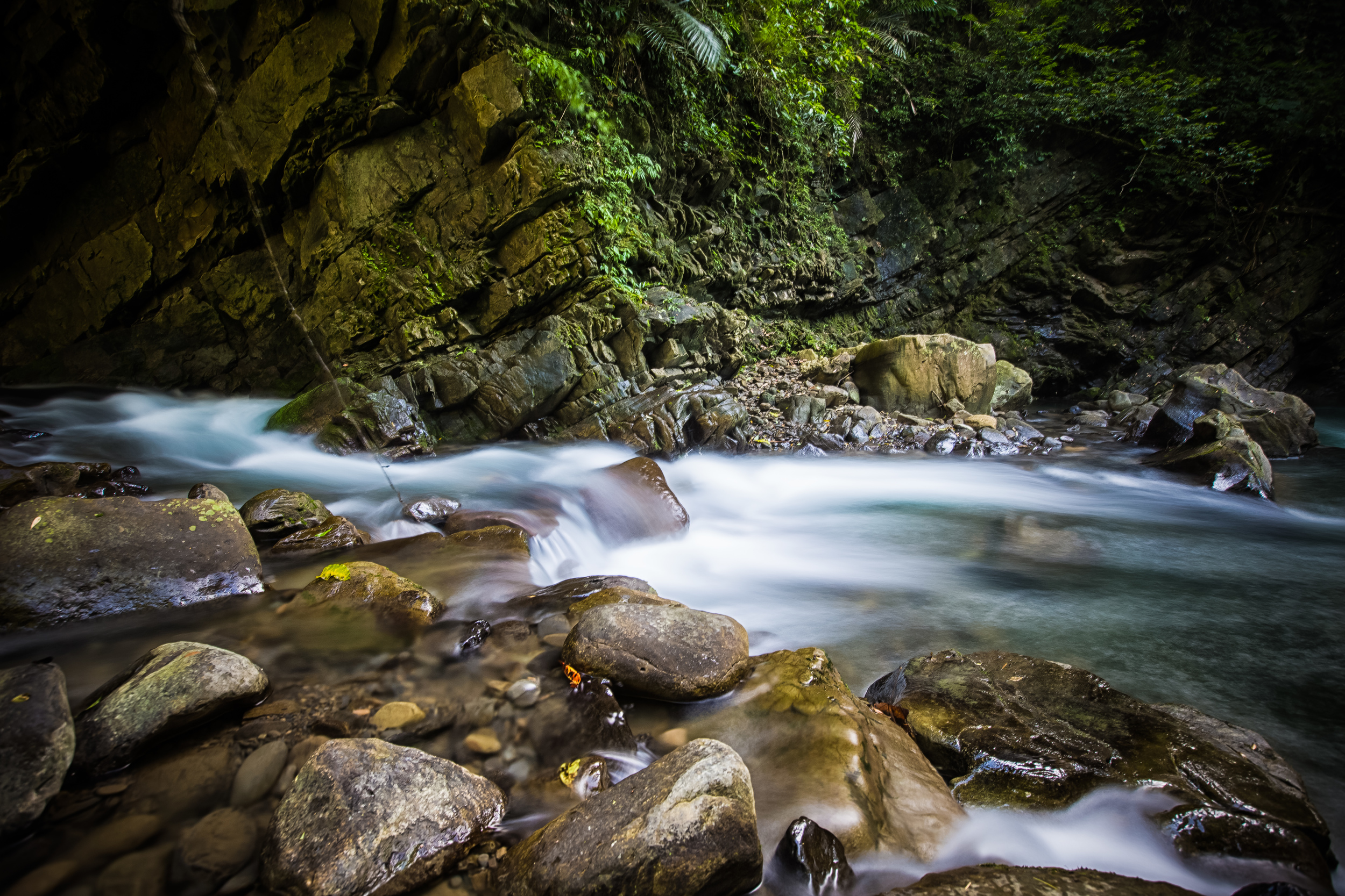
Waterfall #1 has several tiers and the water you're likely to see flowing down the falls isn't like what you'll see at the other set however the sheer height of the falls and the fact that it has several tiers makes it much more beautiful than the other set. I estimate that it is about 40 meters tall making it considerably larger than Waterfall #2.

It isn't that easy to get very close to Waterfall #1 and it seems like it is best viewed from a distance. If you plan on getting close to it, you're going to have to have river tracing shoes and be prepared for wet, slippery rocks that are dangerous. It's possible to get up close and personal with it, unfortunately the day that I went it called for rain and as I was crossing the river it started, so I didn't try to climb up on the rocks. 

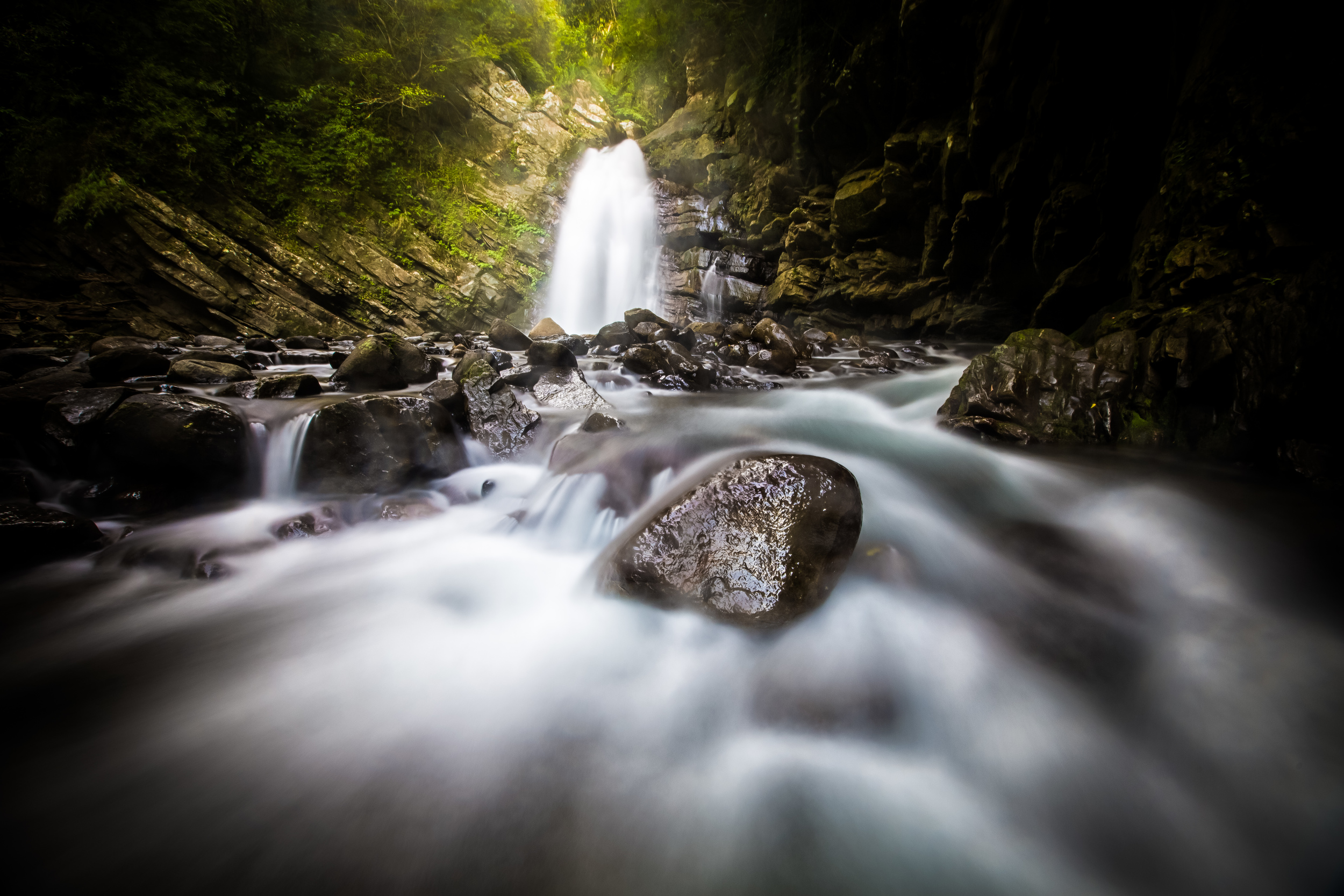
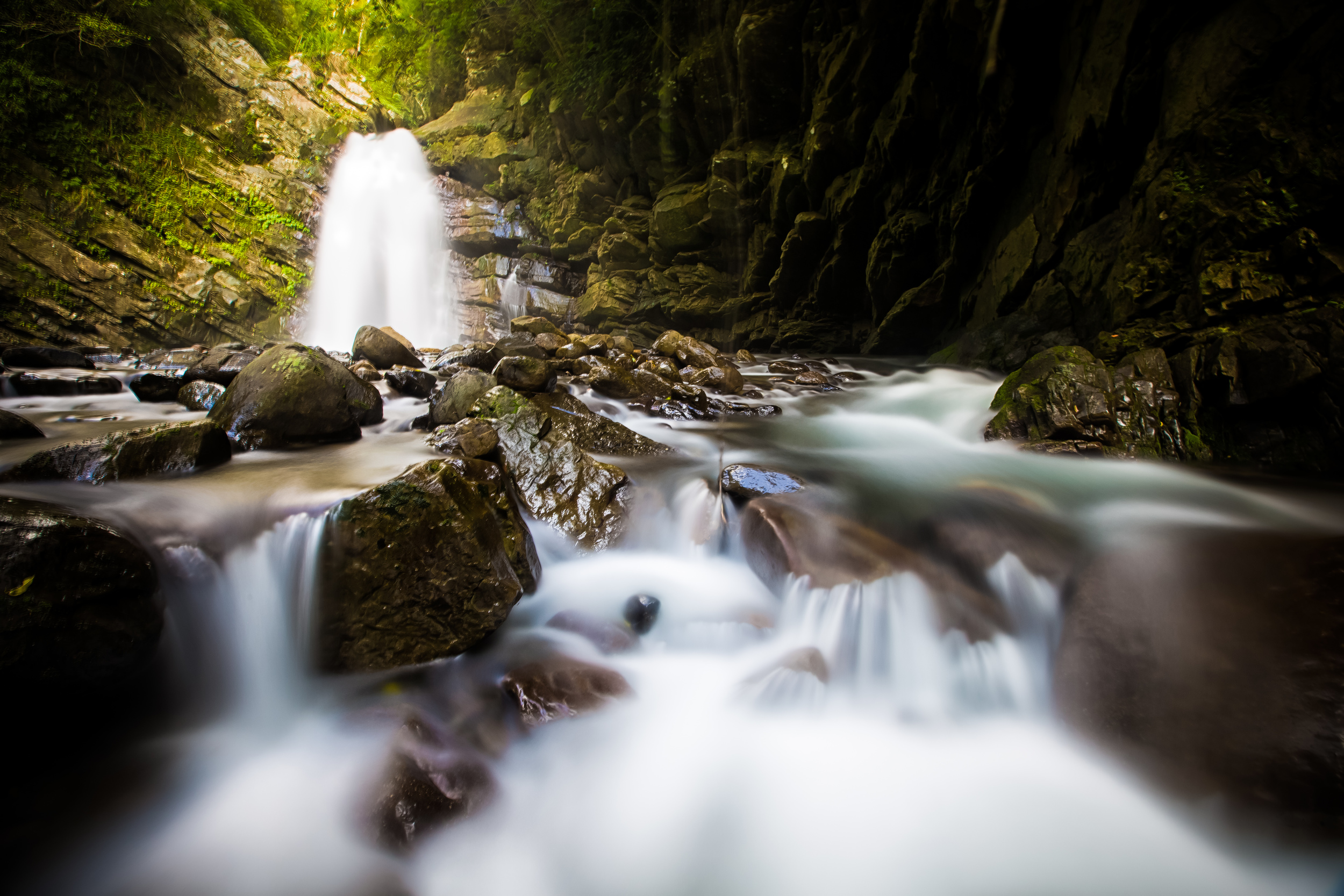
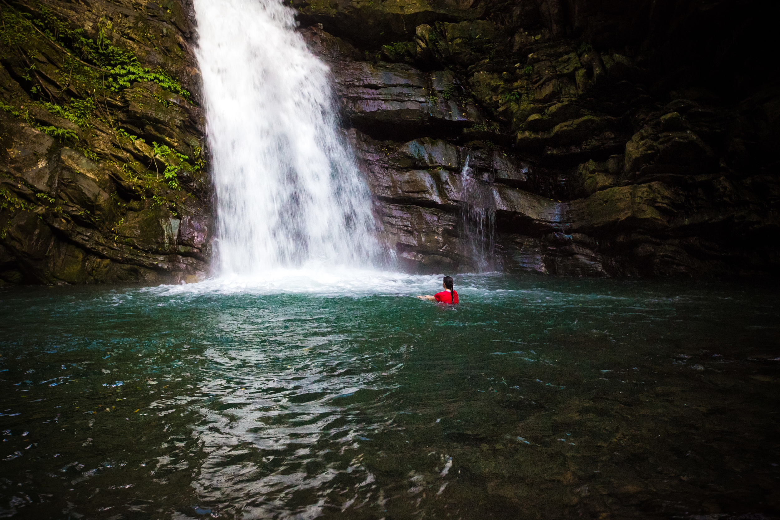
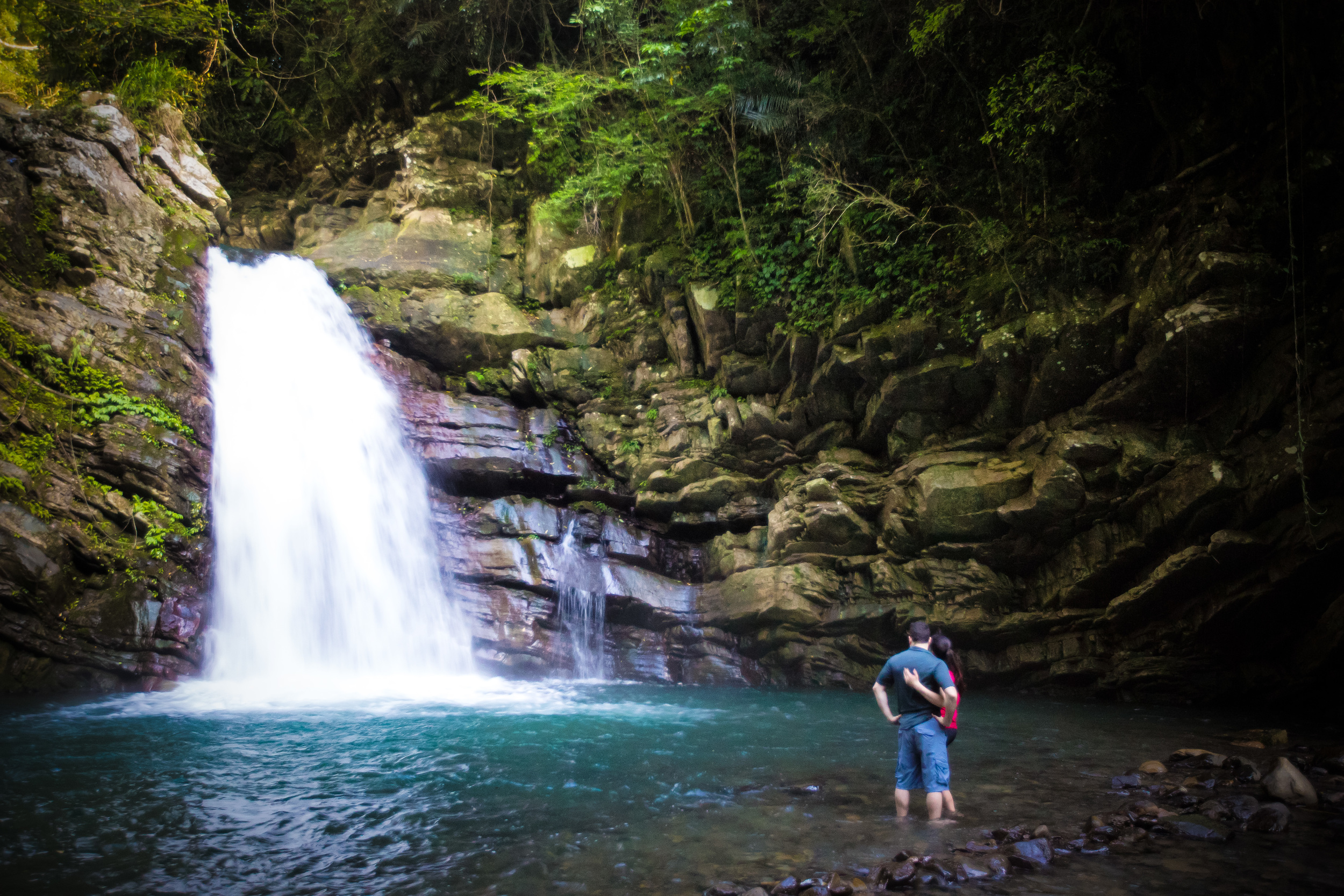
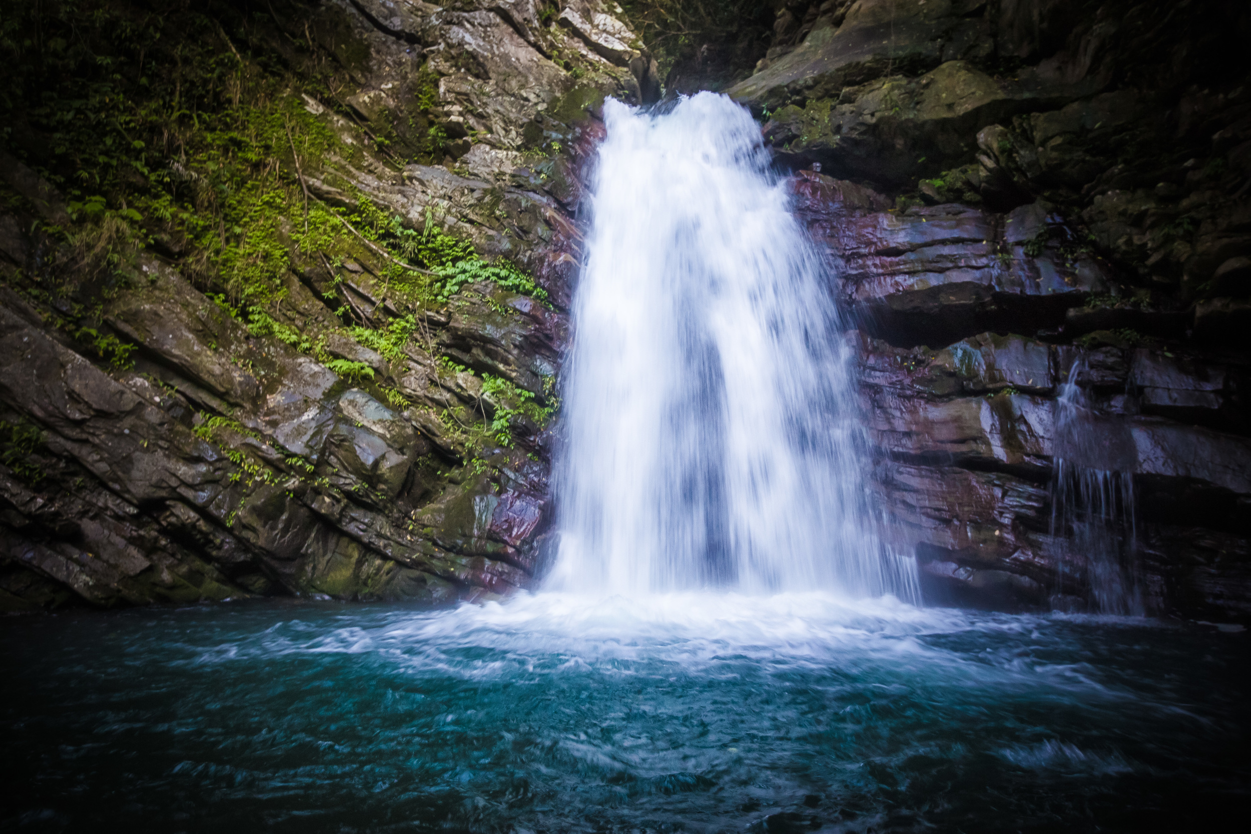
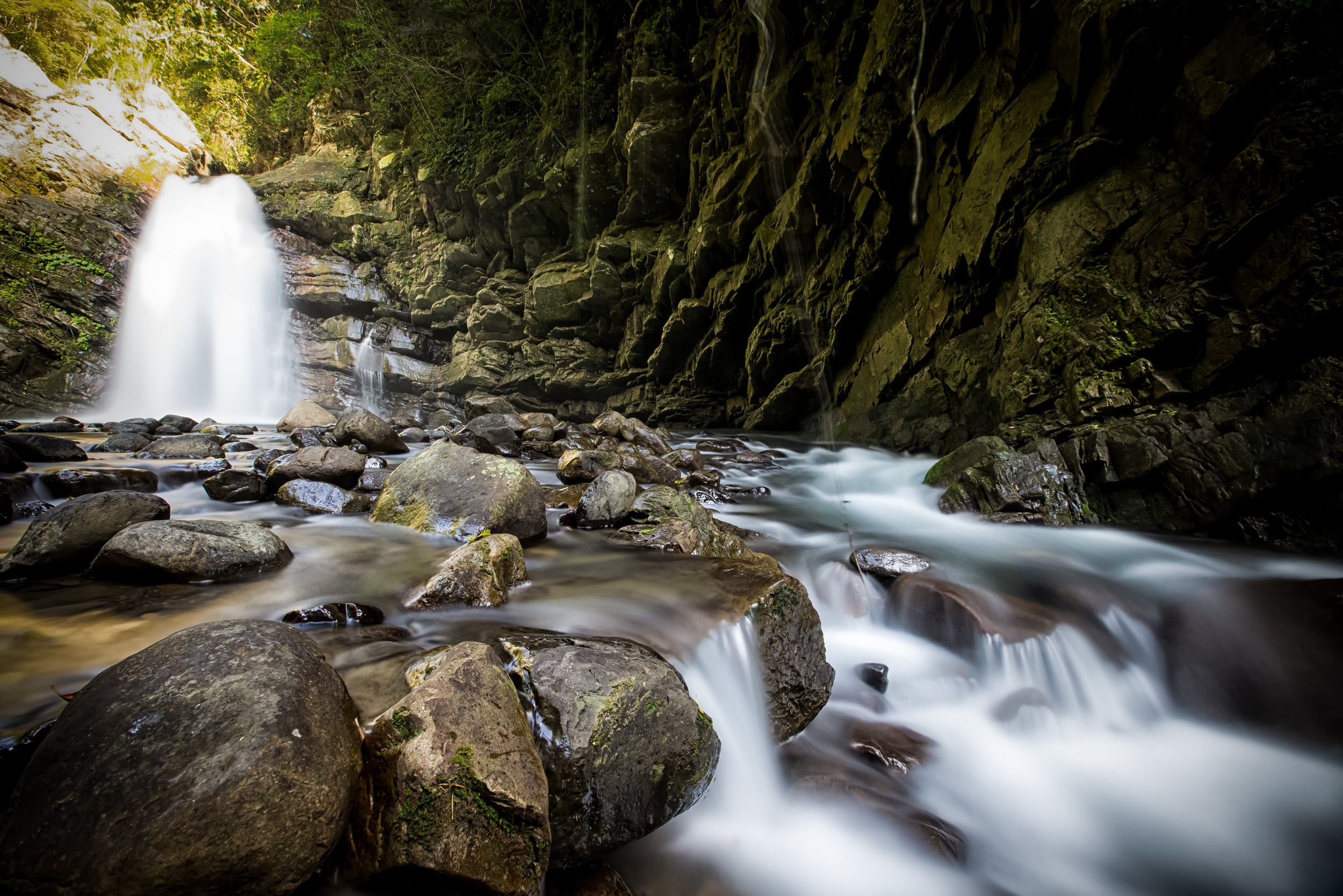
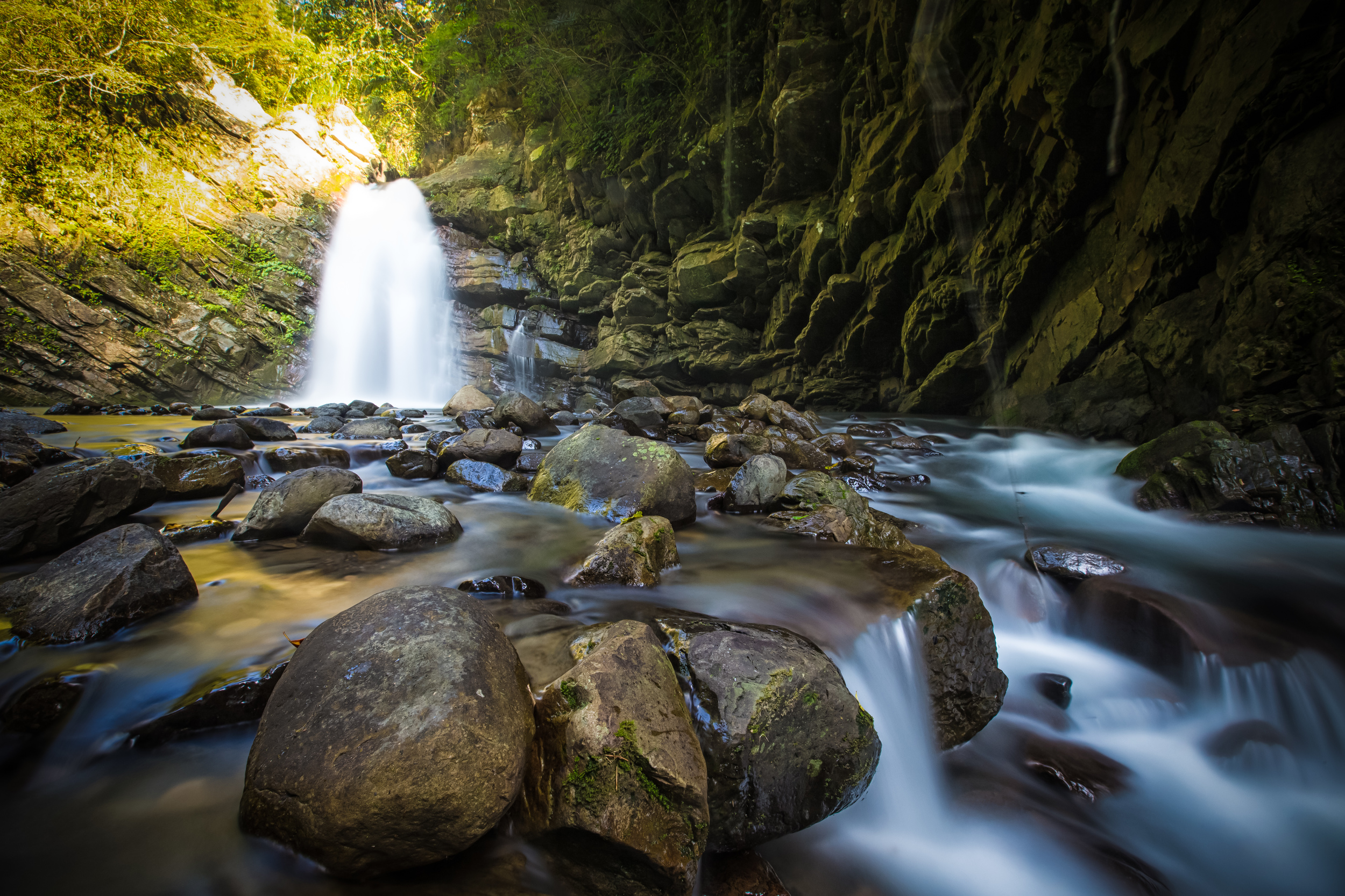
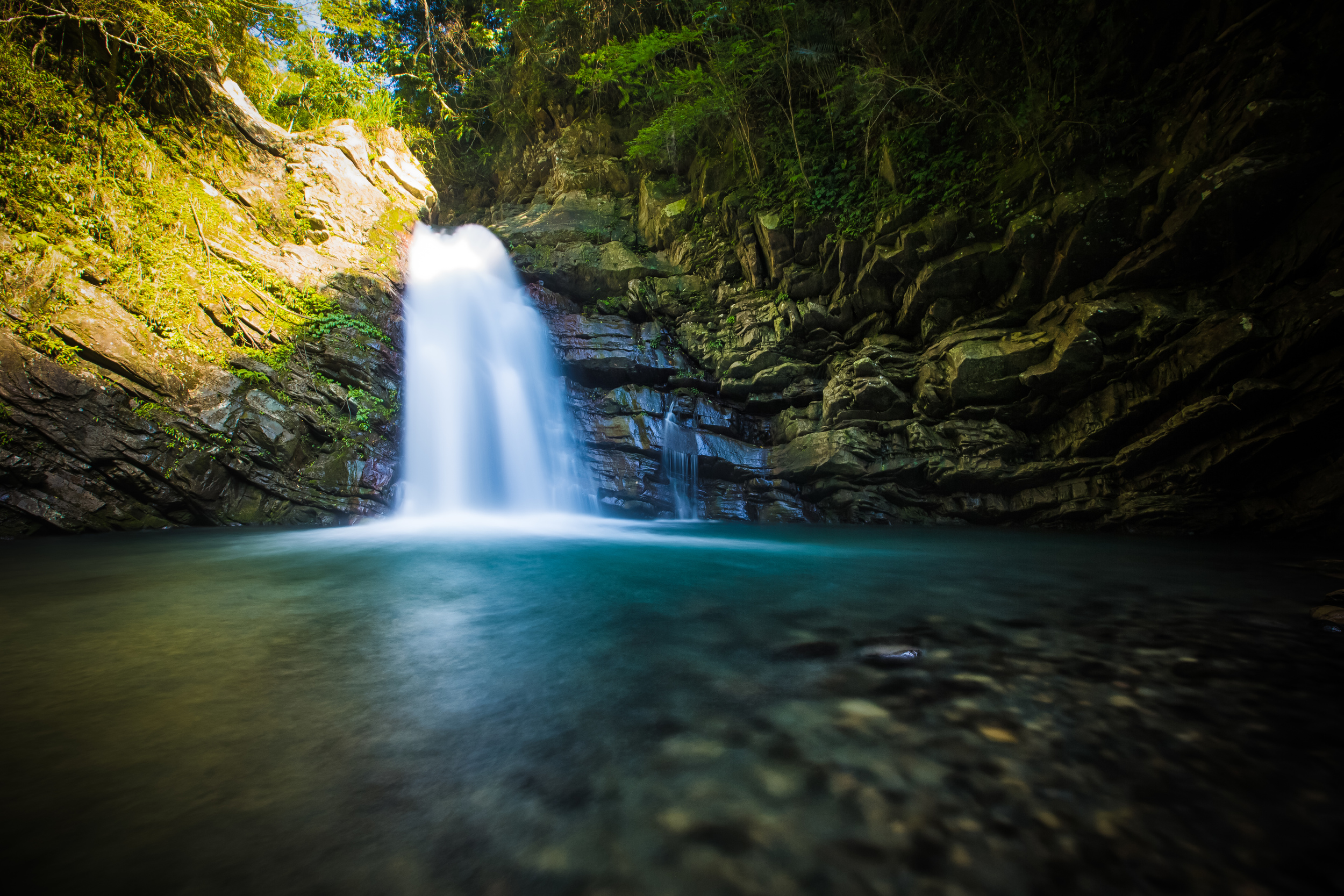
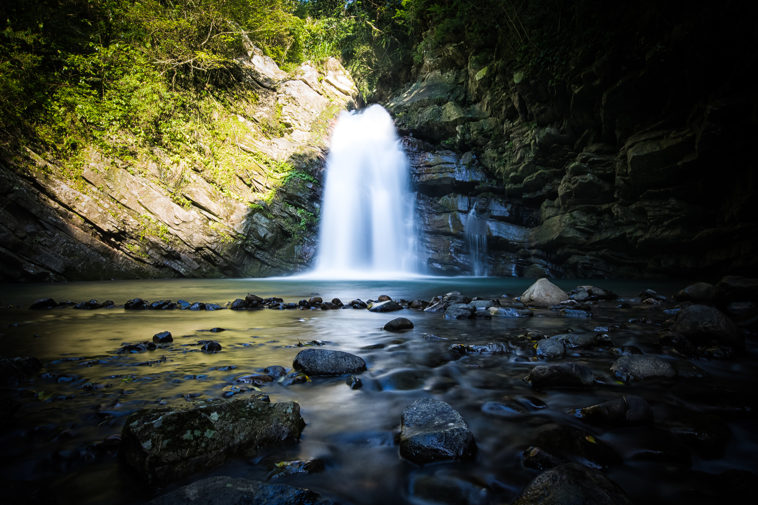
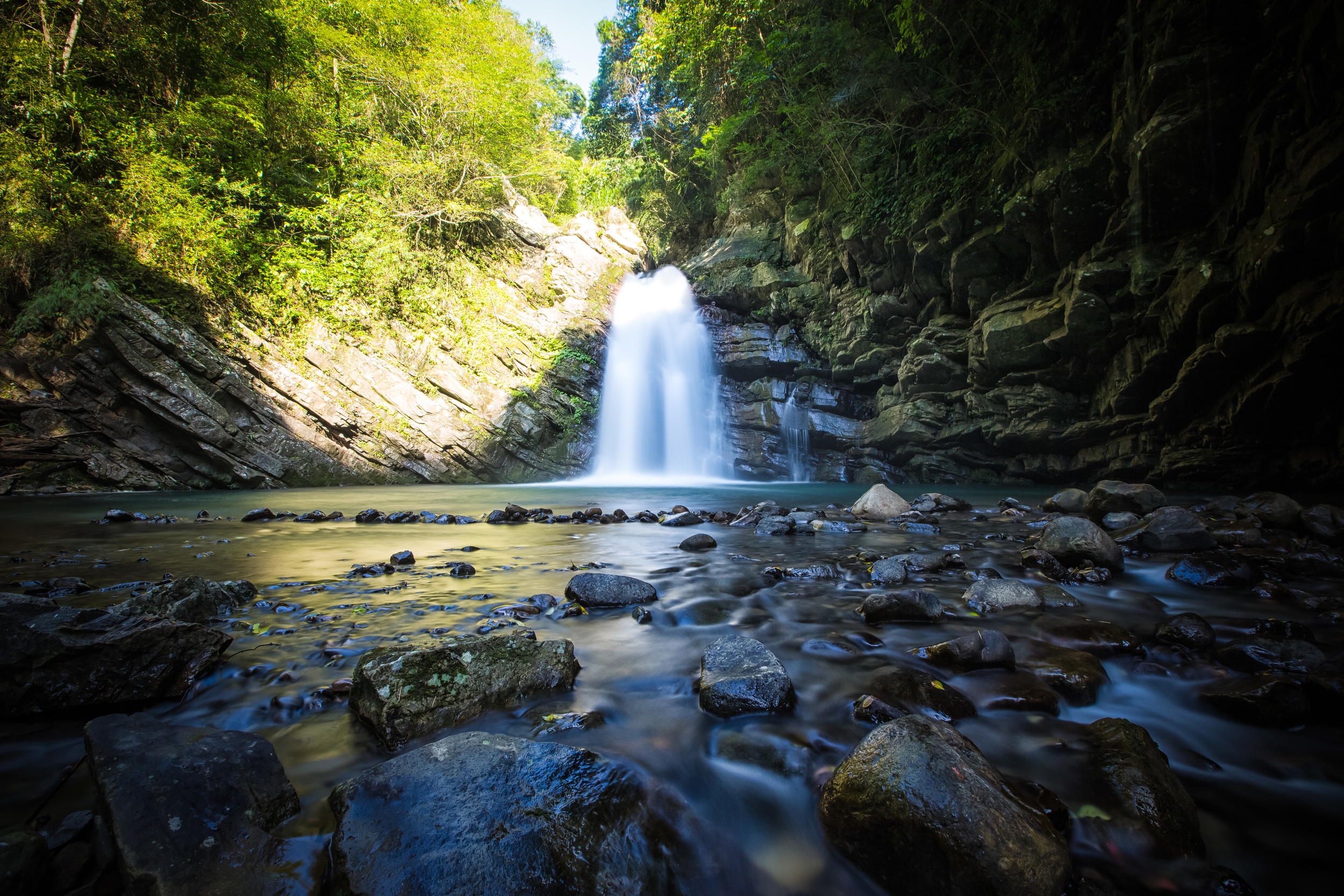
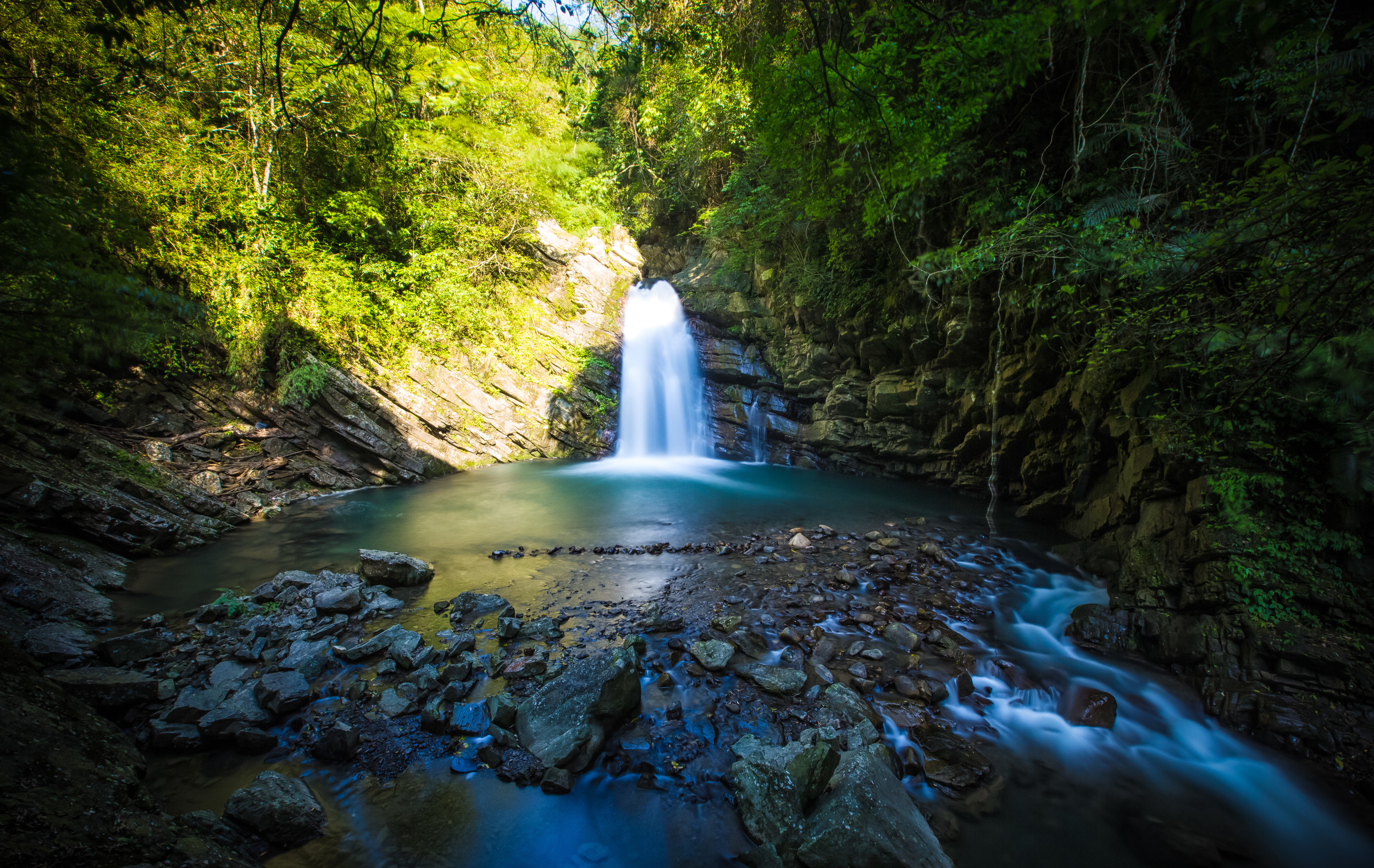
Waterfall #2 is about a one hundred meter hike from the trailhead to the first set and sits on a much more developed trail than the other. No ropes are necessary and it is a short two minute walk from the road to the falls. When you arrive at the falls you come up to a viewing platform where you can see the falls from a distance.

There are warning signs that swimming is not permitted and I'm not going to recommend you go for a swim, but I'm pretty sure I would have if I wasn't carrying a bunch of photo equipment with me. To get to the base of the falls you need to be really careful and jump over the rail at the viewing platform to walk down a small hill. I have to say that if you choose to check out the falls at base level or go for a swim that high you have to be really careful and make sure you're wearing proper footwear. It's not likely that your cellphone will have service in the area so if an accident happens you're not in the best situation.

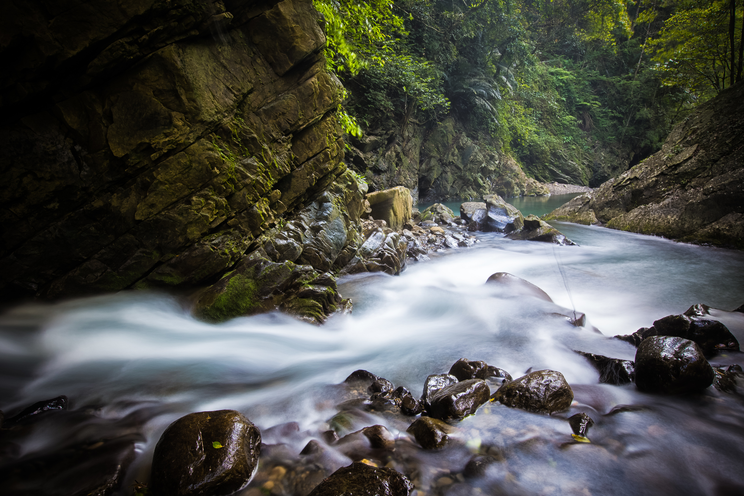
Apart from the two major waterfalls within the park, there are actually several waterfalls within the valley and while heading back to the trailhead I noticed serval more large sets of falls in the distance on the other side of the mountain. I'd really love to find out if there are any river tracing groups that are familiar with the area because there is so much more to see than these two sets of falls. 

I find that these waterfalls (and the forest park as a whole) are under-appreciated and not many people visit them, so I hope that if you're in the area you should definitely check them out. The valley is beautiful and there is some pretty awesome scenery to be found within the park. 

If you like camping there are great campgrounds in the indigenous village near the falls and if you know anything about Taiwan's indigenous peoples you're sure to have a great time if you hang out with them for a weekend!

The drive to the waterfalls through Jianshi is absolutely beautiful and it's only about a 20 minute drive past Neiwan. There is lots to do in the area so if you're looking for a great day trip you might want to start with these falls then check out some locations in Jianshi and then end the day in Neiwan for some dinner on the old street.

For GPS location and similar info check out these links:

Taiwan Waterfalls - Yuan Yang Valley

Follow Xiaofei - Yuan Yang Valley Waterfalls 


Tiemu Waterfall (鐵木瀑布)

Tie-Mu Waterfall (鐵木瀑布) which translates literally as "Iron Wood Waterfall" is a beautiful waterfall in Taoyuan's mountainous Fuxing Village (復興鄉) in an area between the popular Dongyanshan Forest Park (東眼山森林遊樂區) and Xiao Wulai Waterfall (小烏來瀑布) and makes for an excellent side trip if you're in the area or even an excellent place to escape the hot summer heat for a swim in a chilly mountain river. 

The waterfall is a part of Xiayun River (霞雲溪), an important river that finds its source high in the mountains in an area between Dongyanshan (東眼山) in Taoyuan county and Manyueyuan (滿月圓) in New Taipei City. The river flows down into Taoyuan and eventually merges with the much larger Dahan River (大漢溪) a few kilometres away from the waterfall and ultimately flows into Taoyuan's Shimen Reservoir (石門水庫). 

There is an area downstream from the waterfall which seems quite popular for camping, swimming and barbecuing during the summer months but strangely the waterfall seems like it is relatively unknown and for some reason isn't really appreciated by travellers (and locals) which I find a bit odd considering the size of the falls and the close proximity to the road and a village. 

The waterfall is situated within the beautiful Xiayun Village (霞雲村) an Atayal (泰雅族) village just off of the Northern-Cross highway (北橫公路) - The small Indigenous village s surrounded by mountains and the river runs directly through it making it quite a pretty place to visit. While driving through the village searching for the waterfall there was a community activity being held at the elementary school which was promoting Atayal culture to the children who lived there. 

Getting to the waterfall can be a bit precarious as there are no markings that tell you how to get to the falls so if you plan on going remember that while Google Maps is often your friend, it isn't really to be trusted in this case as it will have driving around in circles.

To make things easy, before you arrive at Xiayun Elementary School (下雲國小) take a right turn on Kuzhi Road (庫志道路) and go down the hill, cross the bridge and go up the hill for about 100 meters before arriving at a small wooden platform on the right side of the road.

The platform has a spot to view the waterfall from above but it is mostly covered by trees, so in order to get a better look just take the stairs down the hill which will bring you to the top of a cliff where you will have a much better vantage point to see the waterfall.

From the cliff you can make your way down to water-level using ropes to scale down the rock face (It is actually quite easy so don't worry too much!) or you can turn right and walk down a trail that follows a path above the river but leads you away from the waterfall.

There are warning signs about deep water and swimming that are meant to dissuade people from swimming, but the pool in front of the waterfall is a pretty good one for a swim, especially during the hot summer months. On the day I visited the falls the water was only about shoulder deep but there was a current that would put you back to the shallow part of the pool. 

If you plan on going for a swim, remember to be careful and exercise caution. Fuxing village is quite remote and the closest hospital is probably more than an hour away. You don't want to find yourself getting seriously hurt while swimming. Also, when accidents happen in places like this there is usually a knee-jerk reaction from the government to shut down access.

This was the first waterfall I've had a swim in so far this year and I had a great time cooling off - The water was cold but refreshing on a 35 degree afternoon! I'm a little annoyed with myself that I have lived in Taoyuan for so long and never knew about this beautiful place until this year but I'm sure I'll go back many times in the future! 

If you plan on visiting, have fun and make sure to be careful while enjoying the natural beauty of the area!

Link: Follow Xiaofei - Tiemu Waterfall


Sunset at Gaomei

I have wanted to visit the Gaomei Wetlands (高美濕地) for quite some time and it just so happened that on my way back from my recent trip to Nantou that I had a chance to stop in and check it out just before sunset. 

The problem was that I was completely unprepared and without a tripod and filters for my lenses, there was no way that I was going to get the photos that I’ve always wanted to get there. The wetlands are really beautiful and are really interesting for landscape photographers which is one of the reasons why I've always wanted to visit. 

Not having the proper gear didn’t really deter me though - I think its better sometimes to familiarize myself with a place and visit more than once so I know how to get what I want and what gear I need to bring with me to achieve those goals. 

To that effect I only planned to take a few shots of the beautiful sunset and share it with people. I’ll visit the wetlands again and go into better detail about them then, but I will give a brief introduction to the wetlands right now for people who don't know what they are. 

Gaomei Wetlands

The Gaomei Wetlands are an over 300 hectare protected plot of land along the western coast of Taiwan in the Qingshui (清水) area of Taichung. They are a small part of the much larger Dadu Estuary Wildlife Habitat (大肚溪口野生動物保護區.) The wetlands have a special mix of mud and sand that make it possible for diverse biological habitats of fish, crabs, birds and invertebrates (animals not poiticians).  

The biological diversity and beautiful landscape are what makes the Gaomei wetlands popular with tourists and photographers alike. Tourists can walk down the boardwalk and soak their feet in the water or play on the sand while photographers spend a lot of their time shooting the landscape or using long telephoto lenses to shoot the birds which inhabit the area and feed on the crabs and other culinary delicacies that the wetlands have to offer. 

Children playing

Children playing. 

Part of Gaomei’s landscape includes the massive wind turbines that provide renewable energy to the people of Taiwan. During my most recent visit I noticed that a few of the turbines weren’t working, only to find out later that six of the eighteen turbines were destroyed by Typhoon Souledor and had not yet been repaired. 

Some people consider these turbines to be annoying and an eyesore ruining the beauty of natural landscapes like this, but I happen to like them and I'm never really bothered when they're around. It is easy to get shots of the wetlands however without the turbines crowding up your shot. 

If you plan on visiting Gaomei, be sure to remember to wear sandals (so you can get in the water) and wear a windbreaker as it can be incredibly windy near the coast. If you're a photographer like me, remember a tripod and some natural density filters to get yourself some good shots! 

I'll visit the wetlands again sometime this summer and when I do go, I'll go prepared meaning that the shots will be a lot better than what I'm sharing today! I hope you like what you see anyway.  


Gallery