Over the years I’ve published quite a few articles about the mountains and hiking trails that encircle Taipei City - Starting with popular hikes like Elephant Mountain (象山) and the rest of the so-called Four Beasts (四獸山), I’ve also covered trails such as Fuzhou Mountain (福州山), Qixing Mountain (七星山), Jiantan Mountain (劍潭山), Jinmian Mountain (金面山) and Guanyin Mountain (觀音山). I’ve even published a guide that provides a comprehensive list of the best mountains and vistas in the city where you can take awesome photos of the city in my Taipei Cityscapes Guide.
With so many articles dedicated to the mountains that surround the capital of this great nation, some readers have asked why I’ve yet to publish anything about the popular ‘Battleship Rock’ (軍艦岩) hike in the city’s Beitou District (北投區) - Well, I’m here today to finally answer that question.
However, you may find yourself a little disappointed.
The ‘Battleship Rock’ I’m going to introduce today isn’t the popular hike in Taipei, but another tourist destination that shares the same name deep in the mountains of Hsinchu. Suffice to say, you won’t be getting instructions on how to hike the popular Taipei mountain this time round, but hey, you get to learn about and (possibly) enjoy photos of an entirely different ‘Battleship’ that rarely gets much attention.
The Battleship Rock I’m introducing this time is a lesser known, yet beautiful tourist stop high up the mountains of Hsinchu County’s Jianshih Village (尖石鄉). Instead of a beautiful cityscape, this location features a couple of beautiful suspension bridges, the confluence of two large rivers, wild hot springs, maple trees and a much larger ‘battleship' than the one in Taipei. However, while all of that might sound great, the biggest difference between this ‘Battleship’ and the one in Taipei is accessibility.
The hike in Taipei is one that is easily reachable via the city’s excellent public transportation network while this one is likely out of reach for most tourists. Nevertheless, even though Hsinchu’s Battleship Rock is more difficult to reach, if you are lucky enough to visit, likely on your way to Qalang Smangus (司馬庫斯部落), Cinsbu (鎮西堡) or the Syaroko Historic Trail (霞喀羅古道), you’re in for a treat.
As a travel-related article, I won’t be overloading you with information this time - I’m just going to spend some time introducing some of the cool things that you’ll see if you ever have a chance to visit the area. And hopefully the photos I share today might entice you to want to take some time to visit the area for a weekend, especially if Smangus is your final destination!
For those of you who landed here hoping to read about Taipei’s Battleship Rock, I hope I didn’t mislead you. I’ll eventually publish something about that hike - It’s on my list of places to write about, I just haven’t gotten to it yet, and these days I prefer to write about destinations that are off of the typical tourist’s radar.
Btunux Tukang (秀巒軍艦岩)
To introduce Hsinchu’s Battleship Rock, most writers would probably start with some scientific information about the geologic process that took place to form this beautiful rock. However, I feel like it’s a better idea to start out with an explanation of its name and the people who have lived in its midst for hundreds (if not thousands) of years.
Translated literally from Chinese as ‘Battleship Rock’ (軍艦岩 / jūn jiàn yán), it is known as ‘Btunux Tukang’ in the Tayal Indigenous language (泰雅語). Located a short distance from the rock, you’ll find the ‘Hbun-Tunan’ (控溪部落) tribe of Taiwan’s Tayal Indigenous People (泰雅族), whose ancestors settled along the river around four hundred years ago.
In the Chinese language, the tribe’s name is literally translated into English as the ‘River Control Tribe’ (控溪部落), a name which was given to them by the Japanese, and is something that might lead one to believe that they somehow nefariously controlled access to the mountains and river. However, in the Tayal language, ‘Hbun-Tunan’ instead refers to the geographic location where the two rivers intersected, and the traditional marketplace of goods that the tribe became known for.
Making their home in the river valley close to where Battleship Rock is located was geographically significant as the tribe played an important role within greater Tayal society for quite some time as the tribe was strategically located along the historic hunting trails used by the Indigenous people to traverse the mountains.
Acting as somewhat of a middle-man between the various tribes on either side of the river, the Hbun-Tunan, who are more commonly known these days as the Xiuluan Tribe (秀巒部落), created a marketplace that allowed the various tribes in the mountains to transport fruit, vegetables, meat and other commodities for trade.
That being said, the river valley was not only a strategic place to live, it was also filled with abundance as the river and the mountains provided the tribe with more than enough sustenance to get by on, and today that marketplace continues to thrive as Xiuluan Village (秀巒村) is the largest producer of peaches and pears in Taiwan.
Living in the midst of the giant rock, at some point, the Hbun-Tunan started referring to it as ‘Btunux Tukang’, which is likely pretty difficult for most native English speakers to even try pronouncing. Nevertheless, as the story goes, it was likely a name that was influenced by missionaries living in the area, because to the indigenous people, it was simply just a big rock. Thus, in Tayal, ‘Btunux’ is the equivalent of ‘rock’ (石頭) and ‘Tukang’ would have been a relatively new word to them that translated as ‘warship’ (軍艦).
Sadly, I spent quite a while trying to figure out the meaning of the name, consulting several Tayal scholars, who also thought it was funny.
Situated at the confluence where the Baishi / Sakyaking River (白石溪 / 薩克亞金溪) and Taigang / Takejin River (泰崗溪 / 塔克金溪) meet to form the Yufeng / Maliguang River (玉峰溪 / 馬里光溪), Battleship rock is said to resemble the bow of a giant warship. However, when it comes to (almost all of) Taiwan’s popular rock formation tourist destinations, my imagination tends not to be as wild as others. In this case though, I suppose you could argue that the sharp triangular shape of the rock cutting into the river actually does create the effect of a boat speeding its way through the water.
Admittedly, I’m not as knowledgeable about Taiwan’s river systems as others, but I was surprised to learn that two rivers that can see joining together here, eventually join with the greater Dahan / Takoham River (大漢溪 / 大嵙崁溪), which flows into Taoyuan, and is part of the river system controlled by the Shimen Reservoir (石門水庫).
Writing previously about the Youling Waterfalls (幽靈瀑布), Xiao Wulai Waterfall / Rahu-Ulay (小烏來瀑布) and other points of interest along the river, I was actually unaware that they were all part of the same tributary.
Note: For each of the location names above, I’ve included the name more commonly used on maps today as well as their original Tayal names for a bit of clarity.
Looking at Battleship Rock from a distance, you’re likely to notice the various layers in the rock, telling the story of its long history. Dating back to the collision of tectonic plates that allowed the land mass we known as Taiwan to emerge from the Pacific Ocean, the stripes in the rock are primarily comprised of silt, shale and white sandstone, each of which consists of a different shade.
Unfortunately, there is very little written about the area, and very few resources about provide any concrete estimation of how tall the rock is, but I’d estimate its anywhere between twenty to thirty meters tall.
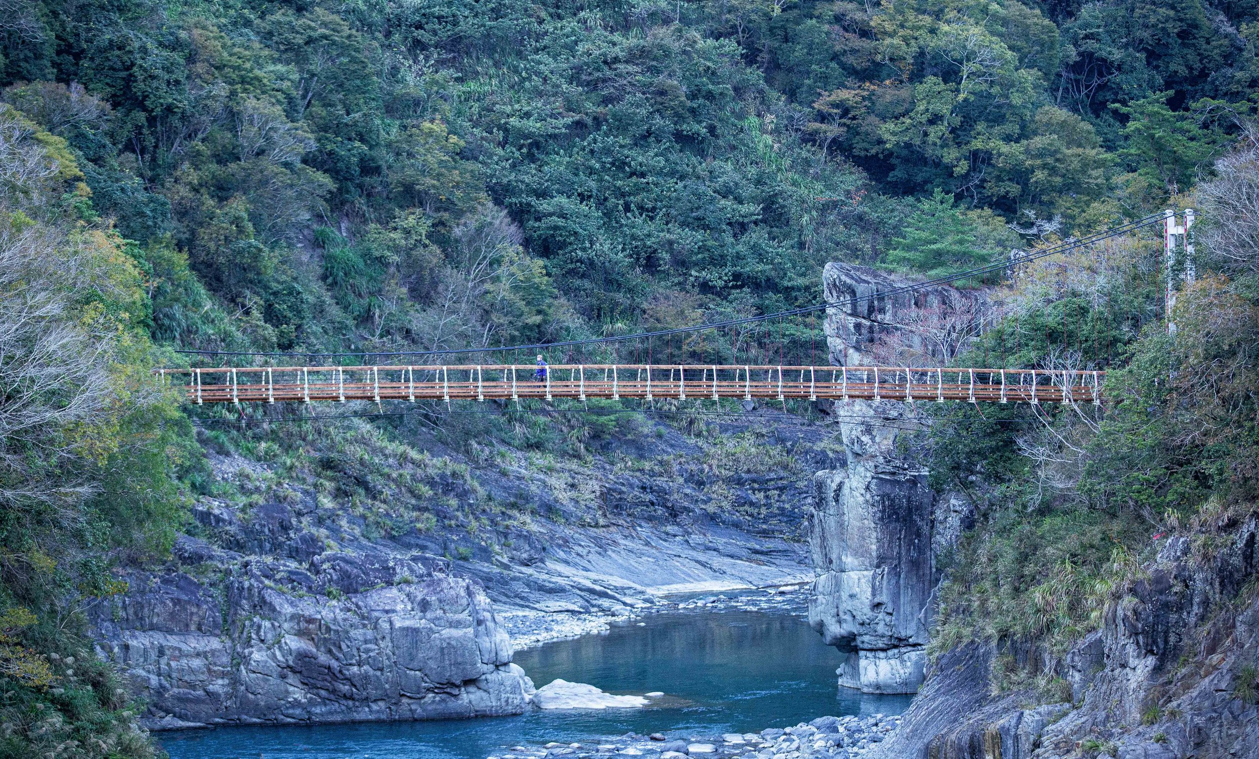
Fortunately, for anyone visiting today, the local government constructed a sixty meter long Battleship Rock Suspension Bridge (軍艦岩吊橋) in 2015 (民國104年), just over where the two rivers meet up.


The suspension bridge not only allows visitors to get a view of the rock from vantage points above the river, but also provides with the opportunity to cross to the other side to make your way down to the river bank where there are even closer views.
Likewise, just above the Baishi River, you’ll find the Kongxi Suspension Bridge (控溪吊橋), which was originally constructed during the Japanese-era, and then later rebuilt in 1985 (民國74年). In this case, the bridge allow visitors to enjoy the maple trees that grow on this side of the mountain during the late fall and winter months in addition to allowing visitors to make their way to the Taigang Wild Hotsprings (泰崗野溪溫泉) where you can dip your feet in the water.
That being said, it’s important to remind readers that (as I mentioned earlier) the Hbun-Tunan tribe sat at the crossroads of the so-called ‘ancient’ network of Tayal trails that allowed the various tribes to connect with each other - so when the Japanese arrived in Taiwan in 1895, these routes were thought to pose a risk to their control. The early years of the colonial era saw a heavy handed approach to suppressing any opposition to Japanese rule, and given the tribe’s strategic geographic location, the military converted the ancient trails into police patrol roads which were equipped with artillery batteries and police stations in remote mountain areas.
While attempting to control the movements of the Indigenous people, a number of violent massacres took place leaving a legacy of violence that pushed the indigenous people further into the mountains and completely changed their traditional way of life.
Today, if you cross the Kongxi Suspension Bridge and continue hiking several kilometers up the mountain, you can find the ruins of some of those historic outposts, which were spread throughout the mountains, especially along the Syakoro Historic Trail (霞喀羅古道), where some of them have recently been restored.
Note: During the same visit to the area, I hiked part of the Syakaro Historic Trail, but it was more of a volunteer experience that didn’t allow me to hike the entire trail, so I missed out on the parts of the hike that I was most interested in. Eventually I’ll hike the entire length of the trail and write a blog about it, but until then I recommend you check out Anusha Lee’s article about the trail
Syakaro Historic Trail: A Hike with History, Suspension Bridges and Fall Foliage (Taiwan Hikes)
Somewhat ironically, despite the area being referred to as Battleship Rock, the maple trees growing on the mountain on the other side of the Kongxi Suspension Bridge have become the star attraction in recent years. During the months when the trees are changing colors, you’ll find the parking lot full of shuttle vans bringing tourists up and down the mountains.
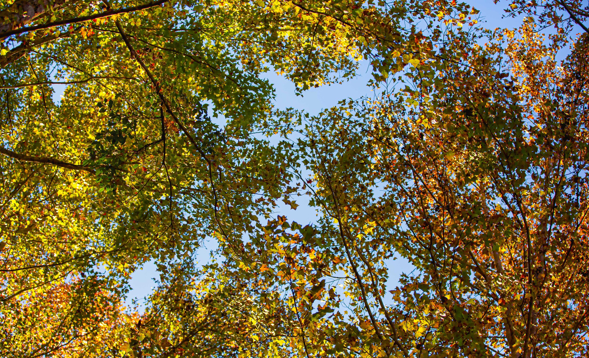
While the Battleship Rock area isn’t the best spot for maple viewing in Jianshih Village, it’s probably the easiest for most people to get to, making it a popular spot for weekend day-trippers. Coming from Canada, it’s difficult to impress me when it comes to maple trees, but after years of not seeing the leaves change colors back at home in the autumn, it was nice to see Taiwan’s mountains changing colors, especially in this area with the combination of the rivers and the mountains.


With that in mind, the best time to visit the area is in the autumn between October and January, but you’ll want to remember that the maples change colors at different times than they do in North America, so you should consider going a bit later in the year to see them, or simply check the recent photos from the area on Instagram to see if its a good time to visit or not.
Visiting the Battleship Rock area probably won’t require a whole lot of time, but if you plan on hiking the trail to see some of the ruins, or soaking your feet in the wild hot spring, you might want to schedule a bit more time to enjoy yourself. Either way, the parking lot next to the bridge is 100NT per visit for a car, and 30NT for scooters. Everything else is free, unless of course you decide to buy some delicious indigenous snacks from the vendors across the street.
Getting There
Address: Xiuluan Village, Jianshih Village, Hsinchu (新竹縣尖石鄉秀巒村)
GPS: 24.633680, 121.279510
As mentioned earlier, the biggest difference between Taipei’s Battleship Rock and Hsinchu’s Battleship Rock is accessibility. The hike in Taipei is pretty easy to get to, but this one is considerably more difficult.
Part of the problem, at least for most international tourists, is that there is no method of public transportation that will take you anywhere near the area. So, if you’re interested in visiting, your only option is to go by car or scooter, or arrange for a shuttle bus to get you there.
That being said, if you’re driving a car or a scooter, I recommend inputting the address or coordinates provided above into a GPS system to map out your route. Depending on where you’re coming from, you’ll want to get off of Highway #3 at the Zhulin Interchange (竹林交流道) and make your way towards Neiwan (內灣) on the #120 County Highway. Passing Neiwan, you’ll continue on towards Jianshih on the #60 rural road pretty much until you arrive.


As one of the stops along the road towards Smangus or the Syaroko Historic Trail, if you’ve planned a trip to either location, Battleship Rock is one of the must-stops along the road. Not only will you get a break from sitting in the shuttle bus, but you’ll also enjoy the opportunity to get a sneak peek of some of the amazing natural beauty that you’re going to experience on your trip. On the other hand, if you’re just enjoying a day-trip through the area, it makes an excellent place to stop, hike a bit and then turn back on your way home. Whatever your itinerary, a visit to Hsinchu’s Battleship Rock is a rewarding experience
References
秀巒軍艦岩步道 (健行筆記)
漫步新竹尖石「秀巒軍艦岩」、「軍艦岩吊橋」壯闊美景 (Jamie慢森活)
秀巒 Hbun-Tunan (霞喀羅國家步道)
控溪部落 Hbun-tunan (Taiwan Indigenous People’s Portal)
Gallery / Flickr (High Res Shots)