New Taipei City

The Taoyuan Valley (桃源谷步道)

In a recent case, the Shilin District Court in Taipei ordered the Yangmingshan National Park Administration to pay NT$3.96 million (US $134,000) in compensation to a family whose mother had died as a result of injuries caused by being pushed over by a wild water buffalo.

The family’s lawyer argued that the park administration hadn’t provided adequate safety measures for tourists and that the thirty-or-so water buffalo that graze in the area were a danger to society.  

The ironic thing is that the water buffalo have been grazing on the grassy pasture since the Japanese Colonial Era (1895-1945), and are one of the main reasons why Qingtiangang (擎天崗) has become such a popular tourist destination in the first place.

Link: Court awards compensation to family of woman killed by water buffalo (Focus Taiwan) 

While I do have sympathy for the family, it was only a matter of time until one of the thousands of people who invade the personal space of the buffalos on a weekly basis were seriously injured. The mostly docile buffalo have had to put up with people approaching them (and their young) for photos for quite some time now. 

This, in addition to a general lack of understanding about the behaviour of wild animals is something that makes for a dangerous situation.

So, in order to ensure the public’s safety, large fences were erected to separate the ferocious buffalo and the visitors which ultimately limits the freedom that the animals have enjoyed for the past century, but also their grazing space.

Likewise, the fences that have been erected are somewhat of an eyesore on the extremely picturesque mountainous plateau.

This reminds me of the infamous Liebeck v. McDonald’s court case in America, where the restaurant was more or less sued for selling hot coffee. 

While this water buffalo case might not have been as frivolous, as adults, we should probably all be mature enough to understand the danger involved in approaching a wild animal for a photo. Unfortunately people these days get caught doing some tremendously moronic and dangerous things for a little bit of attention on social media.  

What happened at Qingtiangang is similar to what has also happened at Linkou’s beautiful Water Buffalo Valley (水牛坑), which became one of the hottest Instagram photo spots in Northern Taiwan a few years back. 

The local media describes the area as Taiwan’s “Grand Canyon”, but similar to Qingtiangang, that wasn’t particularly the main attraction - The valley also happened to be the grazing space for a much larger group of water buffalo than you’ll find at Yangmingshan

Today though, thanks to the irresponsible masses of Instagram, the land owner has had to erect signs in the valley that read “Restricted Area - No Entry Unless Authorized” and has to have security hanging out to ensure that none of the people who visit are approaching the buffalo.

Likewise, the large group of buffalo that once grazed there can only do so under the watchful eye of their owners - who obviously don’t feel like paying out a massive settlement to some Insta-fool who invades the space of one of the buffalo.

Now that both Qingtiangang and Water Buffalo Valley have been somewhat damaged as tourist destinations, the collective attention of Taiwan’s Instagram community seems to have descended upon a new location to ruin, New Taipei’s Taoyuan Valley (桃源谷).

I’ve had the Taoyuan Valley hike on my list of places to write about for quite some time, but now that it has become an Instagram hotspot, I decided that it would have to jump to the top of my list. 

This isn’t because I wanted to follow the trendy masses, but simply because I didn’t want to miss out on an opportunity to hike the beautiful trail and enjoy the space before it suffers a similar fate and ultimately gets fenced up. 

If you ask me, the main attraction to the valley should be the awesome hike and the amazing views you get when you arrive at the top - But yes, the trail is home to another large group of free-roaming water buffalo who (currently) have a massive patch of land to graze on. 

The Taoyuan Valley Trail (桃源谷步道) 

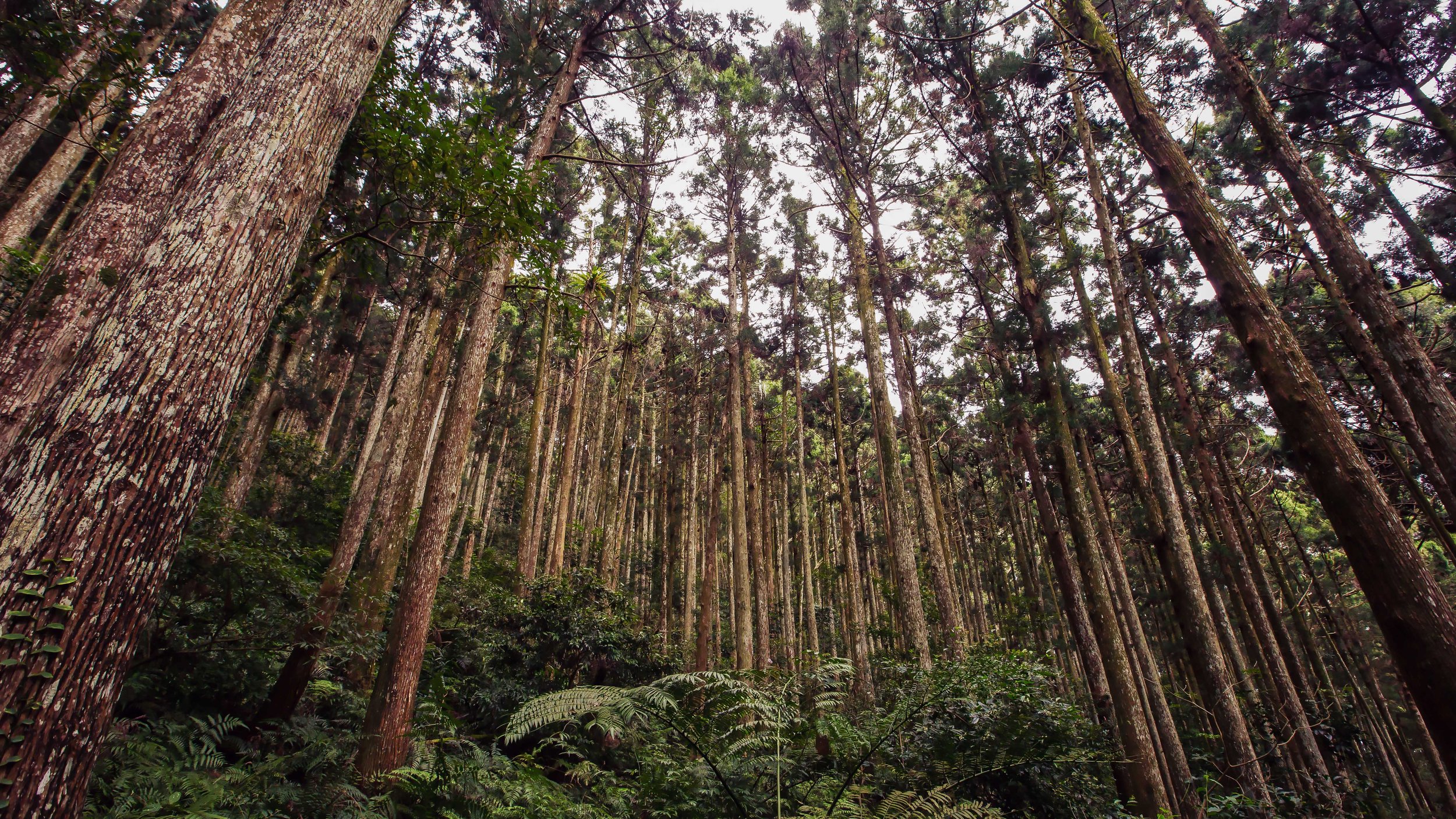
The famed Taoyuan Valley grassland stretches for more three kilometres along a beautiful sloped ridge between Wankentou Mountain (灣坑頭山) and Neiliao Mountain (內寮山) on the northern edge of the Snow Mountain Range (雪山山脈). 

From the top of the ridged grassy slope, visitors are treated to beautiful 360 degree views of Taiwan’s North-East Coast, including a birds-eye-view of Turtle Island (龜山島), as well as the mountains of New Taipei’s Pingxi District (平溪區) to the rear. 

The beauty of the valley lies in its combination of the sea, land and sky, giving hikers jaw-dropping views overlooking the Pacific Ocean while also enjoying the rare site of such a large patch of grassland, free roaming water buffalo and the mountainous terrain that makes Taiwan such a geographically diverse country. 

At an average elevation of around 500 meters (above sea level), the long stretch of grassland allows makes for an ideal location to sit along the ridge for a picnic or to just enjoy the view.

Originally named “Da’niu pu” (大牛埔) and “Kun’niuzai Mountain” (綑牛仔山), a nod to the historic usage of the grassland by farmers, hikers need to be careful where they’re walking while on the ridge as the water buffalo are prone to randomly unloading their droppings for hikers to step in.

Today the name “Taoyuan Valley” is a nod to “The Peach Blossom Spring” (桃花園記), a fable written by Tao Yuanming (陶淵明) in 421, which describes a chance discovery of a utopia where humans led an ideal existence in harmony with nature.  

Link: The Peach Blossom Spring (Wiki) 

What you should make sure to remember is that even though it is named “Taoyuan” in English, it’s not the “Taoyuan” (桃園) that you’re thinking of just south of Taipei.

Considering what I mentioned above, one would hope that the current name of the grasslands could inspire people to act a little more harmoniously with nature, and not harass its full-time residents. 

Hiking the Taoyuan Valley

Hiking Guide to the Taoyuan Valley www.goteamjosh.com/blog/taoyuangu

One of the saving graces for the Taoyuan Valley is that if you don’t have a car, you have to hike up the long trail to get to the valley. So, unlike the other destinations I mentioned above, (which are pretty easy to get to) this one actually requires a bit of effort. 

That being said, if you have a car, the ‘hike’ only takes about twenty minutes.

Fortunately, the road that takes you almost all the way to the top is quite narrow and offers very little in terms of parking spots. On weekends, it tends to be a dangerous route to take as (lazy) hikers end up stuck in their cars on a dead-end road that isn’t very easy to escape from.

When the only other alternative is to actually hike the trail, most of Taiwan’s Instagram celebrities don’t really even bother trying to make an attempt. So even though the trails can be busy at times, you should be able to take photos of the vast valley without large crowds of people.  

If you took a look at the map provided above, you may be thinking this hike seems like a long one, but it should relieve you to know that it is actually only a small portion of the much larger network of trails on the historic Caoling Trail (草嶺古道).

Links: Caoling Old Trail (草嶺古道) - Foreigners in Taiwan | Caoling Historic Trail - Taiwan Trails and Tales

Given that it is part of a network of trails, we’re blessed with a number of options when it comes to getting us to the valley:  

  • Taoyuan Valley Trail (Stone Guanyin) - 桃源谷步道(石觀音線)

  • Taoyuan Valley Trail (Neiliao) - 桃源谷步道(內寮線)

  • Wujuwushu Trail - 吾居吾墅步道

  • Wanshentou Trail - 灣坑頭山步道

  • Caoling Historic Trail - 草嶺古道

  • Tamlan Historic Trail (Ao-Di to Dali trail) - 淡蘭古道北路(澳底-大里段)

For this blog post however, I’ll only be focusing on the most commonly used trails:

  1. One that takes you up the mountain from one train station and ends at another.

  2. One that allows you to walk straight up the mountain to the ridge.

  3. One that allows you to cheat a bit and drive your car most of the way to the top.

The one I’ll focus on most though is the first one, which is generally speaking considered to be the “complete” Taoyuan Valley experience - giving hikers the best of what this hike has to offer.

The Taoyuan Valley Circuit Hike

Let me start by offering a few important details about the hike: 

  • Hiking Time: 5-7 hours

  • Total Distance: About 15-18 km

  • Elevation: 10m - 530m

  • Difficulty: Depends on the trail you take. It could be quite easy, or a rather difficult one.

  • Trails: Well-developed paths with periodic signs, rest stops and washrooms.

  • Best time to hike: Spring and Fall

This hike basically starts at one train station and ends at another, so if it wasn’t obvious enough already, what this means is that the best way to do this one is to simply leave your car or scooter at home and make use of Taiwan’s amazing public rail system!

From which station you start is more or less up to you, but I’d caution that the incline from the Daxi side going up is quite a bit more difficult.

Generally speaking, most hikers elect to start from Dali Train Station (大里火車站) and later finishing by hopping back on the train at Daxi Train Station (大溪火車站). 

  • Dali Train Station to Trailhead (大里火車站 - 登山口)

When you get off the train at Dali Station, the trailhead is a short walk north. 

From the entrance of the station you’ll find signs pointing you in the direction of the Dali Visitors Centre (大里遊客中心), the Dali Tiangong Temple (大里天公廟) and the Caoling Historic Trail (草嶺古道), which you’ll follow until you reach the temple. 

Getting to the temple should only take a few minutes from the train station and once you’ve arrived, you’ll simply walk up to the front and then follow the signs to the trailhead, which is near the rear of the building. 

Don’t be surprised that the trailhead says “Caoling Historic Trail” and not “Taoyuan Valley Trail” as the Taoyuan Valley is just a part of the overall network of trails. 

GPS: N24 58.220 E121 55.540

The incline of this hike is one that starts out relatively easy with a tree-covered trail, but eventually opens up once you’ve reached the entrance to the Taoyuan Valley trail requiring you to walk along an open ridge with lots of stairs that bring you the long way around.

Once you’ve completed the hike and you’re back down on ground level on the Daxi side, you’ll find signs pointing you in the direction of Daxi Train Station, which is about a kilometer south of the trailhead. 

  • Daxi Train Station to Trailhead (大溪火車站 - 登山口)

If you choose to start your hike from Daxi Train Station, the trailhead is about a fifteen minute walk north of the station taking you through the historic fishing village. 

From the train station, you’ll walk out of the entrance, turn left and start walking along the coastal highway until you reach Guishan Road (龜山路), where you’ll turn left and walk up a narrow road to the trailhead. 

GPS: N24 56.530 E121 53.770

If you’re worried that you won’t be able to find the trailhead, never fear, there are signs along the road that point you in the direction of the trail and once you get to the narrow road where you start walking up the hill, there are signs on both sides of the road pointing you in that direction. You can’t really miss it. 

One thing that you’ll want to keep in mind about the Daxi Trail is that it can be quite slippery. If it is raining, the five kilometer hike could be somewhat of a treacherous one. You’ll find signs reminding you about this, which you should take seriously as the stone steps can be quite dangerous.

Stone Guanyin Trail (石觀音線)

The “Stone Guanyin Trail” is another one of the trailheads that you can reach from Daxi Train Station.

The key feature of this trail is that it is a hike that allows you to go straight up the mountain and back down again (on the same trail) while saving a considerable amount of time and traveling a much shorter distance.

You’ll also be treated to a beautiful Buddhist Temple and an open-faced cave that has a shrine inside.

That being said, it shouldn’t surprise you that that the longer trail mentioned above has a much more gradual incline, while this one is a relentless set of stairs that you’ll hike straight up the mountain until you reach your destination.

To reach this trailhead, you’ll exit the Dali Train Station, turn right and walk about two kilometres until you reach the trailhead. Once you’ve reached the trailhead area, you’ll have to cross under a railroad bridge and then follow the road to the trailhead.

The signage here isn’t as prevalent as the main trail, so you’ll want to be careful not to get lost along the highway.

To help, there’s a bus stop next to the the road where you’ll cross under the train bridge named Fanshuliao Bridge. The bus that services this station, “Toucheng Ocean Line” doesn’t come all that often, so you’d have to be pretty good with your timing to actually make use of the bus. Still, it’s an option.

Neiliao Trail (內寮線)

The Neiliao Trail for the Taoyuan Valley is more or less the cheaters method of getting to the valley as it is merely a twenty minute walk from your car on a tree-covered path to the main attraction.

If you’re not really into hiking, have access to a car and want to get your Instagram photos, this trail is probably the one that you’ll want to use as it requires extremely little effort.

It also has a fully equipped restroom at the base of the trail and once you’ve reached the valley.

This is probably important for all those instagram celebs who don’t like to break a sweat and a need a safe place to change their clothes for their photoshoots!

Like I mentioned above though, if you’re visiting on the weekend, you’ll have to deal with quite a bit of traffic on the narrow mountain road where there is very little in terms of parking, so you might actually spend several hours in the car waiting for a parking spot.

I’ve marked (on the map above) the mountain road in Gongliao that you’ll have to turn on to get to the trailhead, but there’s also adequate signage in the area that should help you out if you’re driving and don’t have a GPS.

What to Expect

Now that you know how to get to and from the train stations to the trailheads, it’s probably a good time to prepare you for what to expect when you hike the Taoyuan Valley Trail.

So what should you expect?

To put it simply, stairs. Lots and lots of stairs. 

If you’ve hiked Taipei’s Elephant Mountain or any of the Four Beasts, you should more or less know what to expect. The Taoyuan Valley trail is a hike through the woods on a well-developed (mostly) cement path.  

Even though the trail is very well-developed and includes periodic rest stops (and even restrooms), the hike tends to be a long one. Still, despite the length of the hike, it is considered to be an easy one and none of this should prevent you from trying to hike it. 

You can also take solace in the fact that once you reach the valley, you’ll have a long walk along a beautiful (and most importantly) flat mountain peak that you’ll follow until you start your descent back to ground level. 

You’ll need to make sure to bring some snacks and more than enough water.

I brought a 2000cc bottle, but that ended up not being enough on a 35 degree day.

You should also have a good pair of hiking shoes and a raincoat in case the weather takes a turn for the worse. 

Apart from that, you won’t need much else for this one except for some money for your train tickets and maybe a little more for a feast of fresh seafood when you finish. 

At this point, I should mention that if the weather forecast isn’t looking good on the day that you’re planning on doing this hike, you’ll probably want to save it for another day. 

You’ll see why if you read this post about the hike from the always amazing, Tom Rook. 

Link: Taoyuan Valley Hiking (Over The City) 

How long this hike takes to complete is completely up to you. 

It obviously depends on your hiking pace, how much time you stop to rest and how much time you use to take photos of the beautiful landscape. 

I arrived at the Daxi Train Station at 10am and finished around 5pm.

I did take use up quite a bit of time taking photos as well as chatting with other hikers at the various rest stops.

It goes without saying that unless you plan on only hiking the Neiliao Trail, you shouldn’t be starting this one in the afternoon. You’ll need an early start, but the actual hiking portion of this trip goes by surprisingly quickly, despite the length of the trail. 

The Taoyuan Valley has always been a popular destination for Taiwan’s avid hikers, but in recent months it has also become popular with the Instagram crowd. This means that the crowd you’ll find at the valley on the weekend are a mixed bunch of senior citizens in rubber boots and wannabe models.

Thankfully most of the models don’t really stick around very long and for the most part don’t crowd up the trails as they prefer to endure the traffic jam on the road to the top. 

Still, as I mentioned above, the Taoyuan Valley is currently one of the few remaining places where Taiwan’s Water Buffalo are continued to graze freely amongst the crowds of tourists. 

All it takes though is one accident and that could all change.

Let’s hope that that doesn’t happen anytime soon.

If you visit, enjoy the buffalo, but please don’t invade their personal space.

New Taipei City Martyrs Shrine (新北市忠烈祠)

A few months ago, when I wrote my annual ‘Year in Review’ post for 2019, I mentioned that I was still unsure as to what my personal project for the new year would be - At the time there was a lot going on in the world and I felt a bit odd because I’m usually on the ball with these things.

I also always have a long list of places that I plan to visit, take photos of and write about. 

Looking back at that post now, I think I was probably a little naive.

Who knew that 2020 was going to turn out to be such a dumpster fire?

As I’m posting this, we’re eight months into the year and almost every country in the world has been turned upside down thanks to the Coronavirus.

As a side note, I’ve kept busy over the past couple months writing about all the wonderful places I visited in Vietnam and Thailand during my trip in January (just before things got out of hand), but I’ve also been putting a lot of consideration into what I’d focus on once it became safe to freely travel again.

I think I’ve finally figured that out. 

After receiving numerous emails and requests, I visited the National Revolutionary Martyrs Shrine in Taipei to get some photos and then wrote a blog about it.

If you’ve read the post, you’re probably aware that I’m not particularly a fan of these places (for various reasons), but while doing research for the post, I was reminded that the majority of the “Martyrs Shrines” that exist in Taiwan today sit on the site of a former Shinto Shrine from the Japanese Colonial Era

Considering that I’ve already written about the Taoyuan Shinto Shrine, Yilan Shinto Shrine, and the Tungxiao Shinto Shrine, all of which have been converted into Martyrs Shrines, I figured that I’d make one of my personal projects for the year link together with the other (ongoing) work I’ve been doing related to historic buildings from the Japanese Colonial Era.

It’s important to note that only in special cases do the Martyrs Shrines of today have much left with regard to the original design and layout of their Shinto Shrine days.

In most cases almost everything was torn down and new buildings were constructed in their place.

Fortunately though, we can still find evidence of the history of these locations through the layout of the grounds, the trees planted on the site and with the presence of objects like the the stone lion guardians, lanterns, etc.

By my count, there are currently fifteen Martyrs Shrines in Taiwan that were once Shinto Shrines and I’ve only covered four of them, which means I have another eleven to visit!

Over the next few months, I plan to travel around the country to check them out while also visiting some of the other spots on my long list of places to visit.

To start, I’m going to introduce the site of the former Tamsui Shinto Shrine (淡水神社), which has since been converted into the New Taipei Martyrs Shrine (新北市忠烈祠).

I’ll briefly talk about the history of the Shinto Shrine (with some historic photos) and then introduce the Martyrs’ Shrine that exists on the site today. 

The Martyrs’ Shrine isn’t exactly what most would consider a major tourist attraction (by itself), but it conveniently sits on a picturesque mountainside overlooking the Tamsui River (淡水河) and is fortunate to be neighbors with a handful of other historic tourist destinations that are within walking distance.

The shrine is known for its natural beauty and while it may not be busy with tourists, it has become a preferred setting for local photographers, who use the beautiful Japanese-era stonework and the pine trees as a backdrop for wedding photos. 

Tamsui Shinto Shrine (淡水神社)

Constructed on the Tamsui Shinto Shrine (たんすいじんじゃ) started in 1936 (昭和10年) and was officially opened three years later in 1939 (昭和14年).

Often considered one of the prettiest of all the Shinto Shrines in the greater Taipei area, the shrine overlooked the beautiful Tamsui River with Guanyin Mountain (觀音山) in the distance.

Highly regarded for the way it harmoniously blended with the natural environment, the shrine earned the title as one of the ‘eight scenic spots’ in Tamsui (淡水八景) in part thanks to the sando (參道), or the “walking path” which was lined with pine trees (something that thankfully still exists today). 

Not only was the walking path lined with trees on either side, but also a collection of stone lanterns (石燈籠) that lit the way at night. The walking path also had a Torii gate (鳥居) at both ends with two larger stone lanterns (大石燈籠) at the top of the hill.

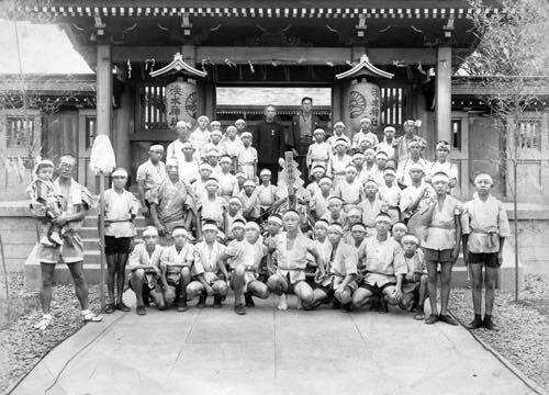
The torii, which you can see from the historic photos below were both quite large and beautiful.

Once you reached the top of the hill you’d find a Purification Fountain (手水舍), where you’d be required to perform a cleansing ritual before entering the shrine.

On the opposite side of the fountain was the Shamusho (社務所), which acted as the Administration Office and living quarters for the priests who lived at the shrine.

As you continued along the path up the hill, you’d be met with a stone wall and a set of stairs guarded by two ‘Komainu’ stone lions (狛犬) with another Torii gate at the top.

Interestingly, although the lions and gate have since been replaced, the layout remains the same today. 

Once you passed through the Torii gate at the top of the stairs you’d find yourself in a courtyard full of trees with another gate known as the Middle Gate (神門) acting as the entrance to the shrine.

The Middle Gate was constructed of wood and was known for its traditional Kirizuma-zukuri gabled roof (切妻造) design that surrounded the innermost part of the shrine.

Once you passed through the Middle Gate you’d find the “Haiden” or “Worship Hall” (拜殿) in the middle of another courtyard.

Even though there are few pictures of the shrine available, what we do have shows us that the architectural design of the building was similar to that of what we can see today at the Taoyuan Shinto Shrine (桃園神社) with its impressive ‘Irimoya’-style hip-and-gable roof (入母屋造).

Unlike Chinese-style places of worship, you wouldn’t have found statues of the gods inside the worship hall, instead you would find a simple shrine with a mirror and behind that a door that led to the Honden (本殿) or “Main Hall”, which is traditionally off-limits to anyone except for the priest who resided at the shrine. 

The deities that were enshrined in the Honden were Prince Yoshihisa (能久親王), Emperor Meiji (明治天皇), Ōmononushi (大物主命) and Emperor Sutoku (崇德天皇).

In fact, most of the over two hundred Shinto Shrines constructed during the colonial era were home to shrines dedicated to Prince Kitashirakawa Yoshihisa, who was the first member of the Japanese royal family to pass away (outside of Japan) in more than nine hundred years. He died from what is believed to be malaria in Tainan in 1895, the same year that Japan took control of Taiwan. 

Link: Prince Kitashirakawa Yoshihisa (Wiki) 

I suppose you could say, the unfortunate thing about this beautiful shrine was that it was officially opened only a few short years before the Japanese Colonial Era came to an end.

When the Second World War ended in 1945, Japan was forced to give up its control of Taiwan, which was then ambiguously awarded to the Republic of China.

In 1953, the shrine officially became the Taipei County Martyrs Shrine (台北縣忠烈祠). which retained the original buildings until 1975 when it was bulldozed and converted into a Chinese-style shrine.

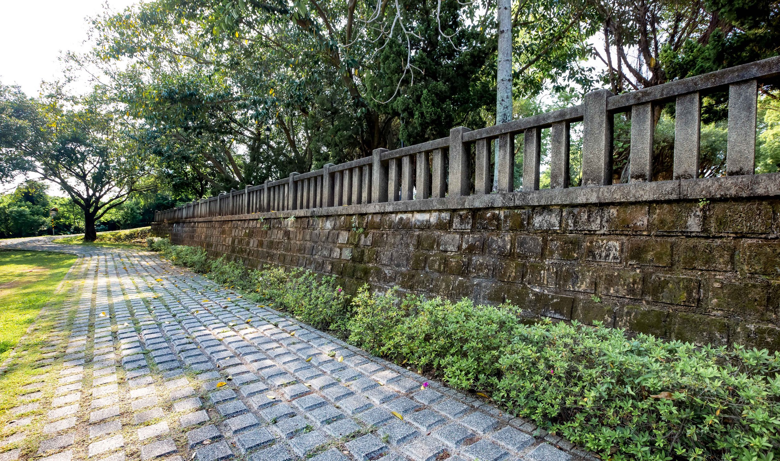
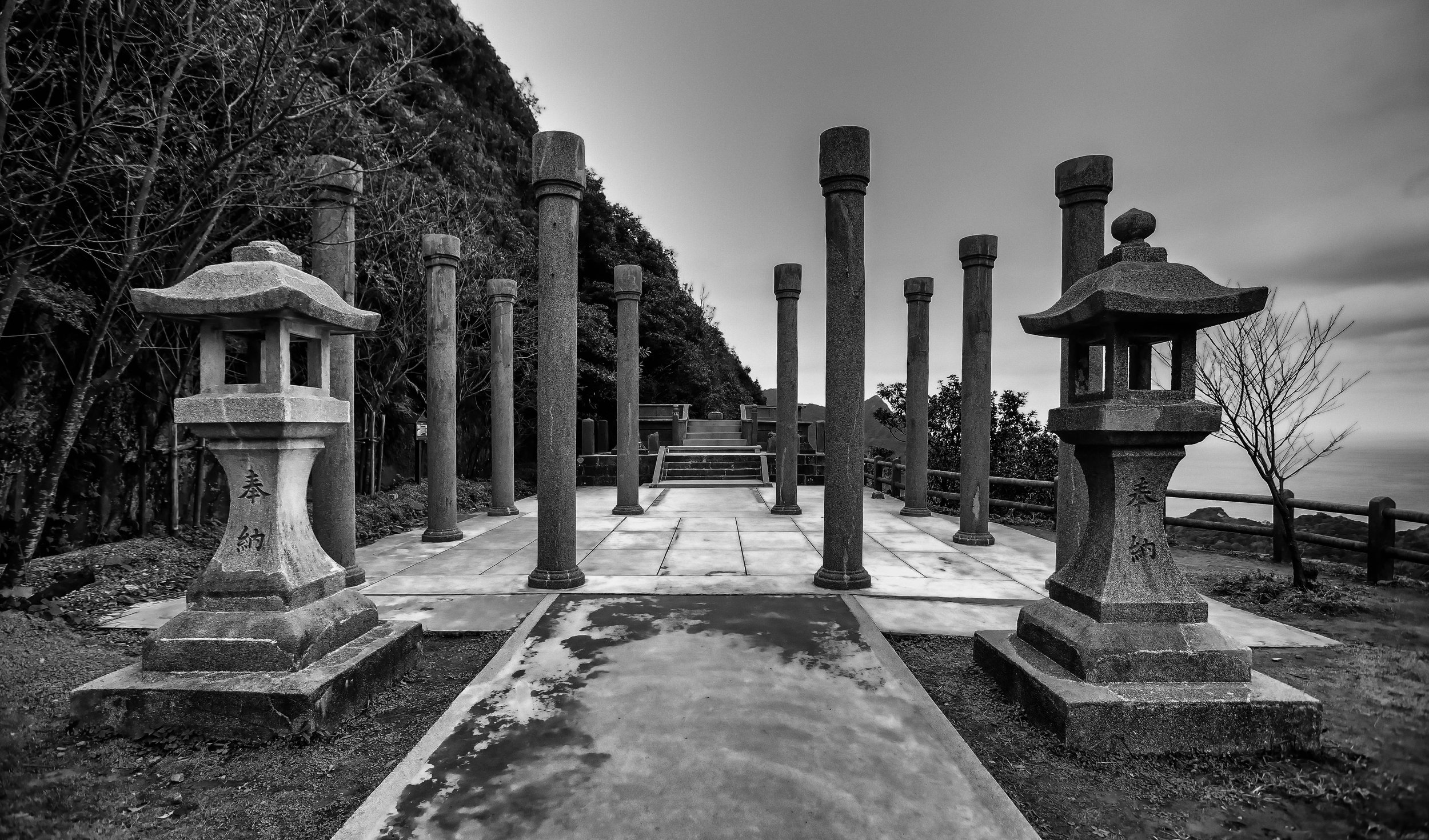
Today all that remains of the original shrine (in this location) are the beautiful pine trees that once lined both sides of the walking path, the stone wall, guardian lions (although they were replaced at some point) and the overall schematic design of the landscape. 

Hsing-Chong Temple (淡水行忠堂)

The good news is that not everything from the former Shinto Shrine has been destroyed. 

When the last remnants of the Tamsui Shinto Shrine were torn down in 1975, several of its pieces were transferred to nearby Hsing-Chong Temple (行忠堂) in the mountains of Tamsui.

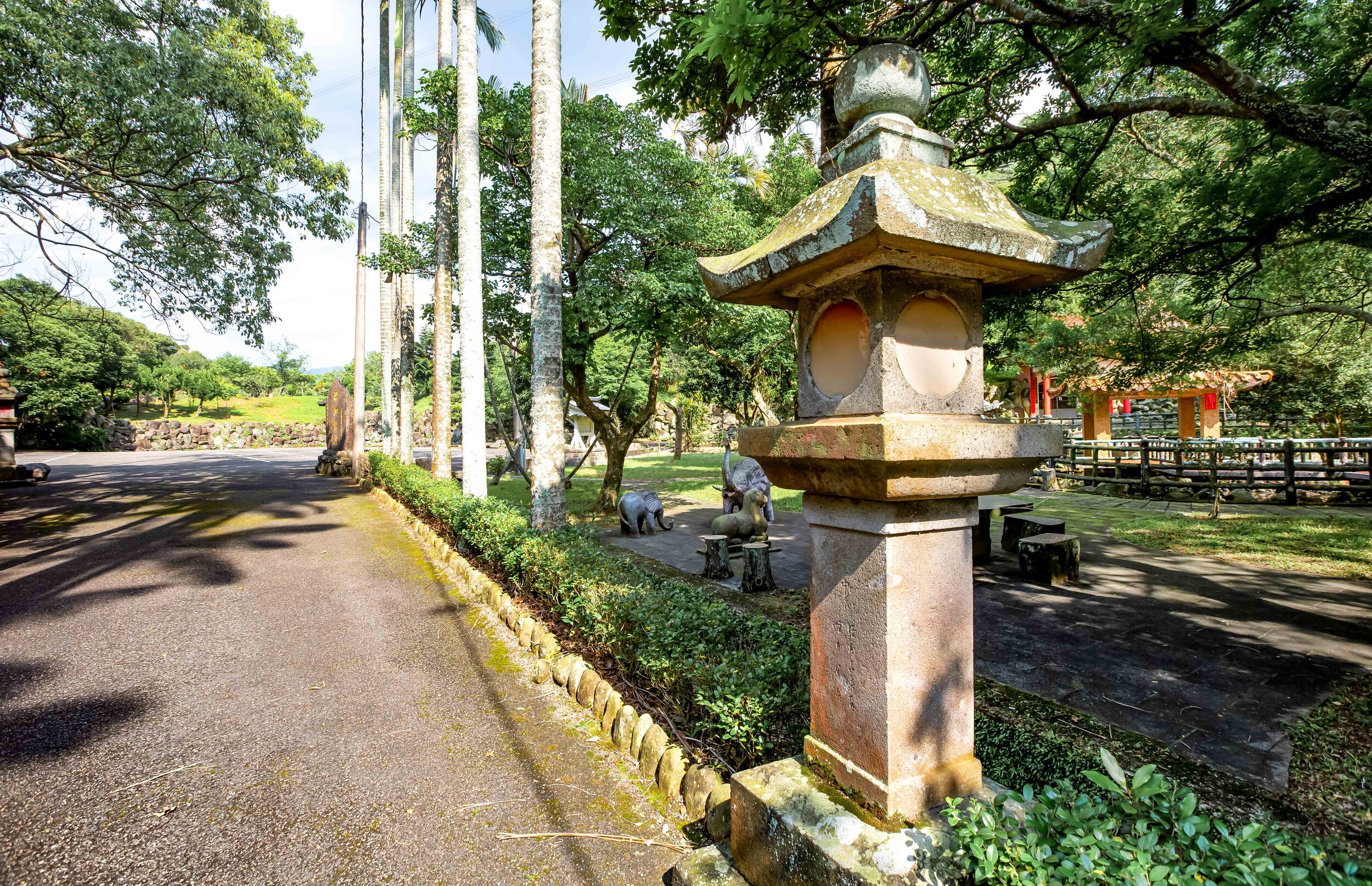
The people at the temple were able to preserve sixteen of the original stone lanterns from the walking path, the two larger stone lanterns, the purification fountain and the original information board (揭示場) which you’ll often find at the entrance of shrines.

The amazing thing is that during the 1970s, the government was pushing an extreme anti-Japan policy that sought to demolish anything from the colonial era that was deemed unnecessary.

The fact that this small temple was able to preserve as much of the original Shinto shrine as they were was no small feat. The other amazing thing is that in order to preserve all of these pieces of the shrine, they had to find a way to transport them to their temple in the mountains. 

You might be thinking that’s not really that big of a deal, but the thing you need to realize is that getting around back then wasn’t as easy as it is today.

This problem was exacerbated by the fact that the lanterns would have weighed thousands of kilograms.

With a seven kilometer distance between the Shinto Shrine and Hsing-Chong Temple, a mixture of ox-pulled carts, rudimentary cranes and trolleys were used in addition to the the help of dozens of people to bring the pieces of the shrine to their new home where they can still be enjoyed today.

Why would this temple in the mountains of Tamsui, which is dedicated to Guan Gong (關聖帝君), want to preserve these pieces of the Shinto Shrine you ask? Well, thats not really very clear.

Your guess might be as good as mine.

When I enquired with the caretakers of the temple as to why they’d preserve these pieces of the Shinto Shrine, they replied: “I’m not really sure, but probably because they were pretty and free.”

Taiwanese temples can sometimes be a bit eccentric and if you visit this specific temple, you’ll see that it’s a bit odd compared to others in terms of its design and decoration. 

Address: #18 Chung-shan village Danshui District, New Taipei City

(新北市淡水區忠山里18號)

New Taipei Martyrs Shrine (新北市忠烈祠)

You’ve read this far and might still be asking yourself: “What exactly is a Martyrs Shrine?” 

That’s okay - I’ve visited quite a few of these shrines and I still find myself asking this question. 

To put it in simple terms, Martyrs Shrines in Taiwan are more or less war memorials for the fallen members of the Republic of China Armed Forces.

There are over twenty of these shrines throughout Taiwan (and the outlying islands), each of which with an interesting history - which doesn’t necessarily relate to anything to do with the Martyrs Shrine itself. 

Its also important to note that these shrines actually have very little to do with “Taiwan” as the majority of the ‘martyrs’ worshipped in the shrines were soldiers who died during the various conflicts in China from the founding of the Republic of China in 1912 until the 1950s.

That being said, even though the Republic of China has been at peace for several decades, if a member of the Armed Forces passes away in the line of duty, they are also afforded the respect of becoming a martyr.

If you’d like more detail about these shrines, I recommend taking a few minutes to check out my post about the National Revolutionary Martyrs Shrine, which explains the purpose of these shrines.

As I mentioned above, of the twenty or so Martyrs Shrines in Taiwan, the vast majority of them are located on the former site of (or are repurposed) Shinto Shrines that dates back to the Japanese Colonial Era.

Ironically, in a few cases, some of those Shinto Shrines were Japanese-style Martyrs Shrines dedicated to Taiwanese people who passed away in the line of duty.

Which if you think about it certainly has a lot more to do with “Taiwan” than the Martyrs Shrines of today do. 

The New Taipei City Martyrs Shrine, as I’ve likewise already mentioned, sits on the site of the former Tamsui Shinto Shrine (1939 - 1953), which was abandoned shortly after the Japanese relinquished control of Taiwan.

In 1953, the shrine was incorporated into the network of Shinto Shrines that were being preserved and converted into war memorials for the Republic of China.  

It goes without saying that when the Chinese Nationalists took control of Taiwan that they wanted to rid the island of the memory of its colonial past. When they arrived, Taiwan was home to over two-hundred Shinto Shrines, but only a few of them were saved from demolition and vandalism by being “preserved” and converted into Martyrs Shrines.

In 1953, when the Taipei County Martyrs Shrine (台北縣忠烈祠) was established, they initially left the buildings as they were, but removed any reference to the original shrine as well as the deities inside.

For the next two decades, not much changed at the shrine which kept its original Japanese-style design.  

In 1975, however it was decided that the original shrine would be demolished and a Chinese palace-style building would be constructed in its place.

It’s important to note that even though the original Shinto shrine was demolished, the grounds maintain much of the original landscape design and the Japanese adherence to harmony with the natural environment.

So today, when you approach the shrine you’ll still find the same set of stairs and the stone wall that date back to the days of the Shinto Shrine. The arched gate at the top of the stairs however has been converted into a white Chinese-style ‘pailou’ gate (牌樓) that has a plaque in the middle that reads “New Taipei City Martyrs Shrine” (新北市忠烈祠). 

Note: The “Taipei County Martyrs Shrine” was renamed the “New Taipei City Martyrs Shrine” in 2011 when the county was converted into an amalgamated super city. 

Once you’ve passed through the gate there is still the same path that leads you to the Middle Gate (中門). which is constructed using the same Chinese-palace style as the rest of the complex and has a wall that wraps around the rest of the shrine area. 

When you pass through that gate, you’ll see the Main Hall (主殿) directly in front of you, but you’ll also automatically be met with a giant tree on your left that is yet another leftover from the days of the Shinto Shrine. Likewise, with the exception of the pathway, the rest of the area is covered with well-maintained grass, which isn’t all that common in Taiwan. 

During my visit, the grassy courtyard area on the inside of the gates were the resting area for a couple of local egrets which were enjoying the sun at the quiet shrine. I’m guessing that their presence probably means that they feel comfortable in the area due to a lack of visitors to bother them. 

The Main Hall of the Martyrs Shrine is a simple building with a shrine room and two rooms to the side.

The room to the right has some benches and a television which plays an information video about the shrine and its history, while the room to the left is more or less used for storage.

One of the main differences between this Martyrs Shrine and the National Revolutionary Martyrs Shrine in Taipei is that you are able to simply walk into the main hall and check out the shrine.

The room is white and has Republic of China iconography on the walls and the ceiling, in addition to two sets of flags on the left and right side of the main shrine. 

The altar consists of a large collection of spirit tablets (牌位) dedicated to the ‘martyrs’ from the various conflicts that the Republic of China’s Armed Forces have taken part in over the past century. 

Link: Spirit Tablets (Wiki)

The set up of the shrine is simple and clean, without all of the pizazz that you’ll find at typical places of worship in Taiwan. In this way, it makes the place a lot more peaceful, but it is a war memorial, after all.

While there isn’t really all that much to see in the shrine room, I recommend walking around the to the back of the hall where you’ll find a grassy tree-covered rear courtyard.

This is the area that used to be home to the Shinto Shrine’s “Honden” (拜殿) and was once off-limits.

Today it’s probably a perfect place for a picnic.

Getting There


Address: No. 31, Lane 6, Section 1, Zhongzheng Road, Tamsui District, New Taipei City

(新北市淡水區中正路一段6巷31號)

The New Taipei City Martyrs Shrine is close to one of northern Taiwan’s most popular tourist destinations, the Tamsui Old Street (淡水老街).

I’m not exaggerating when I say that tourists who take a day-trip to the area are extremely spoiled for options.

In Tamsui, not only will you be able to enjoy the historic riverside and the ‘Old Street’, you’ll also be able to feast on lots of local snacks and have the opportunity to visit a number of historic and cultural destinations in close proximity to the MRT Station.

That being said, the Martyrs Shrine isn’t really all that close to the MRT Station.  

Sure you can walk from the station to the shrine, but with so much to do in the area, you’re much better off saving time by hopping on a bus, checking out the shrine, and then moving on to check out some of the other amazing places of interest in the area.

With so much to see, you’re also going to have to do a bit of research beforehand to decide where to spend your precious time! 

If you have a car or scooter, getting to the shrine is easy. 

Simply input the address provided above into your GPS or Google Maps or use the map provided here. 

If you’re driving a car or a scooter, you won’t have to worry, there is an ample amount of parking near the shrine, so you should be able to easily find a spot.

If you’re like most tourists though, you’ll probably make use of public transportation. 

To take the bus to the shrine, simply exit Tamsui MRT Station (淡水捷運站), the terminal station of the Taipei MRT’s Red Line (紅線) and walk to the large bus stop across the street. 

To do this, you’ll have to walk to the first walk to the large crosswalk and then backtrack a bit once you’ve crossed the street. The bus stops are directly in front of a gas station and are pretty hard to miss. 

From there you can take the five minute bus ride to the shrine on bus #757, #857, #880 or Red 26 where you’ll get off at the “Huwei Fort (Martyrs' Shrine Court)” (滬尾砲台(忠烈祠球場)) bus stop. 

Once you’ve gotten off the bus you’ll see a sign for the Martyrs Shrine and all you’ll have to do is walk up the historic and beautiful tree-covered hill to the entrance.

In terms of the other things in the area that you can see, you’ll find the Hobe Fort (滬尾礮臺) and the Drop of Water Memorial Hall (一滴水紀念館) next door to the shrine. Nearby you’ll also find the beautiful Fort San Domingo (淡水紅毛城), the Tamsui Customs Wharf (淡水海關碼頭), the Taipei Customs Officers’ Residence (小白宮) and a beautifully restored Japanese home overlooking the river known officially as “Former Residence of Tada Eikichi” (多田榮吉故居). 

In addition to these spots, there are a number of places to check out along Tamsui Old Street including the historic Tamsui Presbyterian Church, Huwei MacKay Hospital, Fuyou Temple (福佑宮), Qingshui Temple (淡水清水祖師廟), Tamsui Longshan Temple (淡水龍山寺), Lovers Bridge (情人橋), etc. There’s also the boat ride across the Tamsui River to Bali Old Street (八里老街).   

Its safe to say that the New Taipei City Martyrs Shrine probably isn’t high on the list of destinations for your average tourist. If you’re visiting the Hobe Fort or any of the spots nearby though, I’d say that a visit to the shrine is well worth an extra few minutes of your time.

That being said, I’ve been living in Taiwan for a long time and the only reason I wanted to visit was because it was the site of a former Shinto Shrine. Its definitely a nice option if you’re looking for a tranquil spot to take some photos of a pretty shrine without a million other people getting in the way! 


Bitou Cape (鼻頭角)

If someone who planned on visiting Taiwan asked me for some travel advice, I’m not sure that my suggestions would be very much different than what most other people would say: “Hike a mountain”, “Visit a temple” and “Have dinner at a nightmarket”. Most of the time though, I actually just want to say “Travel South”, “Travel East”, and most importantly: “Get out of Taipei!”

For some people though, leaving the city was never actually an option or a consideration. 

So what’s the next best thing? If you’re asking me, I think it would be renting a car or scooter and taking a day trip to the North Coast.

Not only is the North Coast one of the prettiest areas of Taiwan, it is also jam-packed full of places for tourists to visit. It is also home to several beaches and fishery harbours where you can stop for a swim and have the most amazing seafood dinners known to man.

The experience of riding a scooter along the beautiful coast with the Pacific Ocean on one side and tall green mountains on the other is one of those things that you’ll always remember when you think back to your time in Taiwan.

You’ll also want to stop every few minutes to take photos! 

With so many things to see and do, its understandable that most tourists have a bit of difficultly deciding where to spend their precious time - There are of course some places that are considered must-stops - The Yehliu Geopark (野柳地質公園), Golden Waterfall (黃金瀑布), Nanya Peculiar Rocks (南雅奇石), Shen’Ao Elephant Trunk Rock (深澳象鼻岩) and the beautiful nature hike at Bitou Cape (鼻頭角), are a few such examples.

The thing is though, unless you have your heart set on a photo with the ‘Queens Head’ (女王頭), I’m going to suggest that you save some time and just skip the overly crowded Yehliu Geopark.

Yes, I realize that sounds like tourist blasphemy, but the North Coast is full of similar-looking landscapes and cool-looking rocks, so you might be better off taking the road less travelled and enjoying some of the less crowded locations.

If you do you should easily be able to hit all of the other must-stop destinations in a single day-trip (if you start early)

While I can’t predict your itinerary, if I were your guide for the day, I’d probably start with a visit to the Elephant Trunk Rock, followed by the Golden Waterfall, Yin and Yang Sea (陰陽海), Nanya Rocks and then Bitou Cape before heading back in the direction of Taipei.

I’d probably end the day with dinner at one of the fishery harbours, the Keelung Miaokou Night Market (基隆廟口夜市) or heading up the mountain to Jiufen (九分) to enjoy the sunset. 

For those who do take a day trip to explore the coast, the ‘unofficial’ last stop is almost always going to be the Bitou Cape nature trail - The beautiful hike, which for so long was a secret the locals kept to themselves, has become a hot spot for international tourists thanks to the amazing views it provides of the coastal landscape. 

Bitou Cape (鼻頭角)

“Bitou Cape”, known locally as “Bitoujiao” (鼻頭角) is one of the three major capes on Taiwan’s northern coast with the other two being Sandiao Cape (三貂角) to the east and Fugui Cape (富貴角) to the west, all of which are popular tourist destinations. 

Bitou Cape, which is separated from the North Coast Highway (北部濱海公路) by a narrow fishery harbour is home to a small village of local fishers and a number of seafood restaurants, scuba diving tour groups, a park and the popular hiking trail. 

The narrow village, which cuts into the mountain, almost always appears like it is in a perpetual traffic jam as tourists seem to think that they can just drive in to find a parking spot (Pro Tip: You can’t) and with two lanes of traffic trying to traverse the narrow one lane road, its usually a mess.

If you walk in however, you can easily enjoy the quaint little village where the owners of the restaurants will heckle for your business and the park at the far end offers some nice views of the coast.

Most people however visit for the popular ‘Bitoujiao Hiking Trail’ which takes you up and around the mountain where you’ll enjoy amazing views of the coast.  

Bitoujiao Trail (鼻頭角步道)

These days, the vast majority of the people visiting Bitou Cape are coming solely for the short (yet rewarding) hike on the Bitoujiao Trail and not the small village below. While I’m sure the restaurants and business owners in the village benefit from the influx of tourists to the area, most people are really only coming to get photos of the beautiful northern coast from the small mountain above the village. 

Like a lot of areas around Taiwan these days, the popularity of the Bitoujiao trail has skyrocketed thanks to the ‘Instagram-effect’ with the majority of people visiting not for the hike itself, but the beautiful photos that you’re rewarded with if you take the time to visit.

Unlike some of the other ‘insta-famous’ landscape areas that have become popular in recent years, this one is probably one of the easiest to hike and shouldn’t actually pose much difficulty as the trail is well-developed and doesn’t require any hiking experience.

So, if you plan on bringing grandma and grandpa, don’t worry too much. They’ll be fine. 

The total length of the trail is 3.5 kilometres from start to finish, but that number includes a part of the trail that leads to the Bitou Lighthouse (鼻頭角燈塔). That part of the trail is currently under reconstruction and isn’t open to the public. So, I’d estimate that the trail is actually no longer than two kilometres in length. 

Likewise, the official estimate of the amount of time that you’ll need to complete the hike is around ninety minutes. Without a trip to the lighthouse though, your trip is going to be considerably shorter, so you’ll probably be able to complete the circuit in about an hour, but that depends on how much time spend taking photos.

So when will the path to the lighthouse re-open? That’s hard to say as there is no official estimate as to when the trail will be fixed. You may think to yourself that you could just do what the fishermen do and walk down to the coast and make your own trail to the lighthouse, but I’d caution you against it. A few months ago a couple of tourists had the same idea and one of them ended up dying while the other was critically injured. 

Link: 鼻頭角祕境浪捲1死1傷/祕境非步道 風管處不管?

If you are planning to do this hike, it is important to note that the trail is simply just a well-developed route that takes you around the mountain and although it may seem like a ‘circuit’, its a bit more like a horseshoe.  

There are two trailheads for the hike - one starts from within the small village while the other starts a short distance away at the local elementary school. With two trailhead options for starting your hike, you might be wondering which one is the best to start your hike.

There are arguments both for and against starting the hike at either one of the trailheads but as far as I’m concerned, there is really only one option. 

The best option for starting this hike is from the Bitou Elementary School side. 

Let me tell you why.  

The first reason is because if you’ve driven there, parking your scooter or car in the small parking lot along the highway (or along the road to the school) is relatively easy. Likewise if you take the bus, the bus stop is next to the road that takes you up the hill to the elementary school.

The most important reason though is that if you start your hike from this trailhead that you’ll be walking in the direction of all the beautiful scenery, which you’d probably miss if you started from other side, unless of course you’re weird and you make a habit of walking backwards. There are also considerably less stairs to walk up if you start from this side.

How you hike the trail of course is up to you, but if you start your hike from the Elementary School, you’ll be able to easily park your vehicle, enjoy the scenic beauty and finally enjoy a bit of the village where you can buy some after-hike snacks from some of the vendors before heading back to your vehicle or the bus stop. 

Getting There


When you look at the map, it might seem like getting to Bitou Cape could be difficult, but don’t let its location fool you, you can easily get there if you have your own means of transportation or through the use of public transportation.

If you’re driving a car or a scooter, all you’ll have to do is input “Bitou Cape” (鼻頭角) into your GPS and let it do all the work for you. If you’re traveling in a car from Taipei, you’ll want to get on the highway and head north until you reach the Dahua Interchange (大華交流道) where you’ll switch to the #62 Expressway (62快速公路). From there you’ll drive until you reach the north coast where you’ll switch to the North Coast Highway (濱海公路) which you’ll follow until you reach Bitou Cape.

If you’re driving a scooter you’re going to have to take a much less direct route to either Keelung (基隆) or Ruifang (瑞芳) where you’ll be able to reach the coastal highway.

I highly recommend that if you’re taking this option that you use the scooter directions option in Google Maps to map out the best route as there are way too many options to list here.  

If you’re taking public transportation you have a couple of options: The first is to take the train to either Keelung Train Station (基隆車站) or Fulong Train Station (福隆車站) and then transferring to Bus #791.

If you take the train to Keelung, you’ll have to sit through a long bus ride along the bus North Coast highway where the traffic can be quite heavy. If on the other hand you take the train to Fulong and transfer to the bus from there, the bus ride is much shorter.

Bus #791 runs from 6:00am - 9:30pm every day and shows up in intervals of 30-40 minutes during peak times and every 50-60 minutes during off hours. 

No matter where you get on the bus, you’ll want to make sure to get off at the “Bitou Cape” (鼻頭角) stop which has a nicely constructed and covered bus stop. It should also go without saying that if you get on the bus at Keelung Train Station that you should hop on the bus heading towards Fulong and vice versa. 

Link: Keelung Bus (基隆客運) #791 

If you’d like to take a bus directly from Taipei, simply make your way to Taipei West Station (台北西站) and purchase a ticket for Kuo Kuang Bus (國光客運) #1811 or ##1812 where you’ll get off at the Bitou Cape stop. I would caution you though, these buses don’t run as frequently and even though they might be ‘faster’, you’re going to pay a bit more.

You could also likewise hop on a bus from Ruifang Train Station (瑞芳車站), which is where you’d want to go if you planned on visiting Pingxi (平溪) or Jiufen (九分). From the bus terminal across the street from the train station you’ll want to hop on Keelung Bus #886 or #856, both of which go to Fulong. 

The reason why I’m not expanding on the Taipei or Ruifang options is that they are either inconvenient, expensive, slow or will require a lot more waiting around than the first option.

Ultimately its up to you, I’ve provided several options, so choose the one that best fits your itinerary! 

Bitou Cape was once considered somewhat of a guarded secret among locals, but the cat is certainly out of the bag as it has become a popular destination over the past few years. Thanks to the effort of photographers and Instagram celebrities, the area has also become a highly-regarded stop for both local and foreign tourists. Considering that it is one of the north coasts most scenic locations, it is definitely one of the places you’re going to want to stop if you’re visiting the area. 

Unfortunately at the moment, a large portion of the Bitou Cape Trail is currently under reconstruction and closed to the public. I plan on revisiting when the trail to the lighthouse reopens to get photos of that part of the trail as well as (I hope) better photos.

Until then though, I’m leaving this post here for your reference! 

If you plan on visiting Taiwan, a visit to the scenic north coast is one of my most highly recommended day trips, so I hope that you’ll take the time to enjoy some of Taiwan’s most stunning landscapes during your visit to the country!