Travel

Fort San Domingo (紅毛城)


A few months ago I was commissioned to take photos for an article, a sample forty-eight hour itinerary for people visiting Taipei for the Indonesian travel magazine, DestinAsian.

I couldn’t imagine only having two full days in Taipei - After more than a decade, I’m still finding new places and enjoying new experiences. It goes without saying that the article covered quite a few of the places I’ve already been to, but strangely there were a couple that were still new to me.

You might think its weird that an article describing places that people should see during a forty-eight hour trip to Taiwan actually took me, a travel photographer, over a decade to visit.

All I can say is, maybe I just don’t really have a thing for old forts.

I hail from Nova Scotia on the East Coast of Canada and grew up seeing forts all over the place - English forts, French forts, my neighbours snow forts, etc.

They just don’t really excite me very much.

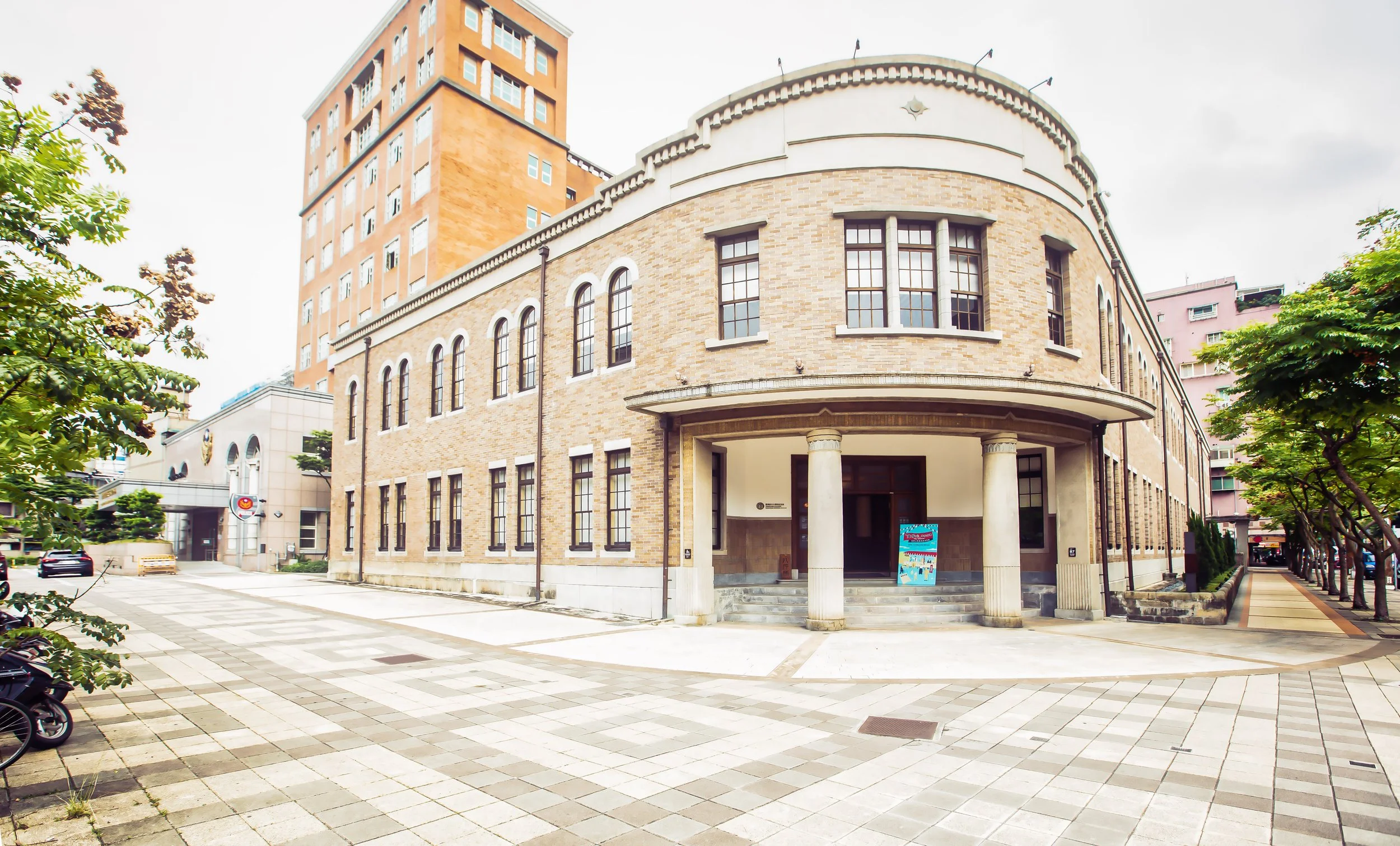
Still, when you’re getting paid to take photos, you can’t really pick and choose what the client wants, so on an early morning, I made my way out to Tamsui to take photos of one of the area’s most important tourist destinations, the historic Fort San Domingo.

Geographically speaking, Tamsui (or Danshui) is actually a lot closer to where I live than Taipei is, but if you’re not driving a scooter or a car, its a bit of a pain in the ass to get there. If I drove a car, it would have taken about half an hour but with a bus to Taipei and then the long MRT ride, it ended up taking almost two hours.

Given the amount of time it takes to get out there, every time I’ve visited I’ve more or less stuck to the popular areas around the Old Street and the riverside. It’s also a bit embarrassing to admit that I was always under the impression that the fort was quite a distance away from the downtown area which prevented me from visiting.

Suffice to say, I found out that it is actually within walking distance from the MRT station.

Now that I’ve visited Fort San Domingo, I can honestly say that I regret not visiting sooner.

Not only should this spot be on the itinerary of every tourists visit to Tamsui, it is one of the few historic spots in Northern Taiwan that deals with Taiwan’s Western Colonial history.

History

With a history dating back to 1624, Fort San Domingo, both a fortress and consulate, has been one of the most significant locations (with regard to western trade) in Taiwan for almost four centuries. Over its long history it has been controlled by the Spanish Conquistadors, the Dutch, the Qing, the Japanese and the British before becoming a National Historic Site in the modern era.

With such a long list of owners, the fort also had a variety of names - Today we refer to it by its original name “Fort San Domingo” (聖多明哥城) but it has also been referred to as Fort Antonio (安東尼堡), Koumoujyo (こうもうじょう) and colloquially by the locals as Âng-mn̂g-siânn (紅毛城), which in Taiwanese Hokkien translates as the “Red Hair Fort”, a clever way of describing the ‘weird-looking’ Dutch people who came to Taiwan.

Coincidentally if you visit the fort today, it appears red in colour, painted that way to match the consulate residence next door, although I’d like to think that it was an ironic way of paying homage to the nickname the locals gave it.

Spanish Era

The history of a fort located in this area started with the construction of the original Fort San Domingo around 1628-1629. The Spanish, who had already established a colony on what is today’s “Heping Island” (和平島) in Keelung, sought to increase their land holdings and expanded by force into the Tamsui area which was already a popular trading outpost with Chinese merchants.

The original Fort San Domingo was constructed simply of clay, wood and bamboo polls but didn’t last very long. A few years after it was constructed, it was attacked and demolished by a group of angry locals who were irritated with the taxes levied on them by the Spanish governor.

In 1637, a year after the fort was demolished, it was rebuilt, but this time they instead used stone and raised the walls to over twenty feet making life for the over one hundred soldiers stationed inside much safer from attacks by local militias.

The locals unfortunately turned out to be the least of their concerns because in 1641 the Dutch started to show more interest in the region and weren’t really big fans of the Spanish hanging around.

After a couple of attempts (over a period of two years), the Dutch were able to kick the Spanish out of Taiwan. Before they did though, the Spanish demolished the fort out of spite, because they weren’t interested in sharing it.

Dutch Era

As mentioned above, the Dutch East India Company (荷蘭東印度工色) started to take an interest in the area in the mid-1600s with plans to expand their trade with the locals. First though they had to expel the Spanish from Tamsui and Keelung to ensure their monopoly on trade and the safety of their trade ships.

In 1642 the Dutch sailed into Tamsui harbour with a large naval and land force and laid siege on the fort for a period of three weeks. They then moved on to and eventually took the port at Keelung ending the short lived Spanish occupation of Taiwan.

Once the Dutch kicked the Spanish out of the area they moved quickly to secure their position constructing a new fort on the site of the original that laid in ruins. The new fort, named Fort Antonio (安東尼堡), constructed in 1644 is the historic site that you can still see today.

With 32 foot high walls made of brick and stone was home to over 80 soldiers who were stationed there to protect the area and ensure that the trade of deer skins and sulphur went smoothly.

A few decades later, In 1661, a naval fleet of over 200 ships, led by Koxinga (鄭成功) landed in southern Taiwan with the intention of expelling the Dutch and establishing a base of operations on the island. After a nine-month siege the Dutch were defeated and signed articles of surrender at their southern stronghold at Fort Zeelandia (熱蘭遮城).

Undeterred, they quickly signed a cooperation agreement with the newly established Qing empire in China and reestablished their Taiwan base of operations in Keelung and Tamsui.

Their stay however was short lived as they were unable to retake any of their former holdings in central Taiwan and revolts by the Basai Indigenous peoples (巴賽族) saw many of their properties burnt to the ground.

Under constant threat from the locals and being caught in the war between Koxinga and the Qing in the south, the situation became untenable and Dutch decided to abandon the fort and left Taiwan in 1668.

Qing Dynasty

From 1683 - 1867 the fort controlled by Qing government representatives stationed in Taiwan.

The Qing never actually took up residence in the fort but they constructed stone walls with four gates around the perimeter in order to fortify their position in case of attack.

During the reign of the Jiaqing Emperor (嘉慶帝), China got involved in several incursions with the French over territory in Vietnam. In response the French sailed to Taiwan and attacked in Tamsui and Keelung. Easily defeated, they soon realized that their coastal defense network in Taiwan was more or less useless so in the following years they constructed several fortifications in key economic hot spots to protect their interests.

None of that would really matter though because in 1860s, as a result of the Second Opium War (第二次鴉片戰爭), the Qing were forced to sign the Treaty of Tianjin (天津條約) ceding Hong Kong to the British as well as Fort San Domingo (among many other properties) which would be used as a trade consulate.

When the British moved in, the fort was in bad shape with moss and other stuff growing on the walls, so they decided to clean it up and paint the fort red. Later they constructed the beautiful residence next to the fort to serve as a consular residence.

Notably, British linguist Herbert Allan Giles, known for his creation of a romanized system for Mandarin, lived in the fort or a period of three years while conducting research on what would become the Wade-Giles system of romanization (威妥瑪拼音), which is still widely used in Taiwan today.

Japanese Colonial Era

When Japan took control of Taiwan in 1895, things pretty much stayed the same at the British Consulate. The office continued to conduct its affairs and thanks to the colonial governments development projects, was able to modernize the property with running water, a sewage system and electricity.

In 1930, the Japanese government listed the site as a National Historic Monument (史蹟名勝天然紀念物保存法) and conducted surveys of the site to ensure its preservation.

Modern Era

When the Second World War came to an end, the Japanese were forced to surrender control of Taiwan to Chiang Kai-Shek and the Republic of China. The British returned to Taiwan and re-opened the consulate in 1946 and even though diplomatic relations between the ROC and the UK broke off a few years later, the consulate remained open to maintain economic ties.

In 1972, the British moved out of the consulate and tried to sell the land to the local government which wanted to turn the fort into a public museum. The asking price for the land however was far too high and the government refused to pay. Instead of selling the fort, the British placed the it under the stewardship of the United States which would maintain the grounds.

When America established relations with the People’s Republic of China in 1979, they were forced to cut formal diplomatic relations with Taipei, which once again made the question of the ownership of the fort an issue. The British didn’t have much interest in continuing to argue with the government, so in 1980 they turned over ownership of the fort, which was then listed as a National Historic Site and plans were made to open it up to the public.

In 1984, after a period of restoration, the fort was opened and amazingly attracted more then 40,000 visitors on its first day of operation.

Ownership and operation of the fort was later transferred to Taipei County (Currently New Taipei City) in 2002, which came up with plans to renovate the park after years of tourism put considerable wear and tear on the grounds.

After being closed for a year the fort reopened again to the public in 2005 as part of the Tamsui Historical Museum (淡水古蹟博物館), a network of historic sites in the area that has a modest admission fee and provides access to each of the sites.

Design

The area that encompasses ‘Fort San Domingo’ consists primarily of two main buildings which include the fort and the former consular residence. The area however is set up a bit like a park with a nature area on the hill below the main buildings with some additional buildings setup that help tourists learn about the area and provides shaded rest stops for visitors to have some food or drinks.

Strangely though, the actual fort is often a bit of an afterthought for most tourists as they prefer to spend most of their time touring and taking photos of the beautiful Victorian-style mansion instead. And you know what, I can’t really blame them. As far as architecture goes, the consular residence is absolutely beautiful and is a rare sight in Taiwan - The fort on the other hand isn’t really that appealing to the eye.

Fort San Domingo (主堡)

The information you’ll received on site claims that Fort San Domingo is the oldest surviving historic building in Taiwan. I’m not sure how much I believe that, but I guess I’ll give them the benefit of the doubt on this one, because yeah, it is pretty old.

The fort, which was constructed on the top of a hill overlooks the mouth of the Tamsui River and was constructed in a strategic location allowing the people in the tower to have the ability to closely watch who was coming and going through the river.

The fort is square-shaped and is about 15 meters in length and 13 meters in height. The walls around the fort are about two meters thick and were constructed with the thought that they could withstand artillery attacks.

The two-storey fort used a mixture of stones and brick to strengthen the walls of the structure. The outside walls, which were originally painted white were painted with stucco and lacquer but was later repainted red by the British to match with the colour of the consular residence.

The interior of the fort consists of a few rooms, which used to house soldiers and later consular officials. There’s not much to see inside, but the people who run the site have added some exhibitions that let you learn about what life was like when the fort was once a military outpost.

Consular Residence (領事官邸)

The beautiful Victorian-style Consular Residence is where most tourists focus their attention while visiting the area. The large two-storey brick building, constructed in 1891 is considered to be indicative of British colonial style architecture but mixes in a bit of local construction techniques that help to shelter the building from wind and rain.

The exterior of the red brick building is beautifully designed with arches along the veranda that encircles the perimeter of the building and makes for some beautiful photos.

The interior consists of several rooms on the first floor that were used for consular affairs including offices, a large foyer, meeting room and dining room, etc. The second floor likewise consists of three large bedrooms and storage rooms that housed the consular officials and their families. The rooms are large and beautiful and are currently full of displays that educate guests on what life in the residence was like.

The residence was designed by a British architect, but the craftsmen who constructed the building as well as the bricks and other material used in its construction were all imported from Xiamen in China. Likewise, the fireplace and clocks in the building were also imported, but directly from England.

Unlike the fort, most of the rooms in the residence are open the public and there are informative displays in each of them that allow visitors to learn about the house.

If you’ve got time, I recommend checking out each of the rooms, then walking around the perimeter of the building and checking out the line of cannons that sit to the rear of the building in the area between the fort and the consular residence.

For a more detailed description of the design of the consular residence check this link: Tamsui Historical Museum - The British Consular Residence.

Getting There


Fort San Domingo is located a short distance from the main stretch of the Tamsui Old Street. If you are planning a day-trip to the area, I recommend first walking from the Tamsui MRT Station (淡水捷運站) to the fort, checking it out and then making your way back to the MRT station walking along the riverside. This way you’ll get to walk the entire loop and not miss anything.

There are of course a few places you could stop along the way including the historic Fuyou Temple (福佑宮), Tamsui Church (淡水禮拜堂), the Tamsui Red Castle (淡水紅樓) and the Tamsui Customs Officers’ Residence (小白宮) among others.

If you follow this route, you can easily leave the MRT station and walk straight down Zhongzheng Road (中正路) until you reach the fort - even visiting a few places along the way. Then when you’re finished you can explore the Old Street along the riverside on the way back.

For those who have their own itinerary in mind, the address for the fort is:

No. 1, Lane 28, Zhongzheng Road. Tamsui District, New Taipei City. (新北市淡水區中正路28巷1號)

If you prefer to save some time and take a bus to the fort, you can take either bus #836 or Red 26 directly from the Tamsui MRT Station bus terminal.

You should also note that Fort San Domingo is open on weekdays from 9:30-5:00 and from 9:30-6:00 on weekends. It is closed only on the first Monday of every month.

There is also a modest admission fee of $80NT that offers visitors access to Fort San Domingo as well as nearby Hobe Fort (滬尾礮臺) and the Tamsui Custom Officer’s Residence (小白宮).

You have the option of paying with cash or your EasyCard (悠遊卡).

After living in Taiwan for so long, it is hard to believe that it took an article about a 48 hour trip in Taipei to get me to this historic tourist destination. In retrospect that is something I regret, I should have visited much sooner. If you’re travelling in the Tamsui area, you should definitely take the time to visit as well.


Postcards from Edinburgh

Are you one of the millions of people around the world who has taken one of those ancestry tests? You know, one of those things where you swab a bit of saliva and after a few months your DNA tests arrive in the mail with a detailed calculation of your genealogy? I’m a bit skeptical of their authenticity, but for the people who’ve tried it, it would seem like they appreciate the results.

Two years ago, my step-sister sent one to my step-father as part of his Christmas package - My step-dad, a French-Canadian with Acadien heritage seemed quite eager to see the results of the test. During our Christmas family FaceTime chat, we talked about it and even though we felt skeptical that the results would really tell us anything we didn’t already know, I could understand why he would be interested in a test like this as the history of the Acadien people in Eastern Canada is a complicated one.

My own genealogy however isn’t as complicated.

My entire family hails from Scotland - My parents, their parents, their grandparents and their parents. Granted, I likely have some other Eastern European or English roots mixed in somewhere but you’d have to go pretty far back to find them. I’ve never needed one of these tests to explain this stuff to me as my family history is well-documented.

Edinburgh Castle sitting atop Castle Rock.

This is because my grandma’s older brother kept an extremely detailed family history, which he spent countless hours researching and was constantly updating. I remember visiting his place a few times during family gatherings and having him show us he detailed map of our family’s history that he traced back for dozens of generations.

After my uncle passed away, the family tree he created passed on to his son, who has carried on his fathers work of ensuring that the history of our family is one that we can easily learn about.

My family mostly hailed from the northern highland regions of Scotland, near Inverness. They moved from Scotland to Nova Scotia, Canada, which if you’re not aware means “New Scotland” in Latin, and my grandfather moved to a town named “Inverness” to work as a coal miner after the war.

Think about it. Moving from Inverness, Scotland to Inverness, New Scotland.

I always thought it was a bit quirky to say the least, but I’m sure many of the Scots and Irish who uprooted their families and moved to North America in the 19th and 20th centuries are likely to have similar stories as many of North America’s towns and streets share the same names as those in back home. 

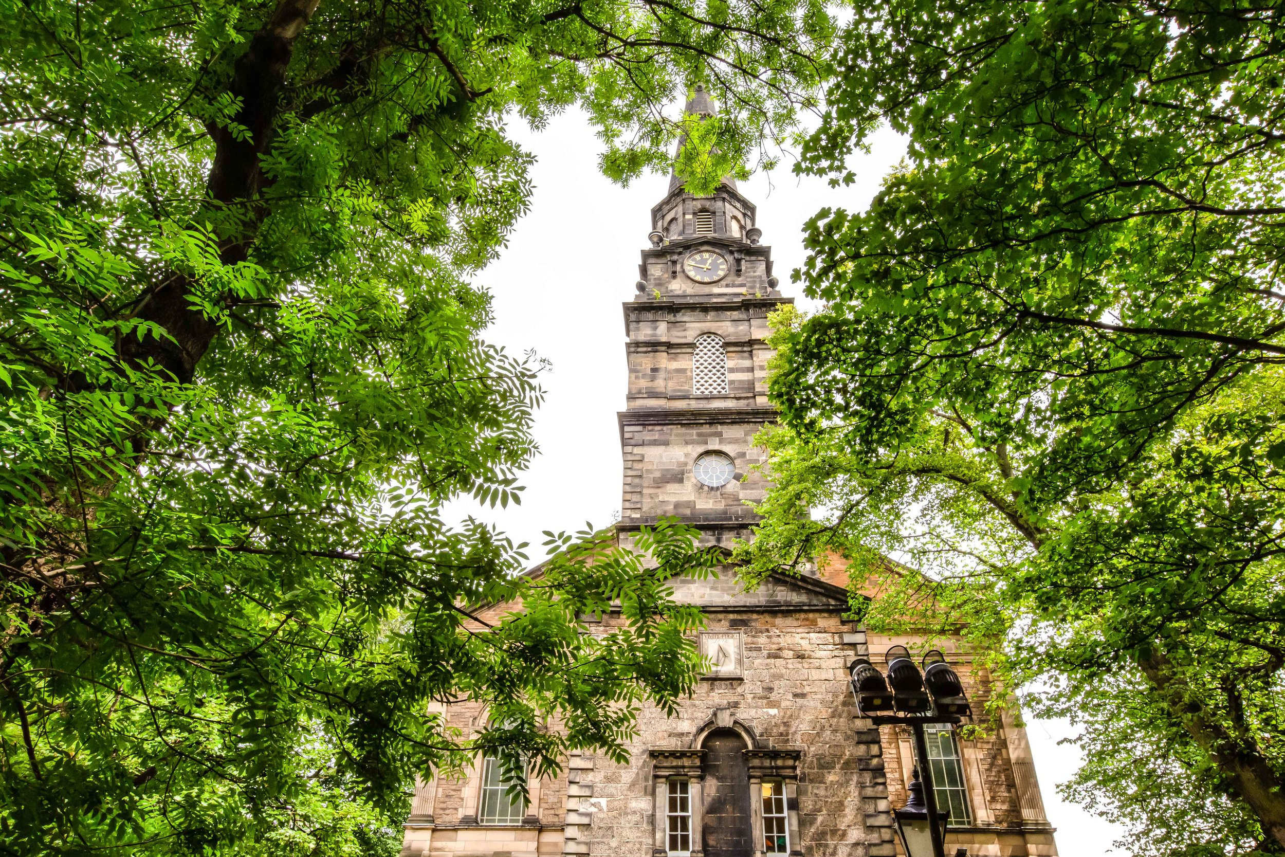
St. Mary’s Cathedral

Suffice to say, visiting Scotland was always one of my top priorities, but since I’ve lived in Asia for much of my adult life, I’ve never had the opportunity to enjoy Scotland in the way that only and an adult could. So when my girlfriend’s year-long working holiday was finishing up, we decided to travel Europe for a month.

Scotland was of course at the top of our list of places to visit.

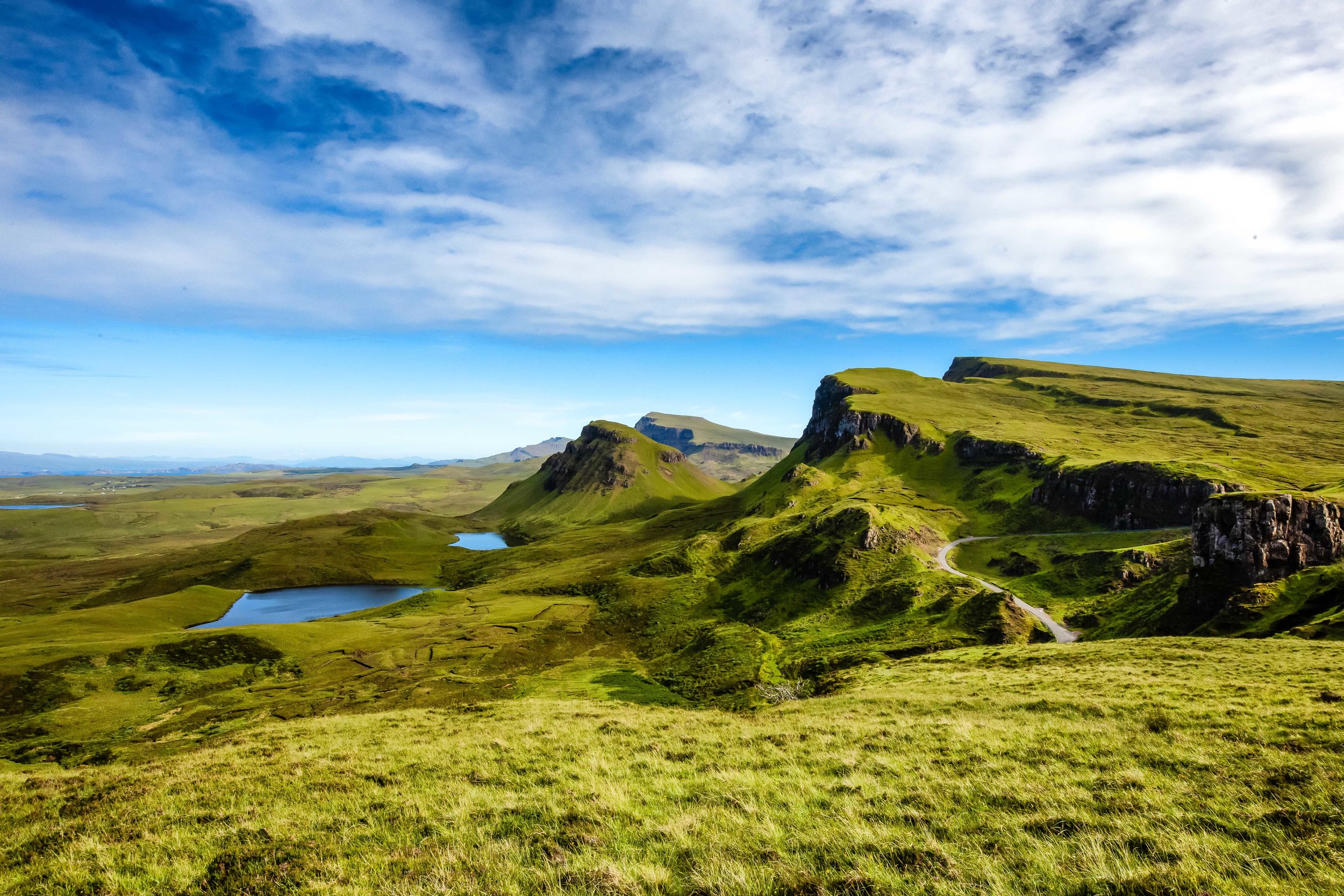
I put together a two-week excursion which would allow us enough time to visit the historic cities of Edinburgh and Glasgow before taking a road trip through the beautiful Scottish Highlands and then a week on the Isle of Skye.

Our first stop? Edinburgh, the capital city of the country.

The Ruins of Saint Anthony's Chapel.

If you weren’t already aware, much of Edinburgh is listed as a UNESCO World Heritage Site with almost 5,000 listed buildings that showcase the medieval street layout of “Old Town” and the well-planned Georgian-style layout of “New Town”.

Recognized as one of Europe’s most beautiful cities, Edinburgh has a little something for everyone to admire with an organic mixture of architecture ranging from Gothic to the ultra-modern. It doesn’t matter if you’re on a walking tour of the city or enjoying the scenery from mountain vistas like Calton Hill or Arthurs Seat, you’re sure to enjoy the unique history and beauty of the ancient Scottish capital.

For today’s post, I’m going to depart from my usual style and instead just share some snapshots of the city. I’ll offer a short explanation of some of the locations, but this one is simply going to focus on some of the photos I took while roaming around the city. I hope you enjoy them.

Calton Hill

Easily one of the most identifiable locations in the city, Calton Hill, which is included as part of the UNESCO World Heritage Site, is home to a couple of architecturally significant structures, offers panoramic views of the city and is the perfect spot for an afternoon picnic.

Often the subject of photographs and paintings of the city, the peak of Calton Hill is home to several monuments, most notably the National Monument and the Nelson Monument with the southern slope of the hill home to the Scottish Parliament and Holyrood Palace.

The National Monument, a memorial constructed to memorialize the fallen members of Scotland’s Armed Forces during the Napoleonic Wars was intended to be a ‘memorial of the past and incentive to the future heroism of the men of Scotland’ but due to a lack of funds was never actually completed.

Modelled after the Parthenon in Athens, the unfinished monument has been described as “the Pride and Poverty of Scotland”, but has since become one of Edinburgh’s most iconic structures.

Today it can be seen from almost everywhere you go in the city.

View of Calton Hill from Arthurs Seat

Likewise, the Nelson Monument, a commemorative tower constructed in honour of Vice Admiral Horatio Nelson is another of Calton Hill’s opposing structures. The two-century old monument, a 32 metre (105ft) high tower, sitting 171 metres (561ft) above sea level has a public viewing gallery at the top and is a popular tourist attraction.

What I found more appealing however was the large patch of grass on the southern slope of the hill which provided the perfect space for a romantic afternoon picnic. Knowing this, we prepared some food bought at a nearby supermarket and instead of waiting in line to climb to the top of the tower, had a perfect afternoon enjoying the views of the city.

Scott’s Monument

Another of Edinburgh’s most iconic structures, the Scott Monument, a 61 metre (200ft) Victorian-Gothic tower, dedicated to Scottish author Sir Walter Scott sits along the popular Princes Street shopping stretch near Edinburgh’s Waverley Railway Station.

Completed in 1846, the monument sits in a public park sandwiched between the railway and busy Princes Street. Described by Charles Dickens as the “spire of a Gothic church taken off and struck on the ground”, the design of the monument initially met with considerable criticism but like the National Monument mentioned above, it has since become one of the city’s most iconic images.

The 200ft tall tower has an observation platform where visitors are able to pay an admission fee and climb the 287 steps to the top to enjoy the views of the city. The climb to the top however is a busy one, is quite cramped for space and is a steep climb. If you’re visiting on a nice day, you’re probably better off acting like a local and finding an empty patch of grass where you’ll be able to check out the monument, enjoy the weather and do a bit of people-watching.

The Royal Mile

Sea Gulls care little for James Braidwood’s successes

In almost every nook and cranny of Edinburgh you’ll be able to enjoy the historic character of Scotland’s historic capital. If you don’t end up joining one of the many walking tours offered, you’ll easily be able to appreciate the eclectic mixture of architectural styles that the city so vibrantly puts on display.

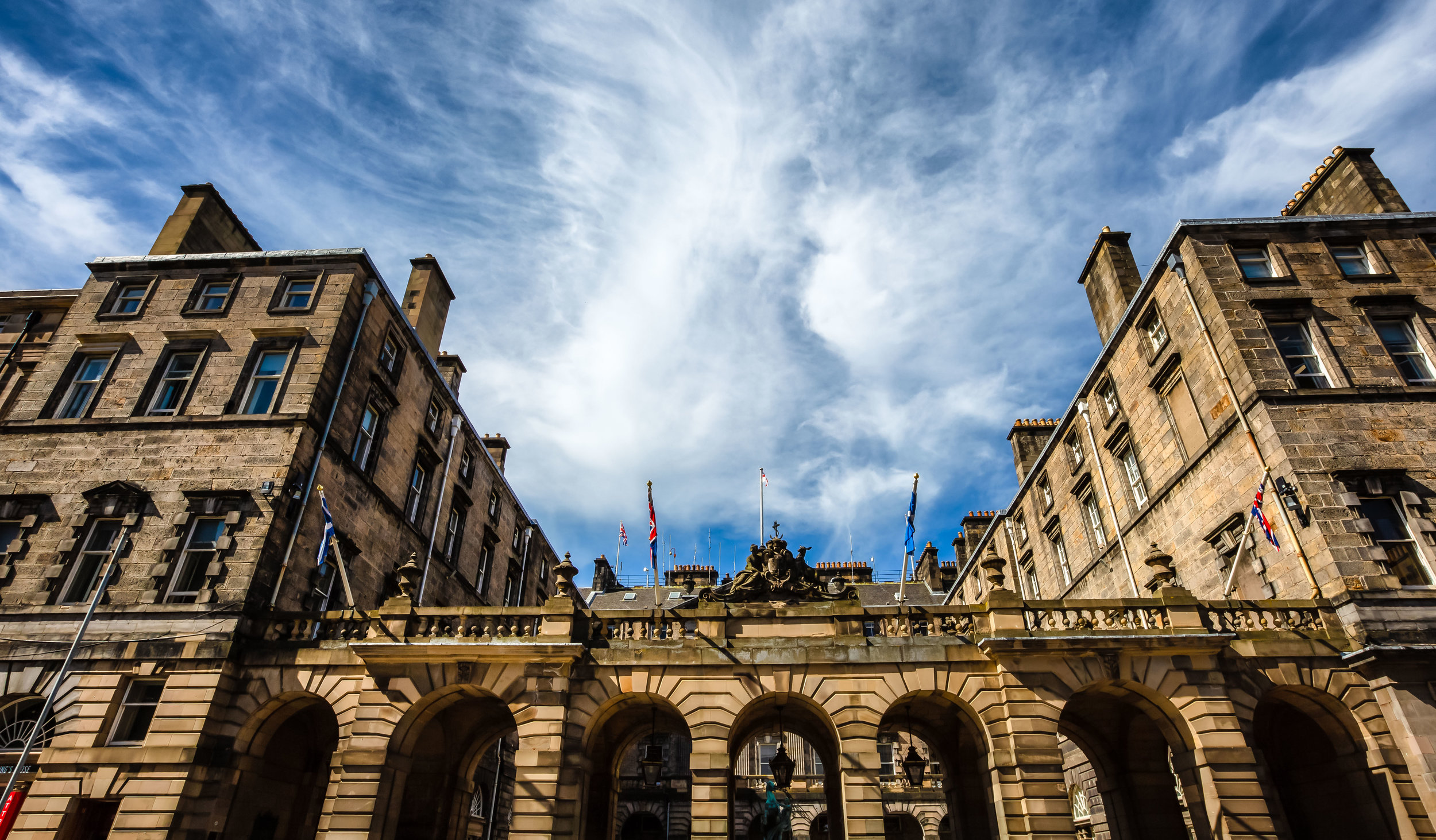
This is especially prevalent on the Royal Mile where you start with the ultra-modern Scottish Parliament at one end with Edinburgh Castle on the other. What you’ll find on the long road between the two however is a mixture of buildings that span the past few hundred years of Edinburgh’s history.

You could spend hours, days or weeks simply walking up and down the Royal Mile enjoying all the small details, the monuments, churches, civic buildings, restaurants and tourist traps.

The cobblestone street is one of the busiest tourist areas in Edinburgh, but there is good reason for that as it gives tourists a great introduction to some of the best that the city has to offer.

 Even though my entire family hails from the Northern-Highland regions of the country, as a Scottish kid born outside of the country, my visit to Edinburgh was one of those heartwarming experiences that reminded me of my family, our history and how after all these years I was able to fully appreciate how much this land feels like home, even though I was just a tourist.

Fortunately on this visit, I was able to share the experience with my girlfriend who also fell in love with the city (and the country) which ensures that I’ll be able to visit again quite soon!

Edinburgh is a lovely city and if you’re planning a visit, I’m sure you’ll enjoy it as much as we did. If you do visit, make sure to try the Haggis. It really isn’t as bad as it sounds.


Fire Mountain (火炎山)

I’ve lived in Taiwan for well over a decade now and for almost as long as I can remember, every time I’ve travelled south along the national highway, I’ve always enjoyed the view when crossing the Da’an River (大安溪), the area that geographically separates Miaoli from Taichung. 

The reason for this is quite simple, the Miaoli side has a beautiful mountain that glistens in the sun whenever you pass by. When you consider most of Taiwan’s mountains are lush with greenery, this one stands out thanks to almost red-like soil on the mountain side.

Its fair to say that I’ve probably passed by the mountain on the highway a few hundred times throughout my years living here and even though in the back of my mind I always wondered about the mountain, by the time I arrived at my destination, I had already forgotten about it.

Over the past year though, the mountain, which I’ve since learned is aptly named “Fire Mountain” (火炎山), has become a bit of a hit with young people, especially those on Instagram who hike (most of the way) to the top to get a photo of themselves at a spot that has become known as “Taiwan’s Grand Canyon” (台灣大峽谷). 

In retrospect my curiosity about the mountain should have led me to finding out about it much sooner, but sometimes my curiosity about mysterious places often leads me down really deep rabbit holes, so I’ve been trying to make an effort as of late to not let my curiosity take up so much of the little free time I have. 

That being said, the proverbial cat is out of the bag when it comes to this mountain and its recent popularity meant that a visit was definitely in order as I rarely miss the chance to get those super popular instagram photos (Pardon the sarcasm) 

Fire Mountain (火炎山)  

Situated on the geographic barrier between Taiwan’s Miaoli County and Taichung County, “Fire Mountain” or “Flame Mountain” (火炎山) has become one of the new hot spots on the country’s day-hike scene and is highly regarded for its stunning landscapes.  

Once a protected nature reserve and home to several endangered local bird species, the mountain was for quite some time restricted only to researchers and bird watchers with a permit. Now it has reopened to the public and thanks to the skill of some Instagrammers, its popularity has skyrocketed making it one of the busiest trails in central Taiwan, second of course only to Yuanzui Mountain

Stunning landscapes and Instagram photos aside, as one of Taiwan’s Top 100 Mountains (小百岳), Fire Mountain has always been a popular one among crowds attempting to complete one of Taiwan’s hiking challenges. It is also a popular stop for local birdwatchers who visit the mountain every year between April and May to observe flocks of migratory birds arriving back in Taiwan from the Philippines. 

Note: To avoid a bit of confusion I think I should explain: There are two lists of ‘100 Peaks’ in Taiwan. One is a list of 100 peaks that are over 3,000 meters above sea level, known as the “Bai Yue” (台灣百岳) while the other is a list of 100 Peaks that can be climbed relatively easily known as the “Mini Bai Yue” (小百岳), this mountain is on the list of smaller peaks. 

Link: 台灣小百岳列表 (Wiki)

Link: 100 Peaks of Taiwan (台灣百岳) 

Video: Taiwan’s 100 Best Mountains (Goldthread / Youtube)

At its highest, Fire Mountain reaches an elevation of 614 meters on its Northern Peak (北峰) while its Main Peak (主峰) is 596 meters above sea level. Formed hundreds of thousand of years ago, the geological structure of the mountain is similar to that of many of Taiwan’s mountains in that it was created by the movement of tectonic plates.

From the outset, this mountain set itself apart (from the others) in its composition from the ground up thanks to the weak cohesion of sandstone and sedimentary rock that make it less stable. Speaking plainly, this instability simply means that the physical attributes of the mountain are in a constant state of change, so whenever there is a heavy rain, typhoon or earthquake, the mountain changes a bit. 

This natural effect is also the reason why the mountain has become so attractive as its jagged peaks, cliffs, valleys and slopes have all been formed by natural degradation over time. 

Unfortunately (as mentioned above) due to the fragility of the mountain, it had to be closed off to the public for several decades. In 1986 (民國75年) the government designated the mountain as the “Fire Mountain Nature Reserve” (火炎山自然保護區) in order to allow for the mountain to naturally repair itself to prevent the effects of erosion, and to also allow the native Masson’s Pine Tree (馬尾松) to replenish itself. 

Now that the trail has reopened, it has become a popular weekend destination for hikers and day-trippers, so the local government has made an effort to improve the safety of the trail allowing for a much better hiker experience for all. If you do plan on hiking this one (and you should), its important to remember that it is still a protected nature reserve, so try to have as little impact as you can on the natural environment and as always remember to take your trash with you. 

Hiking Fire Mountain

This hike is relatively easy and will only require a few hours of your time. Unlike many of the other mountains that have become popular in recent years, this one is essentially just a brisk nature walk, so you don’t need to be an experienced climber to complete the hike. With this in mind, if you’d like to bring your family or friends for an afternoon outing, this is a trail that should allow everyone to get a bit of exercise and enjoy a bit of Taiwan’s beautiful mountainous landscapes.  

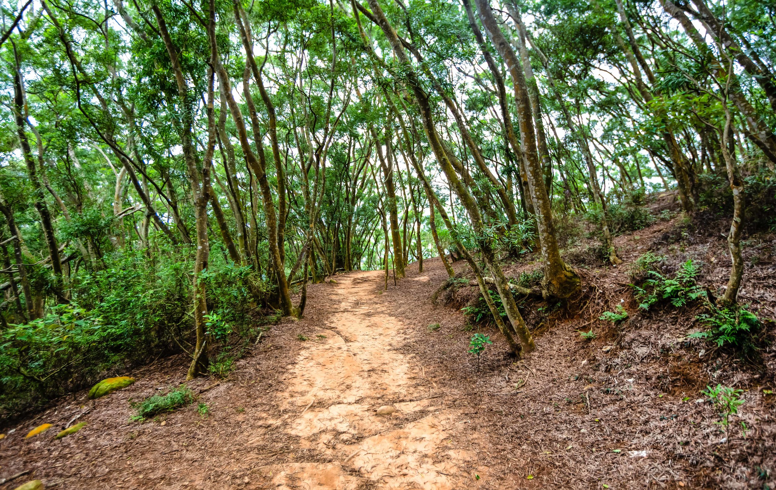
From the outset, the incline of the trail rises at a gradual pace which means that you won’t be starting out with a steep set of stairs like so many other trails. After about five-to-ten minutes of walking, you’ll start to be able to see the elevated highway through the trees and the path will start turning red.

As you hike you’re going to start noticing a few warning signs on the trail where there will be a beaten down path nearby - Unlike most of Taiwans trails, where hikers tie markers to trees which indicate the direction you should be heading in, this one is quite well developed and there is signage everywhere. The lack of these markers isn’t entirely a terrible thing in this case though as the warning signs you’ll see along the way (more often than not indicate) that there is a picturesque vista nearby.

So whenever you come across a warning sign, you’re likely to find an unmarked path branching off from the main trail that leads to an area where you’re able to take photos, and the higher you climb the more beautiful these vistas become. 

The warning signs however are obviously there for a very important reason - The cliffs where you’re able to take these beautiful photos are often quite dangerous and while it may seem like a good idea to get a photo of yourself sitting on the edge of the cliff, you should be aware that erosion on this mountain is a real thing and that if you’re not careful, you might be involved in a landslide of your own making.

You definitely don’t want to have your dead body featured on the news and force the closure of the trail, which would ruin the experience for everyone else, so use your brain and stay safe.

Each time you approach one of the vistas, you may start thinking to yourself that you’ve arrived at the ‘famous photo spot’ but I assure you, when you reach the ‘spot’, you’re going to know. This is because there is a rather generous amount of signage that indicates that you’re approaching the ‘Grand Canyon’ and once you’ve arrived, you’ve pretty much reached your destination. 

When you’re standing at the trailhead and you’re looking at the map of the trail, it provides an ‘estimate’ of how long it should take you to complete the hike. Something that you’re going to have to learn about these signs here in Taiwan is that the estimate is way off and it is never going to take nearly nearly as long to complete. Still though, these estimates are good at scaring people away.

The local authorities estimate that this mountain is going to take about 3.5-4 hours to complete, but its important to note that the vast majority of hikers aren’t coming here to "complete” the mountain, they’re only really hiking to the Grand Canyon and then heading back to the trailhead. With this in mind, you can easily shave off an extra hour or so of the estimate.

Unfortunately, if you are hiking this trail on the weekend, the time you save by not hiking to the peak may end up not being time saved at all - Hiking on the weekends mean that you’re going to have to deal with a bit more traffic on the trails. It also means that if you want to take photos at the Grand Canyon that you’re going to have to get in line with a bunch of ravenous (yet beautiful) Instagram celebrities. If you’re like me though, you may feel quite entertained by watching them take photos with all all their weird poses. 

Given that the trail is so well-developed and that hiking it is rather difficult, you shouldn’t have much trouble hiking this one. If you take a look on instagram at some of the outfits many of the instagram celebrities have worn while hiking, it should offer a much better indication of just how easy this one is. Nevertheless, this is a mountain, so you’ll want to make sure you bring enough water and wear proper footwear. You’ll probably also want to bring a raincoat with you just in case it starts to rain. 

Tour / Permit 

Trailhead warning sign and map

It seems like there is a bit of misinformation out there about whether or not you need a permit to hike the mountain or whether you need to have a tour guide take you up the mountain. 

Let me dispel both of these rumours right now. 

You might have read somewhere on the internet or heard from a friend that you need a permit to hike the mountain. That’s false. You don’t need to have a permit. There are quite a few mountains in Taiwan where you’ll need a permit, but this isn’t one of them. You’re not going to encounter anyone at the trailhead checking for permits or identification. What you will find at the trailhead is simply a map of the route and several warnings about the danger of walking too close to unstable cliffs. 

The reason why people claim that a permit is necessary is because years ago the mountain was a protected nature reserve for replenishing trees and protecting a few endangered local species of birds, most notably the “Grey-faced Buzzard” (灰面鵟鷹) which migrates to the Philippines during the Winter and returns in Taiwan in April each year. 

Those issues seem to have been rectified with time, so they’ve reopened the trail to the public. 

Hello friend!

You might have also read online, especially on some Taiwanese tour sites that you need to take a tour to hike the mountain. That is also false.

If you see a website claiming that you need to join a tour to hike this one, they’re just spreading misinformation in order to make some money off of their paid tours. I don’t want to ruin anyone’s business, but I also don’t like people spreading false information to tourists in order to cheat them and make money. 

Of course having a tour guide and travelling with a tour group could solve some of the travel issues involved with getting to the mountain, but most of these tours are more expensive than what you would pay if you followed the travel advice I’m going to provide below. 

Ultimately it is up to you how you get to the trail, but you definitely don’t need a permit and its not necessary to join a tour - All you have to do is simply walk up to the trailhead and enjoy your hike. 

Getting There


One of the main obstacles to climbing Fire Mountain is actually getting to Fire Mountain. 

When I say that, I mean for those who don’t have their own means of transportation, be it car or scooter, getting to the trailhead can be a bit of a hassle that will probably include a train ride and a taxi ride. 

If you have a car, getting to Fire Mountain is rather straight forward - Take the National Highway Number One (國道一號) and get off at the Sanyi Exit (三義交流道). From the interchange make a right turn and then at the first set of traffic lights turn left on Road 13 (台13線). Follow that road until you reach the bottom of the hill where you’ll find yourself under the highway. The trailhead is located directly next to that road. 

When you want to park your car, there isn’t much choice in terms of legal parking spots, so you’ll likely have to park in the “正松泉停車場” paid parking space by the trailhead. The parking fee is only 50NT though, so it shouldn’t be much of a problem - unless of course its full. 

If you are relying on public transportation, the easiest way to get there is to take a train and then take a taxi from the station to the trailhead. If you are travelling from the north, I recommend getting off at Miaoli’s Sanyi Station (三義車站) and if you’re coming from the south, you could get off at Taichung’s Tai’An Station (泰安車站). The distance from both stations is more or less the same, but the trip from Sanyi is probably the most straightforward and should cost around $200NT 

It is important to remember though that if you are taking a train to Sanyi or Tai’An, that at some point you’ll have to switch to a Local Train (區間車) as the Express Trains don’t stop at either of those stations. If you’re coming from the north, get off at Miaoli Station (苗栗車站) and if you’re coming from the south get off at Houli Station (后里車站) to transfer. 

Once you’ve arrived and you get in the taxi, if you can’t speak Chinese you can show him this or try your best to read the pinyin: “我要去火炎山登山口” (wǒ yào qù huǒ yán shān dēng shān kǒu). Considering the popularity of the hike as of late, the driver is likely to know exactly where you want to go. You might also want to remember the drivers phone number or get a copy of his card so that you can call him to pick you up. 

For most travellers this hiking trail isn’t going to be a particularly easy one to get to, but it is a fun one and if you do decide to hike it, you’re going to be rewarded with excellent views of Taiwan’s so-called “Grand Canyon” as well as the Da’an River that stretches all the way out to the ocean. The hike is relatively easy and is well-maintained, so with a bit of effort you’ll be rewarded with several picturesque vistas and you’ll be able to get one of those important instagram photos that everybody’s looking for.

Remember though, some of the cliffs are dangerous, so if you notice a warning sign, it’s best to take some precaution while at the same time enjoying the experience of hiking this beautiful trail.