The Sandiaoling Waterfall hiking trail (三貂嶺瀑布群) is an amazing hike in northern Taiwan on the Pingxi rail line (平溪線) featuring three large waterfalls while hiking above the Keelung river that passes through the area.
The hike is easy and takes about three hours from the trailhead and back with ample time to enjoy each of the waterfalls.
The hike starts near the Sandiaoling train station (三貂嶺車站) on the Pingxi rail line which means it makes a lot of sense to use public transportation to arrive at the trailhead.
You can also drive there - I actually drove both times I went - but you’re going to have to make sure that your car has a GPS system installed beforehand as its not that easy to find the correct route to arrive at near the station.
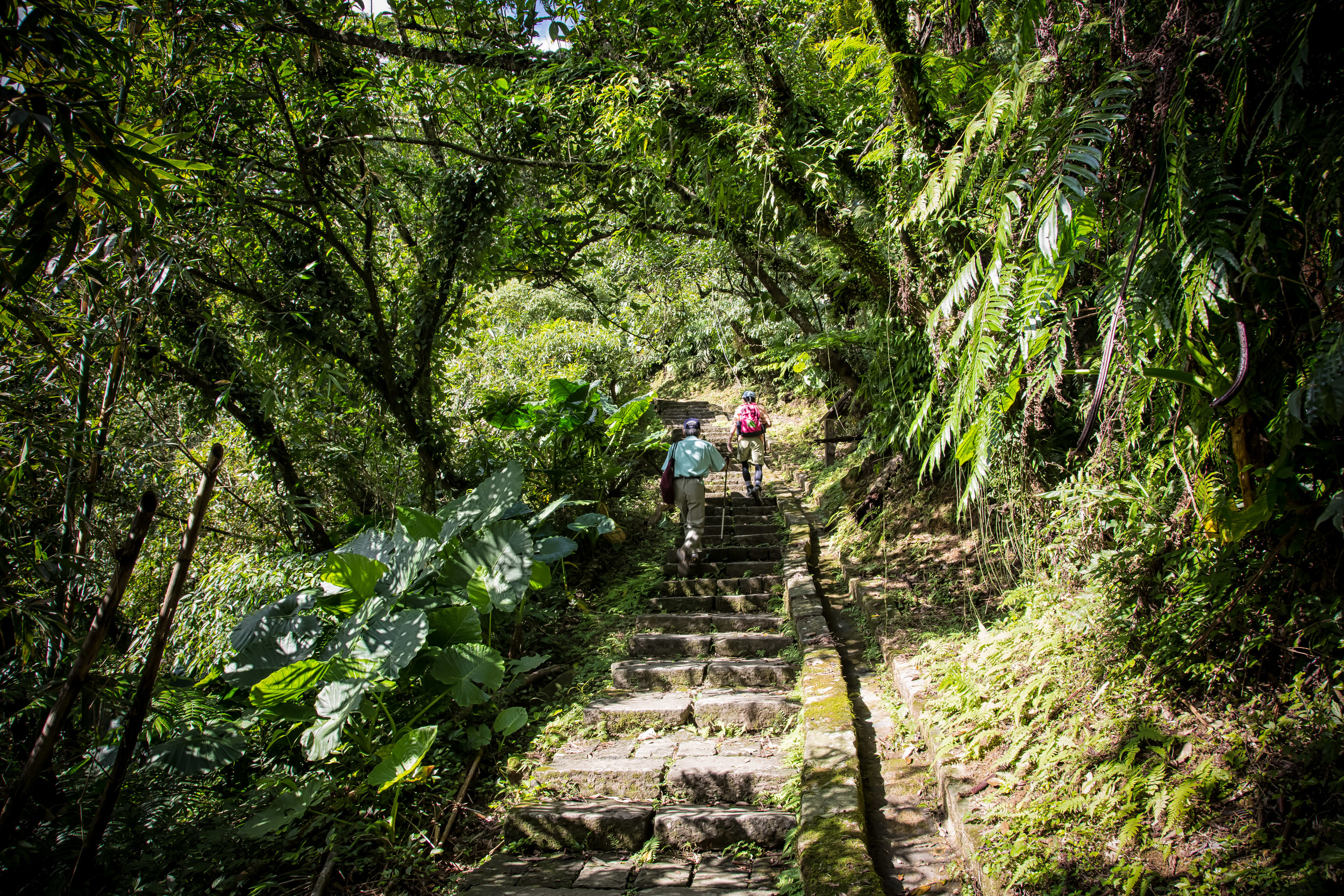
From the Sandiaoling train station you make your way towards a bridge and on the right you will see an abandoned elementary school and a trailhead marker with a map that will indicate where the trail starts.
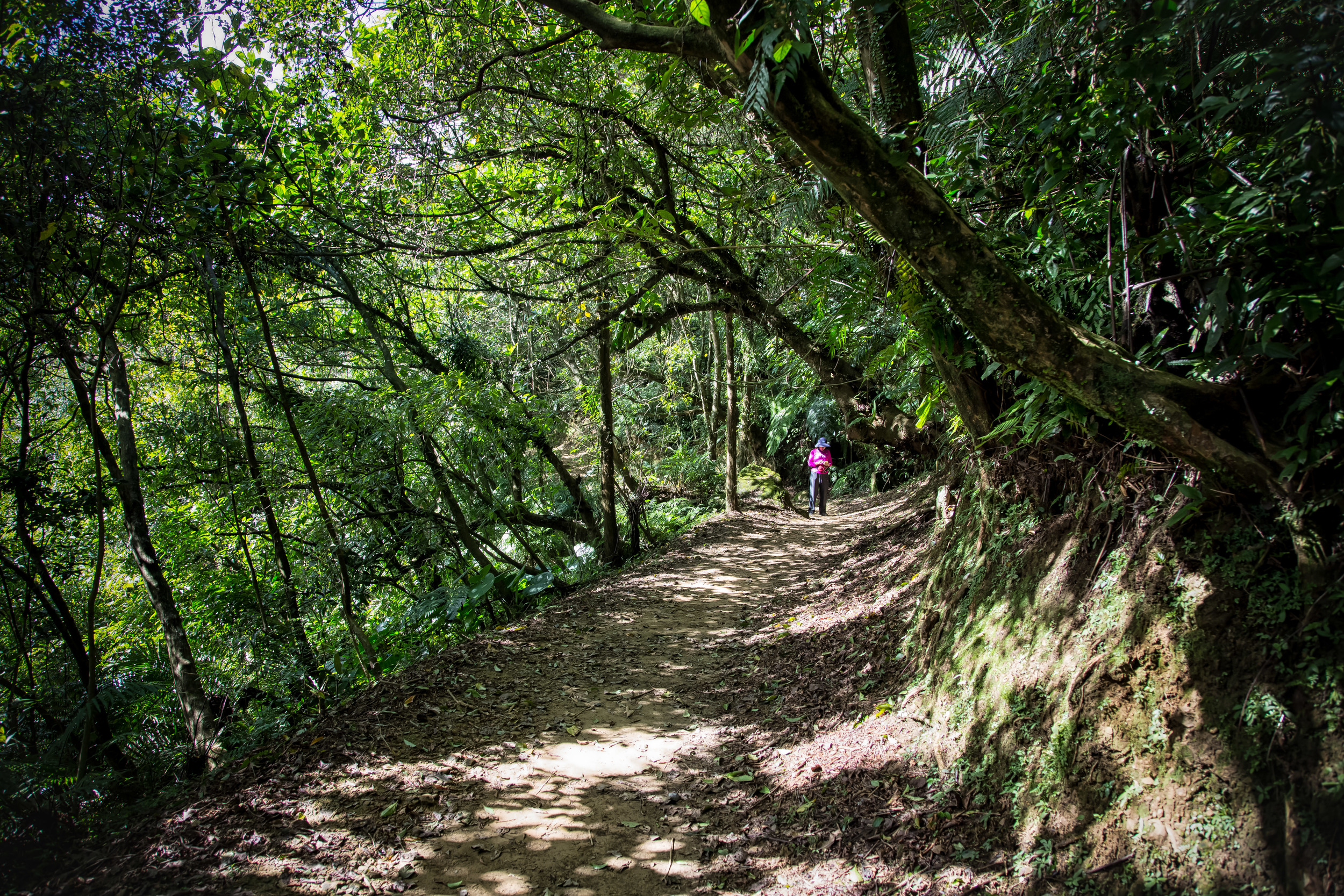
The beginning of the trail is probably the most difficult part of the entire trail for non-hikers as it involves walking up a lot of stairs that will take you high above the Keeling river before eventually levelling out.
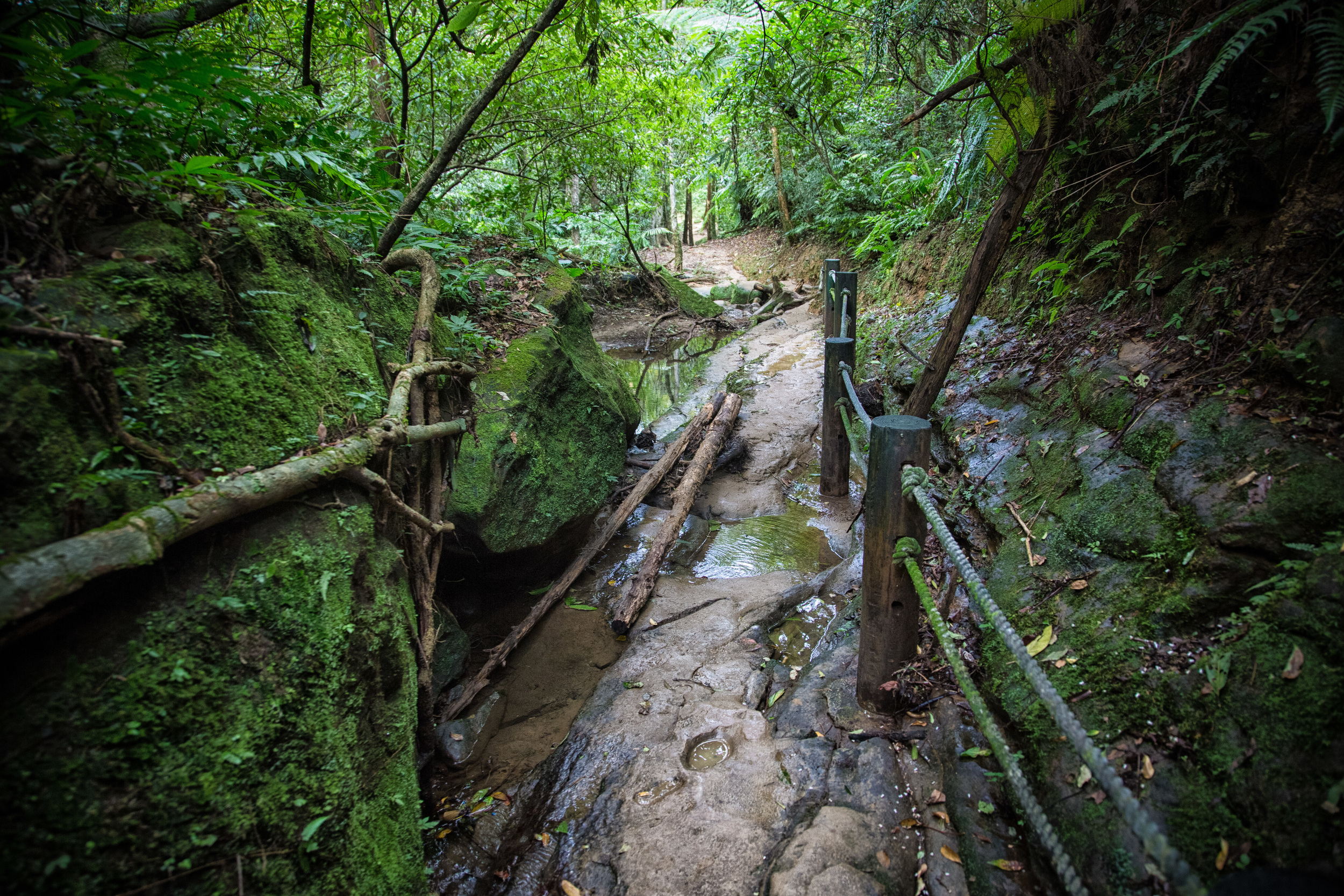
From there on though the rest of the hike is extremely easy and is more or less just a comfortable stroll through a beautiful forest with a well-maintained yet sometimes muddy path.
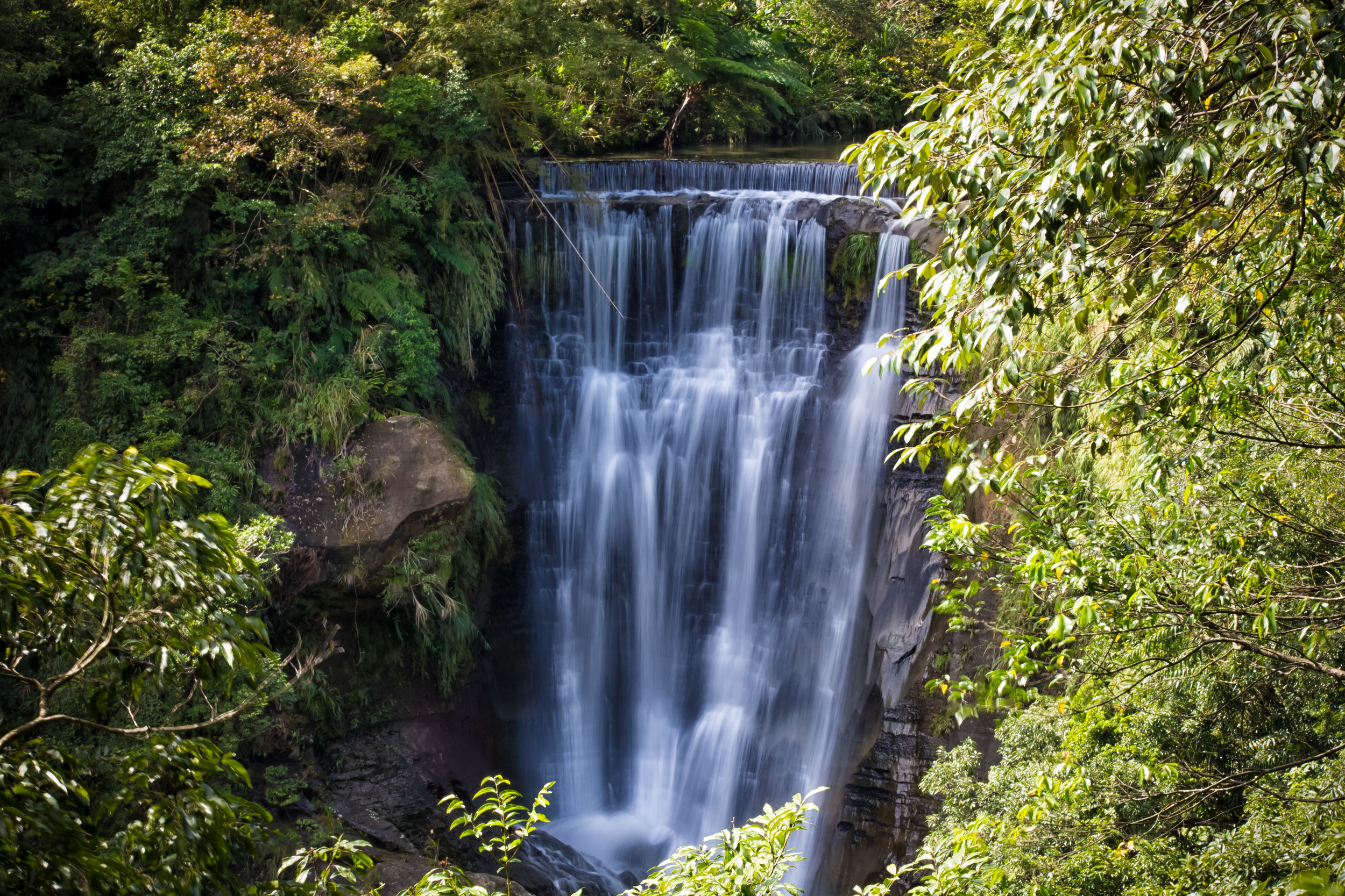
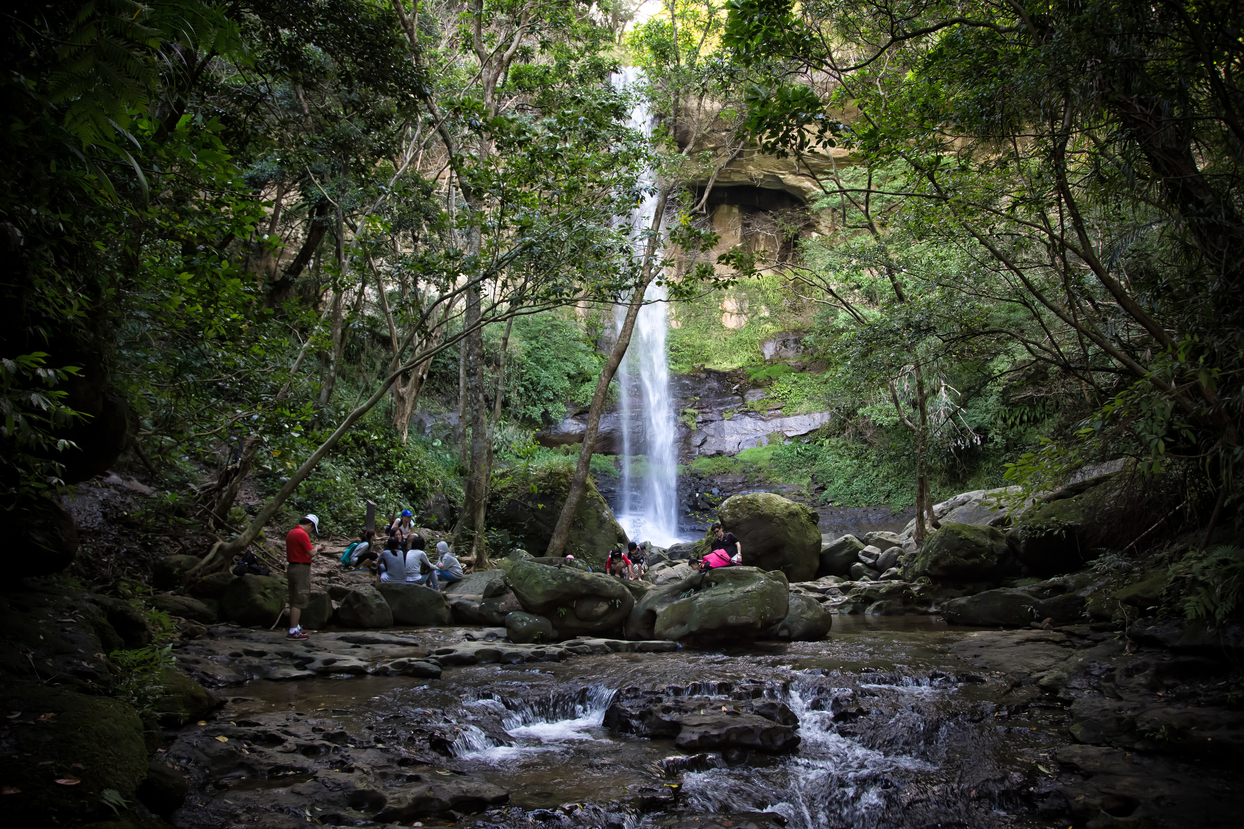
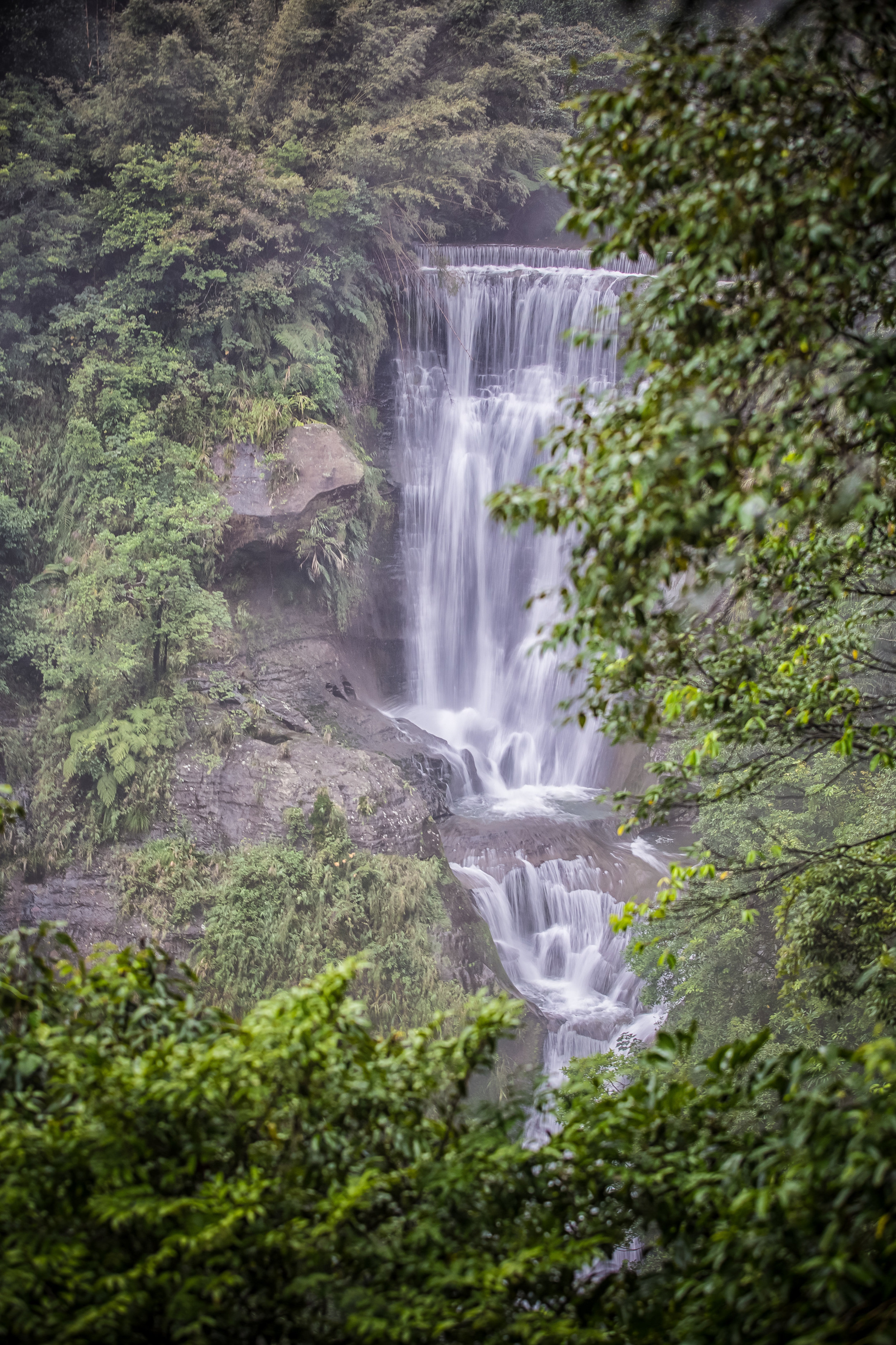
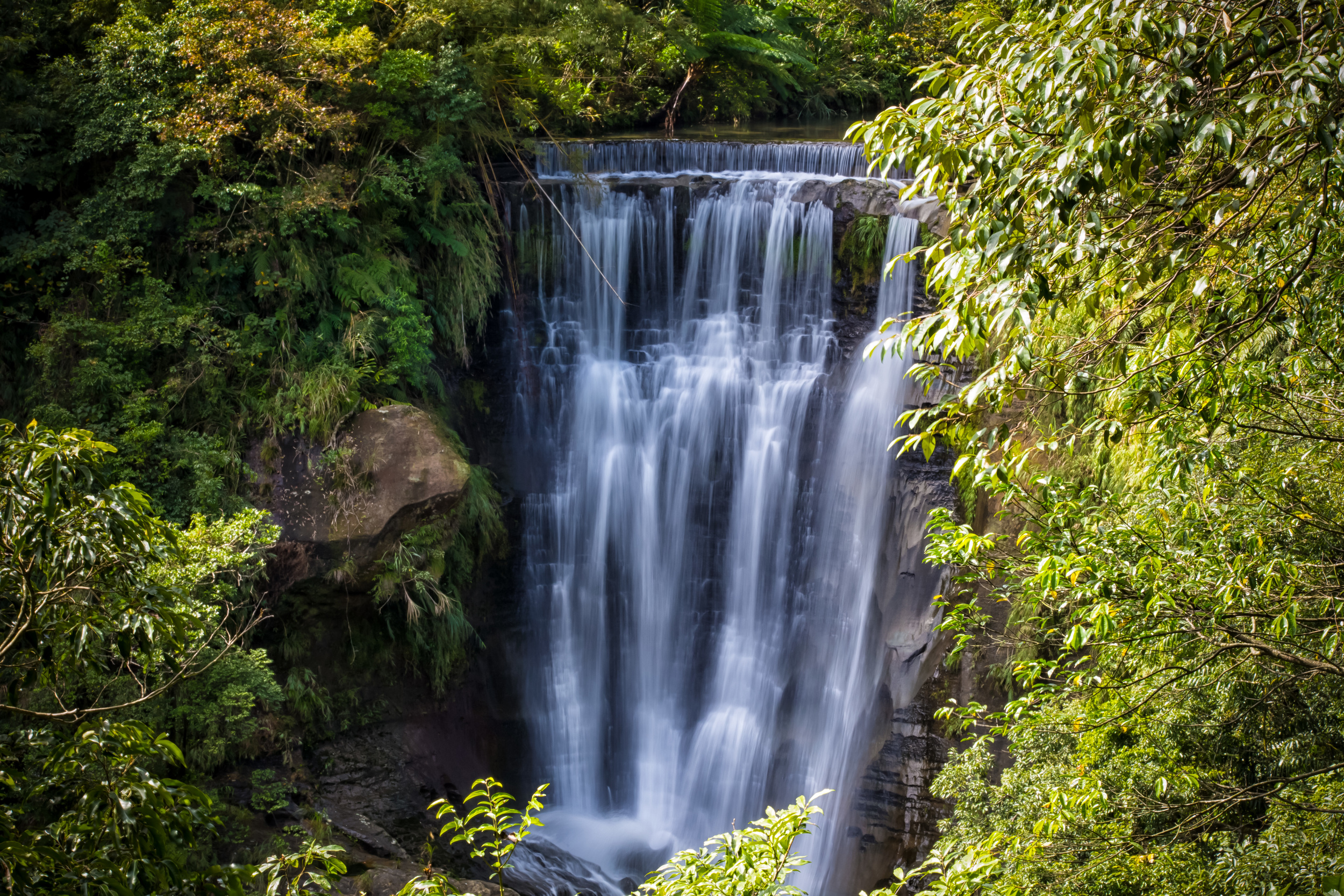
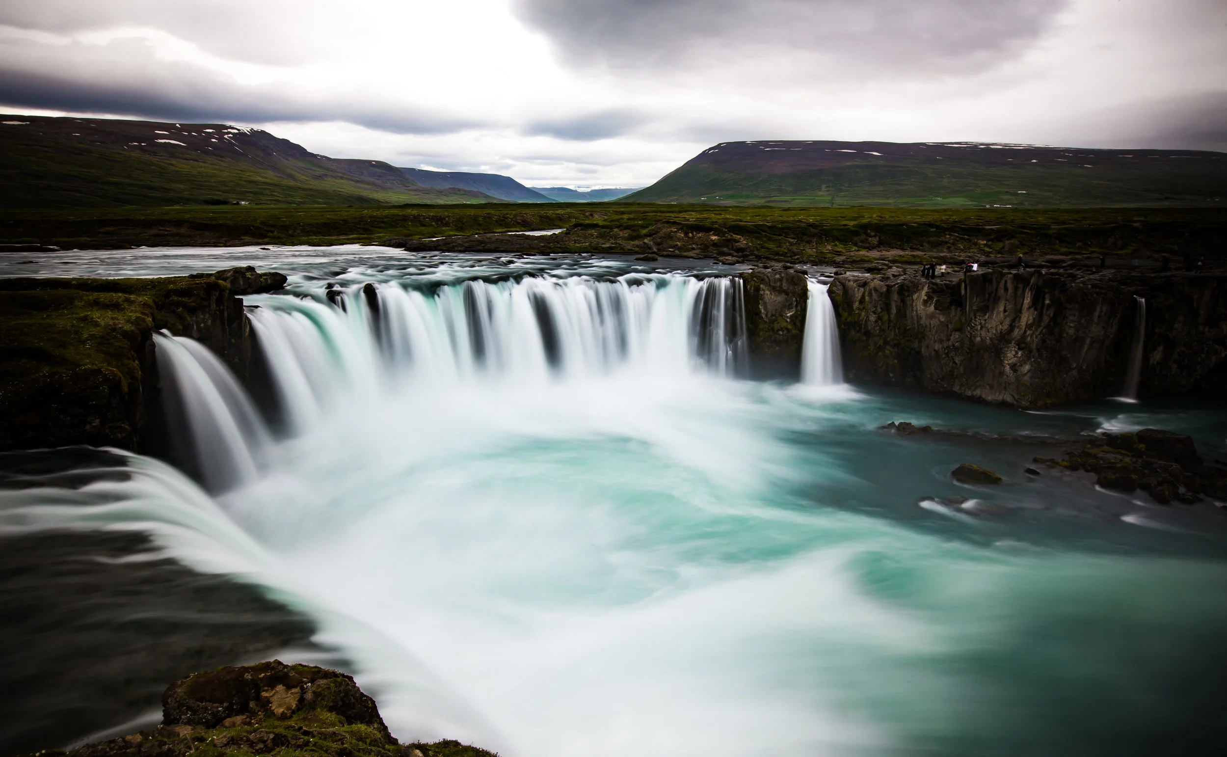
After about 20-30 minutes of hiking you will arrive at the Hegu falls (合谷瀑布) which are the first of the three waterfall on the hike. You can’t actually get close to the falls (unless you want to do some river tracing) but there is an observation deck where you can observe them from a distance and have an excellent view.
There is signage next to the waterfall that describes the Hegu falls as the most "beautiful" and the most "magnificent" of the three, but I beg to differ on that a little bit. The Hegu falls are however the biggest and do have the largest flow of water (depending on the amount of rain) that connects with the Keelung river.
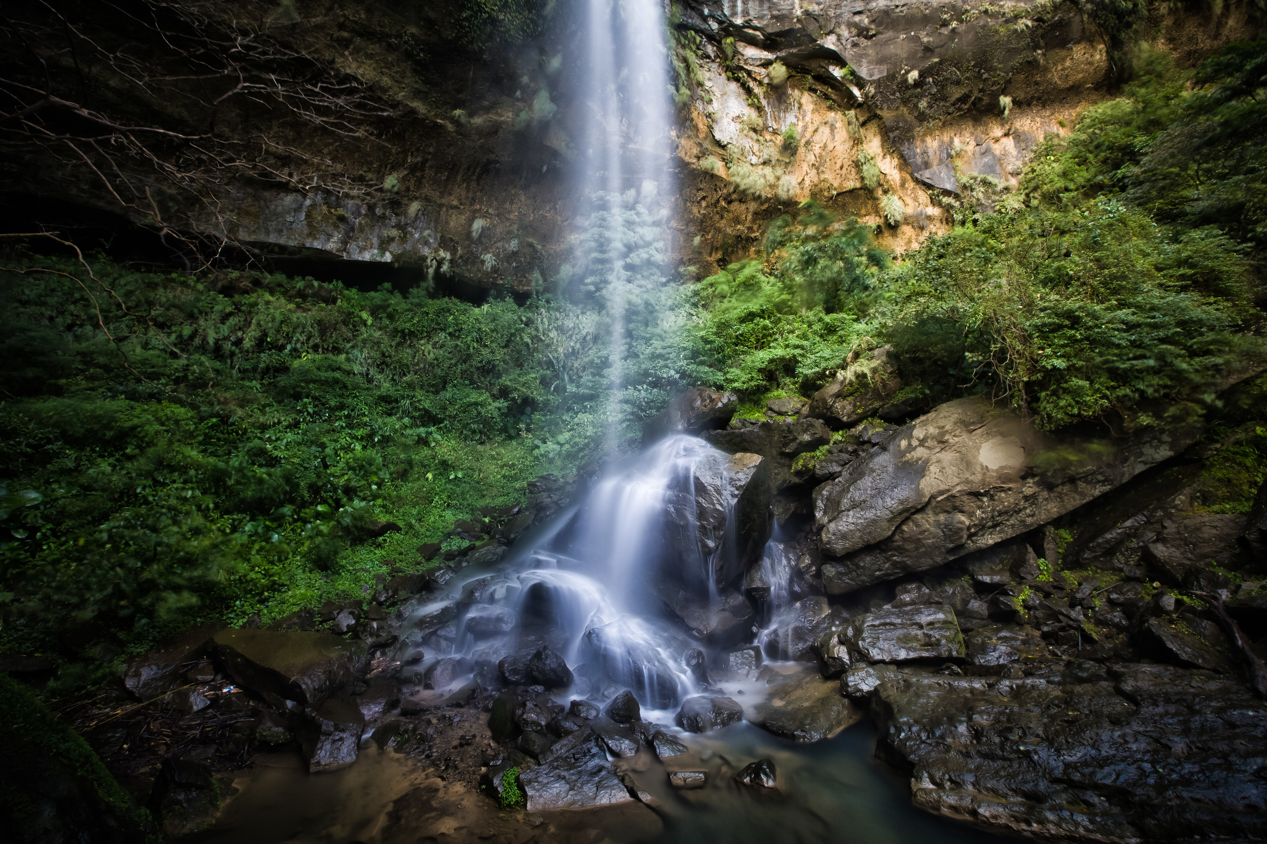
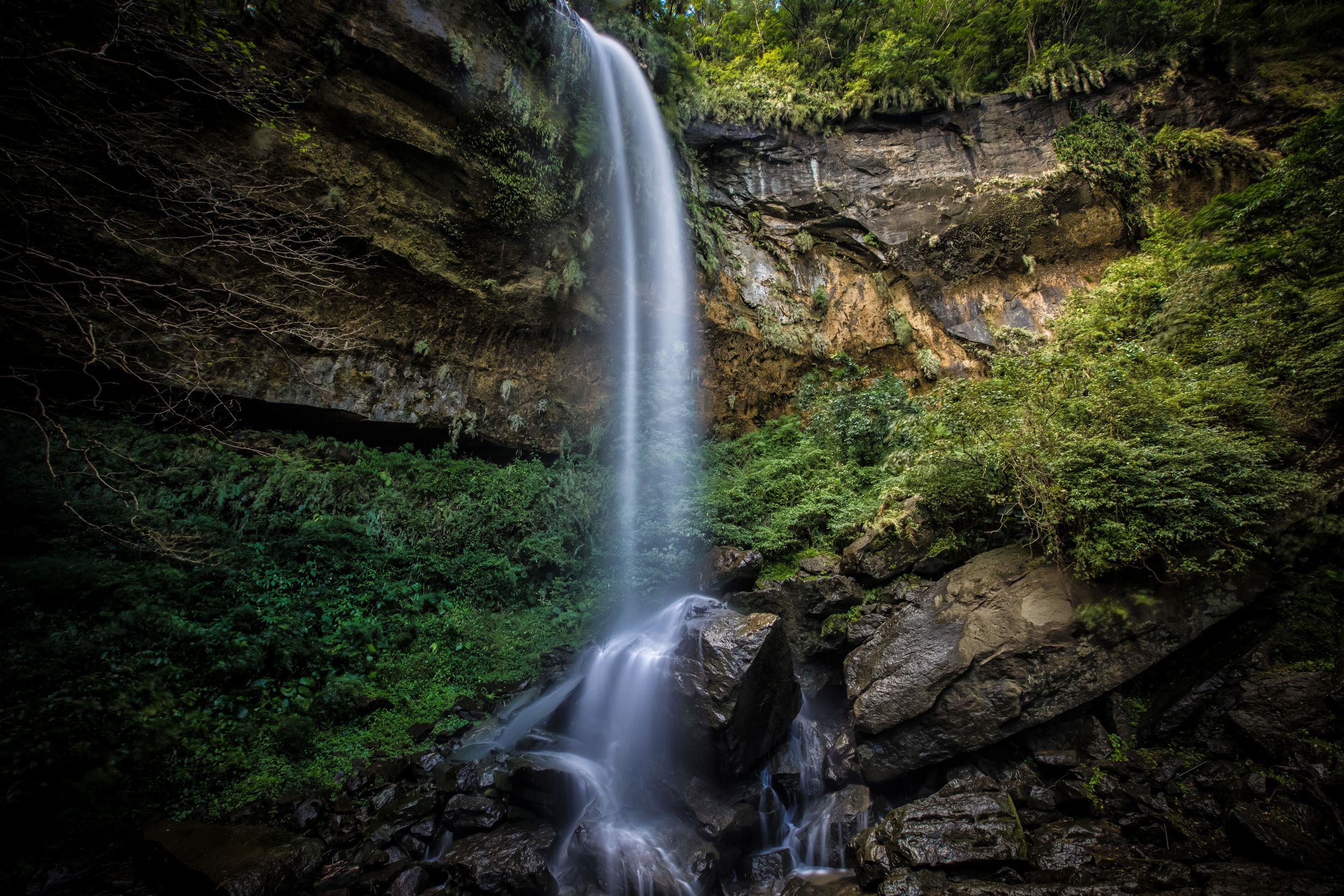
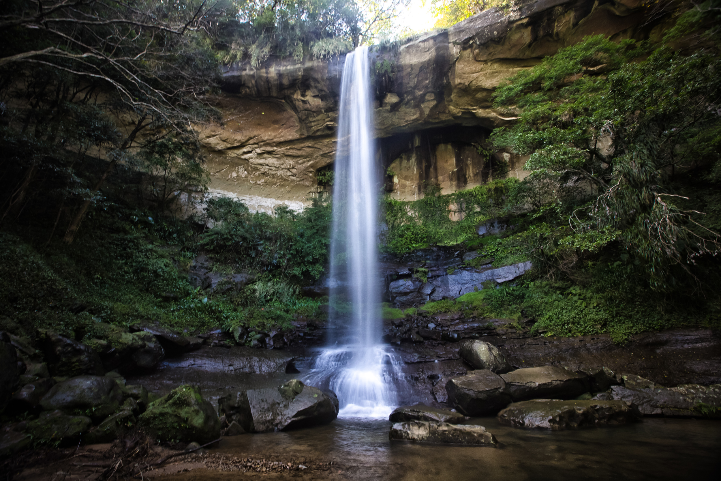
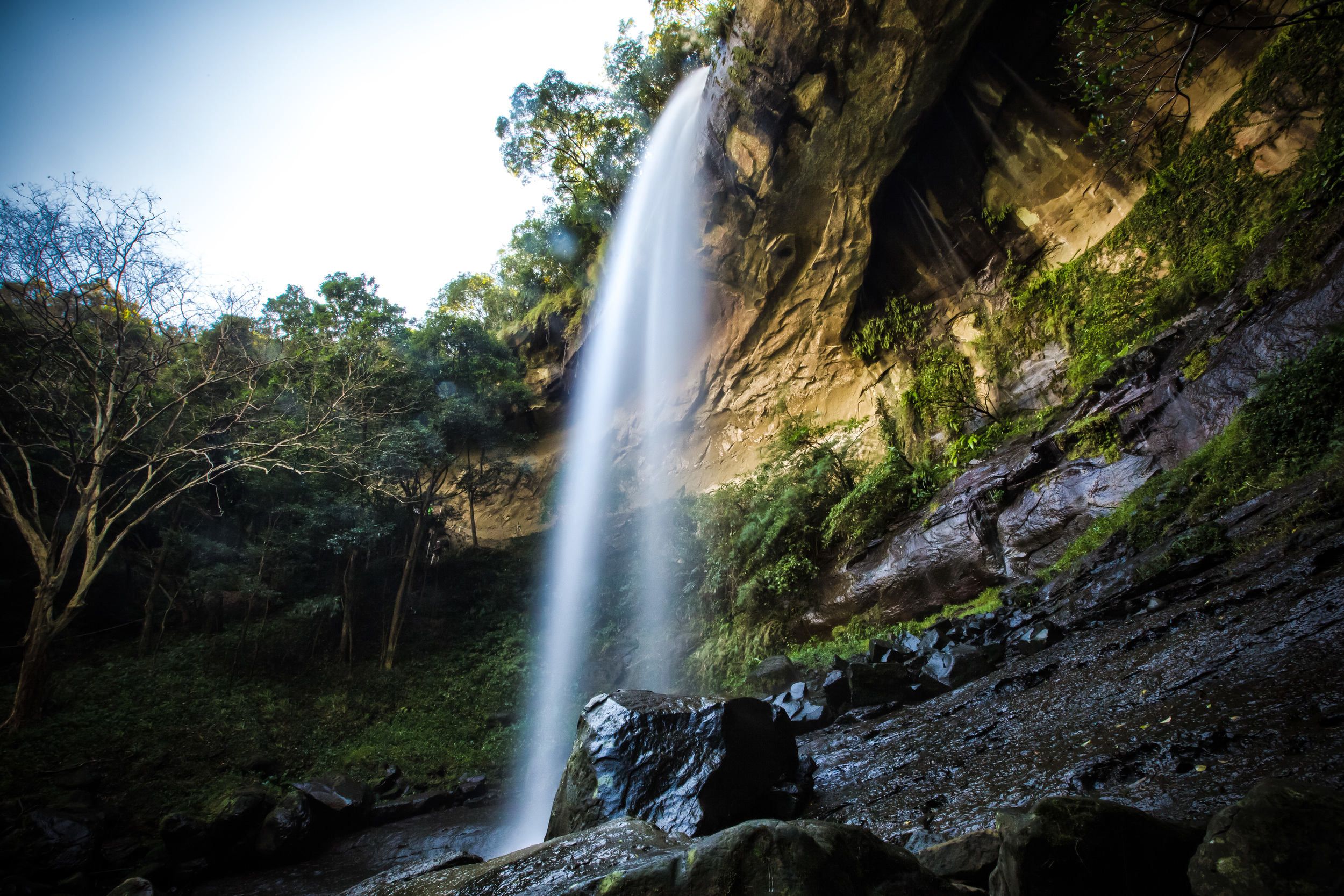
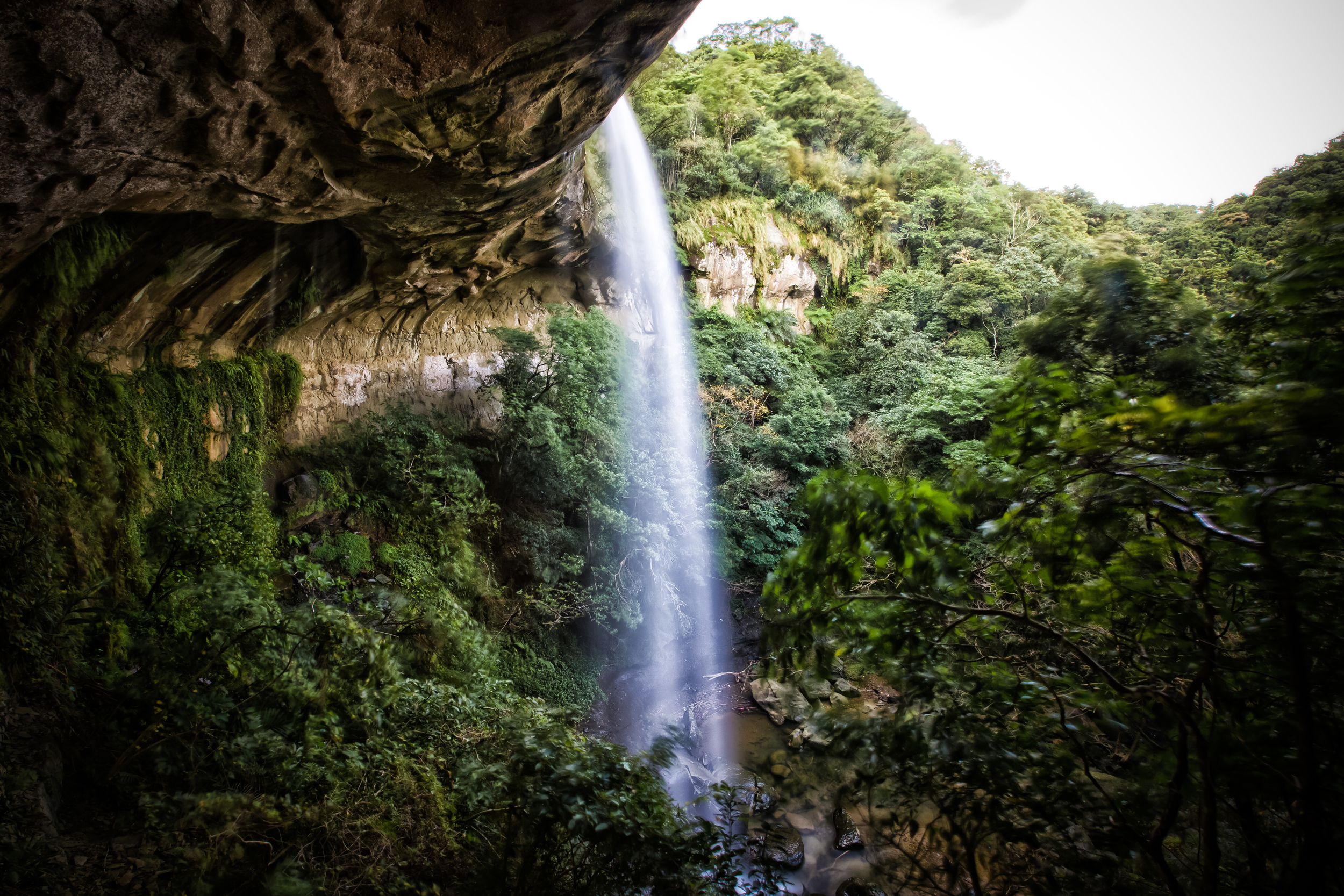
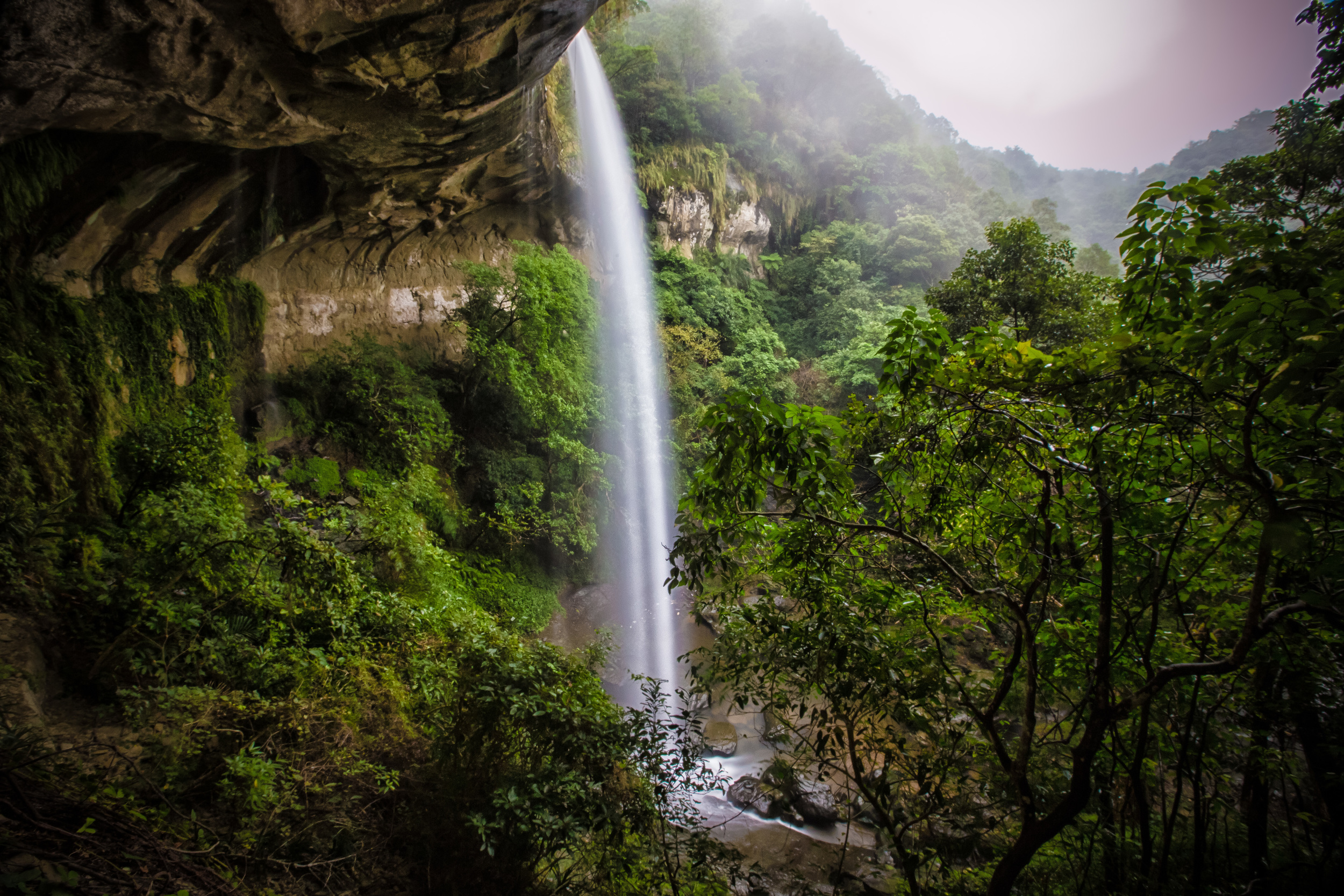
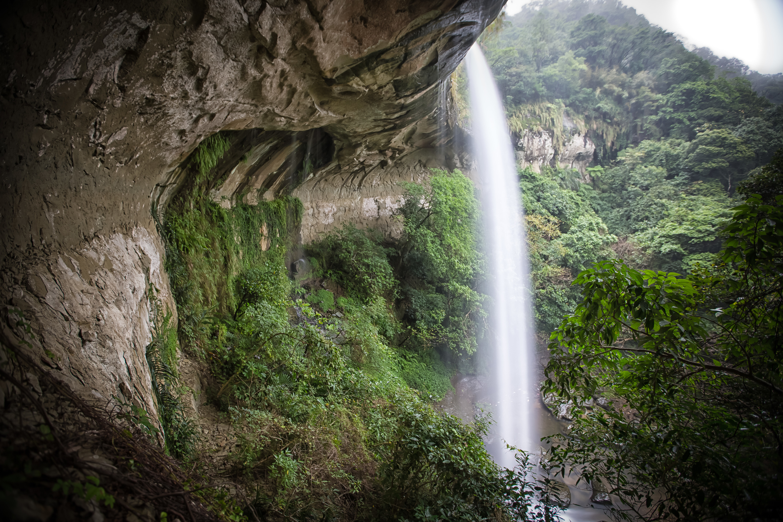
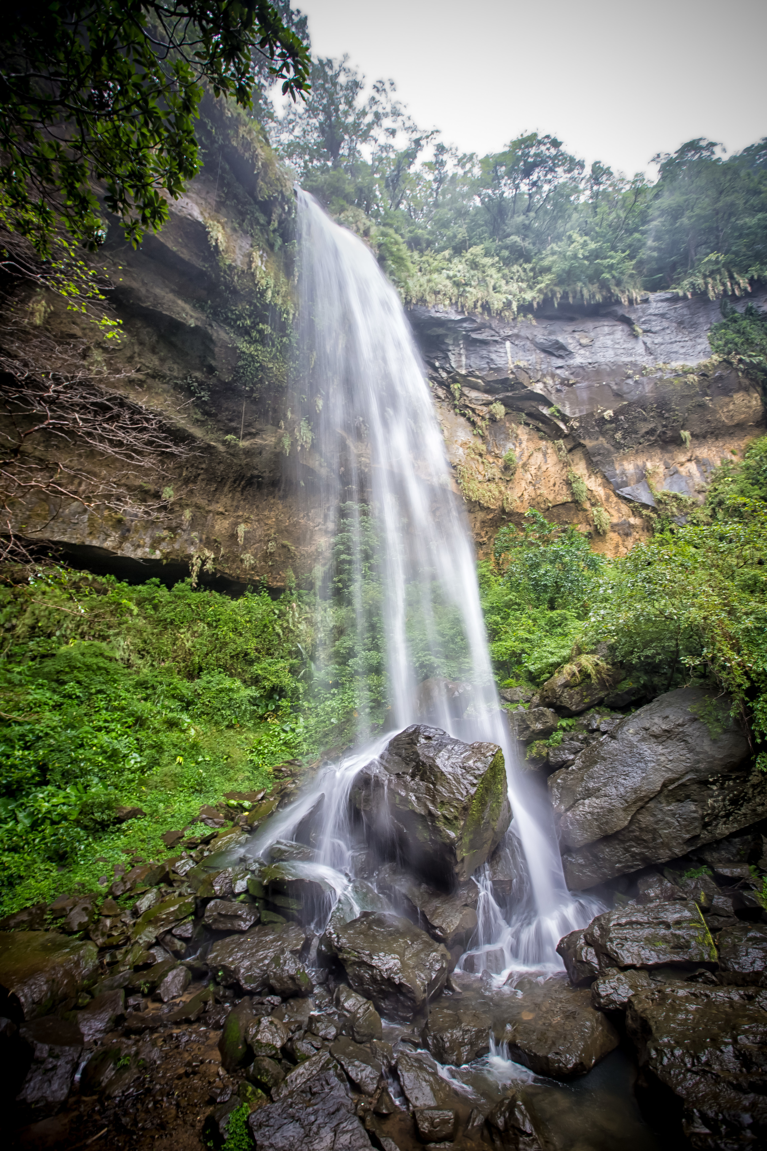
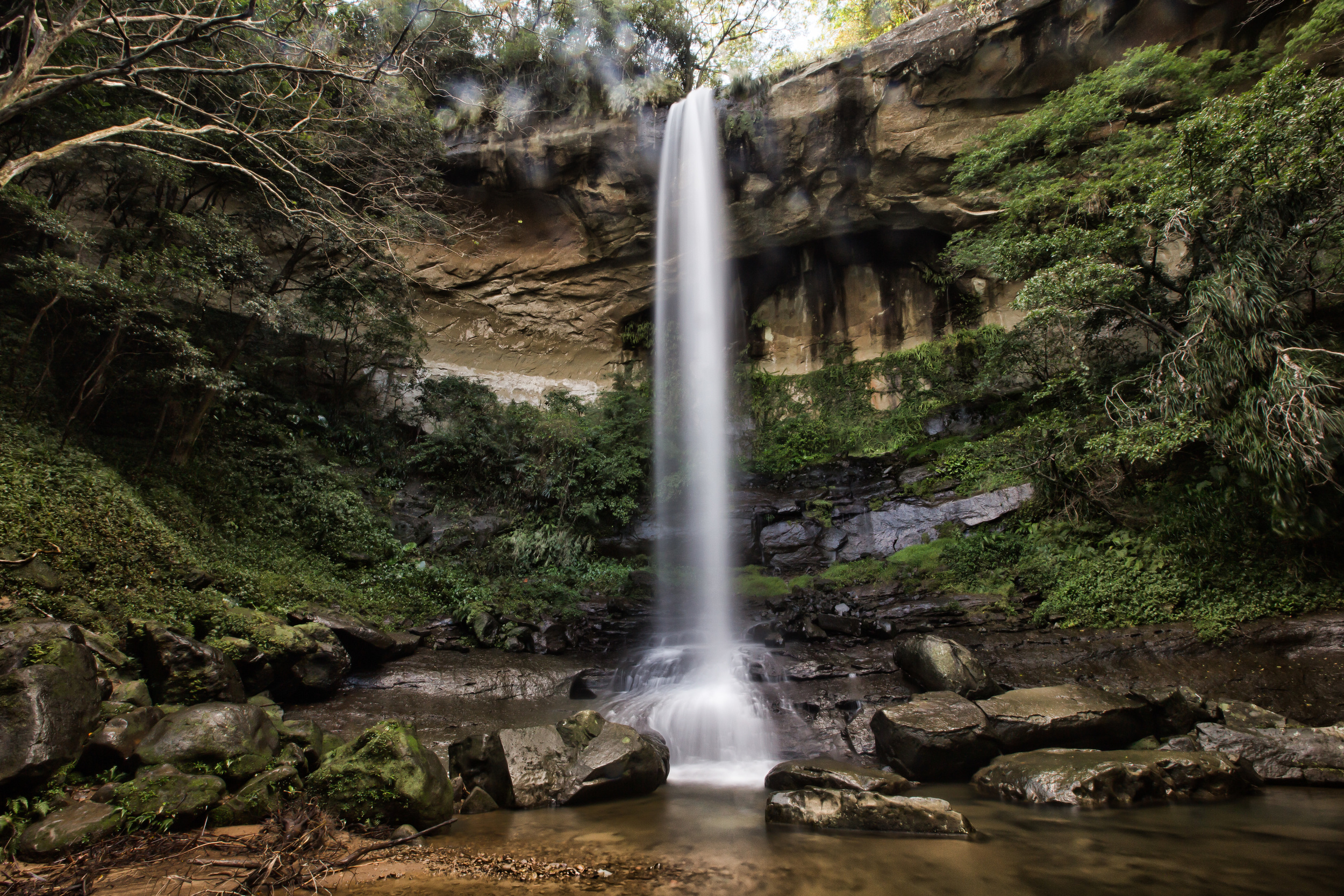
After passing the Hegu falls it is only about a short 10-20 minute walk to the Motian waterfall (模天瀑布) which is probably my favourite of the three.
The Motian waterfall doesn’t have a lot of water flowing from it, but it falls directly on rocks piled up below it that creates a beautiful effect when you are taking long exposure shots. If you are river tracing, you can get a bit closer to the falls and wade around in the pool below it, but there is lots of signage discouraging you from doing that.
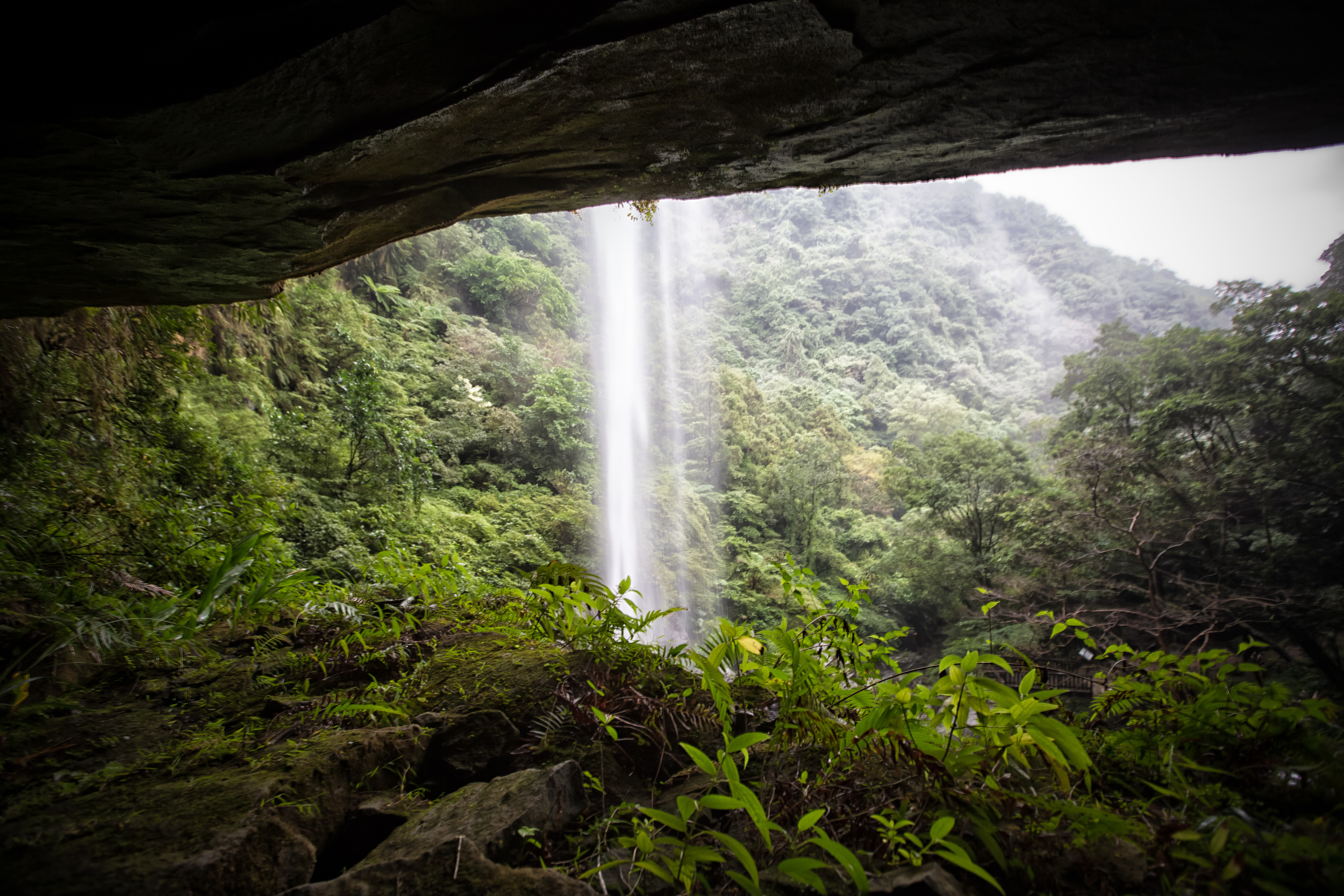
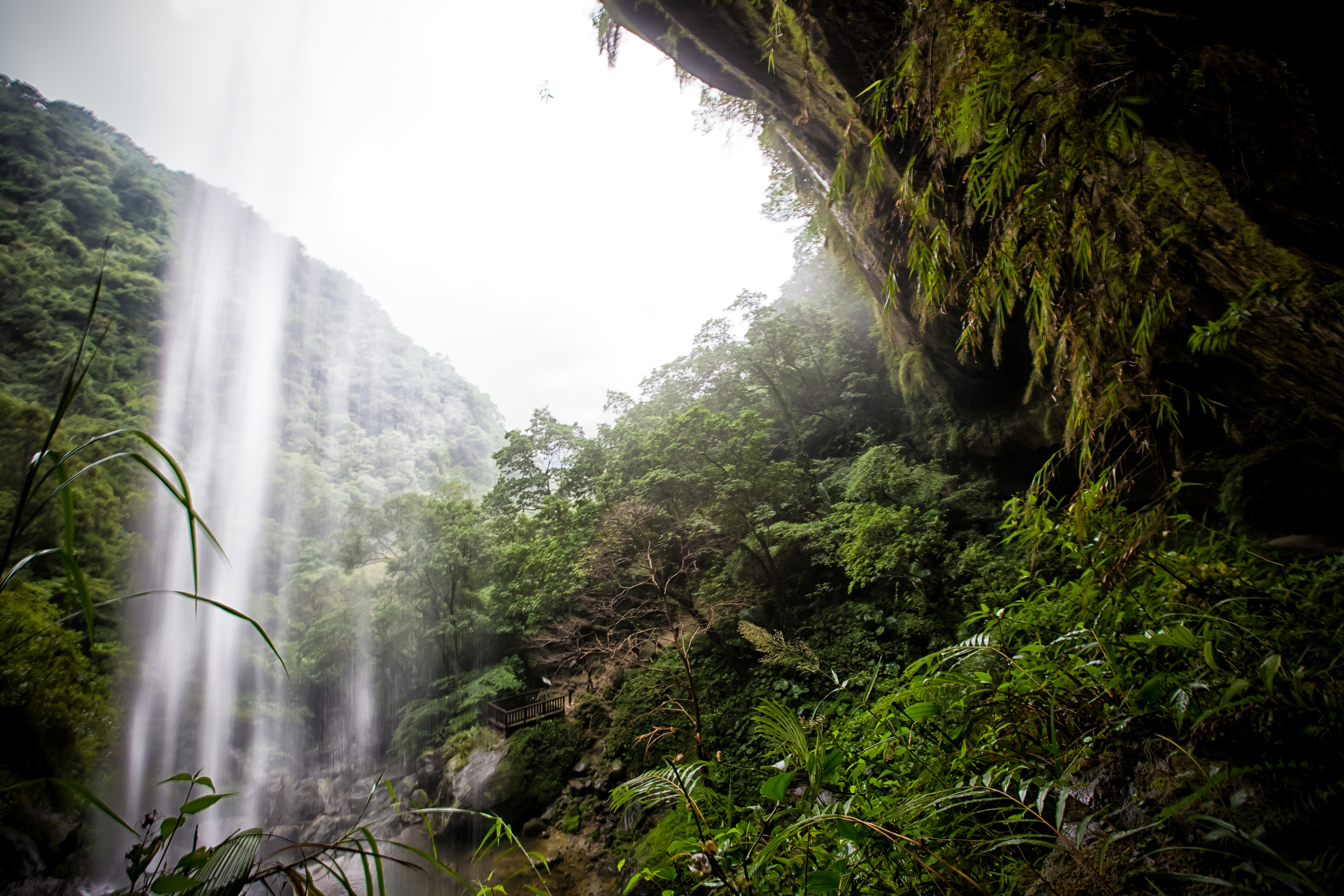
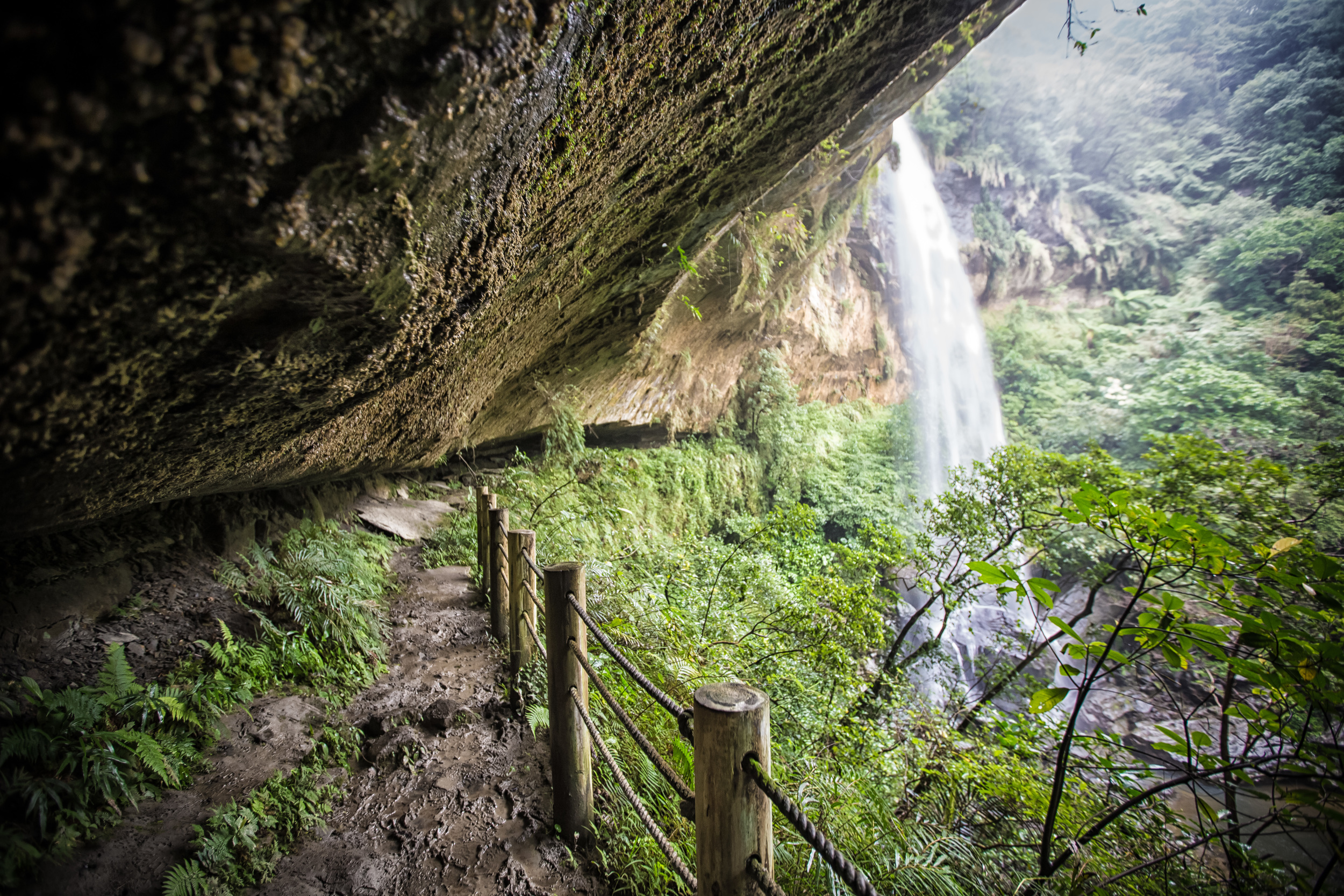
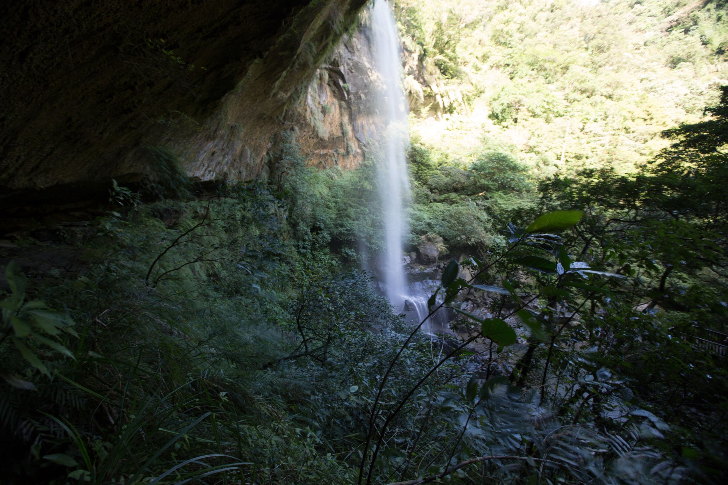
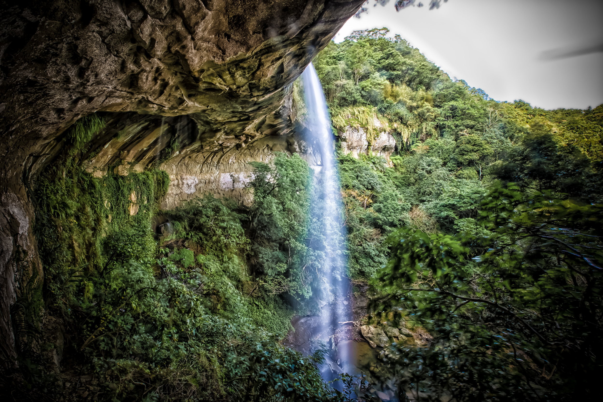
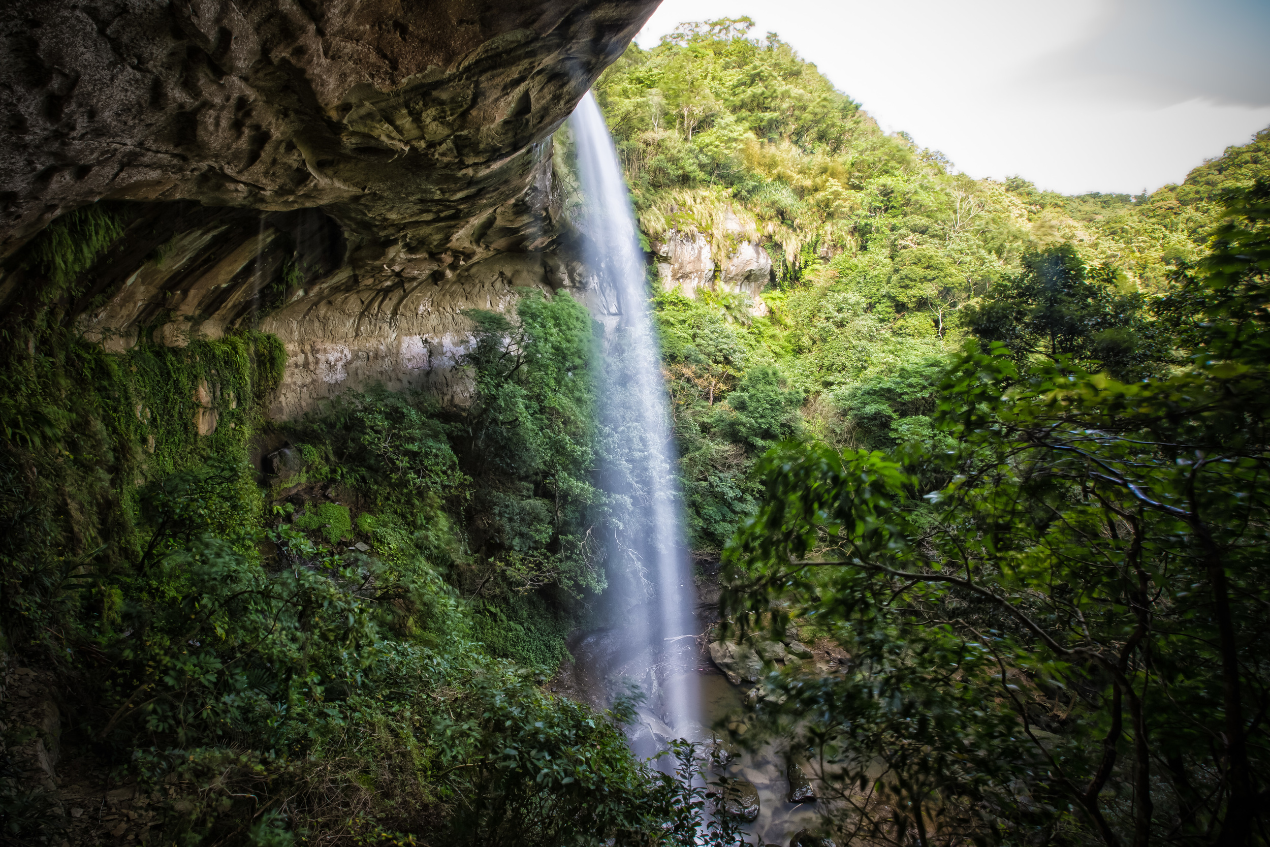
The Motian falls can be viewed from an observation deck at the base, but can also be viewed from somewhat of a cave behind the waterfall. The cave isn’t that high, so for me, a 181cm tall guy, I had to be bent over being really careful that I didn’t knock myself out on a rock above my head. It is well worth it though to stand or sit behind the waterfall and relax for a little while.
After the Motian waterfall is the Pipa-Dong waterfall (枇杷洞瀑布) which is actually just above the Motian falls. In the past, to reach the Pipa-Dong waterfall you had to climb up a mountain slope with some pretty slippery logs secured to the side of the mountain and ropes to pull yourself up with. This has recently changed though and there is now an elaborate system of metal stairs that were recently installed making the hike extremely easy (I was actually looking forward to climbing on the ropes)
After climbing the stairway it is only a short walk to the Pipa-Dong waterfall, which is probably the best waterfall of the three if you wanted to have a little swim. If the weather is good you can easily cross the small river and on the other side its much easier to get closer to the falls for better pictures or to just relax beside them as the trail-side gets a bit congested with hikers on busy days.
There is a ridge next to Pipa falls where you need to climb up if you plan on continuing your hike. I climbed up to the ridge because there was a vantage point that was pretty awesome for taking shots of the waterfall.
From the ridge you either have to decide on going back the way you came, or continuing on and finishing the trail which takes you out for a walk along the tracks between the Dahua train station (大華火車站) and the Shifen Train Station (十分火車站.)
Both times I went, I drove, so it was pointless for me to finish the trail as it would take me no where near where I needed to be, so I just went back the way I originally came.
Now that I mention it, you might have noticed that my photos are actually from two different trips to Sandiaoling. I originally went in the middle of November and when I arrived it was raining cats and dogs. That didn’t really deter me as I was prepared for the rain - as Pingxi is notorious for getting a lot of it.
The hike was amazing that day, but it proved to be extremely difficult getting the shots I wanted when I couldn’t keep my lens dry. When I got home and saw all the files on my computer I was a little disappointed. So, I decided to go back again when I had a chance.
Luckily the weather was great at the end of the month, so I made my way back.
The second time I did the hike, it was just as amazing, but it was much easier to get the shots that I wanted and the day was unusually sunny and hot for the end of November.
Due to the recent improvements on the trail, it seems that the hike has become much more accessible to almost anybody who wants to try it.
Men, women and children of all ages and fitness levels should able to take a day trip to Sandiaoling and enjoy a bit of nature without suffering too much.
Make sure to bring enough water, and very importantly for my Taiwanese friends - Wear appropriate footwear. Don’t wear that new pair of 4000NT sneakers you just bought - proper footwear (probably gore-tex hiking boots) are a necessity for this hike as you’re likely to encounter mud and streams along the path.
I highly recommend making a day-trip out of the Sandiaoling waterfall trail - if you’re a hiker, there are obviously more challenging hikes in the area, but this one is all about enjoying nature. If you’re not a hiker, don’t be intimated - you can easily enjoy the hike and when you finish you’ll feel a sense of accomplishment that may spurn your interest in a whole new hobby!
Map / Location
Gallery / Flickr (more shots on Flickr)