Landscape

Jökulsárlón Glacier Lagoon

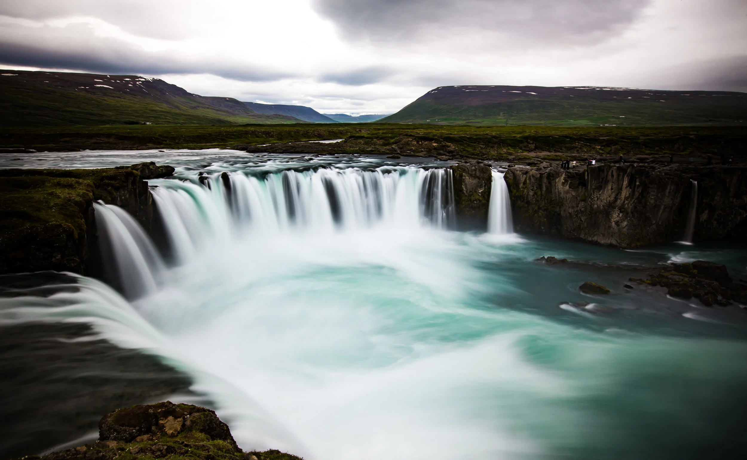
After the first few days of travelling in Iceland, I was starting to get a bit tired of waterfalls. It seemed like every stop along the road was a bigger more beautiful waterfall than the one that preceded it.

Don’t get me wrong, I’m a big fan of waterfalls, but Iceland is certainly packed full of them.

That was of course until we reached the Southern Coast and started to enjoy the spectacular views of the ocean on one side with and giant mountains and glaciers on the other.

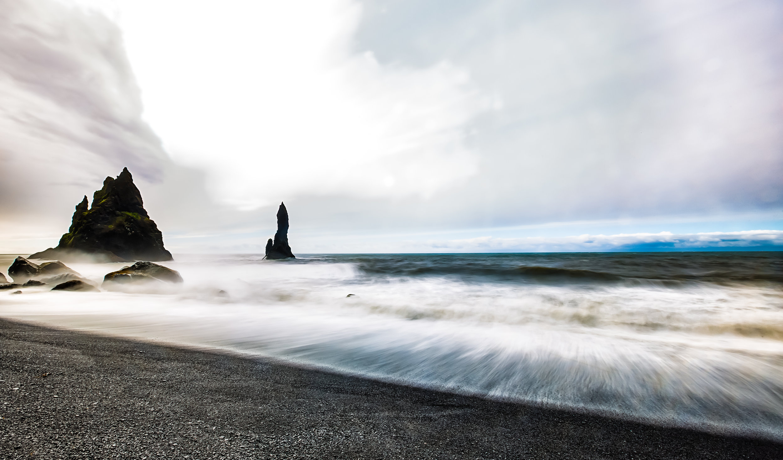
Even though a few of our stops along the Southern Coast of the country did include some waterfalls, the most memorable were the stops in places like the Dyrhólaey Lighthouse, Kirkjufjara Beach and the beautiful black sand Reynisfjara beach.

While each stop was picturesque and enjoyable, I don’t think any of them could have compared to our stop at the breathtakingly beautiful Jökulsárlón Glacier Lagoon.

I’m not exaggerating when I say that no amount of adjectives could really describe how we felt when we parked our car at a random parking lot along the highway, climbed up a small hill and discovered the prize hidden behind it.

It was one of those moments in life where your heart skips a beat and you feel so happy to be alive.

So, let me set the scene for you.

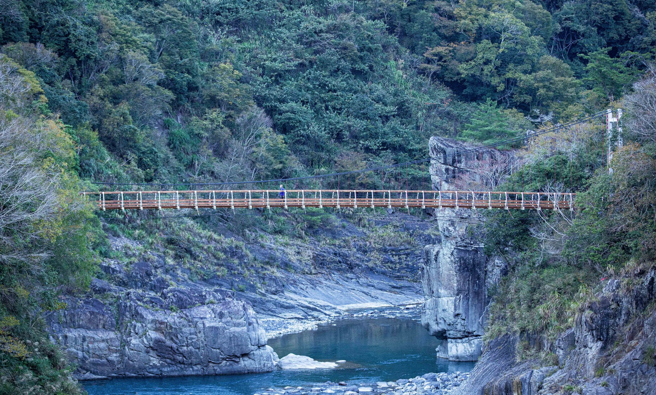
I was driving the car along the Southern Highway, it was late in the evening and we had just finished visiting Skaftafell National Park where we got up close to the Svínafellsjökull Glacier and then spent a few hours hiking to check out Hundafoss and Svartifoss.

We were a bit tired and were in somewhat of a rush to get to our hotel when I pulled into one of the many makeshift parking lots next to the road. I figured we wouldn’t spend much time in this spot, so I grabbed my camera and left my camera bag full of lenses and my tripod in the car.

We slowly climbed up the hill that acts as a barrier between the lagoon and the highway and once we got to the top our jaws dropped with the sheer beauty of what we saw.

Then, with a much quicker pace we walked back down the hill to where we parked the car and grabbed all of our camera gear - This wasn’t going to be a place where we would just be spending a few minutes taking photos.

The Glacier Lagoon

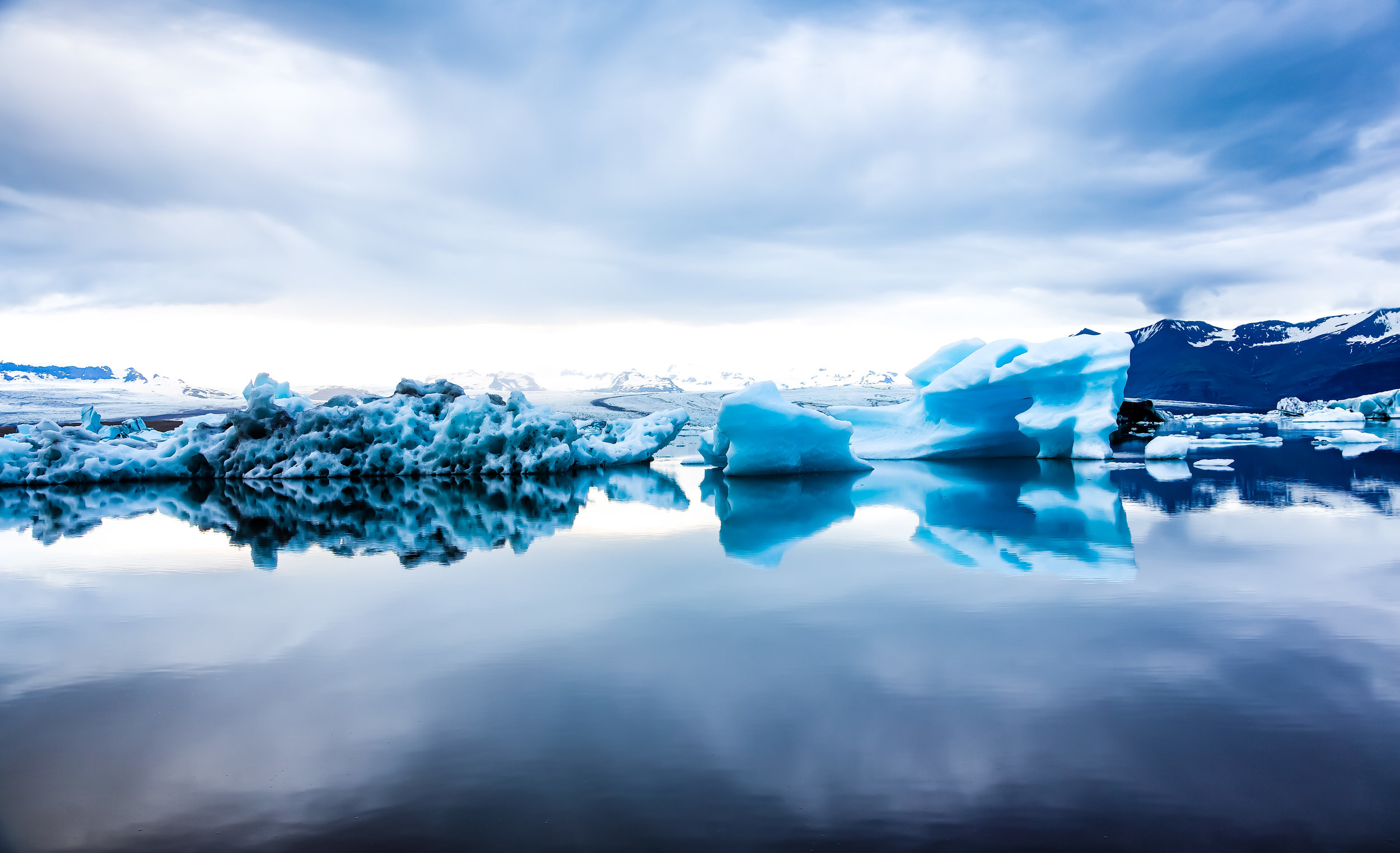
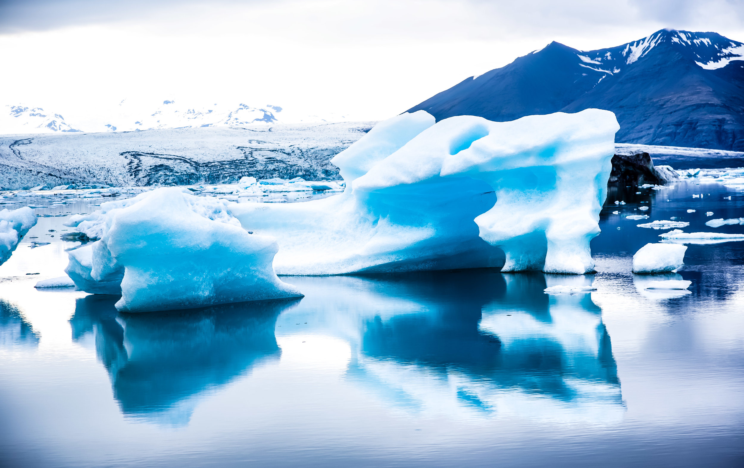
A popular location for tourists, photographers, nature lovers and filmmakers, Iceland’s Jökulsárlón Glacier Lagoon is widely regarded as one of the country’s most stunningly beautiful locations and attracts thousands of visitors every year.

The beauty of the lagoon is undeniable, but there is also a certain irony as its existence which should also serve as a reminder of the catastrophic effects of global warming and the damage we have done to our planet.

The lagoon formed in the early 1900s when the Breiðamerkurjökull Glacier started to retreat - Since its formation almost a century ago, the the surface area of the lagoon has grown to almost four-times its original size with a currently size of 18 km².

The Breiðamerkurjökull Glacier which provides the lagoon with its icebergs and most of its water is an outlet of the much larger Vatnajökull Glacier. Together the glaciers form the largest of its kind in Europe and covers almost ten percent of Iceland’s total land area (8,100 km²).

Don’t let the size of the glacier fool you though, it is still retreating at an alarming rate with evidence that Breiðamerkurjökull alone has lost an estimated three square kilometres in land mass over the last century.

Most alarming is that the less than a century old glacial lagoon has become Iceland’s deepest lake with a current depth of around 248 meters - all of which used to be composed of ice.

The icebergs that float around in the lagoon are chunks of the glacier that have broken off due to rising temperatures. Those huge chunks of ice that float around in the lagoon are often more than a thousand years old and once they’ve broken off from the iceberg more or less float around in the lagoon for around five years before they are eventually small enough to float out to sea.

Even though most of the water in the lagoon comes from the melting of the glacial ice, salt water is also mixed in as the lagoon has a river mouth that meets up with the Atlantic Ocean. The mixture of fresh and salt water allows for a large variety of fish (salmon, herring, trout and krill among others) to swim upstream and settle in the area.

The large supply of fish in turn makes the lagoon an ideal feeding ground for migratory sea birds and seals, both of which can be seen hunting for food.

Another feature of the mixture of fresh and salt water is that it transforms the icebergs into either a milky shade of white or into a bright blue colour.

The bright blue icebergs in particular which appear almost diamond-like become even more beautiful once the icebergs become small enough to float out to sea through the river mouth. Once they float out to sea they’re often pushed back into the shore which has created an additional attraction that has become known as the Diamond Beach.

When visiting the lagoon there are a few things you’ll want to keep in mind:

The first thing is that no matter what season, the water is extremely cold. If you climb down the hill to the shore, be very careful not to get too close to the water. Full body exposure to the water for less than a minute is enough to turn you into an iceberg.

The second thing you’ll want to pay attention to is where the sea-birds are nesting. The birds tend to be very territorial and they are not afraid of humans. If you get too close, especially if they’re nesting you may get swarmed.

You’ll also want to keep in mind that drone photography is strictly prohibited in the area.

There are many places around Iceland where drones are banned but here at the lagoon it’s important to keep in mind that flying a drone is dangerous and will interrupt the nesting and feeding of the birds. As mentioned above, the birds are extremely territorial and are likely to attack, so if you care about your flying camera, you may want to leave it in its case while visiting.

Getting There


The Jökulsárlón Glacier Lagoon is around a 370km drive (around 4.5 hours) from the capital city of Reykjavik.

Situated about halfway between the southern towns of Vik and Höfn, getting to the lagoon is quite simple as it is just a stop along the southern highway.

It probably isn’t really a suitable destination for a day-trip out of the capital but if you are spending any time on your trip to Iceland in the southern portion of the country you should definitely make a stop.

If you’ve decided that you’re not going to bother renting a car while visiting Iceland, you’re going to have to rely on public transportation to get to where you want to go. There are tours out of the capital offered by tour groups like Reykjavik Excursions which offer tourists access to several different destinations. It is important to remember that if you want to book a tour that you should do so well in advance as the seats on the daily tours tend to fill up quickly.

Checking out the lagoon on your own is of course free of charge with free parking as well but you may also want to consider some of the boat tours of the lagoon offered by some of the various tour operators in the area.

If your trip to Iceland doesn’t include the southern portion of the country, you’re really missing out - Some of the most breathtaking sights you’re going to see are located in the south and this glacier lagoon might just be the icing on the cake. I’m not sure that photos could really do this place the justice it deserves - You have to see it with your own eyes to truly appreciate how beautiful and peaceful this glacial lagoon is.

Of all the destinations in Iceland, this one should be at the top of every travellers list.


Reynisfjara (Black Sand Beach)

For most travellers, a white sand beach vacation is just what the doctor ordered after a long and stressful year of work. Travel Agencies all over the world offer attractive vacation packages that allow weary travellers to simply hop on a plane and be transported to a beautiful beach resort - where all they have to do is lay around, eat, drink and relax.

Having visited the beautiful beaches of Boracay, Bali and Palau (among others), I can certainly attest that this style of vacation helps to recharge the soul and even though its not the sort of trip that I typically prefer to go on, I can certainly understand why people are so fond of them.

If you’re looking to relax on a beach its unlikely that Iceland is going to be on the top of your list of destinations - The small island nation in the North Atlantic isn’t exactly known for its beach-resorts.

Instead it is a nature lovers paradise where visitors spend their precious vacation time time in awe of giant glaciers, steaming volcanoes, massive waterfalls and the spectacular Aurora Borealis.

Nicknamed the ‘Land of Ice and Fire’, the country is known more for its geo-thermal hot springs and spas than it is for beaches, but you might be surprised to learn that Iceland is home to one of the top-ten (non tropical) beaches in the world!

Just don’t expect to go for a swim.

Southern Iceland’s ‘Black Sand Beach’, known to locals as Reynisfjara is one of the country’s top attractions and for good reason - It is one of the prettiest beaches you’ll ever have the luck of visiting.

Black Sand?

Why is the sand at Reynisfjara ‘black’ while most of the worlds other beaches have either golden, brown or white sand?

Well, thats actually quite simple to explain.

The beach is located near the very active Katla Volcano. The lava from each of its eruptions flowed down from the mountain eventually reaching the coast. This allowed for the formation of basalt rocks when the lava met with the frigid temperatures of the North Atlantic.

With each of Katla’s eruptions, the topography in the region changed and the land area also expanded - so much that thousands of years ago this beach didn’t even exist.

The “sand” that you’ll find on the beach is actually more similar to fine rocks and pebbles than the finely grained sand that you are used to on other beaches.

The supply of this special black sand howeveris constantly being replenished thanks to the volatility of Katla which is in a constant state of activity.

The Reynisdrangar Basalt Columns and Folklore

For travellers, the beach is highly regarded as one of the most beautiful in the world - Locals on the other hand hold Reynisfjara in high regard not only for its beauty but for some supernatural events that (they’re convinced to have) occurred there once upon a time.

Local folklore tells of two different stories that attempt to explain why the beach looks the way it does with the beautiful basalt columns at the far end.

Icelanders debate about which myth is the most accurate but everyone agrees that the common feature of both is that trolls were most definitely involved.

If you’re unaware, trolls are basically the bane of every Icelanders existence.

These trolls, unlike their internet counterparts however are quite dangerous.

The first legend tells of a husband whose beloved wife was kidnapped and murdered by two of these dangerous trolls.

The husband, seeking vengeance pursued the trolls to Reynisfjara and somehow froze them as they attempted to escape to sea.

How he froze them, I can’t really tell you but I’d like to think that it was by the power of love.

The second legend tells of a group of trolls who lived in the caves on the beach and terrorized ships that passed by.

The trolls were not only greedy but a bit daft, so one day when they went out to sea to attack a ship they lost track of time.

When the sun came up, they were turned to stone on the spot - unfortunately the ship and the people on it were turned to stone as well.

Link: Folklore in Iceland  

In actuality the ‘Reynisdrangar basalt columns’ were not formed by the nefarious activity of trolls but are naturally occurring and were at one time connected to Reynisfjall mountain.

Thousands of years of weathering and sea erosion has submerged part of the mountain making the columns seem as if they are disconnected from the mountain by a patch of ocean.

Reynisfjall Mountain and Hálsanefshellir Cave

Reynisfjall Mountain, which is located next to the beach is a 340 meter (1115 ft) tall mountain that is at least five kilometres in length and about 800 meters wide.

The mountain is most well-known for its pyramid-shaped cliff of basalt columns which look like they were sculpted by hand rather than by the work of Mother Nature.

The columnar joints on the side of the mountain, known to locals as ‘Garðar’ are one of the most popular locations for taking selfies in Iceland and were even featured in an episode of the Game of Thrones.

You aren’t likely to find trolls making their homes in the mountain, but it is important to note that the mountain is a nesting ground for various species of seabirds. Depending on the season you might see fulmars, guillemots and if you’re lucky some puffins!

On the beach you are bound to come across the beautiful ‘Hálsanefshellir Cave’ which is just a small cavern in the mountain.

The interior of the cave looks a bit like the basalt columns on the outside and is a great place to escape when the winds get too high and you’re feeling cold.

Be careful not to stay in the cave for too long though, you could get trapped inside during high tide!

Tips and Safety Considerations

 There are some important things that you’re going to want to keep in mind while visiting.

You’ll likely notice a warning sign before you’re able to walk onto the beach. Pay close attention to all of the warnings.

This isn’t a place where you’re going to want to have an unfortunate accident.

  • You can’t swim at this beach. Even if the frigid water doesn’t bother you, the water is extremely dangerous and there have been quite a few unfortunate accidents in recent years.

  • You may feel like you are standing a safe distance away from the water, but the ‘sleeper waves’ at this beach are as sneaky as they are dangerous. Stay at least thirty meters from the water and make sure that you are constantly aware of your surroundings. Don’t turn your back to the ocean.

  • Some travellers may think that its okay to get close to the water but something most people don’t ever consider is that when the waves pull back into the ocean they pull back with even greater force. This means that’s the water will drag out even the strongest of us. If you get pulled out with the water its not likely anyone will ever see you again.

  • If you are travelling with children, make sure to keep an eye on them at all times.

  • There is no one on duty, no lifeguards, no security guards, no tourism officials. You’re on your own if something unfortunate happens!

  • There is a small cafe next to the parking lot. Parking is free but if you want to use the restroom you’re going to have to pay a small fee to get in.

  • The food in the cafe is quite expensive, so you’ll probably want to have a lunch packed.

  • Make sure to pack a down jacket as it tends to be very cold and extremely windy on the beach. Likewise you’re going to need sturdy footwear to walk on the beach.


The beach, which is located near the country’s southernmost village Vík í Mýrdal is about 180 km (110 mi) from the capital of Reykjavik.

If you are driving from the capital you can expect about a 2.5 hour drive along the Ring Road.

There is lots of signage along the way, so its not likely that you’ll need to use GPS to find your way.

If you’ve decided that you won’t bother renting a car while visiting Iceland, you’re going to have to rely on public transportation to get to the waterfall. There are tours out of the capital offered by tour groups like Reykjavik Excursions which offer tourists access to several different stops for around $100USD. It is important to remember that if you want to book a tour that you should do so well in advance as the seats on the daily tours tend to fill up quickly.

If you are visiting the beach you’ll also want to visit other attractions like Skogafoss, Seljalandsfoss, the Dyrhólaey Lighhouse and Kirkjufjara Beach which are all a short distance away from the beach and the small village of Vik.


Jiantan Mountain (劍潭山)

Taipei is a city that is blessed to be nestled in a space that is almost completely surrounded by mountains.

The city’s mountains not only help determine its comfortable climate but also protect it from the disastrous typhoons that often blow in from the Pacific Ocean.

While the mountains serve an important role for the natural environment, in the eyes of its residents the most important role the mountains play might be to provide spaces for recreation and weekend getaways!

Taipei’s mountains are often filled up with locals wanting to escape the city for a bit of exercise and to spend a bit of time enjoying the beautiful natural environment.

The city government has done an amazing job over the years developing and maintaining countless hiking routes throughout many of its mountainous areas - All of which offer residents a safe place to hike without ever having to worry about getting lost.

If you are a visitor in Taipei there are a multitude of options to choose from when you are looking for a place to enjoy the natural environment.

Guide books and travel blogs often point tourists to the same few destinations - most notably Xinyi District’s “Elephant Mountain” (象山) for the views of the city - But that means your hiking experience is likely to be one that is shared with hundreds, if not thousands of other people and when you have to compete with others for a selfie on a mountain, you’re probably not really able to properly enjoy nature.

What most tourists may not realize is that there are several trails around the city which offer similar or equally impressive views without having to wait in line to take a photo.

One of those hikes that offers such a perspective is a trail on the northern side of the Keelung River that in recent years has become a popular alternative for photographers and instagrammers wanting to avoid large crowds and a bit of fresh air.

Jiantan Mountain (劍潭山)

Most travellers who come to Taiwan are likely to be familiar with the Jiantan MRT Station (劍潭捷運站) as it is home to the Shilin Night Market (士林夜市), one of Taipei’s most well-known tourist stops.

It isn’t likely though that they’re aware that the station gets its name from the mountain that runs parallel to the station and is located on the opposite side of the night market.

Jiantan Mountain isn’t exactly what you’d consider a ‘high’ mountain - it’s only 153 meters above sea level - it is however a historically important one.

Today the mountain is home to the Grand Hotel (圓山大飯店) and numerous temples and recreation areas that were constructed over the past few decades.

During the Japanese Colonial Era, it was home to the Taiwan Grand Shrine (台灣神宮), the highest ranking Shinto Shrine (神社) in the country, but has unfortunately since been destroyed.

It is also home to the Water God Shinto Shrine (圓山水神社) which you can fortunately still see today.

When sovereignty of Taiwan was ‘relinquished’ to the Republic of China at the end of the Second World War the mountain became a military-controlled area in order to protect President Chiang Kai-Shek and his family who were staying in the Grand Hotel until their formal residence was completed.

Once the residence was completed the mountain continued to remain off-limits to the public as it was constructed at the base on the opposite side of the hotel and it was suspected that communists were roaming the areas attempting to assassinate the first family.

It is widely reported that there is a network of secret tunnels that litter the mountain between the official residence and the Grand Hotel which were constructed so that the president could safely escape in case of attack.

Taiwan was once a much different country.

In 1980, after more than three decades of being prohibited to the public, the mountain was opened up to the public and hiking trails were constructed.

I suppose if you wanted to look on the bright side, the lack of human activity on the mountain for those four decades preserved the natural environment and offered a home to many species of birds.

The 80’s though were a bit of a weird time for Taiwan as the economy was booming and people were looking for ways to spend some of their newfound riches. One idea that people came up with was to start laying concrete pretty much anywhere they could.

Jiantan Mountain was no exception and you’ll find that quite a bit of space was used to create recreational areas for people - most notably badminton courts - and temples.

Today the Jiantan Mountain Hiking Trail consists of a vast network of paths that range from short leisurely hikes to much longer day-hikes that span several city districts.

The hiking trails (for the most part) consist of well-developed paths that have lights which guide your way at night and trail markers which guide you to all of points of interest along the way and help to ensure that you won’t get lost.

The first few minutes of the hike tend to be the most difficult and steepest of the entire trail. Don’t let that scare you away - The rest of the hike is more of a brisk walk through the woods than an actual hike.

Within the first fifteen-to-twenty minutes you’ll arrive at the first ‘observatory’ which provides amazing views of the city and will definitely make you feel better about all those stairs you just walked up.

I’m sure for some people the view of the city from the first observatory might suffice, but you should definitely consider walking a bit further as the first platform doesn’t face the city while the others offer a much more direct perspective. 

After passing the first observatory the rest of the trail tends to even out and you will get great views of Shilin (士林), Beitou (北投), the Danshui River (淡水河) and Guanyin Mountain (觀音山) on one side with a wide-open view of the rest of Taipei, including Taipei 101 on the other side.

Soon enough you’ll arrive at the “Lao Di Fang Lookout” which has become the main destination for many of the people hiking the mountain in recent years.

From there you have the choice to either head back the way you came, continue along the mountain for a longer day-trip or to head down to street level to take a bus back to town.

One thing that you’ll want to note is that the markers on the trail give you an ‘estimated’ amount of time to arrive at each destination. Like most mountains in Taiwan, I’m not sure how they estimated the time intervals but what I can tell you is that you should definitely ignore them.

The estimated 180 minutes from the trailhead to the “Lao Di Fang” Lookout took me about thirty minutes - and its not like I was running. I think their estimations were primarily based on how long it takes 90 year olds with only one leg to climb the mountain.

Lao Di Fang Platform (老地方觀機平台)

Even though Jiantan Mountain has a “peak”, it is safe to say that the majority of people who hike the trail won’t even bother attempting to reach it.

The main attraction of the hike is a platform known as the “Laodifang Lookout” (老地方觀機平台) which allows for panoramic views of Taipei city - and of course is a popular selfie spot.

Lao Di Fang” loosely translates as “Old Place” and was an area frequented in the past by people who would climb the mountain for their morning exercises. It became a daily routine for a lot of them to hike to the area for morning Tai-Chi with spectacular views of the city. 

The platform is advertised primarily as a spot for watching airplanes taking off and landing at Taipei’s Songshan Airport (松山機場) but is also a great spot for checking out the city from the opposite side of the Keelung River with Taipei 101 flanked by mountains.

On a clear day you’ll have spectacular views of the city - but I’d caution you - Hike this mountain only when the weather is great. If your purpose for hiking this mountain is for taking photos of the city, you’ll be sorely disappointed on a day when the weather or air quality is terrible.

The first time I climbed the mountain to take photos for this post, the weather was great, but the air quality was considered “unhealthy” (AQI: 130) so when I reached the lookout I could barely even see as far as the river - Taipei 101 and the rest of the city were completely obscured by a thick cloud of haze.

Such is the case when you’re taking cityscape shots these days in many of the worlds large cities.

Photo Tips

I’m sure I don’t really have to say this but if you’re heading here hoping for night views of the city, make sure to bring a tripod so that you can take long exposures and stabilize your camera. If you’re not travelling with a tripod, it is possible to set your camera on the ledge of the platform and hope for the best but you may end up with a bunch of fails due to the fact that the platform tends to vibrate when people are walking on it.

You may also want to consider bringing a telephoto lens with you so that you can take closer images of Taipei 101 flanked by mountains.

Some of the photos you’re seeing here were taken with a 70-200mm lens.

The platform tends to be a popular spot, especially on weekends, so you may end up having to wait for a spot to get some photos - but your wait will be nothing compared to what has become extremely long waits at other spots.

Getting There


Simply take the Taipei MRT Red Line (紅線) to Jiantan Station (劍潭捷運站) and from Exit 2 cross Zhongshan North Road (中山北路) and make a right turn.

From there simply walk for a few minutes until you arrive at the trailhead.

The trailhead is a steep set of stairs with a traditional gate over it with a map of the trail to its left.

Next to the trailhead you’ll notice a small temple and another building that is equipped with public washrooms which is useful for washing your face and hands after the hike.

Save for the first few minutes, Jiantan Mountain is a relatively leisurely trail to hike and also offers visitors quite a few temples to visit as well as vistas for which to view the city.

Included in the hike you’ll discover a bit of Taiwan’s modern history as you pass by several abandoned military outposts which were once used to protect the president.

If you’re looking to take some beautiful cityscape photos, this hike offers several wide-open vistas which are equally enjoyable during the day and the night and requires very little time and effort but there is more of a focus on exercising and enjoying the peace and quiet of nature than you’ll get at some of the other popular tourist locations around the city.

An added bonus would be that your photos will offer your friends and family a bit different of this beautiful city than what you’ll see in guide books. If that interests you, you should definitely consider visiting Jiantan Mountain!