Travel

Thumb Mountain To 9-5 Peak (拇指山 - 九五峰)

So, you’ve hiked Elephant Mountain, you’ve got your epic travel selfie and some beautiful pictures of the city. Now what? Are you going to head back down the trail and onto your next destination? Or are you going to keep following the trail to see what you’ll discover? 

If you’re like most tourists, you’re probably coming to enjoy the view from the peak of Elephant Mountain and then you’ll head back down to ground level without ever really questioning what amazing things are waiting to be discovered further up the trail. 

If you ask me, thats quite unfortunate. 

So, I’ll let you in on a little secret - You should keep hiking. 

With a little more time and effort you’ll be rewarded with the opportunity to enjoy the view of the city from a couple more mountain peaks and will have the chance to take some beautiful photos of the cityscape while you’re at it. 

The topic of today’s post, if you haven’t already figured it out, is Thumb Mountain (拇指山) and what is known as 9-5 Peak (九五峰), two mountain vistas that are a short distance from Elephant Mountain and are an absolute delight to visit, if you give them a chance. 

The two peaks are located within the same network of trails known as “Four Beasts Hiking Trail” (四獸山) which also includes Elephant Mountain, Tiger Mountain, Leopard Mountain and Lion Mountain. Thumb Mountain and 9-5 Peak however are located at the highest portion of the trail and tower above all the others.

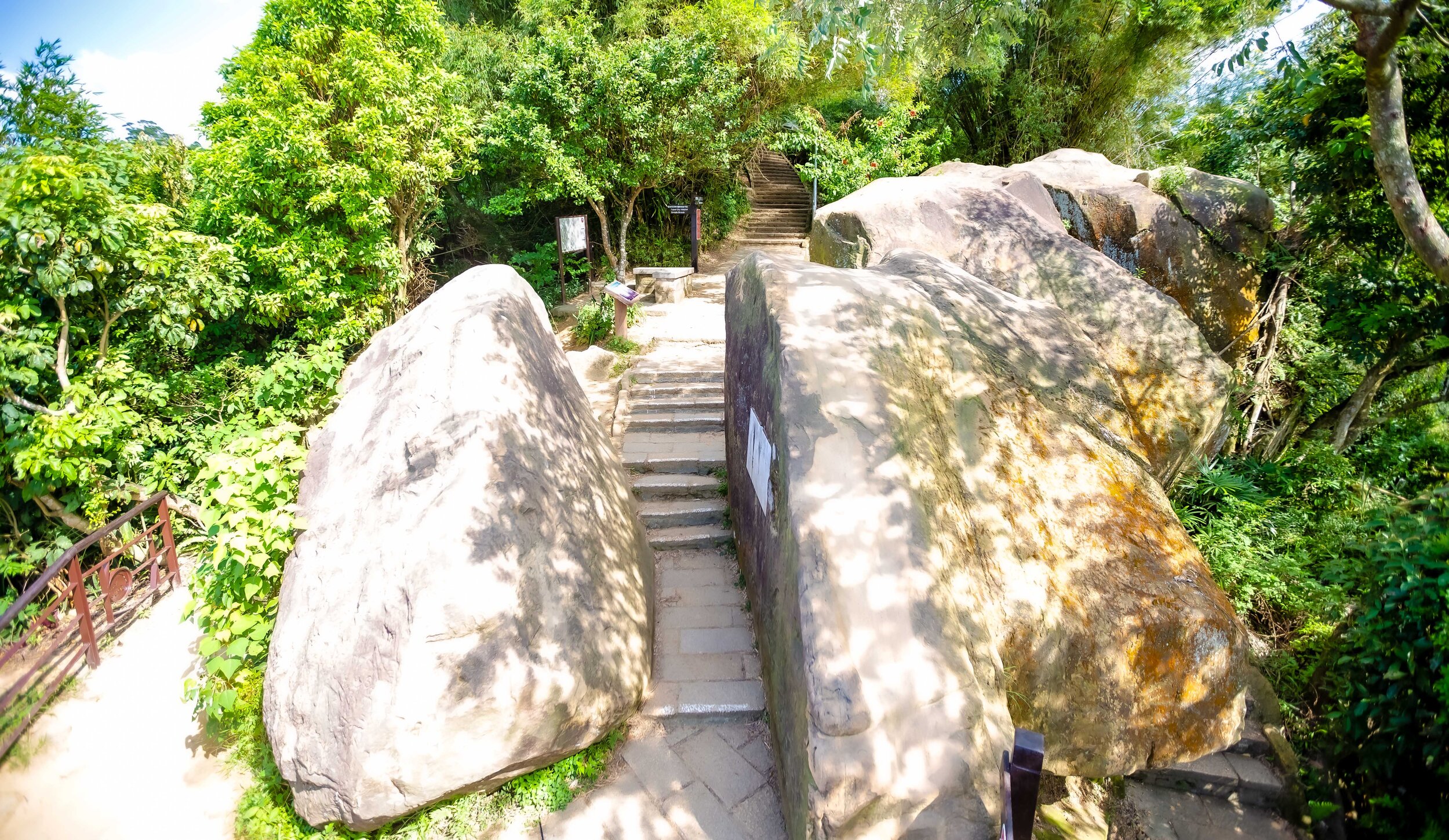
One of the great things about this network of trails is the way that they are set up allowing you to easily summit several different mountain peaks, with only a small amount of time and effort. The trails are also really well-developed, well-marked, well-lit at night and also provide hikers with washroom and water filling stations at various points throughout the hike. 

So, if you’ve hiked Elephant Mountain and feel like continuing along the trail, I’ll share another secret with you - You’ve already hiked the most difficult part of the trail. If you decide to continue hiking to Thumb Mountain and 9-5 Peak, you’ll be able to enjoy a leisurely walk through a beautiful Taiwanese tropical forest and will be rewarded with even better views of the beautiful Taipei cityscape. 

Thumb Mountain (拇指山)

Measuring at 320 meters in height, Thumb Mountain is one of the highest points on the Nangang Mountain range. While standing on top of its beautiful rock face however, you’d be hard pressed to care about that as it is the only peak on the trail that actually gives off the impression that you’re on the peak of a mountain. 

So why is it called “Thumb Mountain?” 

Well that’s simple, because it (apparently) looks like a thumb.

I suppose when you’re walking up the smooth rock face to the peak of the mountain, you could imagine that you’re walking up the back of someone’s thumb, but when it comes to seeing images in rock formations, I’m lacking in imagination. I suppose I might feel differently if I was flying a drone and saw it from above but I’m not here to argue about that.

Considering how well-marked the network of trails is, it is a bit strange that when you arrive at the entrance to Thumb Mountain, there isn’t a sign that points you in in the direction of the peak.

I recall that there used to be a sign, so I asked one of the experienced hikers on the trail what happened to it and they explained that a typhoon blew it away and it has yet to be replaced. This probably means that that a lot of people have been passing by the peak without even noticing. 

The trail to the top of Thumb Mountain is an off-shoot from the main trail and if you’re like most people you may end up walking past the entrance if you’re not playing close attention. 

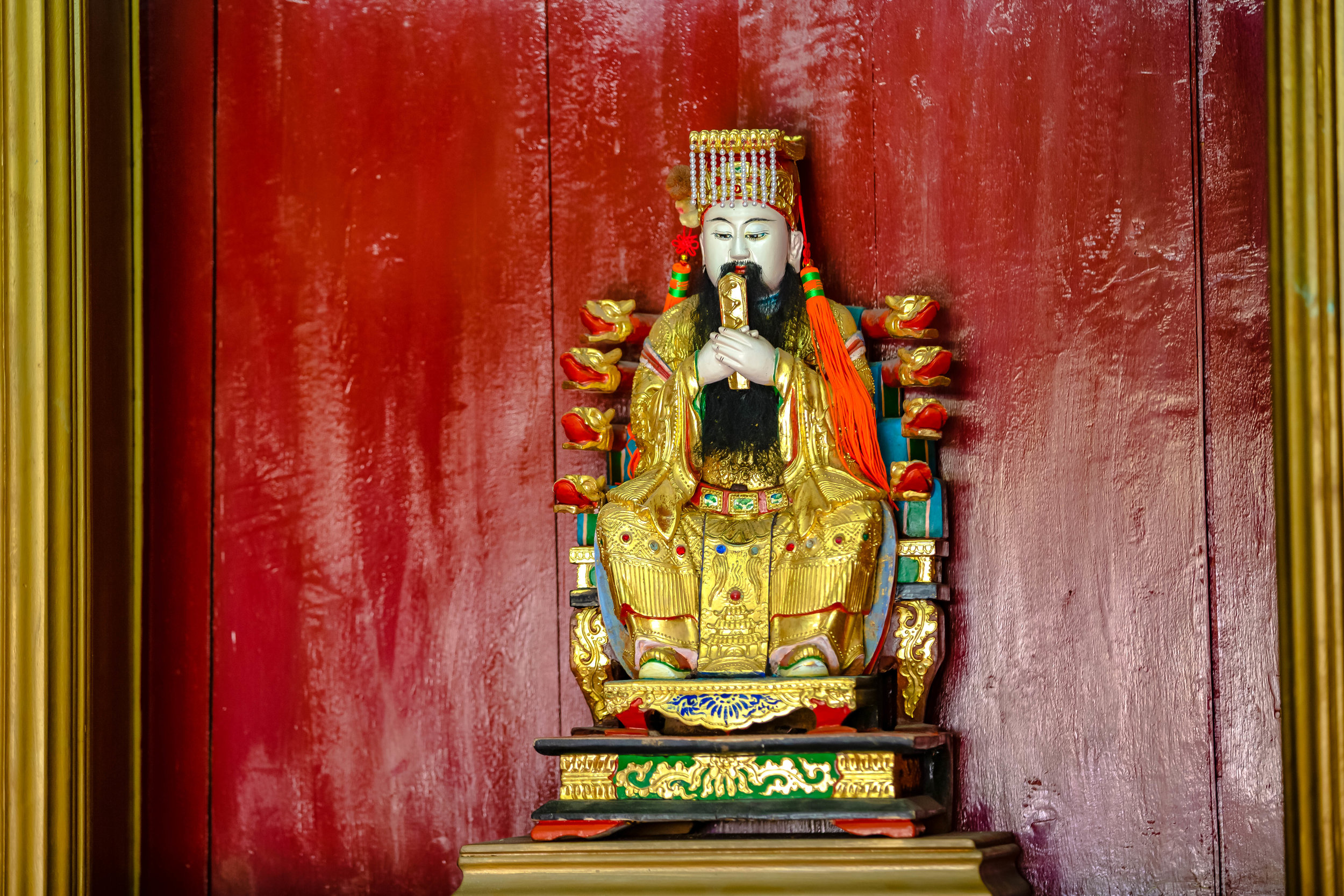
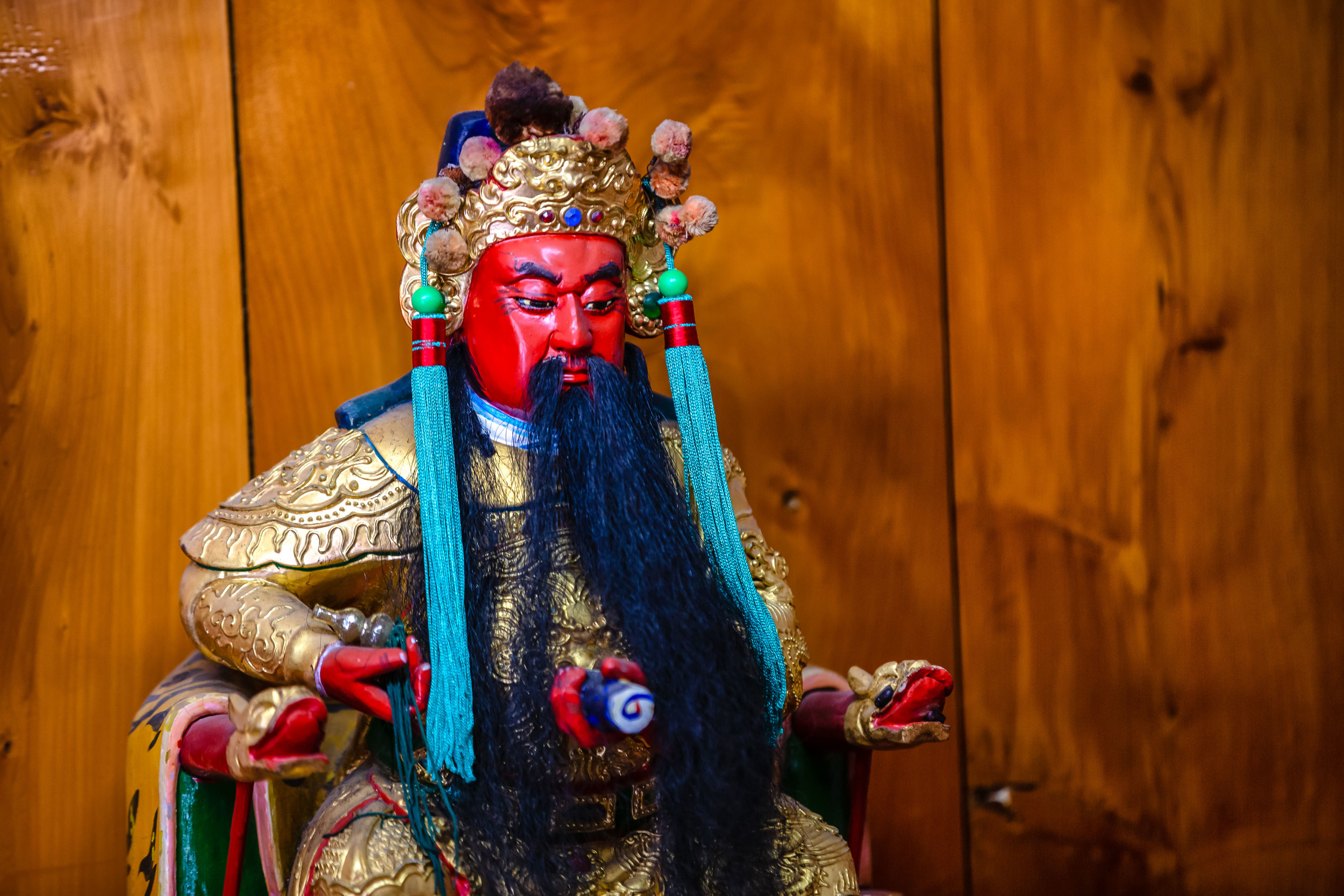
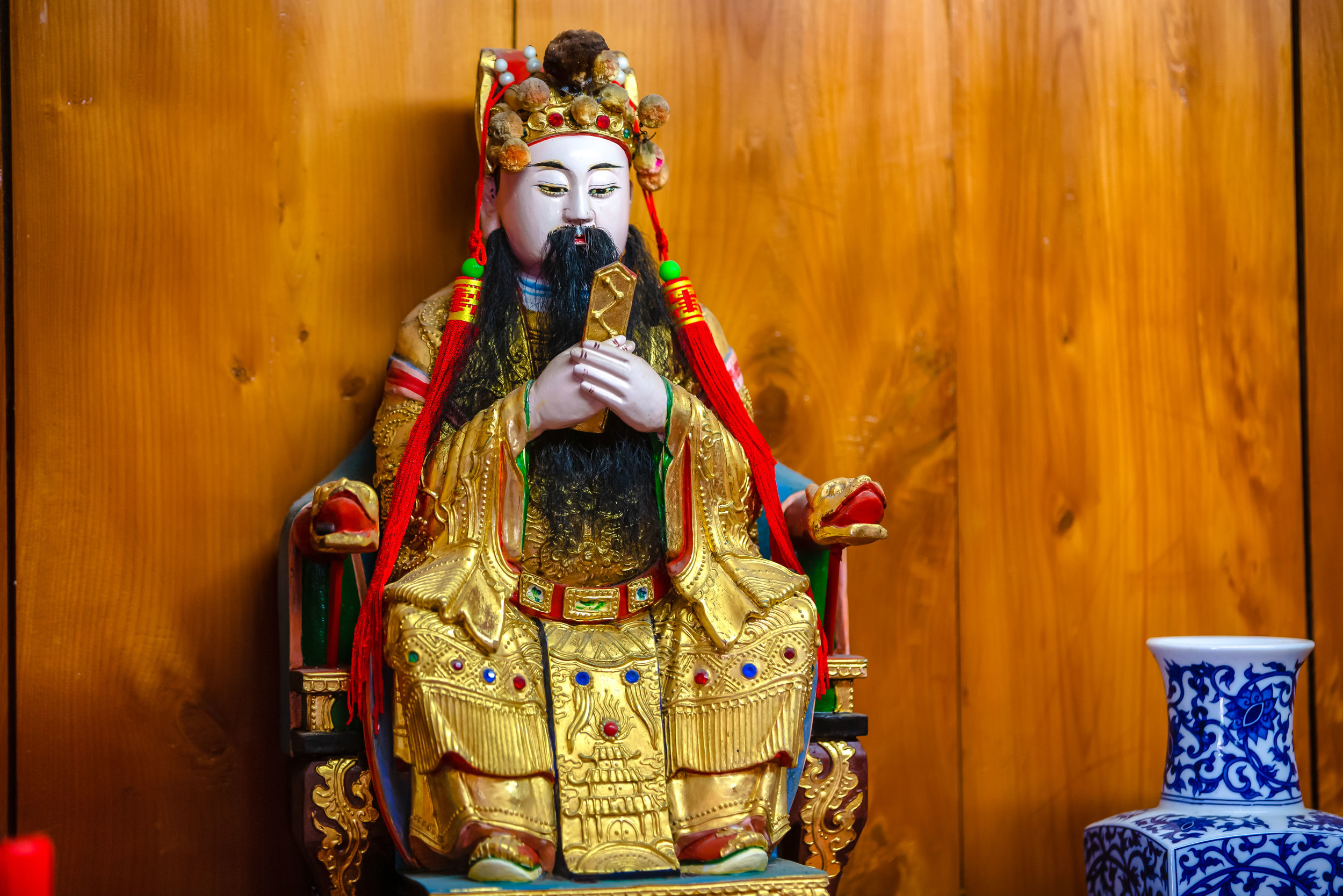
The best way to know if you’ve passed the entrance to the trail without noticing it is if you’ve arrived at a shrine that has been constructed within a rocky part of mountain face. The shrine is actually constructed at the trail level of the rocky Thumb Mountain crag and if you’re walking by you can’t miss it. 

So, if you’re looking at the gods and goddesses, you’re going to have to backtrack until you reach a small clearing in the trail where you’ll find a set of stairs. As you walk up the trail to the mountain, you’ll notice that there are ropes fashioned to the side of the trail that are meant to help you safely get to the top.

Even though the trail isn’t that difficult to walk up, you’ll probably want to hold on just in case, especially when you’re on your way down as the trail can be a bit damp at certain times of the day.

From the trail to the peak of Thumb Mountain you’ll need little more than two or three minutes. 

As I mentioned above, the peak of Thumb Mountain is a rocky mountain face that is probably the most ‘peak-like’ experience you’re going to have on any of the mountains on the trail. The rocks are easy to walk up and once you get to the top there is a marker that indicates you’re on the peak of Thumb Mountain with the official height of the mountain.  

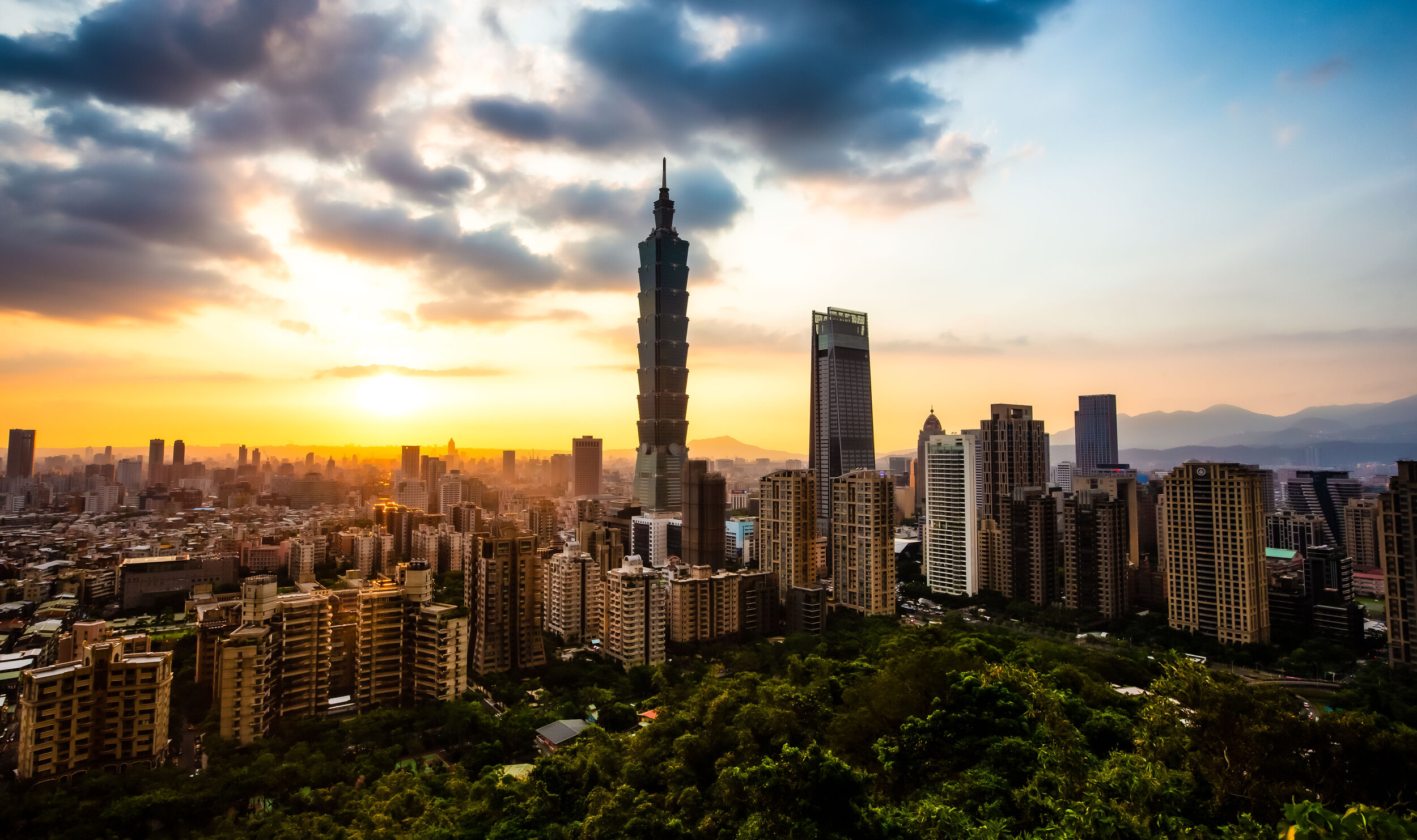
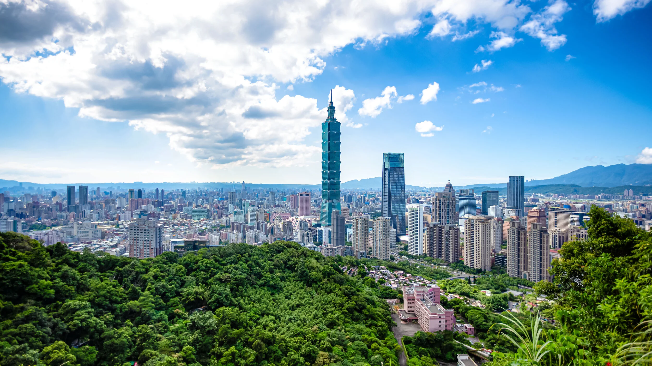
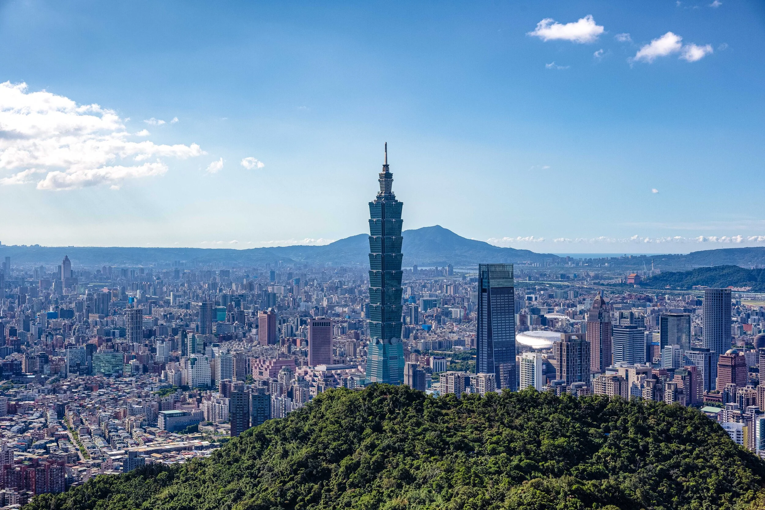
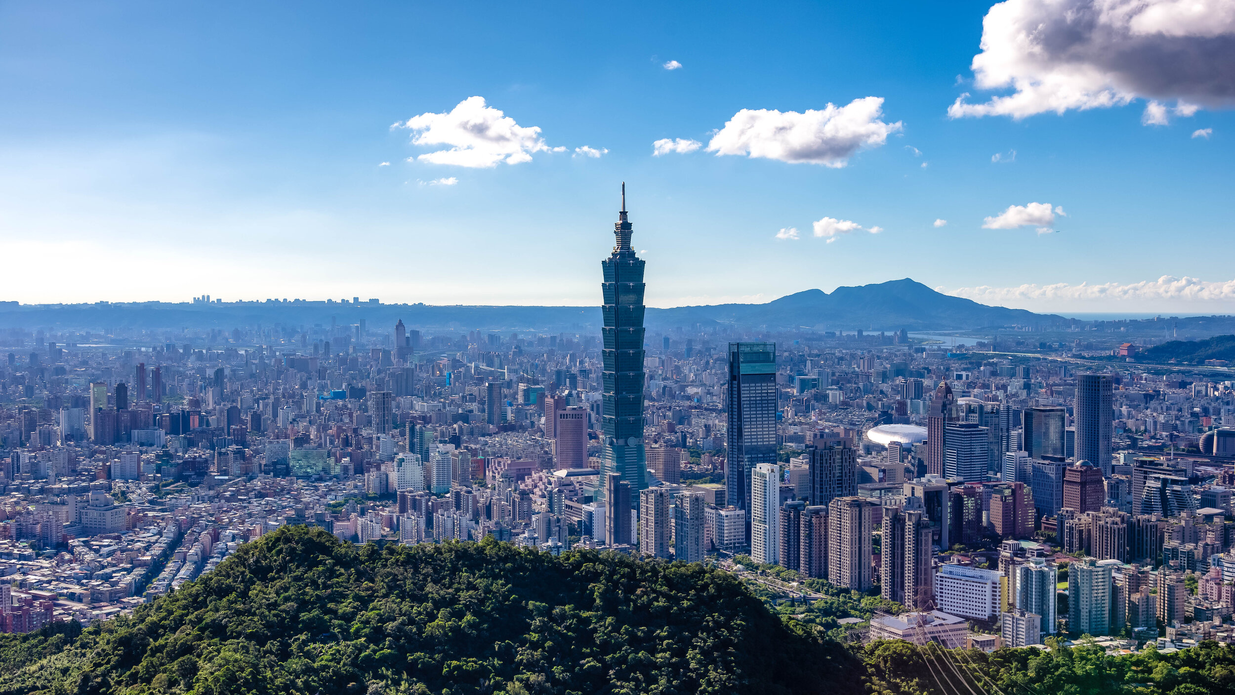
One of my favourite things about Thumb Mountain is that when you’re standing on top, you’re going to have beautiful 360 degree views of the Taipei cityscape as well as the Muzha district to your rear. You may even be able to see the Maokong Gondola in the distance if the weather is clear.

If you’re visiting on a hot day though, you are going to be completely exposed to the sun, so if you want to sit there for a bit to relax, you’re going to need to remember to protect yourself with a hat and sun screen. It also tends to be quite windy on the peak, so you’ll want to be careful when you’re walking around. 

The view from Thumb Mountain looks directly down at the city with only Elephant Mountain sitting between you and the cityscape. You should be able to take some really nice photos from here, but if you’re visiting on a hazy day, you might feel a bit disappointed as it could be difficult to get a clear photo.

Even if the weather seems really nice, if you are planning on hiking all the way to Thumb Mountain and 9-5 Peak, I recommend first checking the current Air Quality index which should give you an idea of how your photos will turn out.

Link: Air Pollution in Taiwan: Real-time Air Quality Index Visual Map

Nangang Mountain (南港山)

If you’re thinking, “Isn’t this blog titled Thumb Mountain and 9-5 Peak? Why is he talking about Nangang Mountain now?”, you’d be making a good point. But the truth is, if you’re hiking to both Thumb Mountain and 9-5 Peak, you’re going to pass by the peak of Nangang Mountain - whether you realize it or not. 

I always thought it was a little weird - “Nangang Mountain” (南港山) is the name for the mountain where you’ll find Elephant Mountain and Tiger Mountain but why are they referred to as mountains in both Chinese and English? Are they mountains or simply different peaks? 

The answer is simple, Nangang Mountain is the name of the mountain, which consists of several different peaks. The “peaks” started being referred to as “mountains” when the hiking trail became popular and people started realizing that the views of the city were beautiful.

GTJ-2019-0914-67.jpg

So is there such a thing as Elephant Mountain? Not really. Should it be renamed to Elephant Peak (象山峰)?

Nah. I don’t think so. Elephant Mountain sounds better.

The peak of Nangang Mountain receives little fanfare, mostly because there’s not really very much to see when you’re there. There’s just a simple marker on one side and a crane-like machine on the other. If you take a picture at the peak of Nangang Mountain, your friends and family on social media aren’t going to get very excited, because there isn’t really anything worth taking a photo of - its just a marker without a view.

And this is why we continue on to 9-5 Peak, where the view is fantastic.

9-5 Peak (九五峰)

For many years 9-5 Peak was an area of the trail that only experienced climbers would attempt to reach. Now though, people of all types can reach Nangang Mountain’s highest point through the well-developed network of trails.

At a height of 375 meters, 9-5 Peak offers visitors one of the best views in the whole city from its lookout. 

In the past, if you wanted to reach 9-5 Peak, you would have to scale up the dangerous mountain side making use of ropes that were fashioned to the rocks. Not only was this too difficult for most people, it also caused quite a few accidents and injuries.

In 2014 for example, a young women lost her grip, fell a hundred meters and died. 

While the ropes still exist and you can still try your hand at using them to climb up the mountain, the city government has made the whole process a lot easier by connecting trails on several different sides of the mountain that allow you to reach the peak. There are currently warning signs that caution hikers of the danger of climbing the mountain side and it seems like the local government is in the process of removing them entirely. 

You might be wondering why all the other peaks on the mountains have relatively normal names while this one is oddly named 9-5 Peak - The name is surprisingly fitting and is meant to pay homepage to an avid hiker who (several decades ago) successfully climbed the mountain at the age of 95.

The name 9-5 Peak (九五峰) is dedicated to Mr. Yang Sen (楊森) who to the surprise of many was able to successfully climb to the peak of Nangang Mountain. Given the difficultly of hiking the mountain several decades ago, it was considered quite a feat for a man of his age to complete the hike, so they renamed the peak in his honour. 

The peak is famously home to a giant rock that people often climb on top of to take photos. The front side of the rock features the Chinese characters “九五峰” etched into the side indicating that you’ve reached the highest point of the mountain. 

The reason why I think the name of the peak continues to be fitting is because the majority of the people you’re going to find on the peak are the elderly retirees of Taipei who hike the trail on a daily basis for a bit of exercise and to meet up with their friends.

When you’ve arrived at the peak, you’ll probably notice that there is a sense of community up there with most of the people stopping to have a chat with their fellow hikers, who are people they see almost on weekly or daily basis.

When I first hiked to the peak over a decade ago, sitting on top of the rock, especially at night provided excellent, even romantic views of the city. Today though, the view from the top of the rock has mostly been obscured by trees and brush that has grown a little too high.

You would think that with such a great view that people would want the trees obscuring the view to be removed, but that isn’t really the Taiwan way. People here wouldn’t support the natural environment being destroyed for something as unimportant as an epic view of the cityscape.

Thankfully, there is an even better lookout a short distance away from the peak where you’re afforded panoramic shots of the Taipei cityscape high above the rest of the mountain range. The 9-5 Peak Lookout is probably the best photo-taking spot on the whole trail and hiking the extra hour or so that it takes to get there is well worth the effort thanks to the spectacular photos you’ll come away with.

Getting There

Route Map for Thumb Mountain and 9-5 peak www.goteamjosh.com/blog/thumbnine

How you get to these two peaks really depends on where you’re starting your hike - In this case, we’re spoiled with several different options, so when you’re planning your hike, your most important consideration is going to be what route you want to take and what you want to see along the way. 

I may just be guessing here, but I would assume most short-term tourists are likely to start on the Elephant Mountain side, while local people or long-term travellers (like myself) are more likely to start on the Tiger Mountain side. 

There are pros and cons to each of these starting points, so let me introduce the different routes you can take and the walking method for each. 

Route 1 - Elephant Mountain - 9-5 Peak

What is likely to be the most popular route for tourists is to start hiking at the Elephant Mountain trailhead, completing that trail and then making your way from there to Thumb Mountain and then onto 9-5 Peak. This route might seem like it is the most convenient due to the fact that its close to an MRT station and allows you to first enjoy the beauty of Elephant Mountain.

You will however have to deal with a much steeper climb as well as a much more crowded trail for the first section of the hike.

If you’re a short-term tourist visiting Taipei, hiking this route combines a visit to Elephant Mountain and allows you to travel a bit further than most other tourists do. 

The thing is though, I’m not exaggerating when I say that the Elephant Mountain trail is quite steep and there is a section of the route that takes you to Thumb Mountain that is also quite steep.

There are better options if you’re worried about wearing yourself out on the hike.

Route 2 - Tiger Mountain - Thumb Mountain

Another option would be to take the MRT to either Houshanpi Station (後山埤捷運站) or Yongchun Station (永春捷運站) and walk to the Tiger Mountain (虎山) trailhead. From there you’ll continue your hike from the peak of Tiger Mountain to 9-5 and Thumb Mountain and then leaving from Elephant Mountain.

If you elect to take this route, you’re in for a much easier hike with a fraction of the traffic on the trail and you’ll also get to enjoy the beautiful view from Tiger Mountain as well! 

This route requires a 10-15 minute walk from the MRT station to the trailhead but you’ll save time on the actual trail as the distance to 9-5 and Thumb Mountain is much shorter than the route from Elephant Mountain. 

There are several different trailheads for Tiger Mountain, but the closest and easiest to get to from the MRT station or by Youbike are the two trailheads on Songshan Road (松山路). You’ll find them both on the map above.

Route 3 - Songshan Cihui Temple - Thumb Mountain 

Let’s say you’re a pro and you’ve hiked Elephant Mountain and Tiger Mountain a bunch of times and have little interest in hiking them again. Can you still hike to these two mountains while avoiding the others? Sure. You’ll have to keep in mind though that even though there are a number of trails in this mountain network, they all eventually meet up at some point and allow easy access to all the other peaks. 

If you prefer to hike this route, simply take the MRT to either Houshanpi Station (後山埤捷運站) or Yongchun Station (永春捷運站) and then make your way to the beautiful Songshan Cihui Temple (松山慈惠宮) where you’ll find the trailhead at the rear of the building. 

This route will take you around Tiger Mountain and directly to 9-5 Peak where you’ll be able to continue along the trail passing by the peak of Nangang Mountain (南港山) before arriving at Thumb Mountain (拇指山). From there you can either leave the way you came or head down the mountain passing by Elephant Mountain and finishing at the Xiangshan MRT station.

If you want to save a bit of time walking, you could also take one of the various buses that travel through the area. If you take the bus, get off at the Fengtian Temple (奉天宮) stop and then walk up the hill to the temple from there.

If you need info on bus stops or real time info, check the Taipei eBus website for more information. You may also want to download the “台北等公車” smart phone app which uses GPS to let you map your route more easily.

Buses that serve the Fengtian Temple Stop: #46, #88, #207, #257, #286, BL10.

Something that I’ve always questioned in regard to the majority of tourists hiking Elephant Mountain is whether they were only hiking the mountain for a selfie halfway up or if they were just completely unaware of the existence of Thumb Mountain and 9-5 Peak. I suppose you can’t blame most people, these two peaks aren’t really all that well advertised, and thats a shame.

I would contend that one of the best photo locations for a cityscape shop is at the lookout on 9-5 Peak - It gives you the widest perspective of the city that you’re going to get and is an absolutely beautiful spot to enjoy the sunset.

So my advice to you is simple, if you’re going to hike Elephant Mountain and the weather is great, why not take another hour to hike to these two peaks as well? You’re going to enjoy yourself along the path, you’ll get some great photos along the way and you’ll have travelled further than 98% of your fellow tourists.

There’s nothing wrong with taking the road less travelled.


Elephant Mountain (象山步道)

So you’re sitting at your computer, you’re planning a trip to Taiwan and you’re wondering what you’re going to do while you’re here. You type ‘T-a-i-p-e-i’ into Google and what comes up? My bet is that you’re going to get a collection of photos that look more or less the same as the photo above.

This shouldn’t surprise you. 

Taipei is a city with an endless amount of things to see and do - but its fair to say that the undisputed champion of the city’s tourist attractions is the Elephant Mountain Hiking Trail. This is why each and every day hundreds, if not thousands of photos are posted from the many popular photo spots on the trail.

You’re of course welcome to disagree with my assessment, but before you do, I recommend taking some time to hike the mountain and taking note of the amazing mixture of languages being spoken by all of the travelers on the trail. You’re not likely to have an even remotely similar experience anywhere else in Taiwan (at least not in such a high concentration) as you will on Elephant Mountain. 

Even though I’m not a big fan of crowds slowing me down when I’m hiking, I can appreciate the fact that the mountain has become so popular and has played a part in helping so many people from different areas of the world realize that Taiwan is a great place to visit.

It goes without saying that the popularity of the mountain does have its downsides - Namely that it doesn’t matter when you visit, you’re going to be hiking the trail with hundreds of other people. You’re also probably going to have to stand in line at the top to get your cool-looking tourist photo. You’re also going to have to arrive quite early to reserve a spot if you’re wanting to take ‘professional’ style shots of the sunset or the view at night.

If this kind of stuff worries you, never fear, there are quite a few other options for mountain trails in Taipei where you’re able to take beautiful cityscape photos. 

If you’re a short-term visitor though, I can’t recommend enough that you deal with the crowds, hike the mountain and enjoy the experience - I’ve hiked the mountain a hundred times over the years, and even though it has gotten progressively busier, it rarely disappoints. 

Before I start, I’d like to take a minute to explain why I’m writing about this mountain for the second time.

When I first started this blog, I honestly didn’t really have any idea about what direction it would take. I figured I would use it as an outlet to showcase my photography and the beauty of Taiwan, but never could have imagined that it would become such a popular travel resource for people wanting to learn more about Taiwan.

Now that I’m much more experienced with this whole blogging thing, when I look back at some of the articles I wrote when I first started, I feel a bit embarrassed - especially with those that attract a lot of traffic. My Elephant Mountain article in particular is one where I felt like I needed to provide an update and offer much more in-depth information to travelers. 

I hope this updated version helps travelers and answers any questions you may have about hiking this beautiful trail. 

The Elephant Mountain Hiking Trail

Benches designed in the shape of the Chinese characters for Elephant Mountain.

Most tourists seem to be unaware that the Elephant Mountain Hiking Trail (象山登山步道) is essentially just a small section of the much larger network of trails known either as the ‘Four Beasts trail’ (四獸山步道) or the Nangang Mountain Hiking Trail (南港山系). 

The 7km long network of trails also includes Tiger Mountain (虎山), Leopard Mountain (豹山), Lion Mountain (獅山), Thumb Mountain (拇指山), Nangang Mountain (南港山) and 9-5 Peak (九五峰) - all of which provide excellent views of the Taipei cityscape and takes several hours to complete.  

The Elephant Mountain portion of the trail however is just a short hike up a very well-developed set of stairs that should only take you anywhere between fifteen and twenty minutes. Don’t let this fool you though, I’ve seen people showing up in high-heels and their Sunday best thinking that it is going to be quick and easy. 

This mountain trail is steep and even an avid hiker like myself gets a pretty good workout every time I go.

You’re not going to need to wear hiking boots or bring a bunch of gear with you when you go. You’re just going to have to wear comfortable footwear and clothes that are suitable for a bit of exercise.

From the trailhead, you’re going to hike on a very steep incline that will quickly transport you well above the city to a height of about 183 meters (600 feet) above sea level. 

Elephant Mountain Trailhead

The trail is well-developed with a stone path, signage, benches for taking breaks, lights that guide your path at night, water fountains and surprisingly clean washroom facilities. This allows you to not only hike the trail during the day, but also at night without having to worry. 

While there are several cityscape viewing platforms along the way, the main attraction of the trail for most tourists is the area known as the ‘Six Giant Rocks’ (六巨石) near the peak of the mountain. The giant rocks are part of an open space near the peak where you’re going to enjoy the best selfie opportunities, but is also where you’re going to encounter the largest amount of traffic.

Having your photo taken at the rocks is probably the most important part of hiking the trail, so it shouldn’t surprise you that you may end up having to wait in line to get your chance to stand on the rock and take your photos. So if there is a line, its just something that you’re going to have to be patient about if you want to get a photo of yourself.

My advice would be to hike the mountain early in the morning which should save you some time as the mountain isn’t as busy then.

If you’re a solo traveller and are hiking the mountain alone, I recommend requesting a fellow traveller to help you take a photo while standing on the rock rather than simply taking a selfie. If on the other hand you have others traveling with you, you can take turns by having them stand on one of the giant rocks to the rear to take photos of you.

This way you’ll get a bit more perspective when you take your photo and you’ll also save you some time waiting in line if you work together.

Once you’ve finished getting photos at the Giant Rocks area, if you’re not too tired and would like to get some more photos, I recommend continuing your hike a bit further past the Giant Rocks where you’ll come across several other viewing platforms that provide excellent perspectives of the city.

If you hike further up past the rocks, you can choose to complete your hike by returning the way you came, or simply continuing along to Tiger Mountain where you’ll descend upon another MRT station. 

Personally, I prefer to exit through Tiger Mountain for a couple of different reasons - It is a short distance from Elephant Mountain’s final platform, it also allows me to experience another mountain peak, there is less traffic, and more importantly, its much easier on the knees.

How you leave though depends on you, if you missed some platforms on your way up, you’ll probably want to revisit them, so if thats the case you’ll probably just want to head back the way you came.  

Elephant Mountain Photo Spots

Night view of the Taipei cityscape from Elephant Mountain.

When it comes to taking photos of the Taipei cityscape, you’re spoiled for options on Elephant Mountain - There are at least five different vistas for taking photos that provide tourists with an elevated platform giving an even better perspective of the city. 

So when you’re visiting Elephant Mountain, you simply have to ask yourself: What kind of photos do I want to take?

Do you want to take epic travel photos/selfies? Do you want to take professional quality photos of the cityscape? Do you want to take photos of the sunset or the night view? Or are you hoping to get photos of the New Years fireworks? 

Once you’ve decided what you’d like to do, there are a few considerations that you’ll want to keep in mind: 

  1. If you’re hoping to take photos of yourself, you’re probably going to have to wait in line to get up on the giant rock. You should also bring a photo-taking pal who can take turns with you. 

  2. If you’re wanting to take professional quality photos of the cityscape, you’re going to need a camera, possibly a tripod and a spot on one of the platforms where you can set up. 

  3. If you’re hoping to take photos of the sunset, you’re going to have to arrive early, bring a camera and a tripod and wait. Spots on the platforms fill up quickly, so if you don’t want to miss out, you’ll have to arrive several hours early. 

  4. If you’re hoping to take photos of the New Years fireworks, you should probably prepare a tent and camp out for a few days in order to reserve your spot. You may think I’m exaggerating but some of the old guys in Taiwan will have their tripods chained up in spots on the platform several days before New Years and they take turns standing guard. 

Elephant Mountain Photography Platforms

There are a number of platforms and viewpoints located on the mountain where you’re able to take some pretty awesome photos, but even though the signage on the trail is surprisingly helpful, its not easy for tourists to plan their trip in advance with all the scattered information available online.

I’m embedding a map below that includes the location of all the popular photo locations and the routes you’ll take to get there as well as a short description of each of the stops below.

Guide to hiking Taipei's Elephant Mountain (象山) www.goteamjosh.com/blog/xiangshan

  • Photographers Platform (攝手平台)

GTJ-2019-0914-5.jpg

The trail to the ‘Six Giant Rocks’ can more or less be divided into two sections, the first part is a 5-10 minute walk up a very steep set of stairs and the second part is another 5 minute walk up an even steeper set of stairs. Fortunately the space between the two sections is a flat section of trail where you’ll be able to catch your breath and take a break. 

The first viewing platform, the ‘Photographers Platform (攝手平台) sits along this flat piece of land and is an elevated structure that allows hikers the opportunity to take photos of the cityscape. This platform is often full of people so if you want to take photos from here, you’re probably going to have to be patient to get a spot.

Personally I feel like it is a nice spot to stop for a selfie, but its not one of my preferred spots for setting up a tripod and taking photos. I think what this platform does well though is give hikers a pretty good taste of what they’re about to experience as they hike further up the mountain.

  • Fireworks Viewing Platform (煙火平台)

The amazing view of the under-appreciated Fireworks Viewing Platform.

Once you’ve passed the first platform, you have the choice of either hiking up the hill to the ‘Six Giant Rocks’ or continuing straight along the flat path. Most people are going to elect to continue up the hill to their preferred destination, but here is where I’ll let you in on a bit of a secret. If you continue straight along the path, you’re going to find one of the best photo spots on the mountain, the Fireworks Viewing Platform. 

Continuing straight along the flat section of the path you’re going to come upon a covered rest area with public restrooms. What most people don’t realize is that if you keep following the path behind the rest area, you’ll find another trail that will take you to a small platform that has probably one of the best views of the city.

The trail to the platform doesn’t show up on Google Maps, so I’ve drawn a line to it on the map. You’ll see signage along the trail pointing in its direction, but the way they’ve blocked the trail with the rest area confuses a lot of people. Trust me, its there and its awesome!

  • Six Giant Rocks (六巨石)

The view from the popular Six Giant Rocks

The ‘Six Giant Rocks’ area is essentially the main destination for all of the tourists hiking this trail. This is the area where you’re going to get your ‘epic’ Instagram travel photos and also where you’re also going to have to line up with a bunch of fellow travelers all wanting the exact same photo. 

The area is aptly named for the six giant rocks that people climb on to take photos - The first rock you’ll meet as you walk up the stairs, which is coincidentally the smallest of the bunch is the main attraction. People are going to be waiting in line to take turns climbing up to the top of the rock to take their Instagram shots. This is because even though the rock is small, it towers over the peak which provides a unique perspective that makes you seem almost as tall as Taipei 101.

The best way to take photos here is to take turns taking photos with a fellow traveller so if you’re traveling with friends or family, you’re in luck. If you’re traveling solo, you’re going to want to ask another person waiting in line to help you take some photos. Don’t be shy, everyone has come here for the same reason, so make some friends while you’re there.

The reason that you’ll want to have someone else help take your photos is due to the fact that if you simply take a selfie while standing on the rock, you’re not really going to get the full perspective of just how awesome this spot is. If you have someone else helping, they can stand on one of the larger rocks to the real and take wide-angle shots that are so much better.

  • Six Giant Rocks Platform (六巨石觀景台)

Once you’ve finished taking photos at the Six Giant Rocks, you can continue walking along the trail where you’ll very quickly be met with yet another platform for taking photos. The ‘Six Giant Rocks Platform’ is another beautifully constructed elevated platform situated on a cliff and offers some pretty good views of the city. 

The platform has benches, so people like to stop here to enjoy the view and rest a bit. Unfortunately this means that if the mountain is busy on the day that you’re visiting that you’re going to have to wait to get a spot to take photos. 

While I do enjoy taking photos from this location, I don’t think its the best place to set up a tripod to take photos. The reason for this is because when others are walking on the platform, it shakes a bit, so if you’re taking long-exposures, you’re going to have quite a bit of ruined shot. You can however sit your camera on the rail to take some nice photos during the day, especially if you want to take multiple-exposure HDR shots of the cityscape.

  • Chaoran Pavillon (超然亭)

The Chaoran Pavillon is one of the most popular spots for local photographers.

The final photo spot tends to be the most popular one with local photographers, especially with those wanting to take photos of the cityscape at sunset. From the Six Giant Rocks area, it shouldn’t take you any longer than ten minutes to arrive at the pavilion, which thankfully doesn’t require you to walk up any more steep hills. 

While walking along the path you’ll come across a fork in the road with signage pointing that indicates the trail to Thumb Mountain (拇指山) is to the right and to the left you’ll find the pavilion. From there you’ll only have to walk for a minute or two before you arrive. 

The view from the pavilion is beautiful, but spaces fill up quickly, especially before sunset, so if you’re wanting to set up a tripod to take some cityscape photos, or night shots, you’ll probably want to arrive quite early to make sure you get a spot. 

Getting There 

In the past, hikers would have to walk from Xinyi District toward the mountain and (if they were anything like me) would invariably get lost or have to ask directions. All of those problems have been solved thanks to the addition of an MRT station near the trailhead. You can of course still walk to the mountain from the Xinyi area, but the easiest way to get there is by taking the Red Line (紅線) to Xiangshan Station (象山捷運站) and from there walking the short distance to the trailhead.

Something you’ll want to keep in mind is that not all trains go to Xiangshan Station as quite a few end their service at Da’an Station (大安站). Before getting on the train, make sure that it is one that goes all the way to Xiangshan, which is currently the terminal station for the red line.

Once you’ve reached the MRT station, take Exit 2 and walk through Xiangshan Park (象山公園) until you reach the end of the road. From there you’ll see signs directing you to turn left. When you’ve reached the top of the hill you’ll turn right and within a minute or two will arrive at the trailhead which is next to a temple.

If you want to grab some water or a snack before your hike, you’ll find a 7-11 and a Family Mart a short distance away from the park. Before you turn left to walk up the hill, turn right and walk down Xinyi Road to get to the convenience stores.

If you find yourself in the Xinyi (信義) area, you could also just as easily hop on a Youbike, ride to Xiangshan Park and then follow the directions above. 

Likewise, Xiangshan Station is serviced by buses 20, 32, 33, 37, 46, 88, 207, 612 and Red 10. 

If you want to take a bus and need info on bus stops or real time info, check the Taipei eBus website for more information. You may also want to download the “台北等公車” smart phone app which uses GPS to let you map your route more easily.  

While you’re in Taipei, there is certainly a lot for you to see and do, I’d suggest though that Elephant Mountain should be at the top of your list - Not only does it have arguably the best views in the city, it is also a quick and easy hike and is extremely accessible. You can also get some pretty epic travel photos while you’re there and best of all - its completely free. If you’re visiting Taipei and you’re not planning to visit the mountain, you’re certainly missing out on a great experience.


Naha Confucius Temple (那霸至聖廟)

One of my numerous personal projects over the past few years has been to research and document the weird and wonderful history of Confucius Temples here in Taiwan and the roles that they have played (or at least attempted), in shaping Taiwanese society over the past several centuries. Unfortunately, there are still a few that I haven’t had the chance to visit, so this little project of mine remains a work in progress.

I always enjoy having something to look forward to though.

When my girlfriend proposed a week-long trip to Okinawa earlier this year, my first thought wasn’t “Japan? Hells Yes!” Or “Beautiful beaches? Sure!”, it was “Did you know that Okinawa has a Confucius Temple that pre-dates most of Taiwans?

To which I seem to remember receiving a bit of an eye-roll.

I might be a bit of a weirdo, but what better opportunity would there be to check out a Confucius Temple outside of Taiwan where I could compare relatively similar architecture and history?

Link: Confucius Temples of Taiwan

So, as part of our itinerary, we added a visit to the Naha Confucius Temple, which is conveniently located nearby the city’s most important place of worship, the Naminoue Shinto Shrine (波上宮) and is somewhere she really wanted to visit anyway.

Before getting on our flight to Okinawa, I purposely didn’t do any research about the temple as I thought it better to walk in and look at it with a fresh set of eyes. I felt like I would be doing it a disservice if I walked in and compared it to the various Confucius Temples in Taiwan, which tend to be quite large.

What I did know however was that the Naha Confucius Temple rivals that of the Tainan temple in terms of its age and that it was an important place of worship for many of the Chinese settlers who migrated to Okinawa during the Ming and Qing Dynasties.

Going into this blind however almost ended up being a huge mistake.

I would later (luckily) find out that the Confucius Temple we had marked on our map was just the newest rebuild of the original temple and that there was also an older version located a short walk away.

So yeah, there are technically two Confucius Temples in Naha.

Initially, I figured that blogging about the Naha Confucius Temple would be a walk in the park like all of the other Confucius Temple’s I’ve become accustomed to writing about. In fact, whenever I visit one of these temples, thanks to their uniformity in design, I always know where to go, what to look for and how to make the most out of my visit.

These two were different though - not only because of their layout and their history, but I also had to learn a bunch of new terms in Japanese, which I then translated to Chinese and then again into English.

I was happy though to have been able to visit and learn about these historic places of worship and the important roles they played in Okinawan history and contrast that to the experience here in Taiwan.

The Naha Confucius Temple(s) might not be very high on the average tourists list of destinations when they visit Okinawa, but considering their historic and their cultural significance, it’s a shame that more people don’t know about them.

History

To learn about the history of the Confucius Temple in Okinawa, we first have to learn a bit about the history of the Ryukyuan Kingdom (琉球國), which ruled over the Ryukyu Islands between the 15th and 19th centuries.

The tiny island kingdom might seem rather insignificant in terms of the grand scheme of world history, but the role it played in the network of East Asian maritime trade cannot be understated. During its heyday, the Ryukyuan Kingdom was one of the busiest ports of call for all trade happening in East Asia.

Prior to the formation of the unified Ryukyu Kingdom, the islands were split up into three separate principalities known as the “Sanzan” (三山) or “Three Kingdoms” which consisted of “Nanzan” (南山), “Chuzan” (中山) and “Hokuzan” (北山).

In 1372, the Ming Emperor in China sent an envoy to Okinawa to establish tributary relations with the Ryukyuans. From then on, many Chinese were sent to the islands to engage in business or the affairs of state.

In 1416, Shō Hashi (尚巴志), then a prince of the Chuzan kingdom invaded Nakijin Castle (今帰仁城), capital of Hokuzan. He then formed a strategy to invade Nanzan and unify the three Ryukyuan Kingdoms under one banner - a plan which would take thirteen years to complete.

In 1429, Shō and his forces occupied Nanzan Castle (南山城), capital of the Nanzan Kingdom unifying Okinawa into one kingdom, with its capital at Shuri Castle (首里城) in Naha.

Emerging victorious and ending decades of strife between the three kingdoms, the Ming were quick to recognize Shō as the rightful ruler of the Ryukyu’s. This recognition gave legitimacy to his claims to the throne and the close relationship between the two kingdoms proved advantageous for both sides ensuring what would become known as the ‘Golden Age of Maritime Trade’ (黃金時代), making the kingdom one of the most important trading ports in East Asia.

Prior to the unification of the Three Kingdoms, China’s Emperor Hongwu (洪武帝) sent a group of 36 families from Fujian Province to Okinawa. The group, which would later become known as the ‘36 Clans of Kume’ (閩人三十六姓) settled in a small village in Naha known as ‘Kumemura’ (久米村), establishing the first overseas community in Naha.

The so-called ‘36 Clans’ were specifically chosen and sent for the purpose of aiding the kingdom in ship-building, promoting education, the sharing of technology and serving in the government in an official capacity.

It is unclear whether the number ‘36’ is factually correct, but what we do know is that the emperor sent Hokkien craftsmen, scholars and administrators to Okinawa to aide the kingdom in the development of a stable government and consolidating its naval power. The number of residents of Kume steadily rose over time and once the kingdom was unified, the influence of the village became much more significant.

Link: Ryukyu Bugei (琉球武芸) - “The 36 Clans of the Min-People”

Link: Kumemura (Wikipedia)

Kumemura was considered a privileged community comprised primarily of scholars, bureaucrats and diplomats and served as centre of culture and learning in the capital city for almost 500 years.

Today the area known as ‘Kume’ is geographically separated from the rest of Naha by the monorail and stretches from the Prefectural Office Monorail Station (県庁前駅) all the way to the port.

Today, the community prides itself on its literary and cultural significance and is widely regarded among locals as an area that has some of the best schools in the capital and for its Chinese cultural roots. After all these years though, Kume is also considered to be a bit ‘different’ than other areas of Okinawa.

With regard to the ‘difference’ created by the Kume community, it’s safe to say that the influence Kumemura had over the capital area created somewhat of a schism between the local inhabitants of the Naha area and other areas around the country.

This was due to the fact that the capital was culturally dominated by the Chinese immigrants for quite some time. Not only were the first schools in Okinawa ‘Confucian’ but the way the bureaucracy was run was also ‘Confucian’ in nature which mirrored that of the system set up in China. This led to the development of a Confucian set of values and policies that were almost non-existent once outside of the capital.

The dominance of Confucian values in the capital were not always looked upon favorably by the rest of Okinawan society which resisted, but the government’s push for modernization ultimately turned out to be successful in rooting out anything that was deemed to be primitive or uncivilized.

To assist in such efforts, Emperor Kangxi (康熙帝) gifted the capital its very own Confucius Temple in 1671 and from that time on royal rituals would be held at the temple in lieu of traditional Ryukyuan customs.

Indeed, one of the most unfortunate aspects of Okinawa’s modern history has been the concerted efforts by foreign powers (not only the Chinese, but the Japanese and Americans as well) to eliminate the culture, language and traditions of the Ryukyuan people.

These attempts, which started with the Confucian reforms in the 1600s lasted well into the 20th Century and only in the past few decades have the people of Okinawa been able to attempt to revive their language and culture.

Kumemura Confucius Temple (久米至聖廟) 1675 - 1945

As mentioned above, Qing Emperor Kangxi gifted a Confucius Temple to the people of Okinawa in 1675.

Confucianism though has played a role in Okinawa since the early 15th Century, which is significant (at least to me) because that predates its arrival here in Taiwan.

The original temple, which unfortunately burnt to the ground in 1945, would be 350 years old today.

For most of its 270 years of existence it served as a major centre for learning, was home to Okinawa’s first public school and was an important place of worship for commoners and royalty alike.

When Okinawa was annexed by Japan in 1879, the role of the Confucius Temple and the Kumemura community in general fell into decline. The on-site school would be converted into a public school under Japan’s national education system and any remnants of Confucian-style education or influence were removed.

A half century later, the bloodiest battle of the Second World War’s Pacific Theatre came to Okinawa.

What has become known as the Battle of Okinawa (沖繩戰) resulted in tremendous loss on both the American and Japanese side with an estimated 160,000 casualties. The people of Okinawa however suffered the most with the (estimated) pre-war population of 300,000 reduced by almost half with 149,000 killed.

The suffering of the Okinawan people at this time was exacerbated by the fact that they were (for the most part) just innocent bystanders caught in the crossfire. The aid-raids decimated much of the island and to make things worse, they were often arbitrarily executed in the streets by both the Americans and the Japanese leading to many families being completely destroyed.

In the aftermath of the war, almost ninety percent of the buildings on the islands were left destroyed and many cultural and historic treasures were lost. The people who were left had to pick up the pieces, rebuild their lives and also their homes.

Link: The Battle of Okinawa (Wikipedia)

The shrine room of the Naha Confucius Temple

When the war ended, as part of Japan’s terms of surrender, control of Okinawa was transferred to the United States and in conjunction with the newly formed Government of the Ryukyu Islands (琉球政府), the United States Civil Administration of the Ryukyu Islands (琉球列島米國民政府) were tasked with post-war reconstruction.

Most important to the Americans was that the islands infrastructure was constructed in a timely manner, to assist in their plans of constructing various bases on the islands, which to this day (in addition to their continued presence) remains a contentious issue with the locals.

The site of the original Confucius Temple fell victim to those development projects and instead of rebuilding the historic temple, a highway was constructed in its place.

Although there are few photographs available of the original temple, what we do know is that its construction and layout adhered to traditional designs of Confucius Temples with a Hall of Great Perfection (大成殿) in the middle of a large courtyard with buildings constructed on the east and west side. Later, an Education Hall (明倫堂) would be added and would serve as Okinawa’s first public school making the temple grounds a go-to location for your educational or literary needs.

Vocabulary Lesson

I’ve studied this stuff for a quite a while, but writing this blog forced me to learn a bunch of new vocabulary that required looking at stuff in Romanized Japanese, converting it to Chinese and then again to English. Let’s pause for a moment and take a look at some of the vocabulary to make it all a little easier to understand:  

Guide: Romanji / Katakana / Kanji / Pinyin / English

  • Shiseibyō / しせいびょう / 至聖廟 / zhì shèng miào / Confucius Temple

  • Taiseiden / たいせいでん / 大成殿/ dà chéng diàn / Hall of Great Perfection

  • Meirindō / めいりんどう / 明倫堂 / míng lún táng / Education Hall

  • Tensonbyō / てんそんびょう / 天尊廟 / tiān zūn miào / Tianzun Temple

  • Tempi / てんぴ / 天妃 / tiān fēi / Princess of Heaven (Mazu)

Kume Confucius Temple (久米至聖廟) 1975 - 2013

Three decades after the destruction of the original Confucius Temple, a remake was constructed on a plot of land close to where the original was located. The two acre plot of land flanked by a small mountain near the Naminoue Shinto Shrine (波上宮) provided ample space for the construction of the temple.

The land used to construct the new Confucius Temple was originally home to a Taoist shrine named “Tensonbyō” (天尊廟), which suffered a similar fate to many of Naha’s buildings during the American air-raids. The temple was dedicated to Yuanshi Tianzun (元始天尊), an important Taoist deity, and provided a space for Taoists to worship in Kume.

The new version of the Confucius Temple, which in Okinawa is known as “Shiseibyō” kept with traditional Confucius Temple design layouts with access to the temple through a Temple Gate (至聖門) which opened up to a large courtyard with the “Taiseiden” (大成殿) in the centre. In addition to the Confucius Temple though, the grounds also included a rebuild of the Tensonbyō, an additional building named Tenpigū (天妃宮) and a Meirindō on the eastern side.

The situation at this Confucius Temple today is a bit different however.

When the Confucius Temple relocated in 2013, changes were made at this location to reflect the history of the grounds.

The Taiseiden, which was once home to the Confucius Spirit Tablet was converted back into the Tensonbyō and today serves as the main shrine of the temple complex. The main shrine is dedicated to Taoist deities who are known for their devotion to the country and the protection of those within it.

Inside you’ll find a shrine to Lord Guan (關羽), the Dragon King (龍王) and the Goddess Tempi who is better known as Mazu (媽祖). With the statues of the Dragon King and Tempi moved out of their individual shrines, the buildings on the western side of the grounds have been left empty and are currently closed to the public.

Likewise, the Meirindō currently serves as a meeting place for the Kume-Sōseikai (久米宗聖會), a local Confucian Association and also as a library of historical documents relating to the Kumemura area.

While this particular temple isn’t as large as what I’ve become used to here in Taiwan, nor is it as historic, its simplicity in design and the way that it blends into nature make it a spot you’ll definitely want to stop by for a visit, especially if you’re on your way to the Shinto Shrine nearby.

Confucius Temple of the Ryukyus (琉球孔子廟) 2013 - Present

On June 15th, 2013, the Confucius Temple returned home after a seventy year absence to the plot of land where the original 1675 shrine once stood.

The move, which was considered a “dream come true” for many “Kuninda-chu” (久米人) was one that signaled a restoration of an important cultural shrine that was lost during the war and spent seven decades in limbo.

The inauguration ceremony for the newly constructed temple was attended by the mayor of Naha and the governor of Okinawa while the Kume-Sōseikai Association took care of transporting the Confucius Spirit Tablets through the streets of Kume in traditional fashion.

Link: Mortuary Tablet of Confucius Returns to Kume after 69 years (Ryukyu Shimpo)

The newly constructed Shiseibyō sits on a considerably smaller plot of land in comparison to the previous location in Wakasa (若狹町) and Its layout also differs significantly.

The temple is a walled-complex with a large Temple Gate (至聖門) acting as the entrance which opens up to a courtyard with the Hall of Great Perfection (大成殿) directly in the middle. To the east of the Main Hall you’ll find the Meirindō that acts a community centre, place of learning and administration building (but is not generally open to the public).

The Taiseiden is where you’ll find the most significant differences between the temples - The shrine room is much larger with a high ceiling and more floor space on the interior. The main shrine, like every Confucius Temple has a Confucius ‘Spirit Tablet’ (神位) but is flanked by a statue of the Confucius (which breaks with tradition) gifted to the temple by Taiwan’s former President Chiang Kai-Shek (蔣介石) shortly before his death.

Keeping with tradition, on either side of the main shrine you will find shrines dedicated to the Four Sages of Confucianism (四配), Yan Hui (顏子), Zengzi (曾子), Zisi (子思) and Mencius (孟子), all of whom were Confucius scholars and authored books expanding upon the Confucian philosophy after the death of their master.

Like all Confucius Temples, you’ll also find plaques (御匾) placed above each of the shrines - The plaques always consist of four characters and are verses used to describe Confucius and his philosophy.

The phrases aren’t the easiest to translate, but I’ve done my best.

Above the main shrine you’ll find “The Teacher for all Ages” (萬世師表), on the left “Lessons that transcend time” (萬世師表) and on the right “Education for All” (有教無類).

The exterior of the Main Hall is elevated with a set of stairs on the left and right with a stone dragon mural between them. The design is relatively simplistic but you’ll want to pay attention to the two stone dragon pillars and the beautifully designed plaque above the main door that reads “Hall of Great Perfection” in Chinese characters.

The Taiseden (Hall of Great Perfection)

Traditionally a Confucius Temple should also include what is known as the “Chongsheng Shrine” (崇聖祠) in a separate building to the rear of the Main Hall. The shrine is used to venerate the ancestors of Confucius as well as the various Confucian sages and philosophers throughout history.

At this temple, the designers took an approach that breaks with tradition, but to me seems quite ingenious considering the lack of space on the temple grounds. The Chongsheng Shrine at this temple is directly connected to the Taiseiden and is simply a small room to the rear of the building.

To reach the Chongsheng Hall, you just simply walk around to the back of the temple (right side) and you’ll find a door that opens up to a small shrine room. Unfortunately, like the main hall, you won’t be able to walk in to check it out.

Another interesting difference is that you’ll find another “Education for All” (有教無類) plaque placed above the shrine inside the Chongsheng shrine room.

You won’t typically find this kind of plaque in these shrine rooms (they’re always placed in the main shrine in honor of Confucius), but the temple found itself in a bit of a predicament when the Government of the Republic of China (Taiwan) gifted them with a new plaque.

So, to solve the problem, they simply put the older one in the back rather than throwing it into storage.

The Confucius Temple tends to be a quiet place and despite its cultural and historic importance, it doesn’t really attract many tourists. If you find yourself in Naha on September 28th however, which is known as “Teacher’s Day” (教師節) and Confucius’ birthday, you’ll be able to see the temple at its liveliest with ceremonies in honor of the sage.

Getting There

Getting to both of the temples is quite easy and is even easier if you have access to the internet and Google Maps. I’d suggest though that you travel on foot as it will give you the best opportunity to explore as well as save time and money.

If you’ve rented a car, you’ll definitely be able to find a car park nearby where you can drop off your car and check out the area. The problem with car parks though is that the parking fees are rather expensive and if you plan to visit the two temples as well as the Naminoue Shinto Shrine, you’re going to need a bit of time. If you’ve got a car, the best thing to do would be to leave it where you’re staying and take the monorail.

If you choose to walk, you can conveniently take the monorail to either the Prefectural Office Station (縣廳前站) or Miebashi Station (美栄站) and walk from there. I’d personally recommend walking from the Prefectural Office as it is a short walk and doesn’t require making too many turns, making it the easier route to navigate.

I’ve embedded a Google Map below which has the location of both temples and walking routes from both monorail stations.

For your reference, here are the addresses:

  1. 2013 Temple: #30-1 Kume District 2, Naha (沖繩縣那霸市久米2丁目30-1)

  2. 1975 Temple: #25-1 Wakasa District 1, Naha (沖繩縣那霸市若狹町1丁目25-1)

  3. Naminoue Shrine: #25-11 Wakasa District 1, Naha (沖繩縣那霸市若狹町1丁目25-11)


If you’re visiting Okinawa and are expecting to see a bunch of historic temples, shrines and castles, you’re in for a bit of surprise. The Americans bombed the crap out of most of them during the Second World War and re-shaped the island into their own little military playground. Even though the original 350 year old Confucius Temple was burnt to the ground during the air-raids, the temple that was built in its aftermath as well as the current Confucius Temple are well worth your time if you are in the area.

Confucian history in Okinawa is an important case-study in the international relations of the Ryukyu people and speaks to the modern history of the Pacific islands. The temple also speaks to the long-arm of the Ming and Qing and how that history fuels China’s modern expansionist ambitions.

If you’re in the city and you plan on visiting the Naminoue Shinto Shrine, I recommend stopping by both the modern and the historic locations for the Naha Confucius temple. They won’t take you that long to visit, you’ll get some pretty pictures and you won’t have to deal with many tourists. Even if you’re not a Confucius Temple nerd like me, they’re certainly worth your attention.