Mountains

Tiger Mountain (虎山)

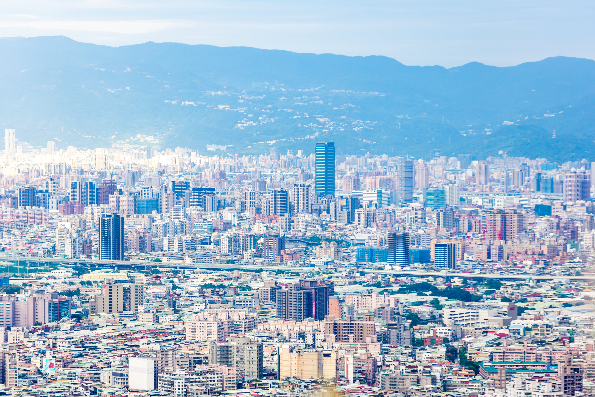
Taipei happens to be one of the world’s most modern cities and is home to almost three million people - What makes the city so special though is that it is extremely well-connected to the natural environment thanks to the mountains that surround it.

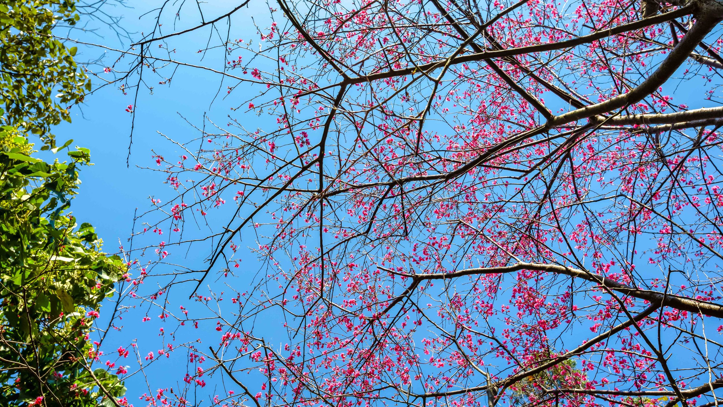
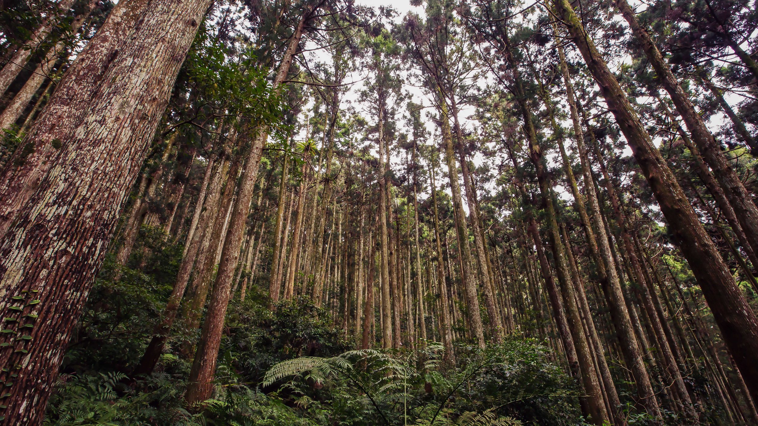
Taipei’s mountains not only create a natural barrier from the elements but also help to determine the city’s humid subtropical environment and offer residents easy access to much needed respite from city life.

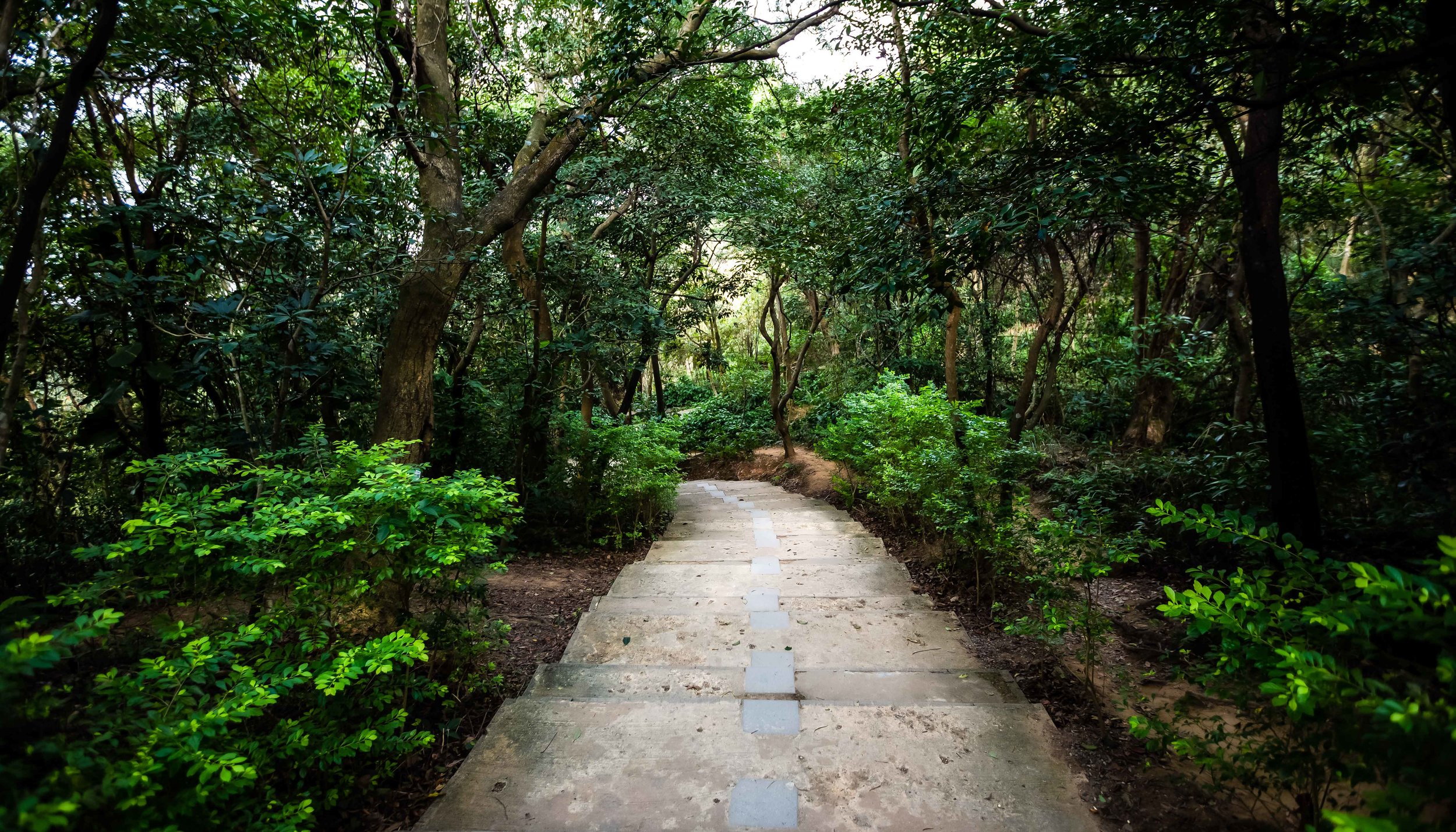
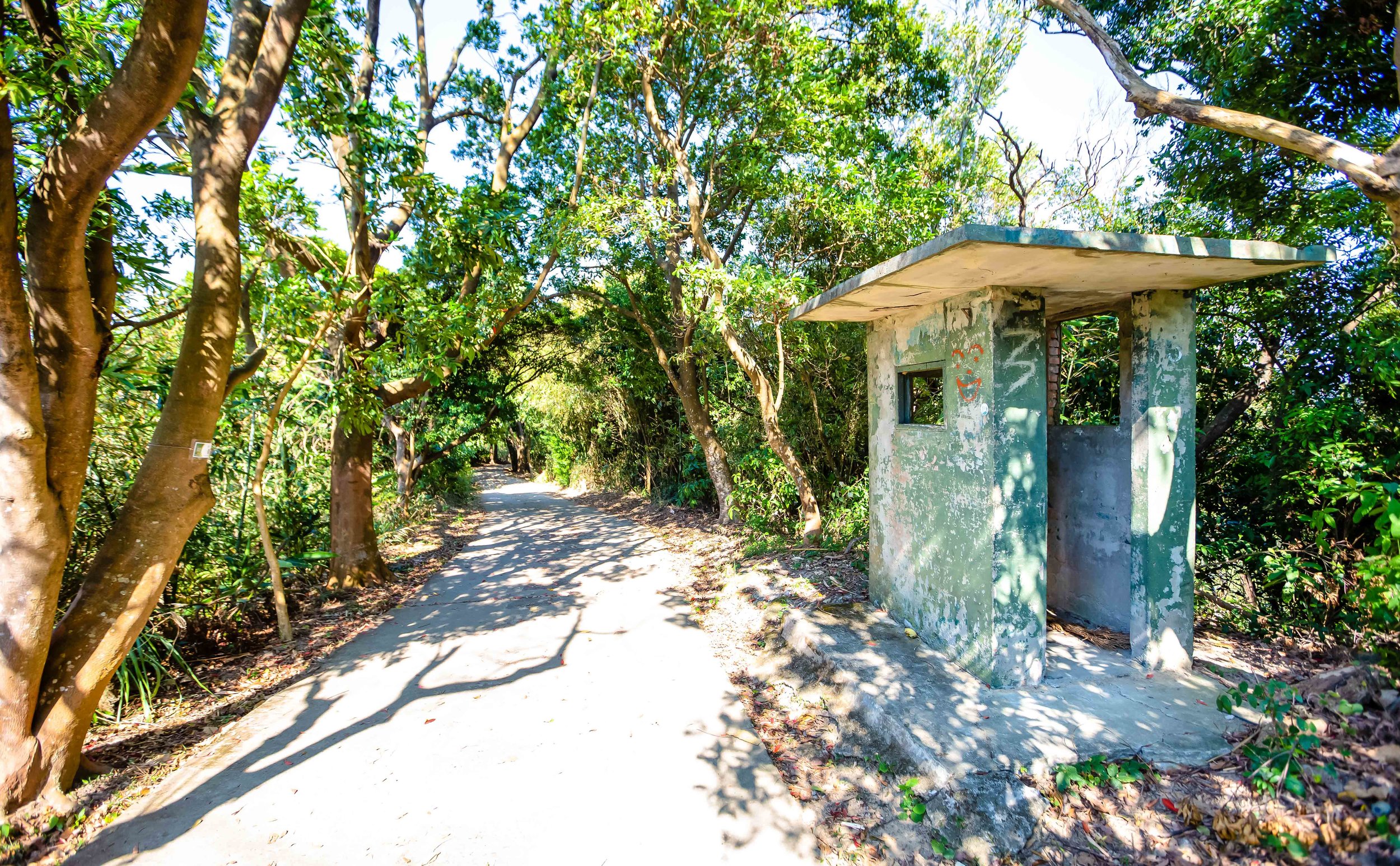
Residents of the city rarely have very far to go to reach one of their mountains and the local government has done an excellent job providing well-developed and well-maintained trails for people to safely enjoy nature.

While the residents of the city are often well-informed when it comes to their mountains, tourists have a bit more difficulty enjoying all that Taipei has to offer.

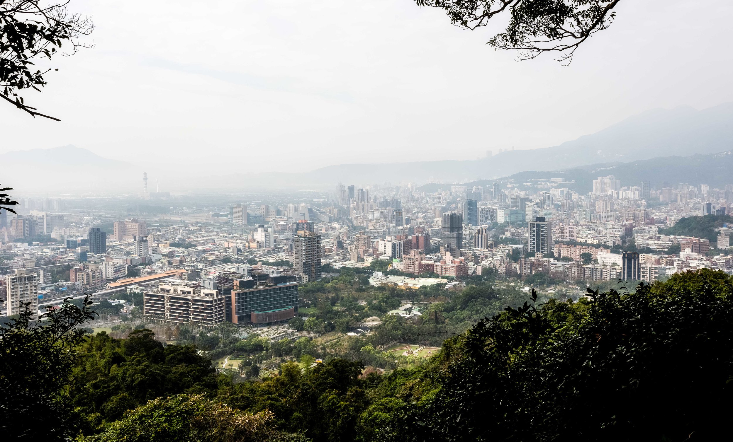
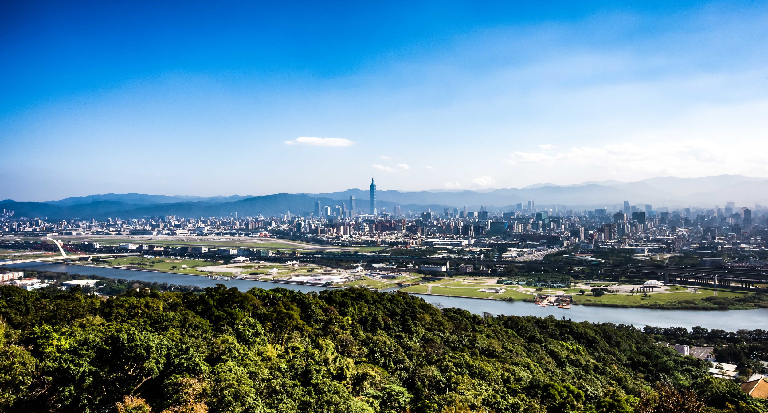
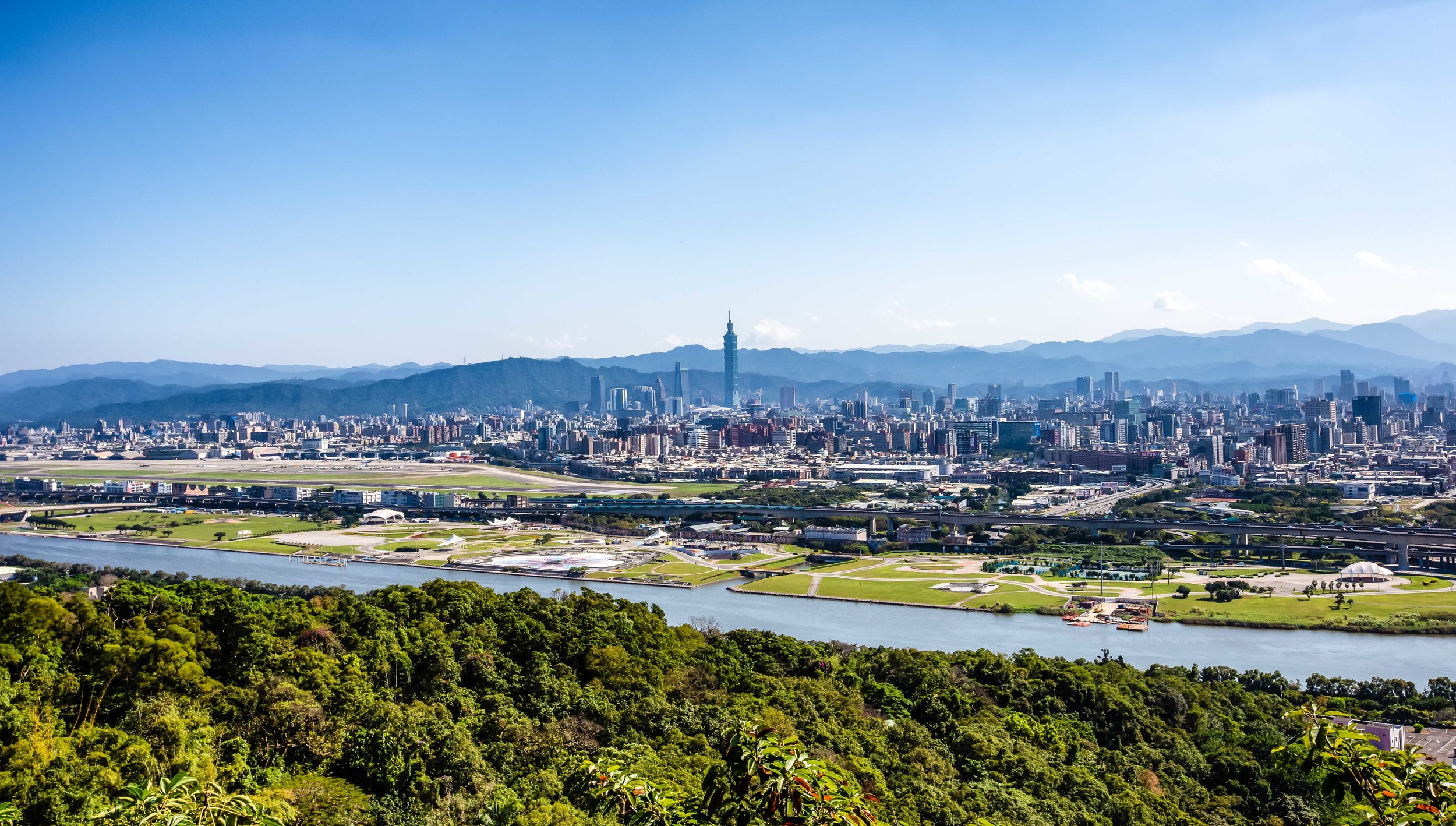
Most people who visit Taiwan are well-aware of the amazing cityscape views available at Elephant Mountain but they’re less likely to know that the city has several other mountain peaks that offer similar views except with considerably less tourists.

Tiger Mountain, which is part of the same network of hiking trails as the much more popular Elephant Mountain, is one such example of a mountain peak that offers amazing views of the city - and more importantly is one with far fewer tourists blocking your view.

It may well be one of the city’s best kept secrets.

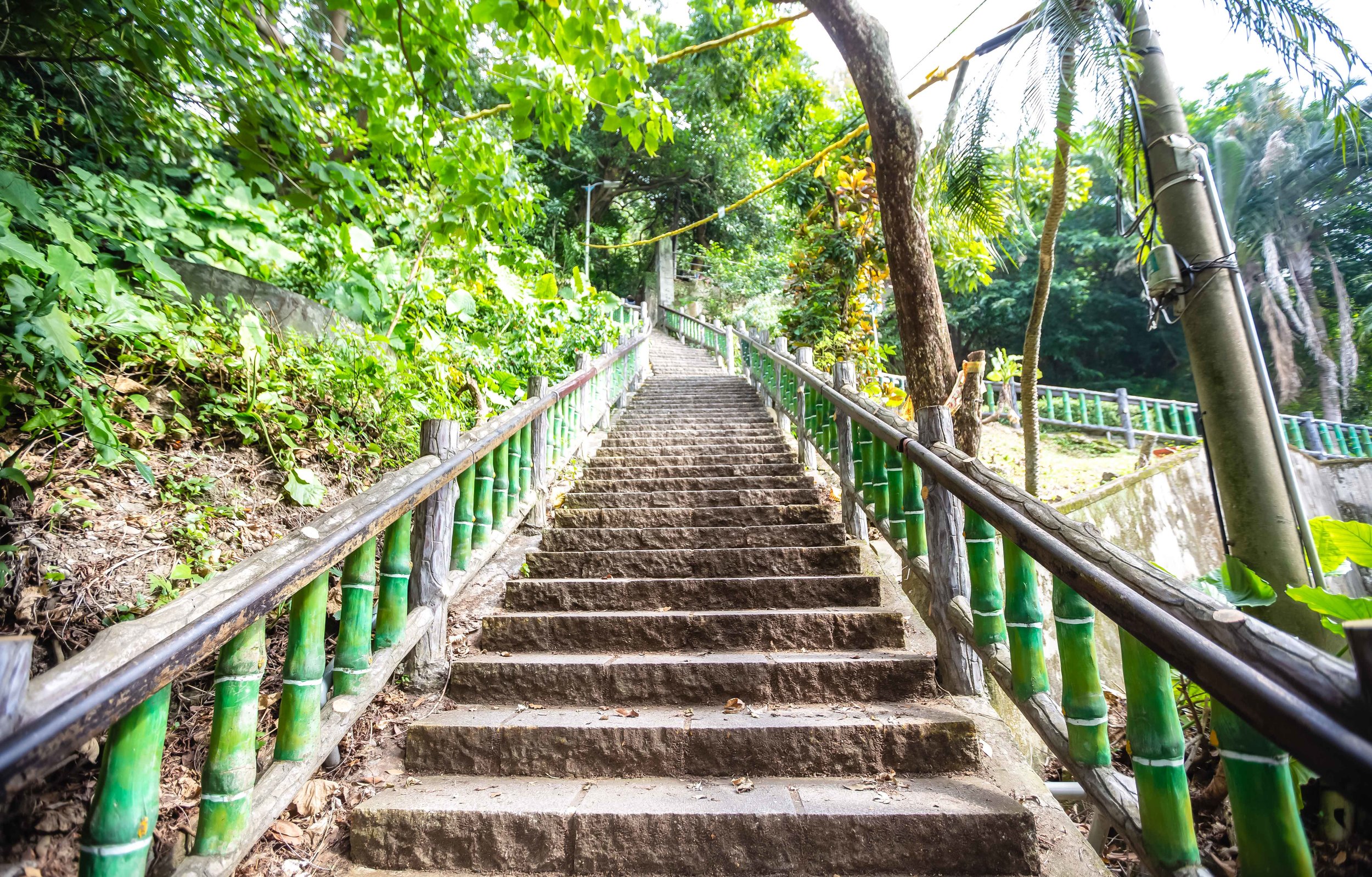
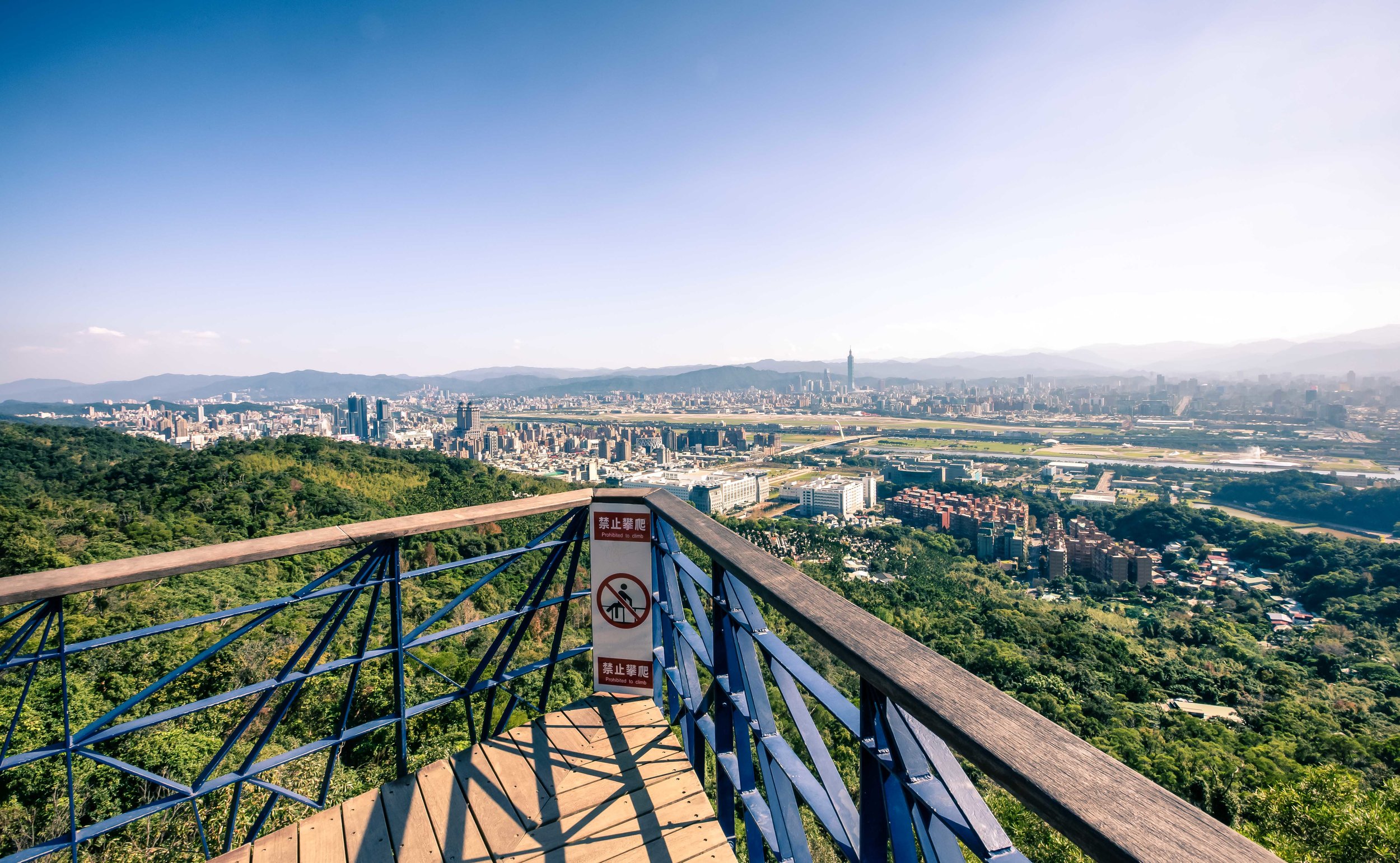
Tiger Mountain Hiking Trail (虎山登山步道)

You could accuse me of a bit of exaggeration - Tiger Mountain isn’t exactly a secret.

It’s safe to say though that it probably isn’t really high on the radar of short-term tourists.

And that’s certainly a shame.

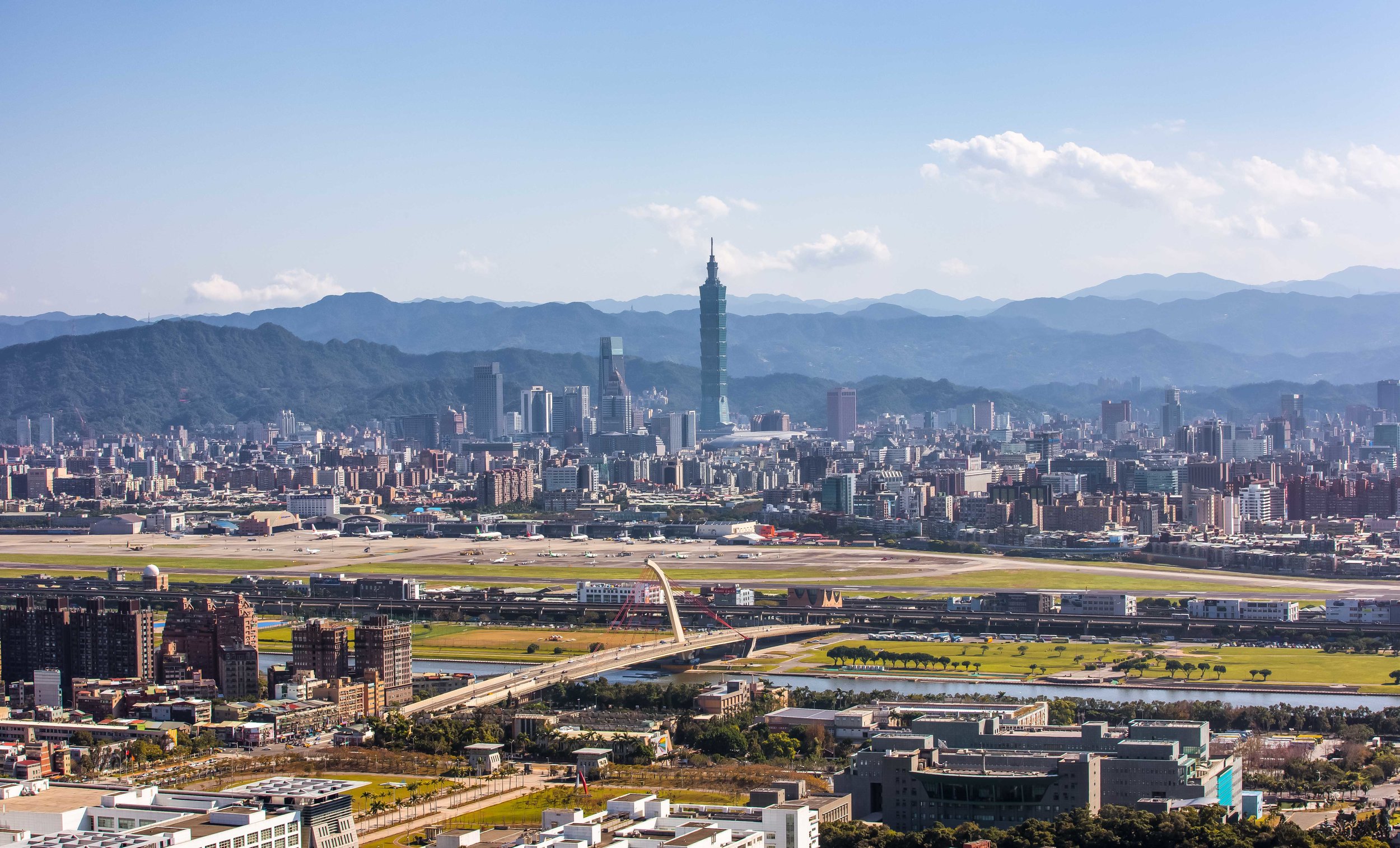
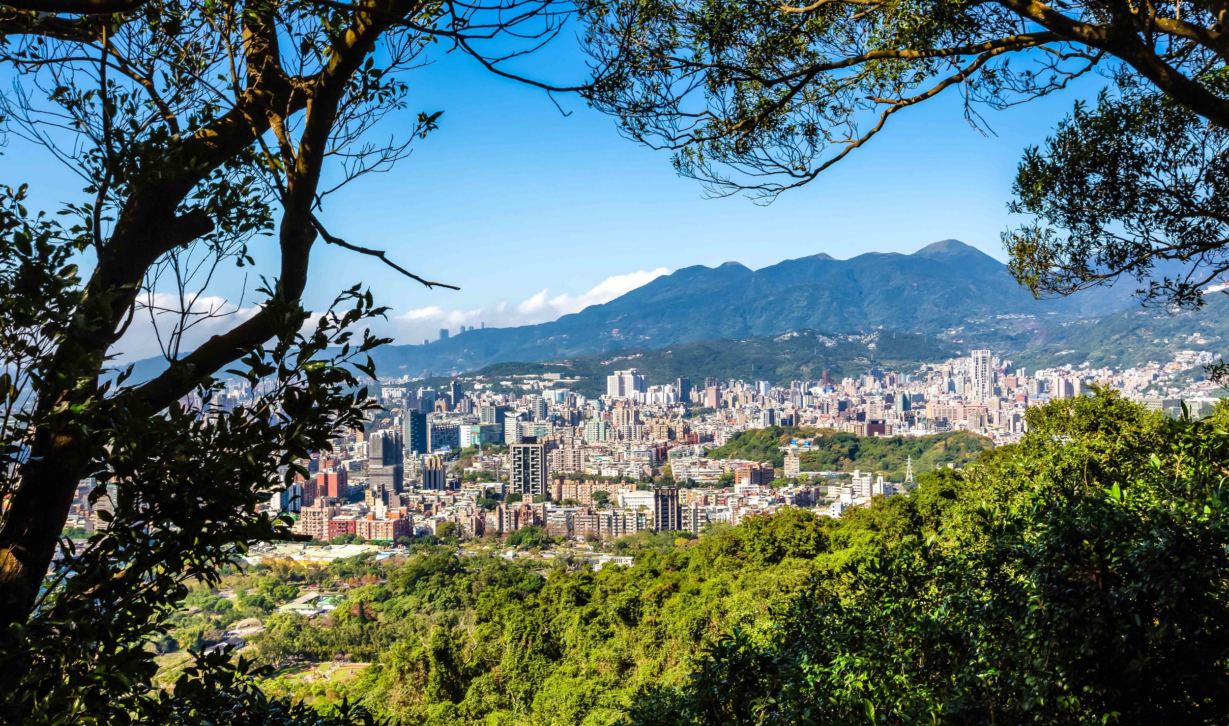
Tiger Mountain offers surprisingly similar views of the Taipei cityscape than its more popular neighbour Elephant Mountain and is also much easier to climb.

The hiking trail also offers hikers access to all of the “Four-Beasts” (四獸山) which include Leopard Mountain (豹山), Lion Mountain (獅山) and Elephant Mountain (象山) as well as other peaks like Thumb Mountain (拇指山), 9-5 Peak (九五峰) and Nangang Mountain (南港山).

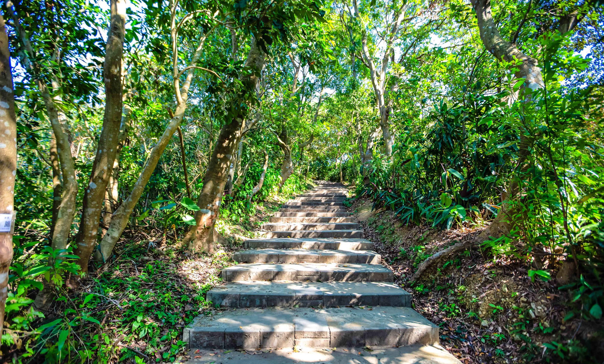
Depending on where you start the hike, it shouldn’t really take you any longer than 20-30 minutes to complete - but that depends on how many times you stop to enjoy the scenery.

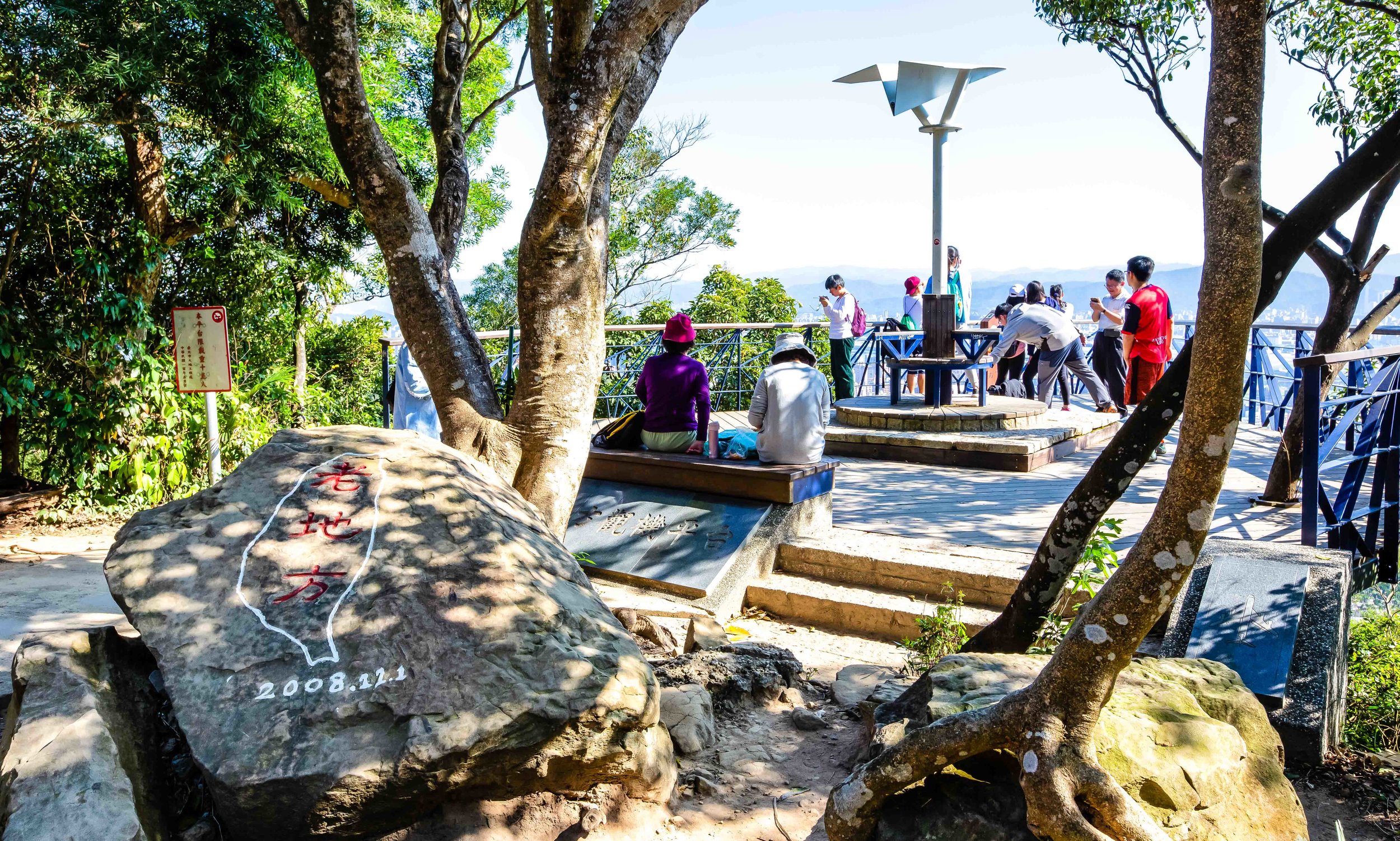
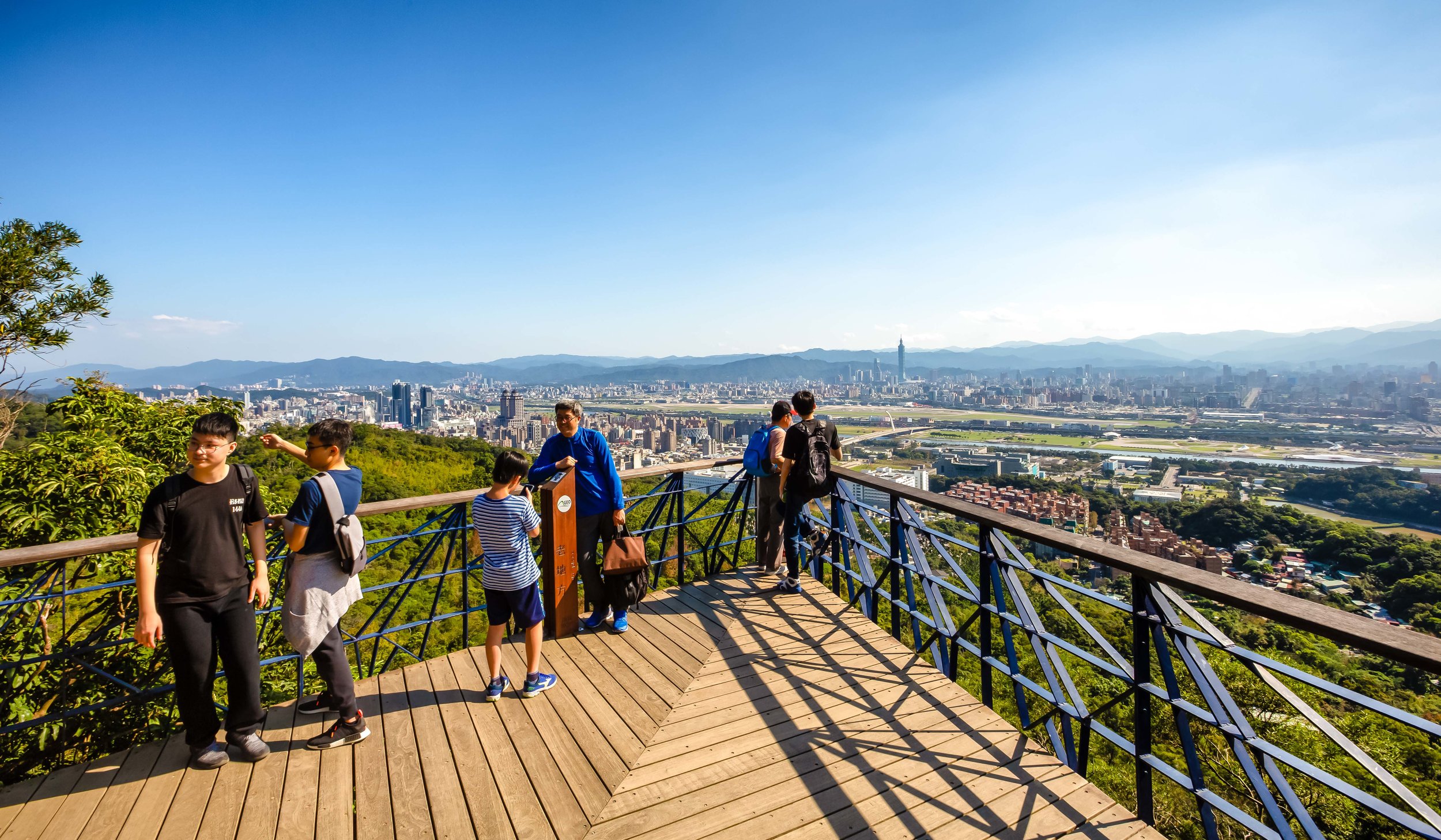
The peak has a platform set up to enjoy the view but even before you arrive there are several vantage points where you’ll be able to enjoy great views of the city.

For those who plan to hike all of the “Four Beasts”, your best bet is to start your hike from Tiger Mountain and finish at Elephant Mountain. This way you avoid a much steeper climb and the throngs of tourists who will get in your way.

You’ll also be able to complete the hike much faster than you would if you started on the opposite side.

The peak of Tiger Mountain

It should be noted that if you are looking for a place to watch the Taipei 101 fireworks, it is unlikely that you’ll be able to get a spot unless you arrive extremely early.

The mountain isn’t a secret with locals and photographers tend to reserve their spaces early for the show!

Leopard Mountain Hiking Trail (豹山登山步道)

If you’ve got a bit of extra time, you may want to consider the short walk from the peak of Tiger Mountain to the peak of nearby Leopard Mountain. You may think that walking from the peak of one mountain to another is going to take a while but it actually only takes about five to ten minutes to get to the next peak / viewing platform.

Once you leave the peak of Tiger Mountain you’ll likely start to notice signs on the trail that point in the direction of Leopard Mountain. You’ll quickly descend to a paved road where you’ll walk past a temple and then make a right turn from there.

The platform to Leopard Mountain is a two minute walk from the temple and offers another visitors another well-maintained platform that gives relatively similar views of the Taipei cityscape.

If you arrive at Tiger Mountain and there are a lot of people on the platform, you may want to consider heading to Leopard Mountain and then coming back later!

If you’d like more detailed information about Tiger Mountain and the rest of the Four Beasts, I highly recommend you check out Neil Wade’s blog “Hiking the Four Beasts Mountains (四獸山) - Tiger Mountain (虎山)” which gives excellent details and includes a map of all the trailheads and points of interest.

Getting There


There are several trailheads that give visitors access to the Four Beasts Hiking Trail - The commonality between all of them however is that you’ll take the MRT to a station on the Blue Line and then walk for about 10-15 minutes before arriving at your chosen trailhead.

The easiest walking route would be to get off the MRT at Houshanpi Station (後山埤捷運站) and make your way to Fengtian Temple (奉天宮) where you’ll find the trailhead to the rear.

This route is the most straight forward because it doesn’t require a lot of turns and there are signs on the road that will easily navigate you toward the temple and the trailhead.

Another route involves getting off the MRT at Yongchun Station (永春捷運站) and turning right on Songshan Road (松山路) and then either making your way toward Fengtian Temple or to the trailhead across the street from Yongchungang Park (永春崗公園) with the latter being a bit closer in terms of walking distance.

There are of course pros-and-cons to each of the trailheads in terms of walking distance from the MRT and some of the things you may or may not see along the way. If you want a shorter walk and a quick climb you should probably consider heading there via Yongchun station.

Either way I highly recommend stopping by Fengtian Temple either before or after your hike - it is one of the city’s prettiest places of worship and is definitely an added bonus to the hike!

It seems like everyone who visits Taipei knows about the view from Elephant Mountain and they’re all willing to climb it to try to get their iconic travel photos.

If you’re impatient like I am and you really don’t have to spend all your time waiting in line to take your turn for a photo you may want to consider trying your luck with Tiger Mountain.

Say no to long lines! Say yes to Tiger Mountain!


Jiantan Mountain (劍潭山)

Taipei is a city that is blessed to be nestled in a space that is almost completely surrounded by mountains.

The city’s mountains not only help determine its comfortable climate but also protect it from the disastrous typhoons that often blow in from the Pacific Ocean.

While the mountains serve an important role for the natural environment, in the eyes of its residents the most important role the mountains play might be to provide spaces for recreation and weekend getaways!

Taipei’s mountains are often filled up with locals wanting to escape the city for a bit of exercise and to spend a bit of time enjoying the beautiful natural environment.

The city government has done an amazing job over the years developing and maintaining countless hiking routes throughout many of its mountainous areas - All of which offer residents a safe place to hike without ever having to worry about getting lost.

If you are a visitor in Taipei there are a multitude of options to choose from when you are looking for a place to enjoy the natural environment.

Guide books and travel blogs often point tourists to the same few destinations - most notably Xinyi District’s “Elephant Mountain” (象山) for the views of the city - But that means your hiking experience is likely to be one that is shared with hundreds, if not thousands of other people and when you have to compete with others for a selfie on a mountain, you’re probably not really able to properly enjoy nature.

What most tourists may not realize is that there are several trails around the city which offer similar or equally impressive views without having to wait in line to take a photo.

One of those hikes that offers such a perspective is a trail on the northern side of the Keelung River that in recent years has become a popular alternative for photographers and instagrammers wanting to avoid large crowds and a bit of fresh air.

Jiantan Mountain (劍潭山)

Most travellers who come to Taiwan are likely to be familiar with the Jiantan MRT Station (劍潭捷運站) as it is home to the Shilin Night Market (士林夜市), one of Taipei’s most well-known tourist stops.

It isn’t likely though that they’re aware that the station gets its name from the mountain that runs parallel to the station and is located on the opposite side of the night market.

Jiantan Mountain isn’t exactly what you’d consider a ‘high’ mountain - it’s only 153 meters above sea level - it is however a historically important one.

Today the mountain is home to the Grand Hotel (圓山大飯店) and numerous temples and recreation areas that were constructed over the past few decades.

During the Japanese Colonial Era, it was home to the Taiwan Grand Shrine (台灣神宮), the highest ranking Shinto Shrine (神社) in the country, but has unfortunately since been destroyed.

It is also home to the Water God Shinto Shrine (圓山水神社) which you can fortunately still see today.

When sovereignty of Taiwan was ‘relinquished’ to the Republic of China at the end of the Second World War the mountain became a military-controlled area in order to protect President Chiang Kai-Shek and his family who were staying in the Grand Hotel until their formal residence was completed.

Once the residence was completed the mountain continued to remain off-limits to the public as it was constructed at the base on the opposite side of the hotel and it was suspected that communists were roaming the areas attempting to assassinate the first family.

It is widely reported that there is a network of secret tunnels that litter the mountain between the official residence and the Grand Hotel which were constructed so that the president could safely escape in case of attack.

Taiwan was once a much different country.

In 1980, after more than three decades of being prohibited to the public, the mountain was opened up to the public and hiking trails were constructed.

I suppose if you wanted to look on the bright side, the lack of human activity on the mountain for those four decades preserved the natural environment and offered a home to many species of birds.

The 80’s though were a bit of a weird time for Taiwan as the economy was booming and people were looking for ways to spend some of their newfound riches. One idea that people came up with was to start laying concrete pretty much anywhere they could.

Jiantan Mountain was no exception and you’ll find that quite a bit of space was used to create recreational areas for people - most notably badminton courts - and temples.

Today the Jiantan Mountain Hiking Trail consists of a vast network of paths that range from short leisurely hikes to much longer day-hikes that span several city districts.

The hiking trails (for the most part) consist of well-developed paths that have lights which guide your way at night and trail markers which guide you to all of points of interest along the way and help to ensure that you won’t get lost.

The first few minutes of the hike tend to be the most difficult and steepest of the entire trail. Don’t let that scare you away - The rest of the hike is more of a brisk walk through the woods than an actual hike.

Within the first fifteen-to-twenty minutes you’ll arrive at the first ‘observatory’ which provides amazing views of the city and will definitely make you feel better about all those stairs you just walked up.

I’m sure for some people the view of the city from the first observatory might suffice, but you should definitely consider walking a bit further as the first platform doesn’t face the city while the others offer a much more direct perspective. 

After passing the first observatory the rest of the trail tends to even out and you will get great views of Shilin (士林), Beitou (北投), the Danshui River (淡水河) and Guanyin Mountain (觀音山) on one side with a wide-open view of the rest of Taipei, including Taipei 101 on the other side.

Soon enough you’ll arrive at the “Lao Di Fang Lookout” which has become the main destination for many of the people hiking the mountain in recent years.

From there you have the choice to either head back the way you came, continue along the mountain for a longer day-trip or to head down to street level to take a bus back to town.

One thing that you’ll want to note is that the markers on the trail give you an ‘estimated’ amount of time to arrive at each destination. Like most mountains in Taiwan, I’m not sure how they estimated the time intervals but what I can tell you is that you should definitely ignore them.

The estimated 180 minutes from the trailhead to the “Lao Di Fang” Lookout took me about thirty minutes - and its not like I was running. I think their estimations were primarily based on how long it takes 90 year olds with only one leg to climb the mountain.

Lao Di Fang Platform (老地方觀機平台)

Even though Jiantan Mountain has a “peak”, it is safe to say that the majority of people who hike the trail won’t even bother attempting to reach it.

The main attraction of the hike is a platform known as the “Laodifang Lookout” (老地方觀機平台) which allows for panoramic views of Taipei city - and of course is a popular selfie spot.

Lao Di Fang” loosely translates as “Old Place” and was an area frequented in the past by people who would climb the mountain for their morning exercises. It became a daily routine for a lot of them to hike to the area for morning Tai-Chi with spectacular views of the city. 

The platform is advertised primarily as a spot for watching airplanes taking off and landing at Taipei’s Songshan Airport (松山機場) but is also a great spot for checking out the city from the opposite side of the Keelung River with Taipei 101 flanked by mountains.

On a clear day you’ll have spectacular views of the city - but I’d caution you - Hike this mountain only when the weather is great. If your purpose for hiking this mountain is for taking photos of the city, you’ll be sorely disappointed on a day when the weather or air quality is terrible.

The first time I climbed the mountain to take photos for this post, the weather was great, but the air quality was considered “unhealthy” (AQI: 130) so when I reached the lookout I could barely even see as far as the river - Taipei 101 and the rest of the city were completely obscured by a thick cloud of haze.

Such is the case when you’re taking cityscape shots these days in many of the worlds large cities.

Photo Tips

I’m sure I don’t really have to say this but if you’re heading here hoping for night views of the city, make sure to bring a tripod so that you can take long exposures and stabilize your camera. If you’re not travelling with a tripod, it is possible to set your camera on the ledge of the platform and hope for the best but you may end up with a bunch of fails due to the fact that the platform tends to vibrate when people are walking on it.

You may also want to consider bringing a telephoto lens with you so that you can take closer images of Taipei 101 flanked by mountains.

Some of the photos you’re seeing here were taken with a 70-200mm lens.

The platform tends to be a popular spot, especially on weekends, so you may end up having to wait for a spot to get some photos - but your wait will be nothing compared to what has become extremely long waits at other spots.

Getting There


Simply take the Taipei MRT Red Line (紅線) to Jiantan Station (劍潭捷運站) and from Exit 2 cross Zhongshan North Road (中山北路) and make a right turn.

From there simply walk for a few minutes until you arrive at the trailhead.

The trailhead is a steep set of stairs with a traditional gate over it with a map of the trail to its left.

Next to the trailhead you’ll notice a small temple and another building that is equipped with public washrooms which is useful for washing your face and hands after the hike.

Save for the first few minutes, Jiantan Mountain is a relatively leisurely trail to hike and also offers visitors quite a few temples to visit as well as vistas for which to view the city.

Included in the hike you’ll discover a bit of Taiwan’s modern history as you pass by several abandoned military outposts which were once used to protect the president.

If you’re looking to take some beautiful cityscape photos, this hike offers several wide-open vistas which are equally enjoyable during the day and the night and requires very little time and effort but there is more of a focus on exercising and enjoying the peace and quiet of nature than you’ll get at some of the other popular tourist locations around the city.

An added bonus would be that your photos will offer your friends and family a bit different of this beautiful city than what you’ll see in guide books. If that interests you, you should definitely consider visiting Jiantan Mountain!


Sanjiaopu Mountain (三角埔頂山)

A few years ago I posted a blog about the beautiful Silver Grass (芒花) that appears during the Autumn and Winter months in Taiwan turning the country’s lush green mountains white.

I might have been a bit ahead of the curve as the blog post was the only English-language resource available at the time that introduced the beautiful weeds.

Since then ‘Silver Grass tourism’ has sort of become ‘thing’ around here and people are flocking to mountains all over the country taking photos of the tall grass.

I’d like to think my humble blog post played a small role in that.

Actually no, I jest.

The sudden popularity of Silver Grass-related tourism as of late is probably thanks to what I’ve started to refer to as ‘Insta-tourism.’

To put it simply, trends in domestic tourism in Taiwan these days is almost completely driven by trends on Instagram and Social Media - Think Pokemon Go, but instead of catching a monster, you get to take photos.

In the the west we’ve taken to referring to those people who earn a living from their Instagram following as ‘influencers’ while here in Taiwan they are known as “Internet Beauties” (網美) or “Internet Celebrities” (網紅).

In Taiwan these so-called influencers play a lot of the same advertising roles that they do in other countries but are also very much engaged in driving new trends and introducing new photo locations to their followers.

A single photo from one of these people has the ability to turn what was once a quiet destination (enjoyed mostly by locals) into a social-media sensation.

As an avid hiker, I’ve found that I’ve always been able to climb mountains on weekends and never really had to deal with traffic jams on the trails. Now though, you have to be very selective of what mountains you are climbing as some of them have become popular spots for Instagrammers to roam around.

As I’ve mentioned before, Jinmian Mountain (金面山), Kite Mountain (鷹山), the Sacred Mother Peak (聖母山步道), Yuanzui Mountain (鳶嘴山) and the Pingxi Crags were all hiking trails that were pretty much only frequented by hiking groups. Today they are all filled with people looking not for a good day of exercise but to increase their follower counts.

Whether or not this kind of tourism is a good thing remains to be seen.

As Silver Grass tourism became a popular trends over the past few years, the mountains where it grows in abundance have been filling up with visitors.

Traditionally, the most popular locations to go and check it out has always been on Taipei’s Yangming Mountain (陽明山), Cixing Mountain (七星山), Datun Mountain (大屯山) or on the historic Caoling Trail (草嶺古道).

This year however there was a new contender for the most popular spot thanks to Instagram.

Like many other mountains in Taiwan as of late, what was once a quiet hiking trail frequented only by locals, Sanjiaopu Mountain (三角埔頂山) has became yet another internet sensation thanks to the power of social media.

The mountain which sits on the border of Taoyuan and New Taipei City was once most well-known for its panoramic cityscape views of the Taipei basin. These days however not many people really care about those beautiful views as Silver Grass tourism has completely taken over.

Interestingly enough, despite the local government having constructed a well-maintained hiking path on the mountain, it was never really that popular as most people stayed away due to the fact that the mountain is also home to a cemetery - which in Taiwan automatically means there are ghosts!

Rising only 285 meters above sea-level, Sanjiaopu Mountain isn’t a very big one and doesn’t actually require much hiking. You can drive your car or scooter almost all the way to the top where there is a parking area at the trailhead.

From the trailhead you only really need to walk about five minutes to reach the peak.

Not really a day trip if that’s what you’re looking for. 

There are however several trails on the mountain that allow visitors to walk around the perimeter where you’ll get different panoramic views of the cityscape.

On a clear day you’ll be able to see as far as Guanyin Mountain (觀音山) to the north and Datun Mountain (大屯山) and pretty much all of Taipei City to the east.

The views on top of this mountain are ideal for landscape or cityscape photographers.

While most people enjoy the views of Taipei City from Elephant Mountain (象山), this mountain provides a completely different perspective than what most are used to seeing and is justifiably very popular after dark for unparalleled night views of the city.

These days however its all about the Silver Grass.

Silver Grass (芒花)

Silver grass or ‘Miscanthus Sinensis’ is a species of flowering plant that is endemic to East Asia growing in Taiwan, Korea, Japan and China. In both Taiwan and Japan, the plant is widely respected and when it is in bloom people will flock to the mountains and hillsides to see it.

Coincidentally in North America attitudes toward the plant are the polar opposite as it is considered an invasive species and is usually destroyed to control its growth.

It's interesting that the so-called “weed” is reviled in one area and highly respected in another.

Between the months of October and December you can pretty much see wild silver grass growing all over Taiwan - Its literally everywhere you find a patch of grass.

If you want to see it growing in abundance, or you want to get some photos of yourself in a field full of it - you're going to have to head to the mountains where it grows without impediment.

Check out my blog post from a few years ago where I posted photos of the beautiful Silver Grass from the top of Datun Mountain in Taipei.

Getting There


As I mentioned above, Datun Mountain and Yangming Mountain in Taipei have always been most popular thanks to their accessibility when it comes to public transportation.

Unfortunately for the ‘influencers’ of the world, if you want to visit this one, you’re not going to be able to rely on public transportation to get there.

I mean, you could take a bus from Shulin (樹林) to Taoyuan (桃園) and get off somewhere in the middle and then walk a few kilometres up the paved mountain road.

But thats not really the best idea if you want to enjoy your time on the mountain.

If you do insist on using public transportation it’d be best to first take a train to Shulin Train Station (樹林車站) and from there take bus 701, 843, 985 or Orange 26. While on the bus watch for the “New Village” bus stop (新村站) where you’ll get off and begin your 2km walk up the mountain.

On the other hand, if you have your own means of transportation you’ll want to take Provincial Highway #1 (省道台一線) from either Taoyuan (桃園) or Xinzhuang (新莊) and turn off at the Dadong Bridge (大棟橋) where you’ll be transported behind some factories and up the mountain.

The mountain has quite a few side roads though and its easy to get lost, so its probably a better idea to input the words “三角埔頂山“ into Google Maps, which will guide you up the mountain where you’ll be able to park.

I realize that by (purposely) posting this blog well-after the Silver Grass season has ended won’t really help you out very much - especially if you’re an Instagrammer looking for a cool new spot to take photos - You’ll have to wait until next year for that.

This mountain however is a great spot all year long, so if you’re looking for somewhere to take cityscape photos that are going to turn out different than everyone else’s - you’ll definitely want to consider visiting this mountain!

Likewise, if you’re reading this blog just in time for Silver Grass season make sure to visit for the Silver Grass but remember to stay for the cityscape photos - especially at night!