In a recent case, the Shilin District Court in Taipei ordered the Yangmingshan National Park Administration to pay NT$3.96 million (US $134,000) in compensation to a family whose mother had died as a result of injuries caused by being pushed over by a wild water buffalo.
The family’s lawyer argued that the park administration hadn’t provided adequate safety measures for tourists and that the thirty-or-so water buffalo that graze in the area were a danger to society.
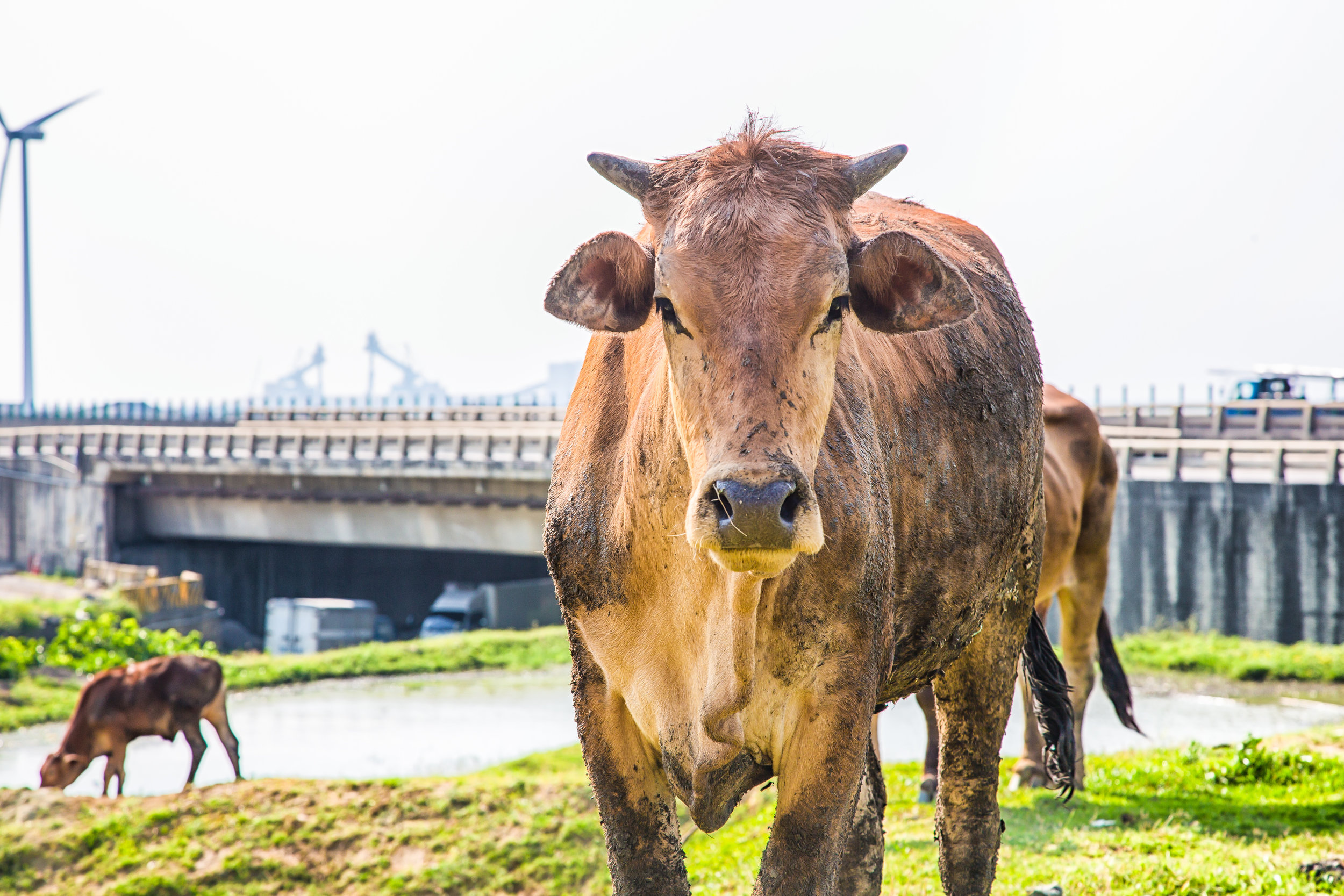
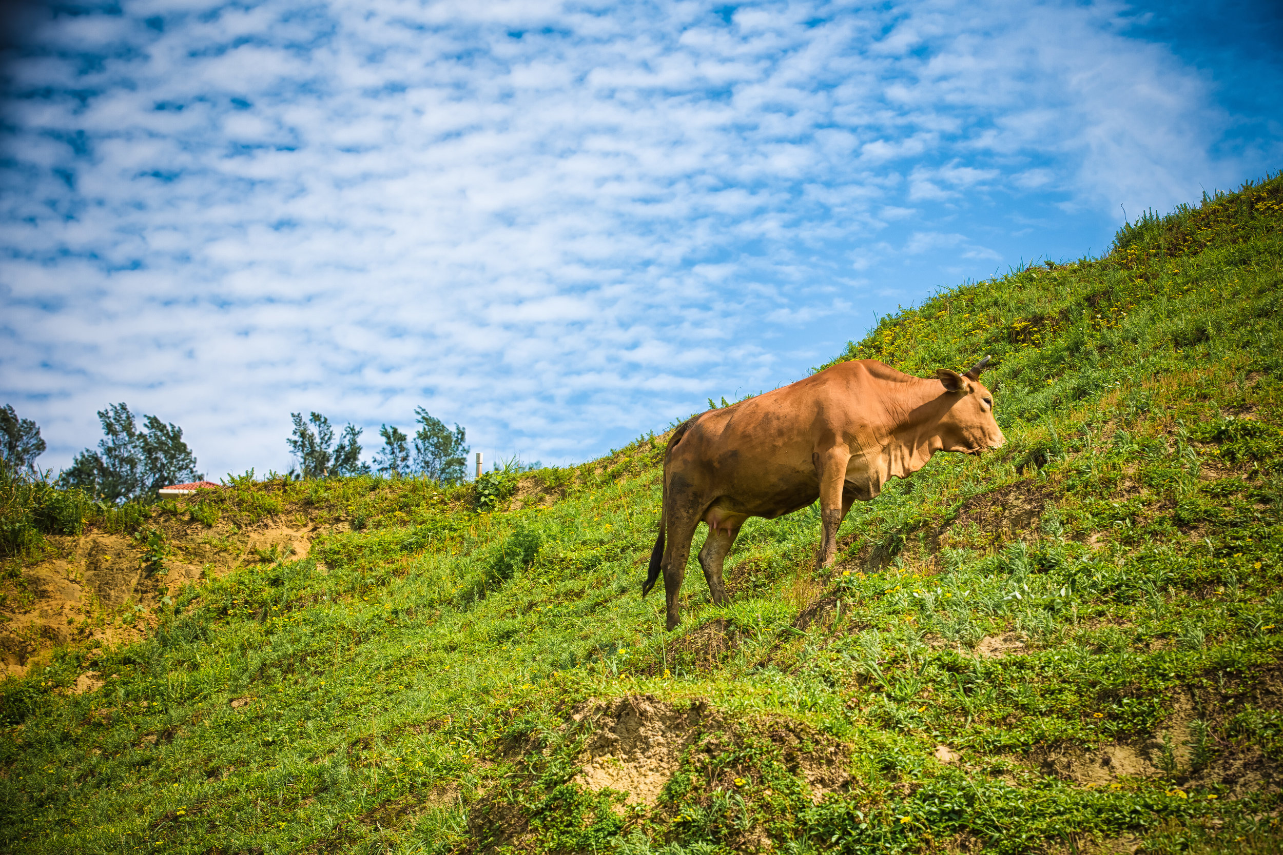
The ironic thing is that the water buffalo have been grazing on the grassy pasture since the Japanese Colonial Era (1895-1945), and are one of the main reasons why Qingtiangang (擎天崗) has become such a popular tourist destination in the first place.
Link: Court awards compensation to family of woman killed by water buffalo (Focus Taiwan)
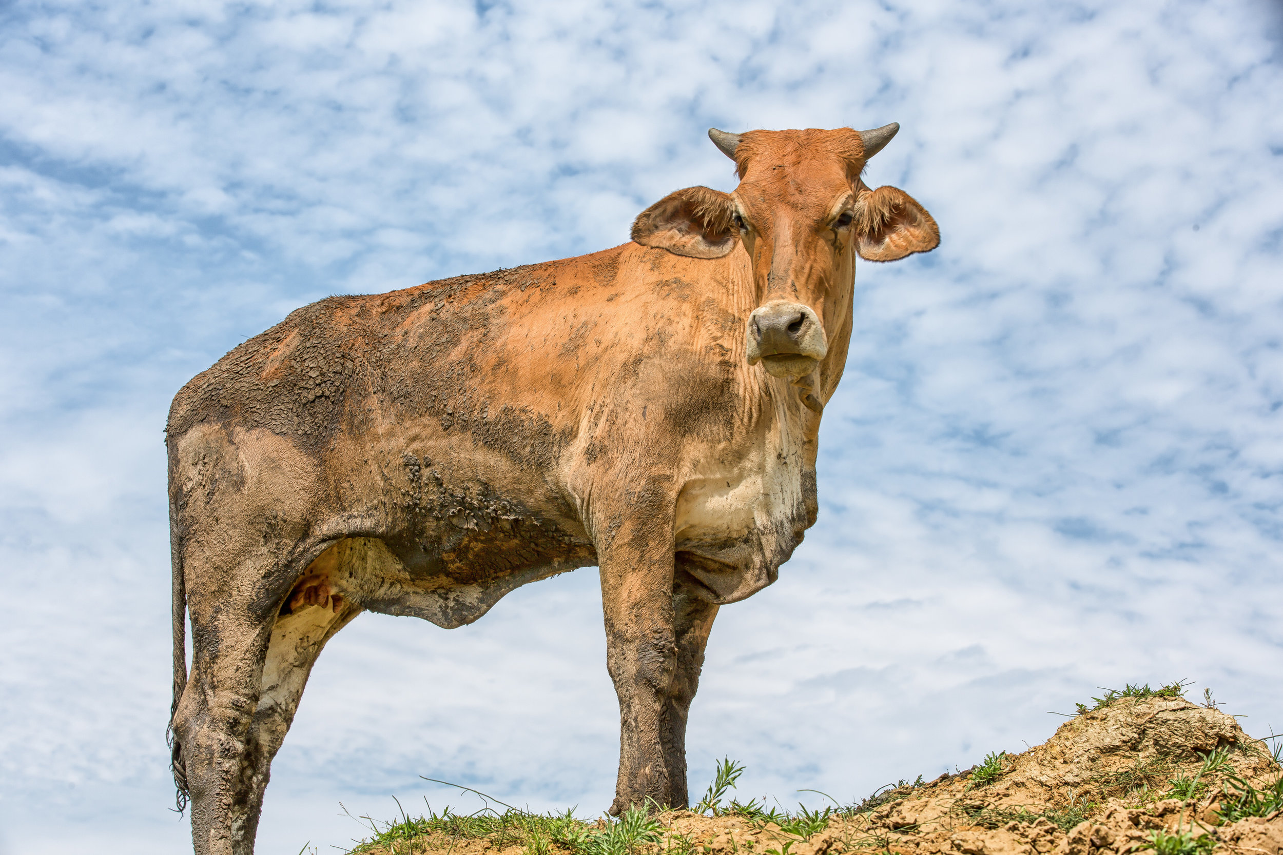
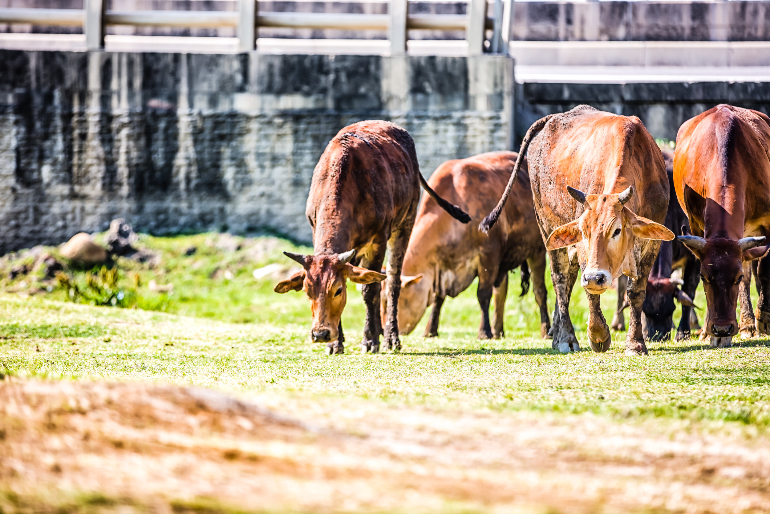
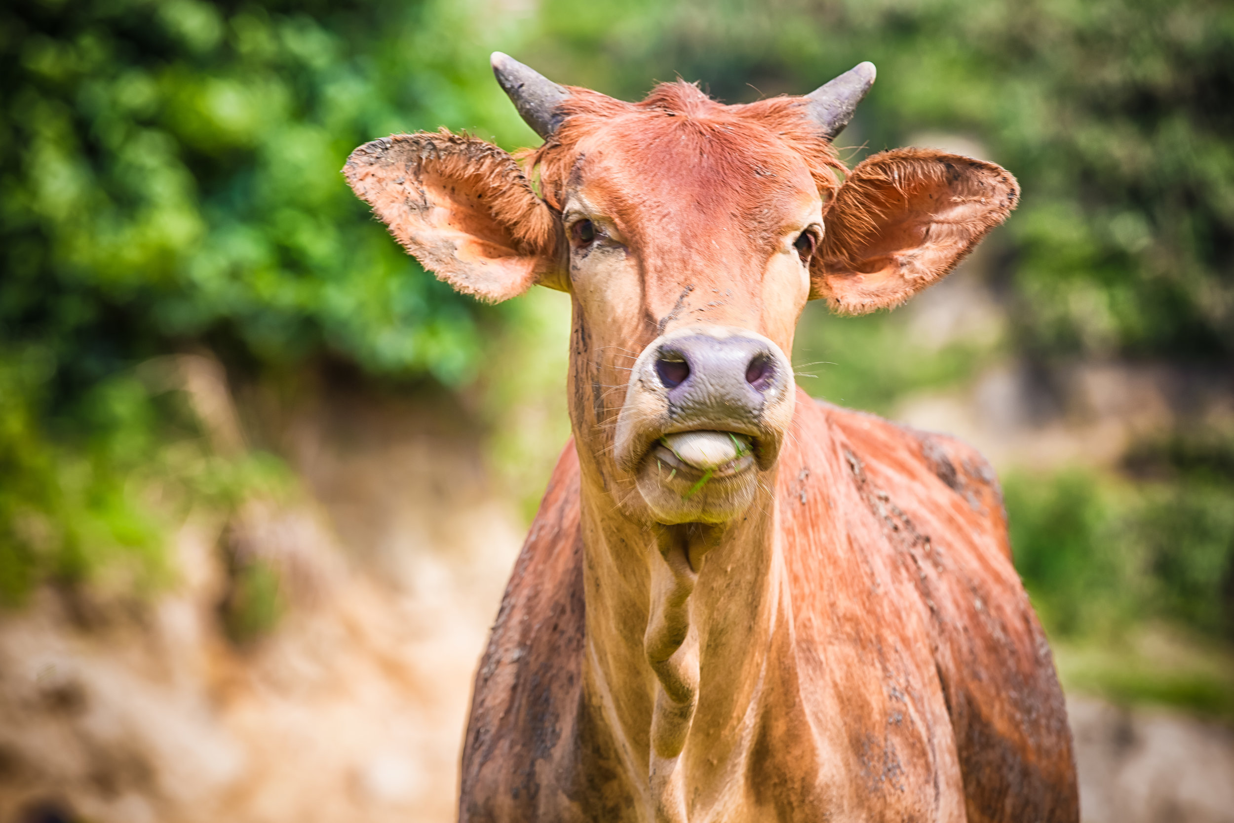
While I do have sympathy for the family, it was only a matter of time until one of the thousands of people who invade the personal space of the buffalos on a weekly basis were seriously injured. The mostly docile buffalo have had to put up with people approaching them (and their young) for photos for quite some time now.
This, in addition to a general lack of understanding about the behaviour of wild animals is something that makes for a dangerous situation.
So, in order to ensure the public’s safety, large fences were erected to separate the ferocious buffalo and the visitors which ultimately limits the freedom that the animals have enjoyed for the past century, but also their grazing space.
Likewise, the fences that have been erected are somewhat of an eyesore on the extremely picturesque mountainous plateau.
This reminds me of the infamous Liebeck v. McDonald’s court case in America, where the restaurant was more or less sued for selling hot coffee.
While this water buffalo case might not have been as frivolous, as adults, we should probably all be mature enough to understand the danger involved in approaching a wild animal for a photo. Unfortunately people these days get caught doing some tremendously moronic and dangerous things for a little bit of attention on social media.
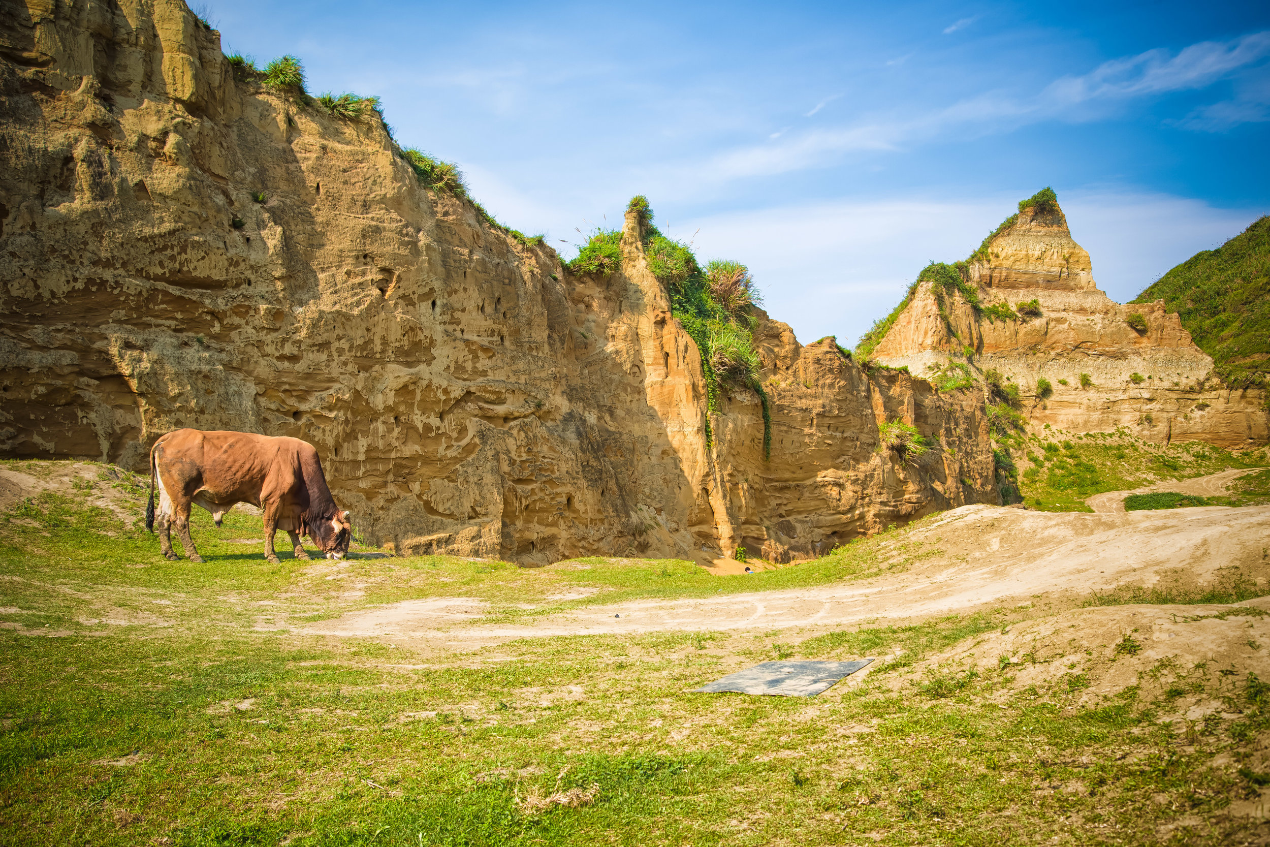
What happened at Qingtiangang is similar to what has also happened at Linkou’s beautiful Water Buffalo Valley (水牛坑), which became one of the hottest Instagram photo spots in Northern Taiwan a few years back.
The local media describes the area as Taiwan’s “Grand Canyon”, but similar to Qingtiangang, that wasn’t particularly the main attraction - The valley also happened to be the grazing space for a much larger group of water buffalo than you’ll find at Yangmingshan.
Today though, thanks to the irresponsible masses of Instagram, the land owner has had to erect signs in the valley that read “Restricted Area - No Entry Unless Authorized” and has to have security hanging out to ensure that none of the people who visit are approaching the buffalo.
Likewise, the large group of buffalo that once grazed there can only do so under the watchful eye of their owners - who obviously don’t feel like paying out a massive settlement to some Insta-fool who invades the space of one of the buffalo.
Now that both Qingtiangang and Water Buffalo Valley have been somewhat damaged as tourist destinations, the collective attention of Taiwan’s Instagram community seems to have descended upon a new location to ruin, New Taipei’s Taoyuan Valley (桃源谷).
I’ve had the Taoyuan Valley hike on my list of places to write about for quite some time, but now that it has become an Instagram hotspot, I decided that it would have to jump to the top of my list.
This isn’t because I wanted to follow the trendy masses, but simply because I didn’t want to miss out on an opportunity to hike the beautiful trail and enjoy the space before it suffers a similar fate and ultimately gets fenced up.
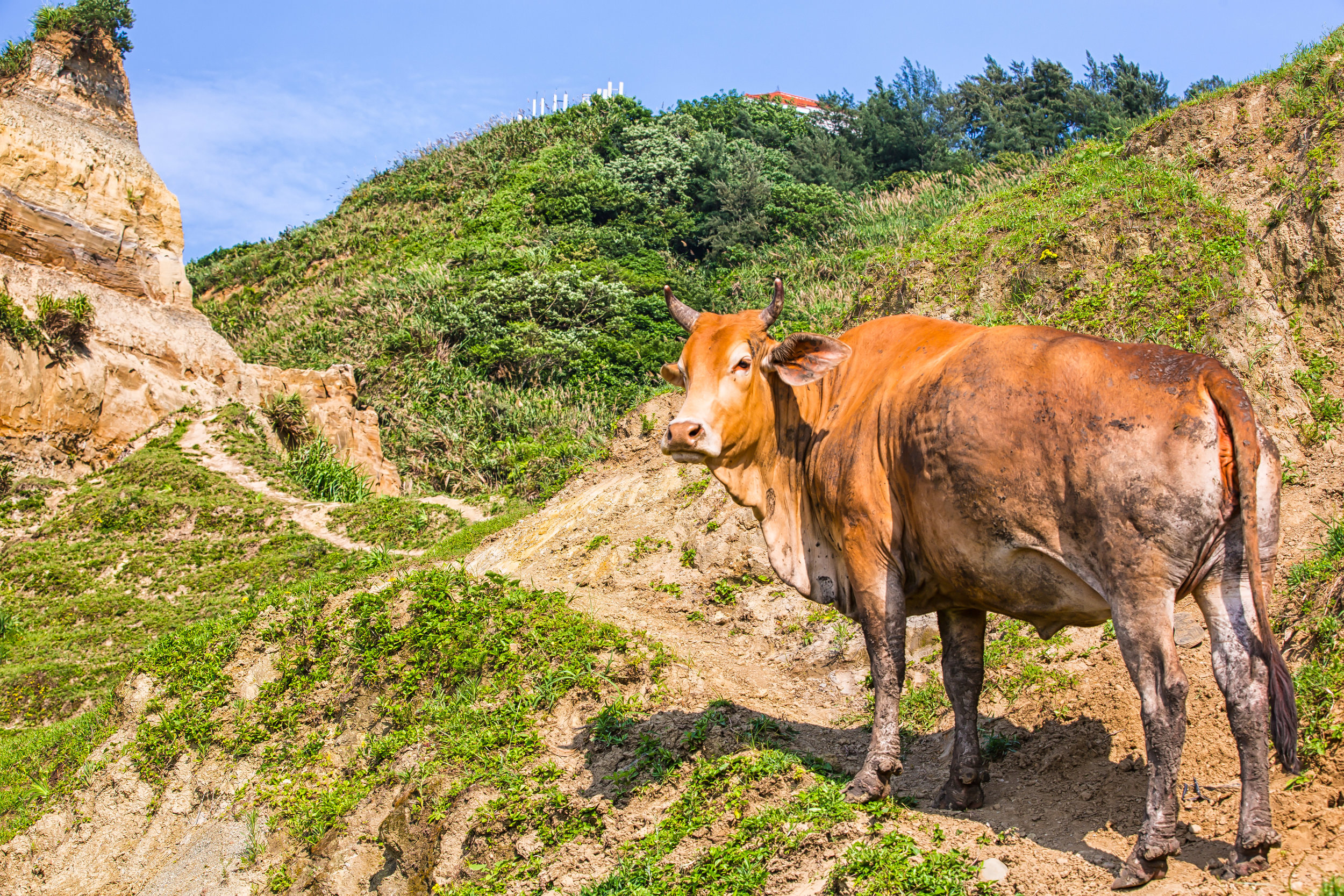
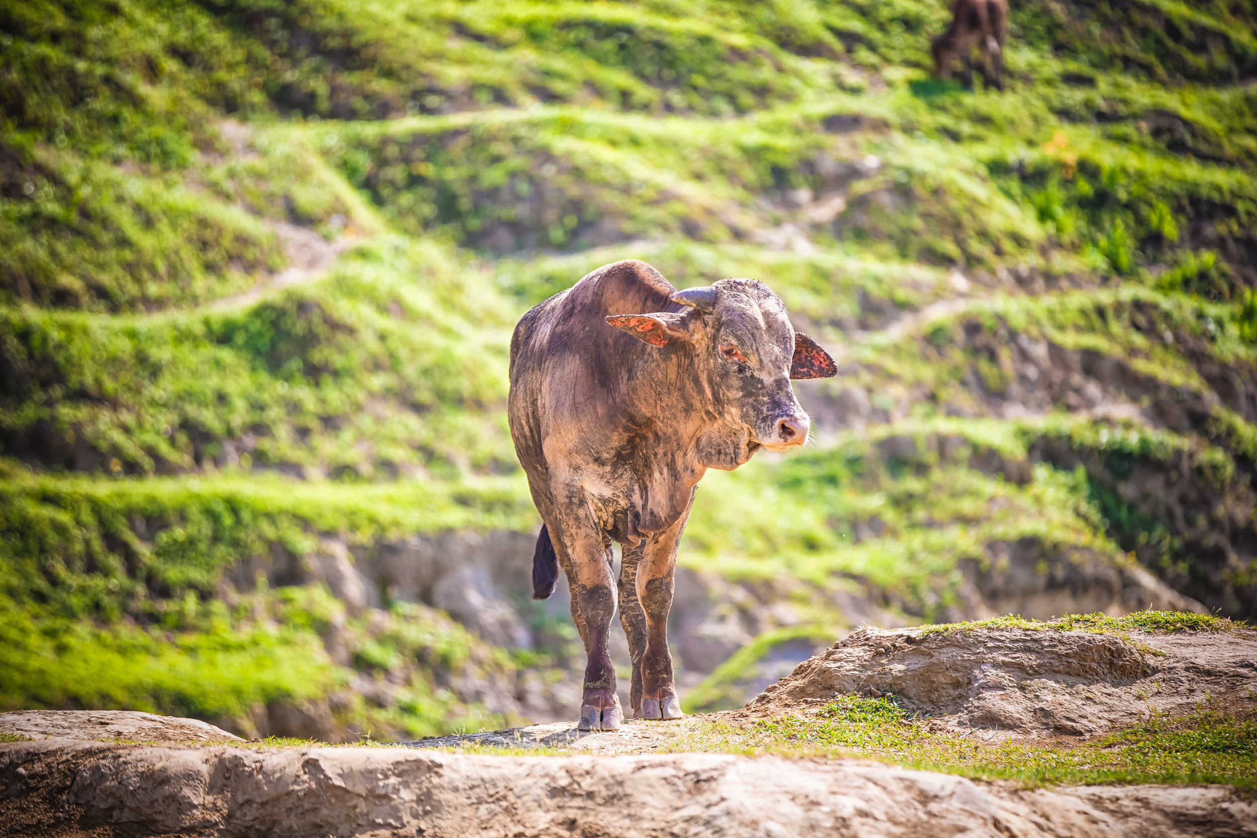
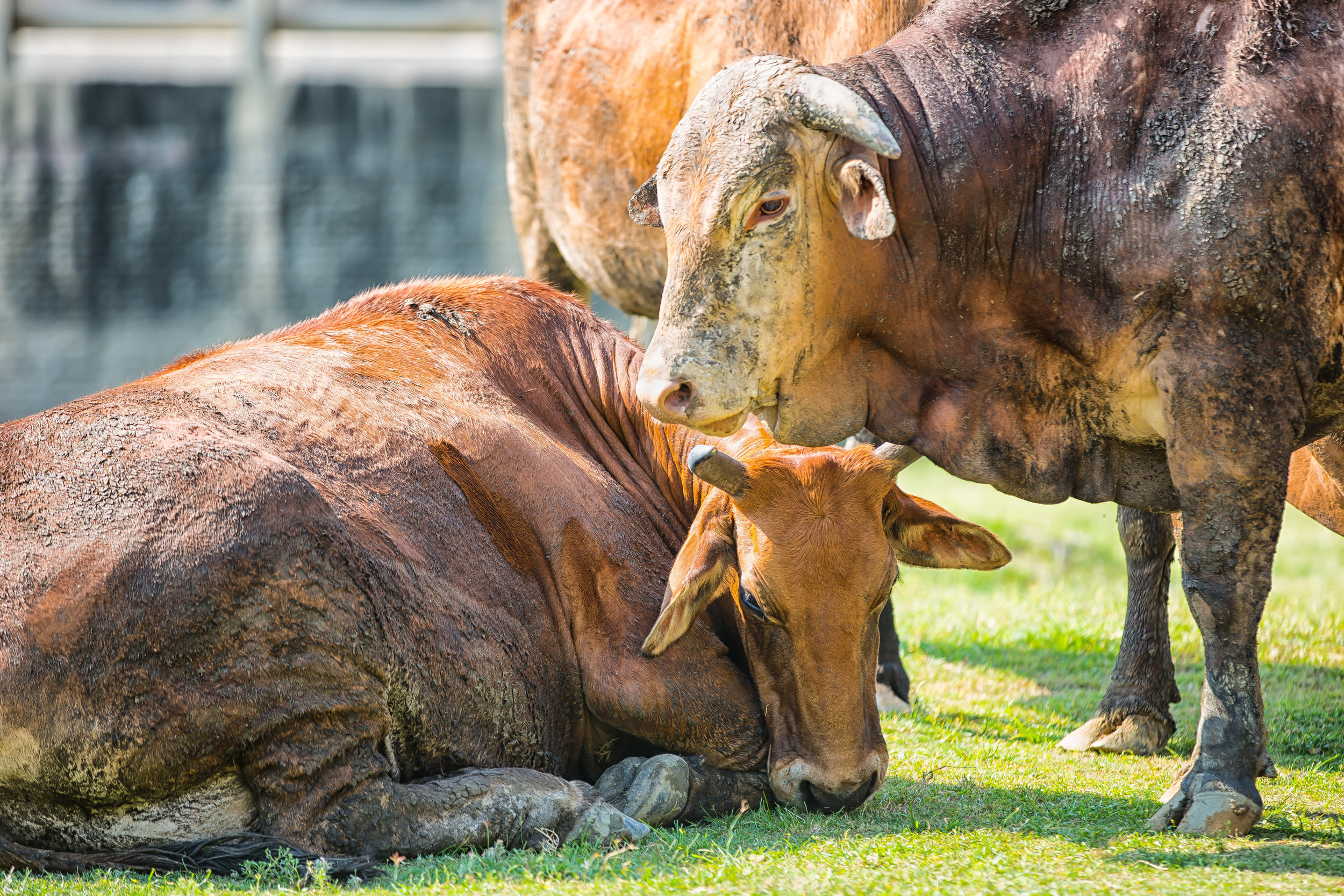
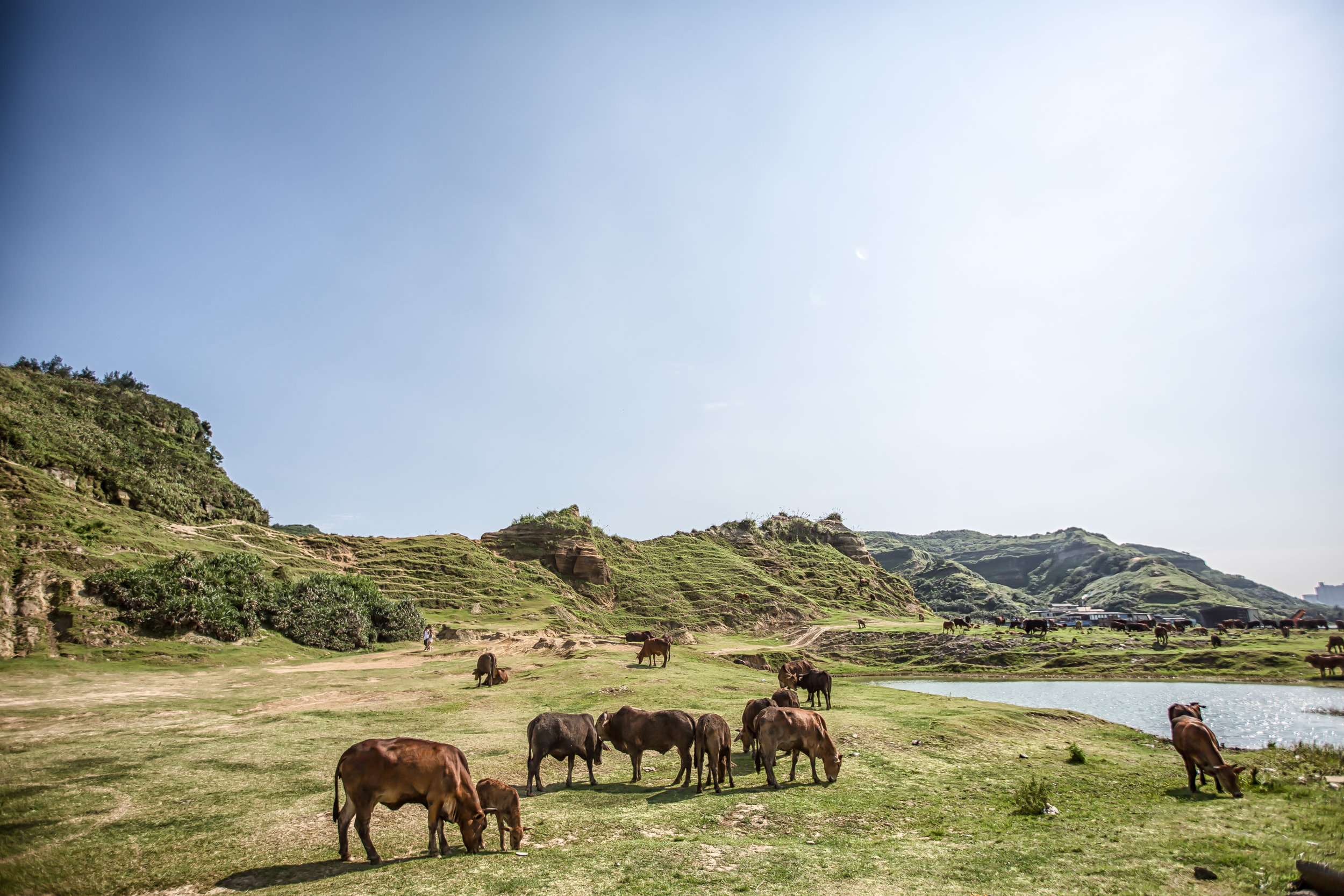
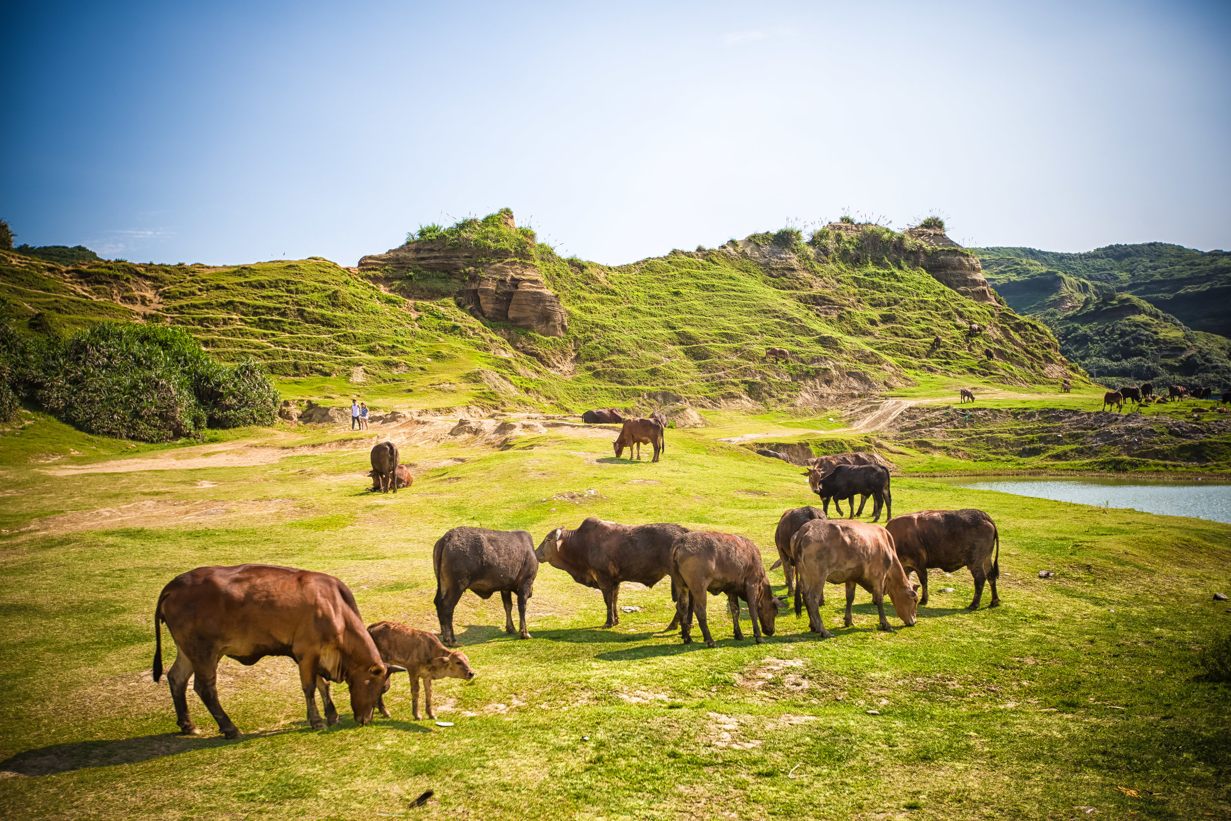
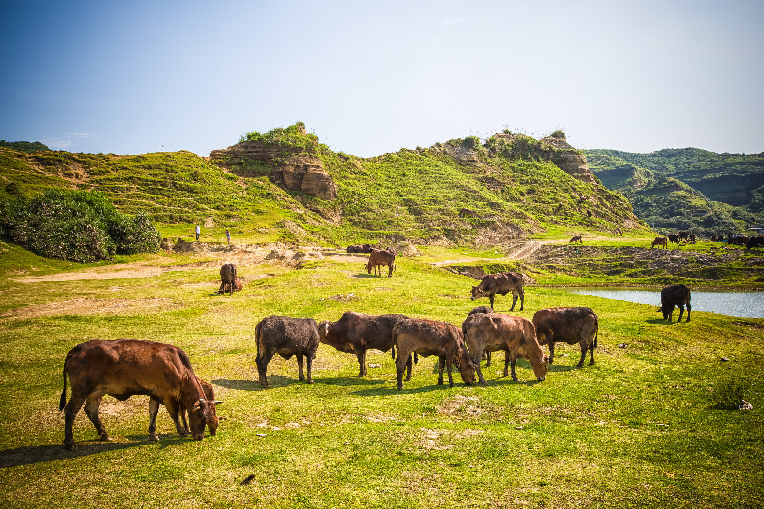
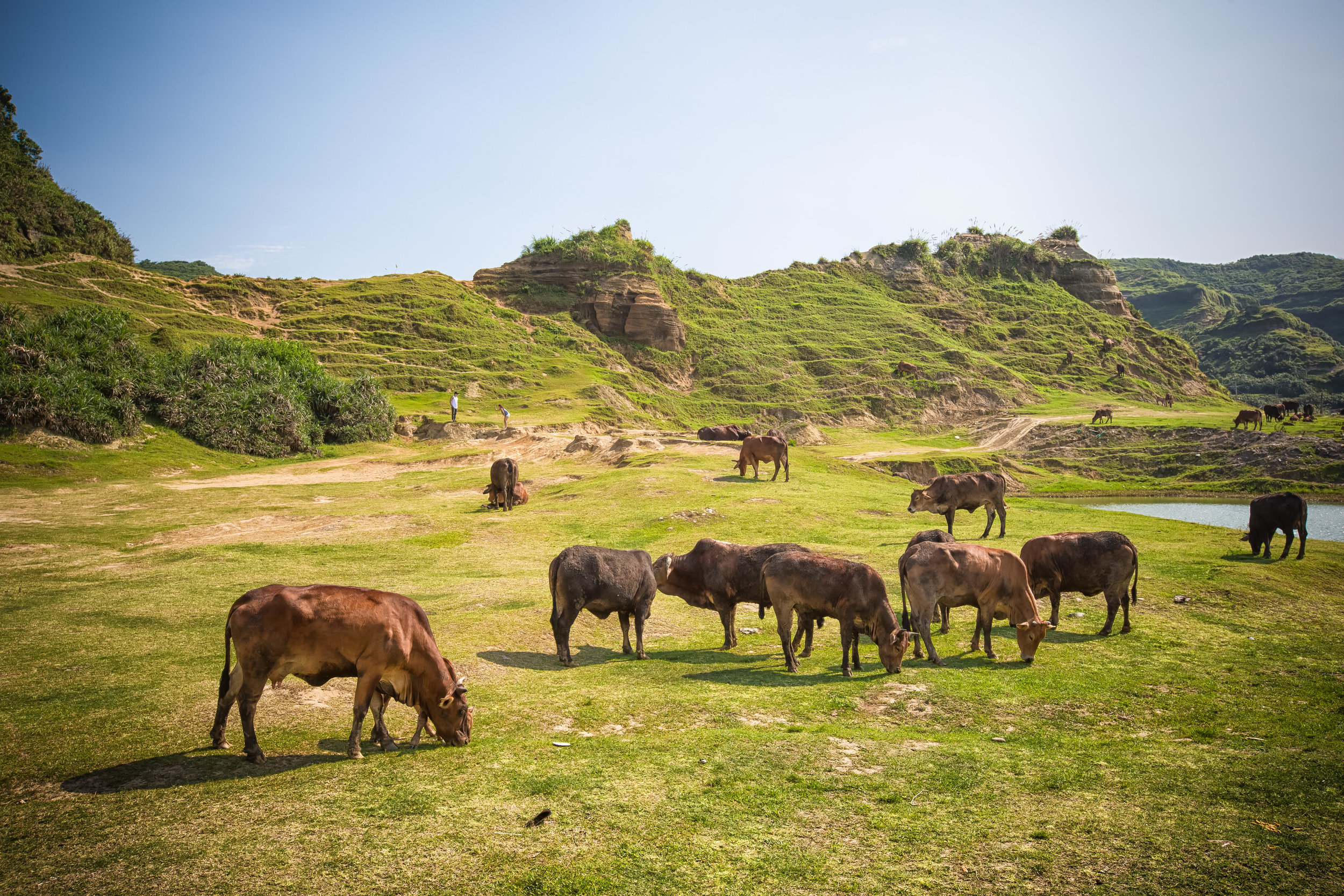
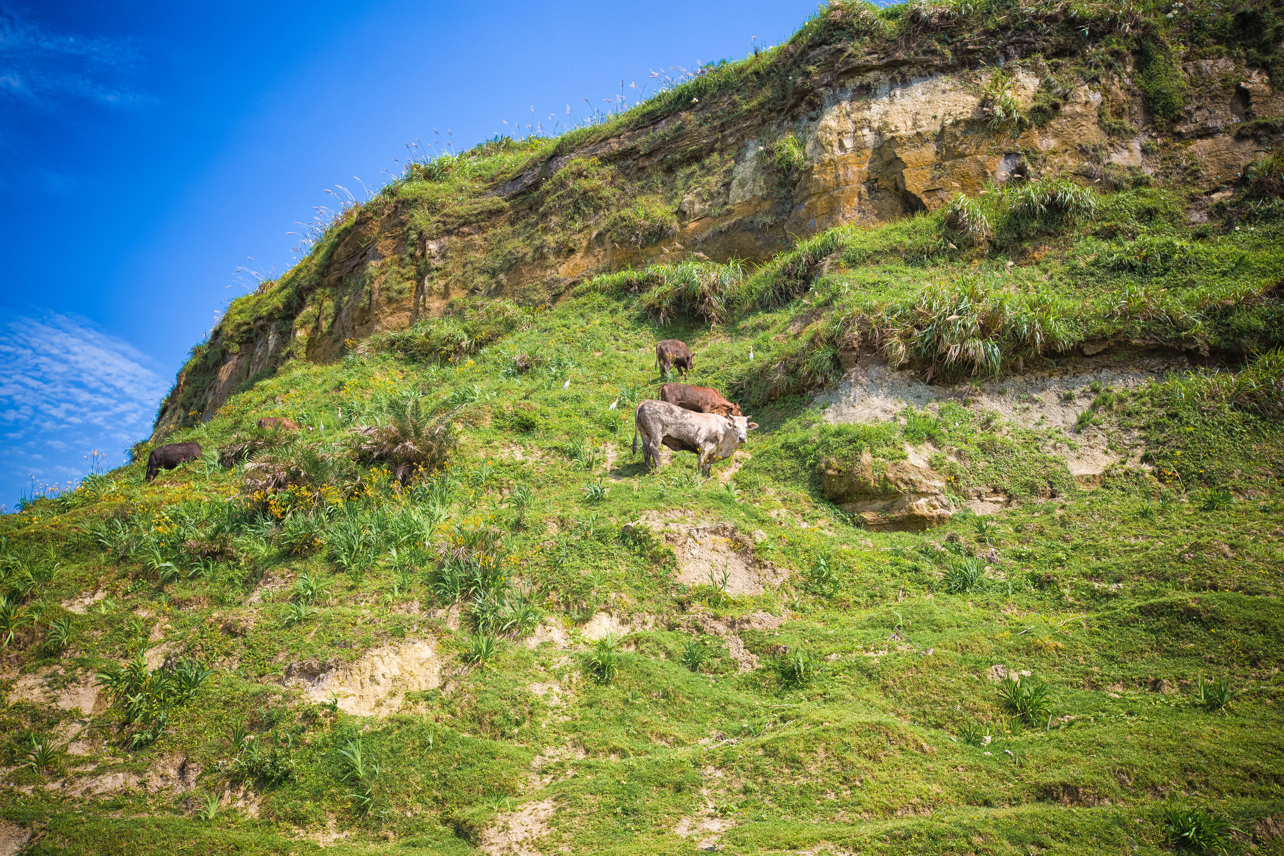
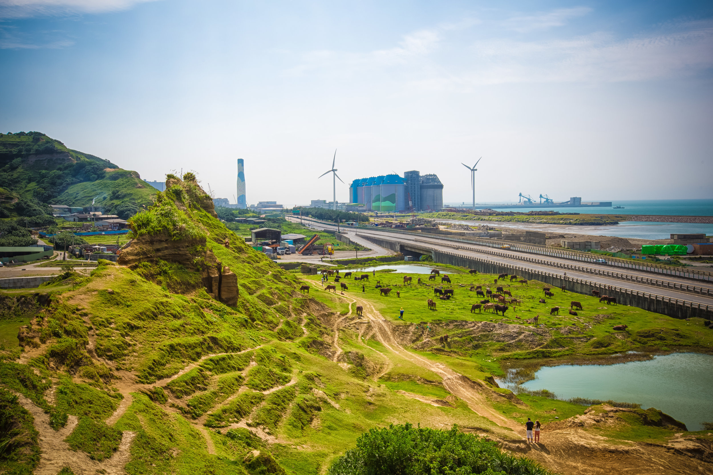
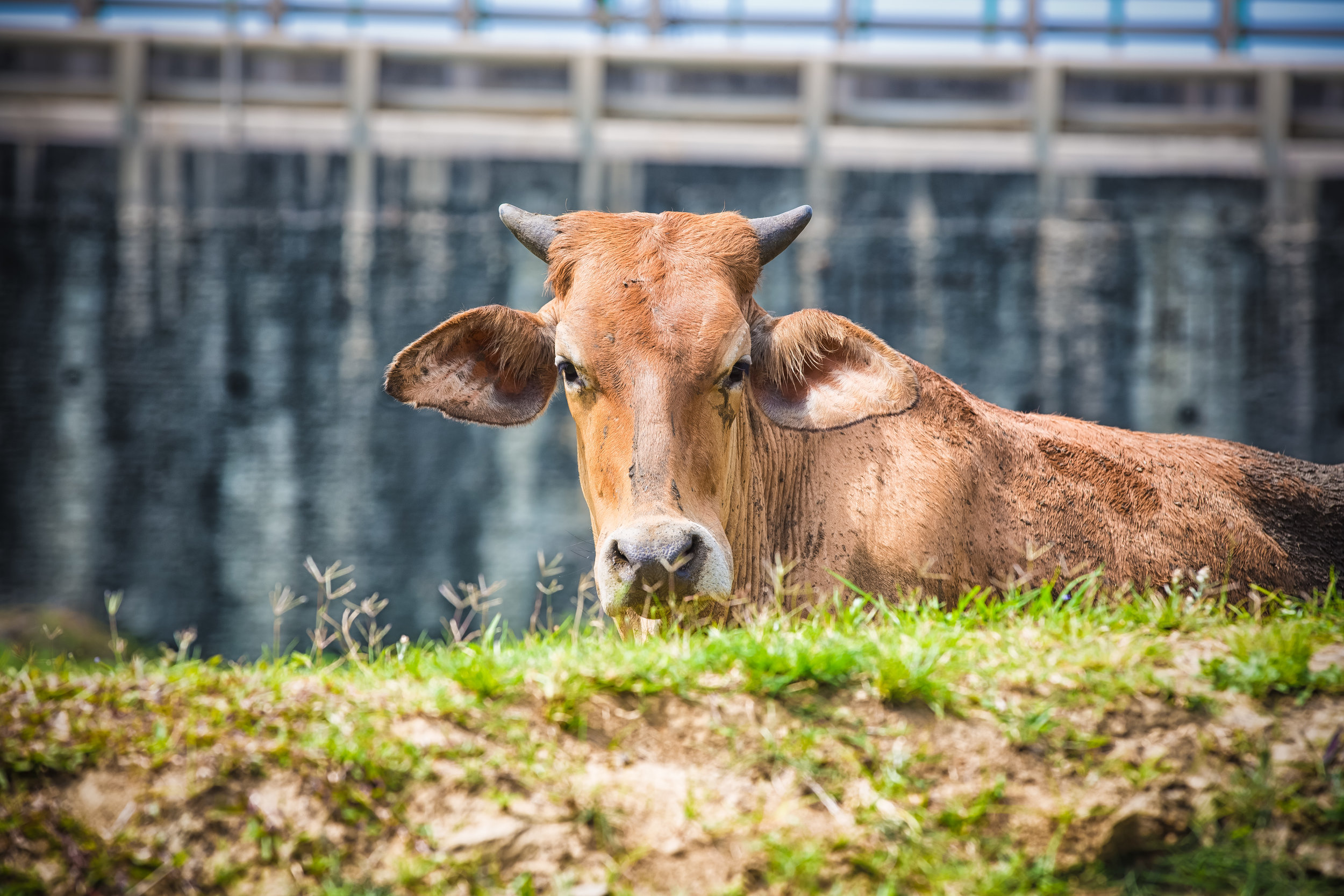
If you ask me, the main attraction to the valley should be the awesome hike and the amazing views you get when you arrive at the top - But yes, the trail is home to another large group of free-roaming water buffalo who (currently) have a massive patch of land to graze on.
The Taoyuan Valley Trail (桃源谷步道)
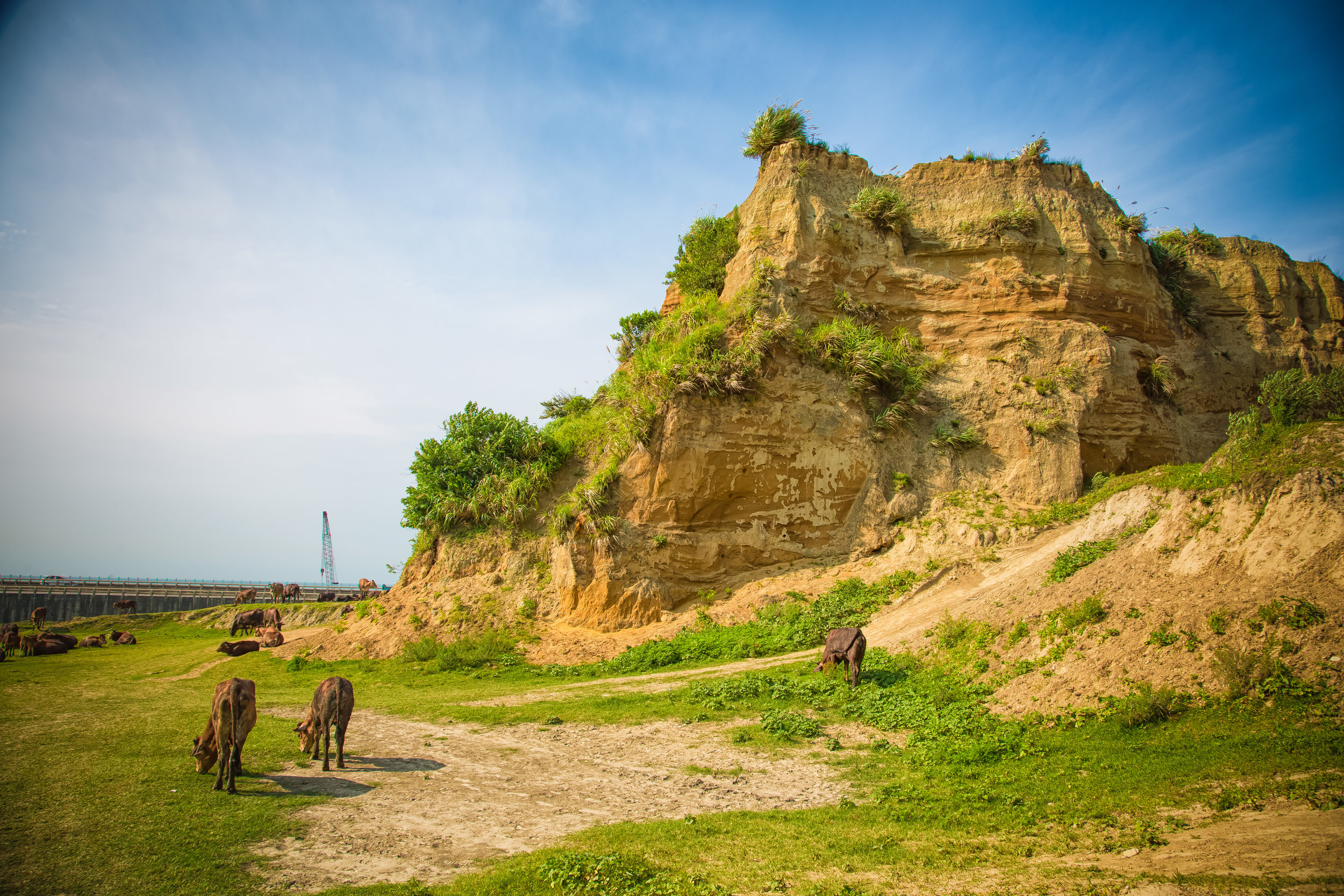
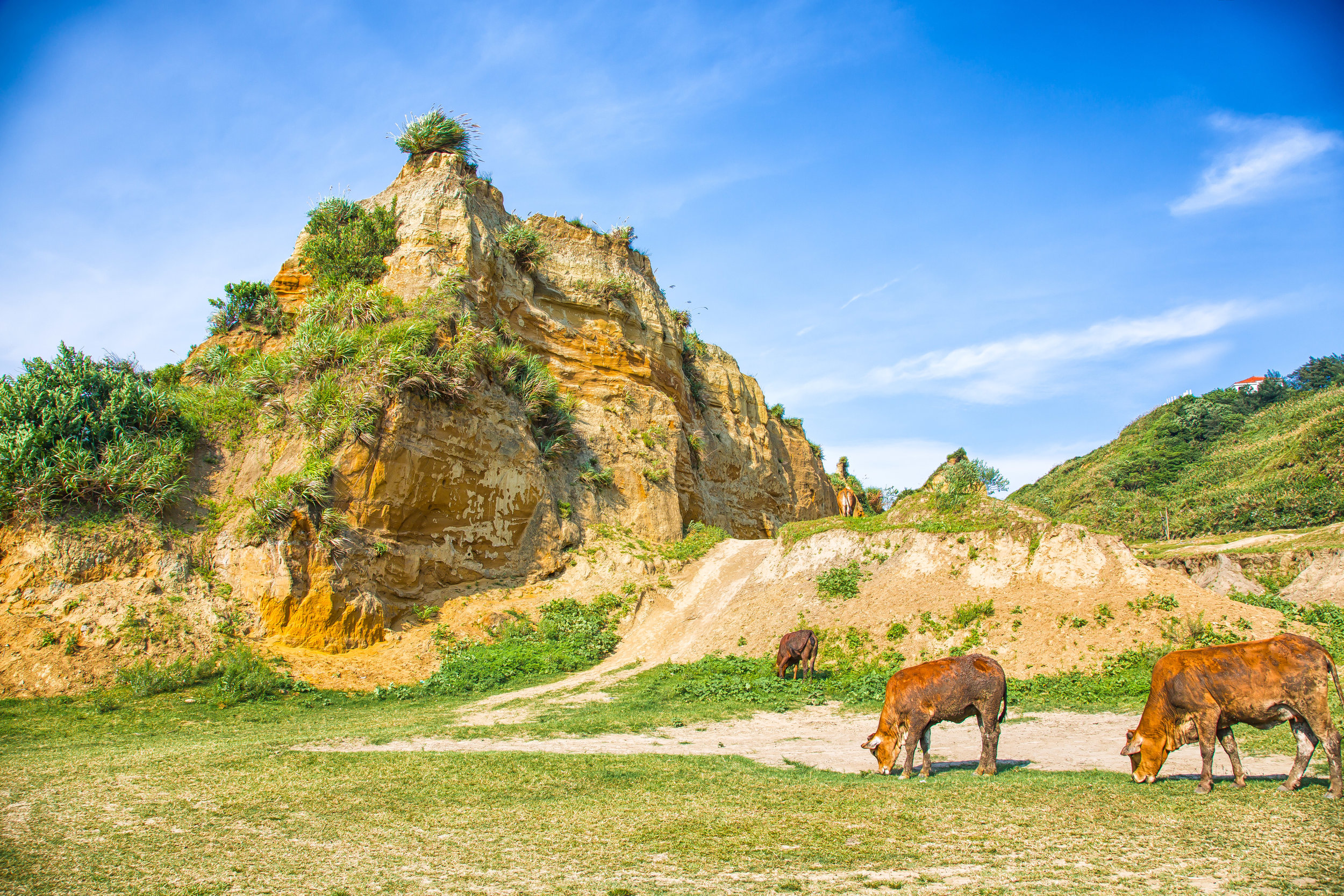
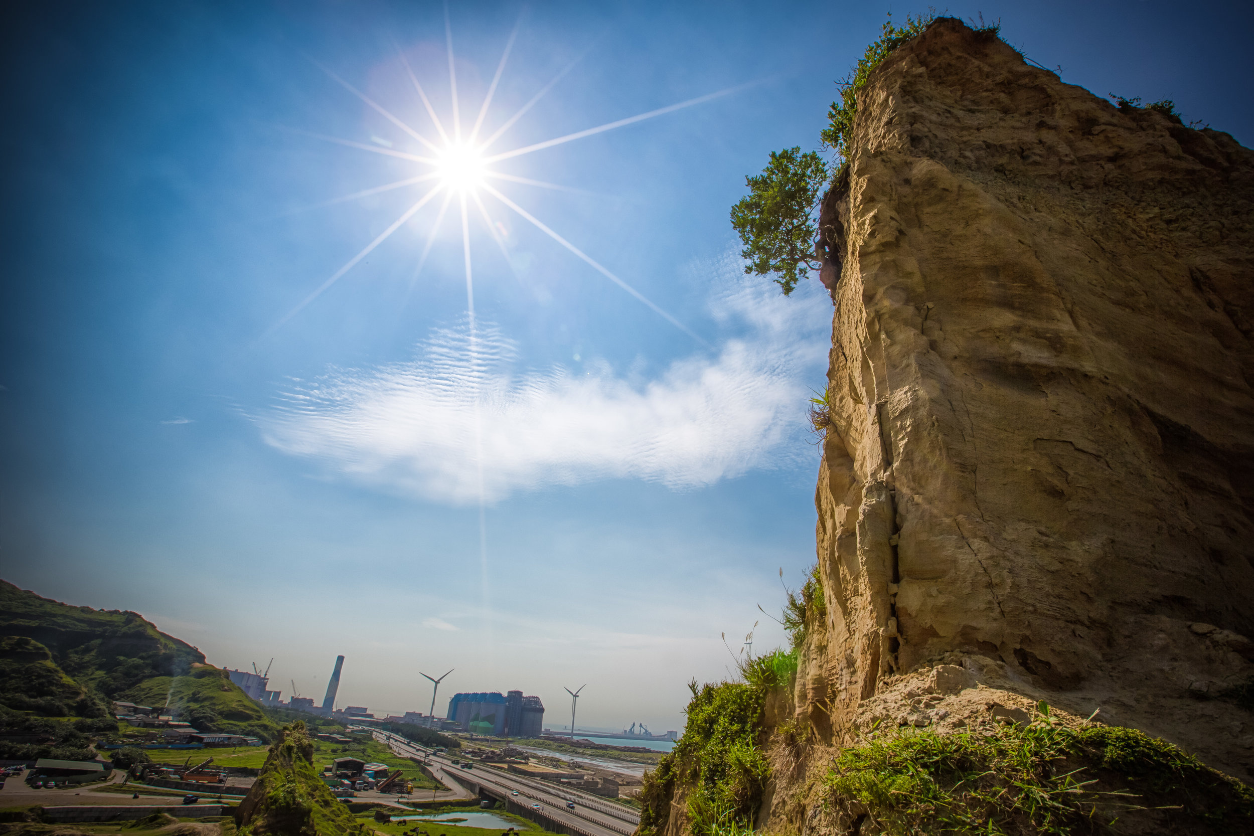
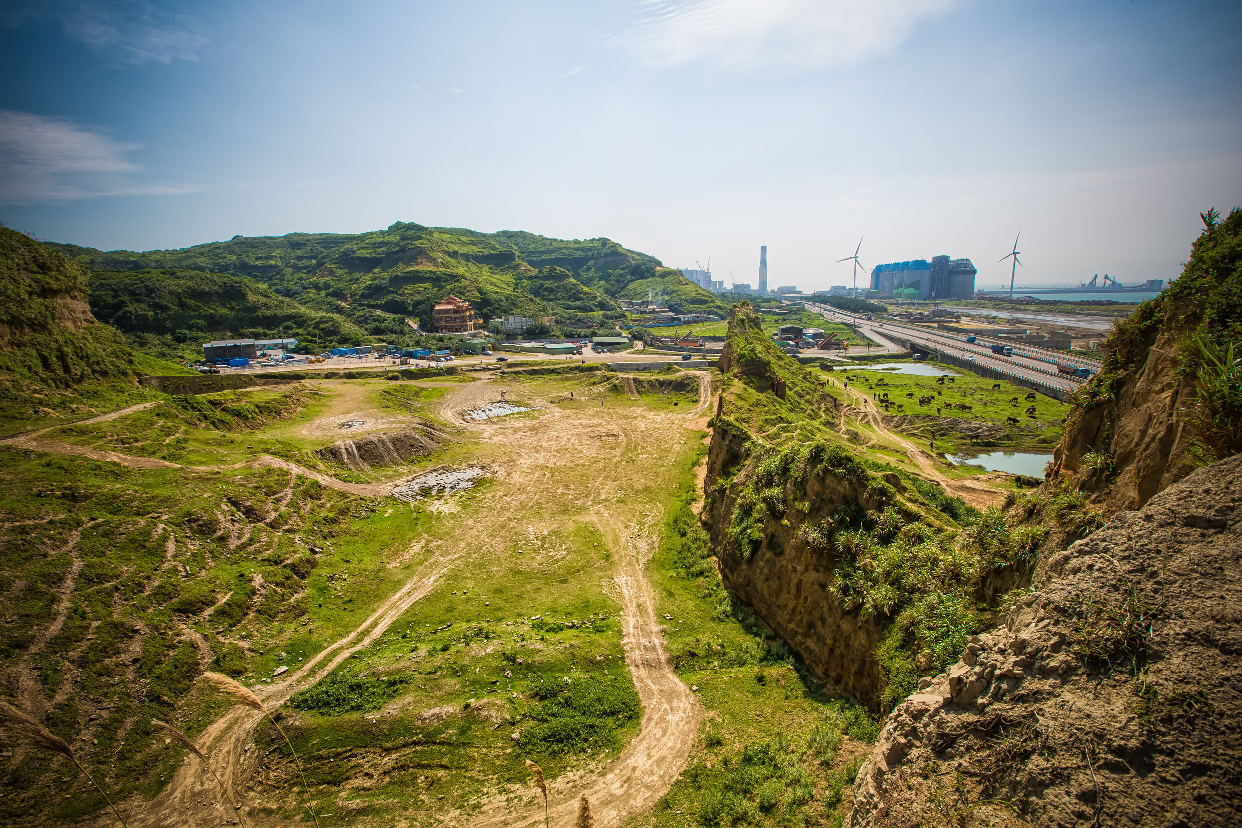
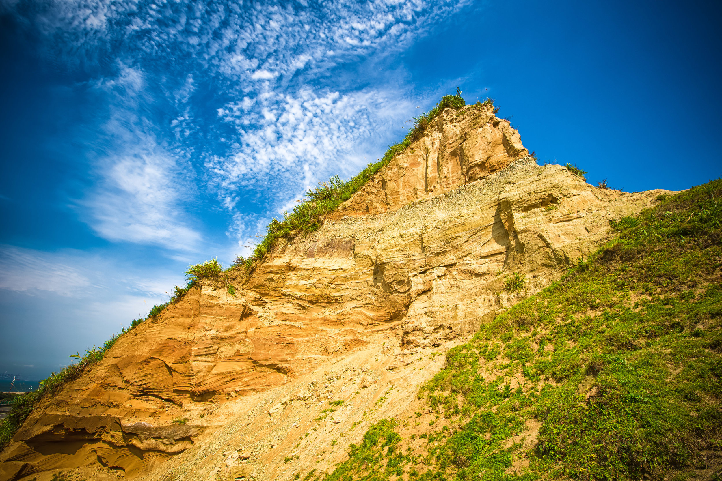
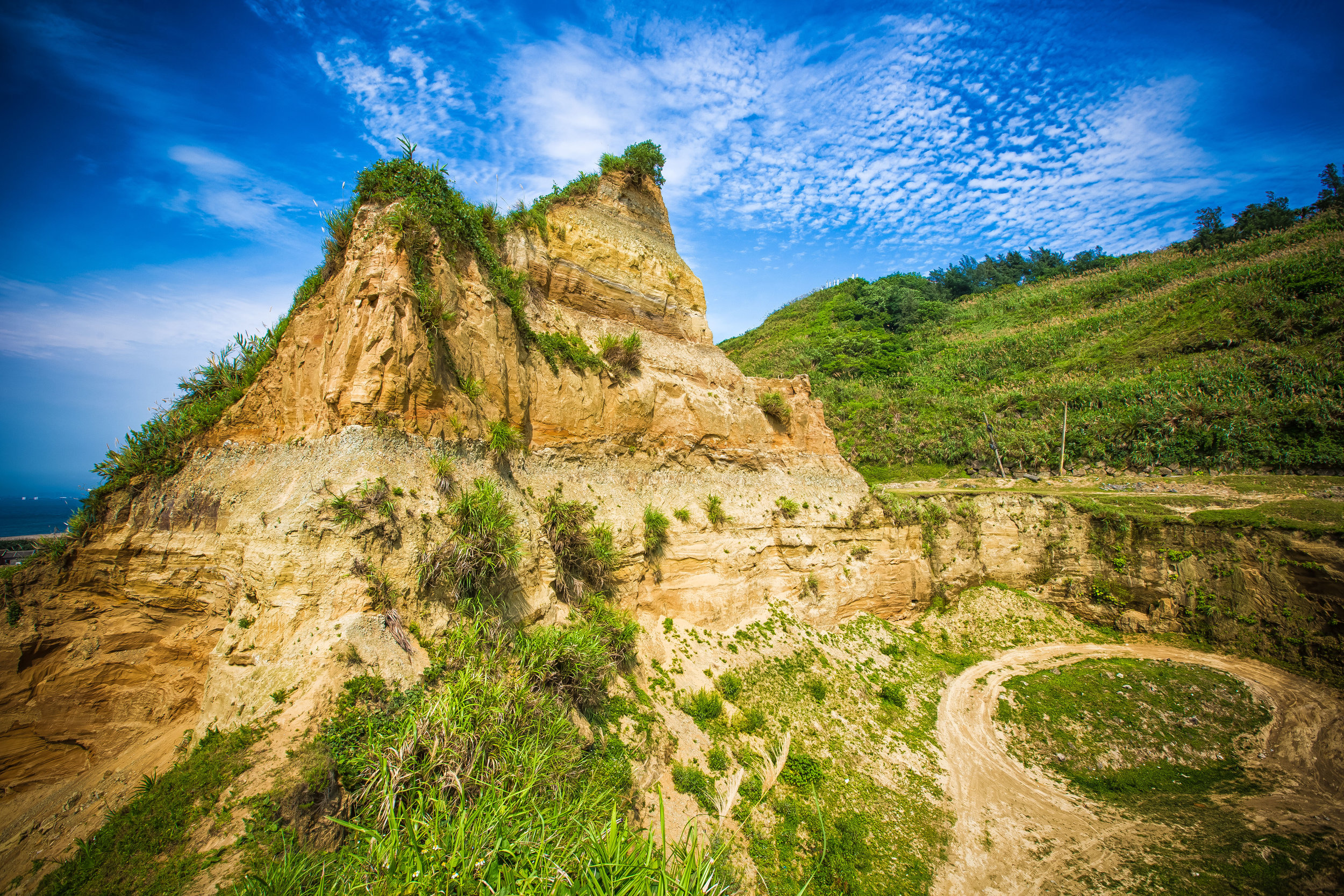
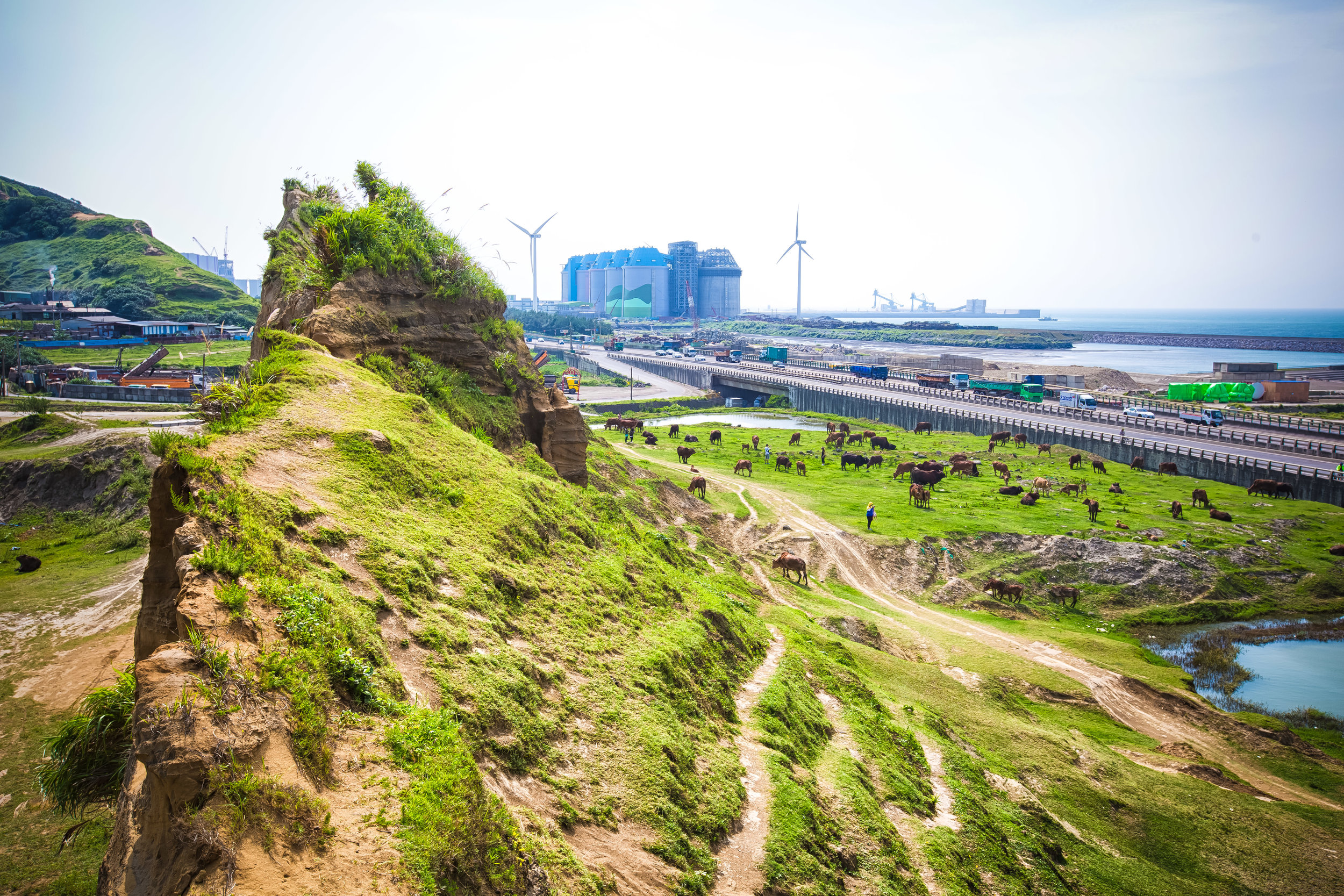
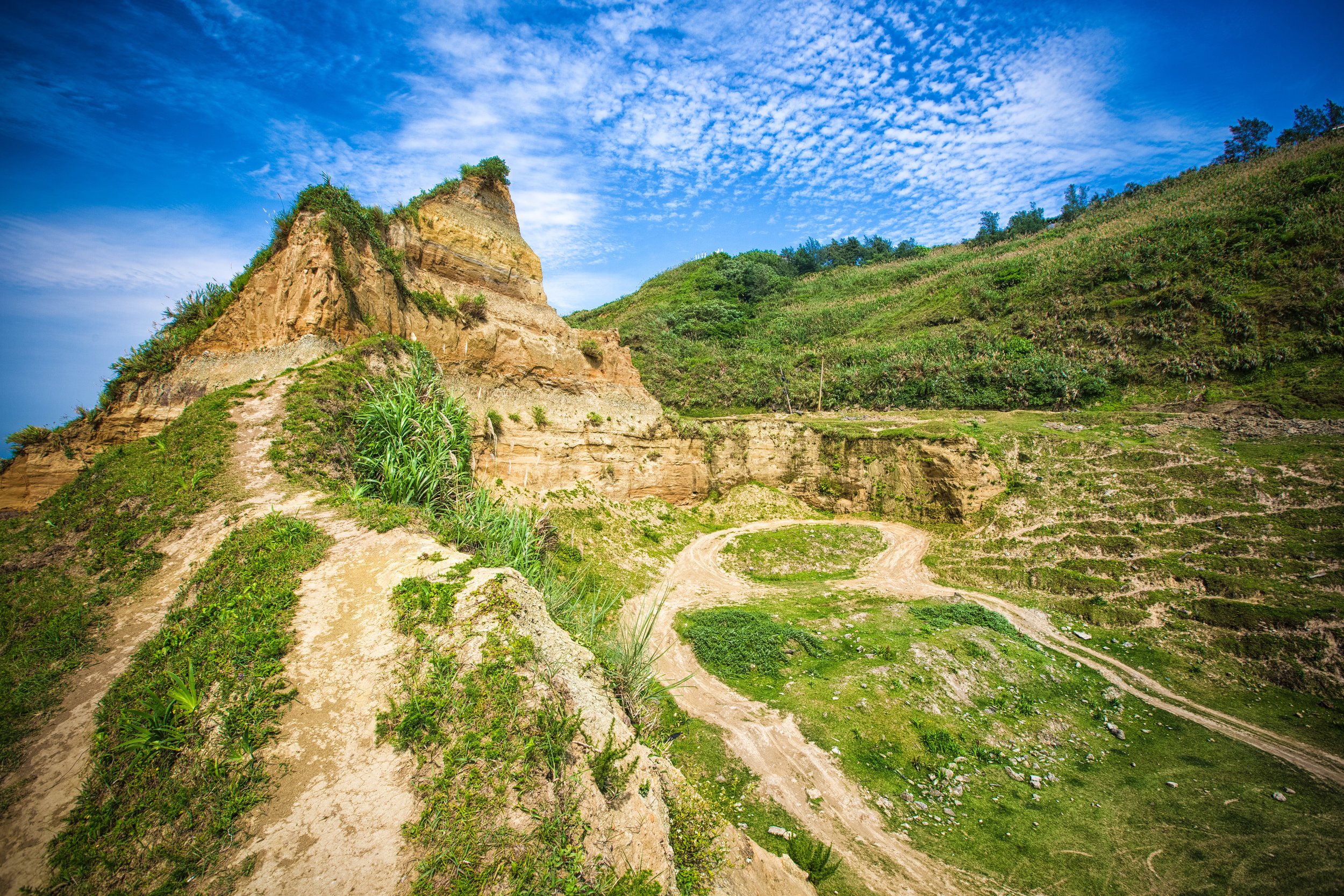
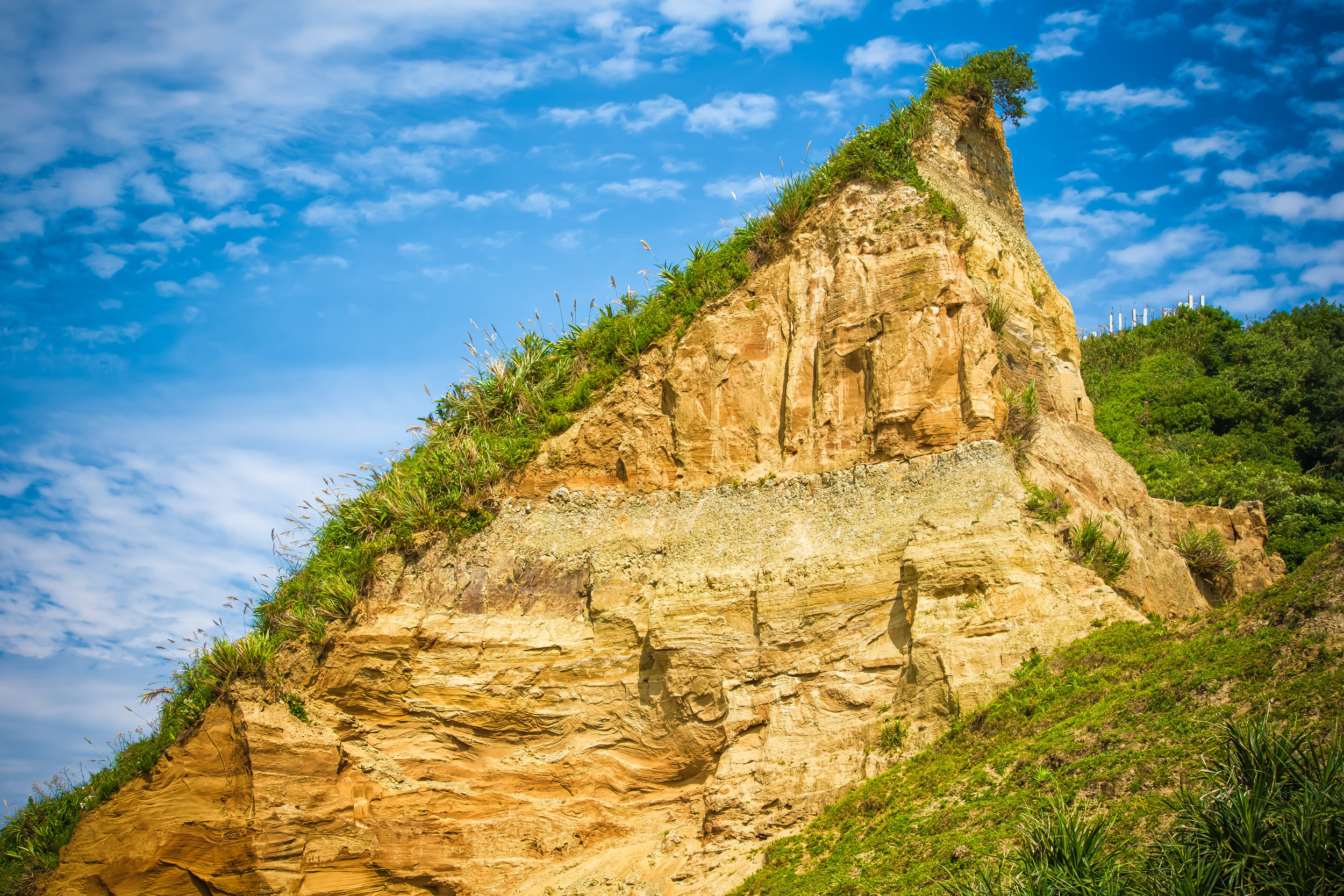
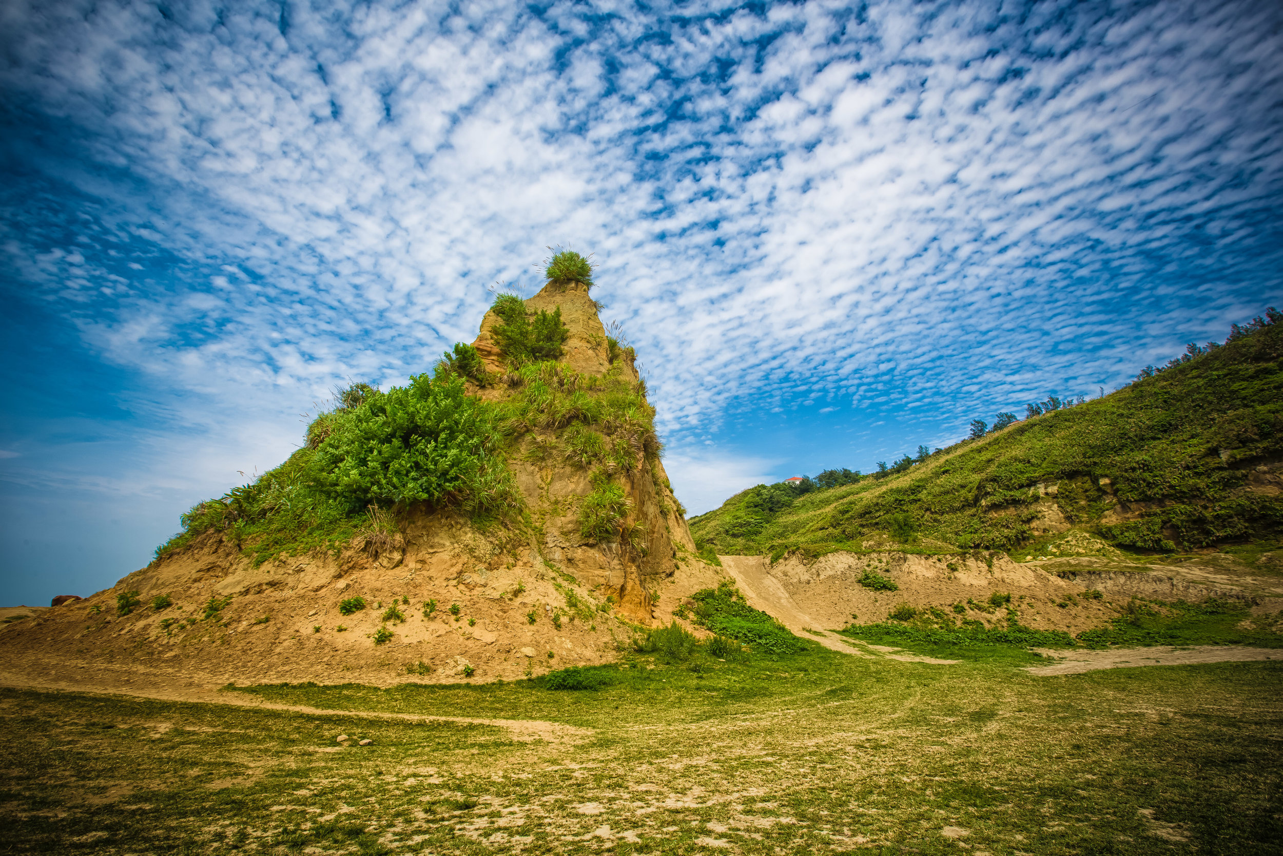
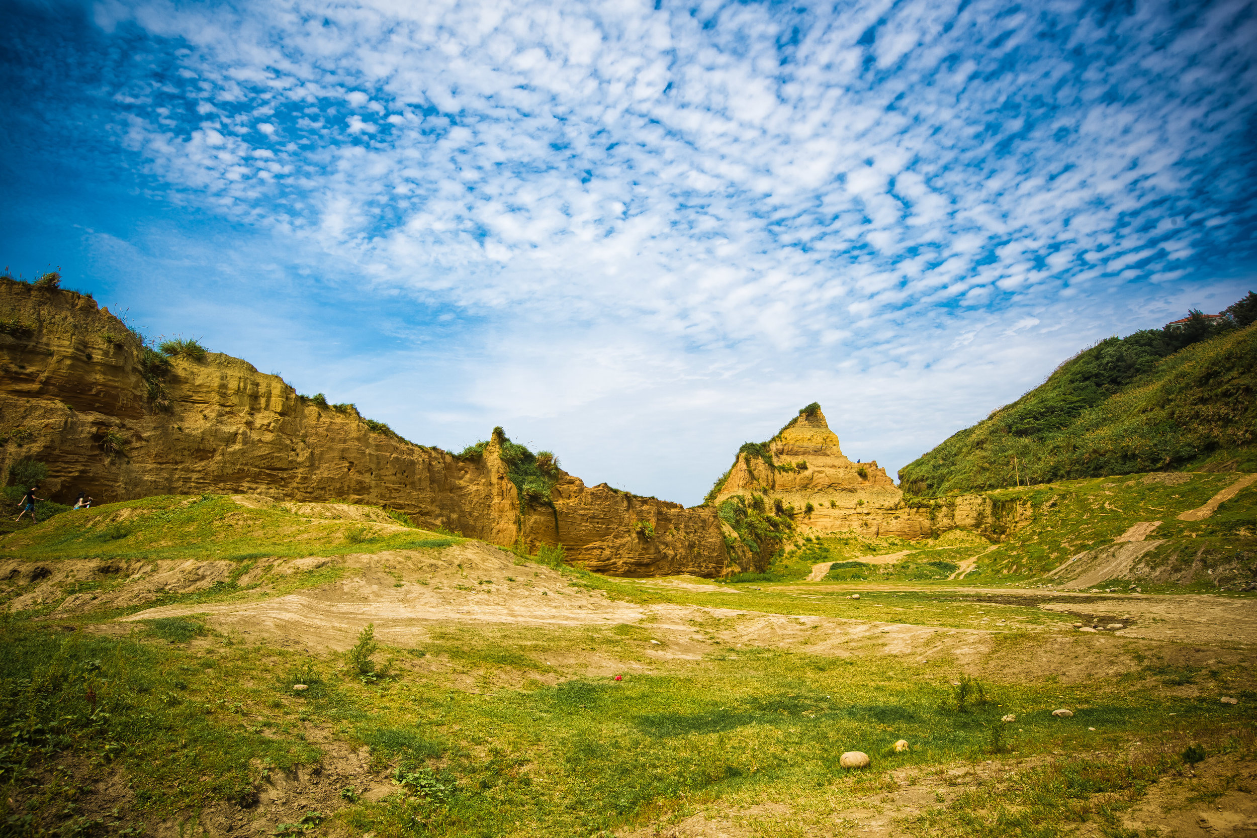
The famed Taoyuan Valley grassland stretches for more three kilometres along a beautiful sloped ridge between Wankentou Mountain (灣坑頭山) and Neiliao Mountain (內寮山) on the northern edge of the Snow Mountain Range (雪山山脈).
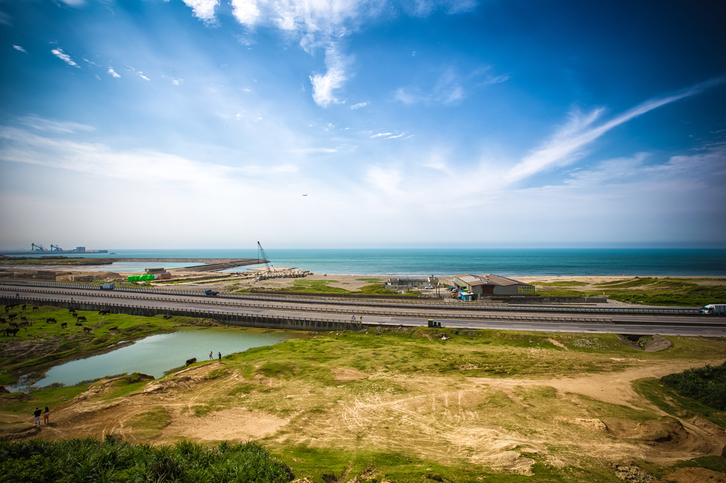
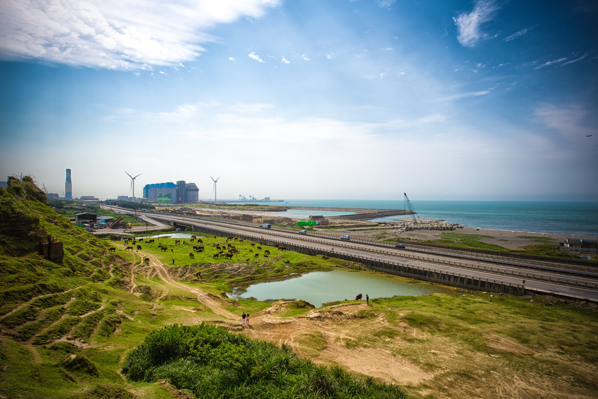
From the top of the ridged grassy slope, visitors are treated to beautiful 360 degree views of Taiwan’s North-East Coast, including a birds-eye-view of Turtle Island (龜山島), as well as the mountains of New Taipei’s Pingxi District (平溪區) to the rear.
The beauty of the valley lies in its combination of the sea, land and sky, giving hikers jaw-dropping views overlooking the Pacific Ocean while also enjoying the rare site of such a large patch of grassland, free roaming water buffalo and the mountainous terrain that makes Taiwan such a geographically diverse country.
At an average elevation of around 500 meters (above sea level), the long stretch of grassland allows makes for an ideal location to sit along the ridge for a picnic or to just enjoy the view.
Originally named “Da’niu pu” (大牛埔) and “Kun’niuzai Mountain” (綑牛仔山), a nod to the historic usage of the grassland by farmers, hikers need to be careful where they’re walking while on the ridge as the water buffalo are prone to randomly unloading their droppings for hikers to step in.
Today the name “Taoyuan Valley” is a nod to “The Peach Blossom Spring” (桃花園記), a fable written by Tao Yuanming (陶淵明) in 421, which describes a chance discovery of a utopia where humans led an ideal existence in harmony with nature.
Link: The Peach Blossom Spring (Wiki)
What you should make sure to remember is that even though it is named “Taoyuan” in English, it’s not the “Taoyuan” (桃園) that you’re thinking of just south of Taipei.
Considering what I mentioned above, one would hope that the current name of the grasslands could inspire people to act a little more harmoniously with nature, and not harass its full-time residents.
Hiking the Taoyuan Valley
One of the saving graces for the Taoyuan Valley is that if you don’t have a car, you have to hike up the long trail to get to the valley. So, unlike the other destinations I mentioned above, (which are pretty easy to get to) this one actually requires a bit of effort.
That being said, if you have a car, the ‘hike’ only takes about twenty minutes.
Fortunately, the road that takes you almost all the way to the top is quite narrow and offers very little in terms of parking spots. On weekends, it tends to be a dangerous route to take as (lazy) hikers end up stuck in their cars on a dead-end road that isn’t very easy to escape from.
When the only other alternative is to actually hike the trail, most of Taiwan’s Instagram celebrities don’t really even bother trying to make an attempt. So even though the trails can be busy at times, you should be able to take photos of the vast valley without large crowds of people.
If you took a look at the map provided above, you may be thinking this hike seems like a long one, but it should relieve you to know that it is actually only a small portion of the much larger network of trails on the historic Caoling Trail (草嶺古道).
Links: Caoling Old Trail (草嶺古道) - Foreigners in Taiwan | Caoling Historic Trail - Taiwan Trails and Tales
Given that it is part of a network of trails, we’re blessed with a number of options when it comes to getting us to the valley:
Taoyuan Valley Trail (Stone Guanyin) - 桃源谷步道(石觀音線)
Taoyuan Valley Trail (Neiliao) - 桃源谷步道(內寮線)
Wujuwushu Trail - 吾居吾墅步道
Wanshentou Trail - 灣坑頭山步道
Caoling Historic Trail - 草嶺古道
Tamlan Historic Trail (Ao-Di to Dali trail) - 淡蘭古道北路(澳底-大里段)
For this blog post however, I’ll only be focusing on the most commonly used trails:
One that takes you up the mountain from one train station and ends at another.
One that allows you to walk straight up the mountain to the ridge.
One that allows you to cheat a bit and drive your car most of the way to the top.
The one I’ll focus on most though is the first one, which is generally speaking considered to be the “complete” Taoyuan Valley experience - giving hikers the best of what this hike has to offer.
The Taoyuan Valley Circuit Hike
Let me start by offering a few important details about the hike:
Hiking Time: 5-7 hours
Total Distance: About 15-18 km
Elevation: 10m - 530m
Difficulty: Depends on the trail you take. It could be quite easy, or a rather difficult one.
Trails: Well-developed paths with periodic signs, rest stops and washrooms.
Best time to hike: Spring and Fall
This hike basically starts at one train station and ends at another, so if it wasn’t obvious enough already, what this means is that the best way to do this one is to simply leave your car or scooter at home and make use of Taiwan’s amazing public rail system!
From which station you start is more or less up to you, but I’d caution that the incline from the Daxi side going up is quite a bit more difficult.
Generally speaking, most hikers elect to start from Dali Train Station (大里火車站) and later finishing by hopping back on the train at Daxi Train Station (大溪火車站).
Dali Train Station to Trailhead (大里火車站 - 登山口)
When you get off the train at Dali Station, the trailhead is a short walk north.
From the entrance of the station you’ll find signs pointing you in the direction of the Dali Visitors Centre (大里遊客中心), the Dali Tiangong Temple (大里天公廟) and the Caoling Historic Trail (草嶺古道), which you’ll follow until you reach the temple.
Getting to the temple should only take a few minutes from the train station and once you’ve arrived, you’ll simply walk up to the front and then follow the signs to the trailhead, which is near the rear of the building.
Don’t be surprised that the trailhead says “Caoling Historic Trail” and not “Taoyuan Valley Trail” as the Taoyuan Valley is just a part of the overall network of trails.
GPS: N24 58.220 E121 55.540
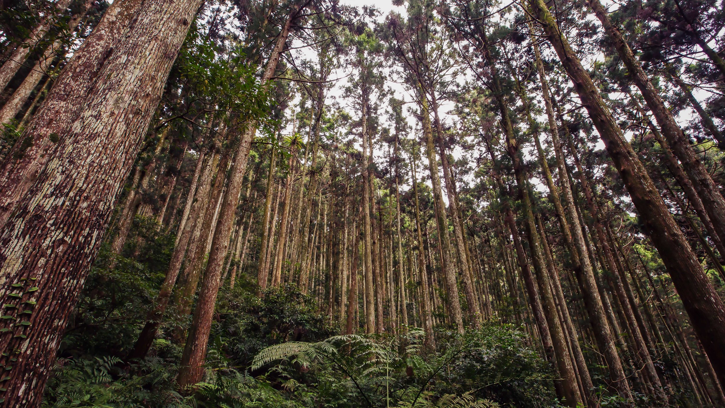
The incline of this hike is one that starts out relatively easy with a tree-covered trail, but eventually opens up once you’ve reached the entrance to the Taoyuan Valley trail requiring you to walk along an open ridge with lots of stairs that bring you the long way around.
Once you’ve completed the hike and you’re back down on ground level on the Daxi side, you’ll find signs pointing you in the direction of Daxi Train Station, which is about a kilometer south of the trailhead.
Daxi Train Station to Trailhead (大溪火車站 - 登山口)
If you choose to start your hike from Daxi Train Station, the trailhead is about a fifteen minute walk north of the station taking you through the historic fishing village.
From the train station, you’ll walk out of the entrance, turn left and start walking along the coastal highway until you reach Guishan Road (龜山路), where you’ll turn left and walk up a narrow road to the trailhead.
GPS: N24 56.530 E121 53.770
If you’re worried that you won’t be able to find the trailhead, never fear, there are signs along the road that point you in the direction of the trail and once you get to the narrow road where you start walking up the hill, there are signs on both sides of the road pointing you in that direction. You can’t really miss it.
One thing that you’ll want to keep in mind about the Daxi Trail is that it can be quite slippery. If it is raining, the five kilometer hike could be somewhat of a treacherous one. You’ll find signs reminding you about this, which you should take seriously as the stone steps can be quite dangerous.
Stone Guanyin Trail (石觀音線)
The “Stone Guanyin Trail” is another one of the trailheads that you can reach from Daxi Train Station.
The key feature of this trail is that it is a hike that allows you to go straight up the mountain and back down again (on the same trail) while saving a considerable amount of time and traveling a much shorter distance.
You’ll also be treated to a beautiful Buddhist Temple and an open-faced cave that has a shrine inside.
That being said, it shouldn’t surprise you that that the longer trail mentioned above has a much more gradual incline, while this one is a relentless set of stairs that you’ll hike straight up the mountain until you reach your destination.
To reach this trailhead, you’ll exit the Dali Train Station, turn right and walk about two kilometres until you reach the trailhead. Once you’ve reached the trailhead area, you’ll have to cross under a railroad bridge and then follow the road to the trailhead.
The signage here isn’t as prevalent as the main trail, so you’ll want to be careful not to get lost along the highway.
To help, there’s a bus stop next to the the road where you’ll cross under the train bridge named Fanshuliao Bridge. The bus that services this station, “Toucheng Ocean Line” doesn’t come all that often, so you’d have to be pretty good with your timing to actually make use of the bus. Still, it’s an option.
Neiliao Trail (內寮線)
The Neiliao Trail for the Taoyuan Valley is more or less the cheaters method of getting to the valley as it is merely a twenty minute walk from your car on a tree-covered path to the main attraction.
If you’re not really into hiking, have access to a car and want to get your Instagram photos, this trail is probably the one that you’ll want to use as it requires extremely little effort.
It also has a fully equipped restroom at the base of the trail and once you’ve reached the valley.
This is probably important for all those instagram celebs who don’t like to break a sweat and a need a safe place to change their clothes for their photoshoots!
Like I mentioned above though, if you’re visiting on the weekend, you’ll have to deal with quite a bit of traffic on the narrow mountain road where there is very little in terms of parking, so you might actually spend several hours in the car waiting for a parking spot.
I’ve marked (on the map above) the mountain road in Gongliao that you’ll have to turn on to get to the trailhead, but there’s also adequate signage in the area that should help you out if you’re driving and don’t have a GPS.
What to Expect
Now that you know how to get to and from the train stations to the trailheads, it’s probably a good time to prepare you for what to expect when you hike the Taoyuan Valley Trail.
So what should you expect?
To put it simply, stairs. Lots and lots of stairs.
If you’ve hiked Taipei’s Elephant Mountain or any of the Four Beasts, you should more or less know what to expect. The Taoyuan Valley trail is a hike through the woods on a well-developed (mostly) cement path.
Even though the trail is very well-developed and includes periodic rest stops (and even restrooms), the hike tends to be a long one. Still, despite the length of the hike, it is considered to be an easy one and none of this should prevent you from trying to hike it.
You can also take solace in the fact that once you reach the valley, you’ll have a long walk along a beautiful (and most importantly) flat mountain peak that you’ll follow until you start your descent back to ground level.
You’ll need to make sure to bring some snacks and more than enough water.
I brought a 2000cc bottle, but that ended up not being enough on a 35 degree day.
You should also have a good pair of hiking shoes and a raincoat in case the weather takes a turn for the worse.
Apart from that, you won’t need much else for this one except for some money for your train tickets and maybe a little more for a feast of fresh seafood when you finish.
At this point, I should mention that if the weather forecast isn’t looking good on the day that you’re planning on doing this hike, you’ll probably want to save it for another day.
You’ll see why if you read this post about the hike from the always amazing, Tom Rook.
Link: Taoyuan Valley Hiking (Over The City)
How long this hike takes to complete is completely up to you.
It obviously depends on your hiking pace, how much time you stop to rest and how much time you use to take photos of the beautiful landscape.
I arrived at the Daxi Train Station at 10am and finished around 5pm.
I did take use up quite a bit of time taking photos as well as chatting with other hikers at the various rest stops.
It goes without saying that unless you plan on only hiking the Neiliao Trail, you shouldn’t be starting this one in the afternoon. You’ll need an early start, but the actual hiking portion of this trip goes by surprisingly quickly, despite the length of the trail.
The Taoyuan Valley has always been a popular destination for Taiwan’s avid hikers, but in recent months it has also become popular with the Instagram crowd. This means that the crowd you’ll find at the valley on the weekend are a mixed bunch of senior citizens in rubber boots and wannabe models.
Thankfully most of the models don’t really stick around very long and for the most part don’t crowd up the trails as they prefer to endure the traffic jam on the road to the top.
Still, as I mentioned above, the Taoyuan Valley is currently one of the few remaining places where Taiwan’s Water Buffalo are continued to graze freely amongst the crowds of tourists.
All it takes though is one accident and that could all change.
Let’s hope that that doesn’t happen anytime soon.
If you visit, enjoy the buffalo, but please don’t invade their personal space.
Gallery / Flickr (High Res Photos)