Thumb Mountain

Taipei Cityscapes Guide

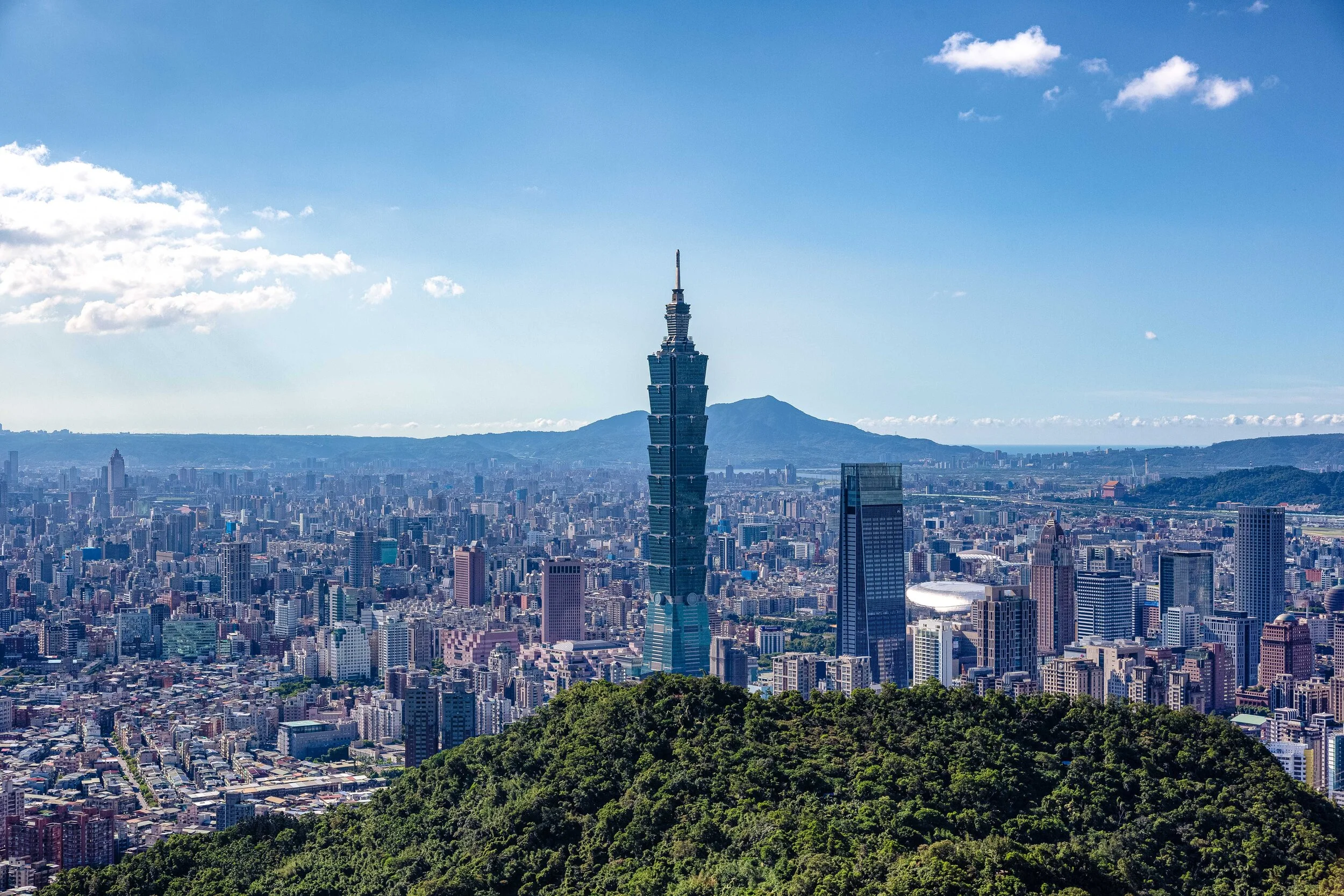
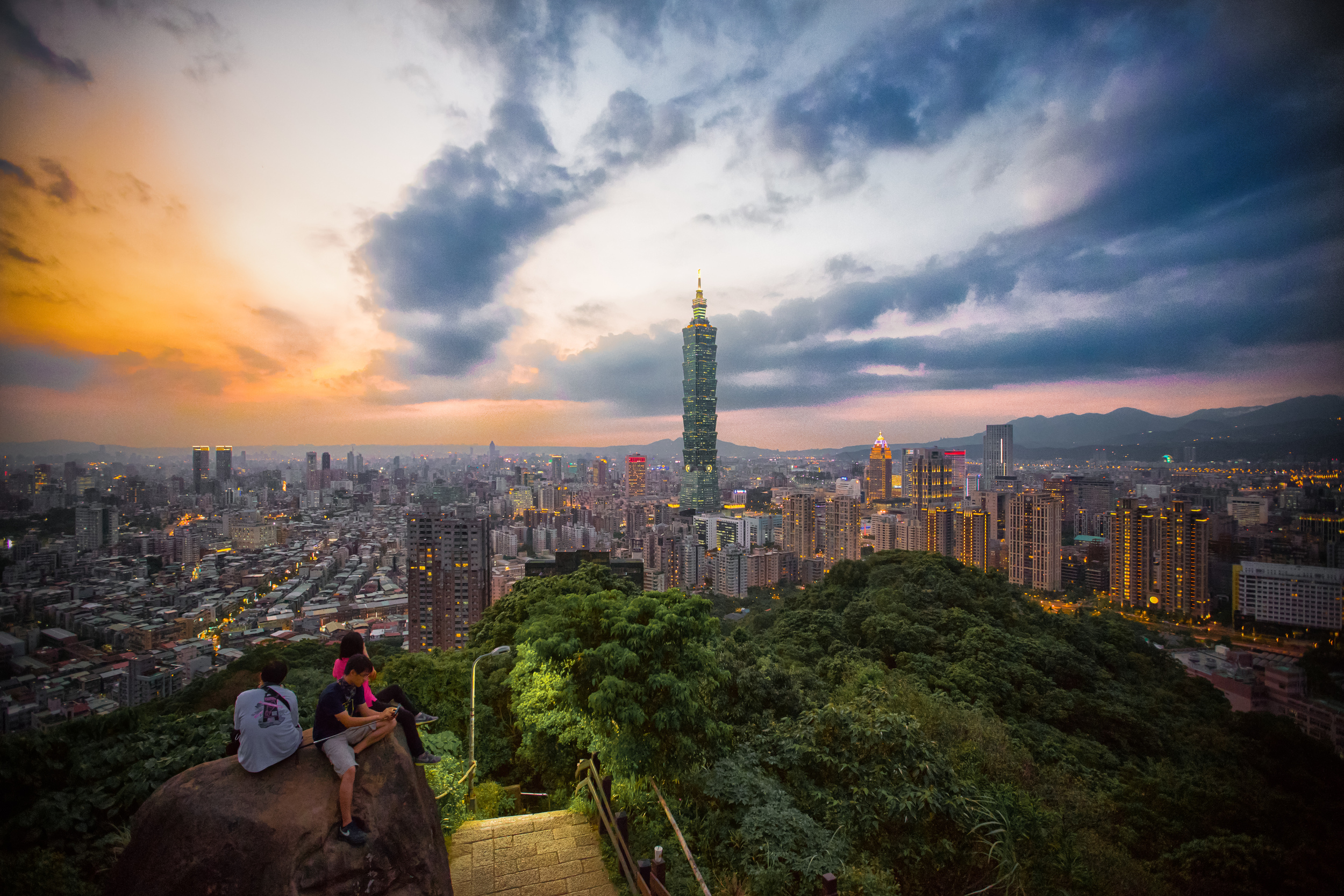
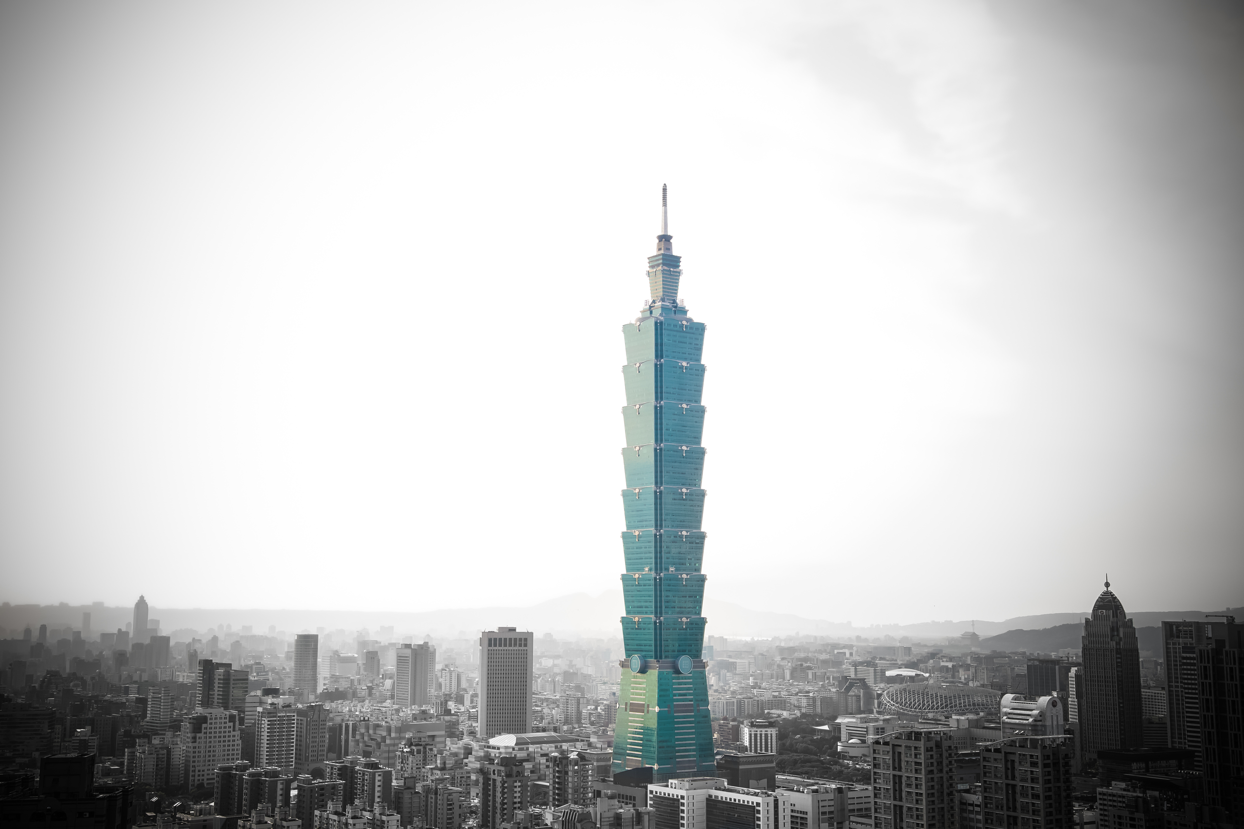
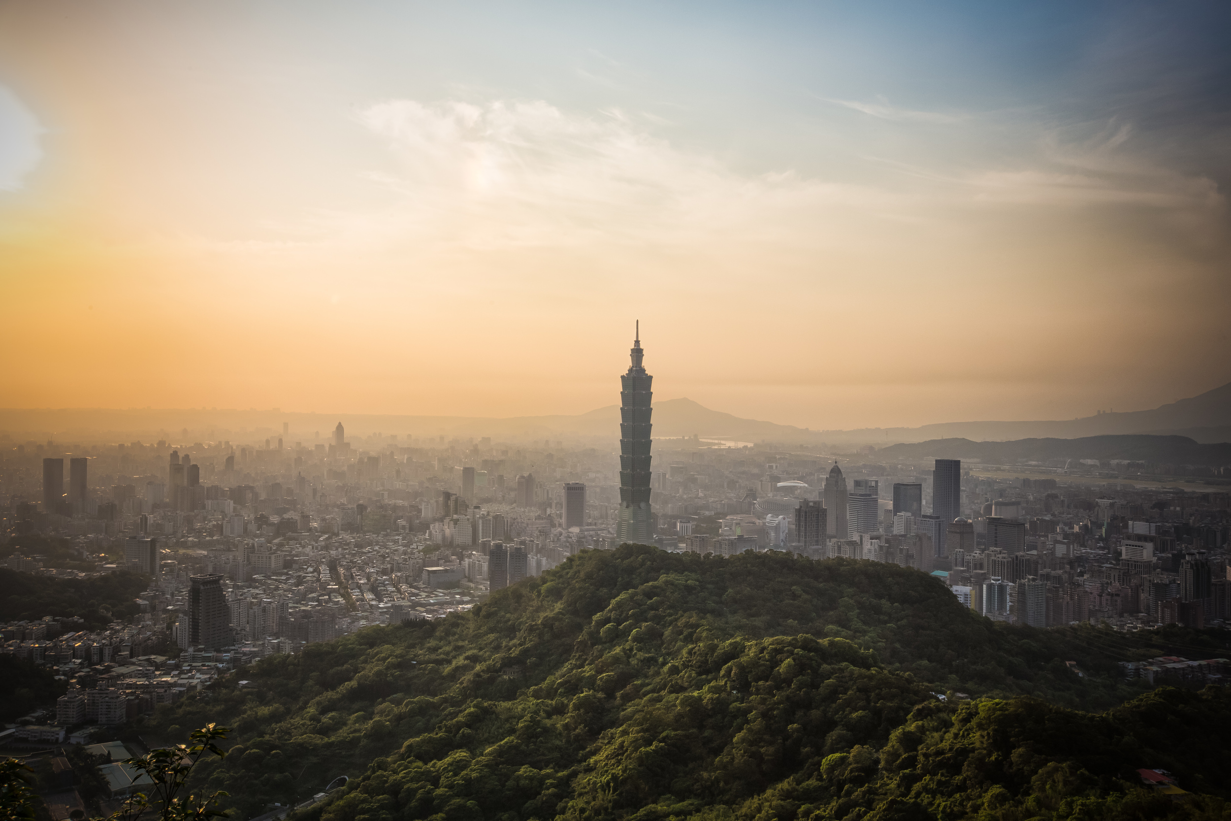
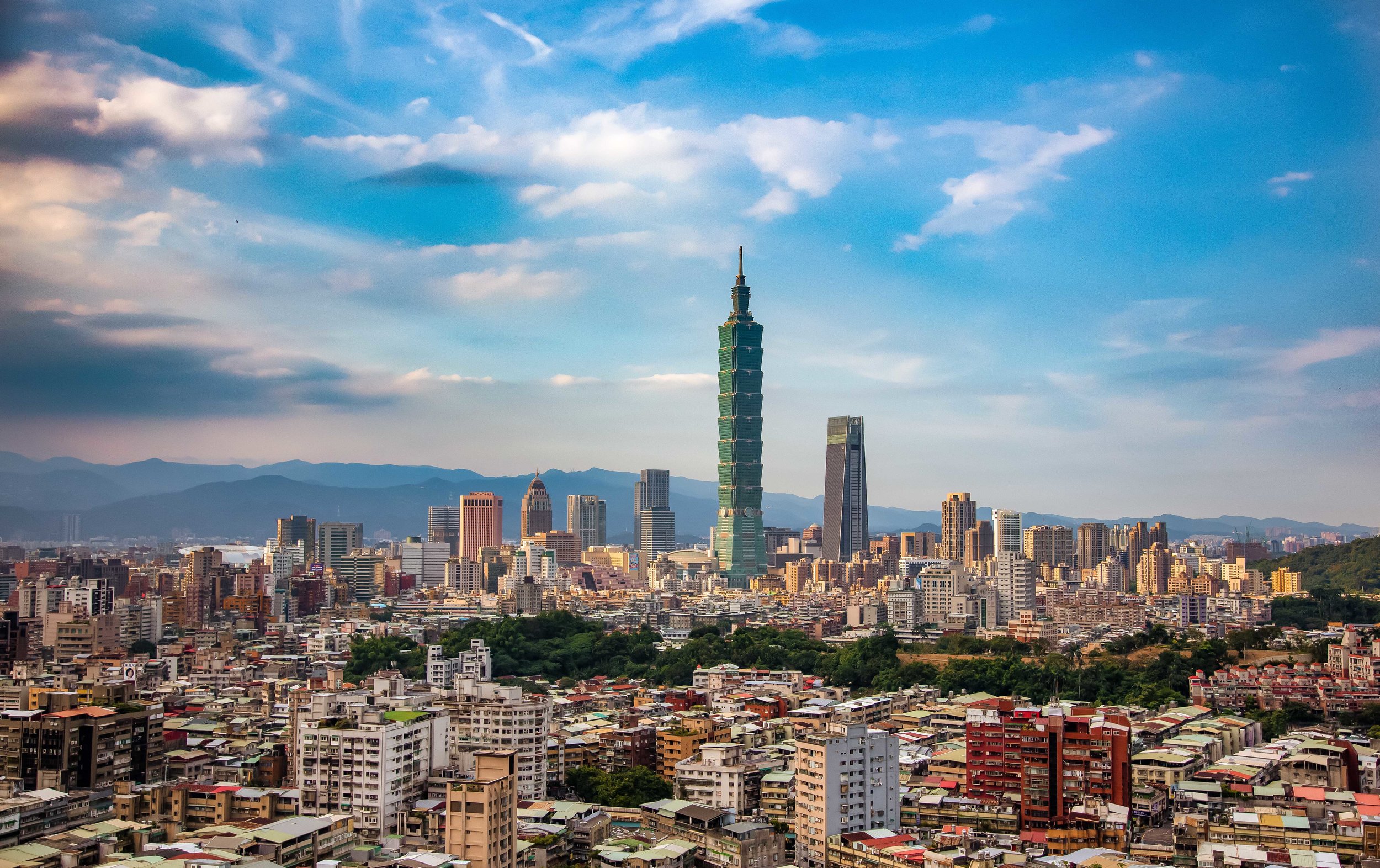
Everyone wants to get that iconic shot of Taipei 101 and the Taipei cityscape while visiting Taiwan.

But how do you get it? Where should you go? 

Taiwan’s rising popularity as a tourist destination means that it important that answers to these questions are readily available in order to help people make the most of their trip. 

While the local government does try its best to attract tourists and provide the necessary information, they often do a poor job of the latter which means people have to to rely on guide books, travel sites and blogs for their travel tips and expertise.

Fortunately, there are some excellent resources out there helping to introduce the country these days and I’m happy that this website has been able to play a small role in that. I have to say though, even though I do enjoy personally responding to people who have questions - I have discovered that I’ve been spending quite a bit of time responding to the same questions over and over again.

So, even though I’m personally not a fan of list-style blogs, I think having something that I can actually direct people to, rather than answering each person individually might save us all some time!

So, if you’ve been looking for a helpful guide to (some of) the best locations to get a shot of the beautiful Taipei cityscape, I think this guide might be of use!

Before I start, I should mention a couple of things:

  • All of these locations are free of charge. I’m not promoting any businesses here.

  • Rooftop photos of the city are popular, but I’m not promoting that here.

  • Each location is accessible using Taipei’s excellent public transportation network.

  • I’m not including any of the popular ground-level locations frequented by Instagrammers.

  • If you want that beautiful cityscape photo, you’re going to have to do a bit of hiking to get it!


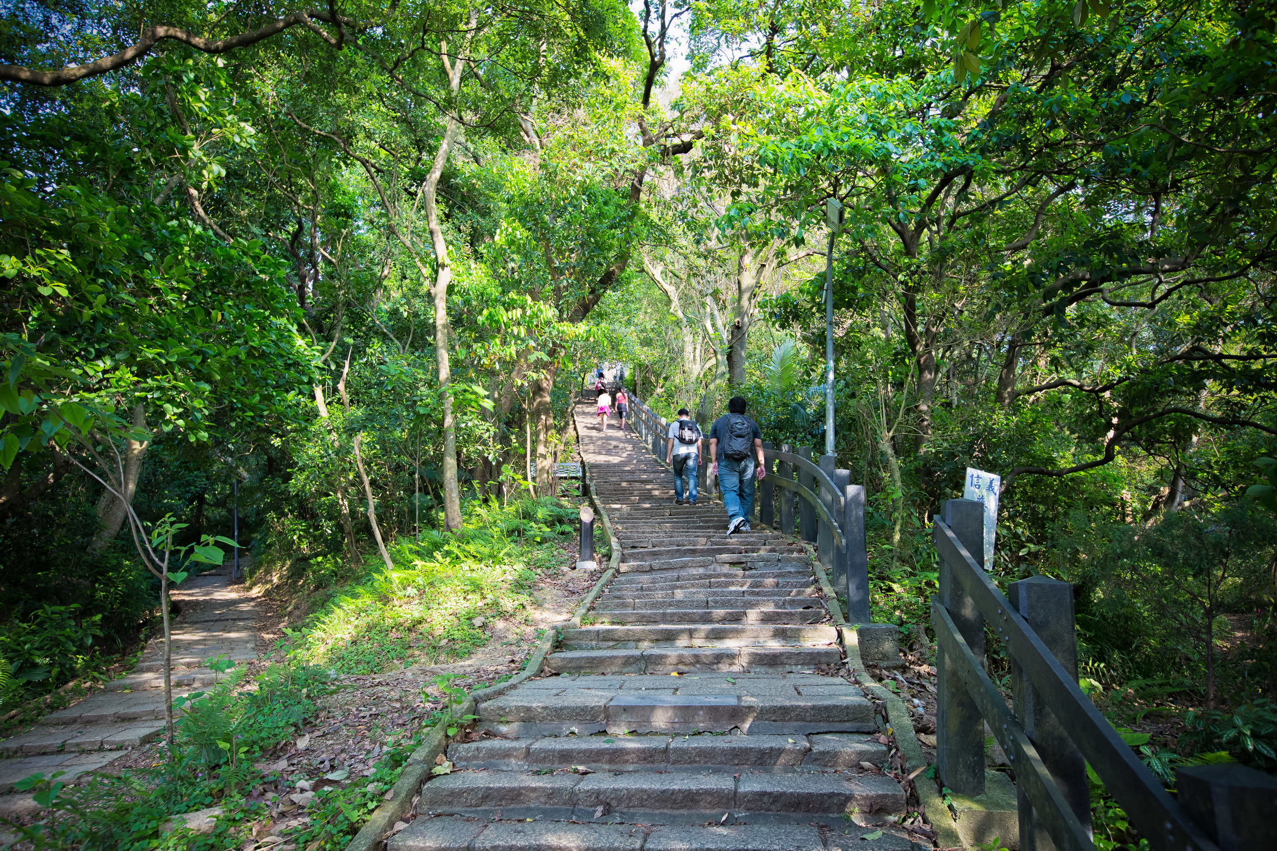
By far the most popular spot for tourists to get their cityscape photos is on the Elephant Mountain Hiking trail (象山登山步道).

The trail is so popular that it even has its own dedicated MRT station!

The problem with Elephant Mountain however is that everybody knows about it - No matter what day of the week you visit, you are going to have to line up to take photos and in most cases you’ll probably miss that beautiful sunset photo that you had your heart set on.

For those landscape photographers who want to get the iconic shot of the Taipei City landscape from this mountain, you’re going to have to arrive quite early in the day to reserve a spot for your tripod as the best locations are always packed with photographers.

Elephant Mountain might be one of the best locations for photos but it goes without saying that it is also one of the most popular, which makes taking photos more of a challenge.

Getting There - Take the MRT’s Red Line to Xiangshan Station (象山站) and then follow the signs that lead you to the trailhead. The hike to the top takes anywhere between ten and thirty minutes.

Link: Elephant Mountain (象山)

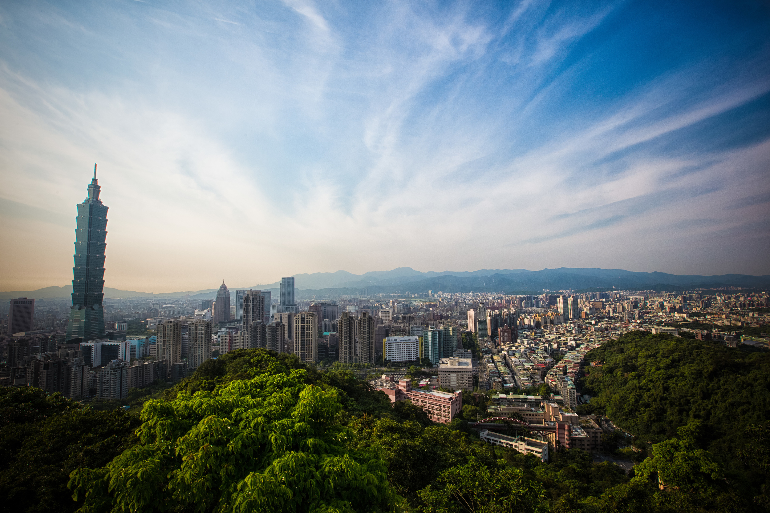
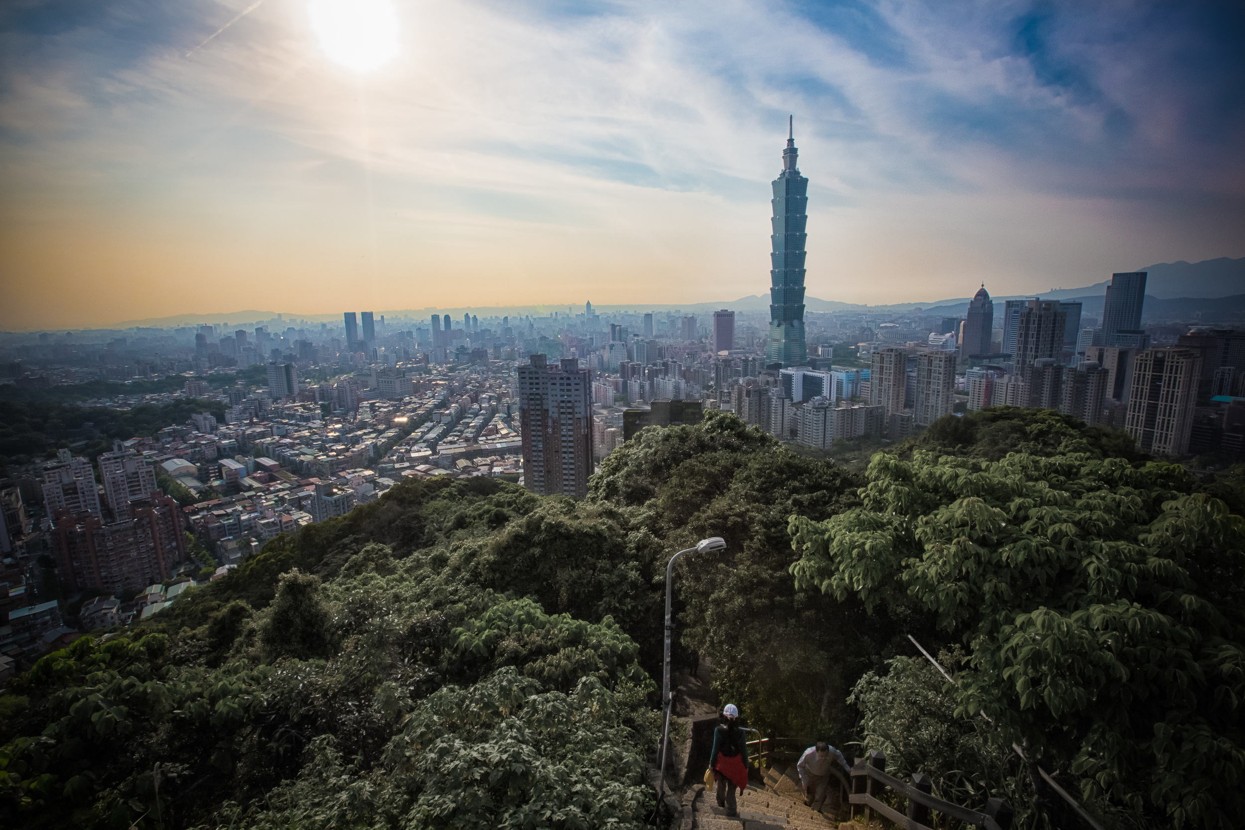
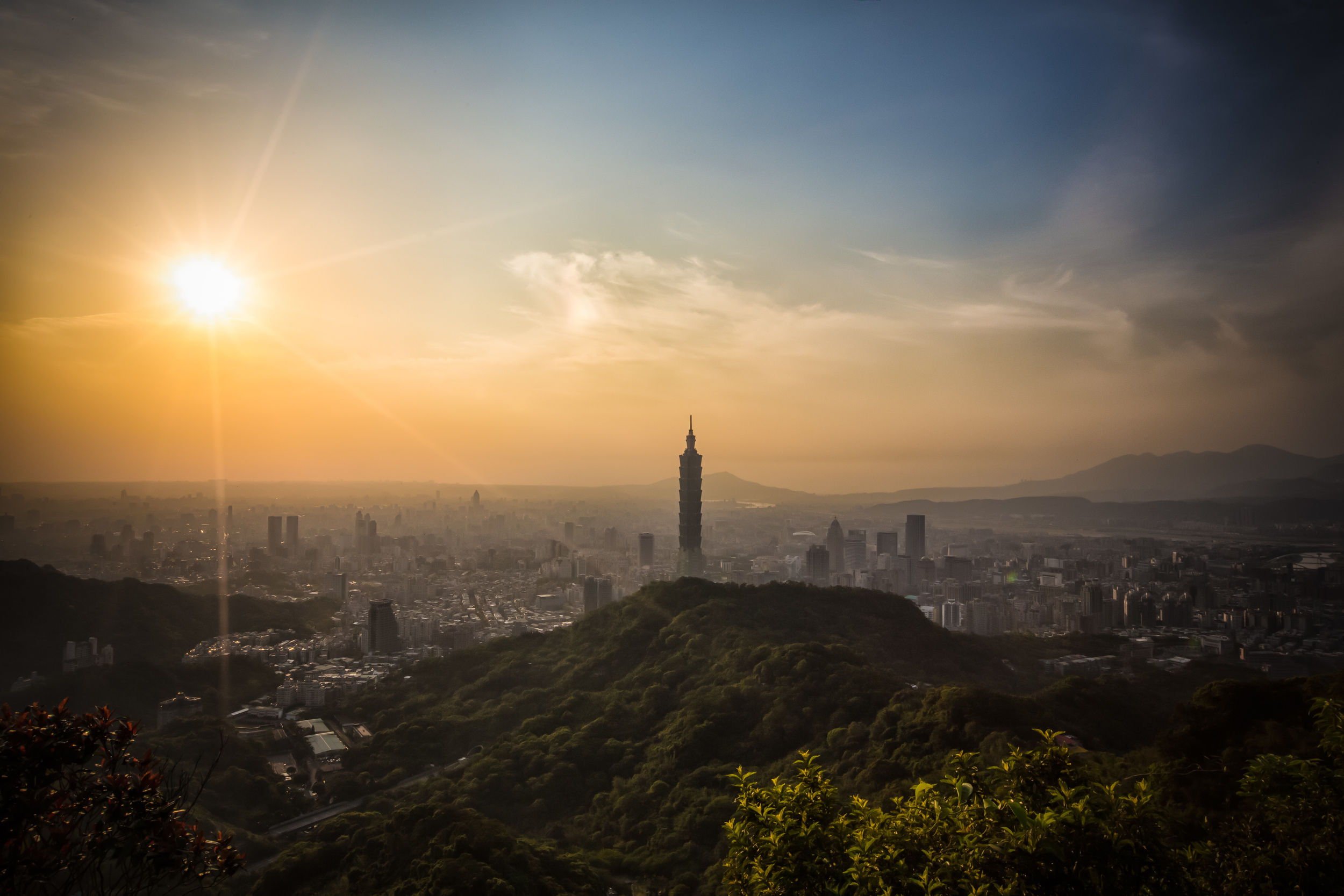
For those wanting to get shots from the iconic Elephant Mountain but also want to escape the crowds and get a different perspective of the city - Thumb Mountain and 9-5 peak are a great option that requires only about twenty to thirty more minutes of hiking.

Situated on the same trail as Elephant Mountain, the peak of Thumb Mountain is considerably higher, is less clogged with tourists and offers a wider perspective of the city that also includes green mountains in the foreground.

Likewise, the observation platform on 9-5 Peak offers probably the widest and most beautiful view of the cityscape that you are going to get on this side of the city.

If you want the iconic photo of Taipei but want something that stands out from almost every shot on Instagram, you’ll want to keep these two peaks in mind!

Getting There - Take the MRT’s Red Line to Xiangshan Station (象山站) and then follow the signs that lead you the trailhead. After passing by the peak of Elephant Mountain, follow the signs which will lead you to the peak of Thumb Mountain and then continue on to 9-5 Peak.

Link: Thumb Mountain (拇指山)

Looking for an alternative to Elephant Mountain to avoid the massive crowds of tourists?

Tiger Mountain might just be the answer for all your social anxieties!

This trail is very much similar to the Elephant Mountain hike in terms of location and how well-developed the trail is (they are actually part of the same system of trails) but it isn’t as well known in tourist circles as it is with locals.

When you hike Tiger Mountain you will be treated with amazing views of the city in a location that differs only slightly from what you get at Elephant Mountain. You can even continue your short hike and can easily connect with other peaks along the Four Beasts Trail (四獸山) - which all offer great views of the city.

It is also a considerably easier hike than Elephant Mountain and takes very little time to complete.  

Getting There - Take the MRT’s Blue Line to Houshanpi Station (後山埤站) and from Exit 2 follow the signs that will lead you to the trailhead. Hiking this mountain doesn’t take a lot of time but you can easily make a day-trip of of the trails behind it that lead to other peaks.

Link: Tiger Mountain (虎山)

Fuzhou Mountain is a well-known alternative for locals who want to avoid the hordes of tourists on Elephant Mountain or on the other Nangang Mountain trails.

While not as popular in tourist circles, the mountain offers spectacular unobstructed views of the Taipei cityscape without the wait.

Situated in Fuzhoushan Park (福州山公園), the hike to the top takes a lot less time and energy than its more popular neighbours and it just so happens that this one is a personal favourite of mine.

Getting There - Take the MRT’s Brown Line to Linguang Station (麟光站) and then follow the signs across the street that lead you to the park. Once inside the forest park follow the signs that lead you to the peak of Fuzhou Mountain.

Link: Fuzhou Mountain (福州山)

Bishan Temple is a massive mountain-side temple in Taipei’s Neihu District - The temple is the largest of its kind in Taiwan, dedicated to the patron saint “Kaizhang Sheng Wang” is not only beautifully ornate but also provides visitors with beautiful views of the Taipei cityscape.

In recent years the temple has actually become more well-known for its beautiful night views of the city than its religious functions - but rest assured, Taiwanese visitors will always pay their respects before enjoying the view.

Likewise, you should also take some time to tour of the temple and the surrounding area.

This one doesn’t require much of a hike as the bus will drop you off near the entrance of the temple - simply walk up the stairs to the entrance and enjoy the view!

Getting There - Take the MRT’s Brown line to Neihu Station (內湖站) and from there walk to the bus stop at #452 Neihu Road, Section 2 (next to a small shrine) and wait for the #2 (小2) bus.

Link: Bishan Temple (碧山巖開漳聖王廟)

This mountain in Neihu (內湖) became extremely popular with locals a few years ago and for good reason - It offers amazing views of the city with beautiful mountains in the background.

The hike to the top takes about 20-30 minutes and even though its quite easy, it is really fun as you get to climb up the rock face of a mountain while enjoying beautiful panoramic scenery.

While at the top don’t forget to get a shot of yourself on the rock ledge that has become an internet sensation in Taiwan.

Getting There - Take the MRT’s Brown Line to Xihu Station (西湖站) and walk toward Tamkang University where you’ll see signs that lead you toward the Jinmian Mountain Trailhead (金面山登山步道).

Link: Jinmian Mountain (金面山)

Jiantan Mountain is a hiking trail that starts near the popular Shilin Nightmarket (士林夜市) and offers not only great views of the city (from the opposite side of the Keelung River) but also allows you to walk around the beautiful Grand Hotel and check out some cool temples.

The mountain has quite a few attractions and can be part of a much larger day-trip if you like, but for the purposes of this blog, people are going to want to head directly to the ‘Laodifang lookout’ (老地方觀景平台) where there are unobstructed views of the city.

This hike might be the longest of all the hikes I’m providing (around 1-2 hours) but you can take solace in the fact that once you’re done, you can visit the Shilin Nightmarket and fill your belly.

Getting There - Take the MRT’s Red Line to Jiantan Station (劍潭站) and from there cross the street and walk toward the Grand Hotel. You’ll see a temple on the side of the road. The trailhead is next to it.

Link: Jiantan Mountain (劍潭山)


Photography Tips

The old saying ‘The best camera is always the one you have with you’ applies quite well to most of these locations. What you’ll want to take into consideration is the kind of photos you want to take and how much equipment you’re willing to carry.

If you are looking to take beautiful, yet simple cityscape photos (to post on your social media), you can do that easily enough with the camera on your smartphone. That being said, a lot of people are like me and are more than willing to carry heavy camera gear up the mountains to get even better shots to bring back home.

No matter what you choose to do, there are a few things you’ll want to take into consideration to avoid the frustration of missing out on the perfect shot.

Smartphone Cameras

  • Smart phones aren’t particularly useful when it comes to ‘focus’ for night shots of people with the city in the background. It is either going to be one or the other. Never both. If you want a photo of yourself and the city, you’ll be better off hiking during the day.

  • If night shots are your only option, bring a light that you can put in front of your camera which will help the sensor focus with the lack of light.

  • You may want to consider purchasing a smart phone tripod at one of the night markets around the city - Having your phone stabilized for a shot always helps.

  • Some smart phones let you manually control your camera’s functions - If you can control your ISO, it could help get better results. If you download the Adobe Lightroom app for example, the free functions allow you to control your camera a bit more than the native camera apps do.

  • Don’t forget that your phone’s camera likely has ‘panorama’ mode. Take a panoramic shot while visiting so that you can post a 3D image on social media!

  • If you are using a filter app that makes you look really young, it’s likely to ruin your shot of the cityscape. Be careful with the apps you use. You can always edit your shots afterwards.

  • Last but not least - If you have a selfie-stick, don’t hit others in the face while taking photos!

Digital Cameras

  • If you plan on taking shots of the sunset and/or shots after dark, you’re absolutely going to need a tripod.

  • If you are bringing a tripod and want to set up in the perfect location for photos, in most cases, you’re going to have to arrive early to ensure that you get a good spot.

  • If you have them, you may want to bring some filters for the sunset.

  • Bracket your exposures - One of the most difficult things about shooting Taipei - and most cities - is all the artificial light that creates issues with dynamic range. If you bracket your exposures (HDR Mode) you’ll be able to capture balanced shots with higher contrast.

  • Shoot in ‘Aperture Priority Mode’ - This allows you to control everything in your camera and will save your photos from the disastrous effects of auto mode which compensates during low light.

  • Manual Focus allows for much sharper images than auto-focus and ensures that your camera focuses on the area that you want.

Locations Map

A map to guide you to the best mountain spots to check out the view of beautiful Taipei. Created by Josh Ellis Photography www.goteamjosh.com


I hope that this guide proves useful if you’re planning a visit - If you have any questions or suggestions for other locations that I might have forgotten, feel free to comment below or send me an email.

I plan on updating this guide quite often, so check back for updates.

Have a great time in this beautiful city and take some nice shots!

Thumb Mountain To 9-5 Peak (拇指山 - 九五峰)

So, you’ve hiked Elephant Mountain, you’ve got your epic travel selfie and some beautiful pictures of the city. Now what? Are you going to head back down the trail and onto your next destination? Or are you going to keep following the trail to see what you’ll discover? 

If you’re like most tourists, you’re probably coming to enjoy the view from the peak of Elephant Mountain and then you’ll head back down to ground level without ever really questioning what amazing things are waiting to be discovered further up the trail. 

If you ask me, thats quite unfortunate. 

So, I’ll let you in on a little secret - You should keep hiking. 

With a little more time and effort you’ll be rewarded with the opportunity to enjoy the view of the city from a couple more mountain peaks and will have the chance to take some beautiful photos of the cityscape while you’re at it. 

The topic of today’s post, if you haven’t already figured it out, is Thumb Mountain (拇指山) and what is known as 9-5 Peak (九五峰), two mountain vistas that are a short distance from Elephant Mountain and are an absolute delight to visit, if you give them a chance. 

The two peaks are located within the same network of trails known as “Four Beasts Hiking Trail” (四獸山) which also includes Elephant Mountain, Tiger Mountain, Leopard Mountain and Lion Mountain. Thumb Mountain and 9-5 Peak however are located at the highest portion of the trail and tower above all the others.

One of the great things about this network of trails is the way that they are set up allowing you to easily summit several different mountain peaks, with only a small amount of time and effort. The trails are also really well-developed, well-marked, well-lit at night and also provide hikers with washroom and water filling stations at various points throughout the hike. 

So, if you’ve hiked Elephant Mountain and feel like continuing along the trail, I’ll share another secret with you - You’ve already hiked the most difficult part of the trail. If you decide to continue hiking to Thumb Mountain and 9-5 Peak, you’ll be able to enjoy a leisurely walk through a beautiful Taiwanese tropical forest and will be rewarded with even better views of the beautiful Taipei cityscape. 

Thumb Mountain (拇指山)

Measuring at 320 meters in height, Thumb Mountain is one of the highest points on the Nangang Mountain range. While standing on top of its beautiful rock face however, you’d be hard pressed to care about that as it is the only peak on the trail that actually gives off the impression that you’re on the peak of a mountain. 

So why is it called “Thumb Mountain?” 

Well that’s simple, because it (apparently) looks like a thumb.

I suppose when you’re walking up the smooth rock face to the peak of the mountain, you could imagine that you’re walking up the back of someone’s thumb, but when it comes to seeing images in rock formations, I’m lacking in imagination. I suppose I might feel differently if I was flying a drone and saw it from above but I’m not here to argue about that.

Considering how well-marked the network of trails is, it is a bit strange that when you arrive at the entrance to Thumb Mountain, there isn’t a sign that points you in in the direction of the peak.

I recall that there used to be a sign, so I asked one of the experienced hikers on the trail what happened to it and they explained that a typhoon blew it away and it has yet to be replaced. This probably means that that a lot of people have been passing by the peak without even noticing. 

The trail to the top of Thumb Mountain is an off-shoot from the main trail and if you’re like most people you may end up walking past the entrance if you’re not playing close attention. 

The best way to know if you’ve passed the entrance to the trail without noticing it is if you’ve arrived at a shrine that has been constructed within a rocky part of mountain face. The shrine is actually constructed at the trail level of the rocky Thumb Mountain crag and if you’re walking by you can’t miss it. 

So, if you’re looking at the gods and goddesses, you’re going to have to backtrack until you reach a small clearing in the trail where you’ll find a set of stairs. As you walk up the trail to the mountain, you’ll notice that there are ropes fashioned to the side of the trail that are meant to help you safely get to the top.

Even though the trail isn’t that difficult to walk up, you’ll probably want to hold on just in case, especially when you’re on your way down as the trail can be a bit damp at certain times of the day.

From the trail to the peak of Thumb Mountain you’ll need little more than two or three minutes. 

As I mentioned above, the peak of Thumb Mountain is a rocky mountain face that is probably the most ‘peak-like’ experience you’re going to have on any of the mountains on the trail. The rocks are easy to walk up and once you get to the top there is a marker that indicates you’re on the peak of Thumb Mountain with the official height of the mountain.  

One of my favourite things about Thumb Mountain is that when you’re standing on top, you’re going to have beautiful 360 degree views of the Taipei cityscape as well as the Muzha district to your rear. You may even be able to see the Maokong Gondola in the distance if the weather is clear.

If you’re visiting on a hot day though, you are going to be completely exposed to the sun, so if you want to sit there for a bit to relax, you’re going to need to remember to protect yourself with a hat and sun screen. It also tends to be quite windy on the peak, so you’ll want to be careful when you’re walking around. 

The view from Thumb Mountain looks directly down at the city with only Elephant Mountain sitting between you and the cityscape. You should be able to take some really nice photos from here, but if you’re visiting on a hazy day, you might feel a bit disappointed as it could be difficult to get a clear photo.

Even if the weather seems really nice, if you are planning on hiking all the way to Thumb Mountain and 9-5 Peak, I recommend first checking the current Air Quality index which should give you an idea of how your photos will turn out.

Link: Air Pollution in Taiwan: Real-time Air Quality Index Visual Map

Nangang Mountain (南港山)

If you’re thinking, “Isn’t this blog titled Thumb Mountain and 9-5 Peak? Why is he talking about Nangang Mountain now?”, you’d be making a good point. But the truth is, if you’re hiking to both Thumb Mountain and 9-5 Peak, you’re going to pass by the peak of Nangang Mountain - whether you realize it or not. 

I always thought it was a little weird - “Nangang Mountain” (南港山) is the name for the mountain where you’ll find Elephant Mountain and Tiger Mountain but why are they referred to as mountains in both Chinese and English? Are they mountains or simply different peaks? 

The answer is simple, Nangang Mountain is the name of the mountain, which consists of several different peaks. The “peaks” started being referred to as “mountains” when the hiking trail became popular and people started realizing that the views of the city were beautiful.

GTJ-2019-0914-67.jpg

So is there such a thing as Elephant Mountain? Not really. Should it be renamed to Elephant Peak (象山峰)?

Nah. I don’t think so. Elephant Mountain sounds better.

The peak of Nangang Mountain receives little fanfare, mostly because there’s not really very much to see when you’re there. There’s just a simple marker on one side and a crane-like machine on the other. If you take a picture at the peak of Nangang Mountain, your friends and family on social media aren’t going to get very excited, because there isn’t really anything worth taking a photo of - its just a marker without a view.

And this is why we continue on to 9-5 Peak, where the view is fantastic.

9-5 Peak (九五峰)

For many years 9-5 Peak was an area of the trail that only experienced climbers would attempt to reach. Now though, people of all types can reach Nangang Mountain’s highest point through the well-developed network of trails.

At a height of 375 meters, 9-5 Peak offers visitors one of the best views in the whole city from its lookout. 

In the past, if you wanted to reach 9-5 Peak, you would have to scale up the dangerous mountain side making use of ropes that were fashioned to the rocks. Not only was this too difficult for most people, it also caused quite a few accidents and injuries.

In 2014 for example, a young women lost her grip, fell a hundred meters and died. 

While the ropes still exist and you can still try your hand at using them to climb up the mountain, the city government has made the whole process a lot easier by connecting trails on several different sides of the mountain that allow you to reach the peak. There are currently warning signs that caution hikers of the danger of climbing the mountain side and it seems like the local government is in the process of removing them entirely. 

You might be wondering why all the other peaks on the mountains have relatively normal names while this one is oddly named 9-5 Peak - The name is surprisingly fitting and is meant to pay homepage to an avid hiker who (several decades ago) successfully climbed the mountain at the age of 95.

The name 9-5 Peak (九五峰) is dedicated to Mr. Yang Sen (楊森) who to the surprise of many was able to successfully climb to the peak of Nangang Mountain. Given the difficultly of hiking the mountain several decades ago, it was considered quite a feat for a man of his age to complete the hike, so they renamed the peak in his honour. 

The peak is famously home to a giant rock that people often climb on top of to take photos. The front side of the rock features the Chinese characters “九五峰” etched into the side indicating that you’ve reached the highest point of the mountain. 

The reason why I think the name of the peak continues to be fitting is because the majority of the people you’re going to find on the peak are the elderly retirees of Taipei who hike the trail on a daily basis for a bit of exercise and to meet up with their friends.

When you’ve arrived at the peak, you’ll probably notice that there is a sense of community up there with most of the people stopping to have a chat with their fellow hikers, who are people they see almost on weekly or daily basis.

When I first hiked to the peak over a decade ago, sitting on top of the rock, especially at night provided excellent, even romantic views of the city. Today though, the view from the top of the rock has mostly been obscured by trees and brush that has grown a little too high.

You would think that with such a great view that people would want the trees obscuring the view to be removed, but that isn’t really the Taiwan way. People here wouldn’t support the natural environment being destroyed for something as unimportant as an epic view of the cityscape.

Thankfully, there is an even better lookout a short distance away from the peak where you’re afforded panoramic shots of the Taipei cityscape high above the rest of the mountain range. The 9-5 Peak Lookout is probably the best photo-taking spot on the whole trail and hiking the extra hour or so that it takes to get there is well worth the effort thanks to the spectacular photos you’ll come away with.

Getting There

Route Map for Thumb Mountain and 9-5 peak www.goteamjosh.com/blog/thumbnine

How you get to these two peaks really depends on where you’re starting your hike - In this case, we’re spoiled with several different options, so when you’re planning your hike, your most important consideration is going to be what route you want to take and what you want to see along the way. 

I may just be guessing here, but I would assume most short-term tourists are likely to start on the Elephant Mountain side, while local people or long-term travellers (like myself) are more likely to start on the Tiger Mountain side. 

There are pros and cons to each of these starting points, so let me introduce the different routes you can take and the walking method for each. 

Route 1 - Elephant Mountain - 9-5 Peak

What is likely to be the most popular route for tourists is to start hiking at the Elephant Mountain trailhead, completing that trail and then making your way from there to Thumb Mountain and then onto 9-5 Peak. This route might seem like it is the most convenient due to the fact that its close to an MRT station and allows you to first enjoy the beauty of Elephant Mountain.

You will however have to deal with a much steeper climb as well as a much more crowded trail for the first section of the hike.

If you’re a short-term tourist visiting Taipei, hiking this route combines a visit to Elephant Mountain and allows you to travel a bit further than most other tourists do. 

The thing is though, I’m not exaggerating when I say that the Elephant Mountain trail is quite steep and there is a section of the route that takes you to Thumb Mountain that is also quite steep.

There are better options if you’re worried about wearing yourself out on the hike.

Route 2 - Tiger Mountain - Thumb Mountain

Another option would be to take the MRT to either Houshanpi Station (後山埤捷運站) or Yongchun Station (永春捷運站) and walk to the Tiger Mountain (虎山) trailhead. From there you’ll continue your hike from the peak of Tiger Mountain to 9-5 and Thumb Mountain and then leaving from Elephant Mountain.

If you elect to take this route, you’re in for a much easier hike with a fraction of the traffic on the trail and you’ll also get to enjoy the beautiful view from Tiger Mountain as well! 

This route requires a 10-15 minute walk from the MRT station to the trailhead but you’ll save time on the actual trail as the distance to 9-5 and Thumb Mountain is much shorter than the route from Elephant Mountain. 

There are several different trailheads for Tiger Mountain, but the closest and easiest to get to from the MRT station or by Youbike are the two trailheads on Songshan Road (松山路). You’ll find them both on the map above.

Route 3 - Songshan Cihui Temple - Thumb Mountain 

Let’s say you’re a pro and you’ve hiked Elephant Mountain and Tiger Mountain a bunch of times and have little interest in hiking them again. Can you still hike to these two mountains while avoiding the others? Sure. You’ll have to keep in mind though that even though there are a number of trails in this mountain network, they all eventually meet up at some point and allow easy access to all the other peaks. 

If you prefer to hike this route, simply take the MRT to either Houshanpi Station (後山埤捷運站) or Yongchun Station (永春捷運站) and then make your way to the beautiful Songshan Cihui Temple (松山慈惠宮) where you’ll find the trailhead at the rear of the building. 

This route will take you around Tiger Mountain and directly to 9-5 Peak where you’ll be able to continue along the trail passing by the peak of Nangang Mountain (南港山) before arriving at Thumb Mountain (拇指山). From there you can either leave the way you came or head down the mountain passing by Elephant Mountain and finishing at the Xiangshan MRT station.

If you want to save a bit of time walking, you could also take one of the various buses that travel through the area. If you take the bus, get off at the Fengtian Temple (奉天宮) stop and then walk up the hill to the temple from there.

If you need info on bus stops or real time info, check the Taipei eBus website for more information. You may also want to download the “台北等公車” smart phone app which uses GPS to let you map your route more easily.

Buses that serve the Fengtian Temple Stop: #46, #88, #207, #257, #286, BL10.

Something that I’ve always questioned in regard to the majority of tourists hiking Elephant Mountain is whether they were only hiking the mountain for a selfie halfway up or if they were just completely unaware of the existence of Thumb Mountain and 9-5 Peak. I suppose you can’t blame most people, these two peaks aren’t really all that well advertised, and thats a shame.

I would contend that one of the best photo locations for a cityscape shop is at the lookout on 9-5 Peak - It gives you the widest perspective of the city that you’re going to get and is an absolutely beautiful spot to enjoy the sunset.

So my advice to you is simple, if you’re going to hike Elephant Mountain and the weather is great, why not take another hour to hike to these two peaks as well? You’re going to enjoy yourself along the path, you’ll get some great photos along the way and you’ll have travelled further than 98% of your fellow tourists.

There’s nothing wrong with taking the road less travelled.


Elephant and Thumb Mountain

Open another window and go to Google. Type in Taipei and do an image search.

How many hits came up that look just like the photo above?

If your search was anything like the search I did - Probably more than 90%

The view from the top of Taipei's Elephant Mountain has become somewhat of a cliché shot for photographers, but they are also a symbol of a prosperous and bustling city.

Hundreds of shots are posted each and every day from this mountain and it has pretty much become a must-take shot for any traveller visiting Taiwan. 

The Trailhead for Elephant Mountain and other peaks. 

Elephant Mountain (象山) is a part of a larger set of mountains known as the Four Beasts (四獸山) which are a set of mountains that surround Taipei City.

As far as hiking goes, this is about as easy as it gets, especially when you consider that your reward for hiking this mountain will be instantaneous panoramic views of the city.

Convenience is also a major factor in the popularity of the mountain as it is easily accessible by Taipei's subway system via the new Xiangshan Station (象山站) which is a short walk from the trailhead.

The path up Elephant Mountain

A random shrine on the path to Thumb Mountain

The Elephant Mountain trail (象山親山步道) is a more or less just a steep set of stairs that takes about ten to fifteen minutes of walking before you arrive at a viewing platform where you will have spectacular views of the city and its most recognizable resident Taipei 101. 

The trail is popular with hikers young and old as well as amateur and professional photographers – be warned though that the photographers on this mountain tend to be MORE annoying than mosquitos as they travel in packs and swarm empty spaces. Sunrise and sunset are popular times on the mountain and if you want to have a space to take some photos you need to arrive quite early.

When New Years Eve rolls around arrival times for a spot on the mountain may require taking a two-week vacation from work and camping in the spot you choose as the best spaces are limited and everyone wants that perfect shot of the fireworks exploding off of Taipei 101. (Examples of the fireworks

One of the popular photo spots on Elephant Mountain (象山) 

The peak of Thumb Mountain (拇指山)

Calligraphy etched onto the peak of the mountain. Rude or beautiful? 

What I personally find most unfortunate about this hike is that the majority of people only get themselves as far as the viewing platform and then turn around to head back to the MRT station. If you do that, you are missing out on all of the other hiking trails which arguable have even better views of the city.

On this hike, rather than climbing any of the other four beasts, I chose to hike to another peak called Thumb Mountain (拇指山) which really isn't that far from Elephant Mountain. If you walk casually through the trail it would probably only be an extra half hour of hiking – I promise though that if you take the extra time to hike, you will be rewarded with even better views of the city (and you don't have to fight for a spot to take photos)  

On the day I did the hike, a 70 year old man came up behind me and we were the only ones on top of the mountain. He commented that his wife was waiting at the bottom for him and that she was really missing out as the views were spectacular and I tend to agree. 

Sunset from Thumb Mountain (拇指山) 

Hiking these mountains doesn't take a lot of skill or time – so rather than paying a bunch of money to run on a treadmill at a gym, why not take the MRT to Xiangshan Station (象山站) and enjoy some of Taipei’s great scenery?

The mountain may be considered an easy hike for seasoned hikers, but don't let that fool you, you will definitely break a sweat walking up this one. If I lived in Taipei, I would probably hike this mountain every day as it is a great work out.  

If you are travelling to Taipei and want that iconic shot of the city, I suggest stopping at the Elephant Mountain platform for a short period of time and making your way further up the mountain to Thumb Mountain! 

If you don't have an expensive full-frame camera and wide-angle lens, the extra time it takes to get to the the peak of Thumb Mountain will likely yield a much better shot as you'll be able to get a much wider view of the city than you would from elephant mountain which is closer to the city.

No matter what kind of shot you get, the important thing is that you are happy with your experience and ultimately enjoy your time in Taiwan! 


Gallery / Flickr (High Res Shots


Recent Posts