台北101

Elephant Mountain (象山步道)

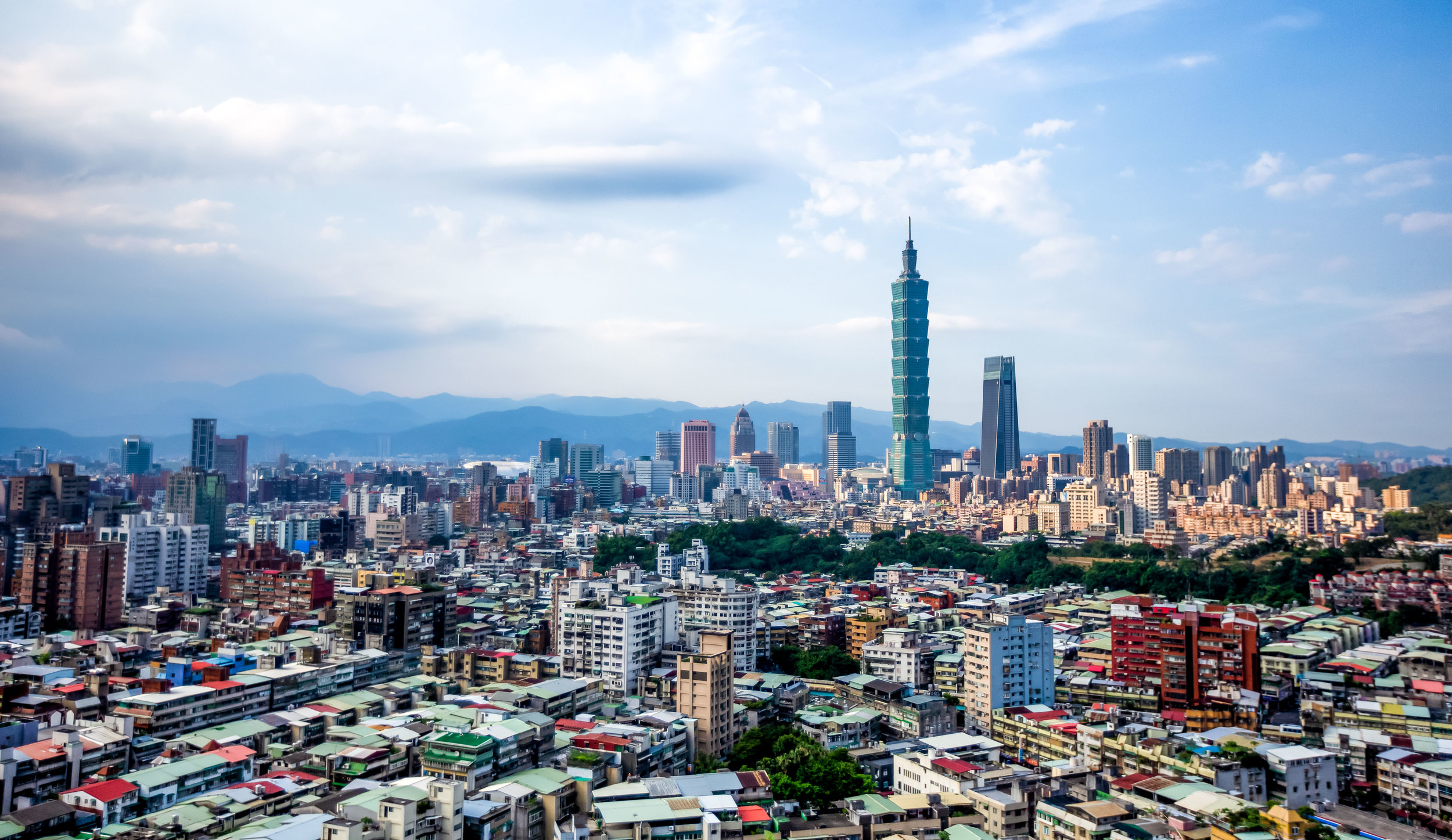
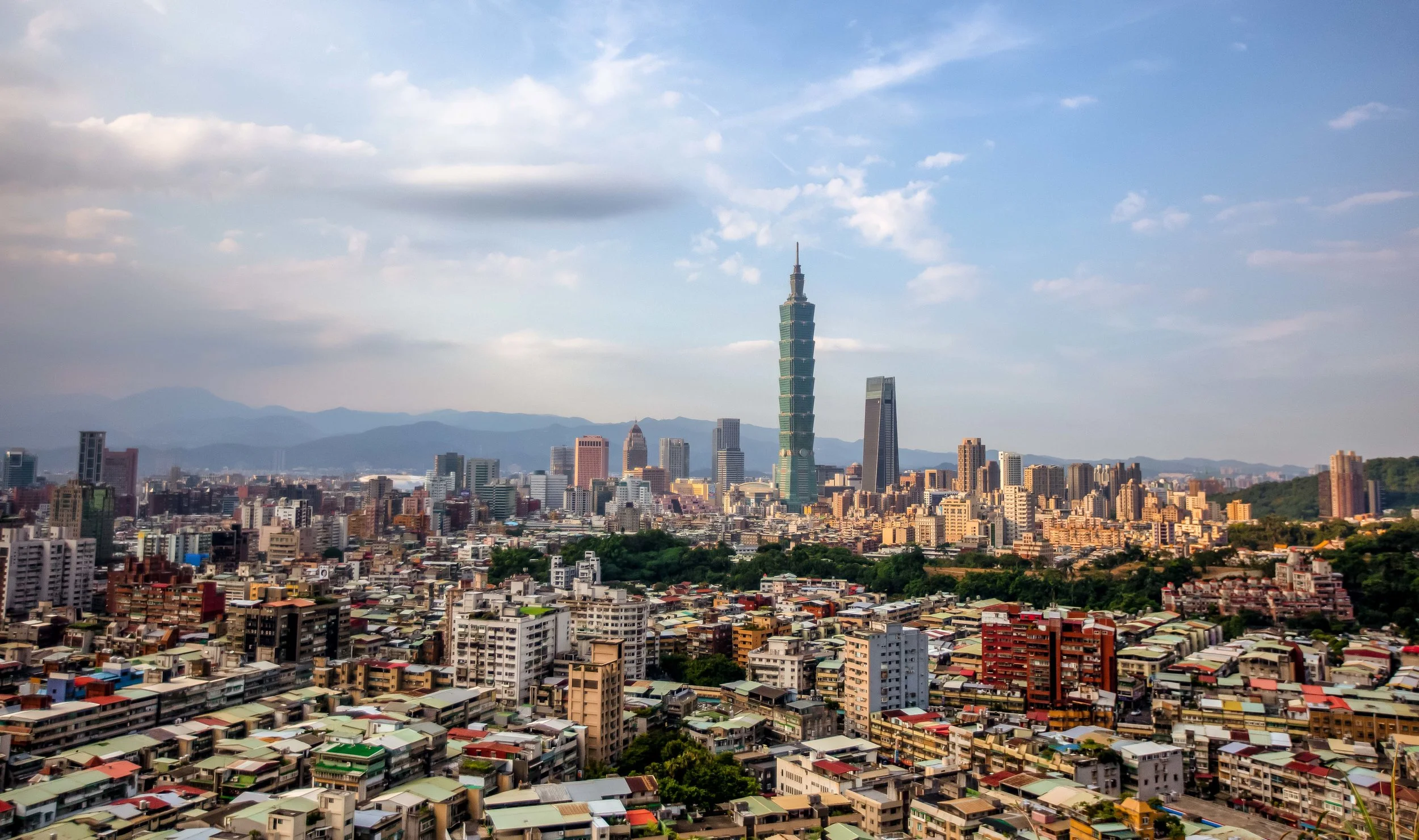
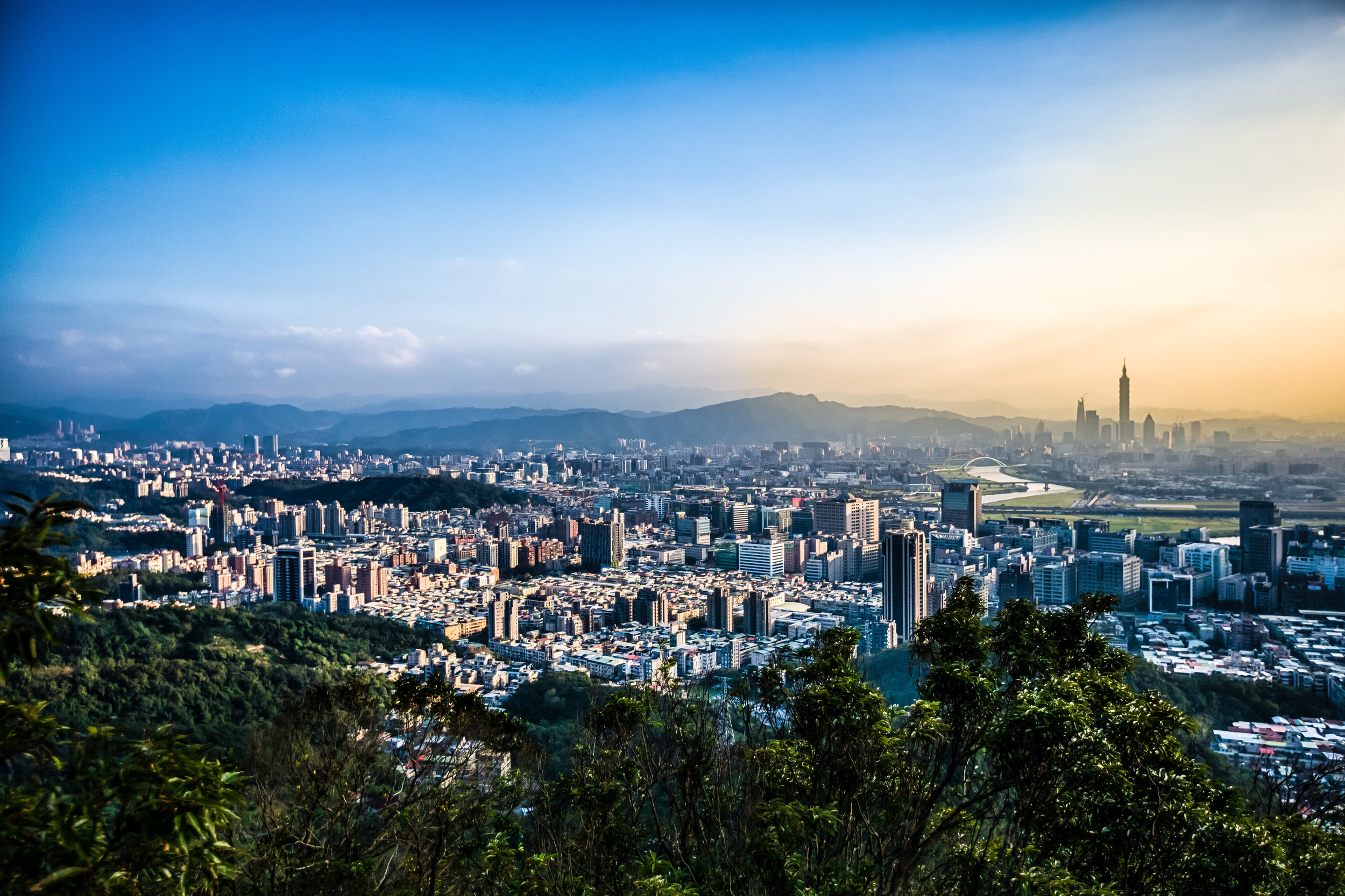
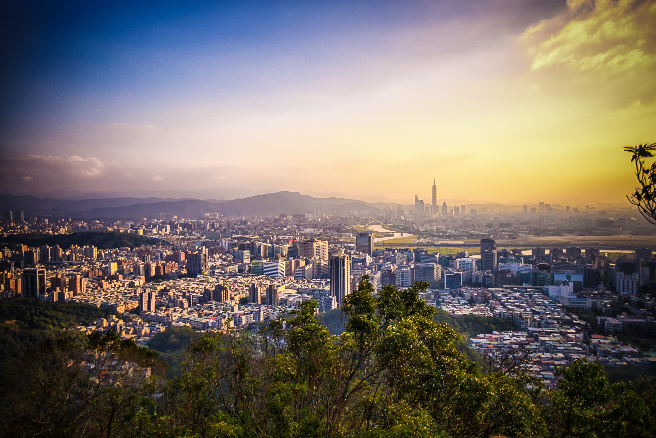
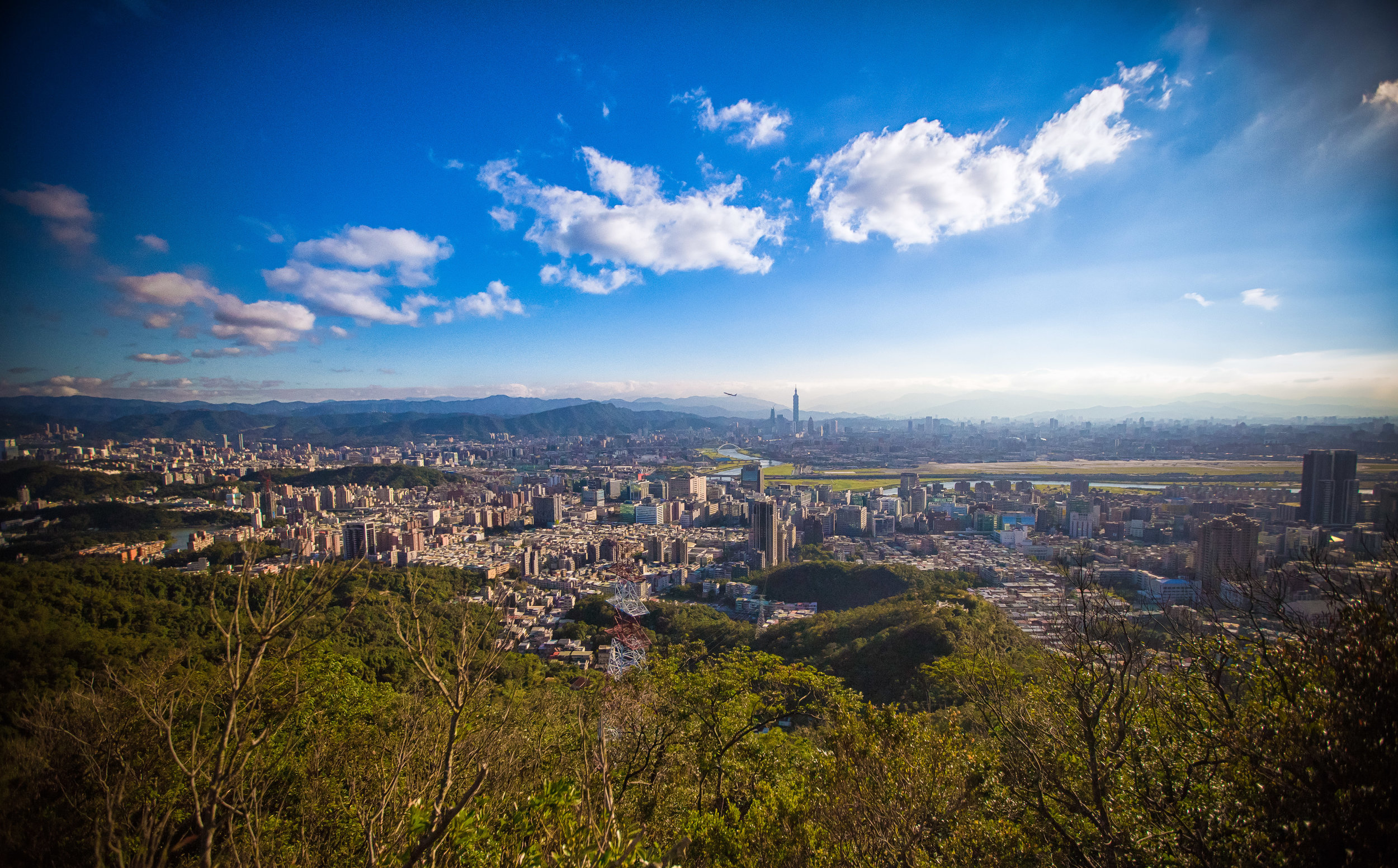
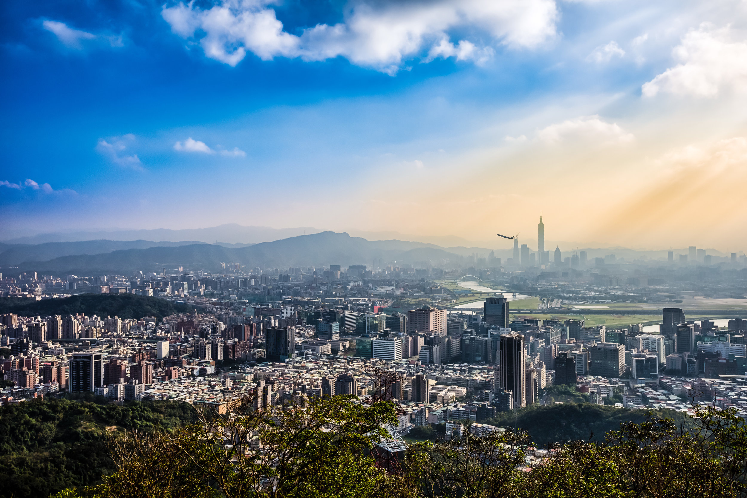
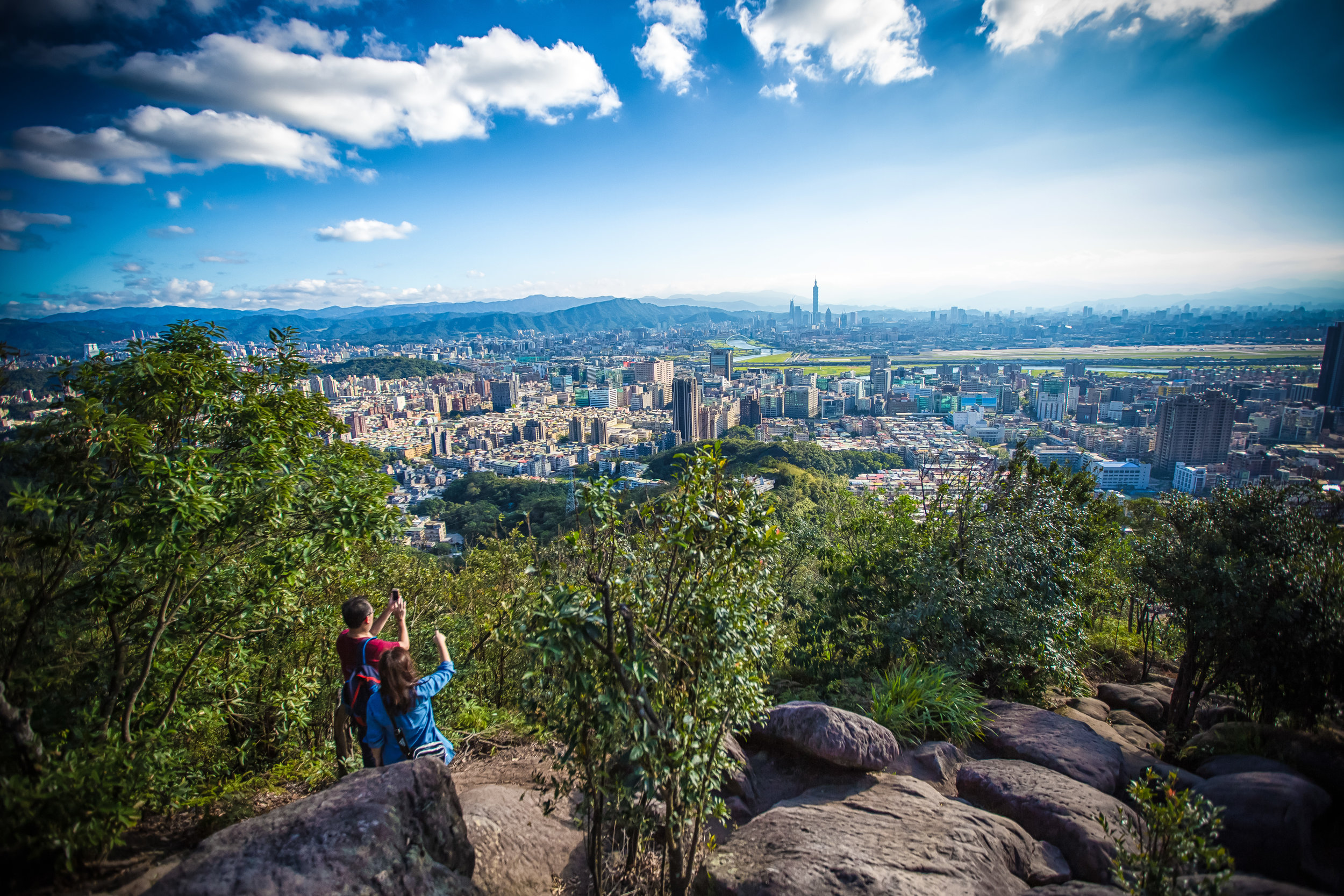
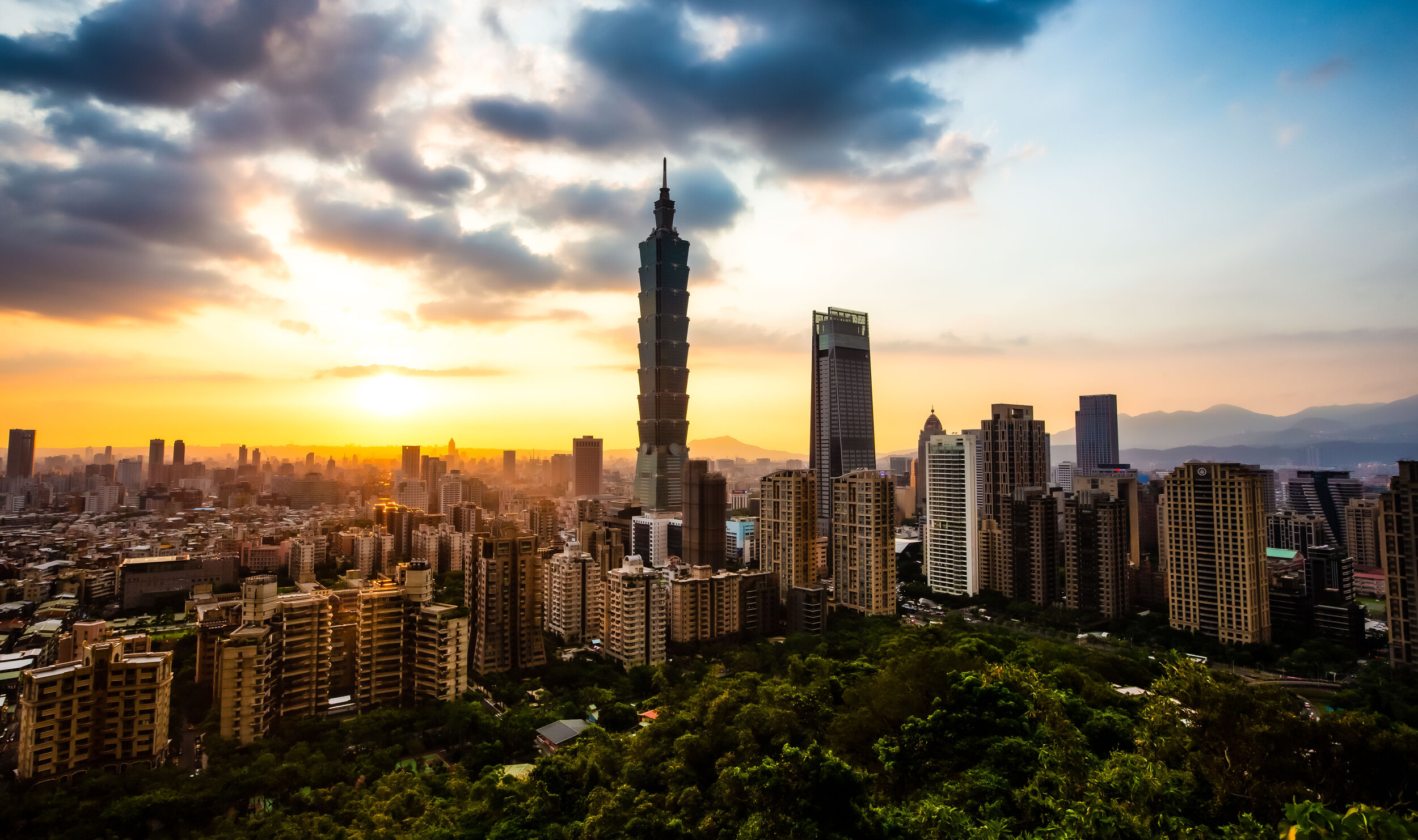
So you’re sitting at your computer, you’re planning a trip to Taiwan and you’re wondering what you’re going to do while you’re here. You type ‘T-a-i-p-e-i’ into Google and what comes up? My bet is that you’re going to get a collection of photos that look more or less the same as the photo above.

This shouldn’t surprise you. 

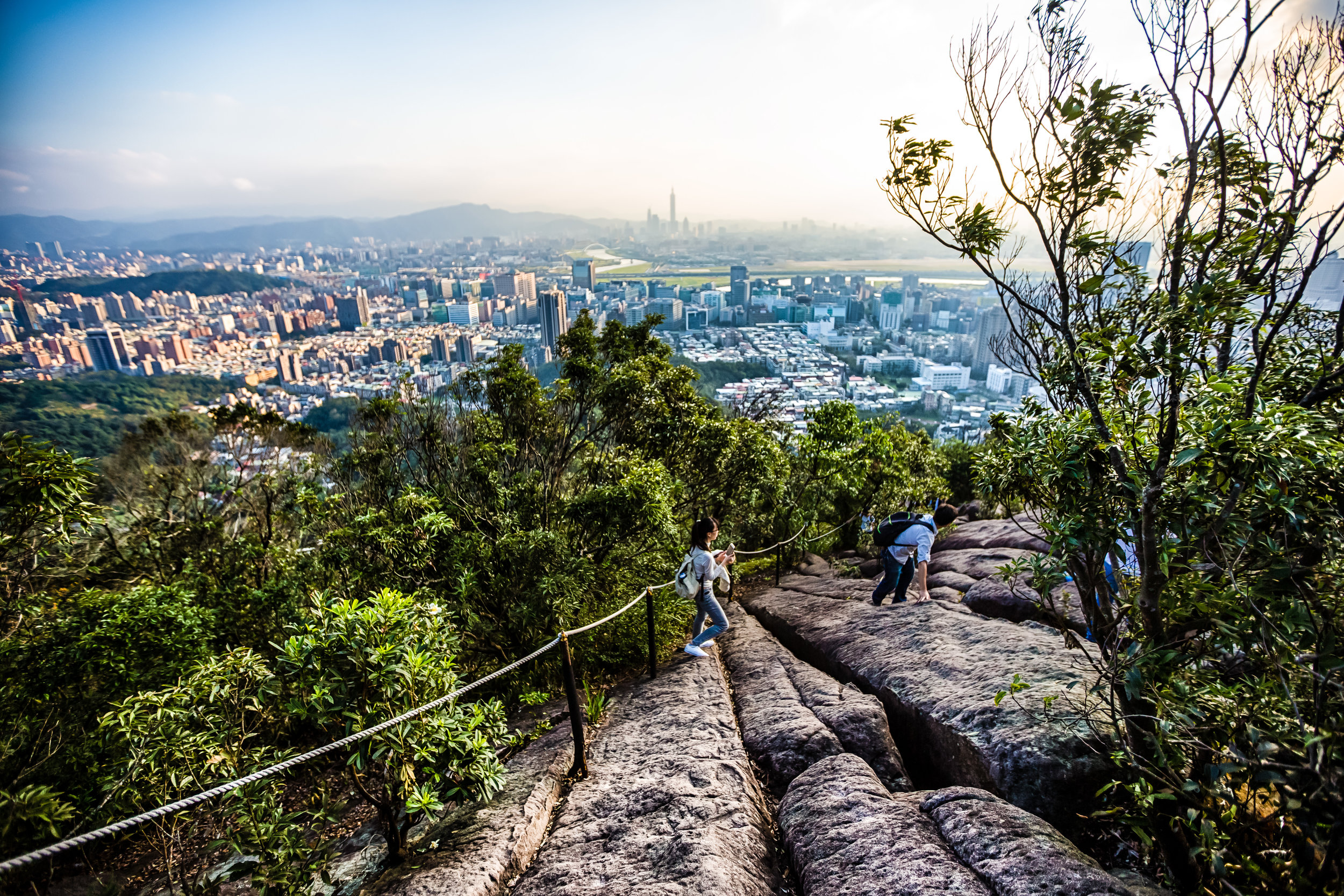
Taipei is a city with an endless amount of things to see and do - but its fair to say that the undisputed champion of the city’s tourist attractions is the Elephant Mountain Hiking Trail. This is why each and every day hundreds, if not thousands of photos are posted from the many popular photo spots on the trail.

You’re of course welcome to disagree with my assessment, but before you do, I recommend taking some time to hike the mountain and taking note of the amazing mixture of languages being spoken by all of the travelers on the trail. You’re not likely to have an even remotely similar experience anywhere else in Taiwan (at least not in such a high concentration) as you will on Elephant Mountain. 

Even though I’m not a big fan of crowds slowing me down when I’m hiking, I can appreciate the fact that the mountain has become so popular and has played a part in helping so many people from different areas of the world realize that Taiwan is a great place to visit.

It goes without saying that the popularity of the mountain does have its downsides - Namely that it doesn’t matter when you visit, you’re going to be hiking the trail with hundreds of other people. You’re also probably going to have to stand in line at the top to get your cool-looking tourist photo. You’re also going to have to arrive quite early to reserve a spot if you’re wanting to take ‘professional’ style shots of the sunset or the view at night.

If this kind of stuff worries you, never fear, there are quite a few other options for mountain trails in Taipei where you’re able to take beautiful cityscape photos. 

If you’re a short-term visitor though, I can’t recommend enough that you deal with the crowds, hike the mountain and enjoy the experience - I’ve hiked the mountain a hundred times over the years, and even though it has gotten progressively busier, it rarely disappoints. 

Before I start, I’d like to take a minute to explain why I’m writing about this mountain for the second time.

When I first started this blog, I honestly didn’t really have any idea about what direction it would take. I figured I would use it as an outlet to showcase my photography and the beauty of Taiwan, but never could have imagined that it would become such a popular travel resource for people wanting to learn more about Taiwan.

Now that I’m much more experienced with this whole blogging thing, when I look back at some of the articles I wrote when I first started, I feel a bit embarrassed - especially with those that attract a lot of traffic. My Elephant Mountain article in particular is one where I felt like I needed to provide an update and offer much more in-depth information to travelers. 

I hope this updated version helps travelers and answers any questions you may have about hiking this beautiful trail. 

The Elephant Mountain Hiking Trail

Benches designed in the shape of the Chinese characters for Elephant Mountain.

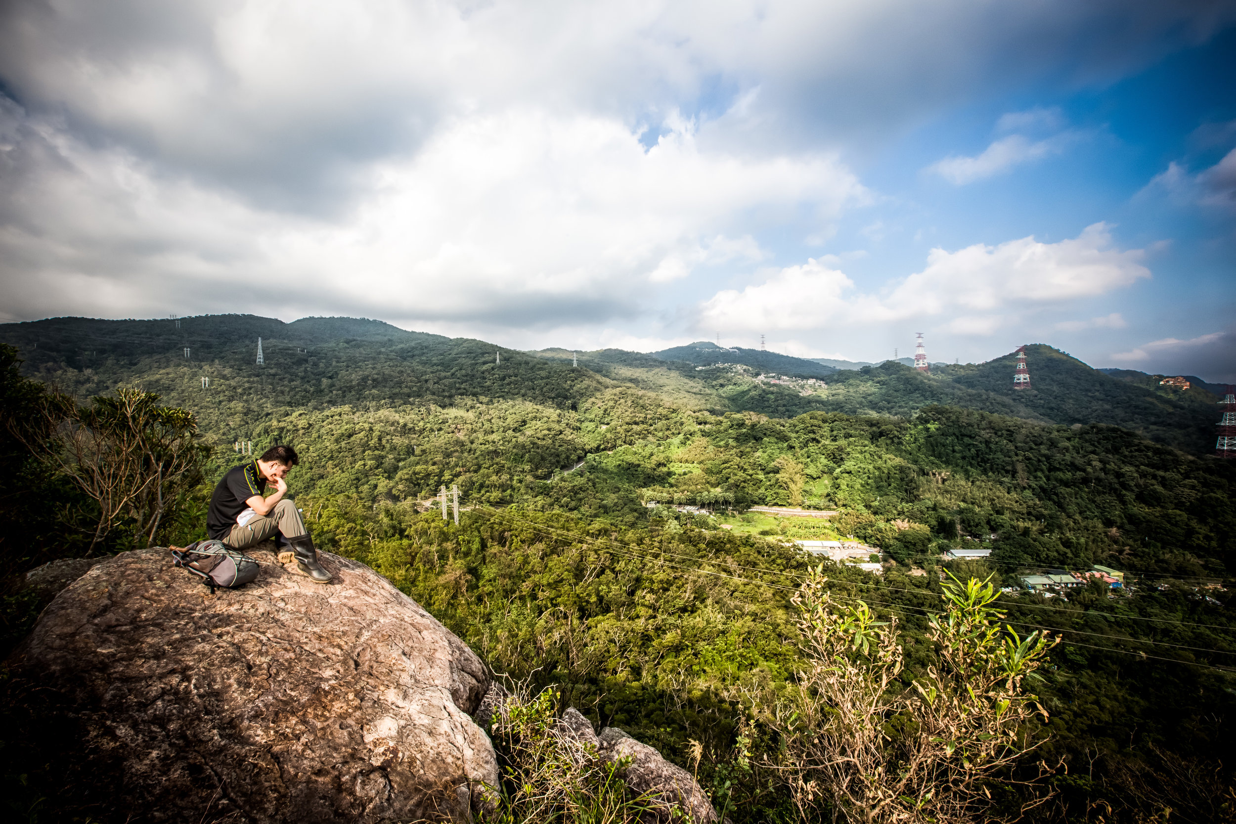
Most tourists seem to be unaware that the Elephant Mountain Hiking Trail (象山登山步道) is essentially just a small section of the much larger network of trails known either as the ‘Four Beasts trail’ (四獸山步道) or the Nangang Mountain Hiking Trail (南港山系). 

The 7km long network of trails also includes Tiger Mountain (虎山), Leopard Mountain (豹山), Lion Mountain (獅山), Thumb Mountain (拇指山), Nangang Mountain (南港山) and 9-5 Peak (九五峰) - all of which provide excellent views of the Taipei cityscape and takes several hours to complete.  

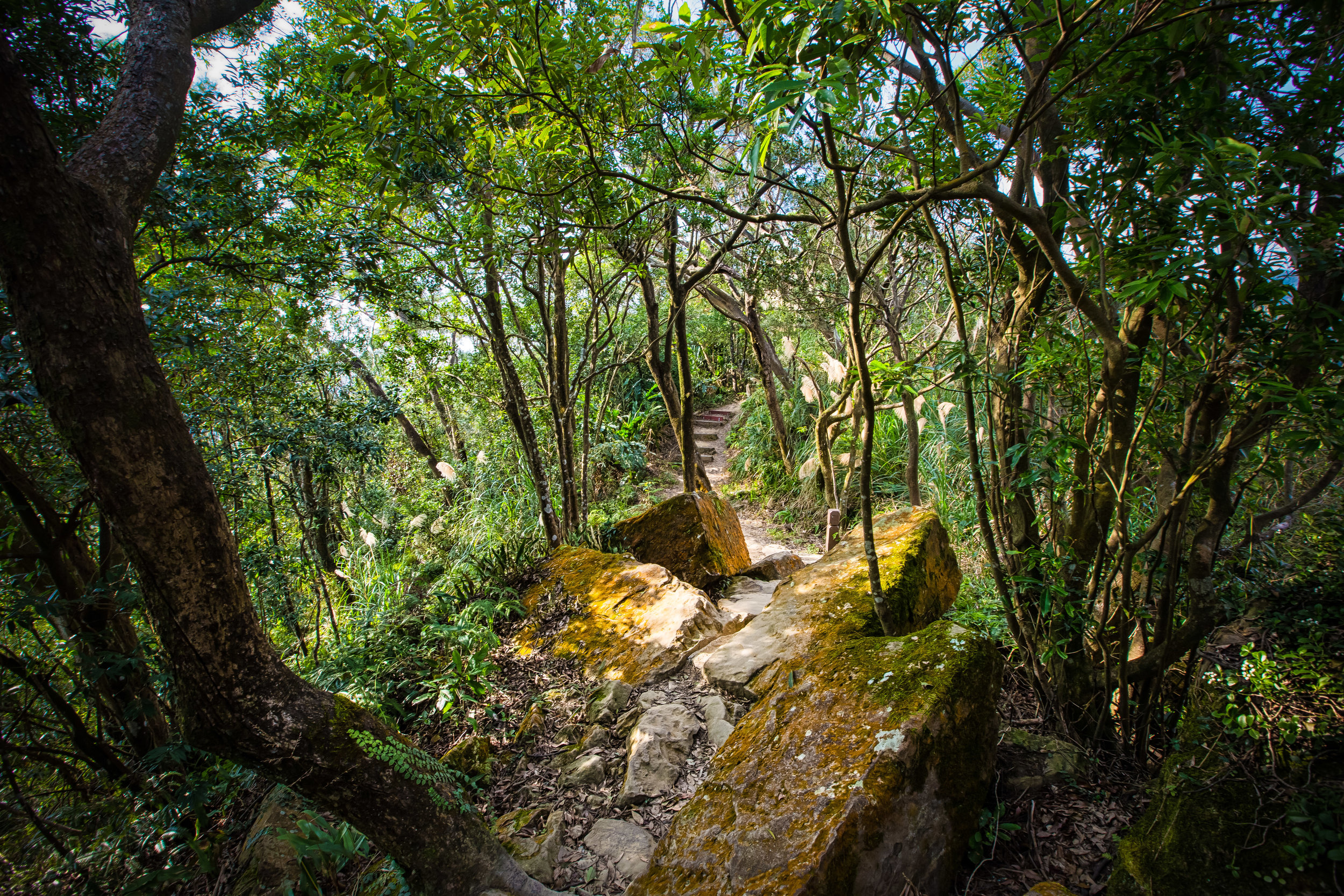
The Elephant Mountain portion of the trail however is just a short hike up a very well-developed set of stairs that should only take you anywhere between fifteen and twenty minutes. Don’t let this fool you though, I’ve seen people showing up in high-heels and their Sunday best thinking that it is going to be quick and easy. 

This mountain trail is steep and even an avid hiker like myself gets a pretty good workout every time I go.

You’re not going to need to wear hiking boots or bring a bunch of gear with you when you go. You’re just going to have to wear comfortable footwear and clothes that are suitable for a bit of exercise.

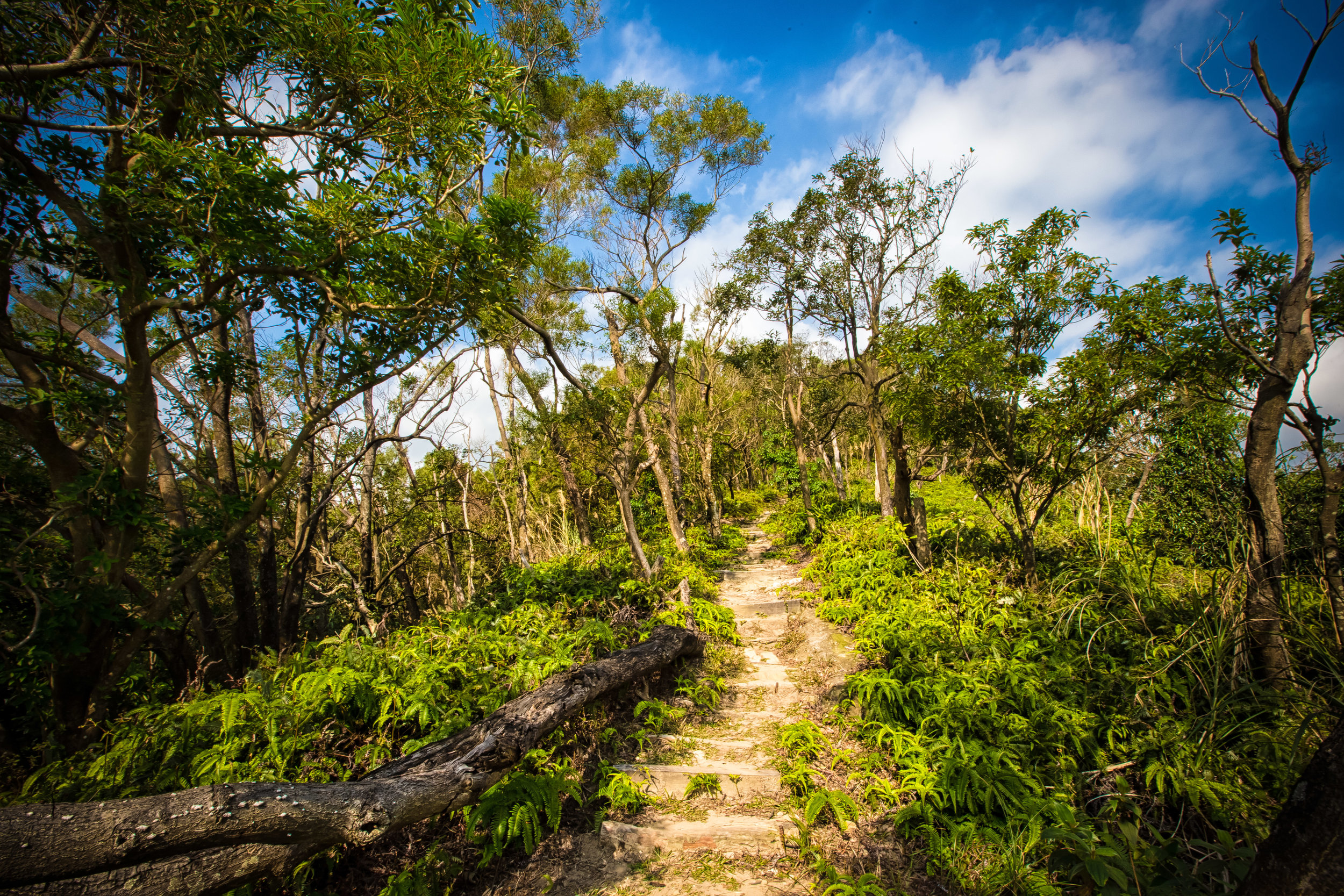
From the trailhead, you’re going to hike on a very steep incline that will quickly transport you well above the city to a height of about 183 meters (600 feet) above sea level. 

Elephant Mountain Trailhead

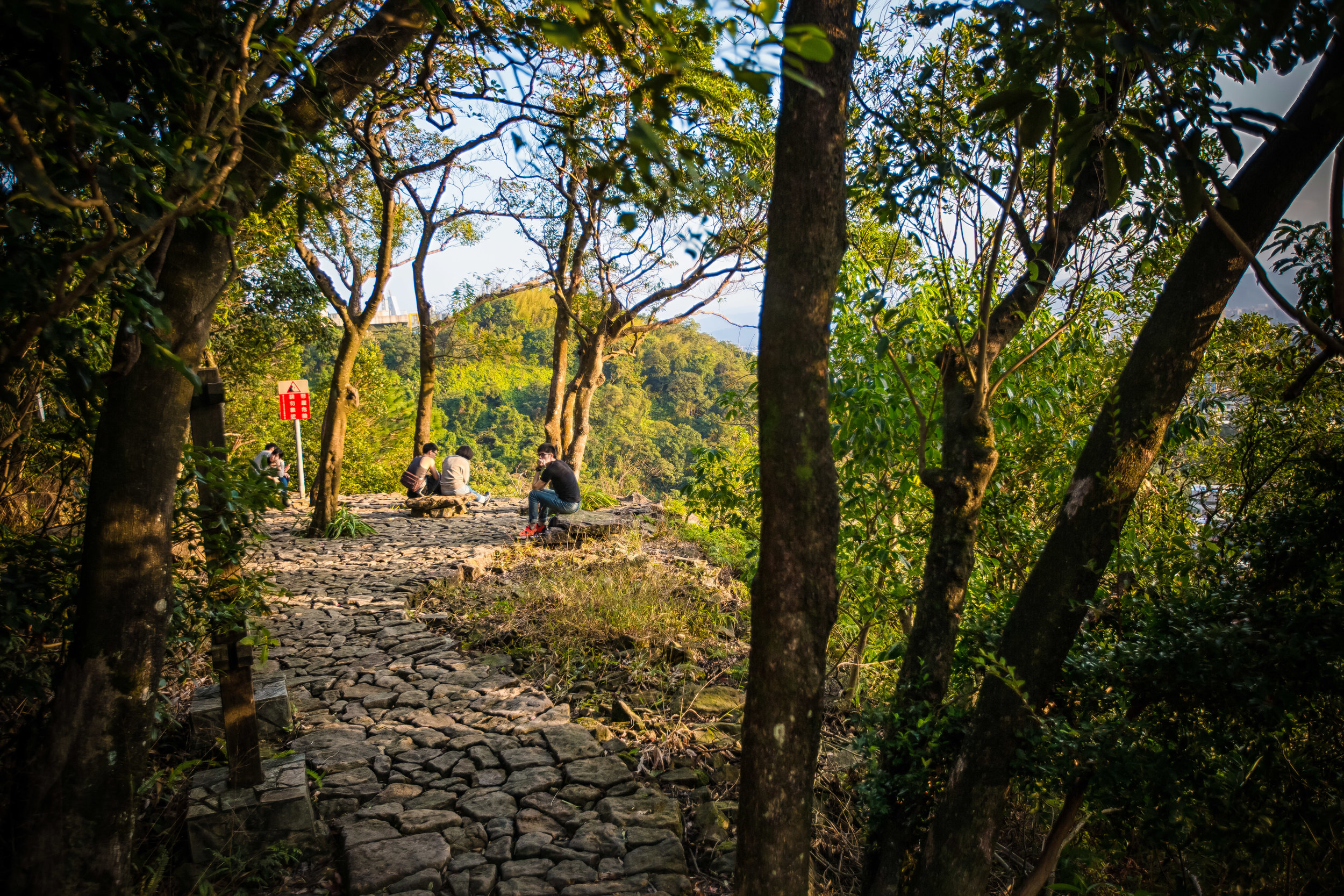
The trail is well-developed with a stone path, signage, benches for taking breaks, lights that guide your path at night, water fountains and surprisingly clean washroom facilities. This allows you to not only hike the trail during the day, but also at night without having to worry. 

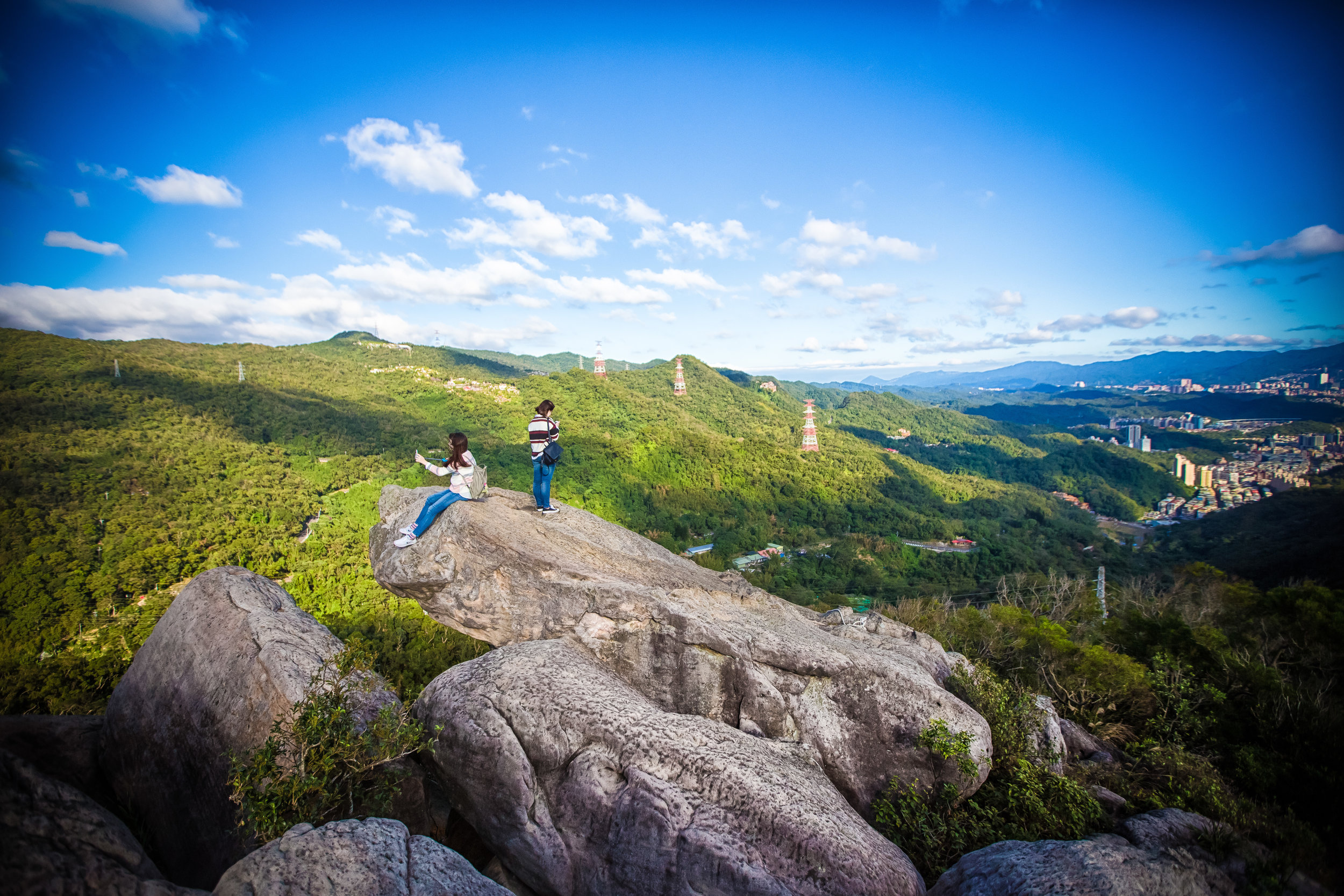
While there are several cityscape viewing platforms along the way, the main attraction of the trail for most tourists is the area known as the ‘Six Giant Rocks’ (六巨石) near the peak of the mountain. The giant rocks are part of an open space near the peak where you’re going to enjoy the best selfie opportunities, but is also where you’re going to encounter the largest amount of traffic.

Having your photo taken at the rocks is probably the most important part of hiking the trail, so it shouldn’t surprise you that you may end up having to wait in line to get your chance to stand on the rock and take your photos. So if there is a line, its just something that you’re going to have to be patient about if you want to get a photo of yourself.

My advice would be to hike the mountain early in the morning which should save you some time as the mountain isn’t as busy then.

If you’re a solo traveller and are hiking the mountain alone, I recommend requesting a fellow traveller to help you take a photo while standing on the rock rather than simply taking a selfie. If on the other hand you have others traveling with you, you can take turns by having them stand on one of the giant rocks to the rear to take photos of you.

This way you’ll get a bit more perspective when you take your photo and you’ll also save you some time waiting in line if you work together.

Once you’ve finished getting photos at the Giant Rocks area, if you’re not too tired and would like to get some more photos, I recommend continuing your hike a bit further past the Giant Rocks where you’ll come across several other viewing platforms that provide excellent perspectives of the city.

If you hike further up past the rocks, you can choose to complete your hike by returning the way you came, or simply continuing along to Tiger Mountain where you’ll descend upon another MRT station. 

Personally, I prefer to exit through Tiger Mountain for a couple of different reasons - It is a short distance from Elephant Mountain’s final platform, it also allows me to experience another mountain peak, there is less traffic, and more importantly, its much easier on the knees.

How you leave though depends on you, if you missed some platforms on your way up, you’ll probably want to revisit them, so if thats the case you’ll probably just want to head back the way you came.  

Elephant Mountain Photo Spots

Night view of the Taipei cityscape from Elephant Mountain.

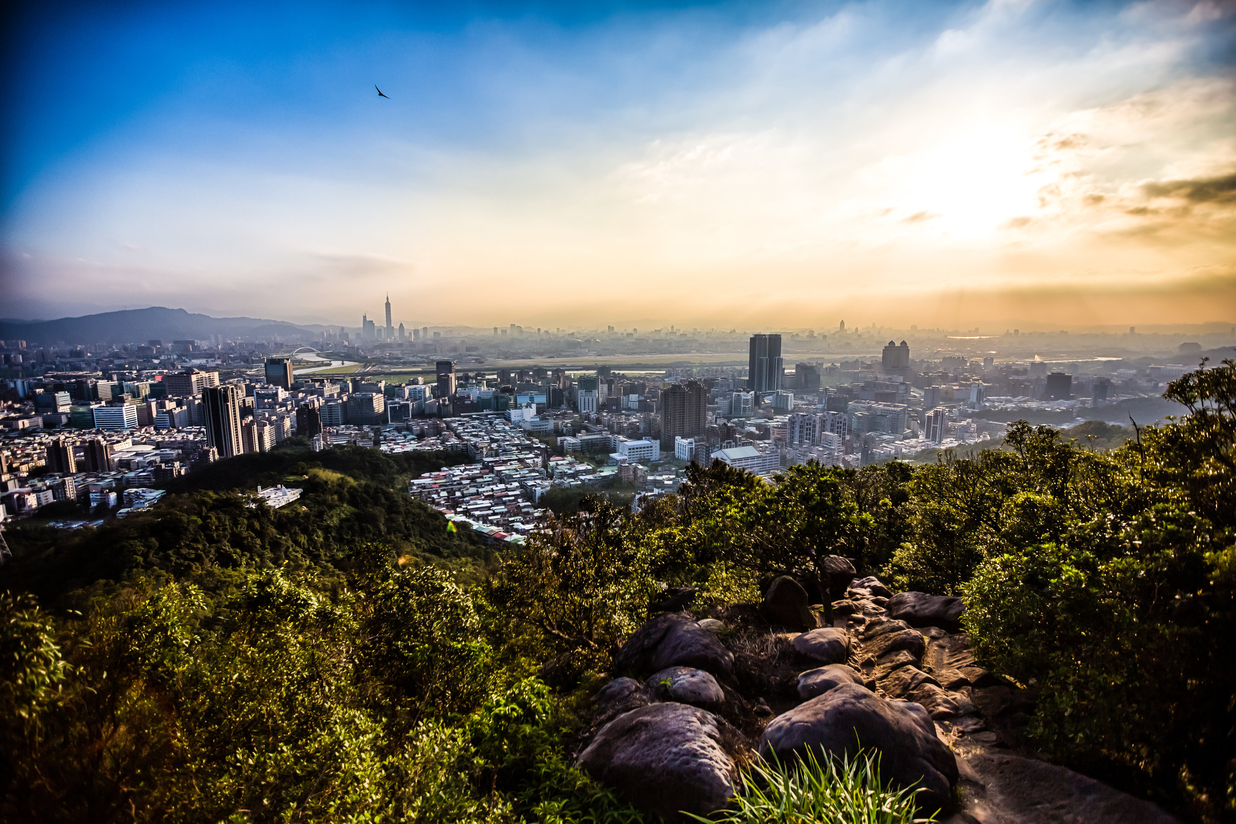
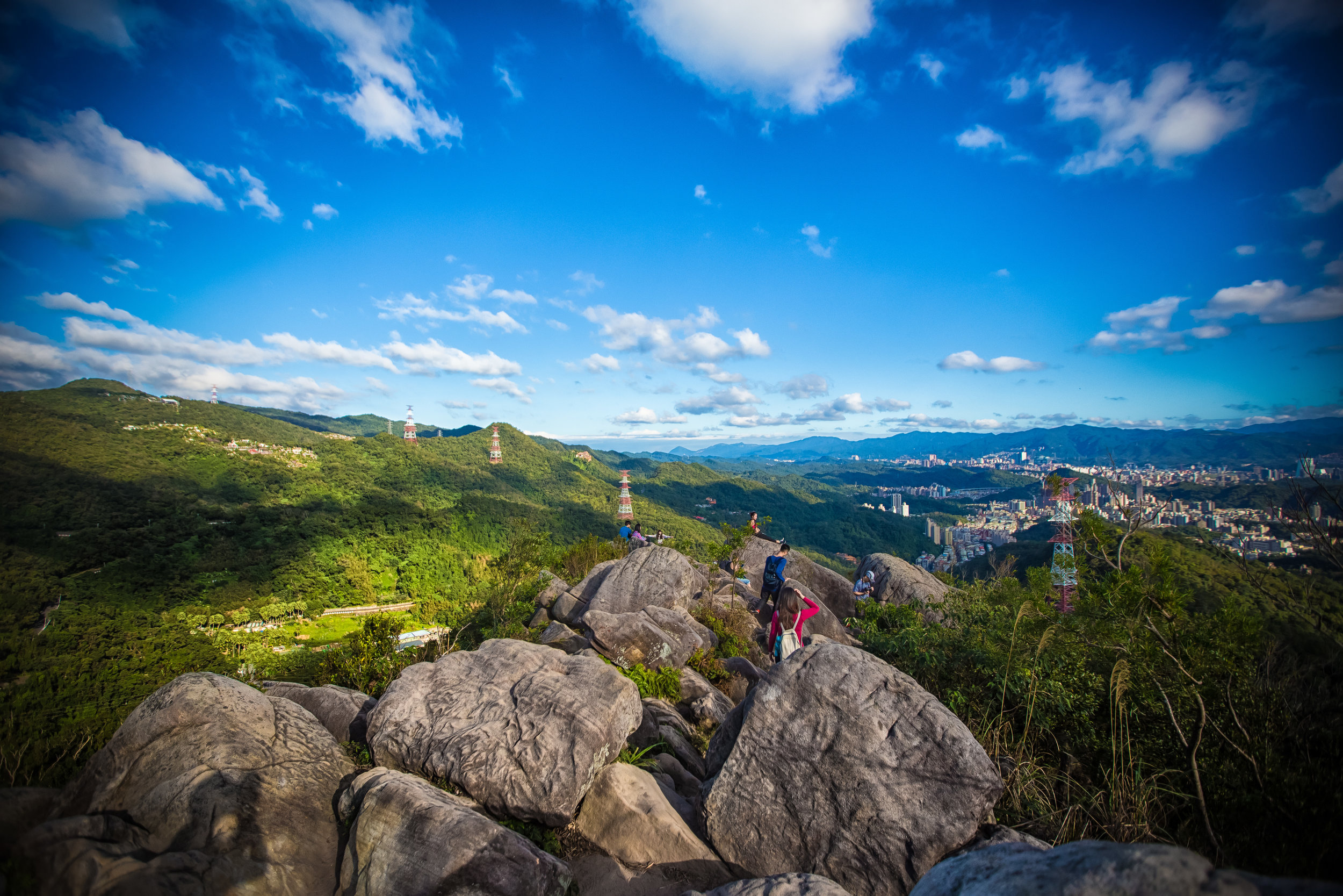
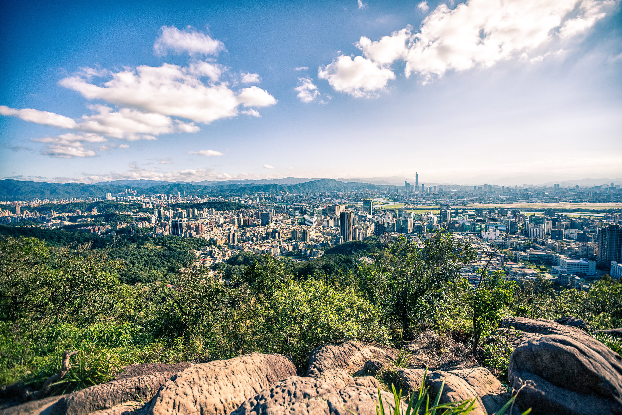
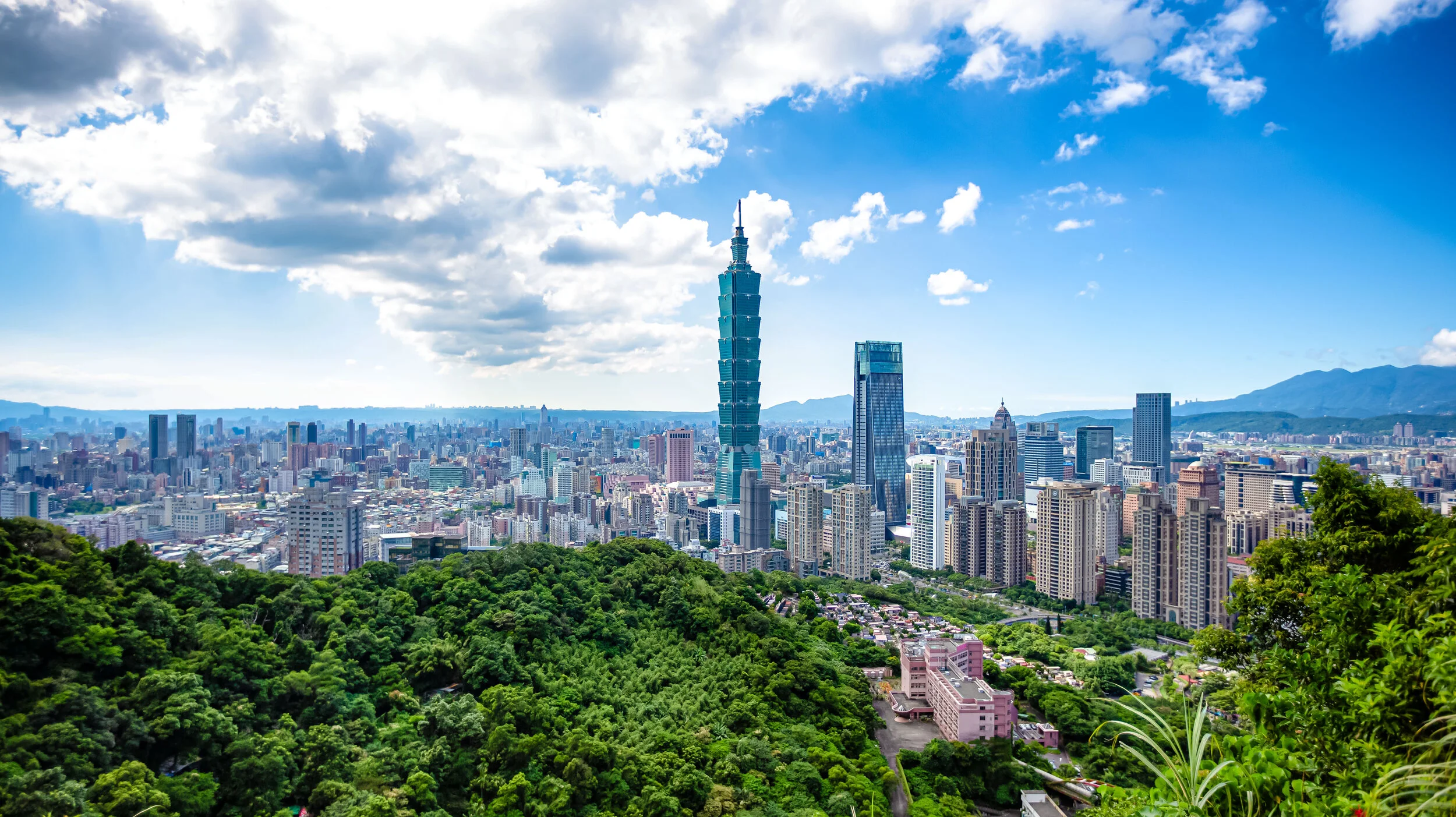
When it comes to taking photos of the Taipei cityscape, you’re spoiled for options on Elephant Mountain - There are at least five different vistas for taking photos that provide tourists with an elevated platform giving an even better perspective of the city. 

So when you’re visiting Elephant Mountain, you simply have to ask yourself: What kind of photos do I want to take?

Do you want to take epic travel photos/selfies? Do you want to take professional quality photos of the cityscape? Do you want to take photos of the sunset or the night view? Or are you hoping to get photos of the New Years fireworks? 

Once you’ve decided what you’d like to do, there are a few considerations that you’ll want to keep in mind: 

  1. If you’re hoping to take photos of yourself, you’re probably going to have to wait in line to get up on the giant rock. You should also bring a photo-taking pal who can take turns with you. 

  2. If you’re wanting to take professional quality photos of the cityscape, you’re going to need a camera, possibly a tripod and a spot on one of the platforms where you can set up. 

  3. If you’re hoping to take photos of the sunset, you’re going to have to arrive early, bring a camera and a tripod and wait. Spots on the platforms fill up quickly, so if you don’t want to miss out, you’ll have to arrive several hours early. 

  4. If you’re hoping to take photos of the New Years fireworks, you should probably prepare a tent and camp out for a few days in order to reserve your spot. You may think I’m exaggerating but some of the old guys in Taiwan will have their tripods chained up in spots on the platform several days before New Years and they take turns standing guard. 

Elephant Mountain Photography Platforms

There are a number of platforms and viewpoints located on the mountain where you’re able to take some pretty awesome photos, but even though the signage on the trail is surprisingly helpful, its not easy for tourists to plan their trip in advance with all the scattered information available online.

I’m embedding a map below that includes the location of all the popular photo locations and the routes you’ll take to get there as well as a short description of each of the stops below.

Guide to hiking Taipei's Elephant Mountain (象山) www.goteamjosh.com/blog/xiangshan

  • Photographers Platform (攝手平台)

GTJ-2019-0914-5.jpg

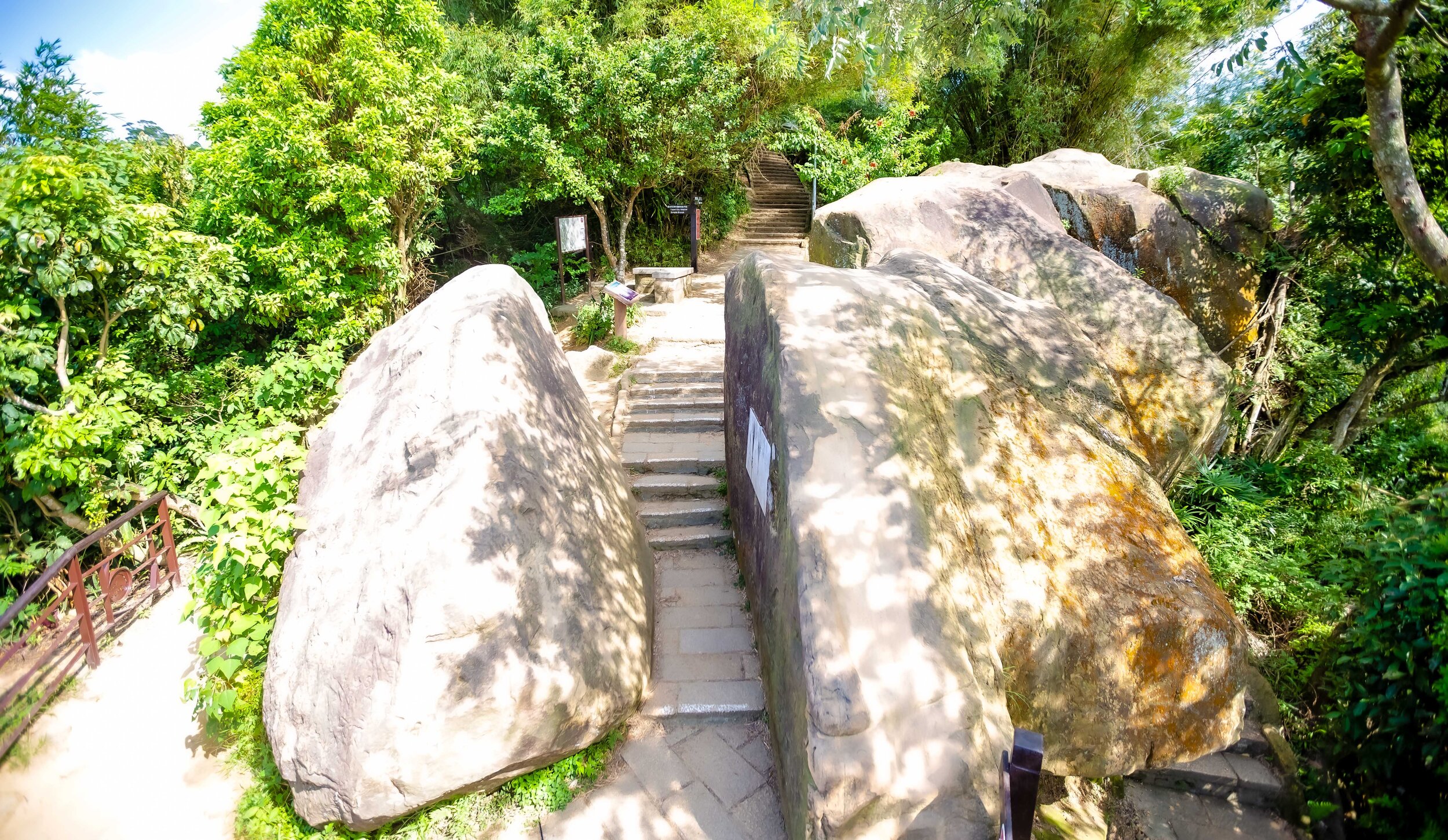
The trail to the ‘Six Giant Rocks’ can more or less be divided into two sections, the first part is a 5-10 minute walk up a very steep set of stairs and the second part is another 5 minute walk up an even steeper set of stairs. Fortunately the space between the two sections is a flat section of trail where you’ll be able to catch your breath and take a break. 

The first viewing platform, the ‘Photographers Platform (攝手平台) sits along this flat piece of land and is an elevated structure that allows hikers the opportunity to take photos of the cityscape. This platform is often full of people so if you want to take photos from here, you’re probably going to have to be patient to get a spot.

Personally I feel like it is a nice spot to stop for a selfie, but its not one of my preferred spots for setting up a tripod and taking photos. I think what this platform does well though is give hikers a pretty good taste of what they’re about to experience as they hike further up the mountain.

  • Fireworks Viewing Platform (煙火平台)

The amazing view of the under-appreciated Fireworks Viewing Platform.

Once you’ve passed the first platform, you have the choice of either hiking up the hill to the ‘Six Giant Rocks’ or continuing straight along the flat path. Most people are going to elect to continue up the hill to their preferred destination, but here is where I’ll let you in on a bit of a secret. If you continue straight along the path, you’re going to find one of the best photo spots on the mountain, the Fireworks Viewing Platform. 

Continuing straight along the flat section of the path you’re going to come upon a covered rest area with public restrooms. What most people don’t realize is that if you keep following the path behind the rest area, you’ll find another trail that will take you to a small platform that has probably one of the best views of the city.

The trail to the platform doesn’t show up on Google Maps, so I’ve drawn a line to it on the map. You’ll see signage along the trail pointing in its direction, but the way they’ve blocked the trail with the rest area confuses a lot of people. Trust me, its there and its awesome!

  • Six Giant Rocks (六巨石)

The view from the popular Six Giant Rocks

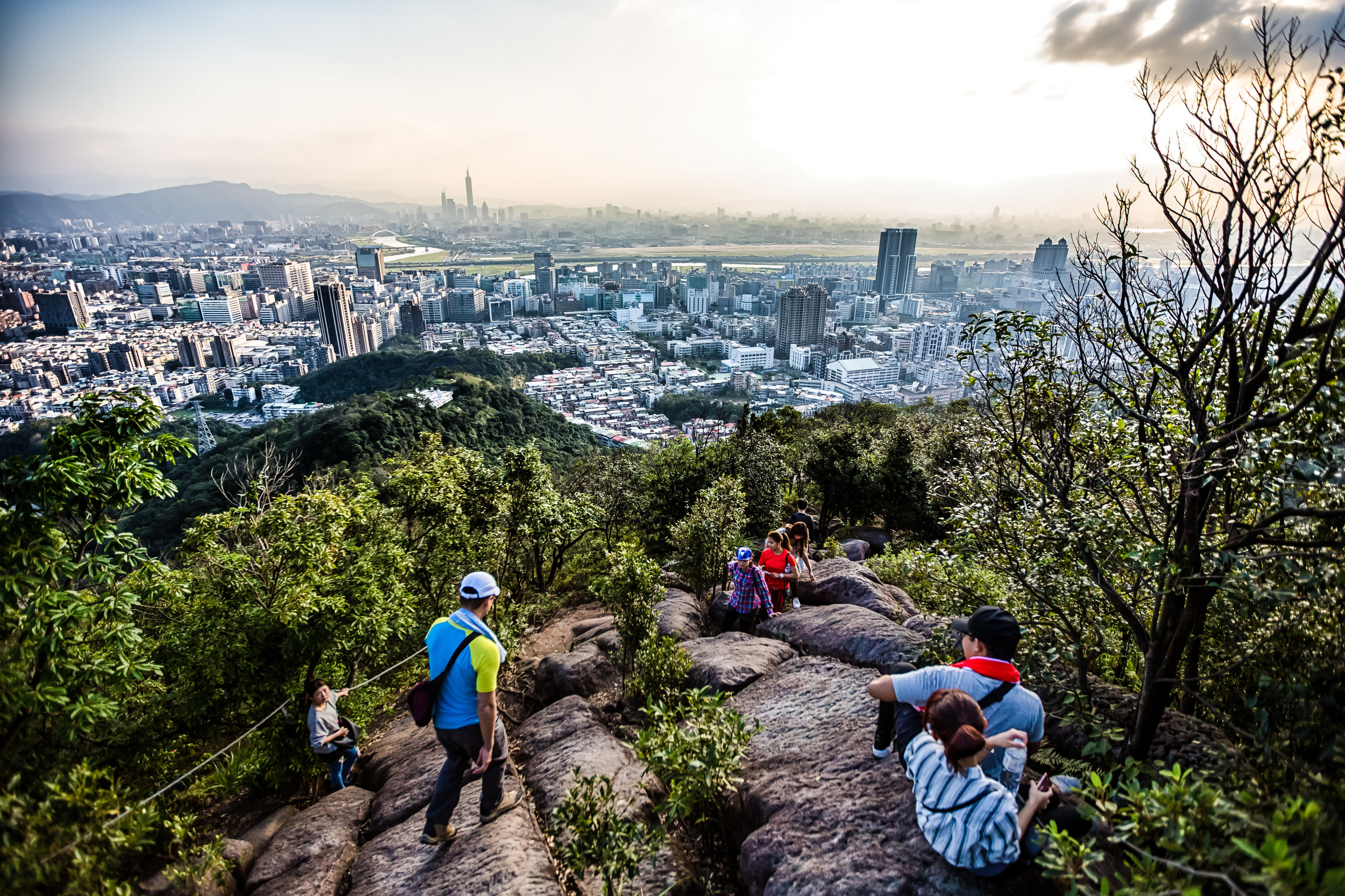
The ‘Six Giant Rocks’ area is essentially the main destination for all of the tourists hiking this trail. This is the area where you’re going to get your ‘epic’ Instagram travel photos and also where you’re also going to have to line up with a bunch of fellow travelers all wanting the exact same photo. 

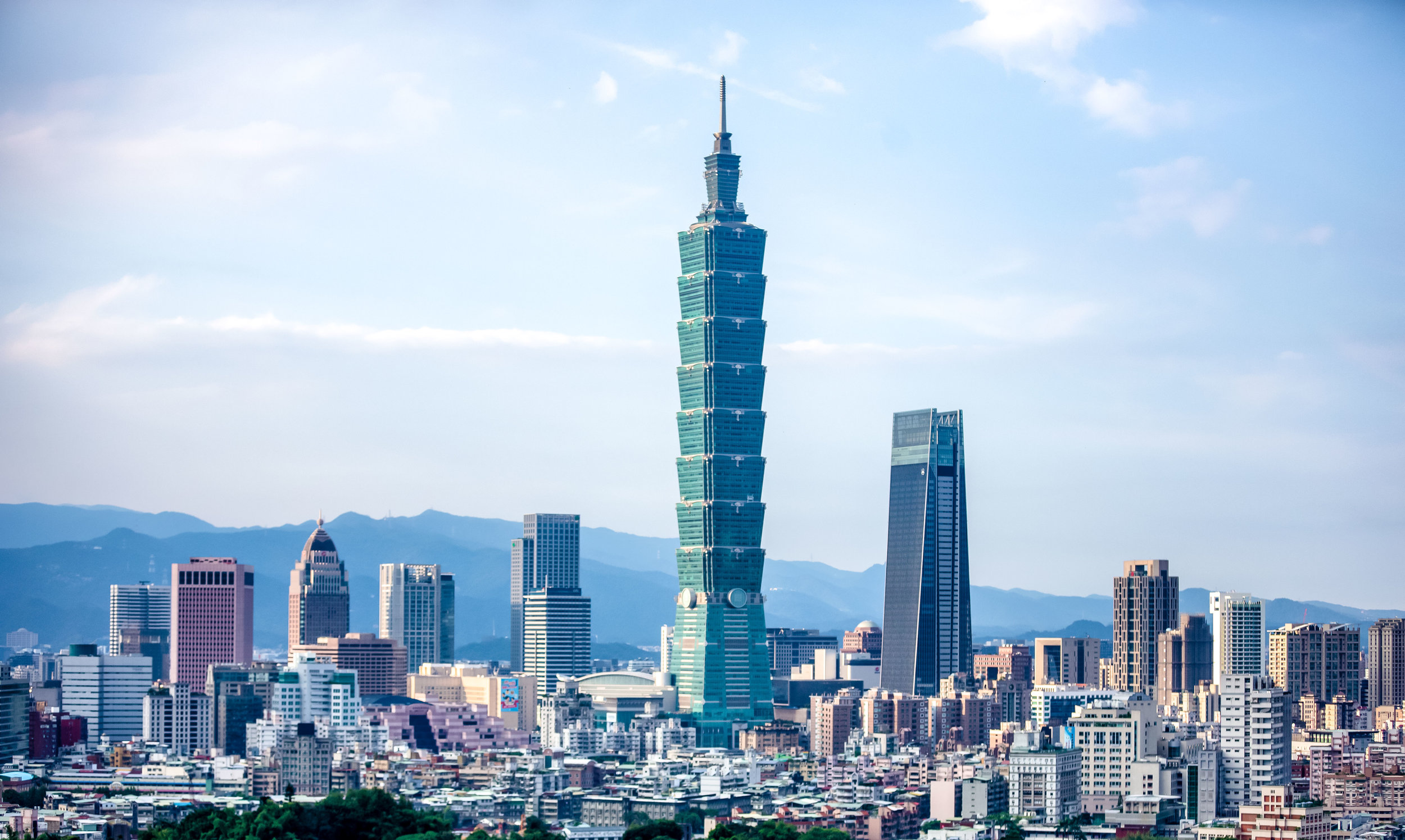
The area is aptly named for the six giant rocks that people climb on to take photos - The first rock you’ll meet as you walk up the stairs, which is coincidentally the smallest of the bunch is the main attraction. People are going to be waiting in line to take turns climbing up to the top of the rock to take their Instagram shots. This is because even though the rock is small, it towers over the peak which provides a unique perspective that makes you seem almost as tall as Taipei 101.

The best way to take photos here is to take turns taking photos with a fellow traveller so if you’re traveling with friends or family, you’re in luck. If you’re traveling solo, you’re going to want to ask another person waiting in line to help you take some photos. Don’t be shy, everyone has come here for the same reason, so make some friends while you’re there.

The reason that you’ll want to have someone else help take your photos is due to the fact that if you simply take a selfie while standing on the rock, you’re not really going to get the full perspective of just how awesome this spot is. If you have someone else helping, they can stand on one of the larger rocks to the real and take wide-angle shots that are so much better.

  • Six Giant Rocks Platform (六巨石觀景台)

Once you’ve finished taking photos at the Six Giant Rocks, you can continue walking along the trail where you’ll very quickly be met with yet another platform for taking photos. The ‘Six Giant Rocks Platform’ is another beautifully constructed elevated platform situated on a cliff and offers some pretty good views of the city. 

The platform has benches, so people like to stop here to enjoy the view and rest a bit. Unfortunately this means that if the mountain is busy on the day that you’re visiting that you’re going to have to wait to get a spot to take photos. 

While I do enjoy taking photos from this location, I don’t think its the best place to set up a tripod to take photos. The reason for this is because when others are walking on the platform, it shakes a bit, so if you’re taking long-exposures, you’re going to have quite a bit of ruined shot. You can however sit your camera on the rail to take some nice photos during the day, especially if you want to take multiple-exposure HDR shots of the cityscape.

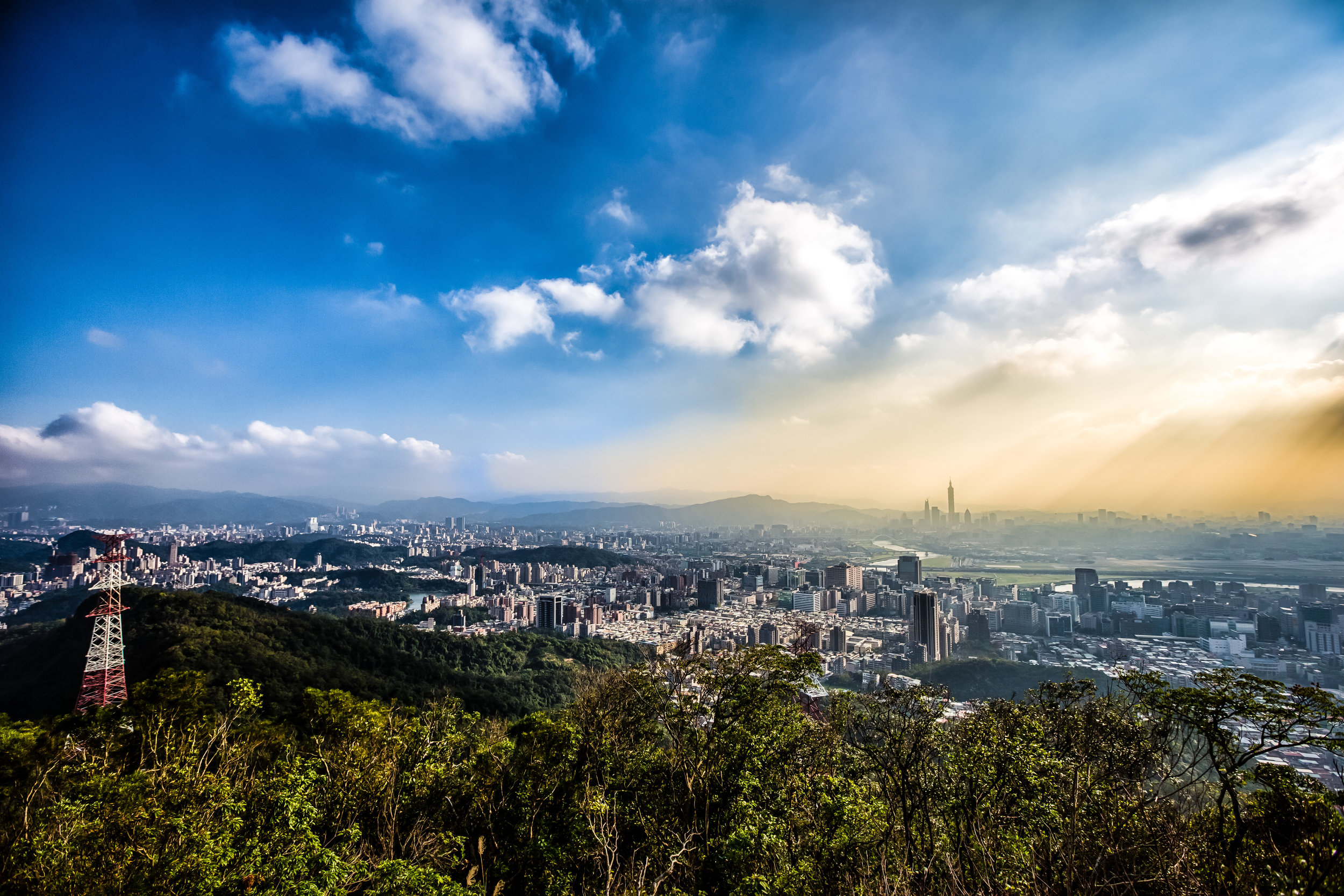
  • Chaoran Pavillon (超然亭)

The Chaoran Pavillon is one of the most popular spots for local photographers.

The final photo spot tends to be the most popular one with local photographers, especially with those wanting to take photos of the cityscape at sunset. From the Six Giant Rocks area, it shouldn’t take you any longer than ten minutes to arrive at the pavilion, which thankfully doesn’t require you to walk up any more steep hills. 

While walking along the path you’ll come across a fork in the road with signage pointing that indicates the trail to Thumb Mountain (拇指山) is to the right and to the left you’ll find the pavilion. From there you’ll only have to walk for a minute or two before you arrive. 

The view from the pavilion is beautiful, but spaces fill up quickly, especially before sunset, so if you’re wanting to set up a tripod to take some cityscape photos, or night shots, you’ll probably want to arrive quite early to make sure you get a spot. 

Getting There 

In the past, hikers would have to walk from Xinyi District toward the mountain and (if they were anything like me) would invariably get lost or have to ask directions. All of those problems have been solved thanks to the addition of an MRT station near the trailhead. You can of course still walk to the mountain from the Xinyi area, but the easiest way to get there is by taking the Red Line (紅線) to Xiangshan Station (象山捷運站) and from there walking the short distance to the trailhead.

Something you’ll want to keep in mind is that not all trains go to Xiangshan Station as quite a few end their service at Da’an Station (大安站). Before getting on the train, make sure that it is one that goes all the way to Xiangshan, which is currently the terminal station for the red line.

Once you’ve reached the MRT station, take Exit 2 and walk through Xiangshan Park (象山公園) until you reach the end of the road. From there you’ll see signs directing you to turn left. When you’ve reached the top of the hill you’ll turn right and within a minute or two will arrive at the trailhead which is next to a temple.

If you want to grab some water or a snack before your hike, you’ll find a 7-11 and a Family Mart a short distance away from the park. Before you turn left to walk up the hill, turn right and walk down Xinyi Road to get to the convenience stores.

If you find yourself in the Xinyi (信義) area, you could also just as easily hop on a Youbike, ride to Xiangshan Park and then follow the directions above. 

Likewise, Xiangshan Station is serviced by buses 20, 32, 33, 37, 46, 88, 207, 612 and Red 10. 

If you want to take a bus and need info on bus stops or real time info, check the Taipei eBus website for more information. You may also want to download the “台北等公車” smart phone app which uses GPS to let you map your route more easily.  

While you’re in Taipei, there is certainly a lot for you to see and do, I’d suggest though that Elephant Mountain should be at the top of your list - Not only does it have arguably the best views in the city, it is also a quick and easy hike and is extremely accessible. You can also get some pretty epic travel photos while you’re there and best of all - its completely free. If you’re visiting Taipei and you’re not planning to visit the mountain, you’re certainly missing out on a great experience.


Fuzhou Mountain (福州山)

Taiwan’s capital city of Taipei is an amazing city that is extremely fortunate to be almost completely surrounded by mountains. It seems like no matter where you are, you’re never far away from a hiking trail and some of those trails have an added bonus of providing hikers with spectacular views of the cityscape.

The sad thing is though, most tourists who come to Taiwan are only really aware of the Elephant Mountain trail, which provides one of the most iconic views of the city, but is also the reason why the mountain is jam-packed every day of the week.

Admittedly, Elephant Mountain does offer the best view and is the most ‘iconic’ spot to take photos of Taipei’s constantly changing skyline - There are however several other locations where you can go to get impressive shots of the city without having to wait all day. So, if you’re like me, and don’t like wasting time in long lines, but still want one of these iconic travel photos, you may want to consider an alternatives.

Most people don’t realize that the Elephant Mountain trail is part of a larger network of trails known as the ‘Four Beasts ’ (四獸山) which also includes Tiger Mountain, Leopard Mountain and Lion Mountain. Likewise you’ll also find Thumb Mountain (拇指山), 9-5 Peak (九五峰), Nangang Mountain (南港山) and Fuzhou Mountain (福州山) close by which are all equally attractive spots, but are frequented considerably less by tourists visiting the city.

Fuzhou Mountain in particular is one that can be easily accessed through Taipei’s excellent public transportation network and takes very little effort to climb but offers maximum enjoyment when it comes to the amazing view of the city.

The mountain which sits directly west of Elephant Mountain offers comparable views of the cityscape, but I would argue the view from this mountain gives visitors a much wider perspective of the city and the lack of any tall buildings obscuring the view of Taipei 101 makes the skyscraper look even more gigantic.

If you’re looking for one of those epic photos and don’t want to have to deal with a bunch of tourists getting in your shot, you’ll definitely want to consider this mountain.

Fuzhou Mountain Hike

Considerably one of the easiest hikes in Taipei, the Fuzhou Mountain trail takes less than twenty minutes from the trailhead to the peak and isn’t even remotely as steep as some of its more popular neighbors. This makes the mountain much more suitable for travelers who are traveling with children or seniors. Like most hikes in the city, the trails are well-maintained with well-developed walkways and even lights that guide your path at night.

If Instagram is any indication, the majority of people who hike this one take almost all of their photos from a specific area, which offers one of the best views of the Taipei cityscape -  but may fail to realize that the park has two additional viewing areas where you’ll also get great views of the city.

Depending on how much time you have and whether or not you plan on visiting one of the platforms or all of the platforms, there are a few things you should keep in mind when planning a trip to the mountain as there are a few different trailheads and a few different ways to get there.

To make things simple, I’m going to separate my recommendations for the trails into two different sections, so if you want to simply get to the most popular platform, take some photos and then leave as fast as possible check out the section immediately below. If however you plan to take your time, check out all three spots, you should check out the second description. It will provide you with faster access to the other two viewing platforms before arriving at the most popular one.

Starting from Fuyang Eco-Park

Once you’re in the park (directions below) you’ll come up to a roof-top pavilion with nearby bathroom facilities. You’ll likely find quite a few locals hanging out there drinking tea and chatting. The nature park, which is completely covered by trees offers a cool respite from the summer heat, so it tends to be a popular place to hang out.

Next to the pavilion is a set of stairs where you’ll start your ‘hike’ up the mountain - I wouldn’t actually even consider this one a ‘hike’ as its more or less just a brisk ten minute walk up a hill. The incline isn’t that steep and after a few short minutes you’ll start seeing the cityscape appearing through the brush.

After the short walk up the hill you’ll reach a park with playground-like facilities with another set of stairs leading up to the platform. This platform, the most popular of the three is where you’ll find the best view of the city.

Even though the view is generally unobstructed, I’d recommend that you bring a tripod with you, especially if you are going to be taking night shots. The taller the tripod the better as it is possible that you may end up having a bit of brush growing in front of the platform.

From this platform you have the option of continuing along the trail to the other two platforms or leaving the way you came to go back to the MRT station. If you’ve got the time, I recommend continuing on.

Starting from Wolong Street Trailhead

Mothra?

The Wolong Street Trailhead is probably the most popular starting point for this hike, but for the life of me I have absolutely no idea why. When you start your hike from the Fuyang Eco Park, you’re constantly surrounded by nature and the path, even though it is well maintained, blends in with the natural environment. The Wolong entrance however is a steep cement trail. There are of course trees all around you, but when you’re walking up a cement path wide enough for cars, I wouldn’t really call that a nature hike. Its more like a walk up a steep street. 

One of the other negatives is that the hike from Wolong Street takes much longer (and that doesn’t even include the amount of time it takes to arrive at the trailhead). If you start at the park and walk at my pace (which is relatively fast) you can be at the viewing platform in around five to ten minutes. The Wolong entrance on the other hand is going to take a bit more time and you’ll have to contend with a couple of really steep sets of stairs that are going to tire you out. 

I suppose the popularity of the Wolong Street trailhead as a starting point is mostly just so that people can make a complete circuit of the main part of the trail. If you start at Wolong, you can easily end your hike at the Eco Park, which is conveniently located near the MRT station. 

How you hike is up to you, but if you’re looking for a much faster and easier experience, I’d recommend not bothering with this trail at all. Personally, I’ve hiked this mountain well over a dozen times and the only time I started from this entrance was to get photos for this blog. Its not likely that I’ll ever start from there on a future visit.

Why are there so few people?

Despite offering what are arguably some of the best views of the city, there is a very practical reason why this mountain isn’t as popular as you’d expect it would be. Suffice to say, most locals consider it to be one of the most haunted areas in the city.

Why? Well, there are actually several reasons, all of which involve ghosts.

  1. The area where the hiking trails currently exist were once home to a graveyard that has since been relocated elsewhere.

  2. The southern side of the mountain, where you won’t find hiking trails, is still occupied by a large public graveyard and there are funeral homes near the base.

  3. The eastern side of the mountain is home to the Taipei Necropolis, an infamous site full of unmarked graves of those murdered by the government during Taiwan’s “White Terror” period (白色恐怖).

  4. The infamous Xinhai Tunnel (辛亥隧道) was constructed inside the mountain and connects two city districts geographically separated by the mountain.

I’m not really a person that pays much attention to this superstition stuff, so let me give you a few details so you’re not that freaked out.

The Taipei Necropolis and 228 Graveyard are actually on a distant part of the mountain range than the hiking trails (Closer to Liuzhangli MRT 六張犁捷運站). Unfortunately, the reminders of Taiwan’s history are enough to keep some away.

Link: The Graveyard at the Center of Taiwan’s White Terror Period (English / 中文)

In the early 2000’s when the graveyard was relocated and the city government started to lay the foundation for the hiking trails, the Taiwanese media (which thrives off of sensationalism) posted articles which complained about the poor job the city government did with relocating the graves and also enforced the idea that this place was definitely one where you wouldn’t want to visit. Here’s a translated excerpt from a 2005 TVBS article:

On Wolong Street in Taipei there was once a cemetery. Five or six years ago the cemetery was relocated and the city converted the area into a park. While the trails were being laid you wouldn’t believe that the city government did such a terrible job of cleaning up the remains of the tombs. It’s outrageous that a tombstone is still clearly visible next to the trail. If you want to enjoy the beauty of the world’s tallest building, Taipei 101, Fuzhou Park will satisfy you. However if you want to climb this mountain you’ll need a bit of courage because you have to walk along a path full of graves.

「台北市在臥龍街附近有一塊公墓,在五六年前墓地遷移之後,市府在原地改建成公園,還舖上木製登山步道,不過市府卻沒有將墳墓的遺跡清理乾淨,離譜的是,有墓碑就被崁進階梯裡,上面刻的姓氏還可以清楚看到。想要眺望世界最高樓台北101週圍的美景,有一個地方可以滿足您,那就是位在臥龍街附近的福州山公園,不過想登高望遠,可能要有點勇氣,因為您得踏著墳墓棧道,一步一步往上走。」

Confounding the urban myths about the mountain being haunted is the fact that the Xinhai Tunnel (辛亥隧道) was constructed within the mountain while the graveyard was still on top. There have have been countless stories about ghosts appearing in the back seats of people’s cars as well as on the road, causing several fatal accidents over the years. In 2013 the tunnel was listed as one of the ‘Top Ten Haunted Sites in Taiwan” by an online poll. (English / 中文版)

Fuzhou Mountain is a vibrant natural area in the middle of the city and is full of life and not those who have already departed this world. I’m sure most foreign visitors won’t have any reservations about visiting. I can attest to the fact that I’ve been in this park more than a handful of times, most of them hiking on my own, and haven’t experienced anything remotely strange - although on one occasion a grandma asked to take a selfie with me.

Getting There


There are a several different trailheads on this mountain, so how you get to the mountain really depends on which trailhead you prefer to start on. The entrance that most people use is a short walk from the Linguang Station (臨廣捷運站) on the MRT’s Brown Line (文湖線). The other two trailheads are either a longer walk away from the MRT station or are accessible by bus.

If you prefer to take the bus, you can take bus GR11 from the Taipower Building MRT Station (台電大樓捷運站) or Gongguan MRT Station (公館捷運站) and get off at the ‘Mortuary Service Office Second Funeral Parlor’ (第二殯儀館) bus stop and walk across the street to the trailhead.

From Linguang MRT Station you have two options for trailheads:

Fastest Route: From Exit 2 cross the street onto Lane 416 Heping East Road (和平東路416巷) and walk straight until you reach Fuyang Road (富陽路). Make a left turn there and walk straight until you reach the park.

Copy this address into Google Maps and it will give you the location of the trailhead: 台北市富陽路165號

Second Route: From Exit 1 turn left and walk down Wolong Street (臥龍街) continuing along for about ten minutes. You’ll find the trailhead, a set of stairs with a trailhead marker next to the road.

Copy this address into Google Maps and it will give you the location of the trailhead: 台北市大安區臥龍街195巷

If you don’t have internet access and can’t use Google Maps to find your way, never fear. When you arrive at the MRT station, you’ll also find maps of the area posted on the walls by the exit. They will offer directions to the Fuzhou Mountain Park (福州山公園).

As an alternative to Elephant Mountain and the other peaks on the ‘Four Beasts’ trail, the Fuzhou Mountain hike is a leisurely trail to hike, especially if you’re traveling with seniors or young children. The park is quite interesting and has some cool stuff to see with a trail that extends much further than just the cityscape viewing platform so if you’re looking for an easy hike with considerably less tourists blocking your view, you’ll definitely want to consider this one. Don’t believe any of the urban myths you hear about the place being haunted. This small mountain in the heart of Taipei offers beautiful views of the city and is a great place to visit any time of the year.


Jinmian Mountain (金面山親山步道)

The evolution of the internet over the past decade has spawned a new age of social interaction with social media having an effect on almost every aspect of modern life. Social media plays such a significant role in the way we see and conduct our own personal, philosophical and business lives that if you or your business don't adapt to the newest social trends you may get left behind.

Life in Taiwan is no different as the people of this country connect freely to the internet and use it to conduct their daily business, stay in close contact with friends and family and pay attention to the latest news and trends in the country.

Trends in social media have become so influential here that they are reported on daily by the Taiwanese media. It doesn't matter if it is a post from the front lines of a protest or the latest cat video on YouTube, the media here eats it up and often dedicates a large portion of their nightly broadcasts to some of this non-news silliness. 

Social-Media trends not only help to spread public discourse but also helps people find dates, inform theme where the best new restaurants and hippest coffee shops are, the best places to shop and even the hippest places to take photos.

101 is over that way! 

If you've lived in Taiwan for any period of time, you'll likely have discovered that when something is popular, people shower their attention upon it. If a new restaurant has earned itself a great reputation online, there will be lines outside and around the corner and copycats sprout up like bad weeds all around the place attempting to cash in on the success of others.

Why am I taking about all of this you ask? Well, if you follow social media trends in Taiwan you will probably have realized by now that climbing mountains has become an in-thing as of late.

The purpose of climbing a mountain however is not for the health benefits of outdoor exericise, the thrill nor the feeling of success while standing on the peak - Its all done for the sake of taking a photo to post to social media. 

Over the past few months there have been a few hiking trails that have reached overnight success thanks to social media and because of that success the mountains are full of well-dressed traffic.  

Mountain trails like the Pingxi Crags, Huang Di Dian (皇帝殿), Wuliaojian (五寮尖), Kite Mountain (鳶山), Battleship Rock (軍艦岩) and the topic of today's post: Jinmian Mountain (金面山) are all trending as of late thanks to the power of social media. 

While I would typically be a bit cranky about having too much traffic on a mountain (people slowing me down) but when the trails are full of young beautiful women who is going to complain? I'm used to just seeing a bunch of sweaty old dudes. 

The sun setting on Taipei City 

Today's post is about one of these mountain hikes which has recently become a social media fad - Jinmian Mountain (金面山) which translates as "Golden Face Mountain" and is also referred to as Jiandao Mountain (剪刀山) or "Scissor Mountain" is a short hike in Taipei's Neihu (內湖) district.

The mountain is not a large one at only 258 meters above sea-level but it is high enough to give excellent views of the city. Like a lot of the other hiking trails in the city, the trails are very well-developed and taken care of and there are markers along the way that ensure that you won't get lost. 

The Jinmian Mountain Trail (金面親山步道) that takes you up to the mountain is only about a 30-40 minute hike and should be quite easy for anyone in relatively good shape. I would say that for most people, hiking Elephant Mountain (象山) is likely a much more difficult experience than this one but I'm used to walking up ridges.

Jinmian Mountain differs a bit from the nearby Elephant Mountain hike in that the route to the top is more like walking up a ridge than a well-developed set of stairs. The ridge aspect of the hike makes it seem more like an actual hike but I'm sure it might be a bit frightening for some people who aren't avid hikers and if you show up dressed in heels, you're going to be disappointed.

If you make it to the top though you will be rewarded with spectacular 360 degree views of the the Taipei cityscape and the mountains behind Neihu district.

You'll also get the chance to take that all-important social media picture on top of the popular scissor-rock which faces the back of the peak.

The city is surrounded by beautiful mountains. 

Getting There

There are three trailheads that you can take to get to the top of the mountain: The first trail is a short walk from the Xihu MRT station (西湖捷運站) that takes you just past Takming University (德明財經科技大學) and is a shorter but more difficult hike that takes you up the ridge.

The second trail is a short walk from Wende MRT Station (文德捷運站) and takes you past the beautiful Bihu Park (碧湖公園) area up a much more leisurely and forest covered route. This route is a bit longer but is also easier on the knees. 

The third route is for those with cars or scooters and takes you up the back park of the mountain to a car park where you let the car do most of the hiking for you.

I've provided links to Google Maps below where I've mapped out the directions from the MRT stations if you're walking or the car park if you're driving: 

Route One - Xihu MRT Station - Peak | Route Two - Wende MRT Station - Peak |

Route Three - Car Park - Peak

The top of the mountain is where you're likely to see the most traffic with people lining up to get photos of themselves on the "scissor rock" which is the reason why there are so many people up there these days and is what has created all of the social media hype as of late.

When I first hiked the mountain, I did it on a holiday weekend and there were far too many people on top of the mountain to make it a comfortable or enjoyable experience. I enjoyed the hazy view for a few minutes and waited patiently for a spot to get some shots of the city before leaving.

While at the top of the mountain I was a bit surprised to see that people were willing to wait for such a long time to get a chance to take a shot of themselves on top of a rock while almost completely ignoring the beautiful cityscape on the other side. Being a bit of a weirdo, I spent all of my time taking photos of the city and the landscape and pretty much ignored scissor rock.

I did the hike a second time a few days after the first with much better weather, much less haze and thankfully much fewer people (I hiked it on a weekday morning). The experience was much more enjoyable as I had the ability to move around freely to get the shots I wanted while not having to wait around for others to move. I even had a chance to hop over onto the rock to see what all the fuss was about. Sorry though, I didn't take any selfies. 

If you are reading this and you want to do this hike but want to avoid the masses of people and long lines for photos, I highly suggest doing it on a weekday so that you can enjoy it a bit more.

Popularity is a fleeting thing and the traffic on this mountain will eventually go back to normal. When it does, it won't change the fact that this mountain is an excellent little afternoon trip for people who are both living and travelling in Taipei and want to enjoy the beauty of the city.

Even though it is an easy hike, I'm a big fan of it and really enjoyed my time sitting alone on the peak with airplanes taking off in the distance.

If you're in Taipei and you're looking for an alternative to Elephant Mountain, this one should be high on your list of places to visit.

If you're Taiwanese and you want to get that shot, just remember not to wear high-heels. It's an easy hike but it's still a hike. You're going to get sweaty!