ocean

Nanya Rocks (南雅奇石)

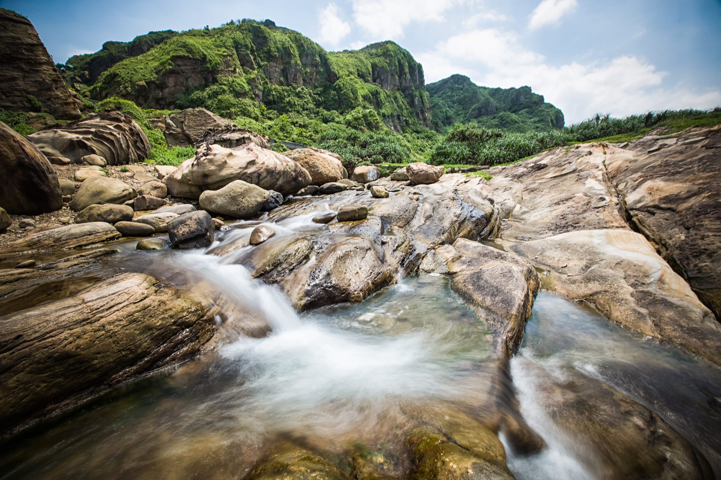
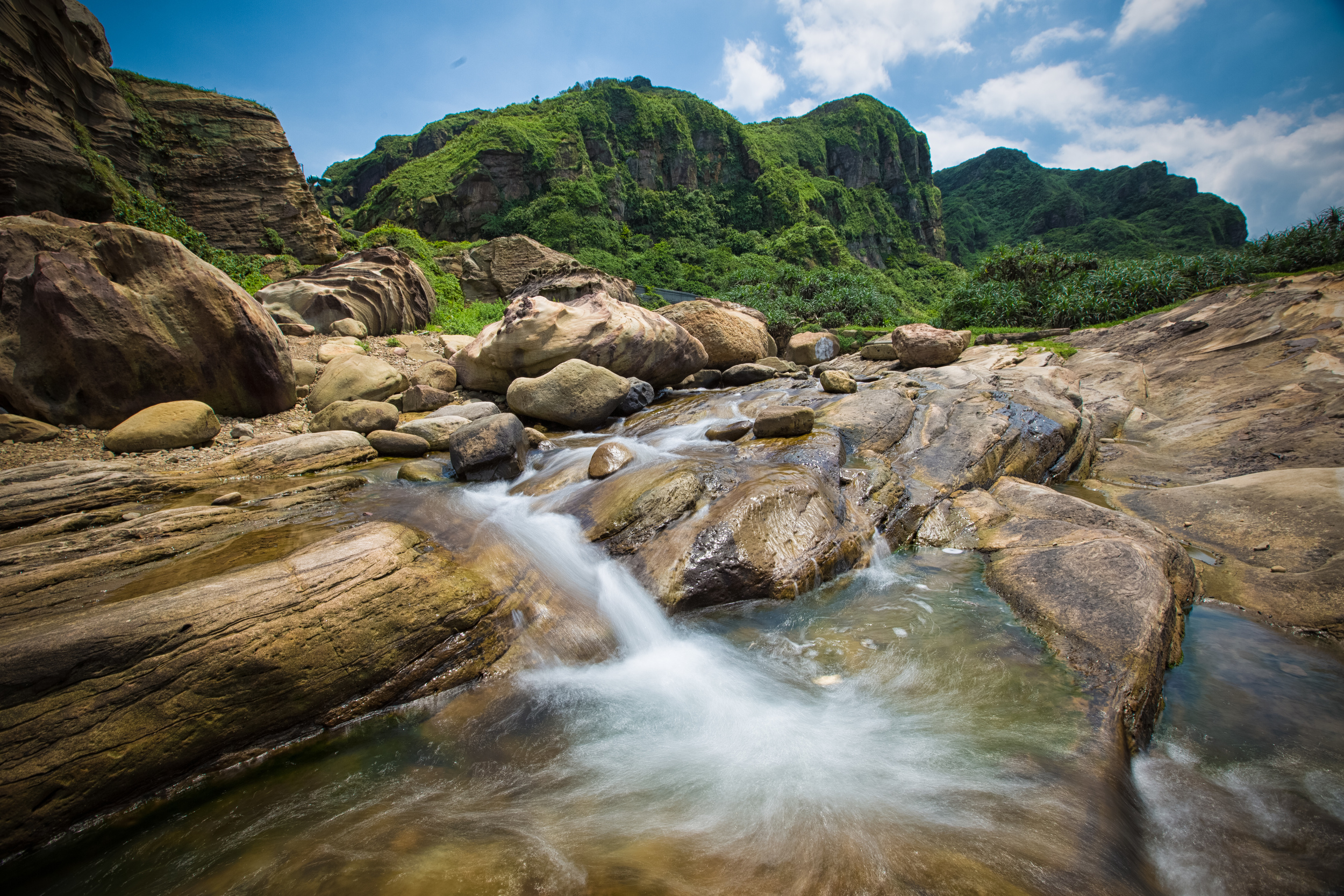
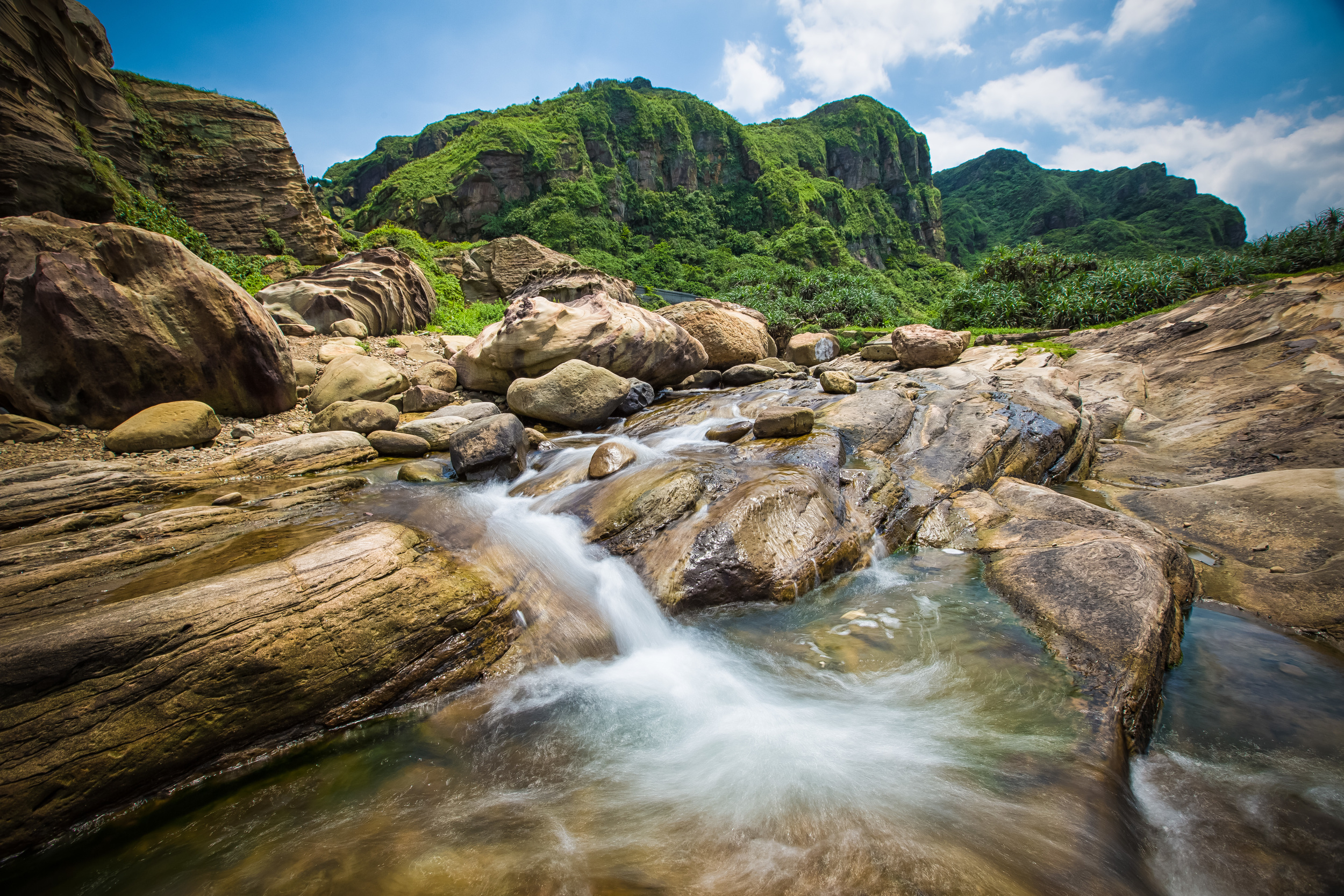
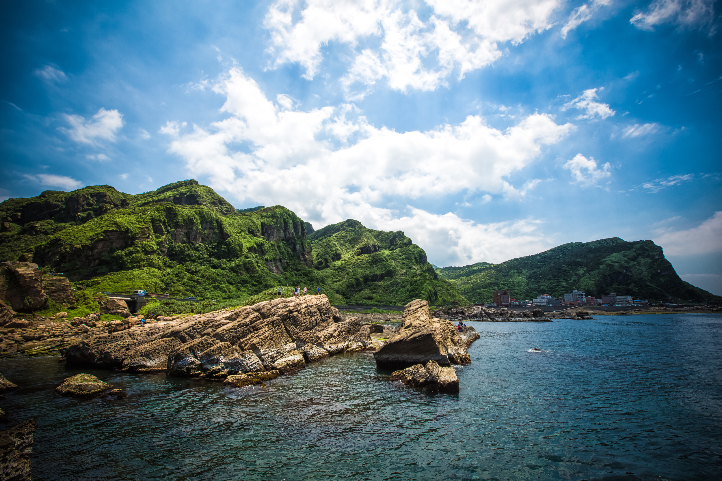
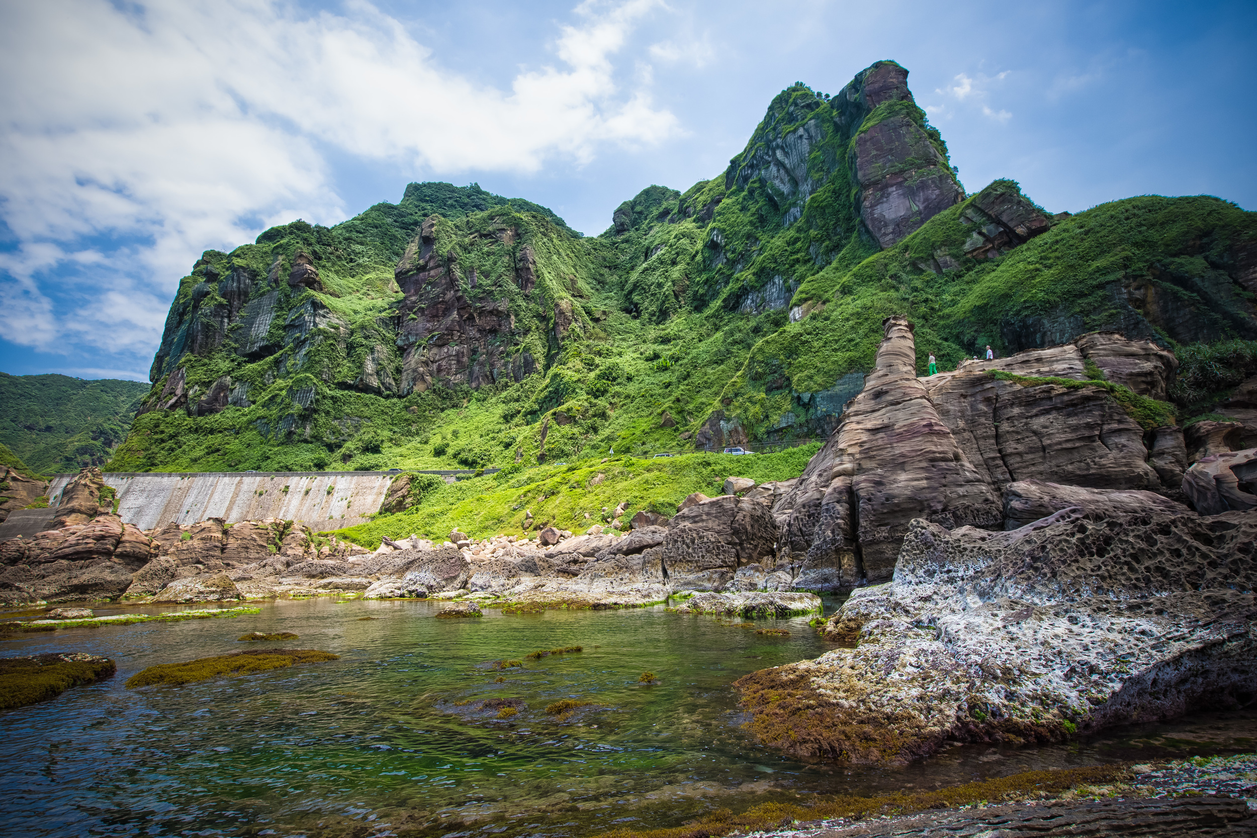
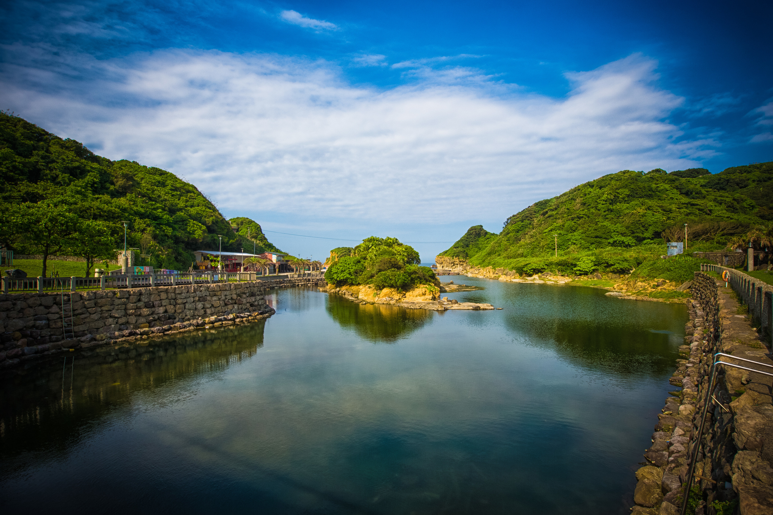
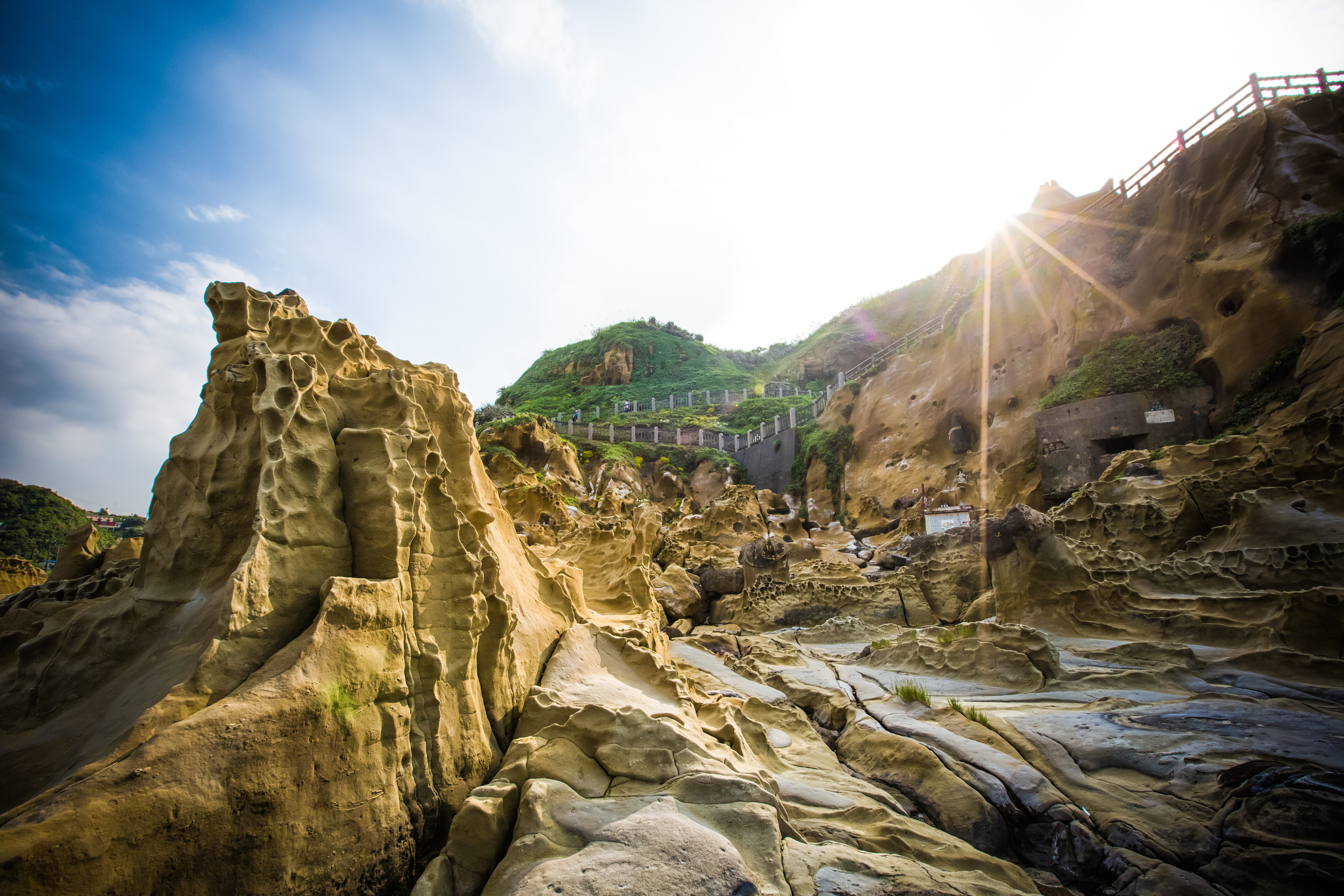
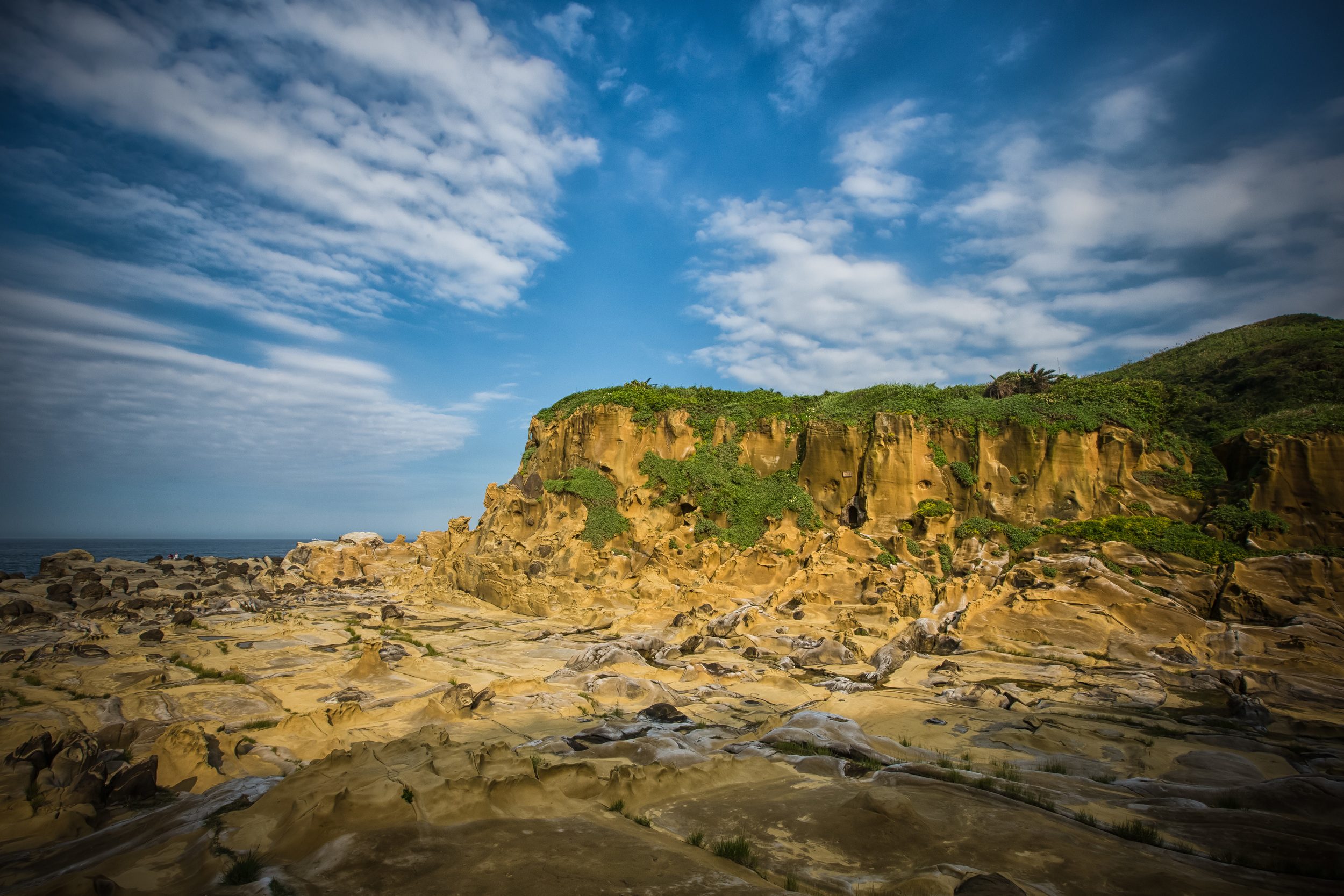
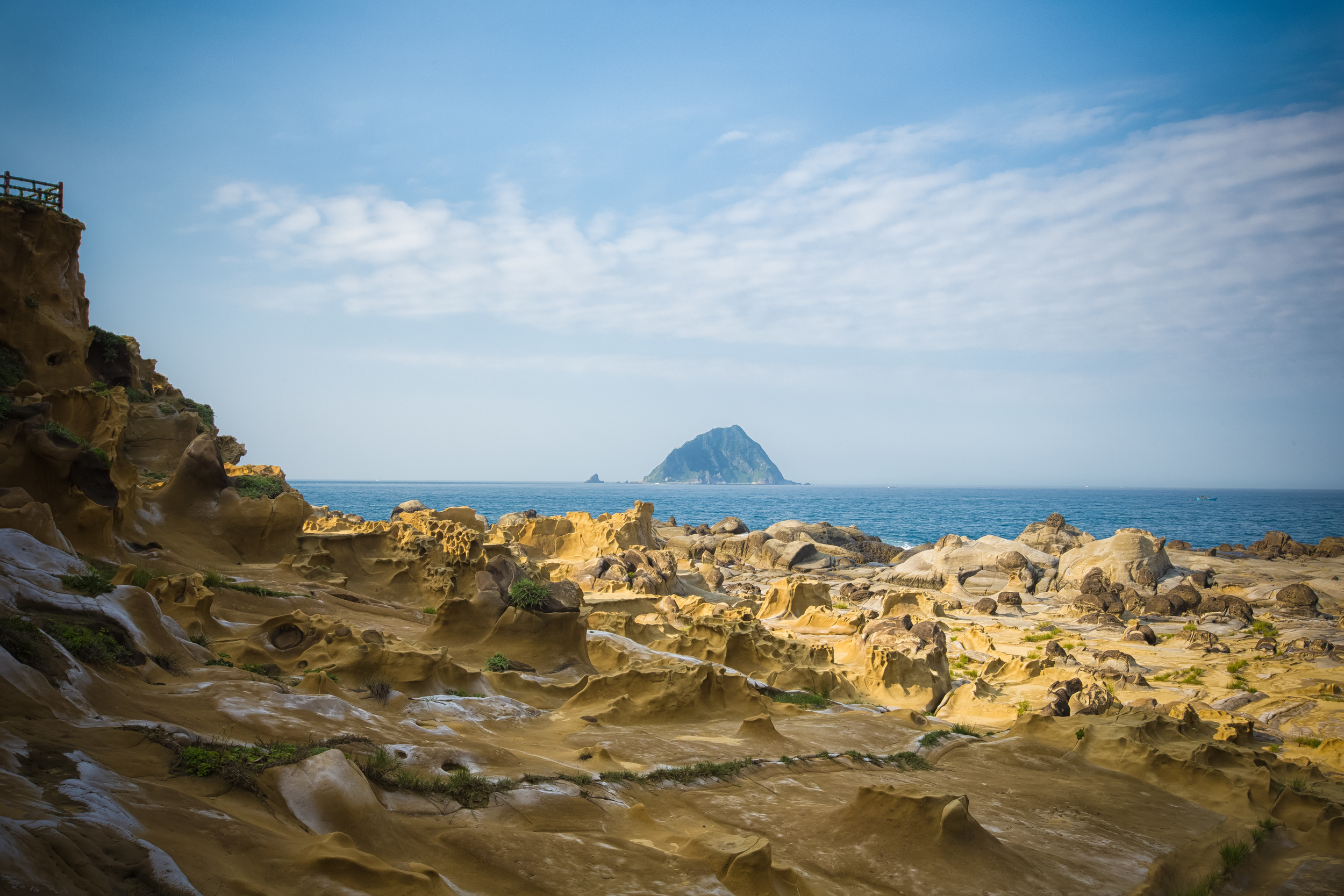
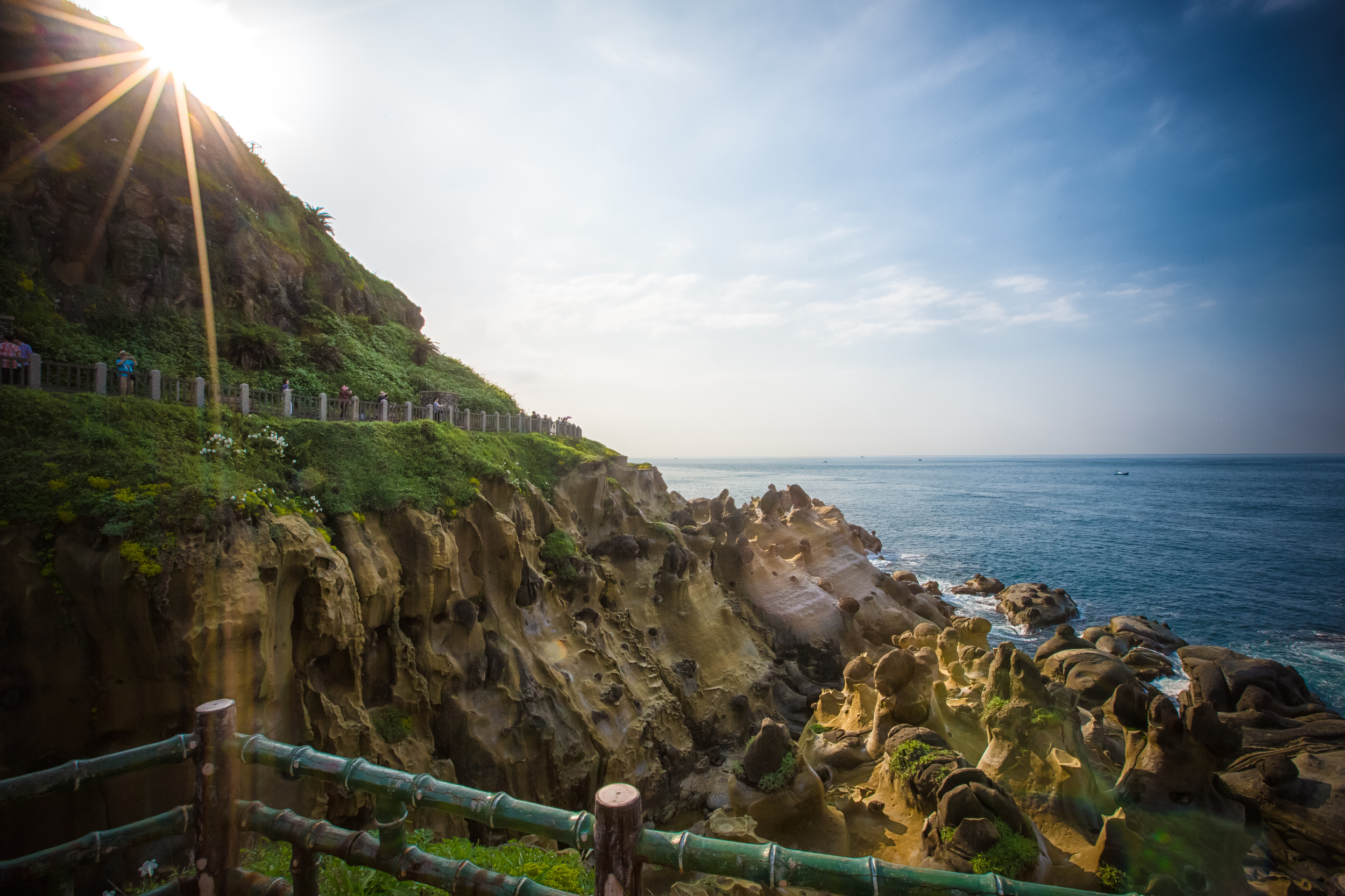
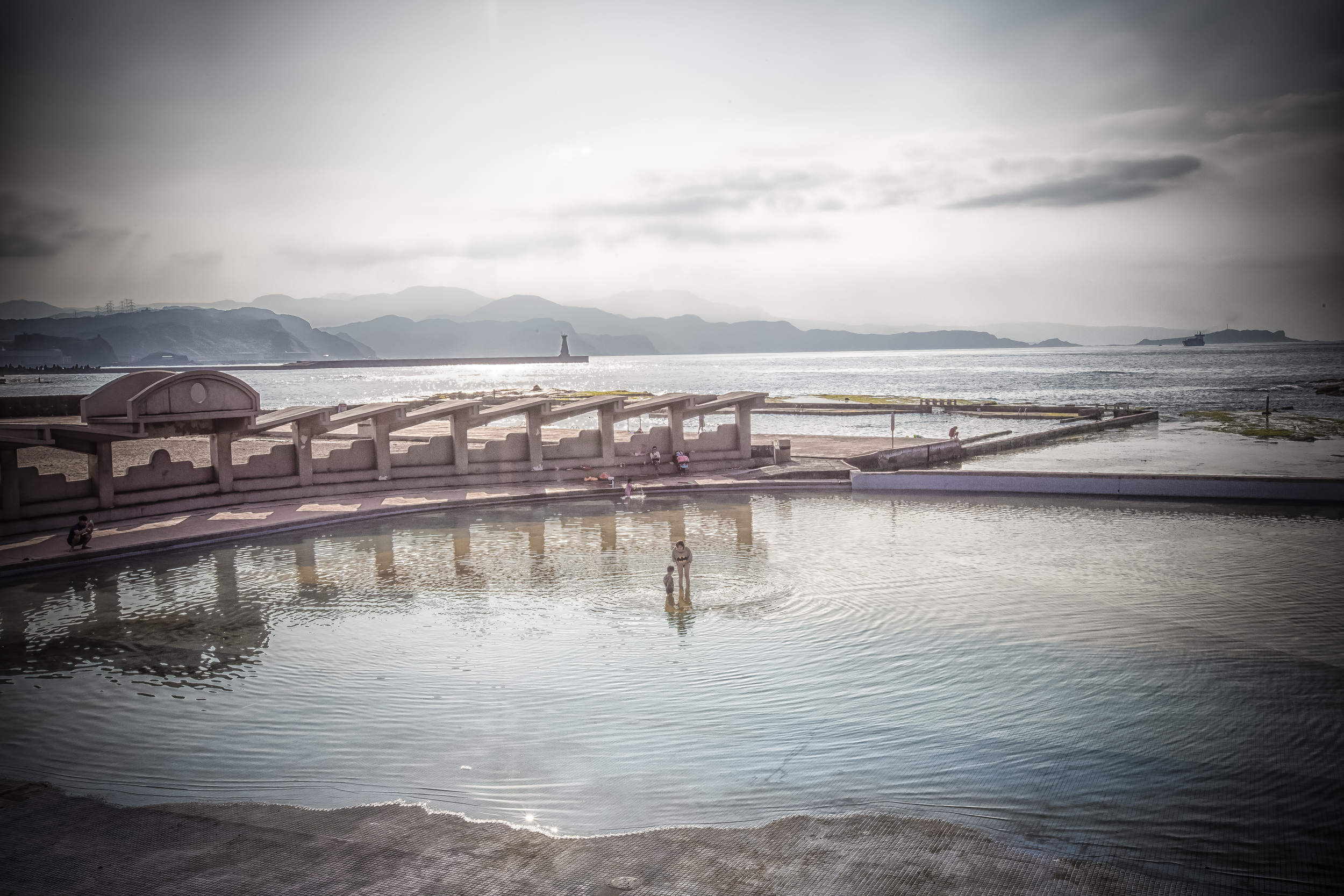
Nanya, otherwise known as "Nanya Peculiar Rocks" (南雅奇石) is considered the 'gateway' to the North East Coast (北海岸) which happens to be one of the most beautiful drives in Taiwan. The drive along the coast features some of Taiwan's most iconic beauty with the Pacific Ocean on one side and giant mountains that seem to rise out of nowhere on the other.

If you're visiting Taiwan for a short time, it's always a great idea to get out of Taipei for a day or two and see some of the beautiful scenery Taiwan has to offer - A tour around the North East Coast is one of my most highly recommended day-trips for travellers and the spectacular scenery will not disappoint.

I had friends visiting from Korea last week and on their final day in Taiwan I decided to take them for a tour of the North East Coast which included a stop at Teapot Mountain, Nanya, Longdong (龍洞), Keelung Miaokou Night Market (基隆廟口夜市) and Jiufen (九份). I planned a full day for them and it didn't disappoint as the weather was beautiful and they were really happy as the scenery on the North East Coast is simply amazing comparing it to the coast of Hawaii.

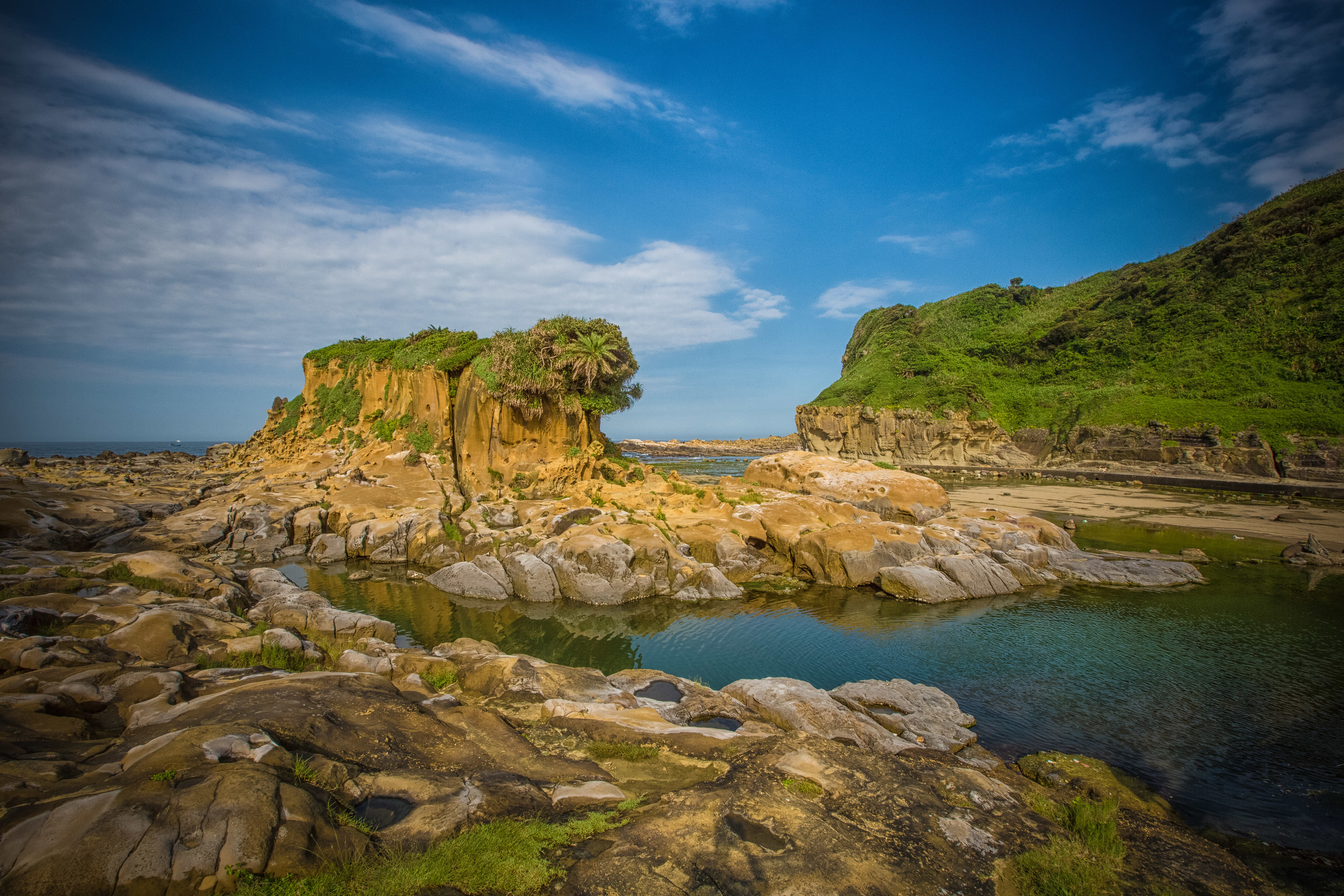
My tour could have included the popular Yehliu Geopark (野柳地質公園) but I'm not really impressed by the park and I prefer to avoid crowds of annoying bus loads of tourists from China who frequent that area. The North East Coast is full of alternate locations where you can find similar rock formations like you'd find in Yehliu. Places like Laomei Green Reef (老梅綠石槽), Peace Island (和平島) and Nanya are good enough for me because you get pretty much the same experience without the "tourist trap" experience.

The great thing about Nanya is that it is just a simple stop on the side of the road along the coast. There is a parking lot for cars and scooters across the street and it's rarely full (even on weekends) so it is easy to park and go check out the rocks. The last two times I visited Nanya there was a police car waiting at the entrance to inform people to lock up their cars and close their windows because there have been incidents of robbery in the area. My guess is that one person had stuff from their car stolen in the parking lot and the police decided to just hang out and protect people. 

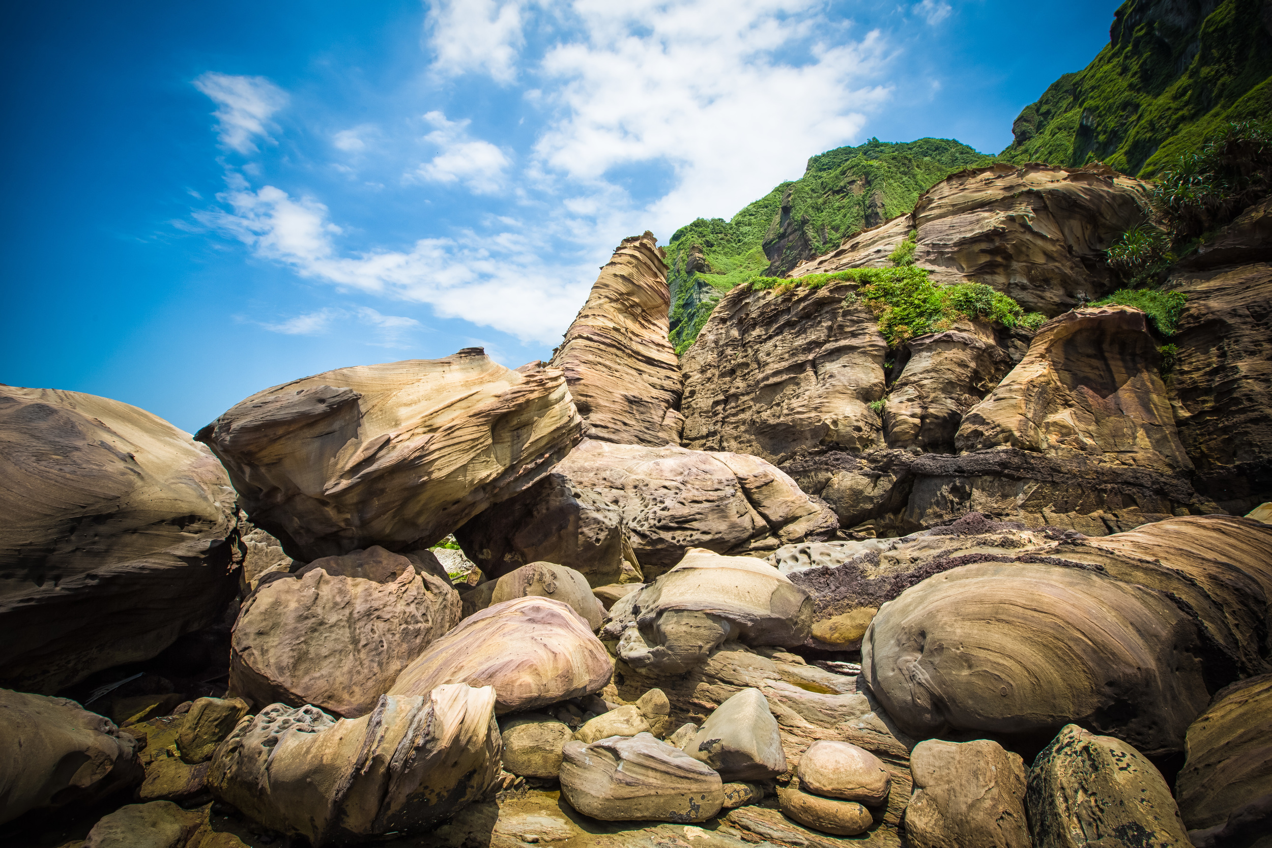
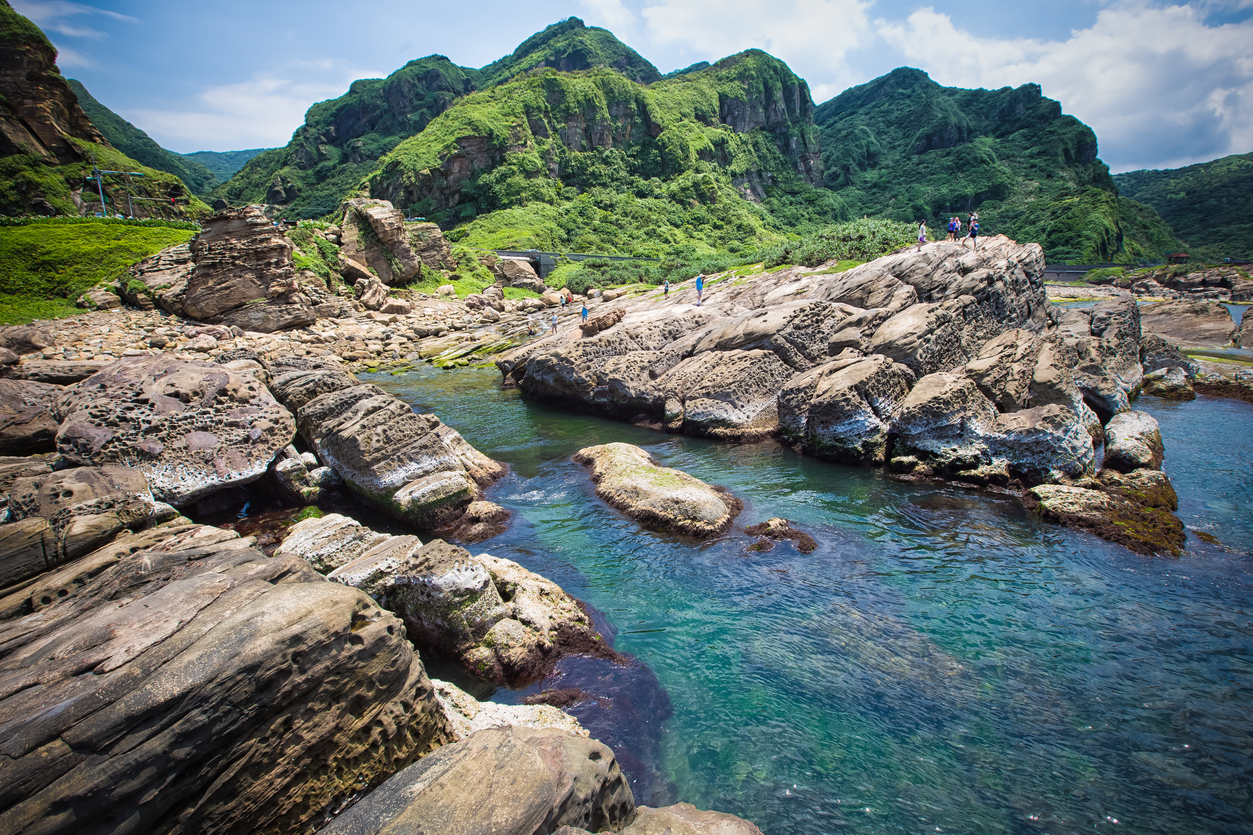
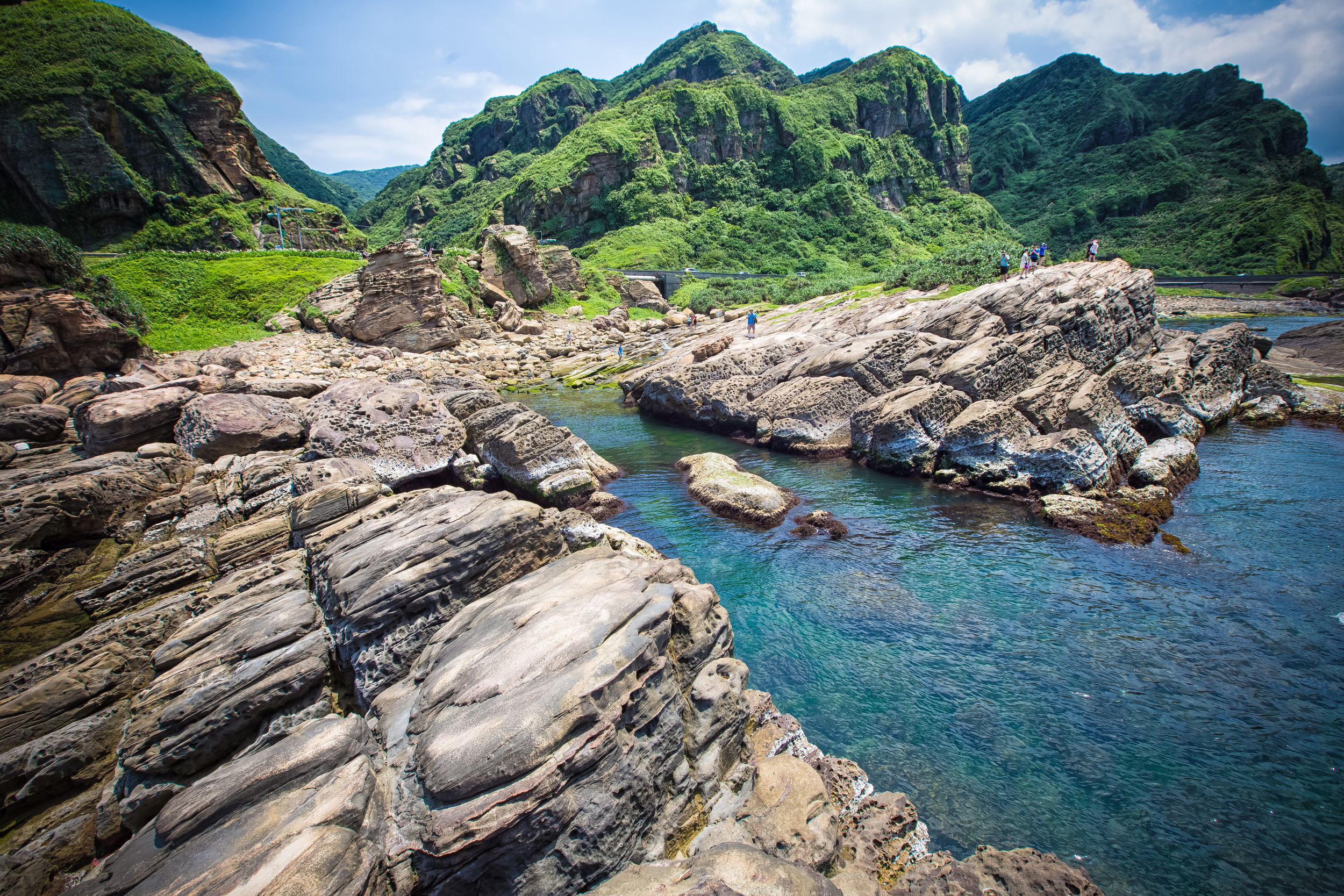
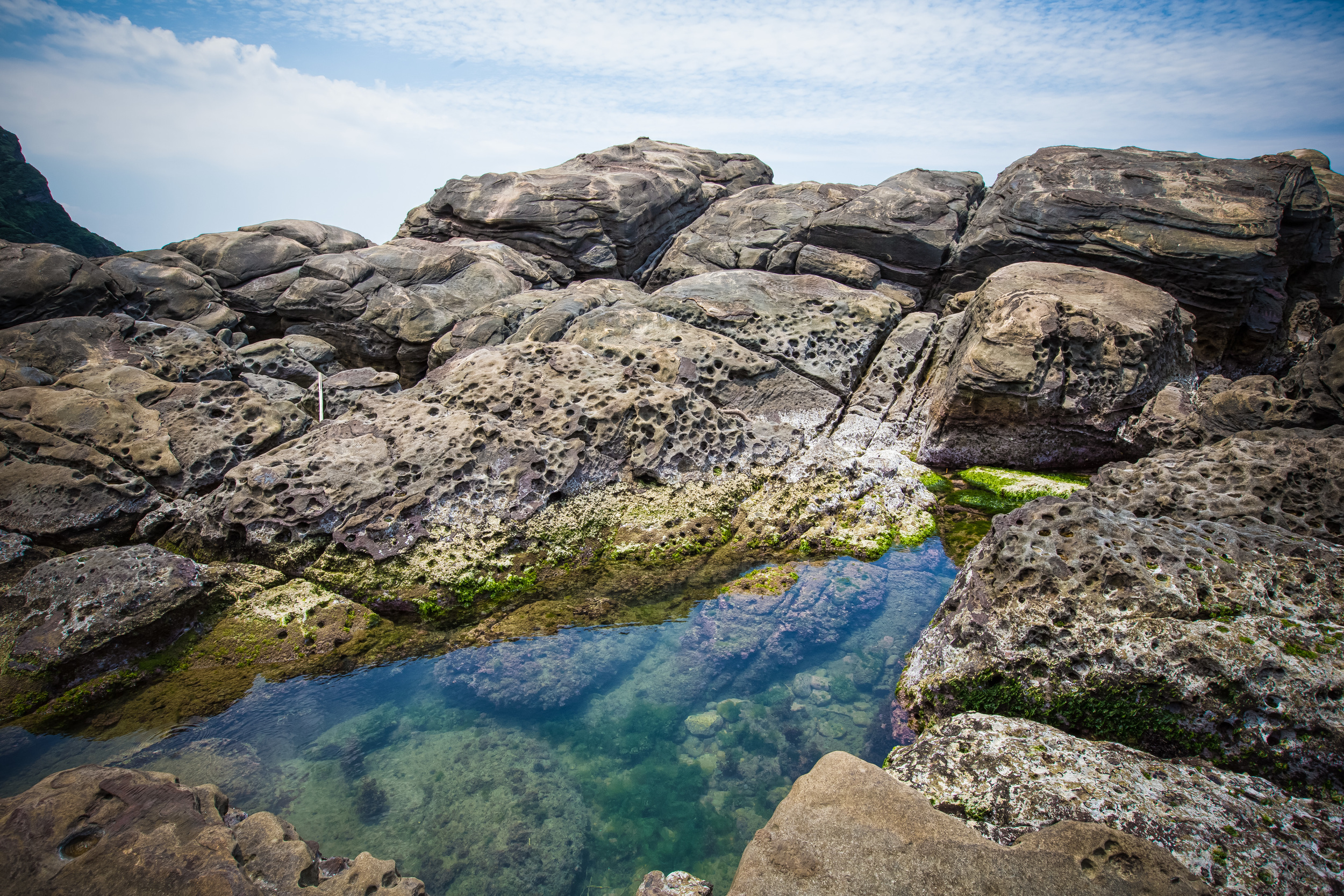
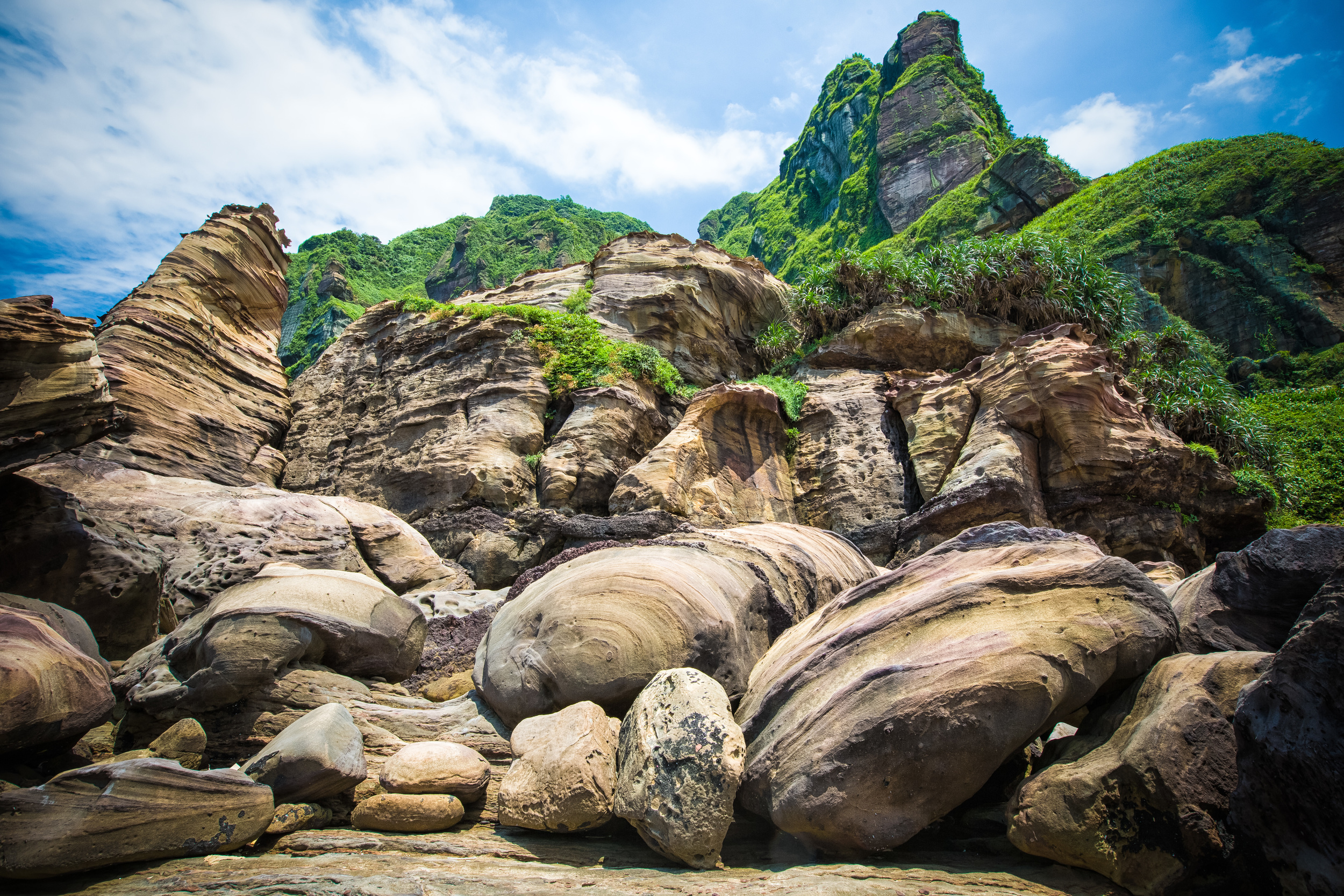
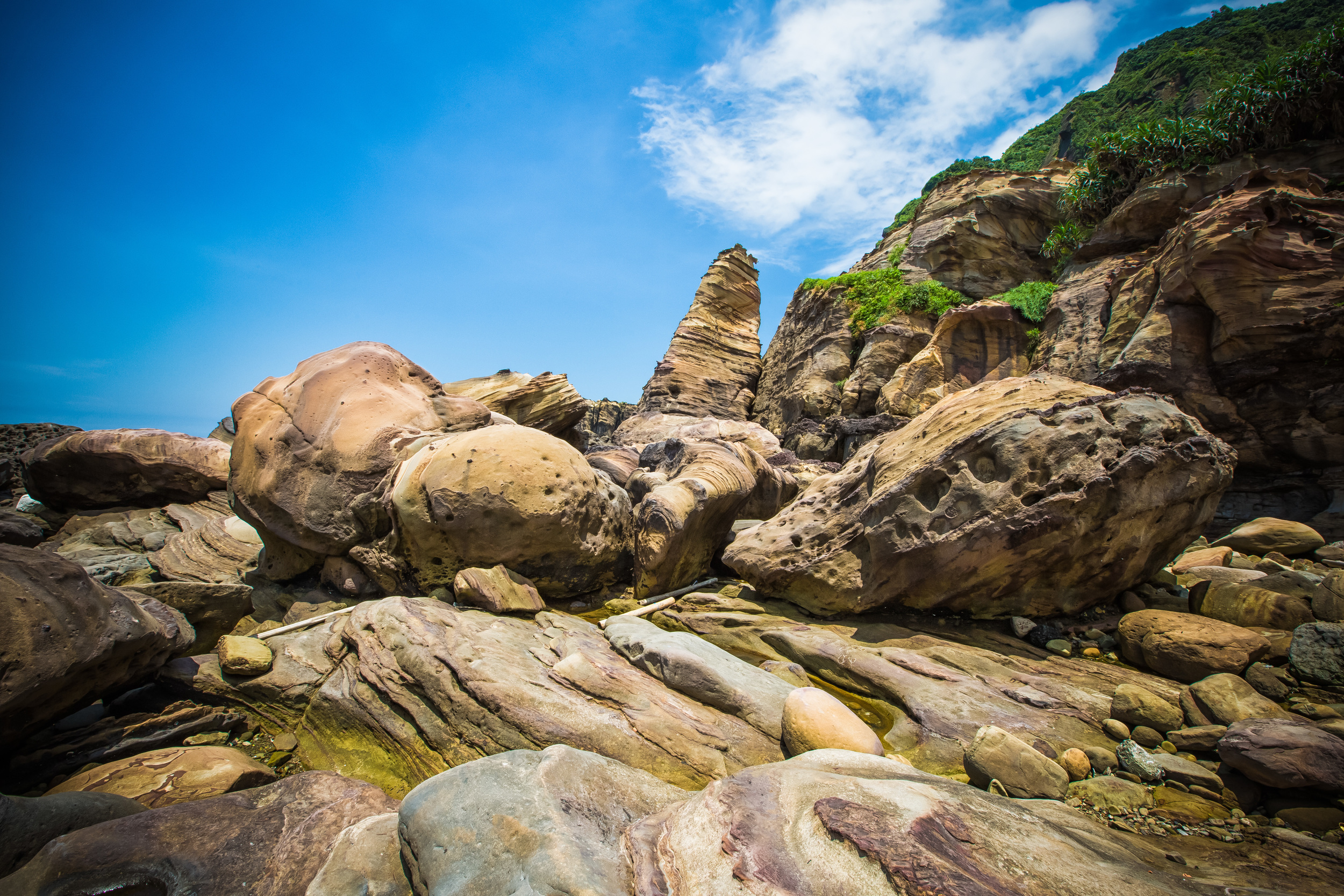
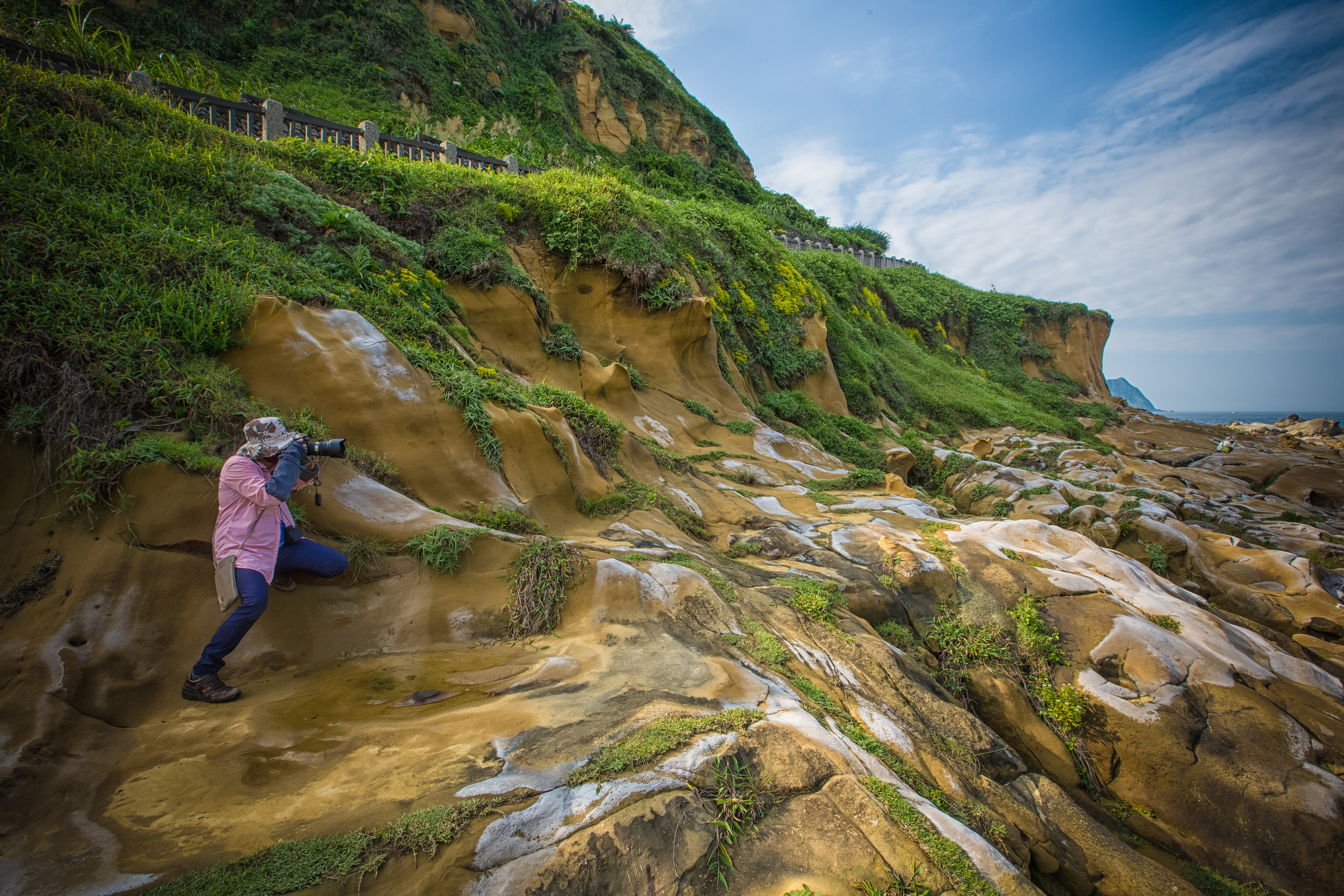
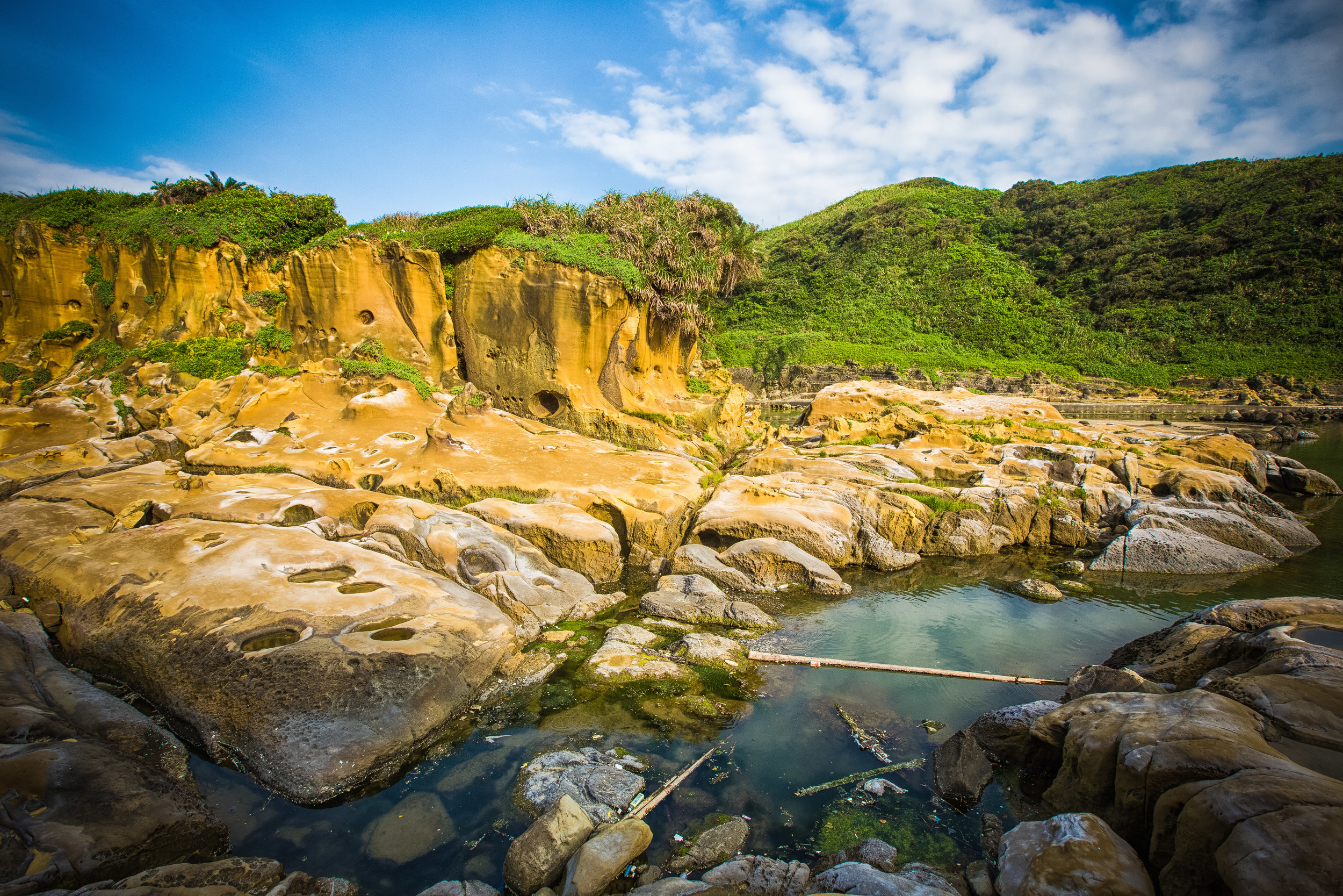
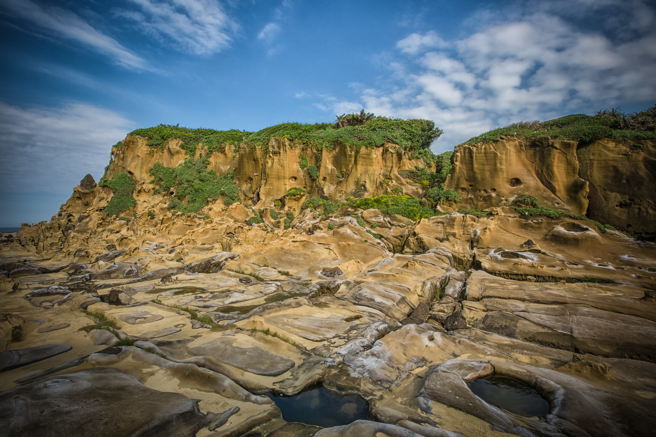
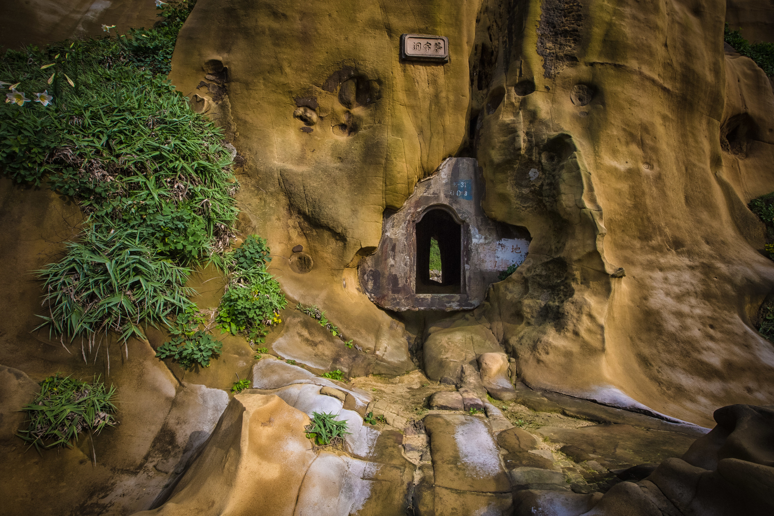
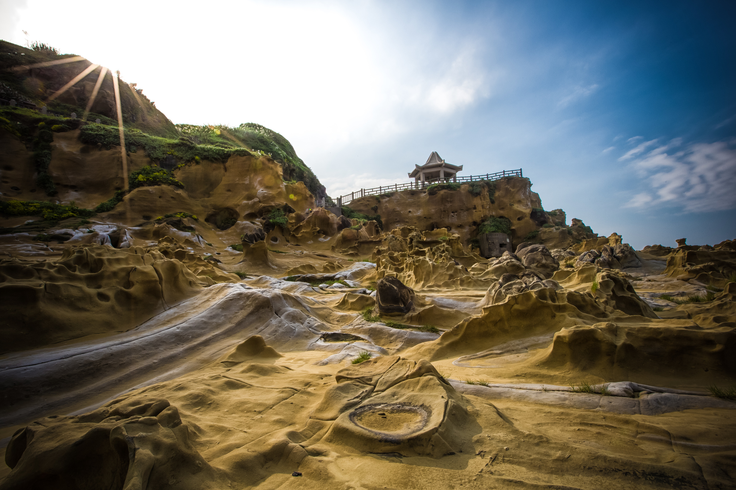
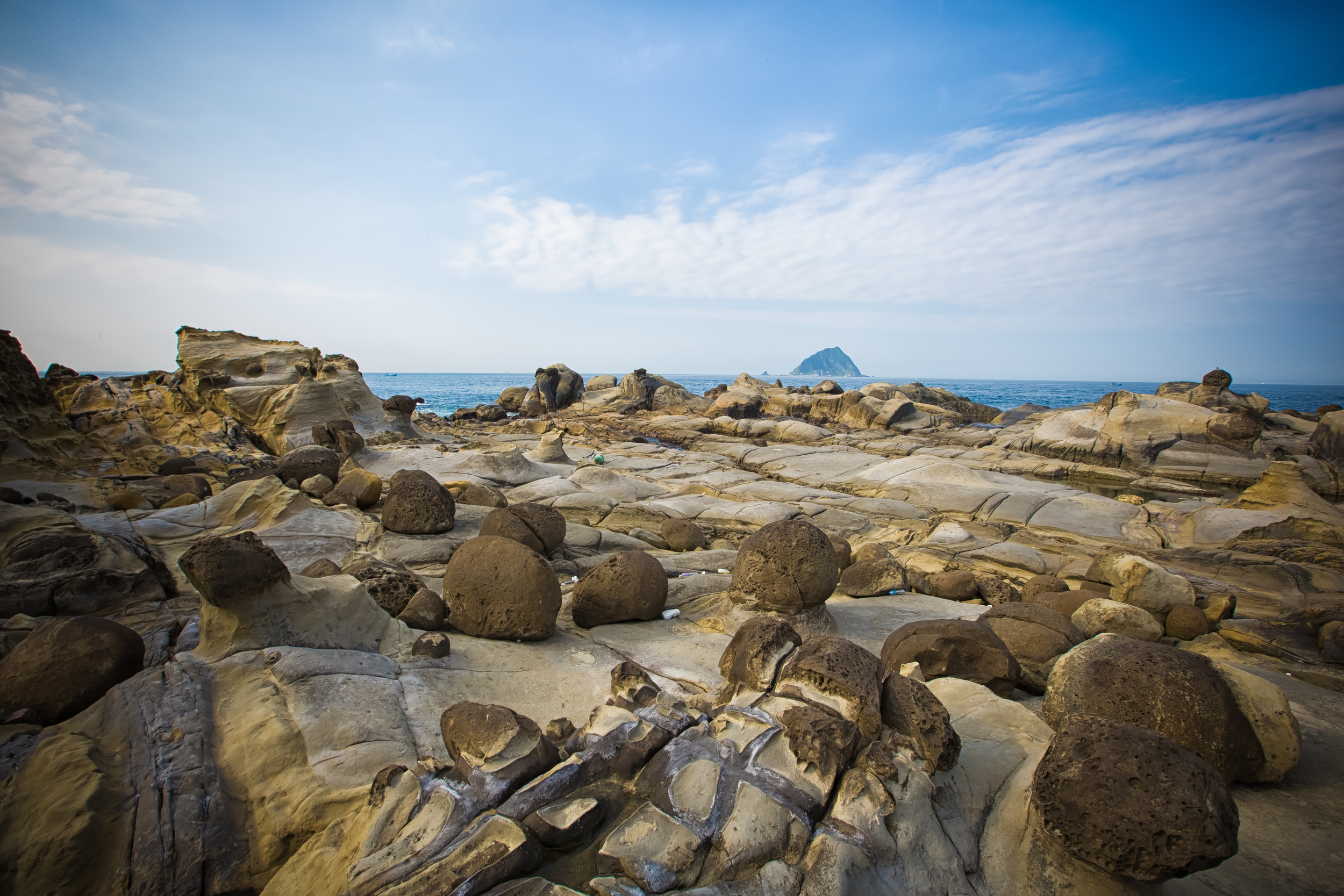
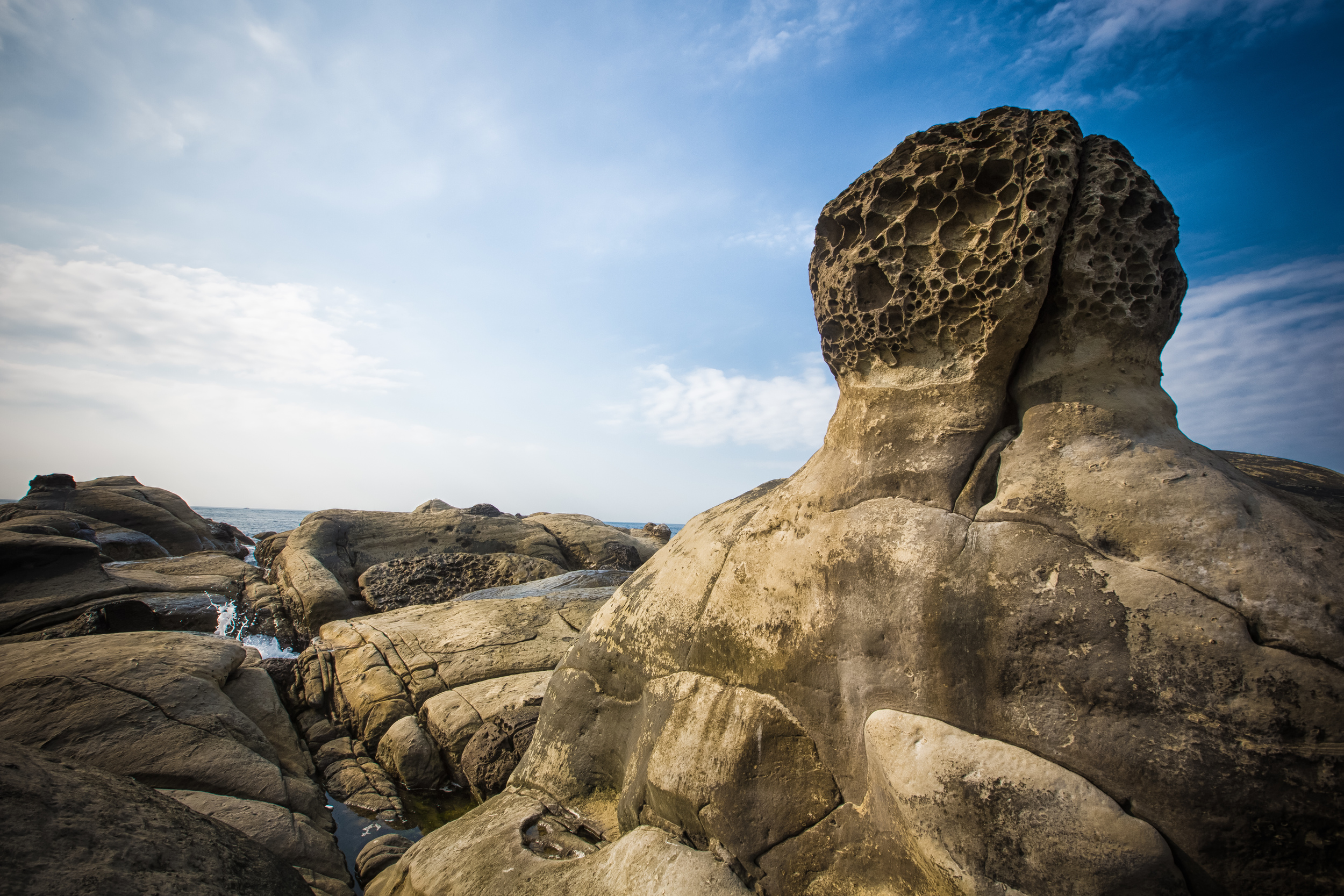
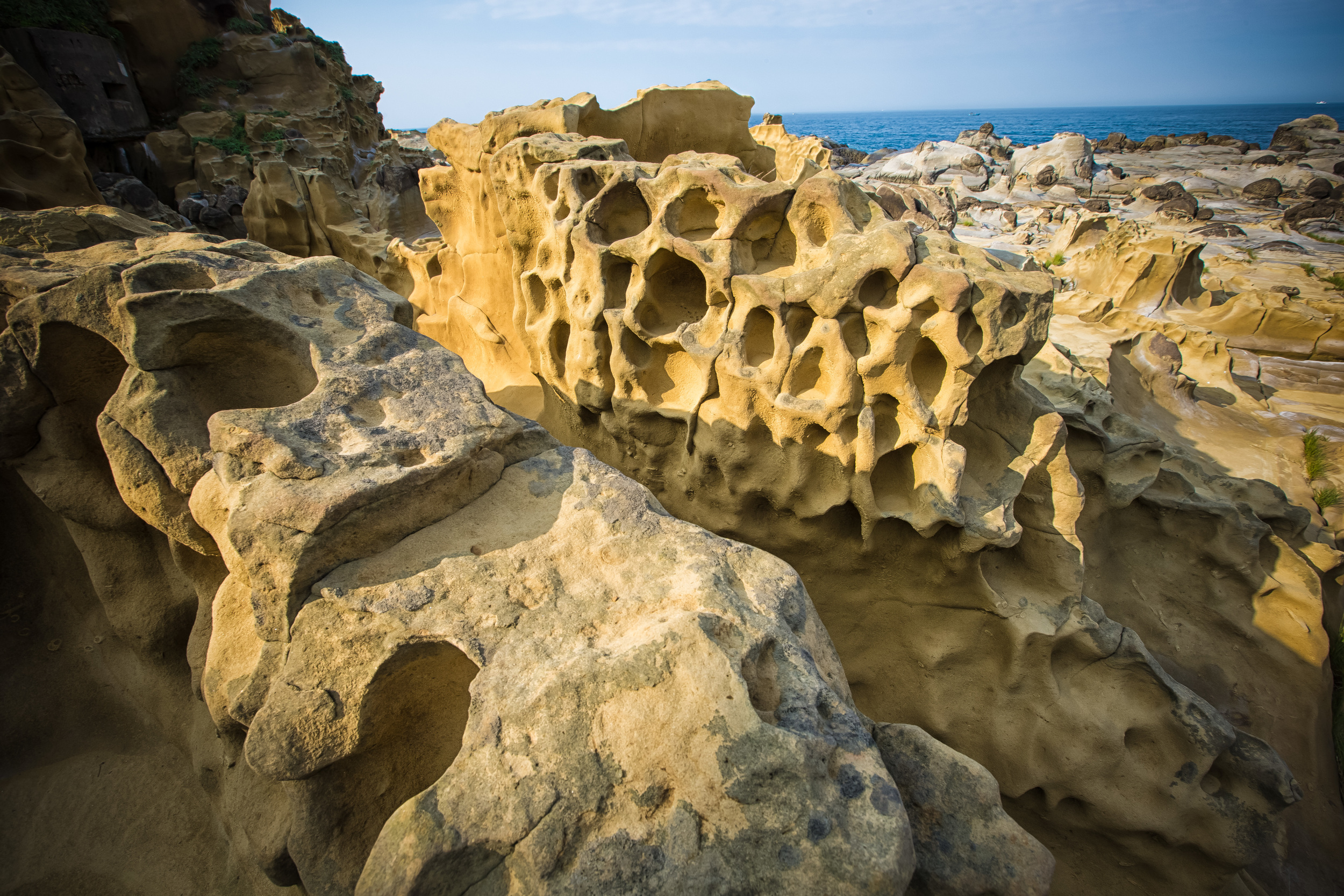
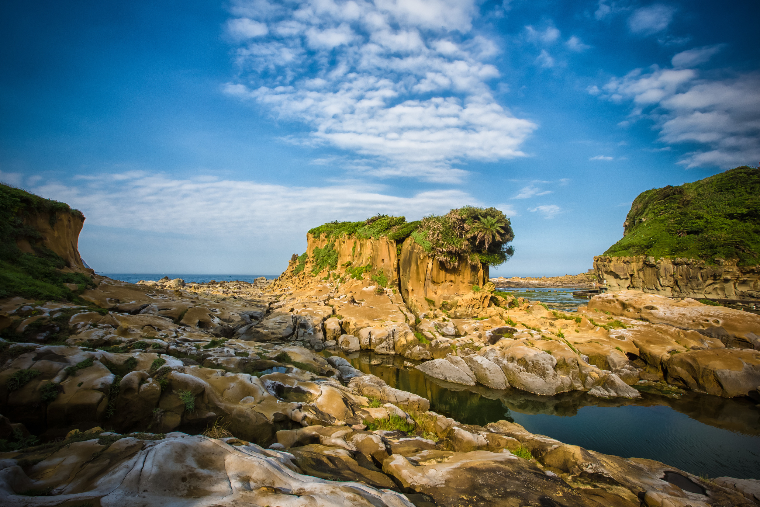
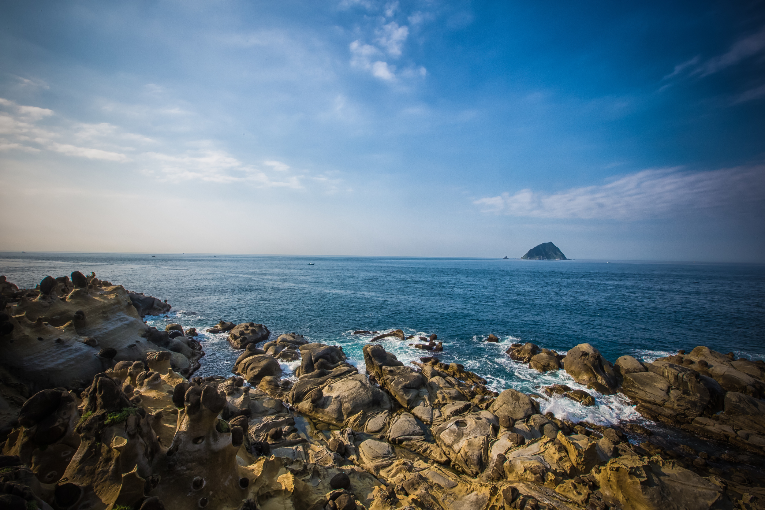
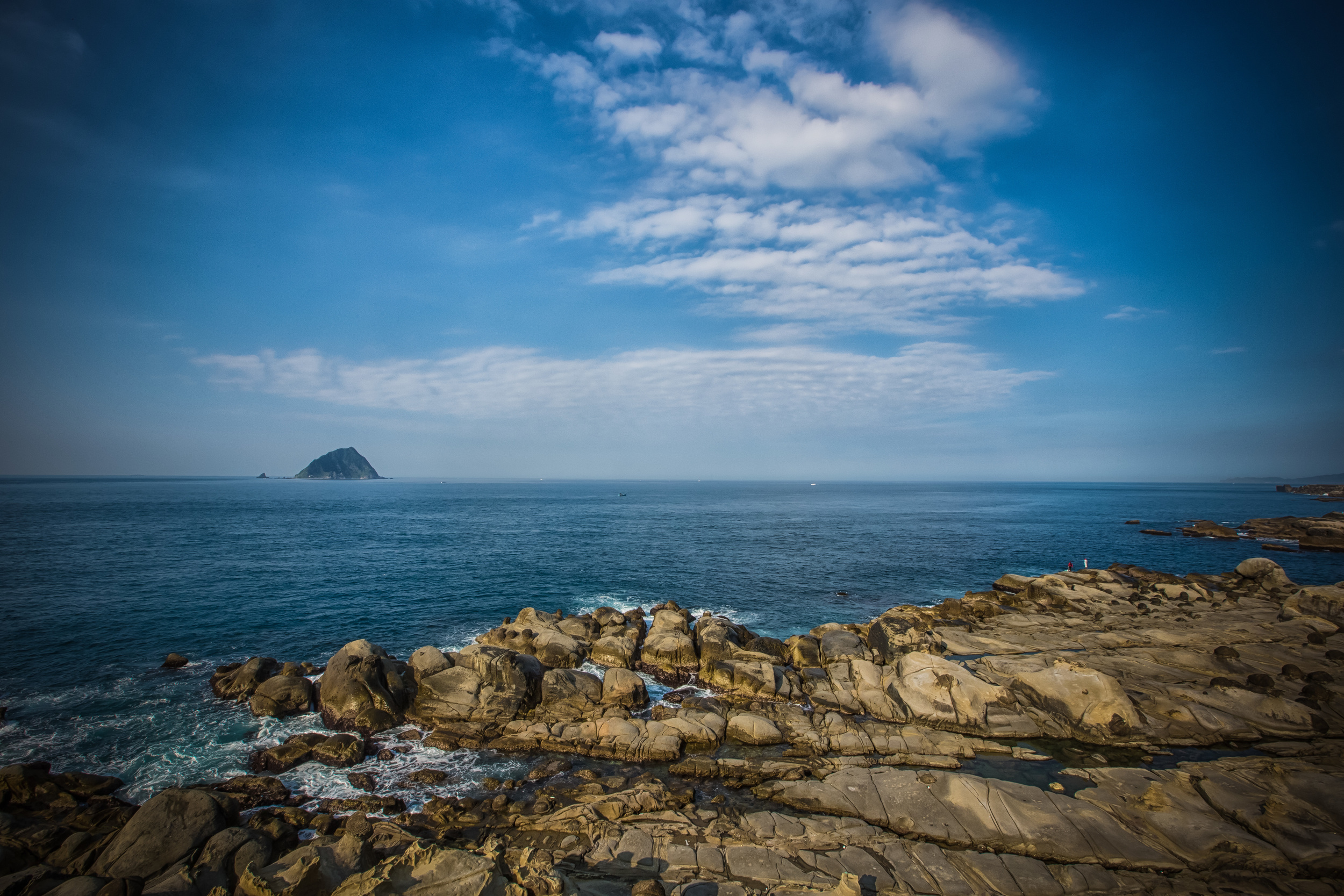
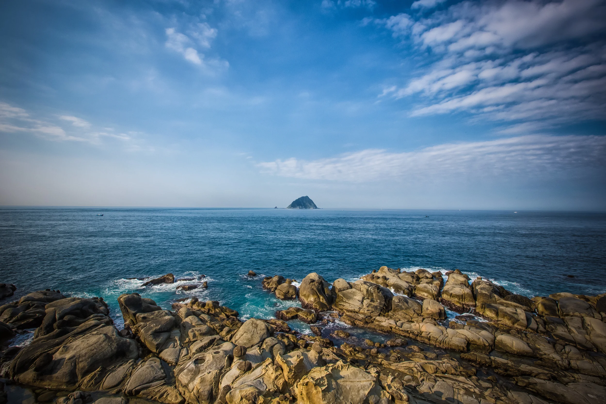
The cool thing about Nanya is that the large rocks which were formed over thousands of years of weathering and erosion stick out in the sky looking like cones. There are also other rocks which have weird looking jokes in them making them look like moon rocks. If you climb on the larger rocks and go out to the edge you are able to see the coral reef in the crystal clear water below. There are also a multitude of crabs, sea cockroaches and other marine life all over the rocks.

You don't need a lot of time to see Nanya but the scenery is beautiful and you're able to enjoy it without bus loads of annoying tourists. If you are visiting the North East Coast on a day trip or you're just driving through it is definitely worth a stop to check it out.


Qingshui Cliffs (清水斷崖)

When people in Taiwan try to tell you about the spectacular beauty of their country, there is one iconic location on the east coast of the country that has become one of the defining examples of the natural beauty of this island nation, as well as one of the symbols of the indomitable spirit of its people. 

One could argue that other nations around the world might also have beautiful coastal landscapes, but few of them can really compare with the stunning geological masterpiece that is put on display at Taiwan’s Qingshui Cliffs.

Like a dragon rising out of the sea, the cliffs have been an awe-inspiring sight for hundreds of years, impressing the likes of early European explorers and as one of the so-called “Eight Wonders of Taiwan”, they continue to impress the large groups of tourists that visit the area.  

While the natural beauty of the cliffs has been impressing us for a few hundreds of years, it shouldn’t surprise anyone that natural beauty on a scale like this has taken millions of years to form and with the continued assistance of the shifting of the Earth’s tectonic plates, the volatile landscape along Taiwan’s eastern coast is constantly evolving. 

The fact remains though that ever since the early explorers first laid their eyes on this island, it has been described as “Isla Formosa”, or the “Beautiful Island” and if you have the chance to experience these cliffs in person, you’ll see that they weren’t bluffing.

The Qingshui Cliffs (清水斷崖)

The “Qingshui Cliffs” are a twenty-one kilometer stretch of coastal landscape along eastern Taiwan’s treacherous Suhua Highway (蘇花公路) between Hualien (花蓮) and Yilan (宜蘭). The long and narrow highway winds along the coast between the two counties and even though it is considered quite dangerous, it is also said to be one of the most beautiful highways in the world with views of the ocean over the steep cliffs. 

While the view of the Pacific Ocean from the highway is absolutely stunning, we are blessed with a couple of stops along the highway that allows us to get out of our cars and walk around to enjoy the beauty of the cliffs.

When I say we’re blessed, it’s nothing short of an engineering miracle that this highway even exists. 

Consider for a moment the engineering skill it takes to construct a highway along such a long stretch of steep cliffs that drop directly into the ocean. The origin of the highway as we know it today started during the Japanese Colonial Era (1895-1945), when a single-lane gravel highway was opened to traffic in 1932, connecting Hualien with northern Taiwan by road for the first time.

If we consider the highway a dangerous one today, imagine what it must have been like when it first opened almost a century ago when there were no guard-rails and cars were constantly under the threat of falling rocks from the mountains above. 

In the decades since the Suhua highway opened, it has been repaired, reconstructed and widened on countless occasion, but thanks to the volatility of the ring of fire, monsoons and typhoons, the flow of traffic along the highway has been a hot button political issue for the Taiwanese government for decades.

As the highway has been in a constant state of “road-work” since the 1930s and has so frequently been forced to shutdown, the government recently completed a much-needed Suhua Highway Improvement Project, bypassing the sections of the highway that have been the most accident-prone and vulnerable to landslides and shutdowns. 

With the use of tunnels that make up over sixty percent of the new highway, the travel time between Yilan and Hualien has been greatly reduced and should help to ensure that traffic between Yilan and Hualien will never have to put up with same issues of the past. 

Links: Suhua Highway Road Trip 2018 (Spectral Codex) |

Final legs of new Suhua Highway open (Taipei times)

As things usually go in Taiwan, for a myriad of reasons, the new and improved highway was originally slated to open to the public in 2015, but was significantly delayed, opening five years later than planned.

Now that the new sections of the highway are finally open, traffic along the original stretch has been greatly reduced and has become a road used most often by tourists wanting to experience the cliffs and the beautiful scenery that you experience along the way. 

Back to the cliffs, with the name “Qingshui” (清水), which translates as “clear water”, one might assume that what is being described is the beautiful azure ocean below - The name however, (albeit likely related to the ocean) is derived from Qingshui Mountain (清水山), which rises directly out of that beautiful ocean to a height of 2,408 meters, almost three times the average height of the cliffs. 

One of the reasons why the Qingshui Cliffs are so geologically significant is because millions of years ago, when Taiwan was still completely underwater, some of the first pieces of land to emerge are thought to have been in this location. Even though Qingshui Mountain isn’t considered to be in the Top 100 highest peaks in the country, geologists believe that the story of this island started in this area when the Philippine and Eurasian plates violently forced the island out of the ocean. 

Another reason why the cliffs are so significant is because they are composed primarily of gneiss, green schist and metamorphic limestone, which is more commonly known as marble. In fact, the Qingshui Cliffs, which are part of the much larger Taroko National Park are part of a massive marble deposit of which Taiwan has one of the worlds highest concentrations.

While the shifting of the plates has played a significant role in the formation of the cliffs, natural forces such as earthquakes, typhoons and natural erosion have shaped the rock walls creating various coves and the overlapping effect that you see when you look at the cliffs from one of the various viewing platforms.

Speaking of those platforms, the government has set up a couple of areas where you can get some really amazing views of the cliffs (each of which I’ll introduce below).

If you’re wondering where you’ll have to go to get the best view of the cliffs, there are conflicting arguments.

Some say that the best way to experience the cliffs is from the beach, others say its from highway-level on one of the platforms, while others argue that they’re best enjoyed from the comfort of the ocean. 

Truthfully, no matter where you go to check them out, they are going to be breathtakingly beautiful.

That being said, we are currently blessed with a number of options. 

This blog post is part of a much-needed update to one that I wrote several years ago when views of the cliffs were quite limited to a few locations. Now that the situation along the Suhua highway has been stabilized and the trails are opened, travelers can easily walk, drive a car or a scooter to one of the designated areas to check out the cliffs. Likewise, if you prefer a beach-level view you are able to get to the beach in a couple of areas where you can either walk or ride an ATV up and down the beach.

One of the most popular activities in recent years however are the kayaking tours that allow tourists to experience the cliffs from the ocean, making for an absolutely unforgettable experience.

As a former kayak instructor back home in Canada, I hope to eventually take part in one of these kayaking tours in the near future, so you can expect that I’ll update this post with some new photos and new information when that happens.

Likewise, there is an abandoned section of the highway where you can get an even better view of the cliffs. Unfortunately I haven’t been able to visit yet. Until then check out Follow Xiaofei’s post about the road: Qingshui Cliffs (Follow Xiaofei)

How you experience the cliffs is completely up to you, but if you are visiting Taiwan and you aren’t visiting Qingshui or Taroko, you are completely missing out. You won’t experience the real beauty of Taiwan in Taipei or at the National Palace Museum, so I highly recommend you book a train ticket to Hualien where its impossible that you don’t fall in love with this country. 

1. Chongde Beach (崇德礫灘) 

One of the most frequent questions that I’ve received over the years regarding the Qingshui Cliffs is asking how to get onto the beach near for a sea-level view. The answer to that question has always been to walk along Chongde Beach, but now there are a couple different options for this as well as a number of activities that you can take part in along the beach. 

In the previous version of this post, I mentioned that if you didn’t have you own method of transportation, the best way to get to the beach was to simply take the train to Chongde Station (崇德車站) and walk to the beach.

Now though, with the help of a car or scooter, you can effortlessly get yourself much further up the beach and save a considerable amount of walking thanks to a road just off of the highway that has an ample amount of parking spaces and allows you park pretty much next to the beach.

In recent years the beach has become a popular destination for people who go on four-wheeler tours up and down the sandy beach as well as for kayaking tours.

Both of which provide some amazing perspectives of the cliffs that weren’t available in years past. 

Links: Kayaking the Qingshui Cliffs (Hualien Adventures)

ATV Adventure (Island Life Taiwan)

If you are restricted to walking, simply take a local train (區間車) from Hualien to Chongde Station and then from there follow the signs that lead you to the beach. The walk shouldn’t take you any longer than ten minutes from the station, but you’ll want to keep track of the train schedule to ensure that you don’t end up staying too late and miss out on the last train. 

If you’re driving a car or scooter, your best option is to pass by the station and make your way to Banxia Beach (坂下海灣), which is only about a kilometer or so north of the station.

To reach the beach, you’ll make your way north on the Su-Hua highway (蘇花公路) until you see a sign on the side of the road that reads De-fung Seafood Market (得豐定置漁場) where you’ll turn off and follow the road down the mountain, under an overpass and then on to the beach.

It’s important to remember that the highway is often full of traffic and if you miss the turn for the beach, you’re not going to be able to turn around for quite some time, so make sure you pay attention or have your GPS or Google Maps open to help out. 

When you’re on the beach, you’ll see signs everywhere reminding you that swimming is prohibited and if you’ve read any of what I wrote above about the cliffs, you should know why. The drop off in this area is so steep that if you even attempt to go swimming, its likely that you’ll get sucked out to sea and who knows where they’ll eventually find you.

Please remember that they’re not joking around when they say the water is dangerous. Don’t try your luck! 

2. Chongde Trail (崇德步道)

The Chongde Trail, which is part of Taroko National Park’s network of trails probably isn’t what you’re thinking when you’re thinking about a hiking trail. The “trail” is more or less a stop on the side of the road that provides a couple of beautiful platforms to get a view of the cliffs. 

That being said, there actually is a “trail” portion to this stop along the side of the highway.

Next to the beautifully constructed forest restroom area there is a 250 meter-long path that brings you to a platform just above the beach where you can take some photos.

In the past, the area where the platform is now located was a set of stairs that allowed tourists to get onto the beach. Unfortunately due to some accidents that have happened in the past, local authorities have closed the path to the stairs and the trail stops at the platform.

Hikers on the trail

On the official Taroko National Park link provided below, it states that hiking the Chongde Trail should take about half an hour, which seems a bit off to me, unless of course they’re including twenty-five minutes of taking photos on the platform?

The hike shouldn’t take you any longer than ten minutes, so make sure to check it out for another perspective of the cliffs.

The “Chongde Trail” has recently been redeveloped and offers quite a few parking spaces for travelers to stop off to check out the cliffs. You can also relieve yourself in the pristine restrooms provided. 

Link: Chongde Trail (Taroko National Park) 中文

3. Huide Trail (匯德景觀步道)

On the other side of the 1500 meter-long Huide Tunnel (匯德隧道), you’ll find the much larger and much more popular tourist spot known as the Huide Trail (匯德景觀步道).

Once again, the newly developed park comes equipped with an ample amount of parking space for tourists, including quite a few spaces for tour buses, allowing everyone to stop to check out the cliffs. 

From the parking lot, tourists are able to check out a couple of different viewing platforms with a trail that allows you to get a perspective of the cliffs looking south towards Hualien.

The platform here though is elevated quite high, so you won’t have to worry too much about people getting in your way or having tall grass obscuring your view.

If you are planning to get photos of the cliffs at sunrise or sunset, this is probably the spot where you’ll want to park yourself as it is where you’ll have the best chance to set up your camera to prepare for the occasion.

That being said, this area tends to be quite busy on weekends and holidays, so if you want to take photos, you may have to wait in line for a bit. 

The beautiful view looking back toward the highway and the Central Mountain Range

Link: Huide Trail (Taroko National Park) 中文

Getting There

https://www.goteamjosh.com/blog/qingshui

Getting to the Qingshui Cliffs isn’t all that difficult, they are located near Taroko Gorge, one of Taiwan’s most popular tourist destinations, so there are a number of options available for tourists. 

Unfortunately for foreign tourists, the various scooter rental shops in Hualien have become quite strict with their rentals, so if you don’t have a local drivers license or an International Drivers License, you might not have much luck finding a scooter to rent during your stay. 

It was explained to me by my rental place that foreigners often “have no idea how to ride a scooter” and when they’re rented out, they come back half destroyed or are involved in an accident, which has had the detrimental effect of causing them to not want to take the risk.

Links: Scooter Rental in Taiwan (Foreigners in Taiwan) 

Exploring Hualien with a Scooter (The Spice to My Travel)

That being said, one of the best ways to get around Hualien, especially with regard to Taroko, is to ride a scooter, so if you can’t get one, you’re going to have to rely on public transportation. 

My personal advice with this one is to try to reserve a scooter in advance.

Some of the scooter rental places in Hualien have excellent online presences and if you shop around, you may be able to find one willing to rent one to you without a local license.

They’ll probably require your International Drivers License, a copy of your passport and a deposit though.

You may want to check with “WOW Scooter Rental”, the owner apparently speaks “great English” and is willing to rent to foreigners.

I can’t vouch for any of that though as I booked through another company nearby.

The problem with public transportation however, whether it’s a bus or train, is that the closest you can get to the cliffs is by getting off at Chongde Station, which then requires a bit of a hike to get to any of the locations introduced above.

If you’re coming from Taipei, you’ll have to take a train to Xincheng (新城車站) and then from there transfer to a local train traveling north to Chongde Station (崇德車站). If you’re traveling from Hualien, simply hop on a north-bound local train (區間車) and get off at Chongde Station. 

Likewise, if you’re taking a bus, you can take Hualien Bus #1132 from Hualien Train Station to Chongde Station, although I’d recommend just taking the train as its faster and cheaper.  

From Chongde Station you can either make your way to the beach or start the long walk up the infamous Suhua Highway. It’s important to remember though that walking on the highway is dangerous and you constantly have to pay attention to the traffic, making it a stressful hike. 

If you’re lucky, you might encounter a friendly taxi driver at Chongde Station who would be willing to take you on a Qingshui Cliffs tour for a set time and price. If thats the case, I highly recommend taking them up on the offer so that you can better enjoy the cliffs and more importantly save time. 

If you have your own means of transportation, the trip to Qingshui is rather straight-forward as it is about a 30km drive from downtown Hualien along the #9 highway. The road from Hualien is wide and there is ample space for cars and scooters to travel safely.

From downtown Hualien, it should only take about half an hour to get there and then from there you can head on to Taroko National Park or your next destination. 

If you’re asking for my travel tips (I know you are), I suggest driving from Hualien and first checking out Baixia Beach, then heading to Chongde Trail and then ending your cliffs tour at the Huide Trail, all of which simply require you to pull off on the same side of the road. Then, once you’re finished you can leave from Huide Trail and make your way back toward Hualien or to the Taroko Gorge.

As I’ve already mentioned above, the #9 Highway, otherwise known as the Suhua Highway is narrow and quite dangerous. Traffic there can be unforgiving to those wanting to randomly make a turn so if you’re coming from the north, it might be easier to just travel to Chongde and then turn around and head north instead of attempting a bunch of left turns along the highway.

However you choose to travel, it’s important to be careful - The highway can be quite treacherous, especially on holidays, so if you’re walking, on a scooter or in a car, remember to pay attention at all times so that you can live to tell about the beauty of the cliffs. 

Family photos on one of the platforms.

As one of the so-called “Eight Wonders of Taiwan”, the Qingshui Cliffs are high on the list of both domestic and foreign travelers itineraries alike. For Taiwanese travelers, a visit to the cliffs is one of those things that you have to do at least once in your life.

For the foreign traveller, a visit to the cliffs is something that will undoubtedly cause you to instantly fall in love with this beautiful country.

There is so much beauty to be experienced here in Taiwan - From the mountains to the ocean, there is something for everyone to love and that’s part of the magic of this special place.


Peace Island Coastal Park (和平島海角樂園)

Keelung's Peace Island (和平島) is a small island in the city's Chung Cheng district that is connected to the city by a small bridge.

The island has had an interesting history as it has been a colonial outpost for the Spanish, Japanese and most recently becoming a restricted military area for the Taiwanese armed forces. There is a residential section on the island, but the majority of the land was used for military purposes and restricted to the public for decades.

The government opened it to the public in 1989 and the Peace Island Coastal Park was opened shortly after allowing visitors to come to the island and tour. The island isn't your typical tourist destination as it doesn't have any famous dishes or many tourist attractions. It is nice to walk around though to experience an area that hasn't really changed in decades. 

Keelung Island in the distance

The Peace Island Coastal Park (和平島海角樂園) is a small park on the northern tip of the island which has excellent scenery, a great view of Keelung Island (基隆嶼) and offers the same type of geological beauty that you can find on the North East Coast of the country and at the Yehliu Geological Park (野柳地質公園)

The park is not especially big and if you are just going for some leisurely sight-seeing you don't need to plan much time to see the entire thing. For people who'd like to make it a day activity, there are areas for swimming in public swimming pools next to the ocean and there are areas to have picnics and a large field for kids to play in. 

A Mushroom rock. 

I'm a bit of a nerd when it comes to Science. Despite only slightly enjoying classes in high school, I've develeped a strange interest in listening to podcasts that talk about new developments in science all night while working on photos.

The reason I mention this is because this park would make a great place for a field trip for Science students as it is a geological goldmine! 

The movement of the earth, shifting of tectonic plates, crashing waves and rock weathering over a period of thousands of years have all been important factors in forming a rare and stunning geological landscape and should be the main reason for people visit the Peace Island Coastal Park - although I'm sure most people just look at the cool rocks and see shapes that look like animals! (A weird thing that Taiwanese people have a habit of doing)

The coastal landscape found here and on the North East Coast of the country is quite rare and a wonderland for visiting geologists.  

Even if you are not a geologist you can still appreciate the almost moon-like rock formations and the hoodoo stones which are extremely rare in a coastal setting!  

You also don't have to be a geologist to appreciate that these stones formed as the seabed rapidly rose out of the ocean during the Miocene geological event which took place between 5 to 23 million years ago! 

Having a swim in the ocean side pool

Currently the people who work at the park would prefer guests not to stray away from the designated paths and it seems like they've recently set up fences to stop people from attempting to walk on the rocks to get closer to the water. 

That didn't really stop me and I got close to the water and did some hopping around on the rocks. After spending about forty minutes exploring the coast however some staff at the park motioned for me to come back. 

The maps on the park's website have quite a few spots listed that I was unable to check out and I think they would be great for long-exposure photography but they were completely blocked off. I hope that those areas are just under construction and are not going to be closed off forever as that would be a shame. 

If you are planning a day on Keelung, or heading out to there to the Miaokou Night Market, you might want to spend an hour or so at this nice little park. You can take a bus from the train station (Bus 104) and get there in 20 minutes. There isn't really THAT much to do in Keelung, so I recommend this park!