Golden Circle

Dettifoss

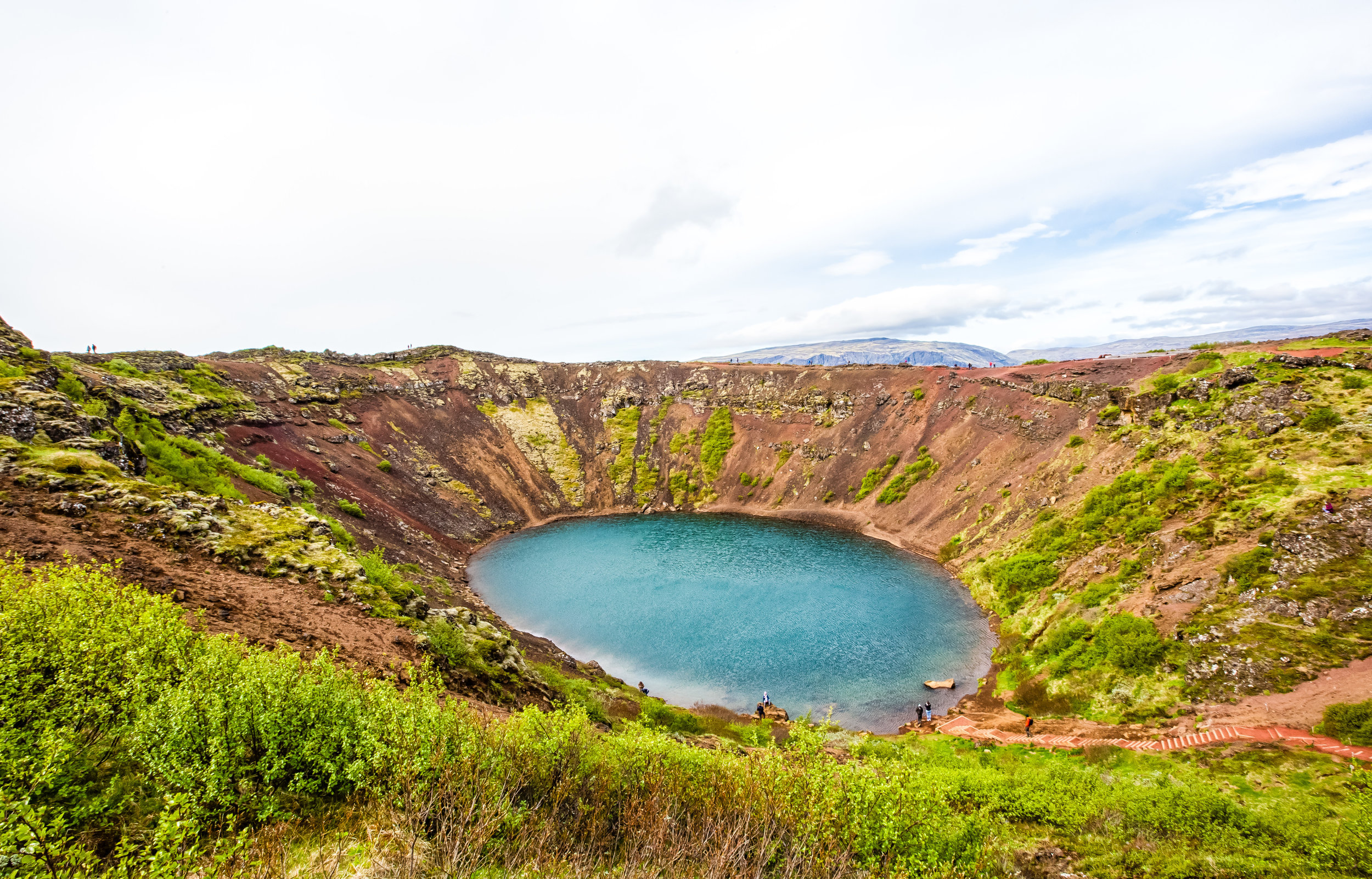
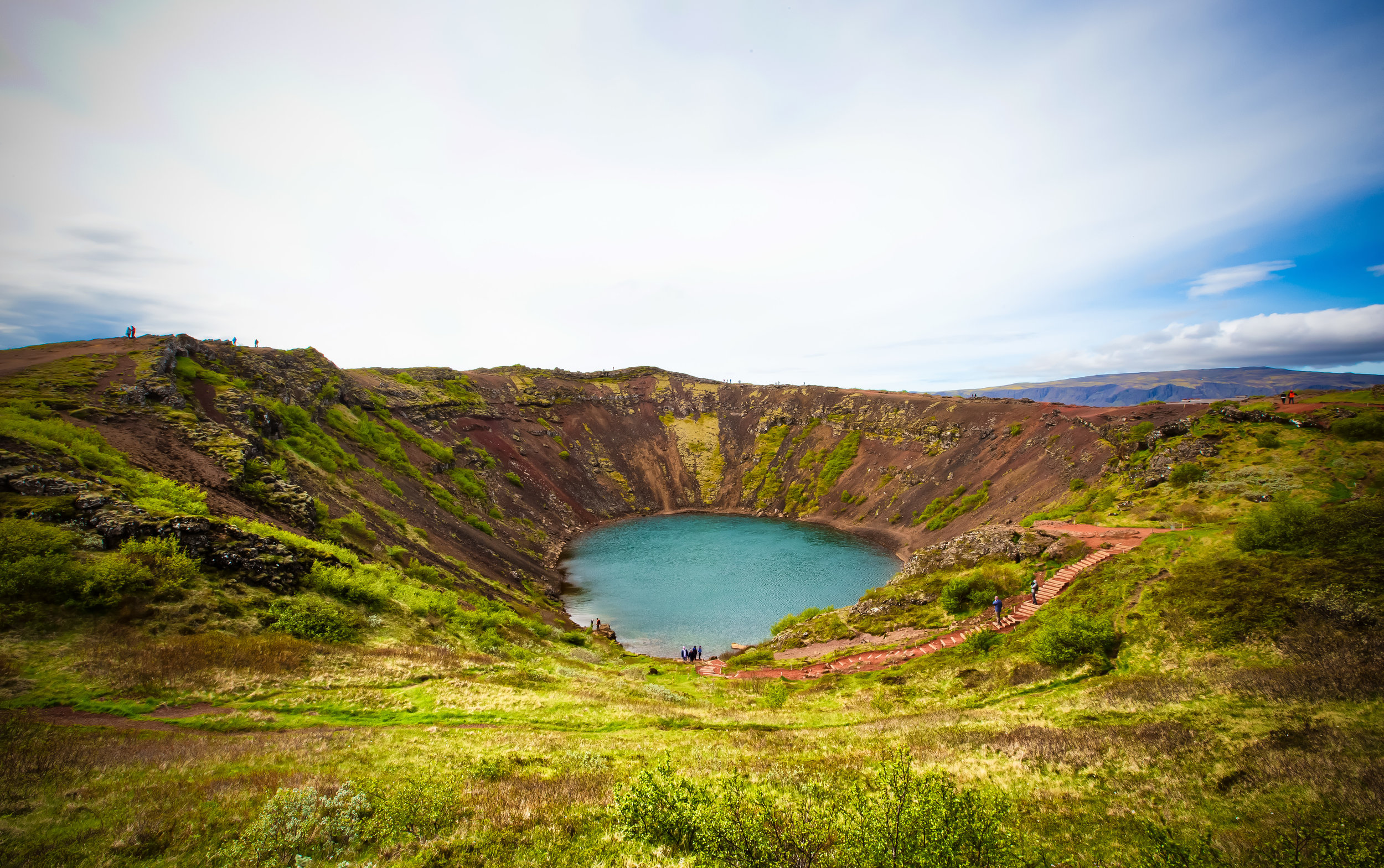
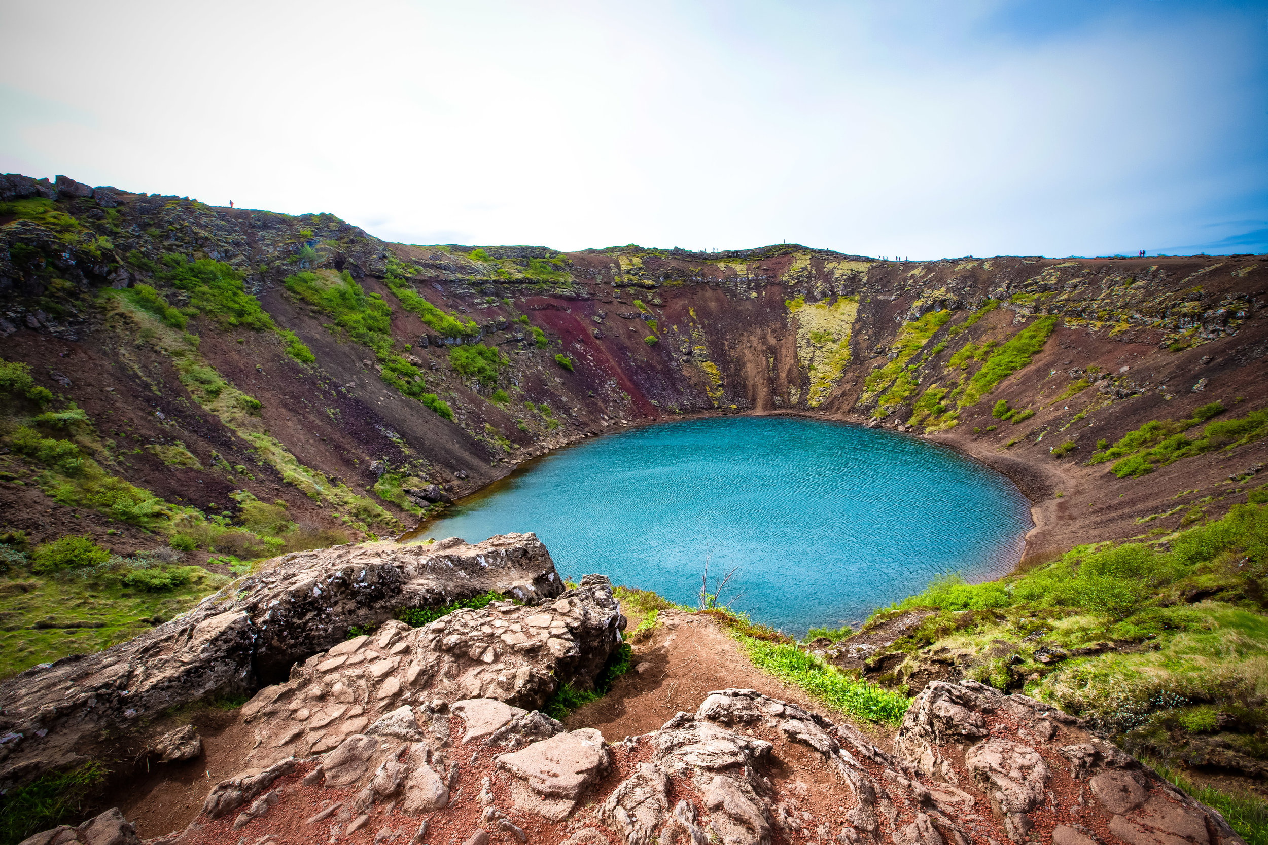
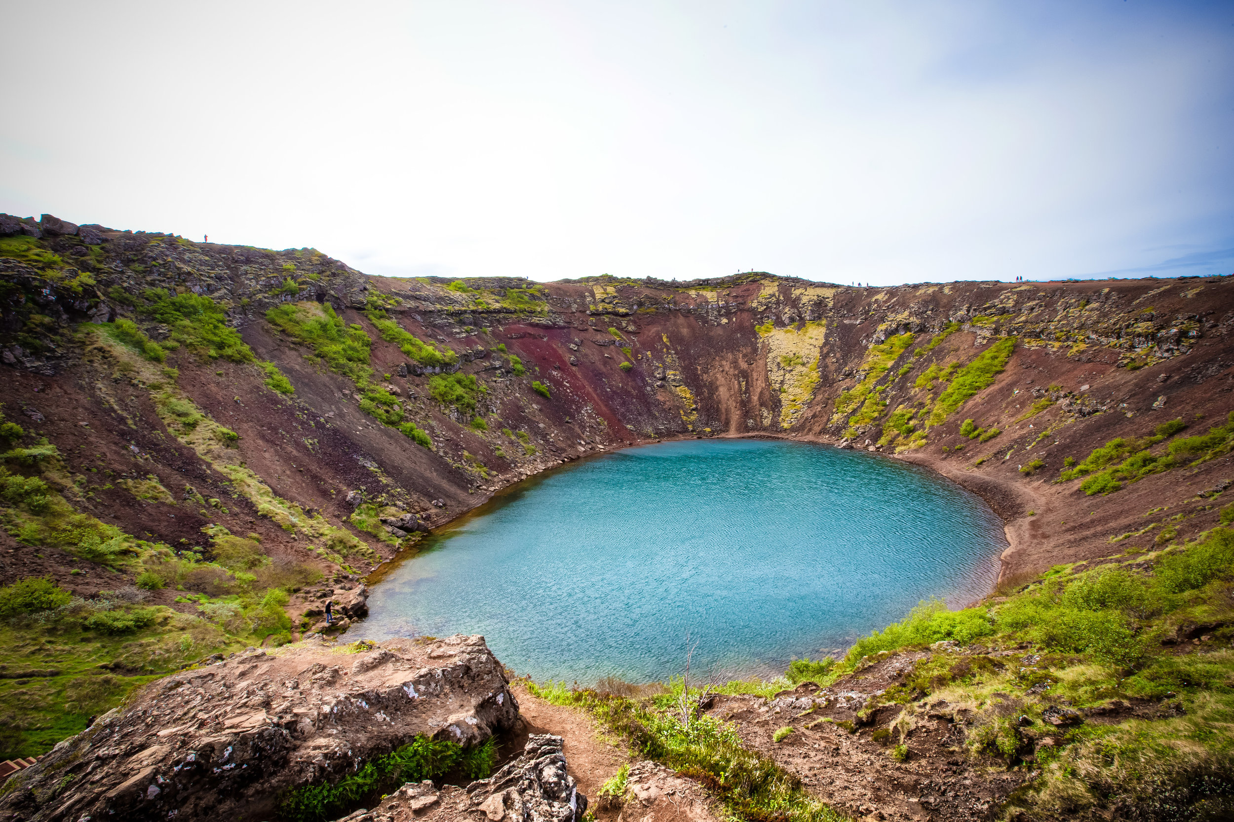
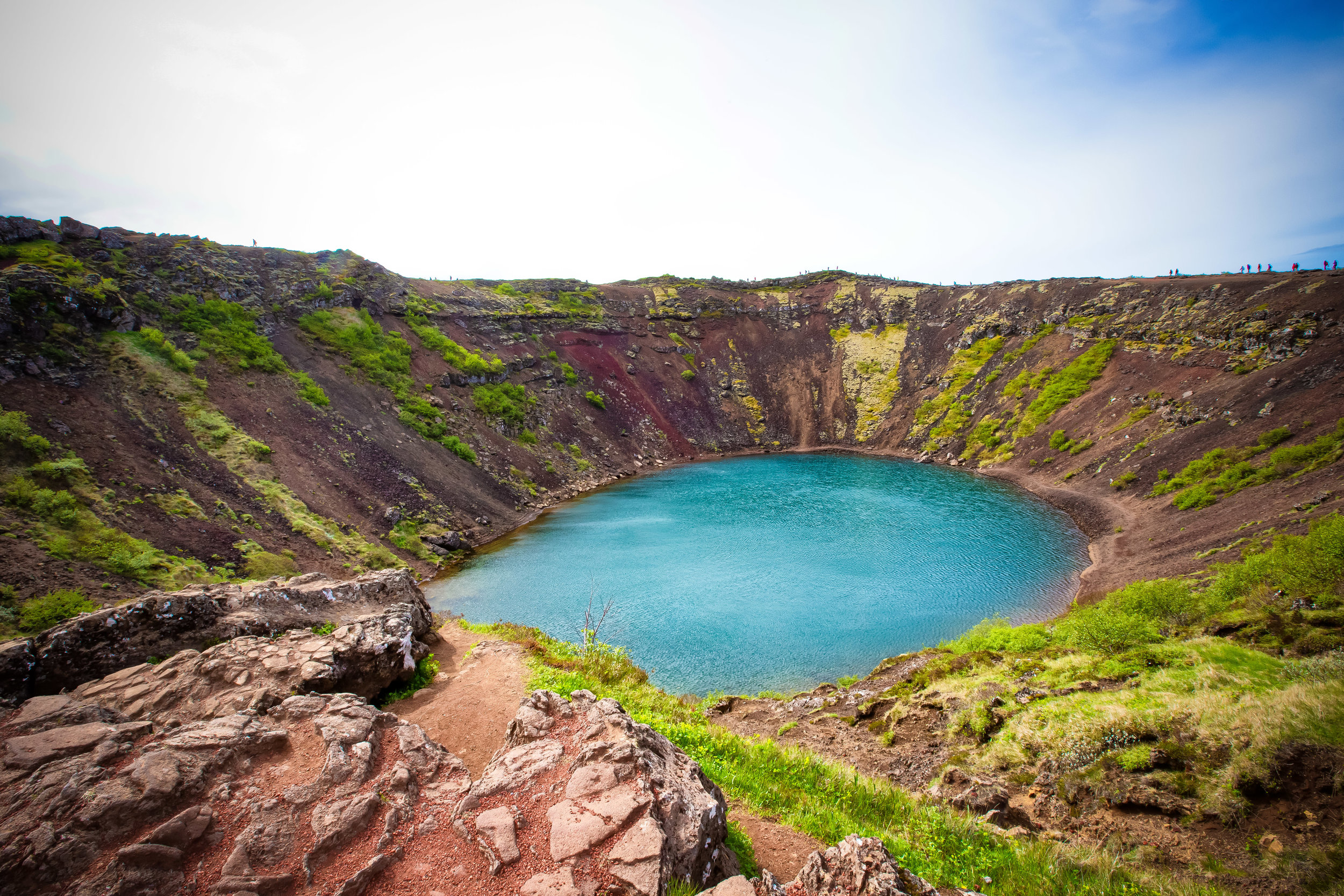
Iceland is a country that is often defined by superlatives - Home to the world’s northernmost capital, Europe’s largest glacier, most powerful waterfall, one of the world’s leaders in energy efficiency and coincidentally one of the most stable economies and oddly enough Europe’s largest banana plantations.

Among many more.

If you are planning on travelling to Iceland, one thing you’ll quickly realize is that it is also one of the most expensive places in the world to visit.

Even though most of the destinations you’ll want to visit are free of charge - Eating, sleeping and getting around is likely to cost you an arm and a leg.

There are of course ways to save money and travel on a budget while in Iceland, but cost tends to be one of the most important factors that prevents people from visiting, or just limiting their travels to the “Golden Circle” route.

If you’re a good at planning and you have the time and resources to travel (What has become popularly known as) the “Diamond Circle” you’ll discover that the northern portion of Iceland is just as amazing as the rest of the country and if you skipped it like many others have, you will have really missed out.

For most, the most important destination on the northern stretch of the Diamond Circle just so happens to be one of those ‘superlatives’ mentioned above - Europe’s most powerful waterfall.

You may be thinking, “I’ve already seen dozens of waterfalls in Iceland, why would I travel hundreds of kilometres north to see another one?” and I wouldn’t blame you if you asked that.

I started feeling a bit weary of waterfalls after a few days in Iceland.

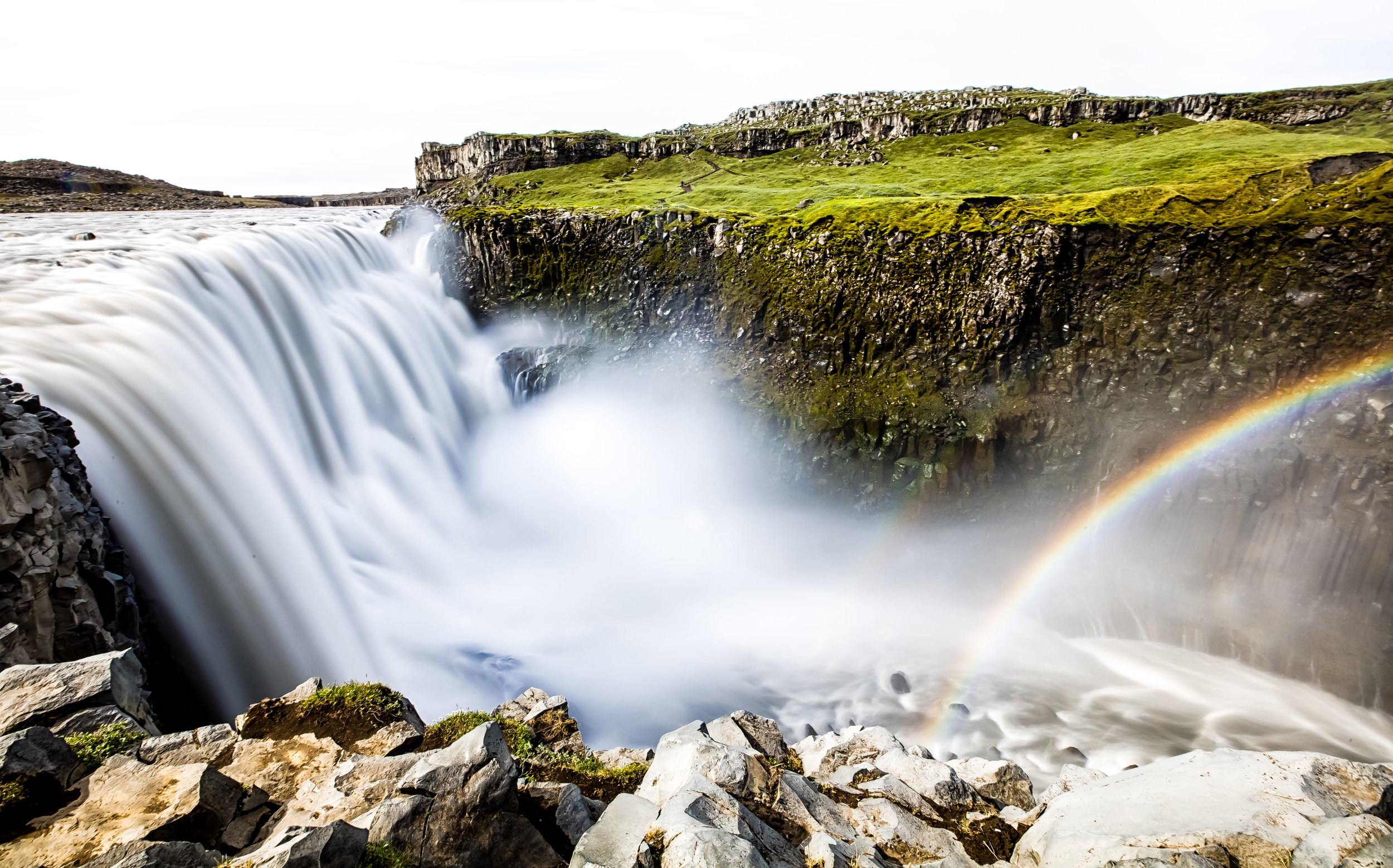
But, its important that you realize that there are waterfalls, and then there is Dettifoss.

Dettifoss is a force of nature.

Standing next to this waterfall is probably one of the most humbling experiences that you’ll ever experience. The sheer size and power of this waterfall in addition to having the ability to just walk up next to it and see it so close is reason enough to make the long journey north.
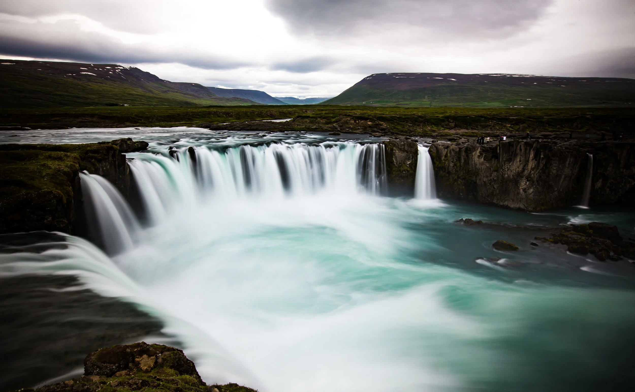
Dettifoss

Known to locals simply as “The Beast”, the name Dettifoss actually translates loosely to English as “The Collapsing Waterfall.

I’d submit that its nickname is probably much more fitting.

Dettifoss is 100 meters (330 ft) wide and 45 meters (144 ft) high, making it among Iceland’s largest waterfalls. The more important measurement though (and the defining feature of this waterfall) is that over 500 cubic meters of water plummets over the falls every second creating a cloud of mist that can be seen from miles away.

It also makes for some really beautiful rainbows.

The water comes from the Jökulsá á Fjöllum river and has travelled hundreds of kilometres from its origin at Vatnajökull, Iceland’s largest glacier, to get to the falls.

The river, which is Iceland’s second longest at 206km in length then continues to flow north until it meets the Greenland Sea on Iceland’s northern coast.

Another one of the waterfall’s defining features is the odd greyish white-coloured water that flows down the river and gives the falls its distinctive colour. You might look at the photos and think that the water is dirty or polluted but the colour is actually common for glacial rivers as they are carrying volcanic sediment out to sea.

Visitors to Dettifoss are able to enjoy the waterfall from two different vantage points - namely on the West or East side of the river. It is important to note that when you are planning your visit that you will to have to keep in mind which side you want to view the falls from.

If you’ve got time to spare, you could check out the waterfall from both sides, but that will require a few extra hours of driving in order to cross the river canyon.

Whichever side you choose, there are parking lots, hiking trails and public restrooms made available by park authorities making your visit rather simple. It should go without saying that no matter which side you visit, you are going to be able to fully enjoy the waterfall.

There are however Pros-and-Cons for each.

By now you may have noticed that all of my photos were taken on the same side of the falls.

I strategically planned where I would stay the night before we went to Dettifoss so that we could wake up early in the morning and take the long gravel road out to the East Bank.

From my research I felt that the view from the East side not only would allow me to get very close to the falls but would also offer me a better view of nearby Selfoss as well.

The road to the east bank is terrible and if you’re driving a rental car you’re going to have to take it easy so that you don’t cause any damage. Likewise the hike from the parking lot to Dettifoss and further on and can be dangerous, especially during winter.

On the East side, the height of Dettifoss will be much more prevalent than the width and you’ll be able to stand next to the river at the base of the falls.

The view on the western side of the falls is a bit higher than that of the east side, so you’ll be able to better enjoy the width of Dettifoss. The view of Selfoss on this side however isn’t as good and you’ll miss out on some of its beauty on this side.

The road to the parking lot is much better and the hiking trail on the western side is much more well-developed as well as being considerably safer if you’re travelling with children or seniors.

No matter which side you visit, if you are planning on visiting both Dettifoss and Selfoss when you’re there, it is about a 2-2.5km round trip from your car!

Getting There


If you are driving directly from Reykjavik, it should take you a little over seven hours to arrive at Dettifoss.

I sincerely hope you aren’t driving directly from the capital just for this waterfall though - That’d make for a really long day and you’d pass by so many other interesting things!

The route you take to the waterfall depends on which side you intend on visiting, but both roads are a simple turn off of Ring Road #1, the highway that circles the country.

East Bank - Road 864 (Hólsfjallavegur)

The road to the East Bank of Dettifoss is a well-developed paved road that is open to the public year round. From the Ring Road it is about a 30km drive to the parking lot.

If you are travelling to the waterfall in the winter months, you’re likely going to be forced to drive this route due to road closures or the type of car you’re driving.

It is possible however that this road will be closed due to weather.

West Bank - Road 862 (Dettifossvegur)

If you like a bit of adventure you’re going to love this road - Road 862 is a simple turn off of the Ring Road and is a bumpy 25km drive to the parking lot.

If you’re driving a 4WD you’ll be able to fly down the road and have a pretty good time.

For everyone else, take it slow and try not to cause damage to your rental car.

The drive from the Ring Road to the parking lot is a flat and rather desolate ride that seems like its never going to end.

There are some resources online that claim that the authorities will close the gate on Road 862 during the winter months while others say that road closures depend on weather conditions. Before you go, make sure to bookmark and regularly check the road conditions and road closures on the Icelandic Road and Coastal Administration site which provides you with real-time information on all of the roads around the country.

Link: Icelandic Road and Coastal Administration.  

You’ll find Roads 862 and 864 listed under ‘Northeast Iceland.’

Dettifoss is the highlight of every travellers journey through the northern section of Iceland’s Diamond Circle. It might be a bit of the way and somewhat of a hassle to get to in comparison to most of Iceland’s other destinations but it is highly worth the time and effort it takes to get there. This waterfall is definitely one that you’re not going to want to miss.

Just don’t try to go for a swim. You may end up in Greenland.


Iceland’s Golden Circle

Featuring quite a few of Iceland’s most iconic tourist destinations, the aptly named “Golden Circle” tourist route is one of the most popular excursions for anyone visiting the country.

The 300 kilometre route is a loop that takes you from the capital city of Reykjavik into the southern area of the country and then back again to the capital.

Usually completed as a day-trip, the Golden Circle is situated on a well-established route that can be visited year-round. The popularity of the route also means that tourists will have a variety of options when considering their itinerary and how they’ll get around.

The three primary stops along the Golden Circle are the Þingvellir National Park, the Geysir Geothermal Area and Gullfoss Waterfall, but there is so much more than you can see and do while making your way around the loop.

With this blog post, I will offer short introductions to some of the most popular attractions along the Golden Circle as well as provide links to the articles I’ve posted about each location.

I will also offer some travel tips and advice for getting around and making the most of your trip.

Route Map

The Golden Circle is an extremely easy route to follow - Once you get yourself outside of the capital city, its more or less a straight drive as you pass by the most important stops along the way.

There are of course other locations that you can check out, but it would be hard to argue that you’d get lost along the way. Most of the destinations are just a simple stop off the main highways.

If you are travelling by car, its likely that you’ll have access to a GPS either in the car or on your phone - Use of a GPS will ensure that you arrive at your destination and most importantly at the best parking space.

The entire route is about 300 kilometres in length, but once you get started you’ll find that each location is never more than an hour away from the previous one.

There are also many other scenic locations to stop along the way for some photos - especially the vast fields full of Icelandic horses!

Þingvellir National Park

Once you’ve left Reykjavík, the first place you’ll find yourself driving through is the historic Þingvellir National Park (Pronounced Thingvellir) which has a special place in the hearts of the Icelandic people.

The drive through the park is beautiful and there are several places where tourists can stop along the way to enjoy the beautiful scenery.


The first major destination along the route is the beautiful Öxaráfoss Waterfall.

The waterfall admittedly isn’t as big as some of the others that you’ll see during your Icelandic travels, but it is a beauty and the area was featured as a shooting location for the Game of Thrones television series.

Visiting the waterfall is free of charge and is a short walk from the parking lot.

Click here for more about the waterfall.


The second major destination along the route is Geysir Geothermal Area.

The park, which is also free of charge is known for its somewhat dormant ‘Great Geysir’ as well as the very active Strokkur geyser which erupts every five to ten minutes.

When visiting, its a good idea to stick around to see a few of the geysers eruptions, check out some of the hot spring pools and possibly also taking a walk up the small mountain for some great views of the valley.

You won’t need a lot of time to visit this area, but it certainly is an enjoyable one - especially if you haven’t seen a live geyser erupt before!

Click here for more about the Geysir Geothermal Area.


Gullfoss Waterfall is probably the most important stop along the Golden Circle day route.

The giant waterfall is one of the most spectacular in the whole of Europe and is a must-stop destination for anyone visiting the country.

The waterfall, which is known in English as the “Golden Waterfall” has well-developed walking paths and allows for visitors to get very, very close - and of course, entry is free of charge!

Click here for more about Gullfoss.


Once you’ve visited the three most important of the Golden Circle’s destinations, depending on how much time you have, you’ll likely be able to visit a few more of the destinations along the route back home.

One location which I highly recommend is the relatively unpopular Faxifoss Waterfall.

The waterfall, which shares the same water source as Gullfoss is a beautiful set of falls where you are able to walk right up to the shore or to the top of the falls.

Click here for more about Faxifoss.


Skálholt Cathedral

Quite a few people will stop in the historic significant area of Skálholt to check out the Skálholt Cathedral and some of the archaeological sites nearby.

For eight centuries Skálholt was one of the most important political and religious areas in the country. 

The current cathedral is only a few decades old, but is built in Icelandic style and visitors are welcome to go inside to check it out.

A visit to the church is a nice break from enjoying all of the waterfalls and natural landscapes that you will have already seen during your tour.  


One of the final stops along the Golden Circle route before reaching the town of Selfoss is Crater Kerið.

The giant volcanic crater was formed by a huge volcanic explosion that forced the volcano to collapse.

Visitors are able to walk around the edge of the 55 meter deep and 170 meter wide crater’s edge before eventually descending down to water-level to check out the pristine water of the crater lake.

Click here for more about Crater Kerið


Getting around the Golden Circle

If you’re travelling through Iceland, the best thing you could do is rent a car in advance and pick it up directly at the airport.

Renting a car is your cheapest option for transportation as buses and taxi’s will end up costing considerably more than driving a car would.

If you are adamant that you don’t want to drive a car, there are a variety of options to get you around the Golden Circle. You could arrange to hire a cab in Reykjavik that will transport you along the route. This will end up being quite expensive, but if you are travelling in a group or can find others willing to travel with you, you can save some cash.

The better option would be to sign up for one of the hundreds of tour options from one of the many tour groups in the capital. Reykjavik Excursions for example has quite a few options for tours along the Golden Circle. Prices there tend to vary between $60-100USD, which seem quite reasonable.

You may also want to consider Gray Line Tours, Arctic Adventures, Reykjavik Sightseeing or check out the Guide to Iceland website which has a lot of information about booking tours.

Tips for Travelling the Golden Circle

Are you driving? Driving yourself is probably the best way to get around the Golden Circle. There are a few things you’ll want to take into consideration before your trip though:  

  • Are you visiting during Summer? The roads are well-maintained and are easy to travel.

  • Are you visiting during Winter? If so, don’t rent the smallest car possible. You’re going to need a 4x4 to ensure your safety.

  • Don’t be fooled by the wide open roads. Speeding is going to cost you and there are speed traps all over the route.

  • There are roundabouts all over the country which are excellent ways to keep people from speeding especially when entering a town. If you are coming up to a roundabout, be sure to reduce your speed as much as possible. There are often speed traps nearby and if you get caught you won’t be happy with the results!

  • Make sure to have a GPS in your car or have Google Maps available on your phone so that you don’t get lost or randomly pass by one of your destinations. Oxrarfoss for example doesn’t have a lot of signage pointing in its direction. You could pass by without even noticing!

  • There are only a few gas stations along the route, so you’re going to want to make sure that you leave with a full tank of gas.

You’ll want to take into consideration the direction you’re going to start in - For example, if getting to Gullfoss early in the morning (when its least busy) is your top priority, you may want to start the route from the south. If you prefer a more leisurely drive, you’ll probably want to head directly to Þingvellir National Park.

There aren’t very many places to eat along the route, so it’d be a good idea to pack a lunch with snacks and beverages for the day. The few restaurants along the way are quite expensive. 

 Stopping along the side of the road to take photos of the beautiful scenery - and of course and Icelandic horses - is recommended but be sure to park somewhere safe that won’t impede traffic. There are many public car stops and camp grounds along the way for you to use!  

Save for an entrance fee at Crater Kerið (400ISK/pax) you won’t have to pay entrance or parking fees at any of the other stops along the way - Unless of course you decide to visit one of the hot spring resorts.

Traveling the Golden Circle is a very economic way to see some of the best scenery Iceland has to offer! 

Have some extra time? Why not turn the daytrip into a several day trip? To make the most of the Golden Circle, you could easily spend the night in one of the cabins or campsites along the way. Spending the night allows you to see and do more and in the summer allows you much more time to explore!  

There are several online guides on the web dedicated to helping people make the best of their Icelandic holiday. If you are looking for more help with tours, accomodations and food options for your trip, be sure to check out some of these excellent resources:  

  1. Guide to Iceland - How to Drive the Golden Circle

  2. Extreme Iceland - A Complete Guide to the Golden Circle

  3. Expert Vagabong - Ultimate Guide to Driving Iceland’s Golden Circle

The Golden Circle is a landscape lovers paradise - There is so much to see and do while visiting small patch of heaven. Most people have a wonderful day trip while visiting the area but others spend several days enjoying the beauty of the natural landscape. Whatever you choose to do, you’re sure to have a great time! 

Crater Kerið

Travelling along Iceland’s popular Golden Circle you’re going to be treated to some of the country’s most spectacular scenery in what is widely known as an extremely geologically-active environment. The Golden Circle is home to geysers, hot spring baths and spectacular geological beauty formed by hundreds of thousands of years of volcanic activity.

More significant to the people of Iceland though is that the geothermal environment that attracts its fair share of tourism has also been harnessed to generate clean electricity providing around 90% of the population with hot water and heating. With the remainder of Iceland’s electricity generated by hydro power, the country has been able to successfully reduce its reliance on fossil fuels to less than 1% of their total electricity production.

The ability to harness the earth’s natural power in such a significant way however comes with the knowledge that at any given time disaster may strike in the form of an earthquake or volcanic eruption.

Iceland is currently home to around 130 active (and inactive) volcanoes which directly contribute to the constantly changing nature of the country’s natural environment.

In 2010 for example, the relatively small eruption at Eyjafjallajökull caused massive disruptions to air travel around Europe and North America thanks to the tons of volcanic ash that it spewed for a period of six days.

What happens though when a volcanic eruption is too powerful?  

In some cases a powerful eruption has the ability to completely collapse all the land around it forming a circular volcanic crater known to geologists as a caldera.

Iceland is home to quite a few of these craters, especially in the Western Volcanic Zone, and a few of them have become popular tourist attractions.

Most notable of those is ‘Crater Kerið’ in Southern Iceland which now serves as a popular destination for tourists along the Golden Circle route to see first-hand the awesome power of the Earth’s destructive capabilities.

Crater Kerið

The massive volcanic crater known as Crater Kerið (Pronounced: Kerith or Kerid) is one of Iceland’s youngest at an estimated age of around 3000 years but is well regarded for its visibly recognizable caldera.

Despite its relative youth, the crater has become a popular tourist attraction for its picturesque steep walls of red volcanic rock, aqua-blue crater lake and its convenient location next to the highway.

The crater measures 55 meters (180 ft) deep, 170 meters (560 ft) wide and 270 meters (890 ft) across. The depth of the crater lake tends to vary by season but is generally 7-14 meters deep.

It was originally thought that the crater was formed by a huge volcanic explosion, which is common with most craters of this kind. Upon further study however Scientists found no evidence of such an eruption in the area.

This discovery has led to the current theory that Kerið was once a cone-shaped volcano which erupted and ultimately imploded upon itself.

Scientists believe the eruption was a minor one (occurring around 6000 years ago) but resulted in the volcano depleting its underground magma reserve. The weight of the magma once on the surface collapsed the volcano forming the crater that we see today.

Conditions at the crater tend to vary by season - In the summer, visitors are treated to a colourful crater lake that reflects the sky with volcanic-red crater walls covered in beautiful green moss that blends in with a green valley for as far as the eye can see.

In winter on the other hand, the crater walls are often covered with snow and the lake freezes. If you’re there at the right time of day, it is said to be an amazing location for viewing the Northern Lights.

No matter what time of the year you visit, you will be treated to beautiful views of the surrounding landscape while walking the perimeter of the massive crater.

The landowners have set up a well-maintained path which allows visitors to completely circle the crater as well as allowing you to walk down to water-level of the crater lake.

If you are travelling to the crater in winter, be sure to wear proper footwear and a warm coat. If you are visiting in summer you may not need that warm coat or winter boots, but you’ll definitely need a windbreaker to protect yourself from the wind in the valley.

Getting There


If you are following the popular Golden Circle route, Crater Kerid is about a three-hour drive from the capital of Reykjavik. Most tourists will have already stopped by Öxaráfoss, the Geysir Geothermal Park and Gullfoss before reaching the crater.

Crater Kerid is located around 15 kilometres north of the town of Selfoss or 56 kilometres south of Gullfoss along highway route 35.

If you are following the Golden Circle route, it is likely that the crater will be one of your last destinations before heading back.

It should only take you around 40-50 minutes to arrive at the crater after leaving Gullfoss but that depends on whether or not you’ve stopped at Faxifoss or Skalholt before arriving at the crater.

If you’ve decided that you won’t bother renting a car while visiting Iceland, you’re going to have to rely on public transportation to get around. There are tours out of the capital offered by tour groups like Reykjavik Excursions which offer tourists access to several different stops for around $100USD. It is important to remember that if you want to book a tour that you should do so well in advance as the seats on the daily tours tend to fill up quickly.

Once you arrive at the crater there is an excellent car park provided for guests - You’ll want to take note however that there is now an entrance fee to gain access to the park. The entrance fee is a modest one at 400 ISK ($4.00 USD) per person and is used to help maintain the natural environment at the park.

Visiting Crater Kerid doesn’t really require a lot of time - If you walk around the perimeter of the crater and walk down to water-level it shouldn’t take you more than an hour. The area is a beautiful one though and is a great place to take some landscape photos. You may also want to consider preparing some food and having a picnic before heading off to your next destination.

After travelling around the Golden Circle you may feel a bit underwhelmed with the crater but the crater is an excellent example of the geothermal nature of Iceland’s geography and paints a picture of the land’s storied past. It is definitely worthwhile to stop by and check it out - especially after a day of checking out waterfalls