Writing as extensively as I do about the history of Taiwan’s Japanese colonial era, I’ve been asked several times over the years why I’ve yet to publish anything about the remnants of the ‘Golden Shrine’ near the popular tourist town of Jiufen (九分). Given that I’ve written about a handful of the other shrines that remain (in some form) in Taiwan, as well as publishing articles about Stegosaurus Ridge (劍龍稜) and the Teapot Mountain (無耳茶壺山) hikes - which offer up a birds eye view of the shrine - its understandable that one might wonder why I haven’t covered what has arguably become one of Taiwan’s most well-known Shinto Shrines.
Like most people, I eagerly paid a visit to the Golden Museum (黃金博物館) in Jinguashi (金瓜石) shortly after it’s official opening. However, that visit came shortly after I arrived in the country, and like most newbies, I didn’t really have much idea about what was going on. Thinking back, although I didn’t actually realize it at the time, that particular visit may have been my first experience exploring something related to the Japanese-era.
The popularity of the museum in its early days meant that the area was absolutely packed with tourists on weekends, and as the shrine was an important part of any visit to the area, it was also a pretty popular spot. At that time though, photography was more or less just a hobby for me, and to tell the truth, I was mesmerized by the mountains, so I didn’t didn’t pay all that much attention to the shrine.
I did end up visiting once again several years later, but on that occasion, the shrine was just a short detour on a hike through the mountains, so I just stopped by for a quick minute before continuing further up the trail. That, unfortunately would have been my best opportunity to get the photos I needed, but I missed out, which is something I’ve regretted for quite a few years.
In 2017, the path to the shrine was gated shut and for the next five years it underwent a period of restoration, which helped to bring parts of the shrine (that were unscrupulously knocked down) back to life. It was also a project that saw the planting of hundreds of cherry trees, which in the future should make the shrine an even more popular spot for tourists.
All of that being said, I’m actually relieved that I didn’t write about the shrine after my second visit. By that time I had been in Taiwan for several years, but the amount of knowledge I had accumulated with regard to Taiwan’s history, the Japanese-era, and Shinto Shrines was no where near what I accumulated now after years of research and experience writing about these things. Thus, the information I’m able to provide readers with today will comprehensively combine the history of the shrine, the community that surrounds it, and its architectural design.
Closed for half a decade, the Golden Shrine reopened to the public in late 2022, and its reemergence has been an important catalyst for attracting tourists back to the Golden Museum, once again becoming a popular spot for all of the loal Instagrammers looking for a fresh location to take photos!
However, even though most people are quite content that the shrine has finally been reopened, there has also been some criticism in some circles regarding the length of time that the shrine was closed. More specifically, critics have openly questioned why the shrine wasn’t completely restored to its original likeness, similar to how the Luye Shinto Shrine (鹿野神社) in Taitung was brought back to life.
Personally, I find myself relatively content with the work that has been done to restore the shrine (minus a few minor gripes), and I’m not particularly sure why anyone would want to restore it to its original condition. As a ‘ruined’ site, the shrine allows us to experience a piece of Taiwan’s modern history, but also provides a lesson as to the effort to erase memories of the Japanese-era in the half-century since the Second World War came to an end.
I’d also argue that it would be relatively pointless to completely reconstruct the shrine if they weren’t going to invite the ‘kami’ to return, something that might be a touchy subject in certain circles. Instead, I’m content that there are a number of well-preserved historic photos of the shrine that allow us to see how it would have originally appeared during the Japanese-era, some of which I’ll be sharing with you today.
As I move on, I’m going to start with an introduction of the history of the shrine, and the Jinguashi gold mines. I’ll then follow with a brief timeline of events, and then I’ll provide details about the shrine’s architectural design, so that you can better understand what you’ll see if and when you visit.
Now that the shrine has been reopened, visitors to Taiwan have a ‘golden’ opportunity (forgive the pun) to visit this amazing piece of Taiwanese history. Making that golden opportunity even more attractive is that any visit to the area can may also include with a number of other popular tourist destination including Jiufen Old Street (九份老街), the Golden Waterfall (黃金瀑布), the Gold Museum (黃金博物館), or any of the hiking trails on the mountains nearby. A day-trip, or even a weekend trip to the area is a rewarding one, and is something that every tourist visiting Taiwan does at least once!
Ogon Shrine (黃金神社 / おうごんじんじゃ)
Over the span of Taiwan’s fifty year Japanese colonial era, there were about two hundred Shinto Shrines constructed around the island. The first of them was the Kaizan Shinto Shrine (開山神社/かいざんじんじゃ) in Tainan, which just so happened to be established on the the original site of the Yanping King Shrine (延平郡王祠). The Chinese-style temple had originally honored the pirate-king Koxinga (鄭成功), but if we’re being picky, the first shrine constructed in Taiwan was technically the Ogon Shrine, located on the northern coast of the island.
Whether it was the ‘first’ or the ‘second’ shrine in Taiwan probably isn’t all that important, but as one of Taiwan’s earliest Shinto Shrines, it has a history that dates back more than 125 years - but I can’t really explain the history of the shrine to you without first providing some basic information about the area where it was constructed, who constructed it, and why it was constructed, because all of these things are very much linked together.
Links: Fairy Cave Temple, Keelung Shrine, Taoyuan Shrine, Luye Shrine, Hualien Shrine, Taitung Shrine, Tamsui Shrine, Yilan Shrine, Yuanshan Shrine, Tungxiao Shrine, Kaizan Shrine
When the Japanese arrived in Taiwan in 1895, it’s safe to say that the situation they were confronted with was pretty hostile - The fleeing Qing forces did their best to sabotage and slow down efforts to take administrative control of the island, and the local inhabitants put up quite a bit of resistance as well. Even worse was the environment, which in the end did the most harm to the Japanese armed forces who were met with deadly foes named malaria, pneumonia, dysentery, cholera and smallpox.
By 1897, the government established ‘Taihoku-ken’ (臺北縣 / たいほくけん), an administrative space that encompassed what we know today as New Taipei, Taipei, Keelung, Taoyuan, Hsinchu and Yilan, in an effort to get the island’s major settlements under some kind of control.
Looking to take control of the island’s rich natural resources, in 1896, the colonial government passed the Taiwan Mining Regulations Act (台灣礦業規則), which limited the extraction of Taiwan’s minerals solely to Japanese nationals. One of the first areas allocated for mining operations was Keelung Mountain (雞籠山) on the island’s north coast.
The mountain was initially partitioned into different sections, with the eastern side leased out to Tanaka Choubee (田中長兵衛 / たなか ちょうべえ), who headed the Tanaka Group (田中組) and after about a year of preparation, mining started in the area in 1897, which by that time was known as Kinkaseki (金瓜石/きんかせき).
Note: Interestingly, the name ‘Jinguashi’ (金瓜石) only predated the Japanese era by about two years. Records indicate that around 1893, a farmer was exploring the area and discovered a gold nugget, which soon attracted a bunch of other people looking for gold. The nugget was reportedly the size of a melon, thus the name.
At its heart, Shintoism is a philosophy that promotes a quality of ‘oneness’ with the natural world, and respect for nature. That being said, Taiwan’s development required a considerable amount of natural resources, so when it came to mining, something that is destructive to the natural environment, it was important to also pay homage to the spirits of the mountain. Thus, in 1898 (明治31年), the first generation ‘Ogon Shrine’ (第一代黃金神社) was established by the Tanaka Group.
With nine pits excavated at the Kinkaseki Mines (金瓜山礦場), as mining efforts gradually went moved into the mountain, it was discovered that gold wasn’t the only treasure in the hills, but there was also vast amounts of silver, copper and sulfur. Eventually the Kinkaseki Mines would become one of the most important mining operations in the Japanese empire.
That being said, economic stagnation caused by the First World War drove the international value of raw materials down for the duration of the war. This created financial issues for the Tanaka Group, which ended up restructuring its business and selling its mining rights to the Tanaka Mining Company (田中礦業株式會社) in the 1920s. Then, about a decade later, due to a lack of capital, the land lease was sold off to the Nippon Mining Company (日本鑛業株式會社), which officially changed its name to the Taiwan Mining Company (台湾鉱業株式会社) in 1933 (昭和8年).
Looking at historic photos of the shrine, one thing you might notice is that at some point the architectural design changed completely - Even though there are only a few remaining photos of the original shrine, what we can observe from them is that the shrine went from something that could be considered rather basic to a replication of one of Japan’s oldest and most important Shinto Shrines, the Ise Grand Shrine (伊勢神宮 / いせじんぐう).
Said to be about two-thousand years old, the architectural design of the Ise Grand Shrine is one that constantly changes. Known in Japan as ‘Yuitsu-shinmei' (唯一神明造 / ゆいいつしんめいづくり), is an ancient architectural style that imitates early rice granaries. The important thing to remember here is that the word ‘yuitsu’ (唯一) translates literally as ‘only’ or ‘unique’ which means that the Grand Shrine is the only place of worship that is permitted to use this style today. Thus, the Ogon Shrine, like many other Shinto Shrines across Japan, uses a variation known as ‘shinmei' (神明造 / しんめいづくり) design.
The reason I’m bringing this up this now is because the Ise Shrine, and other shrines that make use of the ‘shinmei’ design, often appear relatively new (despite their age), due to the fact that important sections of the shrine are reconstructed every few decades, which I’ll explain in more detail later.
Link: Ise Grand Shrine (Wiki)


When the Taiwan Mining Company took control of the Kinkaseki Mines in the early 1930s, they put forward an expansion project that would see the reconstruction of the shrine’s Hall of Worship. The Second Generation Ogon Shrine (第二代黃金神社) opened in 1936 (昭和11年), after a period of reconstruction, marking an important occasion for the local community, which was, to say the least, thriving at the time. Nevertheless, given that time frame and the relatively short lifespan of shrines that make use of this architectural style, it was likely due for another face lift in the mid-1950s, something that would ultimately would never take place.
Interestingly, the three deities, or ‘kami’ (神 / かみ), that were enshrined at the Golden Shrine differed somewhat from those that you would have typically encountered at the other shrines across Taiwan, but with more than a million ‘kami’, you would have obviously come across a wide variety of figures in the two-hundred shrines that were constructed around the country.
Keeping in mind that Shintoism was more or less a ‘foreign’ religion to the people of Taiwan, in the early days of the colonial era, the Japanese tended to enshrine deities that were easily identifiable with the people of Taiwan. This effort could be interpreted as a means to ease the people into their new state religion, or it could have just been a reflection of the situation on the island at the time, but the kami that became the most common at shrines in Taiwan shared similarities with the folk religion deities that people here identified with.
The Three Deities of Cultivation (開拓三神 / かいたくさんじん), for example, became quite common within Taiwan’s Shrines as they were deities known for their skills with regard to ‘nation-building’, ‘farming’, ‘business’ and ‘medicine’. Even though it is also common to find shrines dedicated in their honor back in Japan, they were especially important in Taiwan due to what they represented, which shared parallels with the Earth God (土地公 / 福德正神), who remains one of the most important religious figures in Taiwan today.
That being said, the ‘kami’ that became the most common within Taiwan’s shrines would have been housed within the larger places of worship, which focused more on the general public, such as the Taoyuan Shinto Shrine (桃園神社). Shrines like the Golden Shrine in contrast were a bit more flexible with the deities who were invited to take up residence. That flexibility allowed them to focus more on themes that were important with regard to the environment, local economy and the community living in the area.
To give you an example, the kami that was enshrined at the Taipei Water Shrine, known today as the Yuanshan Shinto Shrine (圓山水神社), was one who focused on water. Thus, as you can imagine, at the Golden Shrine, the deities would have focused on mining and facets of the environment.
The three kami that were enshrined at the Golden Shrine were:
Ōkuninushi (大國魂大神 / おおくにたまのかみ)
Kanayamahiko (金山毘古神 (金山彦命 / かなやまひこのかみ)
Sarutahiko (猿田彥大神 / さるたひこのかみ)
Starting with ‘Okuninushi-no-Kami’, one of ‘three deities of cultivation’ mentioned above, he is regarded as the god of nation-building, agriculture, medicine and protection. The next figure, one of the ‘Great Deities’ (大神) of Shintoism, ‘Sarutahiko Okami’, is the leader of the kunitsukami (国つ神), or the ‘gods of the earth’. Finally ‘Kanayamahiko-no-kami', is the god of mines.
As you can see, in each of these three cases, the selection of deities speaks to the specialized focus of the shrine with regard to its focus on the land and the mines on the mountains that surrounded it.
Note: I should probably also point out that each of these three deities are quite old and are the subject of myths and legends detailed in the Kojiki (古事記 / こじき) and the Nihon Shoki (日本書紀 / にほんしょき), which date back to the early 8th Century. Thus, they share a relationship with the origins of the earth, the islands that make up Japan, and the mythical ancestry of kami that were spawned from Izanagi and Izanami.
Coincidentally, the shrine’s annual matsuri festival (祭 / まつり) was conveniently held on June 28th, which just so happened to be the same date as Jiufen’s annual Mazu Pilgrimage (媽祖遶境), making the date a pretty important one for the people of Jiufen and Jinguashi, and was one where all the laborers and students were given a day off of work to celebrate.
Segueing back into the shrine’s history, when the Japanese-era came to an end in 1945 (民國34年), mining operations at Jinguashi were put on hold for a short time until the Chinese Nationalists were able to figure out how to get production back online. In 1946, the Taiwan Gold and Copper Office (臺灣金銅鑛籌備處) was established by the government in order to restructure mining operations on the island. Much of Jinguashi’s wealth ended up being dedicated to funding the Nationalists (futile) effort to defeat the Communists in the Chinese Civil War (國共內戰).
When Chiang Kai-Shek’s Nationalist Government fled to Taiwan, bringing with them almost two million refugees, life on the island changed almost overnight, and over the next several decades the Taiwanese people would have to endure what would become one of the world’s longest periods of Martial Law, known locally as the White Terror Period (白色恐怖).
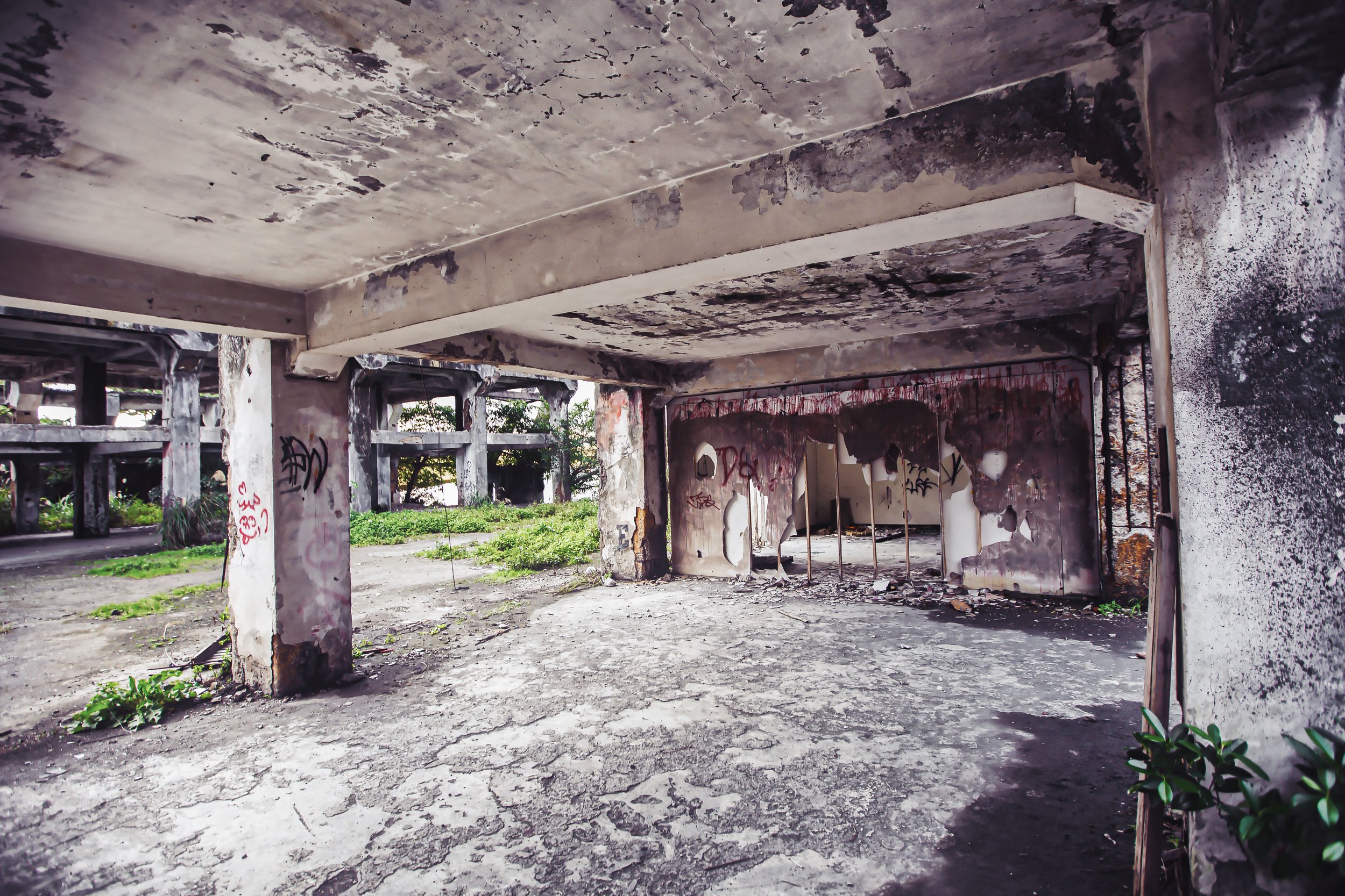
Over the next few decades, Taiwan’s new inhabitants exhibited a considerable amount of anti-Japanese sentiment, and it was during that time that the vast majority of buildings that were related to Japanese culture or religion were vandalized, torn down, or replaced.
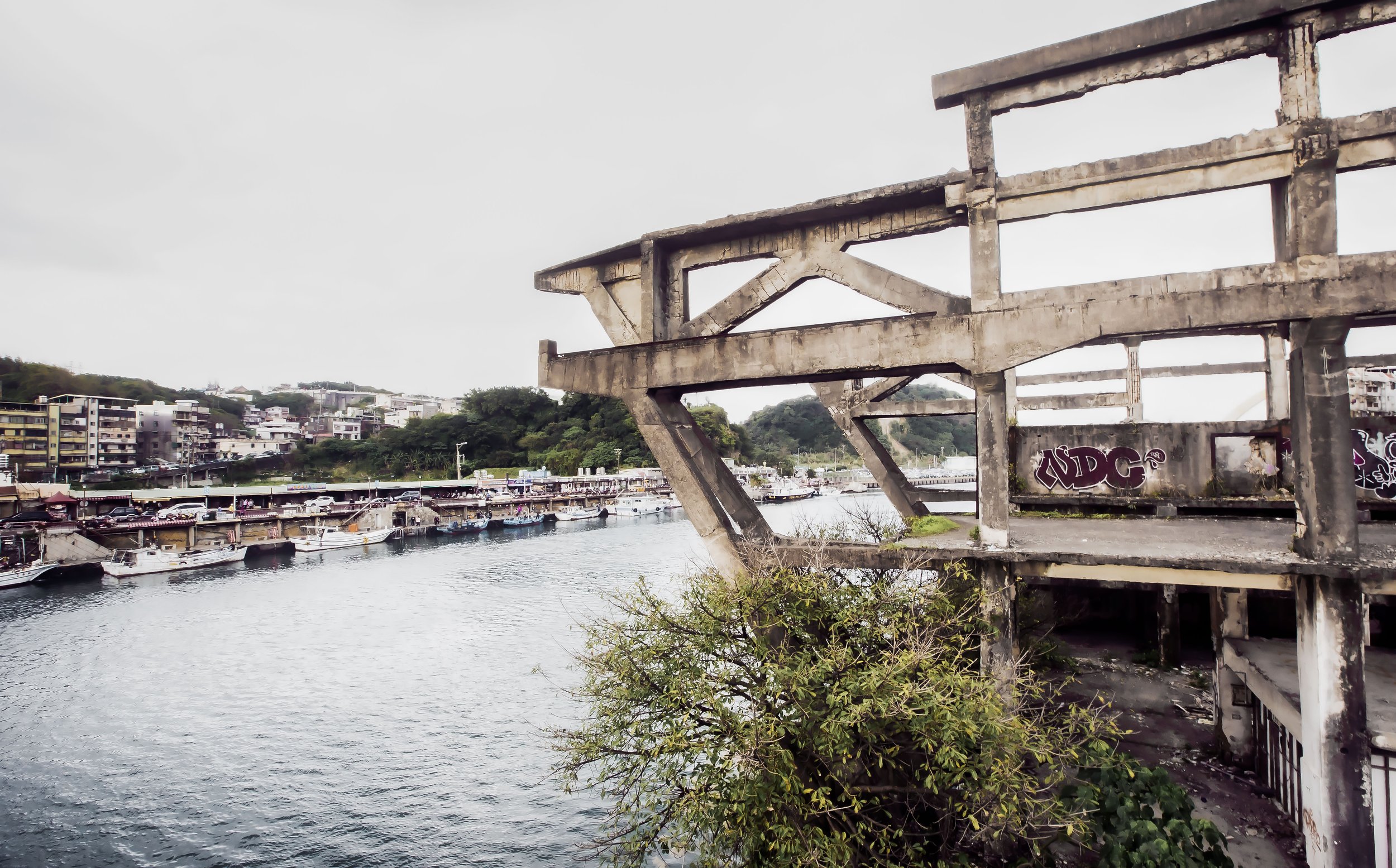
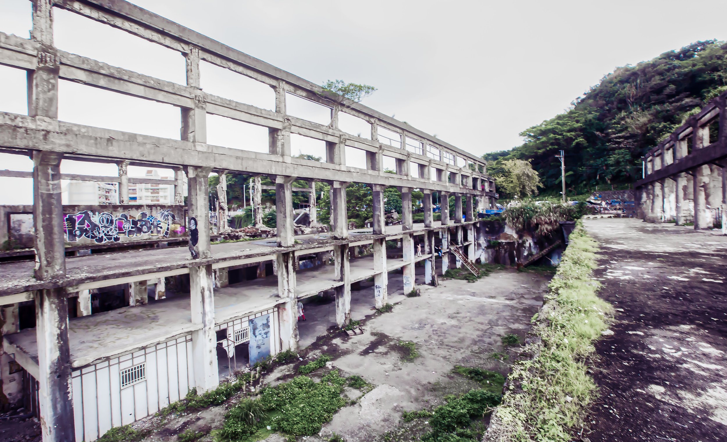
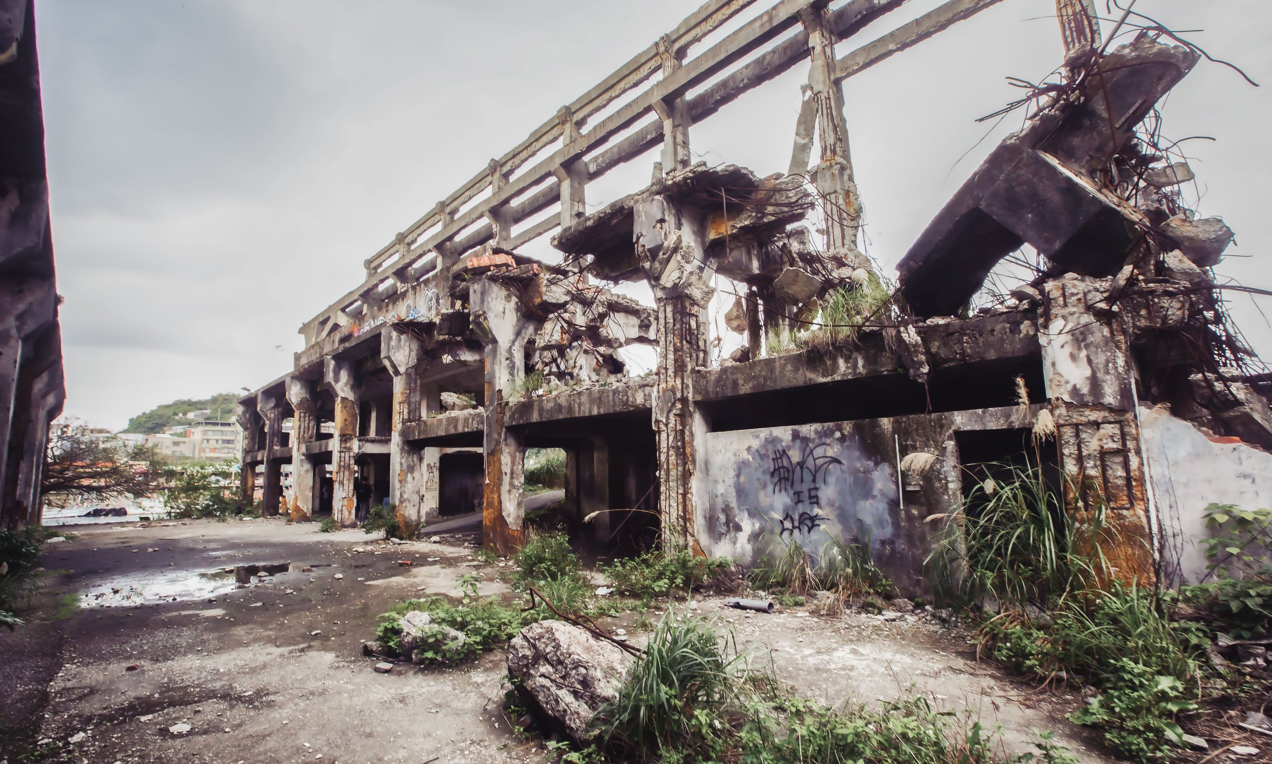
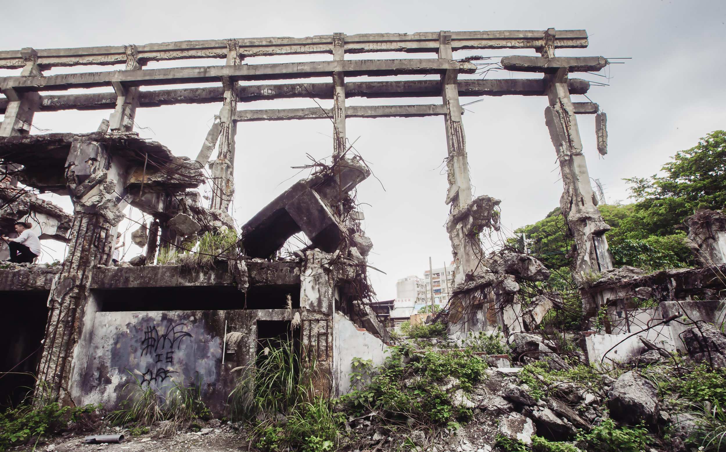
You could probably argue that the saving grace when it came to the Golden Shrine was that it was constructed on the remote side of a mountain, so unlike the majority of Taiwan’s other shrines, it was never really in any danger of getting in the way of development. That being said, the shrine did fall victim to vandalism over the years, leaving the site in ruins. Going back to a point I made earlier though, it is unclear as to whether or not the main parts of the shrine were vandalized or if they just suffered from lack of up-keep.
Nevertheless, several decades after the war ended, natural resources within Jinguashi’s mines were more or less depleted, and with the decrease in the international market value of copper, the Taiwan Mining Corporation was ultimately forced to declare bankruptcy.
Then, in what may come across as a very random decision, the Taiwan Power Corporation (臺灣電力公司) took ownership of the land in 1985 (民國74年), but not much could be done on their part to save the business operations, so mining in Jinguashi came to an abrupt end in 1987 (民國76年), leaving not only the shrine in ruins, but the entire mining community abandoned.
If we then fast forward to the turn of the new millennium, the Golden Shrine was selected as one of the top ten heritage sites in Taipei County - and even though it was simply an abandoned and ruined shrine, it was ranked on the list of one-hundred most important historical sites in Taiwan.
Like the shrine, the mining community fell into disrepair, but due to its historic value, the Taiwan Power Company in conjunction with the Taiwan Sugar Corporation and the Taipei County Government (Currently New Taipei City) jointly funded a restoration project to reopen the mining community as the ‘Jinguashi Gold Museum’ (黃金博物館).
Link: For some great photos of the shrine prior to its restoration, check out this article: Ōgon Shrine from Spectral Codex.
Shortly thereafter, the Golden Shrine was recognized as a protected heritage site (直轄市定古蹟), and despite it still being under the ownership of the Taiwan Power Company, it was put under the operational control of the Gold Museum, and the government was tasked with coming up with plans to have it restored.
It took about a decade, but the restoration project for the shrine officially started in 2017, with the shrine closed to the public for the duration of the project, which ultimately lasted more than anyone expected.
Reopening to the public in late 2022, the Golden Shrine has reemerged as one of New Taipei’s most iconic tourist destinations, and its rebirth seems to be one that has been celebrated by quite a few people as it has become an Instagram hot spot with people from all over the country flocking to the area to check it out.
If all of that history was a little too much for you, before I start describing the architectural design of the shrine, as I mentioned earlier, I’ll provide a helpful, yet brief timeline of events regarding the shrine:
Timeline
1895 (明治28年) - The Japanese take control of Taiwan at the end of the Sino-Japanese War with the signing of the Treaty of Shimonoseki (馬關條約 / 下関条約).
1896 (明治29年) - The Colonial Government enacts the Taiwan Mining Regulations (台灣礦業規則) policy in an effort to standardize and start the extraction of the island’s resources.
1897 (明治30年) - The Tanaka Group starts a mining operation in Kinkaseki / Jinguashi (金瓜石田中鑛山事務所).
1898 (明治31年) - The First Generation Ogon Shrine (第一代黃金神社) is established by the mining company on a flat section of the mountain’s eastern cliffs (大金瓜岩嶂東).
1905 (明治38年) - The first deposits of gold and silver are discovered at the mines in Jinguashi.
1913 (大正2年) - The Tanaka group purchases the Mudan Mines (牡丹坑鑛) on the opposite side of the mountain and merges it with the Jinguashi Mine.
1922 - A mansion is constructed within the Japanese section of the mining community in Jinguashi in anticipation for the royal tour of Taiwan by the crown prince. The tour never actually took place however due to the death of Emperor Taisho (大正皇帝) and the ascension of Emperor Showa (昭和皇帝) to the throne.
1933 (昭和10年) - Ownership of the mines is transferred to the Nippon Mining Company (日本鑛業株式會社).
1936 (昭和11年) - The Colonial Government’s “Japanization” or ‘forced assimilation’ Kominka (皇民化運動) policy comes into effect in Taiwan. The same year, the mining company expanded the shrine into the Second Generation Ogon Shrine (第二代黃金神社).
1945 (昭和20年) - The Second World War comes to a conclusion and Japan is forced to surrender control of Taiwan.
1946 (民國35年) - The Taiwan Gold and Copper Office (臺灣金銅鑛籌備處) is set up by the Nationalist government in order to restructure mining operations on the island.
1949 (民國38年) - Chiang Kai-Shek (蔣介石) and the Nationalist government retreat to Taiwan, bringing with them several million refugees displaced by the Chinese Civil War.
1955 (民國44年) - Mining operations are restructured into the Taiwan Mining Corporation (臺灣金銅鑛物局).
1973 (民國62年) - With gold, silver and copper resources drying up in the mountains, the mining company attempts open-pit mining, and shifts much of the operations on the mountain into smelting and the processing of copper.
1985 (民國74年) - Due to declining resources in the mine and the decrease in the international market value of copper, the Taiwan Mining Corporation is forced to declare bankruptcy with the Taiwan Power Corporation (臺灣電力公司) taking ownership of the land.
1987 (民國76年) - Mining operations in Jinguashi come to an end with all of the mines shut down.
2000 (民國89年) - The Golden Shrine is selected as one of the top ten heritage sites in Taipei County and is ranked #94 on the list of a hundred historical sites in Taiwan.
2004 (民國93年) - The Taipei County Government in conjunction with the Taiwan Power Company and Taiwan Sugar Corporation jointly open the ‘Gold Museum’ (黃金博物館) within the historic mining community and processing areas.
2007 (民國96年) - The Golden Shrine is recognized as Taipei County (Currently New Taipei City) protected heritage site (直轄市定古蹟) with ownership of the site still controlled by Taiwan Power Corporation, the site is put under the management of the Gold Museum.
2010 (民國99年) - The International Armistice Peace Memorial Park (國際終戰和平紀念園區) is established on the site of the infamous Kinkaseki Prisoner of War Camp (金瓜石米英捕虜勞役所).
2017 (民國106年) - A long-planned restoration of the Golden Shrine gets underway in order to preserve the remnants of the abandoned shrine.
2022 (民國111年) - Restoration of the shrine is completed and is officially re-opened to the public after being closed for five years.
Architectural Design
If you’ve ever had the opportunity to visit some shrines in Japan, you’re likely to have noticed that even though their architectural design may vary, but one of the things that remains the same in almost every case is in their their spatial design. The layout of the vast majority of shrines includes several important features that are meant to assist visitors on their road from the ‘profane’ to the ‘sacred.’
Obviously, the ‘sacred journey’ that each visitor embarks upon when they visit a shrine depends on how how much space was reserved for the construction of the shrine. This may come across as somewhat confusing, but when it comes to shrines and their size, the amount of land reserved for a shrine doesn’t necessarily mean you’ll find a large shrine, while on the other hand a lack of space doesn’t mean you’ll find a small shrine. So, even though the Ogon Shrine would have been considered a relatively small shrine in terms of the buildings you would have encountered, it benefited from being located on the side of a mountain, so a lack of space was never really an issue.
Unfortunately, as the shrine has been abandoned and in ruins for quite some time, many of its original pieces have been lost to time, which makes it difficult for most visitors to imagine what it would have originally appeared.
In this section, I’ll focus on the architectural design of the shrine and each of the important pieces that would have made it complete, which I hope helps anyone interested in visiting better understand what they’re experiencing when they visit the shrine today.
For clarity sake, I’m breaking up each of these important pieces into their own section so that I can better introduce their purpose and aspects of their design. Some of this information might be considered too detailed for the average reader, so I’ll attempt to make it as painless as possible.
Link: Architecture and Sacred Spaces in Shinto (Berkeley ORIAS)
The Visiting Path (參道 / さんどう)

The Visiting Path, otherwise known as the “sando” (さんどう), is one of the most important parts of the design of any Shinto Shrine. As mentioned above, the space reserved for a shrine tends to vary, but given that this shrine is located on a mountain, it is afforded a much longer Visiting Path than most of the other shrines that were constructed in Taiwan.
While these paths serve a functional purpose, they are also quite symbolic in that the “road” is the path that one takes on the road to spiritual purification. Shintoism itself is literally translated as the “Pathway to the Gods” (神道), so having a physical path that leads the worshiper from the realm of the profane to that of the sacred is quite important.
Traditionally, the Visiting Path to a Shinto Shrine is lined symmetrically on both sides with Stone Lanterns (石燈籠), known as ‘toro’ (しゃむしょ), and although some of the lanterns at the shrine have been destroyed, there are still several sets that remain today.
One of the things you’ll want to note about each of the lanterns is that the date that they were donated to the shrine is etched into the stone on the rear of the lantern’s base. Most of the lanterns at the shrine were vandalized at some point over the past half century, but we’re fortunate in that one of the sets is still legible, so we’re able to gather quite a bit of information about its origin. If you’re wondering why the dates would have been scratched out, the reason for this is that for the Japanese, instead of using the western calendar of years, their years are set according to the reigns of the emperors. All of the lanterns at the shrine would have predated the Republic of China’s arrival in Taiwan, so the dates were a reminder of Taiwan’s history that the Chinese Nationalists would have preferred to get rid of.
In the case of this shrine, it was constructed in 1936, which was the eleventh year of Emperor Showa’s reign (昭和11年). As it is a habit of mine when identifying these things, I made sure to take a close look at all of the lanterns, and they’ve all been vandalized, but some less so than others.
The Shrine Gates (鳥居 / とりい)
The Shrine Gates, otherwise known as a “torii," are not a completely foreign object here in Taiwan, as you’ll find that most large temples feature their own variation. Even though most of us in the west traditionally associate these gates as iconic images of Japan, the meaning of the gates here in Taiwan, and across Asia remains the same as once you pass through, you are thought to be crossing from the profane world - which is considered to be unclean, to a sacred place. In Japan, the presence of one (or more) of these gates is one of the simplest ways of identifying that there is a shrine nearby, and also one of the best ways to know that you’re approaching a Shinto Shrine rather than a Buddhist temple.
Note: In proper nomenclature, Shinto places of worship are referred to as ‘shrines’ (社) while Buddhist places of worship are better referred to as temples.
The Golden Shrine was originally home to three of these sacred gates, which stretched from the entrance to the Visiting Path to the inner space of the shrine. Unfortunately, today only two of them remain today.
Traditionally, in Japan, shrine gates are numbered, so this shrine would have had a first gate (一の鳥居) to the third gate (三の鳥居). Although information is somewhat limited with regard to the original design of the shrine, it’s likely that the two gates that remain today are the second and third gates.
The two that do that remain at the shrine today fortunately are the originals (although they’ve recently been restored), and were constructed out of concrete, which is probably why they’ve been able to last for so long.
Like the stone lanterns mentioned above, both of the gates would have featured dates and the names of the people who donated money for their construction, but they’ve all been scratched off, or filled in with cement.
If you visit, you’ll notice that the third gate features as ‘sacred rope’ which is known as a shimenawa (標縄 / しめなわ) hanging from the top. The rope was added back to the gate as part of the restoration effort.
The Purification Fountain (手水舍 / ちょうずや)
An important aspect of Shintoism is something known as “hare and ke” (ハレとケ), otherwise known as the "sacred-profane dichotomy." It is thought that once you pass through the shrine gate, which is considered the barrier between the ‘profane’ and the ‘sacred’, it is necessary to do so in the cleanest possible manner by symbolically purifying yourself at the chozuya (ちょうずしゃ), or temizuya (てみずしゃ) provided. A necessity at any Shinto Shrine, the purification fountain is an important tool for symbolically readying yourself for entrance into the sacred realm.
The architectural design of these fountains varies from very simply designed spaces to something that could be regarded as very elaborately designed. Unfortunately, all that remains of the original fountain was part of the base where there would have been water to perform the purification ritual.
As part of the recent restoration of the shrine, a replication of the original fountain’s covered space was added. Although I haven’t seen photos of the original fountain, what they added in the space is unlikely to resemble the original in both its design and the material used to construct it.
Where the replication does help out is that it provides tourists with a spot to protect themselves from the elements on rainy days (of which there are many in that particular area), as well as offering a spot to educate visitors about the history of the shrine with helpful information displays.
Banner Poles (五座旗幟台)
In recent years, some of the most iconic photos of Japan’s Shinto Shrines have been from places like Tokyo’s Nezu Shrine (根津神社 / ねづじんじゃ), where you’ll find hundreds of red Shrine Gates leading up to the shrine. Similarly, quite a few of Japan’s shrines make use of beautiful banners, known as ‘nobori’ (幟 / のぼり).
The long and narrow flags are brilliant in that they are attached to a pole that features a cross-rod at the top to hold the fabric, preventing the flags from furling around the rod. With somewhat of a long and complicated history in Japan, these flags (or banners) typically line the Visiting Path of a Shrine or a Buddhist Temple in great numbers, which can be quite beautiful.
Note: These days, if you visit Japan, you’re likely to also find them used outside of restaurants, for advertisements and for political advertisements, among other uses.
Of all of the historic photos I’ve seen of Taiwan’s historic Shinto Shrines, it seems like few of them used these banners in the way that they were at the Ogon Shrine. As a mountain shrine, the wind on the hill would have been perfect for these flags, adding to the aesthetics.
One of the more predominant features of any of the historic photos you’ll see of the shrine are the giant banners on bamboo poles, and even though the flags are long gone, five of their bases remain along the Visiting Path, and are most apparent next to where the second Shrine Gate once existed.
The Hall of Worship (拜殿 / はいでん)
Known in Japan as the “haiden” (拜殿 /はいでん), for the vast majority of worshipers, it is the spiritual heart of the shrine, and given its importance, it was one of the most architecturally district buildings at the shrine.
Essentially the largest building within the ‘sacred’ space of the shrine, the Hall of Worship was an open space (no walls), with a covered roof propped up by the ten cylindrical columns you see standing there today.
Obviously, given that the shrine is in ruins, and the original building is long gone, it’s difficult for visitors imagine what the original building looked like, but the original columns remain perfectly in place.
As I mentioned earlier, the Second Generation Shrine was constructed with the ancient ‘shinmei-zukuri’ (神明造 / しんめいづくり) architectural design. What this means is that the large columns held up a kirizuma-style (切妻造 / きりづまづくり) gabled roof. Differing from what you’d typically see at larger Shinto Shrines, which feature hip-and-gable roofs, the original roof of the building would have consisted of two inclined surfaces on the front and back, which formed a ridge at the top.
Roofs of this design are essentially meant to resemble and open book, or the Chinese character ‘入’, which you should be able to understand from the diagram provided below.
Considered to be one of the most ‘simplistic’ architectural styles that you’ll come across within the various styles of traditional Japanese architectural design, one of the interesting things about these shrines constructed is that they are generally rebuilt every two or three decades, adhering to the tradition of ‘shikinen sengu’ (神宮式年遷宮/じんぐうしきねんせんぐう), a ritual that provides for the constant renewal of its buildings.
More importantly, as the article linked below explains, the ritual plays a “very important role by enabling the transfer of (our) technical skill and spirit to the next generation. This transfer maintains both our architectural heritage and over 1,000 years of artistic tradition involving the making of the divine treasures.”
Link: [Soul of Japan] Shikinen Sengu, the Ritual of Rebuilding and Renewal (Japan Forward)
The rebuilding and renewal ritual is one that tends to vary between shrines, with some undergoing the process every eighteen to twenty-five years. In this case, the shrine was reconstructed in 1936, which means that it would possibly have been rebuilt again in 1961, 1986, and 2011.
With this in mind, even if the shrine wasn’t vandalized after the end of the Japanese-era, it very likely wouldn’t appear the same today as it would have back when the photos were taken in the late 1930s.
Speaking of those photos, one thing to note is that the roof featured katsuogi (鰹木/かつおぎ) and chigi (千木) ornaments on the top ridge. The katsuogi are long timber-like pieces of wood that rest on the flat base of the roof. While they might seem like a simple decorative element, they’re actually a pretty good indication of the kami that reside within, with an even number indicating a female divinity, while an odd number signifies a male. Taking a close look at the blurry old photos, there were five of them, signifying that the kami enshrined within were all male.
We already knew that, though.
With regard to the ‘chigi’, they can be cut either horizontally or vertically, known as uchi-sogi (内削ぎ) and soto-sogi (外削ぎ) respectively. How they’re cut likewise indicates the kami within, unfortunately, the photos of the Hall of Worship are far too blurry to see their design, but it’s safe to assume given what we know about the shrine that they were cut vertically.
If you’d like see see both of these elements in action in another one of Taiwan’s historic shrines, I recommend taking a look at my article about Taitung’s Luye Shinto Shrine (鹿野神社).
Links: Shinmei-zukuri | Katsuogi | Chigi (Wiki)
Main Hall (本殿 / ほんでん)
Last, but not least, it’s time to introduce the Main Hall, otherwise known as the “honden” (本殿/ほんでん), the most sacred part of any Shinto Shrine, and the home of the gods.
Traditionally, the Main Hall is the area of a shrine that is off-limits to the general public, and would have only been accessible to the staff who resided at, or took care of the shrine. Obviously that’s not the case today as the building is gone and all that remains is its concrete base.
Located directly behind the Hall of Worship, the Main Hall of the shrine kept with the shinmei-zukuri style of architectural design. In this case however, the much smaller building was placed on an elevated cement base.
Interestingly, when taking a look at the historic photos of the shrine, the height of the Main Hall was altered between the first and second generation designs. So, in some of the photos that you’ll see of the shrine, the rear hall is much smaller than the Hall of Worship in front of it, but in others, it is about the same height.
I won’t spend too much time on the architectural design of the Main Hall as I’d just be repeating what I mentioned earlier - All that remains of the hall today is its original cement base, which is quite beautifully designed in its own right. The base is double-layered with a narrow set of stairs in the middle with pedestals for either stone lanterns or possibly ‘Lion-Dogs’, known in Japan as the komainu (狛犬/こまいぬ) on either side of the stairs.
Today, as you reach the top of the base where the wooden structure would have existed, you’ll find a large stone with the Kanji for ‘donated’ or ‘donation’ (奉納 / ほうのう). With these ‘donations’, they’re usually parts of the shrine, like the gates or the lanterns which were paid for through the donations of private individuals.
I can’t place where this stone in particular came from, but it’s possible that it was once part of the pedestal for one of the Lion-Dogs or the sacred cow that was originally located next to the sacred gate.

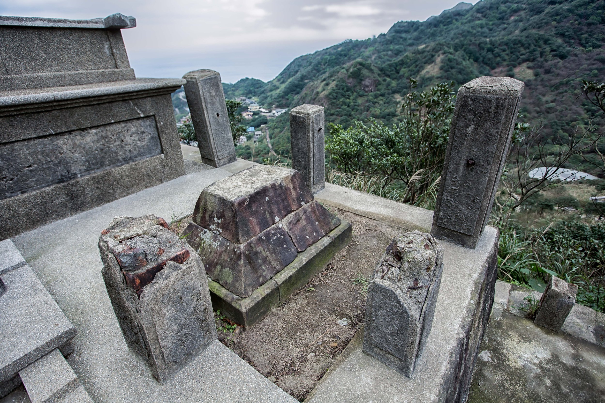
Interestingly, given that this was once a place of worship, locals have taken to placing monetary offerings (coins) on the stone as a show of respect to the former shrine, which is quite endearing, but given the amount of vandalism that took place here, it’s also sad that so much of the original shrine has been lost.
Getting There
Address: #8 Jinguang Road, Jinguashi, Ruifang District (新北市瑞芳區金瓜石金光路8號)
GPS: 121.85862°E 25.105006°N
There are several convenient methods that will help you get to the Golden Shrine, but for most tourists, the best (and easiest method of explaining to get there is to use the Gold Museum as a starting point.
For the more adventurous, you could always hike Stegosaurus Ridge, Teapot Mountain, or any of the other hiking trails on the mountain where the shrine is located, but I’m just going to spend time introducing the direct route that the vast majority of tourists will take to get there.
How you get to the Gold Museum is up to you, but if you’re asking me for travel advice, I think its best that you hop on one of the buses out of Taipei, and take it directly to the Gold Museum. Don’t get off at Jiufen, go directly to the Gold Museum area and then on your way back by all means, stop at Jiufen. If, on the other hand you have your own means of transportation, you’ll have to keep mind that parking in the area can be a bit expensive.
Car / Scooter
If you have your own means of transportation, I recommend inputting the address or coordinates provided above into your vehicles GPS or Google Maps to map out your route to the museum. Depending on whether you’re coming from Taipei, Keelung, or the east coast, the route is going to be slightly different, so it’s much easier to have it mapped out on your preferred positioning system.
It’s important to keep in mind that the car park for the museum isn’t located at the front entrance along the narrow mountain road, so you’ll want to pay attention to the signs along the road that will point you in the direction of the car park.
Below I’ll provide the official directions to the Gold Museum from its official website (slightly edited for grammar and clarity):
Take the Zhongshan Highway in the direction of Keelung → Exit at Dahua System Interchange→ Exit at Ruifang → Provincial Highway 2 → Turn right on Mingdeng Rd. → Pass though Jiufen and head down the mountain towards Jinguashi → Arrive at the Gold Museum
Take the Zhongshan Highway in the direction of Keelung → Exit at Dahua System Interchange → Go in the direction of Ruibin → Provincial Highway 2 → Turn right onto North County Road 34→ Arrive at the Gold Museum
From the East Coast take Provincial Highway 2 to Shuinandong car park → Turn left onto North County Road 34 → Arrive at the Gold Museum.
Train
If you elect to take the train as part of your adventure, you’re going to have to keep in mind that you’ll eventually have to switch to a bus at either Keelung Train Station (基隆車站) or Ruifang Train Station (瑞芳車站) as there aren’t any trains that provide direct access to the area.
The most convenient of the two stations with regard to getting to the Gold Museum area is Ruifang Station, but it’s important to note that not all of the trains bound north out of Taipei will get you to that station. If you find yourself on the wrong train, you may have to get off and transfer to another one near Xizhi (汐止車站) or Badu (八堵車站).
That being said, if you’re traveling from Taipei, it’s much faster and more convenient to hop on one of the buses on the list below as they’re direct from the capital. Taking a bus from the city will also ensure that you get a seat as the buses that roll through Ruifang are often packed to the point that they just pass by you when you’re at the bus stop waiting.
Bus
Conveniently located at the entrance to the Gold Museum, you’ll find the ‘Jinguashi Gold Ecological Park’ (金瓜石 黃金博物館) bus stop. The buses that travel along this route typically pass through Ruifang (瑞芳), Jiufen (九分) and pass by the Golden Waterfall (黃金瀑布) on their way to Shuinandong (水湳洞) along the coast.
Serviced by the following routes, I’ll also provide links to the real time bus information below in addition to where you’re able to hop on:
Taipei Bus #788 (台北客運788): City God Temple - Shuinandong (城隍廟-水湳洞)
Taipei Bus #825 (台北客運825): Ruifang Station - Gold Museum (瑞芳車站-黃金博物館)
Taiwan Tour Bus #856 (台灣好行856): Ruifang - Sandiaojiao (瑞芳-三貂角燈塔)
Taipei Bus #965 (台北客運965): Fuzhong - Gushan Elementary (府中捷運站 - 瓜山國小)
Bus #1062 (基隆客運1062): Taipei - Jinguashi (台北 - 金瓜石)
Bus #F802 (台北客運): Ruifang Train Station - Jinguashi (瑞芳車站 - 金瓜石)
Click on any of the bus routes above for the route map and real-time information for each of the buses. If you haven’t already, I recommend using the Taipei eBus website or downloading the “台北等公車” app to your phone, which makes it easier to map out your trip and find the nearest bus stops to wherever you are located.
1. From Taipei - Jinguashi (台北 - 金瓜石博物館)
The easiest route directly from Taipei to the Gold Museum is Bus #1062, which conveniently sets off from Zhongxiao Fuxing MRT Station (忠孝復興捷運站) and also passes by Songshan Train Station (松山車站) and Ruifang Train Station (瑞芳車站). You also have the option of taking Bus #965, where you can hop on at Wanhua Train Station (萬華車站), Ximen MRT Station (西門捷運站) or Beimen MRT Station (北門捷運站).
2. From Keelung - Jinguashi (基隆 - 金瓜石博物館)
From Keelung Train Station (基隆車站) you can tae Bus #788 directly to the Gold Museum.
3. From Banqiao - Jinguashi (板橋 - 金瓜石博物館)
From Banqiao Bus Station (板橋公車站), located next to the train station, you can hop on Bus #965 and take the bus directly to the Gold Museum
4. From Ruifang - Jinguashi (瑞芳 - 金瓜石博物館)
From Ruifang Train Station, you have the option to take a number of buses that are headed up the mountain to Jiufen and the Gold Museum area.
The thing you’ll want to remember is that the bus stop here is more often than not packed with people, so you may find yourself waiting a bit to get on a bus. On the other hand, there are quite a few buses that pass through the area on the way up the mountain, so it may not be too long of a wait.
After being closed for half a decade, the Golden Shrine is finally reopen to the public. As one of the highlights of any visit to Jinguashi or the Gold Museum, I highly recommend the short hike up the mountain to the shrine if you find yourself in the area. Obviously, as a ruined Shinto Shrine, there isn’t much to see, and it is a skeleton of its former self, but its continued existence remains quite significant with regard to the modern history of this beautiful island nation. Rated as one of the most iconic tourist destinations in northern Taiwan, the shrine provides tourists with a pretty great photo opportunity, so even if you’re not as interested in all of this stuff as I am, why not check it out?
References
Ōgon Shrine | 金瓜石神社 (中文) | 黃金神社 (日文) (Wiki)
Ōgon Shrine (Spectral Codex)
List of Shinto Shrines in Taiwan | 台灣神社列表 (Wiki)
金瓜石神社 ( 國家文化資產網)
[新北市瑞芳].金瓜石.黃金博物園區 (Tony的自然人文旅記)
新北市立黃金博物館 |New Taipei City Gold Museum (Wiki)
礦山上的台灣最初社-金瓜石神社 (晰誌 | See Zine)
金瓜石神社 山神祭 (新北市政府)
The Gold Museum in Jinguashi (TaiwanEverything)
118 Shinto Gods and Goddesses to Know About (Owlcation)
Architecture and Sacred Spaces in Shinto (Berkeley ORIAS)
Encyclopedia of Shinto (Kokugakuin University)
Shinto Architecture (Wikiwand)
Taipower unveils renovated Jinguashi Shinto shrine in New Taipei (FTV News)
Gallery / Flickr (High Res Photos)